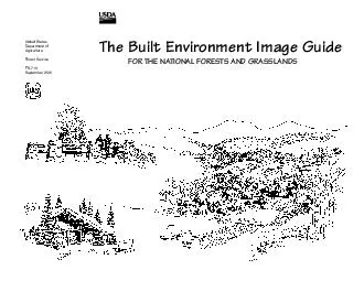
/
United States Department of Agriculture United States Department of Agriculture

United States Department of Agriculture - PDF document

liane-varnes
liane-varnes . @liane-varnes
Follow
409 views
Uploaded On 2016-07-25

United States Department of Agriculture - PPT Presentation

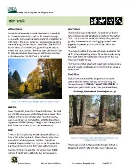
Rim Trail Forest Service Lincoln National Forest Sacramento Ranger District April 2015 Attractions Located on the western rim of New Mexicox2019s beautiful Sacramento Mountains the Rim Trail win ID: 418630

Rim Trail Forest Service Lincoln National Forest Sacramento

Share:

Link:

Embed:

Download Presentation from below link

Download Pdf The PPT/PDF document "United States Department of Agriculture" is the property of its rightful owner. Permission is granted to download and print the materials on this web site for personal, non-commercial use only, and to display it on your personal computer provided you do not modify the materials and that you retain all copyright notices contained in the materials. By downloading content from our website, you accept the terms of this agreement.


Presentation Transcript

Rim Trail United States Department of Agriculture Forest Service Lincoln National Forest Sacramento Ranger District April 2015 Attractions Located on the western rim of New Mexico’s beautiful Sacramento Mountains, the Rim Trail winds through pine and fir trees, quaking aspen and green meadows for 30.5 miles. There are numerous access points along its from Cloudcroft to Slide Campground is open only to hikers and pac k animals. The remainder of the trail from Slide to Sacramento River is open additionally to bikes and motorcycles. No OHV use is permitted Figure 1 – Beautiful aspen along the Rim Trail in Karr Canyon Access . Turn left onto FR24B where you will find the first trailhead. This section of trail is non - mechanized. For other access points, continue 1.1 miles further on NM130 and turn right onto NM6563 (Sunspot Hwy). From there you will find numerous access poi nts (please see maps). Use The Rim Trail is open all year but becomes difficult to hike when snow is present. Cross - country skiers can enjoy this trail during winter months. One of the loveliest times to make thi s trip is in the fall when the aspens and are at their peak autumn colors. Much of the trail is located at elevations near 9,000’ making it moderate in difficulty due to less oxygen. Narrative The Rim Trail was the first U.S. Forest Service Trail in New Mexico to be designated as a National Recreation Trail. It is a combination of old Indian paths, railroad grades, homestead trails and logging routes linked together by newer section built in th e 1960’s and beyond. The majority of the trail p asses through shaded stands of f ir, pine and quaking aspen. At various points along the route there are spectacular views of the Tularosa Basin over 4,000’ below. - side) ca mping sites along its route, mostly at point where the trail crosses open roads. Facilities No facilities are available along the trail so come prepared with water and extra warm clothing. As always be sure to PACK OUT WHAT YOU PACK IN to leave your publi c lands better than you found them. As always, let someone know before you go. Figure 2 – Non - motorized section of the trail between Slide Campground and Cloudcroft Please call or visit the Sacramento Ranger District in Cloudcroft at (575) 682 - 2551 for more information. Map of Rim Trail and surrounding features Figure 3 - Map o f Rim Trail complete 30.5 miles Rim Trail (1 of 3) Cloudcroft to Karr Canyon United States Department of Agriculture Forest Service Lincoln National Forest Sacramento Ranger District April 2015 Attractions Section 1: Cloudcroft to Karr Canyon (FR63) is a popular portion of the 30.5 mile long Rim Trail, due to its proximity to the Village of Cloudcroft and other easily accessible areas. Cloudcroft to Slide Group Campground is a 0.9 mile portion o f the trail that allows only pedestrian/hiking or pack and saddle traffic. From Slide south, the trail adds both mountain bikes as well as motorcycle use. Access From Cloudcroft, take NM130 south 0.8 miles. Turn left onto FR24B where you will find the first trailhead. This section of the trail is non - mechanized (hikers and pack animals only). Other access points and trailheads can be found along the way, as well as parking areas to load and unload your belongings. Many of these parking areas are not immediately adjacent to the trail itself, so you will need to travel to the nearest trailhead to begin your journey. Figure 4 – GPS coordinates of Rim Trail Section 1 Parking areas Figure 5 – Attractions along Rim Trail Section 1, Mileposts begin at NM6563, the Sunspot Hwy Facilities No facilities are available along the trail, so come prepared with water and extra warm clothing. As alwa ys, PACK OUT WHAT YOU PACK IN to leave your public lands better than you found them. Trailheads There are many minor trailheads along the length of the Rim Trail. Some are developed with minimal parking, sign and a gate. Others are simply road crossings with no development beyond road - side parking. Figure 6 – GPS coordinates of Rim Trail Section 1 Trailheads Distances To best �t your needs and abili�es, many short to long loops can be enjoyed along the length of the trail. The matrix below will help determine your path. Figure 7 – Distance Matrix for Rim Trail Section 1 Map of Rim Trail Section 1 Figure 8 - Map o f Rim Trail Section 1 Rim Trail (2 of 3) Karr Canyon to Sunspot United States Department of Agriculture Forest Service Lincoln National Forest Sacramento Ranger District April 2015 Attractions Section 2: Karr Canyon to Sunspot Solar Observatory is the second - most popular section of the Rim Trail with its accessible trailheads along cross - cutting roads. Hiking averages approximately 9,000’ in elevation, so be sure to keep that in mind when choosing an appropriate distance for your hike. Along the way you will find a number of interesting stopping points including Cathey Vista and Sunspot Solar Observatory. Both are located near the end of the Sunspot Scenic By - Way (NM6563). Access From Cloudcroft, take NM130 south until you reach the junction of NM130 and NM6563. Along NM6563 are a number of access roads which cross the Rim Trail. Although many are considered unofficial trailheads, they still make great access points to begin and end a day hike. Figure 9 – GPS coordinates of Rim Trail Section 2 Parking areas Figure 10 – Attractions along Rim Trail Section 2, Mileposts begin at NM6563, the Sunspot Hwy Facilities No facilities are available along the trail, so come prepared with water and extra warm clothing. As alwa ys, PACK OUT WHAT YOU PACK IN to leave your public lan ds better than you found them. Trailheads There are many minor trailheads along the length of the Rim Trail. Some are developed with minimal parking, sign and a gate. Others are simply road crossings with no development beyond road - side parking. Figure 11 – GPS co ordinates of Rim Trail Section 2 Trailheads Distances To best �t your needs and abili�es, many short to long loops can be enjoyed along the length of the trail. The matrix below will help determine your path. Figure 12 – Distance Matrix for Rim Trail Section 2 Map of Rim Trail Section 2 Figure 13 - Map o f Rim Trai l Section 2 Rim Trail (3 of 3) Sunspot to Sac . River Road United States Department of Agriculture Forest Service Lincoln National Forest Sacramento Ranger District April 2015 Attractions Section 3 : Sunspot Solar Observatory to Sacramento River Road is the southern - most and newest section of the Rim Trail. Access There are three access points to this portion of the trail. A convenient parking area is lo cated at the spot where FR5010 meets the Rim Trail. Figure 14 – GPS coordinates of Rim Trail Section 3 Parking areas Figure 15 – Trailhead at Sunspot North Figure 16 – Attra ctions along Rim Tr ail Section 3 Facilities No facilities are available along the trail, so come prepared with water and extra warm clothing. As alwa ys, PACK OUT WHAT YOU PACK IN to leave your public lan ds better than you found them. Trailheads There are many minor trailheads along the length of the Rim Trail. Some are developed with minimal parking, sign and a gate. Others are simply road crossings with no development beyond road - side parking. Figure 17 – GPS co ordinates of Rim Tr ail Section 3 Trailheads Distances To best �t your needs and abili�es, many short to long loops can be enjoyed along the length of the trail. The matrix below will help determine your path. Figure 18 – Distanc e Matrix for Rim Trail Section 3 Map of Rim Trail Section 3 Figure 19 - Map o f Rim Trai l Section 3