/
KuraAraks River Basin GEO GRA PHY CLIM TE ND POPUL TIO KuraAraks River Basin GEO GRA PHY CLIM TE ND POPUL TIO

KuraAraks River Basin GEO GRA PHY CLIM TE ND POPUL TIO - PDF document

lindy-dunigan
lindy-dunigan . @lindy-dunigan
Follow
497 views
Uploaded On 2015-04-30

KuraAraks River Basin GEO GRA PHY CLIM TE ND POPUL TIO - PPT Presentation

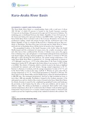
5 percent in Azerbaijan 182 percent in Georgia and 157 percent in Armenia The remaining part is distributed between the Islamic Republic of Iran 195 percent of the basin and Turkey 151 percent Lehner et al 2008 Table 1 and Figure 1 The KuraAraks Riv ID: 57414

percent Azerbaijan 182

Share:

Link:

Embed:

Download Presentation from below link

Download Pdf The PPT/PDF document "KuraAraks River Basin GEO GRA PHY CLIM T..." is the property of its rightful owner. Permission is granted to download and print the materials on this web site for personal, non-commercial use only, and to display it on your personal computer provided you do not modify the materials and that you retain all copyright notices contained in the materials. By downloading content from our website, you accept the terms of this agreement.


Presentation Transcript

1 Kura–Araks River BasinPHY, CLIMND POPULThe Kura-Araks River Basin is a transboundary basin with a total area of about of which 65percent is located in the South Caucasus countries: percent in Azerbaijan, 18.2percent in Georgia and 15.7percent in Armenia. The remaining part is distributed between the Islamic Republic of Iran (19.5percent of the basin) and Turkey (15.1percent) (Lehner et al, 2008) (Table 1 and Figure 1). The Areaountries includedArea of country in basin (kmAs % of total area of the As % of total area of the % of the 190 25060 020Iran (Islamic Republic of)37 080 Irrigation in the Middle East region in figures – AQUASTAT Survey 2008 TbilisiRustavtaistumikiancmgayiti-yramliLankaranNakhchivanGyumriVanadzorpaYerevaTabrizvodabiVazuLakeVa LakeOroomiehSevaLake ShamkiReservoiMigacevirReservoiNakhchivanReservoi andaryanhuryanamkiMingacevirak angh onJinvalTbilisSamu irpacaMakoDalimtstafachatahabalaOrumiyehTURKEYRUSSIAFEDERATION(ISLREPUBLIC OFGEORGIARMENIERIJBoundary of formerNagorno-KarabakhAutonomouOblastNAIVANAUTONOMOUSREPUBLIC SAUDARABIATURKEYIRAQIRANOMANTURKM.AZERJORDANGEORGISYRIARM.UAKUW. AlbersEqual Area Projection, WGS 1984FAO - AQUASTAT, 2009DisclaimerThe designations employed and the presentation of materialin this publication do notimply the exprssion of any opinion soever on the partof the Food and Agriculture Organization of the Unitedons concerning the legalstatusofany country,territory,cityorarea or of its authorities, orconcerning the delimitationof its frontiers or boundaries 03060915kmLegendInternational boundary Rir basin Capital,town Administrativboundar LaRir,intermittentrive SaltpaDam (capacity � 0.1 km Cana Zone of irrigaion development E 1Kura-Araks river basin Kura–Araks River Basin average precipitation is estimated at 447mm/year. Almost half of Georgia, the eastern part, is located in the Kura–Araks River Basin, which has a subtropical dry climate with relatively cold winters and arid, hot summers. The average precipitation varies between and 1mm/year. About 80percent of the rainfall occurs from March to October, while the longest dry period is about 50–60days. Drought years are common. There is a need for irrigation in the areas where precipitation is less than 800mm/year. Average temperatures vary between –1°C in January and 22°C in July.Finally, as far as Turkey and the Islamic Republic of Iran are concerned, while a considerable part of the basin, 15 and 19 percent, respectively, is located in these countries, only a small part of each country, 4 and 2percent respectively, is located in the Kura–Araks River Basin.Average population densities are 128 in Armenia, 93 in Azerbaijan, and 78 in Georgia. There are three cities with an excess of million inhabitants in the South Caucasus: Baku (Azerbaijan), Tbilisi (Georgia), and Yerevan (Armenia) (Ewing, 3003). A majority of the population of the Caucasus still lives below the poverty line. Gross Domestic Product (GDP) has decreased roughly by 50percent since 1991, poverty levels have reached 60–80percent, and unemployment has skyrocketed. Even though all three countries have shown signs of macroeconomic recovery and progress in the implementation of structural reforms, there has been emigration from the region to the Russian Federation, Turkey, the Persian Gulf, and the West (Vener, 2006). The Kura River, with a total length of 1km, rises in Georgia and flows into Azerbaijan before entering the Caspian Sea. It has an average discharge of 0.575year. Two of its tributaries rise in Turkey: the Mtkvari, with an inflow from Turkey estimated at 0.91km/year, and the Potskhovi, with an inflow estimated at 0.25year. The inflow of the Debet River, a southern tributary of the Kura River, is estimated at 0.89km/year from Armenia to Georgia. The annual flow from Georgia to Azerbaijan of the Kura Basin is 11.9km and the annual flow of the Agstay from Armenia to Azerbaijan is about 0.35The Araks River originates in Turkey and after 300km forms part of the international border between Armenia and Turkey, then for a very short distance between Azerbaijan and Turkey, between Armenia and the Islamic Republic of Iran, and between Azerbaijan and the Islamic Republic of Iran. The Araks River is about km long and it has an average discharge of 0.21/year (Berrin and Campana, 2008). The total annual flow from Armenia to Azerbaijan through the Araks River and its tributaries (Arpa, Vorotan, and Vokhchi) is estimated at about 5.62, and from the Islamic Republic of Iran is estimated at 7.5. The Araks River joins the Kura River in Azerbaijan about 150km before its mouth at the Caspian Sea.With respect to storm water and sewage effluent discharges, the Kura–Araks River Basin receives 100percent of Armenia’s, 60percent of Georgia’s, and 50percent of Azerbaijan’s deficit (Berrin and Campana, 2008).The South Caucasus countries are faced with water quantity and quality problems. In general terms, Georgia has a lot of water, Armenia has some shortages due to poor management, and Azerbaijan has a lack of water; moreover, its groundwater is of poor quality. In Georgia, the main use of the Kura–Araks water is agriculture. In Armenia it is agriculture and industry whereas in Georgia drinking water is withdrawn from a large fresh groundwater stock. In Azerbaijan, the Kura–Araks water is the primary source of freshwater, and 70percent of drinking water comes from these rivers. In general, water is used for municipal, industrial, irrigation, fishery, recreation, and transportation purposes. The main water use is agriculture, followed by industry and households uses (Berrin and Campana, 2008). Irrigation in the Middle East region in figures – AQUASTAT Survey 2008 QUDuring the Soviet era and also in the post-Soviet period, large volumes of effluents were discharged into surface water bodies by the municipal, industrial and agriculture sectors, causing pollution of both surface water and groundwater. The largest source of pollution is municipal wastewater, which pollutes the rivers downstream of large cities with organic matter, suspended solids, surfactants, etc. Industrial wastewater discharges also are high, polluting surface water with heavy metals, oil products, phenols and other hazardous substances. In Georgia, for example, large industrial facilities producing manganese, ammonia, machinery, etc. together with arsenic, copper and gold mining and processing plants, oil refineries and power plants pollute the river bodies of the Black Sea and the Caspian Sea basins with heavy metals, oil products, phenols and other toxic substances. In Armenia and Azerbaijan, different industries also have discharged high loads of pollutants into the Kura and Araks rivers and their tributaries (UNEP, 2002). Agricultural return flows also contribute to the Kura–Araks pollution with pesticides such as DDT (Berrin and Campana, 2008). On its way through Turkey and the Islamic Republic of Iran, there is also a large populated area with an advanced industry, which increases the pollution in the Kura–Arak rivers.TED DEVELOPMENT IN THE The total area equipped for irrigation in the Kura–Araks River Basin is estimated at between 2 and 2.5ha, of which Azerbaijan accounts for approximately percent, the Islamic Republic of Iran 21percent, Georgia 14percent, Armenia percent and Turkey 8percent. Agricultural water withdrawal is about 19During the Soviet era, the Caucasus was an important agricultural region that supported the entire USSR. Soviet agriculture was highly inefficient and suffered from poorly equipped infrastructure. At present, agriculture remains the main sector in the region, employing a significant amount of the population. In the Soviet period, from the 1970s to 1980s, industry in the Caucasus was well developed. The major industrial sectors were oil and gas, chemicals and machinery, ferrous and non-ferrous metals, cement, fertilizer, light manufacturing, and food processing. This rapid industrial development resulted in increased environmental pressures. After the USSR was dismantled, industrial production declined sharply because of the energy crisis and the dissolution of economic ties among the former Soviet Republics. Recently, some signs of industrial revival have appeared. However, the growth rate is still insignificant (Vener, 2006).The main Kura and Araks rivers have only two reservoirs but the tributaries have more than 130 major reservoirs. Table 2 shows the large dams in the Kura–Araks River Basin, i.e. dams with a height of more than 15metres or with a height of 5–15and a reservoir capacity greater than 3 according to the International Commission on Large Dams (ICOLD).WA ISSUESDuring the Soviet era, water resources management of the basin was contingent upon the policy that the USSR was implementing at the time. In the 1960s and 1970s, surface water quality standards for a broad spectrum of substances were established. Domestic sewage was required to enter wastewater treatment facilities and undergo both mechanical and biological treatment. Meanwhile, no standards, guidelines or management practices existed for controlling diffused source pollution. Until 1991, there were no taxes on water pollution. Only water use fees were employed, introduced in 1982. In essence, they served more to finance state water protection programmes rather than to give an incentive to water users to conserve a resource. Legal requirements, existing laws, regulations and standards were frequently ignored or violated, because of their strictness and unfeasibility (UNEP, 2002). In the Soviet period the USSR Kura–Araks River Basin signed an agreement with Turkey concerning the use of the Araks River, according to which the water of this transboundary river is divided equally between the countries. According to another agreement signed between the USSR and the Islamic Republic of Iran, the water of the Araks River is divided equally between them. When Armenia, Azerbaijan and Georgia became independent states, the three countries had neither water resources management regulations nor water codes. However, each country has adopted water codes within the last 15 years: Armenia in 1992 and revised in 2002 according to the European Union Water Framework Directives (EU-WFD), and Georgia and Azerbaijan in 1997. Nevertheless, there is no uniform control or management system for the rivers and, in the post-Soviet period, no water quality monitoring by the riparian countries. While the three countries are willing to cooperate on water-related issues since they recognize their dependency on the basin, whose waters they must share, they have not resolved their political, economic, and social issues. Currently no water treaties exist among the three countries, a condition directly related to the difficult political situation in the region. TABLE 2arge dams in the Kura-Araks River BasinI = irrigation; H = Hydropower, W = Water Supply; F = Flood protection; N = Navigation; R = Recreation earest (million main use*VorotanI, H, OI, H, OHer-herVaykI, HTolorsI, HI, Oerd (Ijevan)VorotanTavushTavush1 146TerterTerterI, F, H15 730I, W, F, H, N, R2 677I, W, F, HI, F1 350I, W, F, HI, FI, F20 546I, W, HI, HDalis MtaI, W, R1 333Iran (IslamicMeshkin shahrGhare SouI, WRepublic of)I, W, Hhar ChayI, WYamchialkhli ChayI, WZenouz Chay1 350I, H1 887Turkey25 542 Irrigation in the Middle East region in figures – AQUASTAT Survey 2008 In 1997, an agreement on environmental protection was signed between the governments of Georgia and Azerbaijan. In 1998, a similar agreement was signed between Georgia and Armenia. According to both agreements, the governments will cooperate in creating specifically protected areas within the transboundary ecosystems.Azerbaijan and the Islamic Republic of Iran have an agreement on the protection of the Araks River (UNECE, 2004).In 2002, the Republic of Armenia Commission on Transboundary Water Resources was established, chaired by the Head of the Water Resources Management Agency. This commission, together with corresponding commissions of neighbouring countries, deals with issues related to transboundary water resources use and protection.Table 3 shows the main historical events in the Kura–Araks River Basin.TABLE 3hronology of major events in the Kura-Araks River Basin lans/projects/treaties/conflictsountries involvedain aspectsSoviet periodgreement concerning the use of the water of the raks riverSSR and TurkeyThe water of the raks river is divided equally between them.Soviet periodgreement concerning the use of the water of the raks riverSSR and the Islamic Republic of IranThe water of the raks river is divided equally between them.Surface water quality standardsSurface water quality standards for a broad spectrum of substances was established.Water use feesWater code in In 2002 the code was revised according to the nion Water Framework Water code in Water code in Georgiagreement on environmental Georgia and Cooperation in creating specifically protected areas within the transboundary greement on environmental Georgia and Cooperation in creating specifically protected areas within the transboundary Integrated water resources management plan for The World ank funded the development of this plan.South Caucasus water management project South Caucasus Strengthening the cooperation among water-related agencies and integrating water resources management.Joint river management programme on monitoring and assessment of water quality on transboundary riversSouth Caucasus Prevention, control and reduction of trans-boundary pollution impact.South Caucasus river monitoring South Caucasus stablished social and technical infrastructure for international, cooperative, transboundary river water quality and quantity monitoring, data sharing and watershed management system.Republic of rmenia commission on transboundary water resources was establishedThis commission together with corresponding commissions in neighbouring countries resolved the issues related to transboundary water resources use and Reducing transboundary degradation in the Kura-river basin projectSouth Caucasus countries, the Islamic Republic of IranTo ensure that the quality and quantity of the water throughout the Kura-raks river system meets the short and long-term needs of the ecosystem and the communities relying upon the ecosystem.Caucasus-Georgia strategic plan Support for the South Caucasus regional water management programme as a principal component of its regional conflict prevention and confidence-building