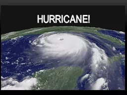
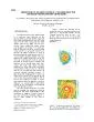
Chem EnKF JianyuRichard Liang Yongsheng Chen 6th EnKF Workshop York University METEOSAT7GOES11 combined Dry AirSAL Product source University of WisconsinCIMSS 00Z25 th ID: 167806
Download Presentation The PPT/PDF document "Studying impacts of the Saharan Air Laye..." is the property of its rightful owner. Permission is granted to download and print the materials on this web site for personal, non-commercial use only, and to display it on your personal computer provided you do not modify the materials and that you retain all copyright notices contained in the materials. By downloading content from our website, you accept the terms of this agreement.
Slide1
Studying impacts of the Saharan Air Layer on hurricane development using WRF-Chem/EnKF
Jianyu(Richard) LiangYongsheng Chen
6th EnKF Workshop
York UniversitySlide2
+METEOSAT-7/GOES-11 combined Dry Air/SAL Product (source: University of Wisconsin-CIMSS)
00Z25th, August, 2010
Definition: Saharan air and mineral dust, warm, dry Origin: from near the
coast
of Africa
Duration
: late spring to early fallCoverage : in the North Atlantic OceanVertical extend : can reach around 500 hPa height
Hurricane Earl (2010)
Saharan Air Layer (SAL)Slide3
Dust inside SAL plays an important role in weather forecast and climate. (1)
Indirect effect: modification of the cloud droplet concentration and size distribution (Twomey, 1977; Albrecht, 1989).(2) Direct effect:
change radiation budget by absorbing and scattering solar radiation.
Dust
Impact on AtmosphereSlide4
SAL Impact on Hurricane
Positive impact:Enhance easterly waves growth and potentially cyclongenesis (eg., Karyampudi and Carlson, 1988)Negative impact:
Bring dry and warm air into mid-level of tropical storms, thus increase stabilityEnhance the vertical wind shear to suppress the developments of tropical storms (eg., Dunion and Velden2004; Sun et al. 2009)
Objectives:
Use WRF-
Chem
and DART to quantify the impact of SAL on TCs.
Hurricane Earl (2010) is chosen to be the first case.Slide5
Hurricane Earl (2010)
Hurricane Earl best track from 25
th , August to 4th September, 2010. (Cangialosi 2011)
Official track forecast from 00Z 26
th
, August to 00Z 30
th
, August. (
Cangialosi
2011)Slide6
Model : WRF-Chem model
Model Configuration: grid size: 36 km, 310X163X57 RRTMG radiation scheme Mellor-Yamada Nakanishi and Niino Level 2.5 PBL
Grell 3D cumulus Lin microphysics scheme
GOCART simple aerosol scheme
Data assimilation:
Data Assimilation Research
Testbed
(DART)
Assimilate MODIS aerosol optical depth (AOD) at 550 nm in addition to conventional observationsLocalization in variables and spaceAdaptive inflation
20 membersModel and Data Assimilation SystemSlide7
DA Experiments In order to represent SAL accurately in the model, two data sets (MODIS AOD and AIRS T&Q) are assimilated into the model.
Experiments:Control: Assimilating conventional obs onlyMODIS: Assimilating MODIS AOD AIRS: Assimilating AIRS temperature and specific humidity retrievals Slide8
a) Use existing dust product to reduce spin-up problem MOZART-4 : output from MOZART (driven by NASA GMAO GEOS-5 model).
MODIS AOD
MOZART-4 AOD
00Z20
th
Assimilating MODIS AOD
(1) Generating ensemble perturbations in meteorological fields
Randomly draw from 3DVAR error covariance
(2) Generating ensemble perturbations in chemistry
b) Random perturbation of aerosol initial and time-dependent boundary condition Slide9
(3) Data assimilation cyclesCycle 6-hourly for 4 days ( from 20
th-24th) , assimilate conventional and MODIS AOD observations
MODIS coverage
12Z23
th
18Z23
th
AOD
Prior vs. ObservationSlide10
00Z24
th
Model AOD
MODIS AOD
RMSE
Total SpreadSlide11
(4) Model Forecast
00Z24th
00Z27thControl
With MODIS
Sea level pressure Slide12
00Z27
th
Temperature (With MODIS)
Temperature difference
(With MODIS – Control)
Model ForecastSlide13
Relative humidity from AIRS
Temperature (
oC) from AIRS
Dust direct and indirect effect can be reflected in the temperature and humidity field of the SAL, which can be observed by satellites such as AIRS (Atmospheric Infrared Sounder).
If we assimilate the AIRS observations, what kind of impacts they can have on the hurricane development?
00Z 23
th
850hPa
Assimilating AIRS dataSlide14
From Aug. 20th to Aug.24th , assimilating conventional observation and AIRS temperature, specific humidity observation together
Diagnostics in assimilating AIRS temperature .
Bias: Post
Bias: Prior
rmse
: Prior
rmse
: Post
Temperature RMSE and BiasSlide15
Sea level pressure. 00Z 24th,August
Control
With AIRS
Analysis difference –sea level pressureSlide16
After the data assimilation,
two forecasts have been made, from 24th to 29th , August.Control
: from the initial condition which come from assimilating conventional observation alone. AIRS: from the initial condition which come from assimilating ARIS data and conventional observation together;
Hurricane track
No AIRS mean track
Best track
AIRS mean track
Ensemble track (no AIRS)
AIRS ensemble track
Model ForecastSlide17
minimum sea level pressure
With airs
maximum wind speed
Best track
AIRS
AIRS
Best track
Control
Control
The thermal properties of SAL have significant effects on hurricane behavior !
Model ForecastSlide18
Summary
Assimilating MODIS AOD can influence hurricane Earl (2010) significantly in this case.The AIRS observations were assimilated into the model. This can improve the accuracy of the temperature and humidity field in the WRF model. The ensemble track and intensity forecasts have been improved significantly.
In this case study, considering dust direct effect alone may not be enough to represent SAL thermal property, and its subsequence impact on hurricane development. Slide19
Future Works (1) Considering dust indirect effect by employing different chemistry schemes such as MOSAIC, which includes interactions between aerosols and microphysics processes.
(2) Assimilating MODIS AOD on top of conventional observations and AIRS retrievals to assess the added value of MODIS AOD