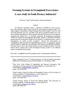
/
Farming Systems in Swampland Ecosystems:A case study in South Borneo, Farming Systems in Swampland Ecosystems:A case study in South Borneo,

Farming Systems in Swampland Ecosystems:A case study in South Borneo, - PDF document

min-jolicoeur
min-jolicoeur . @min-jolicoeur
Follow
399 views
Uploaded On 2015-11-08

Farming Systems in Swampland Ecosystems:A case study in South Borneo, - PPT Presentation

Paper contributed at the 47 Annual Conference of The Australian Agricultural Nuri Dewi Yanti School of Agricultural and Resource Economics The yantin01agricuwaeduau Sarah Lumley School of Ea ID: 187266

Paper contributed the

Share:

Link:

Embed:

Download Presentation from below link

Download Pdf The PPT/PDF document "Farming Systems in Swampland Ecosystems:..." is the property of its rightful owner. Permission is granted to download and print the materials on this web site for personal, non-commercial use only, and to display it on your personal computer provided you do not modify the materials and that you retain all copyright notices contained in the materials. By downloading content from our website, you accept the terms of this agreement.


Presentation Transcript

Farming Systems in Swampland Ecosystems:A case study in South Borneo, Indonesia, and Dennis RumleyIn Indonesia, agriculture makes a significant contribution to the economy. The sector generates about twenty percent of gross domestic product (GDP), is a major employer, and produces foreign exchange from non-oil exports. However, with increased population pressure, especially in the densely populated island of Java, the area of land for agriculture has decreased and cultivation has been forced to expand to marginal land outside Java. To facilitate expansion, the Indonesian government carried out a long-term transmigration programme, which was intended to distribute people from the crowded inner islands of Java and Bali. In Southern Borneo, some of transmigrants are settled on tidal swampland. Because the characteristics of swampland are different from the agricultural land of Java, an appropriate farming system should be employed to accommodate their unique environmental conditions. This paper aims to assess the existing farming systems of indigenous farmers in South Borneo and to compare these with transmigrant farming systems in two different Paper contributed at the 47 Annual Conference of The Australian Agricultural Nuri Dewi Yanti, School of Agricultural and Resource Economics, The yantin01@agric.uwa.edu.au Sarah Lumley, School of Earth and Geographical Sciences, The University of slumley@agric.uwa.edu.au Dennis Rumley,School of Social and Cultural Studies, The University of phone: (08) 9380 7957 2 INTRODUCTIONThe agricultural sector plays a significant role in Indonesian economic development. In 1999, agriculture contributed about 20 percent of gross domestic product (GDP), absorbed 45 percent of the labour force, and produced 26 percent of foreign exchange from non-oil and gas exports. Within the agricultural GDP, the share from food crops is constant at more than 50% of the total agricultural value During the last two decades, the government has placed a major effort on agricultural development, especially on increasing rice production, because maintaining the rice self-sufficiency achieved in 1984 is important to Indonesia. Experiences showed that the instability of rice supply would affect not only the economic but also the political aspects of the country. Therefore, the production and Rice consumption continually increases together with the accelerating population growth and per capita consumption. In 2001, it is estimated that rice production in Indonesia will have decreased from 51.8 million tons in 2000 to 50.8 million tons, while the country requires 52.0 million tons for domestic consumption (Dursin, 2001). Thus, the need for the areal expansion of agriculture cannot be One of potential areas for agricultural expansion is swamp reclamation outside Java. There is about 39 million ha of swampland in Indonesia located mainly in Sumatra, Kalimantan, and Irian Jaya (Noorsyamsi and Sarwani, 1989). About 20.1 million ha of the total area are affected by tides, but about five million ha of these are considered to have potential for agricultural production (Widjaja-Adhi et al., 1992). Increased production efforts are in line with the former national development programs which aimed to resettle landless farmers from the inner islands of Java, Madura, and Bali to the more sparsely populated outer islands through transmigration Indonesia is an archipelagic country consisting of 13,667 big and small islands. However, only seven per cent of those islands are inhabited. This includes the large islands of Sumatra, Java, Kalimantan, Sulawesi and Irian. Like other less developed countries, Indonesia also faces an overpopulation problem. In fact, Indonesia is the fourth most populous country in the world, behind China, India, and 3 the United States. Indonesia’s population problem is further exacerbated by the About 59 per cent of the country’s population resides in Java, which comprises less than seven per cent of the land area of Indonesia. The population density in Java is around 946 people per square kilometre, and for Jakarta, the capital city of Indonesia, the density is almost 13,000 people per square kilometre. In contrast, the densities of other big islands outside Java are less than 100 people per square kilometre. This situation compelled the national government to seek other areas in which to resettle people from these densely populated islands to the less-populated outer islands such as Borneo (Kalimantan) with only has a population density of 20 people per square km (Badan Pusat Statistik, 2001). This strategy was in accordance with the program of areal expansion for agricultural production outside The objectives of this paper are to assess the existing farming systems of local indigenous and transmigrant farmers in two different types of swamplands (A and B), and at the same time to explore the similarities and differences between the systems carried out by the two groups of farmers in South Kalimantan. One goal of this is to see which of the farming systems is more sustainable. Another goal is to attempt to develop sustainability indicators to assist with promoting socially and SOUTH BORNEO (KALIMANTAN): A CASE STUDYKalimantan, otherwise known as Borneo is the largest island in Indonesia and it comprises four provinces: South Borneo, West Borneo, East Borneo, and Central Borneo. Among these four provinces, South Borneo is considered as the gateway to other provinces in Kalimantan, because its location is strategic to other parts of Indonesia, especially Java. In addition, the facilities and infrastructure, such as transportation and communication in this province are relatively developed compared 4 South Kalimantan (South Borneo) is located between 1149’13" – 11628” East Longitude and 1 21’ 49" – 4 10’ 14” South Latitude. The province is bordered by East Kalimantan Province to the north, with Java Sea to the South, with Maccasar Strait to the East, and with Central Kalimantan to the West (see map in appendix 1). South Kalimantan consists of 11 administrative regions, where nine are major districts, and the other two are municipalities; 117 subdistricts and 2.153 South Kalimantan, the province of a thousand rivers, has a total area of 37,660 square kilometres, which is less than two percent of the total area of Indonesia. It comprises about 21,000 square kilometres of forest and mountain range with 1,000 to 1,500 metres altitude above sea level or 57 per cent of the total area (Pusat Data Kalimantan, 1998). The remaining land is used for rice fields (13 per cent), plantations (12.6 per cent), house compound (1.4 per cent), and other uses (15.3 Like other parts of Indonesia, South Kalimantan which is close to the equator has two seasons; the rainy or wet season occurs between December to March and the dry season occurs from June to September. The transitional periods between the two seasons are April to May and October to November. The climate of South Kalimantan is humid-tropicals with an annual rainfall of 2,100 to 3,200 mm, 83 to 169 rainy days, and of 7 to 9 wet months. During the wet season, the monthly rainfall average is 250 mm, while during the dry season it is 100 mm. In 2000, the daily temperature in South Kalimantan ranges between 20.8 to 34.9 with an average of 26.5. The relative humidity varies between 77 to 91 per cent (Badan Pusat Statistik, In 2000, the total population in South Kalimantan was 2,969,028 with a rate of growth of 2.32 per cent during 1990 – 2000. All districts in South Kalimantan showed a significantly decreasing rate of growth during the last decade, from 2.32 per cent in the period of 1980 to 1990, to 1.40 per cent annually in 1990 – 2000. The 5 average population per square kilometre in South Kalimantan is 79.11 people. The figure is much smaller compared to the population density of Indonsia as a whole which has a mean of 106 people per square kilometre. Banjarmasin is the capital city of South Kalimantan and has the highest density in the region, of 7,326 people per square kilometer. The lowest density is in Kotabaru with only 28.32 people per CHARACTERISTICS OF TIDAL SWAMPLANDIndonesia has very large areas of swampy lands along the coastal regions of Sumatra, Borneo, and Irian Jaya which are estimated to cover nearly 39 million ha. There are 20.1 millions ha of tidal swamplands and the the rest is occupied by In South Kalimantan alone, there are about 800,000 ha of swamplands. These comprise 500,000 ha of non-tidal swamplands, 200,000 ha of tidal swamplands, and 100,000 ha of rain fed swamplands. They lie in the six districts of Tapin, Banjar, Tanah Laut, Barito Kuala, Kotabaru, and Banjarmasin which most of them are in Barito Kuala and Banjar District, 67.28 per cent and 17.03 per cent respectively The tidal region comprises that part of the coastal plain where inundation and drainage are determined by the tidal fluctuations of the water level in the sea or in the large river. Along the sea, on either side of the mouth of the rivers, frequent flooding occurs throughout the year at high tide. The water level in the tidal swampland rises as the rainy season starts, usually in October and reaches its maximum in January or February. Subsequently, it declines in March or April and remains stagnant until June. The water table drops when the dry season arrives (Noorsyamsi and Hidayat, The tides are a periodic rise and fall of all ocean waters, which are caused by gravitational attractions of the moon and the sun upon the water and the earth. The moon has more influence than the sun because it is closer to the earth (Encarta Ensyclopedia, 2000). The movement of the moon with respect to the earth causes variation in the level of these forces, hence producing different tidal levels. During the new moon and again during the full moon, the moon, the sun, and the earth are aligned and the forces are maximal, yielding tides of highest-level. They are called 6 spring-tides (Davis, 1973). The neap tide occurs in between the two spring tides, and the sun movements, hence at one point the neap tides become the spring tide Tidal swamplands have unique characteristics in which they are influenced by water movement because of the sea tides. The water depths in the tidal swamplands are controlled by the tides, as well as by rainfall. Based on the prevailing water levels in the fields, tidal swamplands can be classified into four groups i.e. types A, B, C, and D (Noorsyamsi et al., 1984; Widjaja-Adhi et al., 1992; Widjaya-Adhi and Type A swamplands are directly affected by sea tides and always flood the lands during spring and neap tides. The water depth fluctuates by as much as Type B swamplands are directly influenced by the sea tide, but flooded only Type C swamplands never flood, hence they are only influenced indirectly by the sea tide. Tides indirectly affect them by water infiltration through the soil. Water levels are affected more by rainfall than by the tides. Furthermore, the Type D is those swamplands not affected by sea tides. No water infiltration occurs through the soil. The ground-water table is deeper than 50 cm below A major environmental issue with tidal swamplands is the highly complex nature of soil characteristics and the uncontrolled hydrology regime. Tidal swamplands are characterizedby high soil acidity (low soil pH), and the availability of pyrite, aluminium and iron, which therefore may pose acidity problems. In addition, tidal swamplands have deep organic layers, which can be more than 200 cm Soil and water conditions vary greatly in tidal swampland areas. Soil fertility depends primarily on the depth of the peat layer and the existence of a cat-clay layer underneath. The deeper the peat layer, the greater the need for a good drainage system to increase soil pH (Anwarhan, 1981). The soils at the study sites are mostly 7 marginal which means that potential productivity is limited by high variability in Even though the productivity of the reclaimed swampland is much lower than in irrigated areas, it is still promising for agricultural crop production in the future. With the abundant water, especially during the wet season, plus its hydrological and topographical setting, tidal swampland is suitable for wet ricefields and other selected crops such as coconuts, and for secondary crops planted in the dikes (Djamhari, METHODOLOGYIn order to achieve the objectives stated earlier, a farmers’ survey was conducted in selected areas of tidal swamplands in South Kalimantan. Although there are four different types of swamplands, this survey only focusses on types A and B. These involve indigenous and transmigrant farmers. Among six districts with tidal swamplands, the Barito Kuala and Banjar District have a large proportion of this type of land. They consist of more than 80 per cent of the total tidal swampland in South The sample populations consist of the socio-economically and culturally distinct indigenous (local) and transmigrant farmers. To complete a full comprehensive survey off all farmers would be too costly and time consuming, so it was decided to choose a cluster sampling as a less expensive alternative design et al., 1994). Samples were identified by random selection in each cluster There are four different categories of respondent. These are indigenous (local) farmers in type A and type B swamplands, and the transmigrant farmers in the same type of swamplands. In order to have a better picture of the farming systems in the area, two villages of each category were chosen randomly, making a total of eight 8 Table 1. Names of villages selected for the farmers’ surveyLocation Tidal swampRespondentVillageSub-districtDistrict T. MuaraTabunganenBarito Kuala Indigenous farmersAluh-aluh Besar Aluh-aluhBanjar Tanggul RedjoTabunganenBarito Kuala Type ATransmigrant farmersDanda JayaR. BadauhBarito Kuala Sungai TunjangCerbonBarito Kuala Indigenous farmersGampa AsahiR. BadauhBarito Kuala Karang IndahMandastanaBarito Kuala Type BTransmigrant farmersDanda JayaR. BadauhBarito Kuala The formal survey instrument used for data collection was a questionnaire comprising closed-ended questions, whereby all respondents were asked the same questions in the same order, so the answers are comparable. In addition, an extensive consultation and discussion with key informants was also conducted in order to yield a comprehensive picture of the farming systems in the study area. The questionnaire comprised seven sections eliciting basic data on respondents’ demographics, agricultural production practices, water management and other information related to their farming systems. The informal survey was conducted by having discussions with farmers about their farming systems and their relation to sustainable agriculture and The survey was conducted over a four months period from June to October 2002. One hundred and twenty questionnaires were completed for analysis. Data were edited, coded and processed for further analysis. In the preliminary results, a qualititative assessment of indigenous and transmigrant farming practices is presented. In addition, similarities and differences between the systems in both type 9 RESULTS (PRELIMINARY FINDINGS)To achieve ecologically sustainable agriculture in tidal swamplands, the farming systems should follow appropriate management practices which accommodate the specific environmental conditions of these areas. This also follows the selection of suitable crops varieties and species. Most of the crops adopted here The practice of growing secondary crops in the so-called is becoming increasingly common with farmers. The small dikes separating the rice fields are raised and suitable for planting secondary crops, namely cassava, chilli, sweet corn, egg-plant and other vegetables or even fruit trees such as coconut and mandarin, mostly for household consumption. At present, most of the yield values were lower than the potential yield and varied between the type of farmers and land locations. This was due to variations in the agro-physical condition and farmer’s management ability. Such variation suggests that each type of tidal swampland needs an Overview of Indigenous SystemsThe indegenous Banjarese and Bugenise from Kalimantan and Sulawesi are the first people to settle and spontaneously use the tidal swamplands of the coastal areas of the Indonesian archipelago. These local indigenous farmers have been able to utilize tidal swamplands for generations (Anwarhan, 1981). Their first stage in land reclamation is intended to support water control by clearing a forest strip where a narrow drainage waterway is dug so that the land can be drained. This is done to facilitate the flushing and leaching process of toxics elements from the field. At the same time, fresh water from the river flows into the field where the wetland rice is Traditional local farmers have been able to use tidal swamplands for hundreds of years. In their first years, indigenous farmers cultivate rice, and then shift gradually to coconut plantations (Anwarhan, 1981; Watson and Willis, 1985). Meanwhile, farmers open another tidal swampland for rice cultivation. Again, for the next three to five years this field will be adapted to coconut farming. Nowadays, most farmers have abandoned their coconut plants due to the low prices of coconuts. As a staple food, farmers always first cultivate rice on their land in order to have food 10 security at the household level. Hence, the manner of rice cultivation practice is very important in the area to ensure that the farming system is ecologically sustainable.Indigenous farmers adapt their agricultural practice based on the geographical and hydrotopographical conditions. Land management is very simple but is considered for its suitability to ecological conditions. It makes use of tidal movement which brings organic matter and nutrients cycled from the weeds and rice straw. Farmers stated that this system reduces labour requirements and is relatively cheap.There is a multiple transplanting of rice from seeds to young plants before they are planted in the field. Traditionally, local farmers grow only one season of rice monocultures using photo-period sensitive varieties. These varieties only flower when the sunlight duration is at its shortest compared to other months in the year. For countries located in the southern hemisphere like Indonesia, this occurs in June (Noor, In general, these photo-period sensitive varieties produce strong tall seedlings that resists water depths of more than 30 cm at planting times (Anwarhan, 1981) and produce numerous tillers. Consequently, they can tolerate the deep flooding which often occurs in the swampy coastal areas. They are also relatively tolerant to pests and diseases and to the salty and acid conditions of the tidal swamplands. Weeds are not a major problem, because local rice varieties have taller stems (about 150–200 cm) with drooping leaves (Watson and Willis, 1985). These tend to overshadow weeds, so they cannot grow well. Furthermore, these rice varieties have a good eating quality, and On the down-side, local varieties need a long time to mature. They require nine to ten months of growth and are transplanted two or three times during the vegetative period. Production yields of these varieties range from 17.82 to 29.04 kw per ha and include - Siam Unus, Siam Pontianak, Siam Pandak, and Siam Palas. In tidal swampland areas, the indigenous cropping pattern is relatively stable and sustainable. Rice yields of the farming systems for each type of tidal swampland are 11 Table 1. Rice grain yield of local varieties in study area. No. Tidal swamplandFarmerBlek/borongkw/ha Local8.829.04 1Type ATransmigrant5.518.15 Local6.722.11 2Type BTransmigrant5.417.82 Source: Data collection, 2002. The difference in yield is due to different management practices and soil location and fertility. These yields are considered to be quite satisfactory given the diverse features of the ecosystems. However, yields are expected to rise with the improvement in management practices especially with regard to water and land Overview of Original Transmigrant Systems Within the transmigration program, the government introduced High Yielding Varieties (HYV) to plant in the area. The transmigration program was intended to boost rice production. At first, it seemed promising since on their original farms, transmigrants used to plant the same rice varieties two or even three times in a year. HYV is an early maturing variety which only needs 120–125 days from planting to harvest, thus it is possible to increase cropping intensity by up to 300 per cent per year. However, because of the biophysical environments and socio-economic quite understandable since they are risk averse and mostly constrained by limited funds available for their farming. Like most farmers in less developed countries they Rice Cultural Production Practices.The information presented below focuses on the main similarities and differences in the rice farming practices by indigenous and transmigrant farmers in 12 Cultivation practice begins with land preparation. Land preparation as part of land management should be conducted very carefully, so that the pyritic layer is not exposed as this results in oxidation of the soil. In general, land preparation is carried- The soil in type A is usually covered with soft, loose mud from the tides. Therefore, local farmers only need to cut the paddy-straws and/or weeds with a machete and then immerse them into the soil using their feet to enable the decomposition process. This usually takes 45 to 60 days to complete. However, when the planting time is due, and mulch decomposition is not complete, the remaining weeds or paddy-straws should be removed from the field so that they do not cover the young plants or block the canals. (Djamhari, 2001) regarded this system as one form of soil conservations in tidal swamplands because green manuring will In type A, the water from the sea or river will flood the paddy-field bringing organic matter which enhances soil fertility. However, farmers still apply some fertilizer, especially Urea to their crops. Sometimes farmers use Urea only for the ), in order to produce more young plants. In this location, On the other hand, land preparation by local farmers in type B swampland is done by using a tool called a . The tool can be operated even when the field is inundated with 5–10 cm of water. This flooded state is considered most appropriate for land preparation as the pyritic layer is still in an anearobic condition. Farmers cut the paddy-straws and/or weeds using the up to five cm or so below the soil surface (minimum tillage). The straws and weeds are chopped and left for about 20 days. After that period, they are gathered and made into strips (called ). The stripsare left for about 15 days to decompose. Following the first decomposition, the strips are inverted and left for another 10 to 15 days to allow further decomposition. The strips are then distributed over the entire field and used as compost. The next day, lime is scattered over the field and left for about a week or so to allow absorption of the lime into the soil. The field is now ready for planting. The application rate of 13 lime is between 100 and 200 kg per ha. Apart from decreasing soil acidity, lime also Soil in type B is typically less fertile than in type A swampland because the water from the sea or river only floods the field when there is spring tide. Fertilizers used, in general, are Urea. SP 36 and KCl are rarely applied. Furthermore, the amount of Urea is much smaller than generally recommended, the average being about 92 kg per ha. In fact, the recommendation of Urea is 200 kg – 250 kg per ha et al., 1999). The fertilizer is applied between 15 to 30 days after the final rice planting. According to the farmers, fertilizer is not very important in the tidal swampland as long as minimum tillage is used for land preparation and nutrients are recycled to enhance soil fertility. The other reason for fertiliser being “under” used is Transmigrant farmers use prepararation techniques different from those of local farmers. They start by cutting and chopping the weeds and paddy-stems from the previous harvest and leave them for about 15 days. These are then gathered into bundles called “”. About 15 days later, the are inverted and left for another 10 to 15 days so that, both sides of the decompose to become compost. Subsequently, the compost is distributed over the whole field. After a week or so, the field is ready for planting. Lime and fertiliser are applied simultaneously when the plants are about 30 days old. Farmers consider that this reduces labour and also they know which parts of the field have been fertilised. The ratio of Urea to In the last five years, transmigrant farmers, especially in type B, have used machinery for land preparation. Due to the nature of the land, only hand tractors can be operated in the tidal swamplands. Since their capital is limited, the government supplies the tractors while the farmers pay only the operating costs for petrol and operator fees. It appears that this is suitable for transmigrant farmers, because on their island of origin they are used to dealing with machinery. This method also saves labour. However, this technique exposes the pyritic layer to some extent. Consquently, farmers need to apply more lime to their fields in order to 14 Meanwhile, farmers also prepare bed-seedlings for multiple transplanting. The purpose of multiple transplanting is to adapt water level and water quality, since the field is often inundated when planting takes place. When the plants are in the field, they are relatively tall and strong enough to counter unfavourable conditions such as floods and soil acidity. In addition, multiple transplanting produces more tillers and thus saves on seed application. According to the farmers, for this method only seven to eleven kilogram of seeds are required for one ha of cultivations compared with the Multiplanting processes can be conducted two or three times. It depends on the water level and the field location. Mostly triple transplantings are conducted either in type A or in type B. Double transplanting is usually carried out in type C tidal swamplands because the effect of tides in type C is more moderate than in types In type A, the first seedlings are prepared at the beginning of the rainy season in October. The bottom of the seedbeds (usually boxes about onefilled with mud (about 10 cm thick) as the medium for seed germination. This is Seeds are soaked overnight in order to soften the husk and enable sprouting. The next day, seeds are spread into the seedbed (). Usually are put near the farmer’s house for monitoring. After a week, they are The plants from are divided into bunches (consisting of 30 to 40 tillers) and planted at 20 cm x 20 cm apart on . The location of is still around the house, but it is located where the tides can reach it. Mostly, the water level is about five cm above the soil. Sometimes can take place in the field, next stage is to transplant to the third seedling stage called tangkaranak. involves planting the ampakan (or lacakan) into the rice field for about 50 to 60 days growth. The reason for doing the third transplanting is to produce more tillers for final 15 Because of the soft and loose soil condition, the a(tillers) in type A are placed in the middle of the field so as to enable farmers to distribute the easily when planting in the final area. Planting times are usually in the middle of February or beginning of March. Planting should be timed in order to avoid the intrusion of salt water when the plants are in their generative phases. If planting is late, many of Like local (indigenous) farmers in type A, local farmers in type B also practice triple transplanting. However there is a small differences between the groups since the location of local farmers’ fields in type B are further from the river mouth compared to the farmers’ fields in type A. The distance of farmers fields in type B is about the same with transmigrant fields with regard to river mouth. So, their multi The process of multiple transplanting starts with or when the rainy season arrives, generally late October. is carried out on relatively high places such as road side verges. About one handful of seeds is put into a hole, 20 x 20 cm apart. The holes are covered by ash or grass to protect the seeds from rats or birds. After twenty five or thirty days, the young plants are placed in the second seedbed called lambakan. At the stage, the plants grow for about The young plants from are planted on 30–40 cm apart. According to farmers, the wider the spacing between plants the better, because plants produce more tillers. In this area, is planted at the edge of the field, because there the soil is more fertile. Furthermore, the soil is not totally mud, thus it is In tidal swampland ecosystems, water management is considered as one of the key aspects of a stable and sustainable production (Noorsyamsi and Sarwani, 1989; Partohardjono, 1993). Geographically, swampland is located close to the sea or a large river, and poorly drained. (Anwarhan, 1981) suggests that the construction of canal systems for drainage is the first part of reclaiming tidal swampland. The early Banjarese farmers dug a narrow canal so that the land could be drained. The canals 16 are widened and deepened each year until they are sufficient to convey water which either brings the organic materials from the sea tides, or leaches the toxic elements Local farmers in type A rarely conduct water management. Their fields are mostly adjacent to the sea or the river mouth. The fields are always flooded during the spring tide and neap tide, and the water flows are very strong. To some extent, farmers can control the water by digging the land beside their fields for waterways perpendicular to the river or big canal, to a width of two to three metres and a depth of half to one metre. Every year, the troughs are cleared to facilitate water flow in and Farmers in type B tidal swamplands also use a canal system to control the water regime in the area. However, they put a gate in front of each trough so that the water can be kept or released according to plant requirements. Farmers decide among themselves when is the best time to open or to close the gates, which are operated manually. In type B, the fields are only flooded twice a month when the spring tide occurs. Water inundates the field for about three to five days each time, and for only three to four hours daily (Sarwani, 2001). In this case water is not always available throughout the year; therefore farmers need to ensure that they have adequate water In transmigrant settlements, the area was generally opened on a large-scale for direct cultivation by the incoming farmers. In order to reclaim tidal swamplands, the government is required to provide a water management system for the new settlers. In South Kalimantan, the government constructed and operated the Fork Water Management System (Noorsyamsi and Sarwani, 1989). This system consists of a primary canal connected directly to the river. The primary canal has two or three branches as secondary canals with a pond in each tail. The ponds are used to retain the water and leach out toxic substances from the fields. Each of secondary canals At present, this system does not function well because the primary and secondary canals are too long; thus, the ponds are too far from the major river. As a 17 result, tides only reach the middle of the canals and cannot leach the toxic elements A few years ago, the government introduced a new system of water management. The project is divided into two level namely macro-water management and micro-water management. The system of macro-water management is under the government responsibility, while farmers carry out micro-water management. Farmer shallow drainage of 20 cm width and 15 cm depth at a distance of 6 to 12 metres. are also required which function as water conveyor out from shallow drainage and as water supplier in to the field (Widjaya-Adhi and Karama, 1994). Again, this system did not work as expected because social and financial constraints As a substitute, farmers use a system. Farmers build dikes around the field to retain the water when the spring tide arises. At the same time, farmers put plastic pipes of 10 - 15 cm diameter as a (tunnel) below the ground to drain the water. Gorong- gorong functions using a lid that can be Farmers in type A usually harvest rice in early July to mid August, while in type B harvesting begins in mid July and continues until the end of August or early September. The difference between A and B is that in type A farmers need to plant the rice earlier than farmers in type B, to avoid the salt intrusion during the generative Most of local farmers use a tool called for harvesting. This is a small palm-held reaping knife for cutting rice stalks (Echols and Shadily, 1989). Local farmers have used this tool for many generations. All of of local farmer The advantage of this tool is that farmers can selectively cut the ripe rice and leave the unripe in the field. This maximizes their harvest. Another advantage is that this method permits the farmers to use their feet to thresh the rice from its stalks. This is very important to farmer, since agricultural machines are very rare in the area. In addition, by using ranggaman, farmers only reap the head of the rice, so the long stalk 18 is left in the field. This is good for nutrient recycling and enhances soil fertility and minimizes weed growth. Also, farmers do not need to bend when harvesting. However, the major drawback of this method is that it is time consuming. One farmer only harvests about four to five tin cans ( in a day, so it takes about 30 days to harvest one ha rice (assuming it is harvested by the farmer and his wife). As a result, Mostly transmigrant farmers use a grass-knife () to harvest their crops. This tool has only been used for three or four years. The main benefit of using the is that farmers can harvest their crops in a very short time. A farmer and his wife can harvest one ha rice in only 10 – 11 days. It is three times faster than using a . The major shortcoming of using this instrument is that the feet cannot thresh the crops. The stalks must be struck on the ground to detach the rice. Alternatively, it can be threshed with a threshing machine. In addition, the percentage of crops loss is bigger than with the traditional practices. Although this method resolves the labour shortage, its use is questionable because of some of the Local indigenous farmers have maintained farming systems in tidal swamplands for hundreds of years. They thus have the knowledge and experience to overcome many of the constraints and problems associated with cultivating these areas. Local systems have been adapted for agricultural practices which maximize the Unlike the local indigenous farmers, at first, transmigrant farmers practiced their own farming systems in this area, but always unsuccessfully. In their place of origin, transmigrant farmers had fully irrigated systems with relatively fertile soil, while in the tidal swampland they must adapt to less fertile, non-irrigated, and acid soils. Consequently, over the year, they have learned and implemented indigenous 19 Anwarhan, H. (1981). Food crops research in tidal swamp areas. Babcock, T. (1986). The regional impact of a miracle cure. “Central Goverment and Local Development in Indonesia” (M. Andrews, ed.), pp. 157-189. Oxford Badan Pusat Statistik (2000). “Kalimantan Selatan dalam Angka,”. Badan Pusat Badan Pusat Statistik (2001). “Statistik Indonesia 2000,”. Badan Pusat Statistik Balai Penelitian Tanaman Pangan (1995). “Penelitian tata guna air dan pengelolaan hara di lahan marginal Kalimantan,” Balai Penelitian Tanaman Rawa, Dinas Pertanian Tanaman Pangan (1997). “Laporan Tahunan,”. Departeman Djamhari, M. R. (1998). “Karakteristik ekosistem pertanian lahan basah,” Direktorat Jenderal Pendidikan Tinggi, Departemen Pendidikan dan Kebudayaan, Djamhari, M. R. (2001). Banjarese system dalam pertanian lahan rawa. “Banjar Dursin, K. (2001). Indonesia: 140 million farmers and not enough rice. . Asia Times Echols, J. M., and Shadily, H. (1989). “Kamus Indonesia Inggris,” III/Ed. PT Folkertsma, S. (1998). Experience with farmer managed water systems in the tidal lowlands of Indonesia. “Young Professional Forum Seminar at the Tenth ICID Afro-Asian Regional Conference on Irrigation and Drainage”, pp. 11. Indonesian National Committee on Irrigation and Frainage, Directorate General of Water Resources Development, Ministry of Public Works, Hidayat, T. (2001). Studi kearifan budaya petani banjar dalam pengelolaan lahan rawa pasang surut di Kabupaten Barito Kuala. Master thesis, Universitas Keller, G., Warrack, B., and Bartel, H. (1994). “Statistics for management and 20 Noorsyamsi, H., Anwarhan, H., Soelaiman, S., and Beachell, H. M. (1984). Rice cultivation in the tidal swamps of Kalimantan. “Workshop in Research Priorities in Tidal Swamp Rice” (W. H. Smith and G. S. Argosino, eds.), pp. Noorsyamsi, H., and Hidayat, O. O. (1974). The tidal swamp rice in South Contributions Central Research Institute Agricultural BogorNoorsyamsi, H., and Sarwani, M. (1989). Management of tidal swamplan for food crops: Southern Kalimantan experience. Indonesian Agricultural Research Partohardjono, S. (1993). Integrated Farming Systems Research and Development on Reclaimed Swampland in Indonesia. “Technical Pre-Seminar on Lowlands Development and Management”, pp. 1-18. Ministry of Public Works, Directorate General of Water Resources Development and JICA, Jakarta, Saderi, D. I., Galib, R., Murwati, Noor, A., Ningsih, R. D., Rafieq, A., and Amali, N. (1999). “Paket teknologi pertanian di Kalimantan Selatan,” Instalasi Penelitian Sarwani, M. (2001). Penelitian dan pengembangan pengelolaan air di lahan pasang “Pengelolaan Air dan Tanah di Lahan Pasang Surut” (I. Ar-Riza, T. Van Wijk, C. L. (1951). Soil survey of the tidal swamps of South Borneo in connection with the agricultural possibilities. General Agricultural Research Watson, G. A., and Willis, M. (1985). Farmers' local and traditional rice crop protection techniques: some examples from coastal swamplands, Kalimantan, Widjaja-Adhi, I. P. G., Nugroho, K., Ardi, S. D., and Karama, S. (1992). Sumberdaya lahan rawa: Potensi, keterbatasan, dan pemanfaatan. “Pengembangan Terpadu Pertanian Lahan Rawa Pasang Surut dan Lebak” (S. Partohardjono and M. Syam, eds.), pp. 19-37. Pusat Penelitian dan Pengembangan Tanaman Pangan, Badan Penelitian dan Pengembangan Pertanian, Departemen Widjaya-Adhi, I. P. G., and Karama, S. (1994). Development of coastal plains in Indonesia: Research needs and related priorites. International Agricultural 21 APPENDIX Area of study