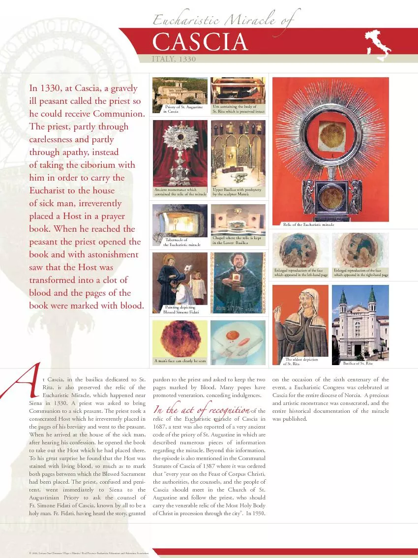
/
Grassland and Mesquite on the Santa Rita Experimental Range: Grassland and Mesquite on the Santa Rita Experimental Range:

Grassland and Mesquite on the Santa Rita Experimental Range: - PowerPoint Presentation

min-jolicoeur
min-jolicoeur . @min-jolicoeur
Follow
343 views
Uploaded On 2019-11-06

Grassland and Mesquite on the Santa Rita Experimental Range: - PPT Presentation

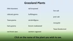
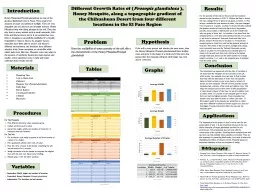
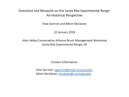
Grassland and Mesquite on the Santa Rita Experimental Range An Historical Perspective Elise Gornish and Mitch McClaran 22 January 2018 Altar Valley Conservation Alliance Brush Management Workshop ID: 763876

grass mesquite 1994 cover mesquite grass cover 1994 increase transects grassland change fire 2000 loam arizona random

Share:

Link:

Embed:

Download Presentation from below link

Download Presentation The PPT/PDF document "Grassland and Mesquite on the Santa Rita..." is the property of its rightful owner. Permission is granted to download and print the materials on this web site for personal, non-commercial use only, and to display it on your personal computer provided you do not modify the materials and that you retain all copyright notices contained in the materials. By downloading content from our website, you accept the terms of this agreement.


Presentation Transcript

Grassland and Mesquite on the Santa Rita Experimental Range: An Historical PerspectiveElise Gornish and Mitch McClaran22 January 2018Altar Valley Conservation Alliance Brush Management WorkshopSanta Rita Experimental Range, AZ Contact Information: Elise Gornish : egornish@email.arizona.edu Mitch McClaran : mcclaran@u.arizona.edu

Grassland and Mesquite on the Santa Rita Experimental Range: An Historical PerspectivePresentation OutlineGrassland and Mesquite Change Since 1900Grass-Mesquite RelationshipMesquite Control HistoryImplications for Mesquite Removal, Fire and Grass RestorationSources of Informationhttps://cals.arizona.edu/srer/ https://cals.arizona.edu/droughtandgrazing/https://uaclimateextension.shinyapps.io/SPItool/ Repeat PhotographyLong-term PrecipitationLong-term Vegetation MonitoringReports from Mesquite Removal Experiments

Grassland and Mesquite Change Since 1900From Grassland to Savanna: ~5-10% Mesquite Cover to 15-30+% Greatest Change above 3500 ft and 14’’/yLeast Change below 3000 ft and <13”/y1902 October PS 3342007 October PS 334Ground photo location

Grassland and Mesquite Change Since 1900100 years on the Ground at 3800’1917 August PS 812017 March PS 811930 June 1935 Sept1950 Nov

Grassland and Mesquite Change Since 1900What else happened?Precipitation and Temperature at PS 81 (3800’): 15.5” and 65 FWet: 30s, 80sDry: 50s and since 1996Cool: 1910s, 50s and 70sHot: since 1996Annual Precipitation since 1900Annual Temperature since 1900192019602000 Stocking Rate/100 acres Very High 1885-1902 High: 1919-1930 Moderate: 1930-2006 Low: since 2007

2. Grass-Mesquite Relationship74 Permanent transects, 3100’-4100’ elevation, grazed but not burnedMesquite: 10% in 195020% in 2015Grass:Increase following wet 80sDown to 1950s at half stocking rateNo clear relationship between mesquite and grass

2. Grass-Mesquite RelationshipMesquite CoverN=38 transectsGrass Basal Cover1994 Possible Relationships Grass increase with mesquite increase Grass unrelated to mesquite increase Grass decrease with mesquite increase

2. Grass-Mesquite RelationshipCloser look on each transects: Sandy Loam Upland 41-3, 12-16” PPTMesquite CoverN=38 transectsGrass Basal Cover1994

2. Grass-Mesquite RelationshipCloser look on each transects: Sandy Loam Upland 41-3, 12-16” PPTNo clear relationship between mesquite and grassBut decrease in grass cover since 1994 Mesquite Cover N=38 transects Grass Cover 1994 2000 2015 1994 2000

Mesquite CoverGrass Cover2. Grass-Mesquite Relationship1994 FIRE:Closer look on each transects: Sandy Loam Upland 41-3, 12-16” PPT 1994 Fire did not increase grass or decrease mesquite cover Trend of declining grass cover also occurred Mesquite Cover Grass Cover 1994 2000 2015 1994 2000 10 10 10 4 0 2 0 2 0 2 0 4 0 4 0 NOT BURNED IN 1994 (N=38 transects) BURNED IN 1994 (N=9 transects) 2000 1994

2. Grass-Mesquite RelationshipGrass under mesquite increases faster than mesquite cover increases0 20 40 60 80 1001:1 Random LineLess likelyMore likely Proportion of grass under mesquite

2. Grass-Mesquite RelationshipGrass under mesquite increases faster than mesquite cover increasesAs mesquite cover reaches 15%, grass is more common than random under mesquiteAs mesquite cover exceeds 40%, grass less likely than random to away from mesquite 0 20 40 60 80 100 1:1 Random Line Less likely More likely

3. Mesquite Control HistoryClearing and Thinning performed 1945-1960Generally, 5 yr increase in grass abundanceLasts longer at wetter locationsMesquite increases to pre-treatment in about 25 yearsException is Pasture 1 clearing in early 1950sMesquite has not returnedSandy Loam Deep 41-1 16-20”

4. Implications for Mesquite Removal, Fire and Vegetation RestorationCaveat: mesquite cover < 50% and <12-16” PPT Temper expectations for positive or sustained response of grass production to mesquite control in most eco-sites in MLRA 40.1 to 41.3Temper expectations for positive or sustained response of grass production to prescribed fire in most eco-sites in MLRA 40.1 to 41.3Consider continued decline of grass cover since 1994, are there actions other than mesquite removal and fireEfforts to increase grass abundance might focus beneath mesquite canopy as the fertile island for grass establishment