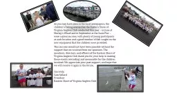
Jessica Rhodes Outline Importance of analysis Summary of existing conservation plans Goals and objectives Study area Methods Deliverables Timeline Importance of Analysis Eastern Shore of Virginia is a critical migration corridor ID: 693670
Download Presentation The PPT/PDF document "Identification of Priority Parcels for H..." is the property of its rightful owner. Permission is granted to download and print the materials on this web site for personal, non-commercial use only, and to display it on your personal computer provided you do not modify the materials and that you retain all copyright notices contained in the materials. By downloading content from our website, you accept the terms of this agreement.
Slide1
Identification of Priority Parcels for Habitat Protection on the Eastern Shore of Virginia
Jessica RhodesSlide2
OutlineImportance of analysisSummary of existing conservation plans
Goals and objectives
Study area
Methods
Deliverables
TimelineSlide3
Importance of Analysis
Eastern Shore of Virginia is a critical migration corridor
Numerous migratory bird species populations in decline
Numerous threats facing migratory birds
Recommendation made to acquire and protect land in a series of conservation corridors Slide4
Existing Plans
Identified focus areas based on broad taxonomic groups
Coarser scale than my study area
Focused on planning versus implementationSlide5
BCR 30 Implementation Plan
Designated focus areas for shorebirds,
landbirds
, and
waterbirds
within BCR 30
Discussed waterfowl focus areas developed by NAWMP
Criterion includes:
Regional importance
Developed at landscape levelDiscrete and continuous habitat
Size Slide6
North American Waterfowl Management Plan
Developed focus area for waterfowl only
Three
tiered approach
Planning area
Focus area
Sub-focus areas
Used similar approach as BCR 30Slide7
Important Bird Areas (IBAs) in VirginiaSlide8
U.S. Shorebird Conservation Plan
Eleven regional groups
Eastern Shore is within North Atlantic Planning Region
Identified goal to protect and manage sufficient areas of high priority habitats to support current populations of breeding, migrating, and wintering shorebirds
Areas in Virginia include:
coastal marshes and mudflats, barrier islands,
Craney
Island, mainland coastal areas, and uplands on the Delmarva PeninsulaSlide9
NAWCA Priority Areas for Waterbirds
Developed as an interim tool
Developed criteria for breeding colonial
waterbirds
NAWMP
and Shorebird Plan
priority areas were
selected for non-colonial waterbirds
and wintering waterbirdsEastern Shore is part of Atlantic Coast Region and Florida priority areaSlide10
Focus Area OverlapSlide11
Goals
Identify and
prioritize
parcels for habitat
protection based on importance to migratory birds
D
evelop
an interactive web mapping application which will incorporate existing data layers with the prioritized parcels identified in my analysisSlide12
Analysis ObjectivesDevelop potential habitat distribution layer for each response guild
Identify non-protected parcels within the study area
Determine acres of currently protected lands for each guild and compare it to management goals
Calculate cost associated with habitat protection
Identify parcels vulnerable to sea level rise
Create a habitat protection prioritization strategy for non-protected parcelsSlide13
Web Mapping Application Objectives
C
reate
an interactive web map which will allow users
to:
View
the prioritized parcels alongside the existing data
layers
P
erform queries to display only the data of interestCreate printable
mapsExport data layers
Compare currently protected habitat acres to acres identified in the analysis and determine if protection goals can be achievedSlide14
Study Area
425,505 acres
Agricultural and
aquacultural
community
Historically hardwood dominated forest with interspersed marshes and wetlands
International Biosphere Reserve
Western Hemisphere Shorebird Network Site
Globally important migration corridor
Insert study area mapSlide15
Protected Lands on the Eastern Shore
124,144 acres (29%) currently protected
21,158 acres permanently protected with ecological disturbance events allowed
26,209 acres permanently protected, ecological disturbance events suppressed
71,151 acres protected but subject to extractive uses
5,625 acres protected through easementsSlide16
Ownership of Protected Lands
Three National Wildlife Refuges
Seaside barrier islands and seaside farms owned/managed by TNC
Four Wildlife Management Areas
One state park
Two natural areas
Barrier Island owned by Department of Conservation and RecreationSlide17
Land Cover on the Eastern Shore
SE GAP
Land Cover
Type
Acres
% of Total
Atlantic Coastal Plain Northern Tidal Salt Marsh
102510.45
24.46
Row Crop
97804.91
23.33
Atlantic Coastal Plain Northern Basin Swamp and Wet Hardwood Forest
60943.81
14.54
Pasture/Hay
41364.40
9.87
Atlantic Coastal Plain Dry and Dry-
Mesic
Oak Forest
27418.61
6.54
Atlantic Coastal Plain Northern Tidal Wooded Swamp
14460.69
3.45
Open Water (Brackish/Salt)
12717.83
3.03
Atlantic Coastal Plain Northern Maritime Forest
12459.58
2.97
Successional Shrub/Scrub (Clear Cut)
10473.69
2.50
Evergreen Plantations or Managed Pine
(can include dense successional regrowth)
8463.61
2.02
Atlantic Coastal Plain Small
Blackwater
River Floodplain Forest
6525.85
1.56
Developed Open Space
4959.14
1.18
Low Intensity Developed
3596.24
0.86
Atlantic Coastal Plain Northern Dune and Maritime Grassland
3415.22
0.81
Successional Shrub/Scrub (Other)
2739.29
0.65
Atlantic Coastal Plain Southern Dune and Maritime Grassland
2693.84
0.64
Atlantic Coastal Plain Northern Fresh and
Oligohaline
Tidal Marsh
2315.20
0.55
Other
–
Herbaceous
1460.36
0.35
Medium Intensity Developed
1364.60
0.33
Quarry/Strip Mine/Gravel Pit
686.89
0.16
High Intensity Developed
517.82
0.12
Unconsolidated Shore (Lake/River/Pond)
257.99
0.06
Open Water (Fresh)
27.67
0.01Slide18
Land Cover Summary
Modified Land Cover Type
Acres
% of Total
Agriculture
139169
33
Forest
130272
31
Salt Marsh
104826
25
Early Successional
20782
5
Open Water
13003
3
Developed
11125
3Slide19
Methods - Guild Development
Develop a species list for response guilds based on habitat requirements during foraging and breeding
Use land cover types as a base
Whole guild approach vs. guild indicator species
Birds may be placed in multiple guilds
Sensitivity to habitat fragmentation
Based on Eastern Shore habitat, not range-wide
Bird list a subset of priority speciesSlide20
Methods - Analysis
Create a layer of all non-protected real estate parcels
Merge all existing focus areas into one data layer
Determine distance from non-protected parcels to other areas of suitable habitat which are protected
Identify areas of contiguous habitat
Determine minimum patch size for guild groups
Identify concentrated stopover areasSlide21
Methods - Analysis (ctd.)
Identify parcels vulnerable to sea level rise
Determine cost of habitat protection activities
Assign
weights to input data layers to prioritize non-protected lands using a weighted overlay
analysis
High
Medium
Low
Non-prioritySlide22
Methods – Web Mapping ApplicationArcGIS Online through USFWS account
Incorporate analysis data and input data layers
Basic web map features will be included
Additional features will include:
Creation of printable maps
Ability to export data
Ability to query data
Dashboard tool displaySlide23
DeliverablesMap for each guild depicting priority parcels
Final report explaining the analysis
Web mapping application
Presentation at ESRI Mid-Atlantic user conference and Southern Tip Ecological Partnership meetingSlide24
TimelineAugust
Gather
existing
data layers
Create any needed
data layers
Finalize guild
assignments
Conduct preliminary data
analysisSeptember
Submit abstractPreliminary design of web mapping application
Create weighting system for data input layersSlide25
Timeline (ctd.)
October
Complete analysis
Develop results section of final report
Finalize web mapping application design
November
Prepare final presentation
Publish web mapping
application
December
Present at ESRI Mid-Atlantic User Conference (December 10-11) in Baltimore, MD
Submit final project reportSlide26
AcknowledgementsDr. Joseph A.
Bishop
- Penn State Advisor
Cindy Schulz, Project Leader – USFWS
Bridgett Costanzo, Supervisor – USFWS
Herb
Bergquist
, Region 5 GIS Coordinator - USFWSSlide27
References
Atlantic Coast Joint Venture (ACJV). 2005. Atlantic Coast Joint Venture waterfowl implementation plan revision. North American Waterfowl Management Plan. Hadley, Massachusetts.
Atlantic Coast Joint Venture (ACJV). 2008. New England/Mid-Atlantic Coast Bird Conservation Region (BCR 30) Implementation Plan. Laurel, Maryland.
Atlantic Coast Joint Venture (ACJV). 2009. Atlantic Coast Joint Venture strategic plan. North American Waterfowl Management Plan. Hadley, Massachusetts.
Brown, S., C. Hickey, B. Harrington, and R. Gill (ed.) 2001. The U.S. Shorebird Conservation Plan, 2
nd
ed.
Manomet
Center for Conservation Sciences,
Manomet, Massachusetts.Clark, K.E., and L. Niles. 2000. U.S. Shorebird Conservation Plan: Northern Atlantic Regional Shorebird Plan, Version 1, U.S. Fish and Wildlife Service, Woodbine, New Jersey.
Devenish, C., D.F. Diaz Fernandez, R.P. Clay, I. Davidson, and I. Yepez Zabala
(ed.) 2009. Important bird areas - Americas priority sites for biodiversity conservation (BirdLife Conservation Series, No. 16). BirdLife International, Quito, Ecuador.Slide28
References
Fraser, J., J. Cohen, J.
Berkson
, E.
Hallerman
., and D.
Hata
. 2006. Factors limiting the migratory shorebird community in Delaware Bay and Coastal Virginia: Implications for the management of bird populations and the horseshoe crab fishery, 2004-present [Internet]. Blacksburg, Virginia [accessed July 21, 2013]. Available from:
http://fishwild.vt.edu/faculty/karpanty/shorebirds.html
. Glick, P., A. Staudt, and B. Nunley. 2008. Sea-level rise and coastal habitats of the Chesapeake Bay: A summary. The National Wildlife Federation, Reston, Virginia.
Graaf, R.M, N.G. Tilghman, and S.H. Anderson. 2013. Foraging guilds of North American birds. Environmental Management 9(6): 493-536.0
National Audubon Society. 2013. Global and continental important bird areas [Internet]. New York, New York [accessed May 24, 2013]. Available from: http://web4.audubon.org/bird/iba/prioritizedibas.htm .
North American Bird Conservation Initiative (NABCI), U.S. Committee. 2009. The State of the Birds, United States of America, 2009. U.S. Department of Interior: Washington, D.C.North American Bird Conservation Initiative, U.S. Committee, 2009. The State of the Birds, United States of America, 2009. U.S. Department of Interior: Washington, DC. 36 pages.Slide29
References
O’Connell, T.J., L.E. Jackson, and R.P. Brooks. 2000. Bird guilds as indicators of ecological condition in the central Appalachians. Ecological Applications 10(6): 1706-1721.
Pashley
, D.N., C.J. Beardmore, J.A. Fitzgerald, R.P. Ford, W.C. Hunter, M.S. Morrison, and Rosenberg, K.V. 2000. Partners in Flight: Conservation of the Land Birds of the United States. American Bird Conservancy, The Plains, Virginia.
Robbins, C.S., D.K. Dawson, and B.A. Dowell. 1989. Habitat area requirements of breeding forest birds of the Middle Atlantic States. Wildlife Monographs 103: 3-34
U.S. Fish and Wildlife Service (Service). 2008. Birds of Conservation Concern 2008. United States Department of Interior, Fish and Wildlife Service, Division of Migratory Bird Management, Arlington, Virginia.
Verner
, J. 1984. The guild concept applied to management of bird populations. Environmental Management 8 (1): 1-14.
Watts, B.D. 1999. Partners in Flight: Mid-Atlantic Coastal Plain bird conservation plan (Physiographic Region #44). Center for Conservation Biology, College of William and Mary, Williamsburg, Virginia. Slide30
Questions?
Jessica Rhodes
U.S. Fish and Wildlife Service
6669 Short Lane
Gloucester, VA 23061
Jessica_Rhodes@fws.gov