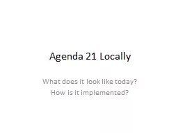
What does it look like today How is it implemented Option 1 Sign the ICLEI Charter Promise that none of your zoning laws regulations ordinances policies plans will conflict with ICLEI and UN policies ID: 488828
Download Presentation The PPT/PDF document "Agenda 21 Locally" is the property of its rightful owner. Permission is granted to download and print the materials on this web site for personal, non-commercial use only, and to display it on your personal computer provided you do not modify the materials and that you retain all copyright notices contained in the materials. By downloading content from our website, you accept the terms of this agreement.
Slide1
Agenda 21 Locally
What does it look like today?
How is it implemented?Slide2
Option 1 - Sign the ICLEI Charter
Promise that none of your zoning laws, regulations, ordinances, policies, plans will conflict with ICLEI and UN policies.
You get help from ICLEI and potential grants and matching funds from ICLEI, Federal and State sources.
You get help with developing your comprehensive development plans and in networking with media, community organizing organizations, business organizations and other government bodies to sell it.
You get to send a voting representative to the biennial meetings of the ICLEI Board to vote on changes to the ICLEI Charter.
You get to use ICLEI logos and materials on your website and in your published documents.Slide3
Option 2 – Don’t Sign the Charter
Federal and state environmental laws, grant rules, and development/business
regs
incorporate many Agenda 21 principles.
A whole industry of “consultants”, “facilitators”, and “professional planning” “expert” companies has grown up around Agenda 21.
The environmental movement and Left pressure and advocate into local Planning Boards.
The push is for Comprehensive Development Plans, Bicycle Transportation Plans, Pedestrian and Hiking Trail Plans, Natural Habitats, Bird Sanctuaries, etc.Slide4
How do you tell?
Option 1 – More
Obvious.
They usually flaunt it. There are budget items. Or the members are listed at: http://www.iclei.org/index.php?id=11454
Option 2 –
Camouflaged.
You have to recognize the code language, the principles, and the policies which are consistent with Agenda 21.
You have to review the Planning Board document, comprehensive plans, zoning laws, etc.
You have to understand the Agenda 21 principles and precepts to recognize what is being implemented.Slide5
2 Long Term Goals of Agenda 21
Government Ownership and Control of all Land
Set aside 50% of land as Core Reserves and Corridors – off limits to Humans
Set aside 25% of land as Buffer Zones with Government controls over resource use and limited human encroachment only as necessary to accomplish government-approved activities.
All human habitation to be limited to the remaining 25% of land in high-density planned urban areas based on 20 minute rule.Slide6
2 Long Term Goals of Agenda 21
Reduce world population from its current 5.5 billion in 2011 to no more than 700,000. Maintain a stable world population in that range through fertility controls and education.
All links and webpages pertaining to the Global Sustainability Summit in Cairo have been scrubbed from the internet.Slide7Slide8
North
Carolina
Long Range Land Use MapSlide9Slide10Slide11
Excerpts of S.P. Policies
(P-R.01) Acquire, develop and maintain neighborhood parks in new and existing neighborhoods.
(G.04, G.05, G.07)
(
P-R.02) Continue development of a greenway system, facilitating open
space retention
and interlinking Southern Pines’
neighborhoods.
(G.04
, G.05, G.07, G.12
)
P-R.06
) Discourage public investment in new utilities infrastructure
through Horse
Country
.
(
G.06, G.07
)Slide12
Excerpts of S.P. Policies
(P-R.04) Collaborate with Moore County, land trusts and others on
effective land
use strategies promoting preservation of Horse Country
.
(
G.06, G.07, G.12
)
(P-S.05) Maintain, expand and improve Southern Pines’ parks, greenway and open-space areas, on-pace and in concert with need and plan objectives.
(G.05, G.06, G.07, G.12, G.17)
(
P-V.03) Pursue open-space and critical-area preservation, using the
smartgrowth
toolbox or other appropriate strategies.
(G.06, G.07, G.12, G.13
)Slide13
Excerpts of S.P. Policies
(P-X.02) Make walking or bicycling a more convenient, safe and economical transportation alternative.
(G.02, G.04, G.05)
(
P-X.10) Minimize land dedicated to parking downtown, ensuring space for services and retaining the continuity of storefronts along downtown sidewalks.
(G.02, G.03
)
(P-X.16) Facilitate the development of a non-automotive
inter-regional transportation
system
.
(
G.13)Slide14
Excerpts of S.P. Policies
(P-V.05) Improve Southern Pines’ sustainability by conserving
water resources
and improving its quality
.
(
G.12, G.13)
(P-V.06) Improve Southern Pines’ sustainability by providing incentives
for increased
recycling of household and construction waste
.
(
G.12, G.13)
(P-V.07) Improve Southern Pines’ sustainability by providing incentives
for energy
conservation
.
(
G.12, G.14)
(P-V.08) Improve Southern Pines’ sustainability by providing incentives
for “green
” building design, practices and construction
.
(
G.12, G.13)Slide15
Definitions
Green Building Design
The philosophy, approach and application of energy and environmental conservation in
the design
and construction of buildings, often associated with specific criteria for
determining compliance
, such as Leadership in Energy and Environmental Design (LEED) certification.
Greenway
A trail facility dedicated exclusively to pedestrian, bicycle and/or equestrian use,
usually following
alignments other than parallel to roadways and
designed
Incompatible Uses
Uses of land that is not harmonious.Slide16
Definitions
Land Use
The specific purpose for which land or a building is designated, arranged, intended, or
for which
it is or may be occupied or maintained.
Landscaping Buffers
The separation of land uses from other land uses or sensitive environmental areas by a
strip of
unoccupied
land, reducing potential conflicts and negative impacts by putting distance
and screening
between the two
.
Open Space
Land in a predominantly natural state or altered for natural resource based uses
and
may include, but is not limited to: riparian areas, agricultural lands, watersheds,
forests, floodplains
, and habitat areas.Slide17
Terms used to disguise Land Area removed from Private Uses
Parks
Nature
Habitat/Preserve
Buffer Areas/Zones
Transition Areas
Hiking Trails
Bicycle Paths
Greenways/
Greenlines
Watershed preserves
Wetlands
Historic sites
Land Trusts
Open Spaces
Common Areas
Public Spaces
Landscaping Buffers