/
High Accuracy Helicopter Lidar & Mapping High Accuracy Helicopter Lidar & Mapping

High Accuracy Helicopter Lidar & Mapping - PowerPoint Presentation

natalia-silvester
natalia-silvester . @natalia-silvester
Follow
432 views
Uploaded On 2016-04-20

High Accuracy Helicopter Lidar & Mapping - PPT Presentation

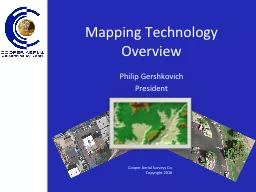
Jeffrey B Stroub CPRLSPPSSP Vice President Business Development September 9 2014 Jeff Stroub CP RLS PPS SP VicePresident Business Development September 16 2014 Understanding USGS LiDAR ID: 285145

surface breaklines usgs lidar breaklines surface lidar usgs hydro accuracy bare earth specification required flattened water enforced point dem

Share:

Link:

Embed:

Download Presentation from below link

Download Presentation The PPT/PDF document "High Accuracy Helicopter Lidar & Map..." is the property of its rightful owner. Permission is granted to download and print the materials on this web site for personal, non-commercial use only, and to display it on your personal computer provided you do not modify the materials and that you retain all copyright notices contained in the materials. By downloading content from our website, you accept the terms of this agreement.


Presentation Transcript

Slide1

High Accuracy Helicopter Lidar & MappingJeffrey B. Stroub, CP,RLS,PPS,SPVice President Business Development September 9, 2014

Jeff Stroub CP, RLS, PPS, SP

Vice-President Business Development

September 16, 2014

Understanding USGS LiDAR

Base Specification Version 1.0Slide2

USGS LiDAR Base Specification Version 1.0Slide3

Goal USGS Base SpecificationConsistency – all USGS funded LiDAR CollectionsUSGS Interest is only LiDAR Derived Elevation ModelsUSGS Scope specific to their mission Hydro-Flattened surface Hydro Enforced optional surfaceA carefully planned project may support other usesUSGS Version 1.1 in concept stageSlide4

H. Karl Heidemann, GISP

Physical Scientist

U.S. Geological Survey/EROSSlide5

5/25

Background

In response to ARRA funding for USGS LiDAR collection, development of a common minimum specification was begun in early 2009; the

USGS NGP Lidar Base Specification, Version 1.0

was published in the summer 2012: .

Time marches on …

NEEA Study on national LiDAR value published

The 3DEP established

ASPRS Accuracy Standards developed

Technical advances in the industry

The now 5 year-old v1.0 Specification requires revisionSlide6

6/25Slide7

7/25ASPRS Accuracy Standard Alignment

Alignment to ASPRS Accuracy Assessment Methodology

NVA on point cloud assessed in single-return areas

VVA must be met (excluding delineated Low Confidence areas)

CVA is no longer reported

Use of ASPRS recommended check point quantitiesSlide8

8/25Lidar Specification Changes

QL2 is the minimum QL for 3DEP lidar collections.

2 points/m

2

10 cm RMSE

Z

LAS Version 1.4 is required.

OGC Well Known Text Georeference information required

LAS Point Record Format 6, 7, 8, 9, or 10 are required.

Proper use of Withheld and Overlap flags required.

Metadata for LiDAR files.

LiDAR metadata tags suggested in v1.0 are required in v1.1.Slide9

LiDAR Specification Changes

2GB limit on swath file size has been removed.

Flightline Overlap requirement has been removed.

Scan Angle guideline has been removed.

Classification:

Two added required classifications

Bridges (17)

High Noise (18)

Classification Accuracy for : QL2, QL1, and QL0

Test areas are now 1 square km, not 1 km squareSlide10

LiDAR Accuracy Accuracy is dependent on:Flying heightSensor parametersRep RateScan Angle Scan frequency

System accuracy Terrain

VegetationBaseline distanceLocation of base station to AircraftSlide11

Plan based onWorkable blocks of dataDelivery tilesBaseline requirementsFlightline distance limitationsControl locationsAccuracyApplicationTopography

LiDAR Project PlanningSlide12

Processing StepsGPS Processing

QC GPSIMU Processing

QC IMUCalibration

Check CalibrationLAS point Cloud OutputVerify coverageClassificationSub sample for MacrosBreakline generationQC Manual Editing

QC process

Generation products

Check DeliverablesSlide13

Full Return Surface ModelSlide14

LiDAR Classified .LAS FileSlide15

ClassificationSlide16

Manual EditingSlide17

USGS ProductHydrologically – Flattened (Hydro-Flattened) – USGS Standard ProductProcessing of LiDAR derived surface (DEM or TIN) so mapped water surfaces are flat from bank to bank, and rivers demonstrate a gradient change. Breaklines are used to establish elevations for water surfaces consistent with surrounding topography, and produce aesthetically acceptable water surfaces in final DEM or TIN. Hydro flattening is driven solely by USGS cartographic mapping needs.Slide18

BreaklinesBreakline specifications vary by project and point densitiesHydrologically-Conditioned (Hydro-Conditioned)Processing of a DEM or TIN so that the flow of water is continuous across the entire terrain surface whether flow in channel or not (evaluation basin / large areas)Hydrologically –Enforced (Hydro-Enforced)Process of mapping water bodies so that lakes and reservoirs are at level surface and so that streams flow downhill……(typically used for hydrologic and hydraulic modeling) – optional productSlide19

Bare-Earth Surface without BreaklinesSlide20

Bare-Earth Surface with BreaklinesSlide21

BreaklinesIf a DEM is required for a project and the breaklines fail acceptance, the DEM will fail acceptance.LiDAR industry has come along way in breakline developmentBreakline generation depends on source material – formerly Photogrammetry now LiDAR derivedSlide22

BreaklinesUSGS Spec.100 Feet River2 AcreSlide23

BreaklinesSlide24

BreaklinesSlide25

BreaklinesSlide26

BreaklinesSlide27

BreaklinesSlide28

BreaklinesA Cross Section is viewed to see if the red XBAR line is set at the lowest elevation.The red XBAR line elevation can be changed if not correct.Slide29

BreaklinesAfter placing the red XBAR lines and setting their elevation so they monotonic you are ready to drape water breaklinesSlide30

BreaklinesThis is a 5000’ x 5000’ TileThis is a full tile with the water bodies and river collected. The red XBARs have been placed and the elevations have been set.Slide31

BreaklinesThe Final check to make sure the river breaklines are monotonicis to run contours. A surface is created with the river breaklines only. Contours are developed for That surface and contours are created crossing only the river breaklines.Slide32

Bare-Earth SurfaceSlide33

Bare-Earth with Breaklines – Hydro Flattened SurfaceSlide34

Bare-Earth Surface - Hydro FlattenedSlide35

Bare-Earth with Contours processed through a Hydro Flattened SurfaceSlide36

Hydro Flattened - Bare-Earth SurfaceSlide37

Hydro Flattened Surface with Flood Stage IntroducedSlide38

Bare-Earth with Breaklines – Hydro Enforced SurfaceSlide39

Bare-Earth Surface Hydro EnforcedSlide40

Bare-Earth with Contours processed through a Hydro Enforced SurfaceSlide41

Hydro Enforced Bare-Earth SurfaceSlide42

Hydro Enforced Surface with Flood Stage IntroducedSlide43

AccuracyField surveying required to establish:FVA – Fundamental Vertical accuracySVA – Supplemental Vertical AccuracyCVA – Consolidated Vertical Accuracy

RMSE Fundamental Vertical Accuracy (FVA

) using check points in open terrain.

FVA = 1.9600 * RMSE(z) = Sqrt[(Σ(Zdata(i) . Zcheck

(

i

))

2 )/n]Slide44

AccuracySlide45

AccuracySlide46

Standard USGS DeliverablesHydro-flattening per USGS water surface requirementsNo single line drain breaklines – optionalMetadata – extraneousRaw point cloud in .LAS – file size fixed at 2gbClassified Point cloud – USGS standard Bare-Earth Surface (Raster DEM) per classification schemeBreaklines per USGS specification - ESRI feature class

No contour processingSlide47

Project ReportingDesigned to USGS and other agency requirements Slide48

Questions and AnswersThank You