/
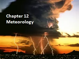
Chapter 12 Meteorology Section 12-1 Chapter 12 Meteorology Section 12-1

Chapter 12 Meteorology Section 12-1 - PowerPoint Presentation

olivia-moreira
olivia-moreira . @olivia-moreira
Follow
351 views
Uploaded On 2018-12-18

Chapter 12 Meteorology Section 12-1 - PPT Presentation

The Causes of Weather Objectives Compare and contrast weather and climate Analyze how imbalances in the heating of the Earths surface create weather Describe how and where air masses form Meteorology is the study of atmospheric phenomena from the ancient Greek meteor high in the air ID: 743495

weather air cold pressure air weather pressure cold fronts warm systems wind surface high masses data effect front winds

Share:

Link:

Embed:

Download Presentation from below link

Download Presentation The PPT/PDF document "Chapter 12 Meteorology Section 12-1" is the property of its rightful owner. Permission is granted to download and print the materials on this web site for personal, non-commercial use only, and to display it on your personal computer provided you do not modify the materials and that you retain all copyright notices contained in the materials. By downloading content from our website, you accept the terms of this agreement.


Presentation Transcript

Slide1

Chapter 12

MeteorologySlide2

Section 12-1

The Causes of Weather

Objectives:Compare and contrast weather and climateAnalyze how imbalances in the heating of the Earth’s surface create weatherDescribe how and where air masses formSlide3

Meteorology is the study of atmospheric phenomena, from the ancient Greek meteor “high in the air”. Slide4

The Causes of Weather

Three main categories of “meteors”

“Hydrometeors”- precipitation“Lithometeors” – smoke, dust, and haze (condensation nuclei)“Electrometeors” – thunder and lightningSlide5
Slide6
Slide7
Slide8
Slide9

Weather and Climate

Atmospheric phenomena interact to affect the environment and life on Earth

Weather is defined as the current state of the atmosphereClimate is the average weather over the course of a 30 year periodSlide10

A Question of Balance

The Sun heats the surface of the Earth as its rays hit, some rays hit directly and some hit the Earth at a low angle. Slide11

Why then doesn’t the heat continue to rise at the equator and make it even warmer than it is?

A Question of BalanceSlide12

The air/wind and ocean water redistribute the heat around the globe, the equator is the main entry point. Slide13

Air Masses

An air mass is a large area of air that takes on the characteristics of the area over which it forms. The land or water area is called the source region.

The characteristics that the air mass can have are humidity, dryness, hot, or cold. Slide14

Classifying Air Masses

Warm and dry continental tropical (

cT)Warm and humid maritime tropical (mT)Cold and dry continental polar (cP)

Cold and humid maritime polar (

mP

)

Arctic (A)Slide15

Source Regions

North America experiences all five types of air masses and the climate and weather varies greatly.Slide16

Air Mass Modification

Air masses do not stay in one place for very long, as they move they transfer heat from one area to another and they begin to acquire the characteristics of the source region that they travel to.

Table 12-1 pg. 304Slide17

Section 12-2

Weather Systems

Objectives:Describe how the rotation of Earth affects the movement of airCompare and contrast wind systemsIdentify the various forms of frontsSlide18

The Coriolis Effect

The Earth rotates from East to West as it spins, this has an effect on the air, the air is deflected to the right in the northern hemisphere and to the left in the southern hemisphere.

This effect forms very specific and distinct global wind systemsSlide19

Coriolis EffectSlide20

Global Wind Systems

There are three basic wind systems in each hemisphere

Trade Winds Prevailing WesterliesPolar EasterliesSlide21
Slide22

Trade Winds

Wind that occurs from equator to 30 N and 30 S

Air sinks, warms, and moves toward the equator in a westerly direction when it reaches the equator, it rises again and goes toward 30 N and 30 S again…cycle completeSlide23

Prevailing Westerlies

Winds between 30 and 60 north and south

The surface winds move toward the poles in a generally easterly direction (the blow from west to east, hence the name)This wind is responsible for the weather patterns that move across the United States and CanadaSlide24

Polar Easterlies

Winds that occur from 60 N and 60 S and the north and south poles

In both hemispheres the winds are characterized by cold airSlide25

Jet Streams

Wind, temperature, and pressure are all related and effect climate and weather

Differences in temperature and pressure create wind high up in the atmosphere that can reach 185 km/hSlide26

Jet StreamSlide27

Large Scale Weather Systems

Despite the jet streams high altitude, it has a dramatic effect on weather, it pushes air across the globe quickly if the air get caught up in the current. It is a hit and miss situation…Slide28
Slide29

Fronts

A front is a narrow region separating two air masses of different densities. The density differences can be caused by differences in temperature, pressure, and humidity.

The interaction between colliding air masses can bring dramatic changes in weatherSlide30

Four Types of Fronts

Cold Fronts

Warm FrontsStationary FrontsOccluded FrontsSlide31

Cold Fronts

In a cold front, cold dense air pushes warm air up steeply. As the warm air rises, it begins to cool and thereby lose its moisture…clouds, showers, and thunderstorms are associated with cold fronts

Solid blue line with blue triangles pointing in the direction of the fronts motionSlide32

Warm Fronts

A warm front occurs when warm air displaces cold air near the surface, the air ahead of a warm front moves slowly and because of less land friction can gradually push up the cold air

Cloudiness and precipitation Solid red line with semicircles pointing in the direction of the front’s motion Slide33

Stationary Fronts

When two similar air masses collide sometimes neither can advance or overtake the other this results in a stationary front or a stall.

Solid blue line with alternating blue triangles and red semicirclesSlide34

Occluded Fronts

A warm front that gets wedged in between two cold fronts, the warm air gets pushed upward and rain is common on both sides of the cold air boarder

A purple line with alternating purple triangles and semicircles pointing in the direction of motionSlide35

Pressure Systems

Rising air is associated with low pressure and sinking air is associated with high pressure

Rising and sinking air combined with the Coriolis Effect result in rotating high and low pressure systemsSlide36

High-Pressure Systems

In a high pressure system, air is sinking…so when it finally hits the surface of the Earth it spreads out pushing everything away.

This clears the skiesSlide37

Low-Pressure Systems

As air rises, it creates space beneath it that is usually filled in by dense colder air. Low-pressure systems pull air in to the Earth’s surface as they rise.

This forms clouds and rainSlide38

Section 12-3

Gathering Weather Data and Analysis

Objectives:Describe the technology used to collect weather dataDescribe problems with long-term forecastsSlide39

Surface Weather Data

Thermometers use mercury or alcohol that expand when heated are used to measure temperature

Barometers use mercury to measure air pressureSlide40

Surface Weather Data

Anemometer is used to measure wind speed

Hygrometer measures relative humiditySlide41

Upper-Level Data

While surface data is important, the weather that we experience is caused by changes that take place in the upper atmosphere

Weather Radar including Doppler Radar and Vipir Radar along with Weather SatellitesSlide42

Short-Term Forecasts

In the early days of weather forecasting, meteorologists simply observed what was going on currently and compared it to the last couple of days and tried to predict the future based upon that…Slide43

Short-Term Forecasts

The key to unlocking the weather forecast puzzle is to understand that the atmosphere acts much like a fluid, so we can apply concepts like temperature, density and pressure to understand it.Slide44

Digital Forecast

High speed computers can analyze large amounts of data very quickly and enable meteorologists to make more dependable forecasts…the more available data, the better the forecast.Slide45

Long-Term Forecasts

The further into the future that you try and predict the weather, the less accurate the forecasts become.

Too many variables to predict accurately over a long period