PDF-EPA’s 303(d) Impaired Waters Geospatial Data at a Glance: Only 3
Author : olivia-moreira | Published Date : 2015-08-11
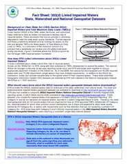
EP A EPAOffice of Water Washington DC TMDL Program Results Analysis Fact Sheet EPA841F10002 January 2010The state and watershedlevel geospatial data reflect
Presentation Embed Code
Download Presentation
Download Presentation The PPT/PDF document "EPA’s 303(d) Impaired Waters Geospa..." is the property of its rightful owner. Permission is granted to download and print the materials on this website for personal, non-commercial use only, and to display it on your personal computer provided you do not modify the materials and that you retain all copyright notices contained in the materials. By downloading content from our website, you accept the terms of this agreement.
EPA’s 303(d) Impaired Waters Geospatial Data at a Glance: Only 3: Transcript
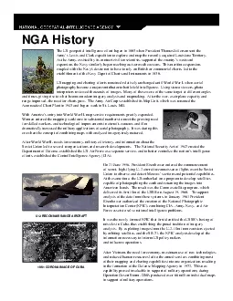
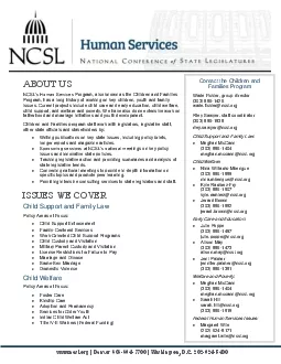
EP A EPAOffice of Water Washington DC TMDL Program Results Analysis Fact Sheet EPA841F10002 January 2010The state and watershedlevel geospatial data reflect. Overview of the Final 2013 VGP. November 6, 2013. Presentation Overview. Background. EPA and the Clean Water Act. VGP basics and key dates. 2008 VGP Overview and Inspection Summary. Final 2013 VGP - Summary of Key Conditions. Waters of the United . States. Audio Dial in . Number. 855-581-6805. February . 27, 2014. Don Parrish. Senior Director, Regulatory Relations, American Farm Bureau Federation. Chair, Waters Advocacy Coalition. Ioannis. . Kokkinidis. Geospatial and Environmental Analysis PhD program. Software and Data Licenses. Proprietary. Limited Distribution. Limited Use. End User License Agreement. Closed . Source Code. – ABS experience . Frank Yu. First Assistant Statistician . Project Management and Infrastructure Division. October . 2013. Increasing demand for location based information about places, people. , human activity, . Call to order and . introductions. Approval . of . June 24, . 2015 meeting . minutes. New council leadership team. Purpose of new leadership team. Clarifying the mission and role of the council. Discussion: Role of committees and workgroups. (Streams, Lakes and Springs). Prepared by: . Florida Department of Environmental Protection, Division of Environmental Assessment and Restoration. Overview of Presentation. Nutrient Criteria Development Timeline. Joe Martin. Water Quality Standards. 1. BEACH Act. Beaches Environmental Assessment and Coastal Health Act. . Signed into law on October 10, 2000.. The BEACH Act amended the Clean Water Act by adding the following sections:. On 21 June 1956 President Eisenhower ordered the commencement of secret high-flying U-2 aircraft reconnaissance flights over the Soviet Union to observe and detect Moscow146s actions and potential cap -364-7700 Washington DC 202-624-5400ABOUT USNCSLs Human ServicesProgram also known as the Children and Families Programhas a long history of working on keychildren youth and family issuesCurrent proj kindly visit us at www.examsdump.com. Prepare your certification exams with real time Certification Questions & Answers verified by experienced professionals! We make your certification journey easier as we provide you learning materials to help you to pass your exams from the first try. Professionally researched by Certified Trainers,our preparation materials contribute to industryshighest-99.6% pass rate among our customers. Start Here--- https://bit.ly/46wICt4 ---Get complete detail on 303 exam guide to crack F5 Certified Technology Specialist - BIG-IP Application Security Manager (F5-CTS ASM). You can collect all information on 303 tutorial, practice test, books, study material, exam questions, and syllabus. Firm your knowledge on F5 Certified Technology Specialist - BIG-IP Application Security Manager (F5-CTS ASM) and get ready to crack 303 certification. Explore all information on 303 exam with number of questions, passing percentage and time duration to complete test. Tim Loesch, MN DNR. Presentation to the . Statewide . Geospatial Advisory Council. May 30, . 2012. Geospatial Data Resource Sites. At the DNR. 2,000 resource professionals. Planners, resource managers, researchers, technicians, conservation officers, hydrologists. Subcommittee Members. Dave DiSera (Chair). Joanne Gabrynowicz. Randy Johnson. Don McKay. Matt O’Connell. Cindi Salas. Tony Spicci. NGAC Geospatial Workforce Development Subcommittee. Purpose:. Provide recommendations on approaches to develop... NGAC Meeting. December 7, 2010. Karen Siderelis. Geospatial Information Officer. Department of the . Interior. Overview. Background. Accomplishments Over Last 9 Months. Next Steps. Geospatial Platform: Call to Action.
Download Rules Of Document
"EPA’s 303(d) Impaired Waters Geospatial Data at a Glance: Only 3"The content belongs to its owner. You may download and print it for personal use, without modification, and keep all copyright notices. By downloading, you agree to these terms.
Related Documents