/
Georges Pummels Caribbean, Florida Keys, Georges Pummels Caribbean, Florida Keys,

Georges Pummels Caribbean, Florida Keys, - PDF document

phoebe-click
phoebe-click . @phoebe-click
Follow
407 views
Uploaded On 2016-07-15

Georges Pummels Caribbean, Florida Keys, - PPT Presentation

and US Gulf Coast Storm Review Apr 12 1999 Update 
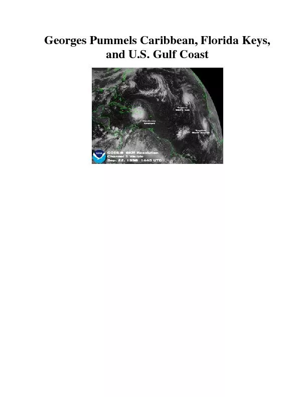
From September 2130 1998 Hurricane Georges left a trail of destruction in the Caribbean region and across the southern US Gulf coast Estimat ID: 406084

and U.S. Gulf Coast Storm Review

Share:

Link:

Embed:

Download Presentation from below link

Download Pdf The PPT/PDF document "Georges Pummels Caribbean, Florida Keys," is the property of its rightful owner. Permission is granted to download and print the materials on this web site for personal, non-commercial use only, and to display it on your personal computer provided you do not modify the materials and that you retain all copyright notices contained in the materials. By downloading content from our website, you accept the terms of this agreement.


Presentation Transcript

Georges Pummels Caribbean, Florida Keys, and U.S. Gulf Coast Storm Review (Apr 12, 1999 Update) From September 2130, 1998, Hurricane Georges left a trail of destruction in the Caribbean region and across the southern U.S. Gulf coast. Estimates indicate more than 600 people were killed (or still missing) as the storm pushed its way across the islands of the Caribbean. The Caribbean islands where preliminary death totals are reported so far include Antigua, Barbuda, St. Kitts, U.S. Virgin Islands, Puerto Rico, Dominican Republic, Haiti, Cuba, and the Bahamas. In the U.S. mainland, there were four Georgrelated fatalities. An elderly woman died from heat stress while being evacuated from New Orleans. Two more people died in Florida and Louisiana in fires started by candles during power outages, and another person died as a result of an auto accident ona slick highway near Crestview, Florida. Puerto Rico reported 12 fatalities. Damage estimates for the U.S. including Puerto Rico are now $5.9 billion. Extreme flooding was reported with rainfall amounts in excess of 20 to possibly 30 inches along portions of the southern U.S. Gulf coast. Mobile, Alabama received 13.0 inches of rain from the storm, which boosted the monthly total to 23.0 inches, breaking the September record of 16 inches set 100 years ago. The highest individual storm total reported thus far is Munson, Florida, which reported 25.0 inches of rain from Georges. Following are reports from individual states and countries as provided by the Southeast Regional Climate Center and other sources: Alabama: Gusts to 85 mph reported. 25foot waves onimmediate coast. 177,000 customers without power. No deaths or major injuries. Severe flooding in southern Alabama, with many homes and businesses flooded. Downtown Mobile flooded in many areas. Florida: 1830 inches of rain in portions of Panhandle, with NEXRAD estimates exceeding 35 inches for one small area near the AL state line. Mandatory evacuations total about 225,000. Severe flooding, high winds, and isolated tornadoes caused extensive damage. Nearly 700,000 without power at some point during storm. Approximately 200 residents in the Florida panhandle were rescued by the Coast Guard Sunday night. A portion of Interstate 10 near the Alabama border was destroyed or washed over. One death reported statewide. On the Florida Keys, 90 mph winds were reported for� 10 hours during storm passage; heavy structural damage from the storm, according to the Florida Division of Emergency Management. More than 900 homes suffered minor damage, 500 major damage, and more than 150 homes were completely destroyed, including 75 houseboats on socalled "Houseboat Row." All Key West residents were without power, and residents are under a "boil water" order. Utility restoration expected to take 710 days. Big Pine Key and Kudjoe Key were hardest hit, including severe stormsurge damage. Since the highest elevation in the Keys is 14 feet, high water quickly swept into homes and businesses. Puerto Rico: A major disaster. Damages estimated to exceed $2 billion. Three direct deaths; nine others from medical complications (heart attacks, etc.). Power and water out to 80% of the 3.8 million people on island. The Federal Emergency Management Agency (FEMA) estimates 33,113 homes destroyed in Puerto Rico, with nearly 50,000 more suffering major or minor damage. The storm destroyed 75 percent of the coffee crop, 95 percent of Puerto Rico's plantains, and 65 percent of its chickens. US Virgin Islands: No deaths and little major damage was reported. Only about 20 homes were destroyed and another 50 damaged. Adherence to building codes likely prevented further damage. Most structures on the three islands had been rebuilt to FEMA standards after hits by Hugo (1989) and Marilyn (1995). Damage reported is almost solely restricted to agriculture (coconuts & mangoes) and livestock losses. tigua: Two dead; major structural damage islandwide; major coastal flooding; major marina, boat, and port damages. St. Kitts & Nevis: Three dead, 3000 homeless; 85% of all homes damaged. Early damage estimate is $402 million. Infrastructure damaged (mosthospitals, police stations, schools damaged); severe damage to airport terminal and control tower. Cuba: Five dead; 2100 homes destroyed; 40,000 homes damaged. 20,000 homes flooded in Holguin Province. Major crop damage; 200,000 evacuated during and after the storm. Haiti: 94 deaths at last tally. 60 missing. Flooding in PortPrince, in Artibonite Valley, CapHaitien. Dominican Republic: At least 210 dead, more than 500 missing. About 100,000 homeless. 70% of all bridges damaged or out; 90% of all plantation crops destroyed; damages estimated at more than $1 billion. Satellite/Radar Images of Hurricane GeorgesSeptember 26Mobile (KMOB) NEXRAD Derived 48hour Storm Totals September 28 Radar Image at 1:07 pm (CDT) September 28 Radar Image at 4:57 am (CDT) September 28 MPEG movie 4.7mb September 28 MPEG movie 2.6mb September 28 Colorized IR Center Moving Inland Over Mississippi September 27 Visible Approaching Mississippi Coast September 25 Colorized IR Over the Florida Keys September 25 Visible Over the Florida Keys September 22 Visible With Tropical Storms Ivan and Jeanne September 22 Visible Striking Dominican Republic September 22 Colorized IR With Well Defined Eye September 21 Visible Near Virgin Islands September 18 Visible ESDIS Operational Significant Event Imagery Precipitation TablePreliminary Precipitation Reports (Based on daily rainfall data from the Climate Prediction Center)Rainfall in affected states for 6day period ending at 12Z on Sep 30, 1998 amounts listed for totals exceeding 10.00: DAYS ID STATION COUNTY ST ELEV LAT LON RAINFALL 6 CEW CRESTVIEW OKALOOSA FL 190 30.78N 86.52W 20.11 5 ALUA1 ANDALUSIA COVINGTON AL 250 31.30N 86.53W 19.57 4 NCVF1 NICEVILLE OKALOOSA FL 60 30.52N 86.50W 19.53 6 GVLA1 GREENVILLE BUTLER AL 470 31.85N 86.65W 19.30 5 VPS VALKARAISO OKALOOSA FL 30.50N 86.50W 19.19 3 GRGA1 GEORGIANNA BUTLER AL 300 31.67N 86.73W 19.15 4 HRT 4 BWTA1 BREWTON ESCAMBIA AL 85 31.07N 87.05W 17.60 6 DEFF1 DE FUNIAK SPRINGS WALTON FL 230 30.73N 86.07W 17.55 3 OCSM6 OCEAN SPRINGS JACKSON MS 30.23N 88.67W 15.67 3 WHTA1 WHATLEY CLARKE AL 170 31.65N 87.72W 15.15 2 KGNA1 KINSTON COFFEE AL 270 31.23N 86.18W 14.27 5 GVAA1 GENEVA GENEV 6 MOB MOBILE MOBILE AL 204 30.68N 88.24W 13.71 6 NPA PENSACOLA ESCAMBIA FL 30 30.33N 87.30W 13.51 5 DIBM6 D'IBERVILLE HARRISON MS 30.48N 88.90W 12.23 6 BIX BILOXI HARRISON MS 26 30.40N 88.92W 12.11 5 EVRA1 EVERGREEN CONECUH AL 290 31.45N 86.93W 12.02 6 CODA1 CODEN MOBILE AL 12 30.38N 6 CLDA1 COFFEEVILLE CHOCTAW AL 46 31.77N 88.13W 11.78 6 BEAA1 BEATRICE MONROE AL 178 31.73N 87.20W 11.77 2 GNVA1 GENEVA GENEVA AL 106 31.03N 85.83W 11.57 6 CLBA1 CLAIBORNE MONROE AL 50 31.62N 87.55W 11.48 6 LEKM6 LEAKESVILLE GREENE MS 51 31.15N 88.56W 10.65 1 PINA1 PINE APPLE WILCOX AL 250 31.87N 86.98W 10.40 6 TOMA1 THOMASVILLE CLARKE AL 405 31.92N 87.73W 10.20 All rainfall reports for LA, MS, AL, GA, SC, and FL Rainfall in Puerto Rico for 2day period ending at 12Z on Sep 23, 1998 amounts listed for totals exceeding 10.00: DAYS = Number of days of data for Sep 2223, 1998 period -- Note that some stations reported only for 1 of the 2 daysID = National WeatheST = State or TerritoryELEV = Elevation in feetLAT/LON = Latitude and Longitude in degrees and hundredthsRAINFALL = Total reported rainfall (inches) for Sep 2223 period, ending at12Z on the 23rd DAYS ID STATION ST ELEV LAT LON RAINFALL 2 COMP4 COMERIO PR 604 18.22N 66.22W 25.68 1 JAYP4 JAYUYA PR 1560 18.22N 66.57W 18.13 2 CIEP4 CIDRA PR 1279 18.35N 66.13W 17.19 2 RORP4 OROCOVIS PR 500 18.22N 66.40W 16.76 1 CAIP4 CAGUAA PR 1475 18.13N 66.05W 15.74 2 BAUP4 OROCOVIS PR 773 18.2 1 SLJP4 SAN LORENZO PR 330 18.17N 65.98W 14.27 2 PCYP4 PONCE PR 253 18.07N 66.58W 14.25 1 NGIP4 NAGUABO PR 2020 18.28N 65.78W 13.78 2 SLKP4 SAN LORENZO PR 490 18.15N 65.95W 13.54 2 GUSP4 JUNCOS PR 1115 18.25N 65.83W 13.18 2 AIBP4 AIBONITO PR 850 18.15N 66.22W 12.32 All rainfall reports for Puerto Rico Noteworthy Hispaniola and Puerto Rico HurricanesList of modern day (post 1950) hurricanes that have struck Hispaniola and/or Puerto Rico. Click on name to see track. For more information on these hurricanes visit the Satellite's Eye Gallery discussion area.Hortense 1989 Hugo 1987 Emily 1980 Allen 1979 Dav 1967 Beulah 1966 Inez 1964 Cleo 1963 Flora 1963 Edith 1958 Ella 1956 Betsy 1955 Katie 1954 Hazel Additional information and LinksNational Hurricane Center Climatic Extremes and Weather Events Hurricanes -- Climatology and Reports Citing the ArticleNational Climatic Data Center; Georges Pummels Caribbean Florida Keys; April 1999; s National Climatic Data Center, Asheville, NC