Explore
Featured
Recent
Articles
Topics
Login
Upload
Featured
Recent
Articles
Topics
Login
Upload
Search Results for 'arcgis'
arcgis published presentations and documents on DocSlides.
ArcGIS PRO MIGRATION , SUCCESSES, AND LESSONS LEARNED Introduction
by marina-yarberry
ArcGIS PRO MIGRATION , SUCCESSES, AND LESSONS LE...
How to enter the world of Python Programming for ArcGIS
by celsa-spraggs
Or, a funny thing happened on the way . from an E...
Expanding the Functionality of ArcGIS Through
by jane-oiler
Tool Building. Designing an Optimized . Pit Remov...
The ArcGIS Platform
by tawny-fly
Cloud and Web Service based GIS. Patrick Gahagan ...
Expanding the Functionality of ArcGIS Through
by alexa-scheidler
Tool Building. Designing an Optimized . Pit Remov...
Digimap data in ArcGIS
by natalia-silvester
Guy . McGarva. EDINA Geo User Support. Ian Holmes...
What’s new at ArcGIS 10.2.1 for INSPIRE
by briana-ranney
Roberto Lucchi. Guenther . Pichler. Outline. INSP...
Extending ArcGIS using programming
by tawny-fly
David . Tarboton. GIS in Water Resources. 22 Octo...
Publishing and Accessing Services using ArcGIS for Flood An
by test
Harish Sangireddy. The University of Texas at Aus...
Embracing JavaScript API for Webpages
by bella
10. /2014. Austin Hildreth. 1.2 Million Customers....
arcpy Dr Andy Evans This lecture
by finley
Introduction to . arcpy. Debugging. Using . arcpy....
Esri’s ArcGIS Enterprise
by luna
IT4GIS. Keith T. Weber, GISP. GIS Director. ISU-GI...
Python Tips/Tricks Scripting Rest Service Downloads
by queenie
Tom Laue. Citizens Energy Group. Overview. ArcMap:...
EADE105 : ArcGIS Desktop Entry 10.5
by Intrilogy
kindly visit us at www.examsdump.com. Prepare your...
EADA105 : ArcGIS Desktop Associate 10.5
by Intrilogy
kindly visit us at www.examsdump.com. Prepare your...
EADE19-001 : ArcGIS Desktop Entry 19-001
by Intrilogy
kindly visit us at www.examsdump.com. Prepare your...
EADA10 : ArcGIS Desktop Associate
by Intrilogy
kindly visit us at www.examsdump.com. Prepare your...
EADP19-001 : ArcGIS Desktop Professional 19-001
by Intrilogy
kindly visit us at www.examsdump.com. Prepare your...
[READING BOOK]-ArcGIS Pro 2.x Cookbook: Create, manage, and share geographic maps, data, and analytical models using ArcGIS Pro
by aariiaankrrish
The Desired Brand Effect Stand Out in a Saturated ...
[BEST]-ArcGIS Pro 2.x Cookbook Create, manage, and share geographic maps, data, and analytical models using ArcGIS Pro
by kaseemjayleen
The Desired Brand Effect Stand Out in a Saturated ...
ArcGIS Pro 2.x Cookbook: Create, manage, and share geographic maps, data, and analytical models using ArcGIS Pro
by thadeusdenym
It’s no secret that this world we live in can be...
Python for ArcGIS Pro: Automate cartography and data analysis using ArcPy, ArcGIS API for Python, Notebooks, and pandas
by leonitusbowden
It’s no secret that this world we live in can be...
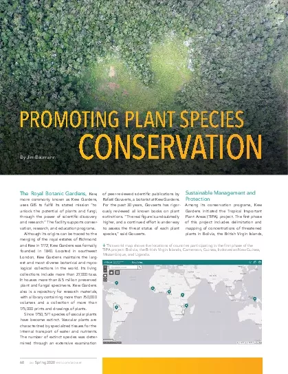
68Spring 2020esricomarcuserThe Royal Botanic Gardens Kew more commonl
by taylor
esricom/arcuserSpring 2020End NotesCameroon Guinea...
Nick Tonias, P.E. A Simplified Approach to Implementing GIS
by shangmaxi
1985. . The CEDRA Corporation is established. . ....
User-Defined Layer Selection and Weighting for Initial Emergency Response Risk Mapping
by enjoinsamsung
Jonas Miller . Advisor: Fritz Kessler. Scenario. L...
Adding a Picture in ArcGIS Getting Started Open ArcMap in
by kittie-lecroy
Adding a Picture in ArcGIS Getting Started Open ...
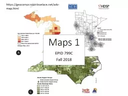
EPID 799C Fall 2018 Maps 1
by min-jolicoeur
https://geocompr.robinlovelace.net/adv-map.html. ...
Universal Credit (UC) Mapping: From zits to hits
by calandra-battersby
Laura Watson-Heard. Mark Burley. Universal Credit...
ESRI UC2013 Plenary Plenary
by calandra-battersby
10.2. Roadmap. Incremental software releases. Con...
GIS Data Collection Using
by ellena-manuel
Esri’s. . Collector App. Harkeerat Kang. 12.7....
GIS in Water Resources Midterm Review 2018
by cheryl-pisano
Blooms Taxonomy of Educational Objectives. 2. Com...
The Geo-Web: Enabling GIS on the Internet
by pamella-moone
IT4GIS. Keith T. Weber, GISP. GIS Director. ISU-G...
Cultivating GIS at the Brooklyn Botanic Garden
by yoshiko-marsland
Kyle Heulitt. Advisor: . Professor . Ken . Tammin...
Community-wide urban stormwater planning utilizing LiDAR, the WinSLAMM model and GIS
by cheryl-pisano
Dan Murphy. Rebecca Gronewold. UNI GeoTREE Center...
ArcGIS Collector and Accuracy of Location and Data
by natalia-silvester
2017 Indiana GIS Day and Conference. Joe . Madej....
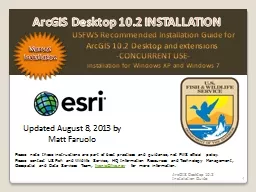
1 USFWS Recommended Installation Guide for
by ellena-manuel
ArcGIS . 10.2 . Desktop and . extensions . -CONCU...
Illegal Border Crossers and
by luanne-stotts
Wildfires in AZ. Geoffrey Krassy. GEOG 594A. Pr...
Automating Service Publishing in an
by liane-varnes
Optimized Server Environment. Brandon Longenberge...
1263703
by cheryl-pisano
...
Main Topics PreQuiz – Participant Expectations – Out-of-Scope and Alternatives
by alexa-scheidler
Introduction, Class Goals and reviewing data (. E...
Load More...


![[READING BOOK]-ArcGIS Pro 2.x Cookbook: Create, manage, and share geographic maps, data, and analytical models using ArcGIS Pro](https://thumbs.docslides.com/975084/reading-book-arcgis-pro-2-x-cookbook-create-manage-and-share-geographic-maps-data-and-analytical-models-using-arcgis-pro.jpg)
![[BEST]-ArcGIS Pro 2.x Cookbook Create, manage, and share geographic maps, data, and analytical models using ArcGIS Pro](https://thumbs.docslides.com/970486/best-arcgis-pro-2-x-cookbook-create-manage-and-share-geographic-maps-data-and-analytical-models-using-arcgis-pro.jpg)