Explore
Featured
Recent
Articles
Topics
Login
Upload
Featured
Recent
Articles
Topics
Login
Upload
Search Results for 'Elevation-Distance'
Elevation-Distance published presentations and documents on DocSlides.
Angles of elevation & depression
by alyssa
Solve problems involving angles of elevation and a...
Angle of elevation and depression
by gagnon
Warm Up. 1.. . Identify the pairs of alternate . ...
8.4 Angles of Elevation and Depression
by cheryl-pisano
-Quiz Friday over Pythagorean Theorem/Special Rig...
Day 3: Angles of Elevation and
by natalia-silvester
Depression. 1/14 and 1/15. EQ: . How do we draw ....
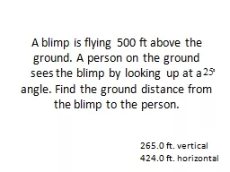
A blimp is flying 500 ft above the ground. A person on the
by olivia-moreira
angle. Find the ground distance from the blimp to...
The Role of Moral Elevation in PTSD and Moral Injury
by davies
Adam McGuire, PhD. Postdoctoral . Fellow. VISN 17 ...
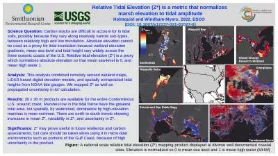
Figure: A national scale relative tidal elevation (Z*) mapping product displayed at diverse well d
by elizabeth
Relative Tidal Elevation (Z*) is a metric that nor...
Online Banking System Trust Elevation
by Younggunner
Online Banking Use Cases. Reference: . http://umld...
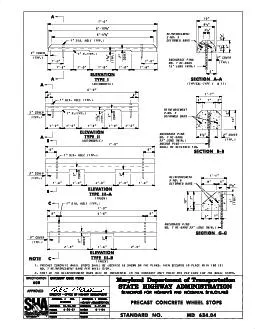
ELEVATION
by elena
TYPE I ELEVATION TYPE II SECTION A-A SECTION B-B E...
ST-Elevation Myocardial Infarction
by danika-pritchard
(STEMI). Greg Johnsen, MD, FACC, FSCAI. Epidemiol...
MnTOPO – A place to view, print, and download LiDAR Elevation Data
by cheryl-pisano
MnTOPO – A place to view, print, and download L...
Kentucky Aerial Photography and Elevation Data Program - KYAPED
by pasty-toler
National Height Mod Partner Meeting. M. ay 1, 201...
ST-Elevation Myocardial Infarction
by pamella-moone
(STEMI). Greg Johnsen, MD, FACC, FSCAI. Epidemiol...
Elevations While a floor plan gives you a view from above, an elevation is a drawn as if someone i
by lois-ondreau
One common use of an elevation is to show the arr...
Elevation and Hydrography
by myesha-ticknor
A match made on earth. USGS, . SouthAtlantic. Wa...
The elevation dependence of snowfall in the Appalachian Rid
by trish-goza
Mike Evans – NOAA / NWS BGM. Mike . Jurewicz. ...
Terrain Analysis Using Digital Elevation Models (
by celsa-spraggs
TauDEM. ). Learning Objectives. To be able to del...
Winter Invertebrate Composition as a Function of Elevation
by min-jolicoeur
How does invertebrate richness, diversity, and ab...
Kentucky Aerial Photography and Elevation Data Program - KY
by myesha-ticknor
National Height Mod Partner Meeting. M. ay 1, 201...
Louisiana Coastal Elevations
by tawny-fly
Slides from Prof. . Roy Dokka. Global sea-level h...
This map shows the elevation in
by trish-goza
meters. Which landforms does this region have?. ...
Effect of Topography in Satellite Rainfall Estimation Errors: Observational Evidence across Contras
by olivia-moreira
Gebrehiwot. . Niguse. Tesfay. 1. , . Menberu. ...
Applications of Trig Functions
by kittie-lecroy
Angle of Elevation. : the angle from the line of ...
8.4 Angles of Elevation and Depression
by alexa-scheidler
Angle of Elevation: the angle formed by a horizo...
Effect of Topography in Satellite Rainfall Estimation Error
by lindy-dunigan
Gebrehiwot. . Niguse. Tesfay. 1. , . Menberu. ...
Office Hours
by tatyana-admore
Mon: 11:30 AM to 12:30 PM & 1:45 PM to 3:0...
Handheld Laser Distance Meter Market Forecast- Global Review 2019-2027
by nimittmr
Handheld laser distance meters are rapidly replac...
Nationwide Moves with Long Distance Car Shipping USA
by nikiautotransport
Ship your vehicle safely across the U.S. with long...
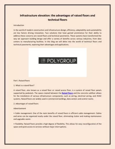
Infrastructure elevation: the advantages of raised floors and technical floors
by ragnarsnakewood
In the world of modern construction and infrastruc...
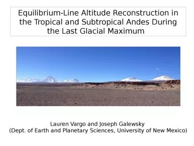
Equilibrium- L ine A ltitude
by zoe
R. econstruction in the Tropical and Subtropical A...
Elevation, space and host plant species structure
by naomi
Ericaceae. root associated fungal communities in ...
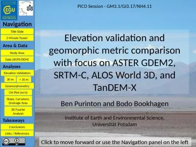
Title Slide Navigation 2 Minute Teaser
by abigail
Elevation validation and geomorphic metric compari...
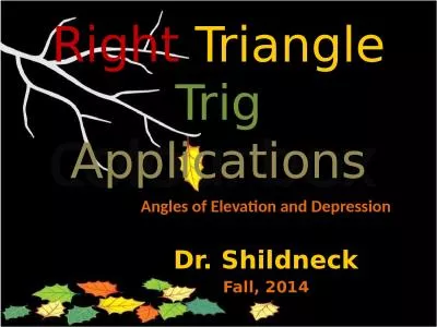
Right Triangle Trig Applications
by helene
Angles of Elevation and Depression. Dr. Shildneck....
Do Now Solve the right triangle given the following information:
by cora
. Section 2.4. Solving Right Triangles. Objectiv...
UNIT 4: MAPPING THE EARTH
by anastasia
After . Unit . 4 you should be able to:. Accuratel...
Qiang Gao 10/13/2009 3D Terrain Modeling with Real Elevation Data
by elena
A Terrain Snapshot from Demo. A Terrain Snapshot f...
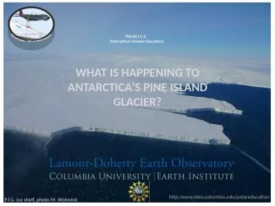
POLAR I.C.E. (Interactive Climate Education)
by reese
. WHAT IS HAPPENING TO ANTARCTICA’S PINE ISLAN...
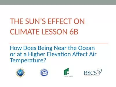
The sun’s effect on climate Lesson 6b
by eliza
How Does Being Near the Ocean or at a Higher Eleva...
AnnalsoftheRheumaticDiseases198443758759CasereportCalcifyingsuprac
by mary
Calcifyingsupracoracoidbursitisasacauseofchronicsh...
Coronary artery disease Acute coronary syndromes
by Wolfpack
Definition. Acute coronary syndrome (ACS) is a te...
Load More...