Explore
Featured
Recent
Articles
Topics
Login
Upload
Featured
Recent
Articles
Topics
Login
Upload
Search Results for 'Esri-Arcgis'
Esri-Arcgis published presentations and documents on DocSlides.
ESRI UC2013 Plenary Plenary
by calandra-battersby
10.2. Roadmap. Incremental software releases. Con...
W W W Service Layer Credits Sources Esri DeLorme NAVTEQ USGS Intermap iPC NRCAN Esri Japan METI Esri China Hong Kong Esri Thailand TomTom
by ellena-manuel
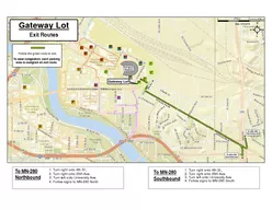
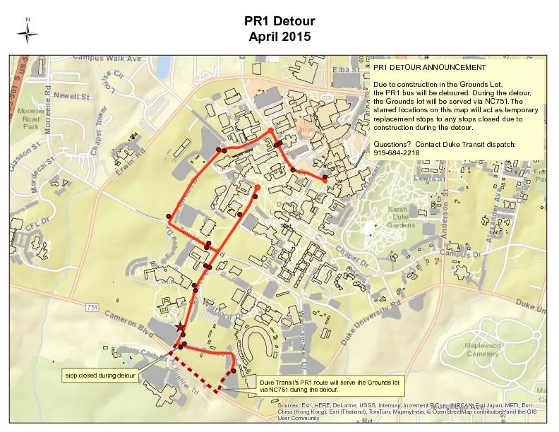
5 Miles 51 51 55 280 Gateway Lot Major Access Rout...
Automating Service Publishing in an
by liane-varnes
Optimized Server Environment. Brandon Longenberge...
How to enter the world of Python Programming for ArcGIS
by celsa-spraggs
Or, a funny thing happened on the way . from an E...
Sources Esri HERE Garmin USGS Intermap INCREMENT P
by sylvia
NRCan Esri Japan METI Esri China Hong Kong Esri Ko...
Ohio ESRI
by pasty-toler
GeoNet. Group. Presented by: Joe . Guzi. GIS Sys...
GIS Software Support at Yale
by phoebe-click
Yale Map Department GIS Software Installation . L...
Stereographic Projection
by jane-oiler
& . Sphere GCS. Celina Bolding & James H...
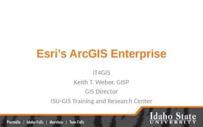
Esri’s ArcGIS Enterprise
by luna
IT4GIS. Keith T. Weber, GISP. GIS Director. ISU-GI...
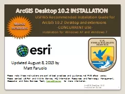
1 USFWS Recommended Installation Guide for
by ellena-manuel
ArcGIS . 10.2 . Desktop and . extensions . -CONCU...
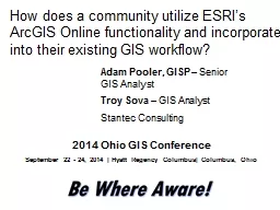
How does a community utilize ESRI’s
by min-jolicoeur
ArcGIS Online functionality and incorporate. into...
2014 ESIP Summer Meeting
by alida-meadow
July 8–11, 2014 . |. Frisco, Colorado. Advanci...
Mapping ACS Data
by olivia-moreira
Jeff Strickland. Assistant Professor of History. ...
ArcGIS PRO MIGRATION , SUCCESSES, AND LESSONS LEARNED Introduction
by marina-yarberry
ArcGIS PRO MIGRATION , SUCCESSES, AND LESSONS LE...
Expanding the Functionality of ArcGIS Through
by jane-oiler
Tool Building. Designing an Optimized . Pit Remov...
The ArcGIS Platform
by tawny-fly
Cloud and Web Service based GIS. Patrick Gahagan ...
Expanding the Functionality of ArcGIS Through
by alexa-scheidler
Tool Building. Designing an Optimized . Pit Remov...
Digimap data in ArcGIS
by natalia-silvester
Guy . McGarva. EDINA Geo User Support. Ian Holmes...
What’s new at ArcGIS 10.2.1 for INSPIRE
by briana-ranney
Roberto Lucchi. Guenther . Pichler. Outline. INSP...
Extending ArcGIS using programming
by tawny-fly
David . Tarboton. GIS in Water Resources. 22 Octo...
Publishing and Accessing Services using ArcGIS for Flood An
by test
Harish Sangireddy. The University of Texas at Aus...
Torres Strait Island Regional Council Page 673
by deborah
Schedule 2 MappingSC212 Poruma Coconut Island maps...
September 32019
by mackenzie
/Jpin L.:6) 1526 Jili Road - I Wi: , 0 ) So...
Improving Cadastre: Development of a Workflow Prototype Using ESRI’s Parcel Fabric
by giovanna-bartolotta
Pennsylvania State University – GEOG 596A. Lind...
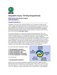
Geographic Inquiry: Thinking Geographically ESRI Schools and Librarie
by sherrill-nordquist
Copyright 2003 ESRI, Inc. water, its plan...
Sources: Esri, HERE, DeLorme, USGS, Intermap, increment P Corp., NRCAN
by conchita-marotz
China (Hong Kong), Esri (Thailand), TomTom, MapmyI...
ArcGIS Utility Network 20-001 Certification
by certsgotlearning
Website: www.certsgot.com
#Certified #Cert...
ArcGIS Online Administration 19-001 Certification
by certsgotlearning
Website: www.certsgot.com
#Certified #Cert...
ArcGIS API for Python 20-001 Certification
by certsgotlearning
Website: www.certsgot.com
#Certified #Cert...
ArcGIS API for JavaScript 19-001 Certification
by certsgotlearning
Website: www.certsgot.com
#Certified #Cert...
ArcGIS Pro Professional 2201 Certification
by certsgotlearning
Website: www.certsgot.com
#Certified #Cert...
ArcGIS Pro Foundation 2101 Certification
by certsgotlearning
Website: www.certsgot.com
#Certified #Cert...
ArcGIS Enterprise Administration Professional 2201 Certification
by certsgotlearning
Website: www.certsgot.com
#Certified #Cert...
ArcGIS Developer Foundation 2201 Certification
by certsgotlearning
Website: www.certsgot.com
#Certified #Cert...
ArcGIS Desktop Professional 19-001 Certification
by certsgotlearning
Website: www.certsgot.com
#Certified #Cert...
ArcGIS Desktop Entry 19-001 Certification
by certsgotlearning
Website: www.certsgot.com
#Certified #Cert...
ArcGIS Desktop Associate 19-001 Certification
by certsgotlearning
Website: www.certsgot.com
#Certified #Cert...
ArcGIS Utility Network 20-001 Certification
by certsgotlearning
#Certification #Dumps #Certification_exam_Dumps
ArcGIS Online Administration 19-001 Certification
by certsgotlearning
#Certification #Dumps #Certification_exam_Dumps
ArcGIS API for Python 20-001 Certification
by certsgotlearning
#Certification #Dumps #Certification_exam_Dumps
Load More...