Explore
Featured
Recent
Articles
Topics
Login
Upload
Featured
Recent
Articles
Topics
Login
Upload
Search Results for 'file raster'
file raster published presentations and documents on DocSlides.
Raster Graphics 2.01 Understand Digital Raster Graphics
by celsa-spraggs
Raster Graphics. Also called . bitmap . graphics ...
Digital Graphics (Unit 19.1/54.1)
by marina-yarberry
Introduction. In digital media, there are differe...
Images, spatial data and
by sherrill-nordquist
matlab. Data. types and storage:. Vector data. -...
A Summary of Some Key Points from Chapters
by daisy
1 and 2 of Peterson. On page 1 Peterson indicates ...
Rastor vs Vector Higher Graphics
by solidbyte
Miss Airlie . What will we learn?. I will learn ab...
Chapter 6 Raster Editing
by karlyn-bohler
© 2013 . Cengage. Learning. All Rights Reserved...
SPD and KEA: HDF5 based file formats for Earth Observation
by tatiana-dople
Pete Bunting. 1. , John Armston. 2. , Sam Gilling...
Image and Sound Editing Raed
by ellena-manuel
S. . Rasheed. 2012. Image. Image.. Digital image...
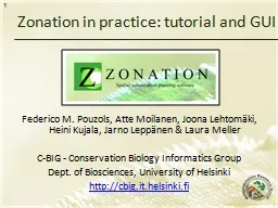
Federico M. Pouzols, Atte Moilanen, Joona Lehtomäki, Heini
by jane-oiler
C-BIG - Conservation . Biology Informatics Group....
Chapter 3 Image Files © 2013
by aaron
Cengage. Learning. All Rights Reserved. May not ...
Content included in posters that would be displayed in a gym and methods by which these posters can
by ripplas
Link to the scenario. Tom wants to attract more m...
Vector Graphics 2.01 Investigate graphic image design
by fluenter
.. 1.01 Investigate graphic types and file formats...
Esri’s ArcGIS Enterprise
by luna
IT4GIS. Keith T. Weber, GISP. GIS Director. ISU-GI...
Planet Earth Modeling Prof.
by eddey
E.Omodeo. e Prof. . C.Braitenberg. Images . analy...
Using Satellite Data in
by emery
GIS. NOAA . Coastwatch. Satellite Course. Version...
B-TEC level 3 Unit 30 task 1
by thesoysi
Thomas Harker. Thomas Harker. Task 01 - (P1) (P2)....
Illustrator lecture 1: how to use Adobe Illustrator with raster maps?
by motivatorprada
WAT-E2090 Water and people. Matlab. Open demo1.mlx...
Lesson 3 GIS Fundamentals
by lois-ondreau
MEASURE Evaluation. PHFI Training of Trainers. Ma...
Fire Lookout Tower
by yoshiko-marsland
Presented by Shaynee Gulliford . Project. Locate ...
Bulk Interpolation using R Environment
by myesha-ticknor
Ji. ří. . Kadlec. . – Aalto University, Fin...
Load More...