Explore
Featured
Recent
Articles
Topics
Login
Upload
Featured
Recent
Articles
Topics
Login
Upload
Search Results for 'geospatial amp'
geospatial amp published presentations and documents on DocSlides.
Department of Homeland Security Science & Technology
by lindy-dunigan
Up. date to NGAC:. Geospatial Interoperability Re...
GLOBAL NEAR-REAL-TIME INTERDISCIPLINARY
by megan
GEOSPATIAL DATA DEVELOPMENT,. ANALYSIS, ARCHIVING,...
Spatial Cloud Computing:
by kittie-lecroy
Usage in Geo-Spatial Sciences. Topics. Problem St...
Spatial Cloud Computing:
by min-jolicoeur
How . can . the geospatial sciences . use and hel...
Adding Value to Registries through Geospatial Big Data Fusion
by angelina
Geospatial Health Context Big Table . Facilitating...
Seeing
by lois-ondreau
Is . Believing. visualizing. . geospatial. dat...
OGC ArcticSDP Search & Rescue Scenario
by pamella-moone
Data Overview. Compusult Limited. 02 March 2017. ...
Geospatial
by faustina-dinatale
(GIS&RS) . Education/Training. Applied resear...
Volunteered Geographic Information (VGI) and communicating
by alexa-scheidler
Krista Jones. 1. , Rodolphe Devillers. 1,2. , Yva...
Environment Canada Data Catalogue
by phoebe-click
Paul . Paciorek. Manager - Data Management. Infor...
3SAQS Technical Workshop
by celsa-spraggs
April 30. th. , 2015. Data Warehouse. Current and...
Civil Engineering, Planning, and the
by radions
Spatial Data Infrastructure . . New Mexico Joint ...
Establishments of Bridgehead for Policy Export and International Relations:
by narrativers
Digital . e-governance of Seoul Metropolitan Gover...
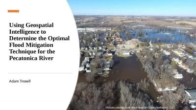
Using Geospatial Intelligence to Determine the Optimal Flood Mitigation Technique for the Pecatonic
by williams
Adam Troxell. Picture courtesy of the Freeport New...
2012 Exchange Network Conference
by luanne-stotts
2012 Exchange Network Conference Breakout #12 –...
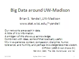
Big Data around UW-Madison
by kittie-lecroy
Brian S. . Yandell,UW. -Madison. www.stat.wisc.ed...
GeoJot GeoSpatial Experts, Inc.
by luanne-stotts
. Founded in 2001. World leader in photo mapping...
Context for IRWIN development
by myesha-ticknor
Wildland Fire I&T . What is IRWIN?. Current d...
THE STEWARDSHIP TASK: PRESERVE WILDERNESS CHARACTER
by faustina-dinatale
Modern Human . Impact. Wilderness Character. MORE...
App on the Move:
by stefany-barnette
A Fine-Grained Analysis of Usage Behavior of Mobi...
The ArcGIS Platform
by tawny-fly
Cloud and Web Service based GIS. Patrick Gahagan ...
FEDERAL GEOSPATIAL SUMMIT
by marina-yarberry
MAY 11, 2010. SILVER SPRING, MARYLAND. PROBLEMS ...
Load More...