/
Daily Weather Forecast Briefing Daily Weather Forecast Briefing

Daily Weather Forecast Briefing - PowerPoint Presentation

stefany-barnette
stefany-barnette . @stefany-barnette
Follow
343 views
Uploaded On 2019-06-21

Daily Weather Forecast Briefing - PPT Presentation

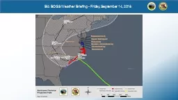
Saturday 17 Jan 2015 Date Executive Summary Sat 117 Ongoing AR landfall today in Oregon Second GIV science flight transect of AR cyclone occluded front and nearcoastal environment Sun 118 ID: 759514

jan pst clouds high pst jan high clouds landfall sun sat coast saturday winds ivt 00z 1600 iwv sunday warm coastal west

Share:

Link:

Embed:

Download Presentation from below link

Download Presentation The PPT/PDF document "Daily Weather Forecast Briefing" is the property of its rightful owner. Permission is granted to download and print the materials on this web site for personal, non-commercial use only, and to display it on your personal computer provided you do not modify the materials and that you retain all copyright notices contained in the materials. By downloading content from our website, you accept the terms of this agreement.


Presentation Transcript

Slide1

Daily Weather Forecast BriefingSaturday 17 Jan 2015

Slide2

Date

Executive Summary

Sat 1/17

Ongoing AR landfall today in Oregon

Second

G-IV science flight transect of AR, cyclone occluded front and near-coastal environment

Sun 1/18

AR weakens as it propagates into N. CA

Mon

1/19

High pressure builds along

U.S. West Coast

Tue 1/20

AR

landfall in British Columbia

Wed-Thu 1/21-22

BC AR propagates/decays east

along coast with impacts nearing Pacific NW U.S.

Fri-Sat-Sun

1/23-24-25

Large-scale flow reconfiguration/downstream

baroclinic

development with possible AR impacts downstream along U.S. West Coast

Slide3

Short-term Overview

15Z

18Z

21Z

00Z

Ongoing AR landfall today with initial anticyclonic curvature over eastern Pacific replaced by more cyclonic curvature with decreasing IWV

Warm air advection

precip

across Oregon and Washington will be replaced by heavy orographic

precip

later in the day

Slide4

Make map 7.71 to overlap

Sat a.m.

<25 mm

25–50 mm

50–100 mm

100–150 mm

150–200 mm

200–

3

00 mm

3

00–

5

00 mm

168-h QPF

Dissipating

Sat p.m.

Sun a.m.

Sun p.m.

Slide5

GOES West Infrared Enhanced Satellite

http://vortex.plymouth.edu/mapwall/goes/goesWirl.24.png

Low clouds within AR

Deeper clouds where warm, moist air ascends along weak warm front

Cold Air

Leading edge of U-L trough

Slide6

GOES West Water Vapor Imagery

http://vortex.plymouth.edu/mapwall/goes/goesWwvc.24.png

Extremely Dry

Deeper clouds, deeper moisture in moist ascent region

Dry air along jet

Upper-level

Trough axis

Slide7

NOAA ESRL PSD SSM/I Water

Vapor: http://www.esrl.noaa.gov/psd/psd2/coastal/satres/data/images/wx_cl/6hr/recent.png

Sat pm

Sat am

TC

Slide8

1255 UTC Radar Reflectivity

HRRR:

Sim

dBZ

1800 UTC

Slide9

MCC Forecast

Saturday:Fog clearing by 10 am PST with temperatures rising to 56F. Cloudy; Haze. Calm winds.Saturday Night:Fog developing by 10 pm PST. Cloudy. Low 47F.Sunday:Mostly cloudy with a high of 60F. Light southeast winds.

Slide10

GFS +24 h forecasts of 500Z/V/

AbsVor (left) and 900 Theta/Z/V (right)Saturday afternoon: Wave-amplified AR landfall OregonUpper-level trough upstream of AR

00Z/18 Jan | 1600 PST Saturday

Slide11

GFS +24 h forecasts of IWV (left) and IVT (right)Saturday afternoon: Wave-amplified AR ongoing landfall Oregon with Coastal IWV ~30 mm and IVT ~600 kg/m/sOffshore IWV ~30 mm and IVT ~700 kg/m/s

00Z/18 Jan | 1600 PST Saturday

Slide12

1

600 PST Saturday

1600 PST Saturday

South-to-North Cross Section along 130W and 125W

AR is stronger offshore with 25% higher water vapor flux below 2 km

Max IVT offshore 888 kg/m/s… max IVT onshore is 788 kg/m/s; FZRL: ~2.75 km

Slide13

GFS +24 h forecasts of IWV for early Sunday morning and Sunday afternoonAR propagating down the coast with IWV values ~28-30 mm along the coast into the Bay Area, but with very weak winds under building high pressure.

12Z/18 (0400 PST Sun) | 00Z/19 (1600 PST Sun)

H

H

Slide14

Oregon

Cali-Oregon

Near BBY

Meteogram

of WV Flux highlights dissipating AR and less precipitation farther south along the coast on Sunday 18 January.

Slide15

Relative Humidity M/gram

Near coastal/onshore warm clouds likely 0–2.5 km through 1800 UTC/18 Jan

Precipitating warm clouds likely on Sunday (18 Jan) between 1200 UTC and 1800 UTC as front/dissipating AR passes

Slide16

WPC

QPForecast:150–200 mm of precipitation expected across Olympic, Coastal and Cascade Mountains in Washington and OregonFar (far) N. CA coastal: ~100 mmSharp precipitation cut-off with 2.5-7.5 mm near Santa Rosa and ~0 mm near BBY

http://www.wrh.noaa.gov/images/sto/GIS/

Slide17

UWA 4-

km WRF

72h QPF

I: 00Z/

17

V: 00Z

/

20

For: AR landfall

Several

elevated/west slope locations expecting 5.12 to 10.24 inches

Two high-mountain locations expecting >250 mm of rain

Slide18

00Z/20 Jan | 1600 PST Monday

Zonal quasi-extended 90 m/s NPJ fueling ETC genesis along/east Dateline with ridge development into Gulf of Alaska; Forcing for descent and surface high pressure along U.S. West Coast

L

H

H

Slide19

00Z/21 Jan | 1600 PST Tuesday

Jet and cyclone propagate and extend eastward, respectively, with AR landfall into British Columbia on Tuesday

L

H

Slide20

“Landfall Probability” IVT >250 kg/m/s

Thu

1/23

Sat

1/24

Sun

2/1

Slide21

Wednesday 21 January 2015

1600 PST Wed 21 Jan 2200 PST Wed 21 Jan

BC AR rapidly dissipates offshore WA/OR coast

Upstream IVT region along warm front of next cyclone

Slide22

Thursday 22 January 2015

Quickly dissipating “AR” within range off WA coastIVT region mainly along warm front of next cyclone

1600 PST Thursday 22 Jan 2200 PST Thursday 22 Jan

Slide23

12Z/23 Jan | 0400 PST Friday

L

L

L

H

H

H

Slide24

24 into 25 January 2015

AR conditions develop/maintained along equatorward side of anticyclonically curved 90+ m/s Northeast Pacific JetAR landfall across WA/OR and northern CA

0400 PST Sunday 25 Jan 0400 PST Sunday 25 Jan

Slide25

ECMWF 204-h IWV GFS 204-h IWV

0400 PST Sunday 25 January 2015

Slide26

IVT Probability and Thumbnails valid on Day 15Agreement between control member and approximately half of the ensemble members

Slide27

Offshore Cloud Forecast

Sat:

Low-mid clouds during day. High clouds overnight

Sun:

Clouds clearing throughout the day

Mon:

High clouds

Tue:

Mostly clear

Wed:

High clouds later in the day

Slide28

Palmdale, CA

Sat:

Clear skies, high 63, winds ENE at 6 knots

Sun:

Mostly clear, high 68, winds W at 8 knots

Mon:

Mostly clear, high 66, winds NW at 7–10 knots

Tue:

Partly cloudy, high 64, winds NE at 9 knots

Wed:

Mostly clear, high 63, winds NE at 11–14 knots gusting up to 20