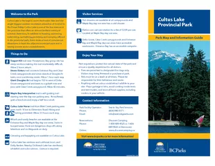
Originally the site of sand and gravel mining to supply Vancouver industry the parks name comes from the French porte deau or waters gate With its variety of campsites waterfront dayuse area and mooring buoys for boaters the park is a popular destin ID: 50359 Download Pdf
Curme Is Refuge Lagoon Refuge Cove ROSCOE BAY MARINE PARK TEAKERNE ARM MARINE PARK WALSH COVE MARINE PARK Ellis Lake Cassel L East Redonda Island Black L West Redonda Island Lancelot Inlet Islands Baker Passage Tenedos Bay Scale in kilometres 12 345
PLUMPER COVE MARINE PARK MASTER PLAN TABLE OF CONTENTS Page A. INTRODUCTION................................................................ 1. Setting...........................................
Park Map and Information Guide Park Background Directions to ParkAs one of the largest parks in the province, Golden Ears Provincial Park is prized for its recreational opportunities. The extensive s
Cultus Lake is one of the few meccas in the province that o ers an almost limitless variety of summer diversions In addition to boating swimming waterskiing sunbathingpicnicking and camping o ered in the provincial park there exists a host of commer
55 56 E Knols Park Meadowlark Park Veterans Park NatureStud Area(Barbara Frot Trail)Veterans Park Kennilworth Park LIRRBELLEROSE AVKETCHUM CTTERRACE DRNORTON DRLORET LNLELANDPINE DRBELLECREST AVCIRCLE
com General Provincial Park Information Web albertaparksca Toll Free 18664273582 Phone 780 4273582 Campsite Group Camp Reservations Toll Free 18775372757 Web reservealbertaparksca Fire Bans in Alberta Web alberta57375rebansca Emergency Police Fire A
Action Brief. Mission. Our intent is to follow the initial guidance provided; to connect all Aquia Harbour parks with a path to make the neighborhood safer for its residents without requiring . HOA.
8 years old. Visited Animal Kingdom. Ate breakfast with all the different characters. Went to the park and rode almost every single ride. Hershey’s Chocolate World. 10 years old. Went on a tour of the factory.
Every party, celebration, or event is an opportunity to bring in special entertainment! And our cast of performers is so full of variety and talent, no matter what your occasion, we have the entertainment for you.
I-395 Gambrill Road Park & RideBacklick RdAlban RdPohick RdChancellorWayGambrill RdRolling RdRolling RdI-95I-95Barta RdFullerton RdLoisdale RdBacklick RdSeminary RdColumbia PikeLeesburg Pike/Rt 7King
Originally the site of sand and gravel mining to supply Vancouver industry the parks name comes from the French porte deau or waters gate With its variety of campsites waterfront dayuse area and mooring buoys for boaters the park is a popular destin
Download Pdf - The PPT/PDF document "Porteau Cove Provincial Park Park Map an..." is the property of its rightful owner. Permission is granted to download and print the materials on this web site for personal, non-commercial use only, and to display it on your personal computer provided you do not modify the materials and that you retain all copyright notices contained in the materials. By downloading content from our website, you accept the terms of this agreement.
Porteau Cove Provincial Park Park Map and Information Guide Porteau Cove Provincial Park, situated on the most southerly ord in North America, features waterfront campsites with a view over Howe Sound to the mountains beyond. Originally the site of sand and gravel mining to supply Vancouver industry, the parks name comes from the French porte deau or waters gate. With its variety of campsites, waterfront day-use area and mooring buoys for boaters, the park is a popular destination all year and nearly always full in the summer. Porteau Cove is perhaps best known for scuba diving, with year-round amenities and amazing marine life. Things to Do Strong winds in Howe Sound make for great windsurng but conditions can change quickly. There is ocean swimming o the rock and pebble beach - sneakers or beach shoes are recommended. No lifeguards are on duty in provincial parks. The scuba diving is excellent, with a variety of fascinating marine life at depths of 6m to 18m. A short walking trail leads to a lookout with a spectacular view of Howe Sound and Porteau Cove, marine waterfowl and the occasional seal. The park oers interpretive programs that showcase habitat and park geography in the high season. The paved, double-wide boat provides easy access for motorized boats, canoes and kayaks. It may be dicult to launch at low tide or in the winter due to driftwood. Mariners should know the ocean currents. The walk-in campsites are ocean-front and the vehicle-accessible sites are open for winter camping. Electrical hookups are available for a daily fee. The shower building at the campground has hot water and electrical outlets. Most sites provide for wheelchair access, the pit and ush toilets are accessible, and the emergency ferry pier oers paved access to view Howe Sound. A sani-station/dump is available year-round; due to freezing, the water may be shut o during winter. The day-use area features ocean-front picnic tables and a pebbly beach with large driftwood. Welcome to the Park Visit www.bcparks.ca for more information! Enjoy Your Stay Contact Information Park regulations protect the natural state of the park and ensure the quality experience for all visitors. Fishing and/or harvesting any marine life is prohibited inside park boundaries. Scuba divers are not permitted to use the boat launch and boats are prohibited in the dive area. Park Facility Operator: Sea to Sky Park Services Ltd. Phone: info@seatoskyparks.com Reservations: Discover Camping Phone: 689-9025 in Vancouver www.discovercamping.com Updated Sept 2009 Visitor Services
© 2021 docslides.com Inc.
All rights reserved.