Analysis of Remote Sensing Data for Tornado Damage
Description: Analysis of Remote Sensing Data for Tornado Damage Assessment Presented by: Justin Novak Advisor: Guido Cervone, Ph.D. Purpose To determine which remote sensing platform is best suited for emergency management 2 Agenda Selection Criteria
Related Topics
Download Presentation
"Analysis of Remote Sensing Data for Tornado Damage" is the property of its rightful owner. Permission is granted to download and print the materials on this website for personal, non-commercial use only, and to display it on your personal computer provided you do not modify the materials and that you retain all copyright notices contained in the materials. By downloading content from our website, you accept the terms of this agreement.
Presentation Transcript
slide1. Analysis of Remote Sensing Data for Tornado Damage Assessment Presented by: Justin Novak
Advisor: Guido Cervone, Ph.D.<br>
slide2. Purpose To determine which remote sensing platform is best suited for emergency management 2<br>
slide3. Agenda Selection Criteria for Study Area
Study Area
Background/Historical
Datasets
Evaluation Criteria
Conclusions 3<br>
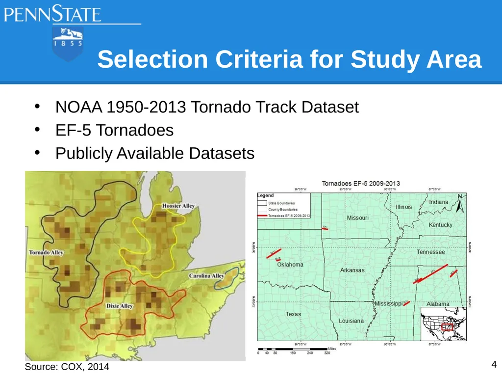
slide4. Selection Criteria for Study Area NOAA 1950-2013 Tornado Track Dataset
EF-5 Tornadoes
Publicly Available Datasets Source: COX, 2014 4<br>
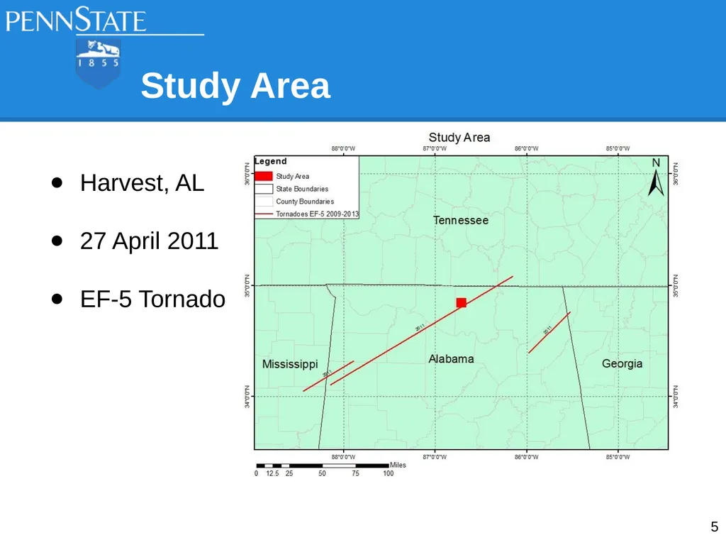
slide5. Study Area Harvest, AL
27 April 2011
EF-5 Tornado 5<br>
slide6. Background/Historical
Harvest, AL Dixie Alley
Northern Alabama
Huntsville, AL #1 Tornado City (Kellogg, 2013)
Population: 5,281 (Gazetteer, 2014)
4 Major Tornadoes in Past 40 Years (NOAA, 2013) 6<br>
slide7. Datasets|Base Layers Global Country Borders
TIGER/Line Shapefile
US State Boundaries
US County Boundaries
Madison County Roads
WGS84 UTM Zone 16N/15N 7<br>
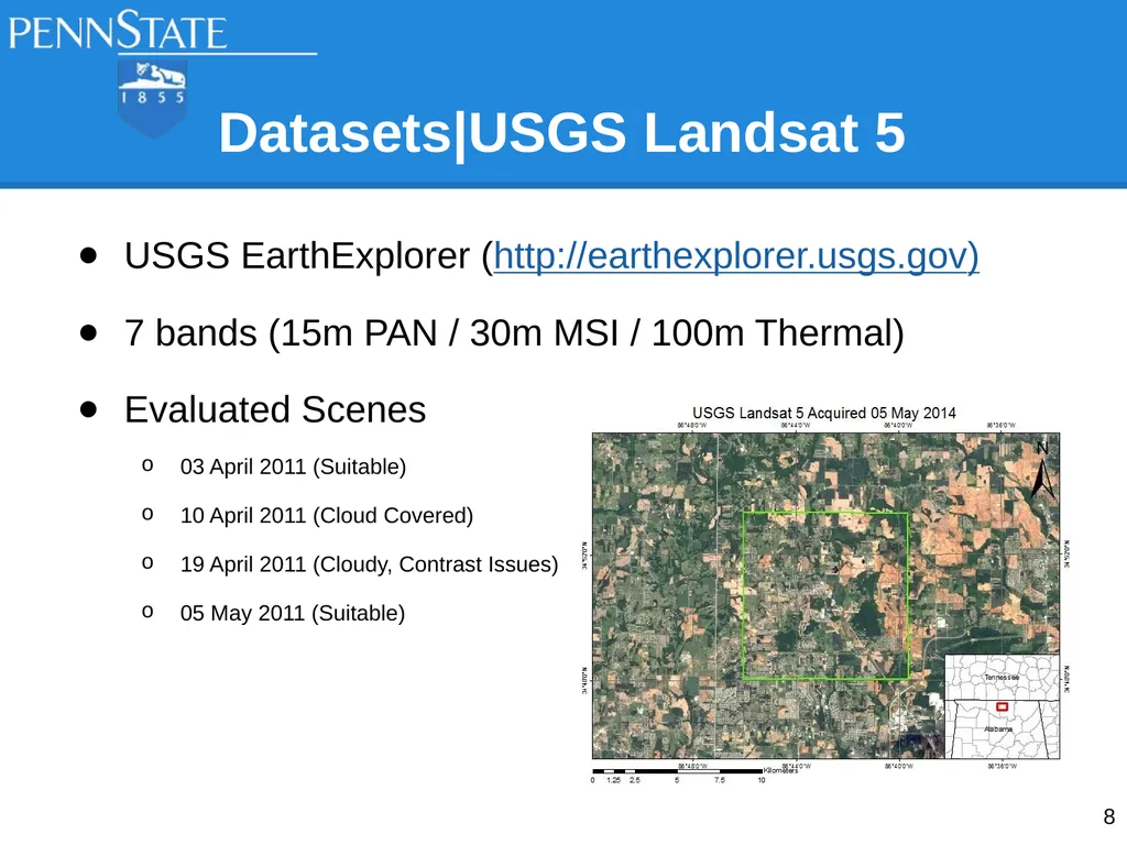
slide8. USGS EarthExplorer (http://earthexplorer.usgs.gov)
7 bands (15m PAN / 30m MSI / 100m Thermal)
Evaluated Scenes
03 April 2011 (Suitable)
10 April 2011 (Cloud Covered)
19 April 2011 (Cloudy, Contrast Issues)
05 May 2011 (Suitable) Datasets|USGS Landsat 5 8<br>
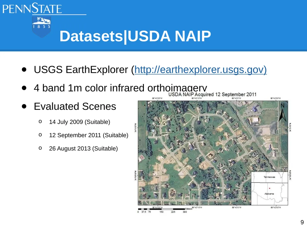
slide9. USGS EarthExplorer (http://earthexplorer.usgs.gov)
4 band 1m color infrared orthoimagery
Evaluated Scenes
14 July 2009 (Suitable)
12 September 2011 (Suitable)
26 August 2013 (Suitable) Datasets|USDA NAIP 9<br>
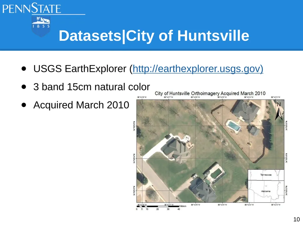
slide10. USGS EarthExplorer (http://earthexplorer.usgs.gov)
3 band 15cm natural color
Acquired March 2010 Datasets|City of Huntsville 10<br>
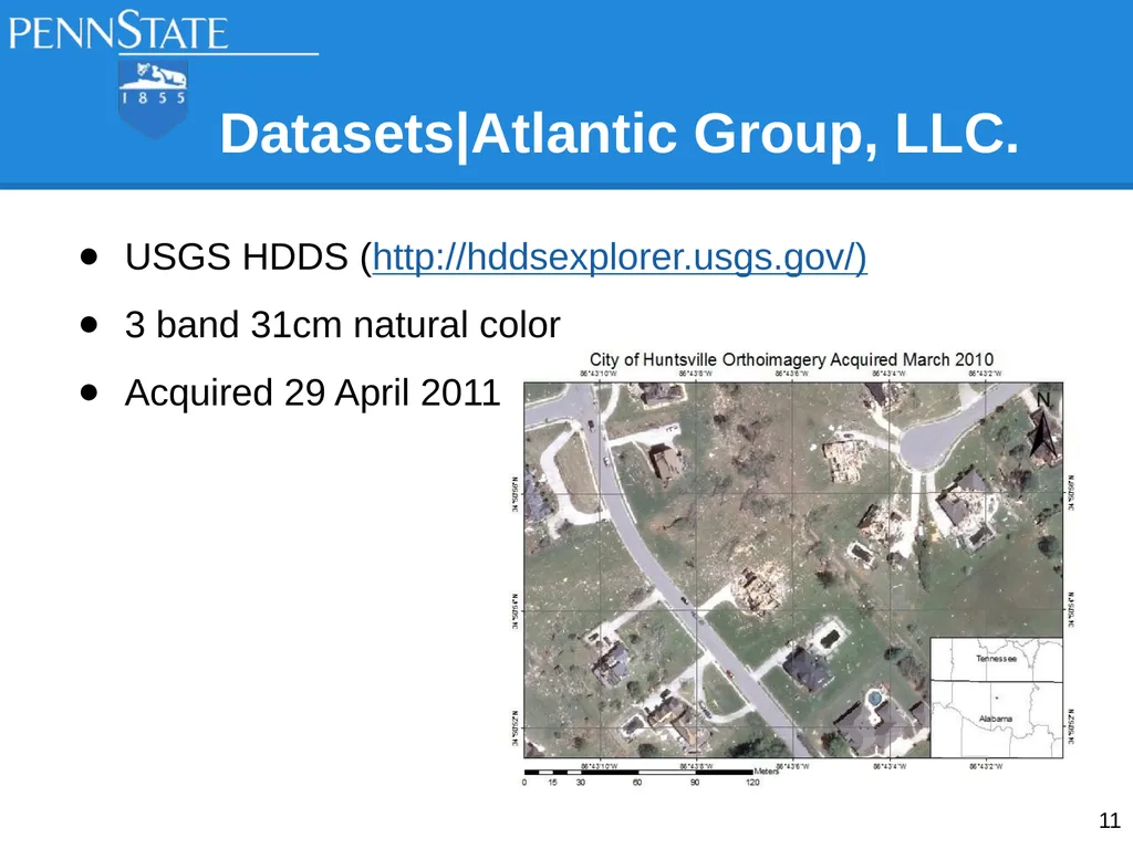
slide11. USGS HDDS (http://hddsexplorer.usgs.gov/)
3 band 31cm natural color
Acquired 29 April 2011 Datasets|Atlantic Group, LLC. 11<br>
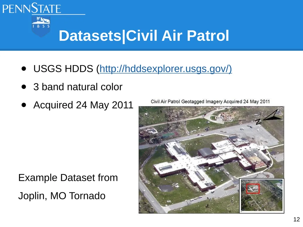
slide12. Datasets|Civil Air Patrol USGS HDDS (http://hddsexplorer.usgs.gov/)
3 band natural color
Acquired 24 May 2011
Example Dataset from
Joplin, MO Tornado 12<br>
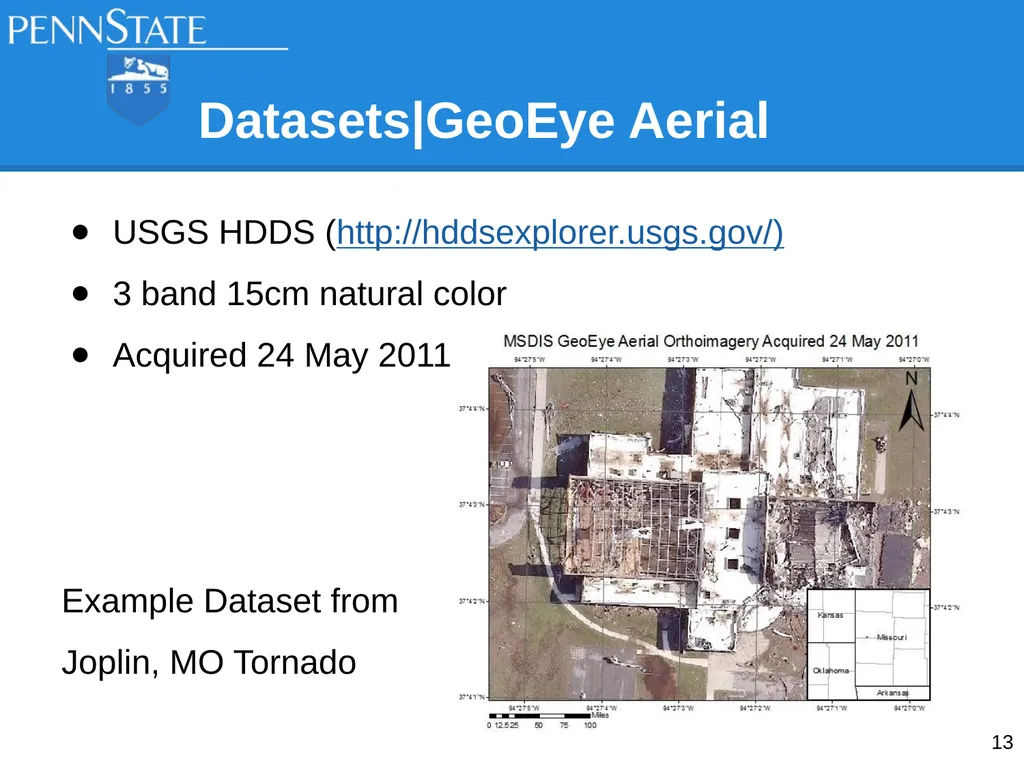
slide13. Datasets|GeoEye Aerial USGS HDDS (http://hddsexplorer.usgs.gov/)
3 band 15cm natural color
Acquired 24 May 2011
Example Dataset from
Joplin, MO Tornado 13<br>
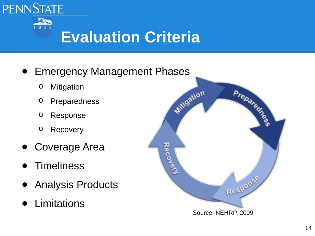
slide14. Evaluation Criteria Emergency Management Phases
Mitigation
Preparedness
Response
Recovery
Coverage Area
Timeliness
Analysis Products
Limitations 14 Source: NEHRP, 2009<br>
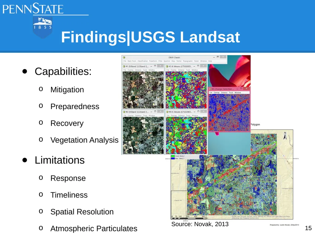
slide15. Capabilities:
Mitigation
Preparedness
Recovery
Vegetation Analysis
Limitations
Response
Timeliness
Spatial Resolution
Atmospheric Particulates Findings|USGS Landsat Source: Novak, 2013 15<br>
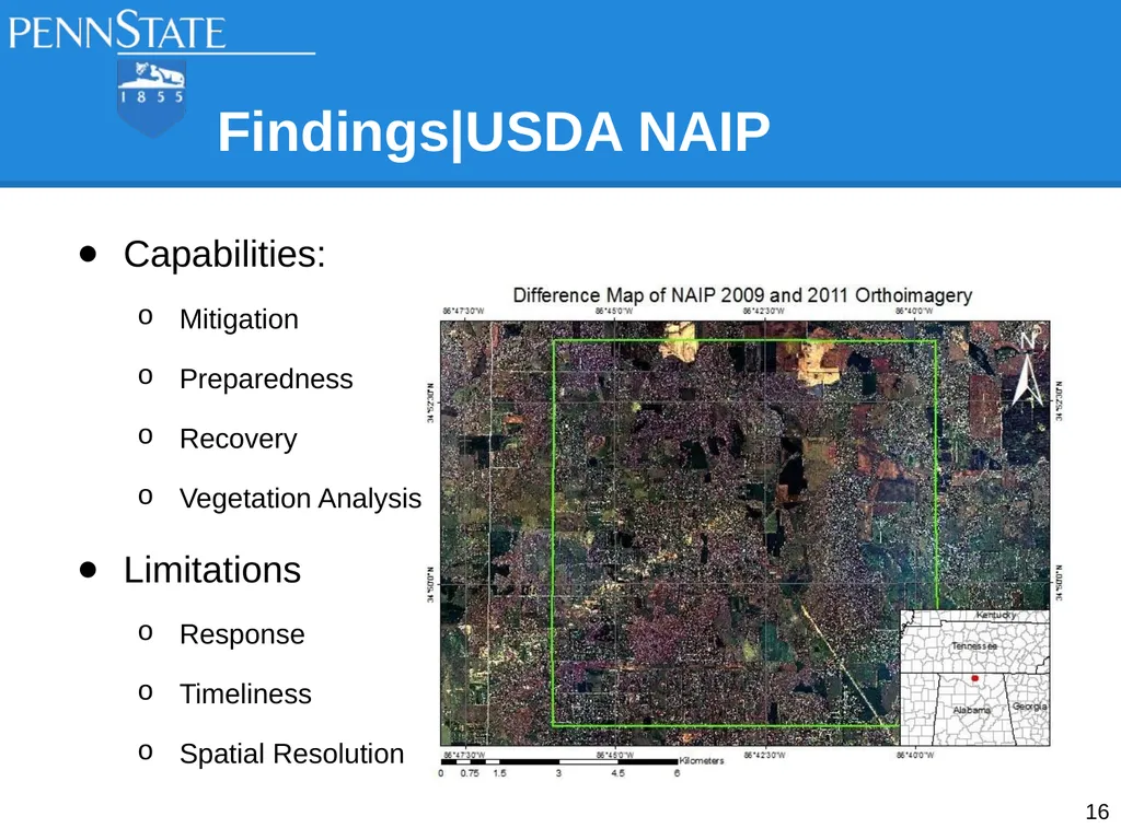
slide16. Findings|USDA NAIP Capabilities:
Mitigation
Preparedness
Recovery
Vegetation Analysis
Limitations
Response
Timeliness
Spatial Resolution 16<br>
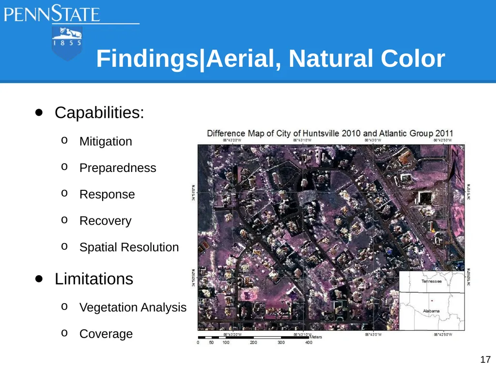
slide17. Capabilities:
Mitigation
Preparedness
Response
Recovery
Spatial Resolution
Limitations
Vegetation Analysis
Coverage Findings|Aerial, Natural Color 17<br>
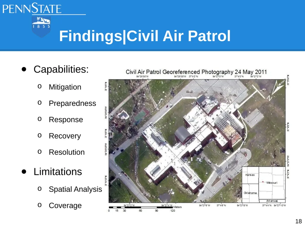
slide18. Capabilities:
Mitigation
Preparedness
Response
Recovery
Resolution
Limitations
Spatial Analysis
Coverage Findings|Civil Air Patrol 18<br>
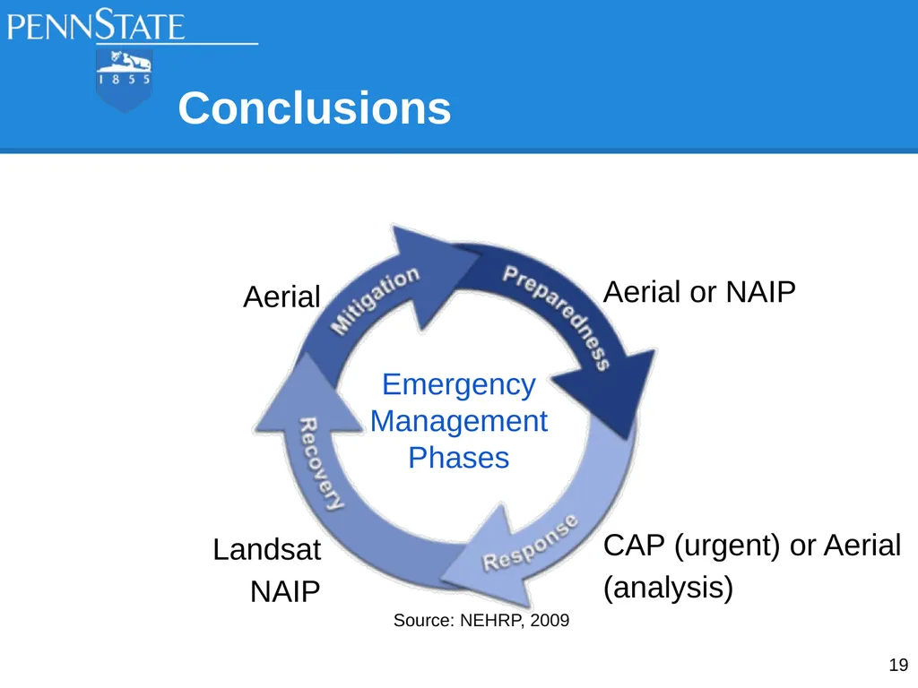
slide19. Conclusions Aerial
Landsat
NAIP 19 Aerial or NAIP
CAP (urgent) or Aerial (analysis) Emergency
Management
Phases Source: NEHRP, 2009<br>
slide20. References Cox, John D. “'Tornado Alley' actually four regions?” Web. Copyright 2014 NBCNews.com. Updated 27 April 2010. http://www.nbcnews.com/id/36807882/ns/us_news-environment/from/ET
National Oceanic and Atmospheric Administration. “SVRGIS”. Web. Dated 18 March 2014. Accessed 20 July 2014. http://www.spc.noaa.gov/gis/svrgis.
NEHRP - National Earthquake Hazards Reduction Program, Introduction to emergency management. Dated 01 November 2009 http://training.fema.gov/EMIWeb/EarthQuake/NEH0101220.htm
Novak, Justin. “Leveraging Remote Sensing for Rapid Identification of Tornado Damage”. Penn State University, GEOG 883. Dated 22 April 2013.
U.S. Census Bureau. “2013 U.S. Gazetteer Files”. Web. Dated 08 November 2013. Accessed 20 July 2014. http://www.census.gov/geo/maps-data/data/gazetteer2013.html 20<br>

slide21. Questions?
Justin Novak
JRN145@psu.edu 21<br>
Advisor: Guido Cervone, Ph.D.<br>
slide2. Purpose To determine which remote sensing platform is best suited for emergency management 2<br>
slide3. Agenda Selection Criteria for Study Area
Study Area
Background/Historical
Datasets
Evaluation Criteria
Conclusions 3<br>
slide4. Selection Criteria for Study Area NOAA 1950-2013 Tornado Track Dataset
EF-5 Tornadoes
Publicly Available Datasets Source: COX, 2014 4<br>
slide5. Study Area Harvest, AL
27 April 2011
EF-5 Tornado 5<br>
slide6. Background/Historical
Harvest, AL Dixie Alley
Northern Alabama
Huntsville, AL #1 Tornado City (Kellogg, 2013)
Population: 5,281 (Gazetteer, 2014)
4 Major Tornadoes in Past 40 Years (NOAA, 2013) 6<br>
slide7. Datasets|Base Layers Global Country Borders
TIGER/Line Shapefile
US State Boundaries
US County Boundaries
Madison County Roads
WGS84 UTM Zone 16N/15N 7<br>
slide8. USGS EarthExplorer (http://earthexplorer.usgs.gov)
7 bands (15m PAN / 30m MSI / 100m Thermal)
Evaluated Scenes
03 April 2011 (Suitable)
10 April 2011 (Cloud Covered)
19 April 2011 (Cloudy, Contrast Issues)
05 May 2011 (Suitable) Datasets|USGS Landsat 5 8<br>
slide9. USGS EarthExplorer (http://earthexplorer.usgs.gov)
4 band 1m color infrared orthoimagery
Evaluated Scenes
14 July 2009 (Suitable)
12 September 2011 (Suitable)
26 August 2013 (Suitable) Datasets|USDA NAIP 9<br>
slide10. USGS EarthExplorer (http://earthexplorer.usgs.gov)
3 band 15cm natural color
Acquired March 2010 Datasets|City of Huntsville 10<br>
slide11. USGS HDDS (http://hddsexplorer.usgs.gov/)
3 band 31cm natural color
Acquired 29 April 2011 Datasets|Atlantic Group, LLC. 11<br>
slide12. Datasets|Civil Air Patrol USGS HDDS (http://hddsexplorer.usgs.gov/)
3 band natural color
Acquired 24 May 2011
Example Dataset from
Joplin, MO Tornado 12<br>
slide13. Datasets|GeoEye Aerial USGS HDDS (http://hddsexplorer.usgs.gov/)
3 band 15cm natural color
Acquired 24 May 2011
Example Dataset from
Joplin, MO Tornado 13<br>
slide14. Evaluation Criteria Emergency Management Phases
Mitigation
Preparedness
Response
Recovery
Coverage Area
Timeliness
Analysis Products
Limitations 14 Source: NEHRP, 2009<br>
slide15. Capabilities:
Mitigation
Preparedness
Recovery
Vegetation Analysis
Limitations
Response
Timeliness
Spatial Resolution
Atmospheric Particulates Findings|USGS Landsat Source: Novak, 2013 15<br>
slide16. Findings|USDA NAIP Capabilities:
Mitigation
Preparedness
Recovery
Vegetation Analysis
Limitations
Response
Timeliness
Spatial Resolution 16<br>
slide17. Capabilities:
Mitigation
Preparedness
Response
Recovery
Spatial Resolution
Limitations
Vegetation Analysis
Coverage Findings|Aerial, Natural Color 17<br>
slide18. Capabilities:
Mitigation
Preparedness
Response
Recovery
Resolution
Limitations
Spatial Analysis
Coverage Findings|Civil Air Patrol 18<br>
slide19. Conclusions Aerial
Landsat
NAIP 19 Aerial or NAIP
CAP (urgent) or Aerial (analysis) Emergency
Management
Phases Source: NEHRP, 2009<br>
slide20. References Cox, John D. “'Tornado Alley' actually four regions?” Web. Copyright 2014 NBCNews.com. Updated 27 April 2010. http://www.nbcnews.com/id/36807882/ns/us_news-environment/from/ET
National Oceanic and Atmospheric Administration. “SVRGIS”. Web. Dated 18 March 2014. Accessed 20 July 2014. http://www.spc.noaa.gov/gis/svrgis.
NEHRP - National Earthquake Hazards Reduction Program, Introduction to emergency management. Dated 01 November 2009 http://training.fema.gov/EMIWeb/EarthQuake/NEH0101220.htm
Novak, Justin. “Leveraging Remote Sensing for Rapid Identification of Tornado Damage”. Penn State University, GEOG 883. Dated 22 April 2013.
U.S. Census Bureau. “2013 U.S. Gazetteer Files”. Web. Dated 08 November 2013. Accessed 20 July 2014. http://www.census.gov/geo/maps-data/data/gazetteer2013.html 20<br>
slide21. Questions?
Justin Novak
JRN145@psu.edu 21<br>