
gpsmap: Routine for verifying and returning the
MJ
Published · 42 slides · 0 views
1 / 1

Description
gpsmap: Routine for verifying and returning the attributable table of given decimal GPS coordinates from a user provided Shapefile Tim Brophy Stata Conference July 1819, 2013 New Orleans Overview What is spatial data? How is spatial data
Related Topics
Share
Embed code
Download this presentation From Below
"gpsmap: Routine for verifying and returning the" is the property of its rightful owner. Permission is granted to download and print the materials on this website for personal, non-commercial use only, and to display it on your personal computer provided you do not modify the materials and that you retain all copyright notices contained in the materials. By downloading content from our website, you accept the terms of this agreement.
Presentation Transcript
01
gpsmap: Routine for verifying and returning the attributable table of given decimal GPS coordinates from a user provided Shapefile Tim Brophy
Stata Conference July 18–19, 2013
New Orleans<br>
Stata Conference July 18–19, 2013
New Orleans<br>
02
Overview What is spatial data?
How is spatial data useful to researchers?
Spatial Data Structure
gpsmap introduction
gpsmap graphically
gpsmap syntax
gpsmap demonstration
gpsmap how it works
Acknowledgments What is spatial data?
How is it useful?
Spatial Data Structure
gpsmap
Graphically
Syntax
Demo
How it works
Acknowled -gments<br>
How is spatial data useful to researchers?
Spatial Data Structure
gpsmap introduction
gpsmap graphically
gpsmap syntax
gpsmap demonstration
gpsmap how it works
Acknowledgments What is spatial data?
How is it useful?
Spatial Data Structure
gpsmap
Graphically
Syntax
Demo
How it works
Acknowled -gments<br>
03
What is spatial data?
How is it useful?
Spatial Data Structure
gpsmap
Graphically
Syntax
Demo
How it works
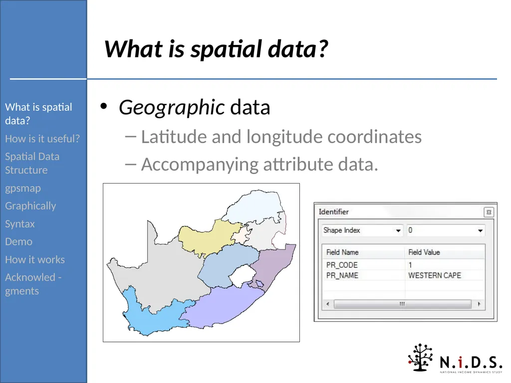
Acknowled -gments What is spatial data? Geographic data
Latitude and longitude coordinates
Accompanying attribute data.<br>
How is it useful?
Spatial Data Structure
gpsmap
Graphically
Syntax
Demo
How it works
Acknowled -gments What is spatial data? Geographic data
Latitude and longitude coordinates
Accompanying attribute data.<br>
04
What is spatial data?
How is it useful?
Spatial Data Structure
gpsmap
Graphically
Syntax
Demo
How it works
Acknowled -gments What is spatial data? Identifies geographic locations, features and boundaries.
Spatial data is often accessed, manipulated or analysed through Geographic Information Systems (GIS).<br>
How is it useful?
Spatial Data Structure
gpsmap
Graphically
Syntax
Demo
How it works
Acknowled -gments What is spatial data? Identifies geographic locations, features and boundaries.
Spatial data is often accessed, manipulated or analysed through Geographic Information Systems (GIS).<br>
05
What is spatial data?
How is it useful?
Spatial Data Structure
gpsmap
Graphically
Syntax
Demo
How it works
Acknowled -gments How is spatial data useful to researchers? Allows researcher to analyse data within or across geographical locations.
In order for this to happen the locations need to be known
Provides data regarding the given geographical locations.
Such as:
population density
geo type (i.e. urban or formal )<br>
How is it useful?
Spatial Data Structure
gpsmap
Graphically
Syntax
Demo
How it works
Acknowled -gments How is spatial data useful to researchers? Allows researcher to analyse data within or across geographical locations.
In order for this to happen the locations need to be known
Provides data regarding the given geographical locations.
Such as:
population density
geo type (i.e. urban or formal )<br>
06
What is spatial data?
How is it useful?
Spatial Data Structure
gpsmap
Graphically
Syntax
Demo
How it works
Acknowled -gments Spatial Data Structure Spatial data is normally stored in the ESRI Shapefile format.
Shapefiles data is a relational dataset
Thus there are multiple tables connected by a primary key.
Each of these table come as a separate file extension.
At a minimum there are three mandatory file extensions.
.shp — shape format; the geometry itself.
.dbf — attribute format; columnar attributes for each shape
.shx — shape index format; a positional index of the feature geometry<br>
How is it useful?
Spatial Data Structure
gpsmap
Graphically
Syntax
Demo
How it works
Acknowled -gments Spatial Data Structure Spatial data is normally stored in the ESRI Shapefile format.
Shapefiles data is a relational dataset
Thus there are multiple tables connected by a primary key.
Each of these table come as a separate file extension.
At a minimum there are three mandatory file extensions.
.shp — shape format; the geometry itself.
.dbf — attribute format; columnar attributes for each shape
.shx — shape index format; a positional index of the feature geometry<br>
07
What is spatial data?
How is it useful?
Spatial Data Structure
gpsmap
Graphically
Syntax
Demo
How it works
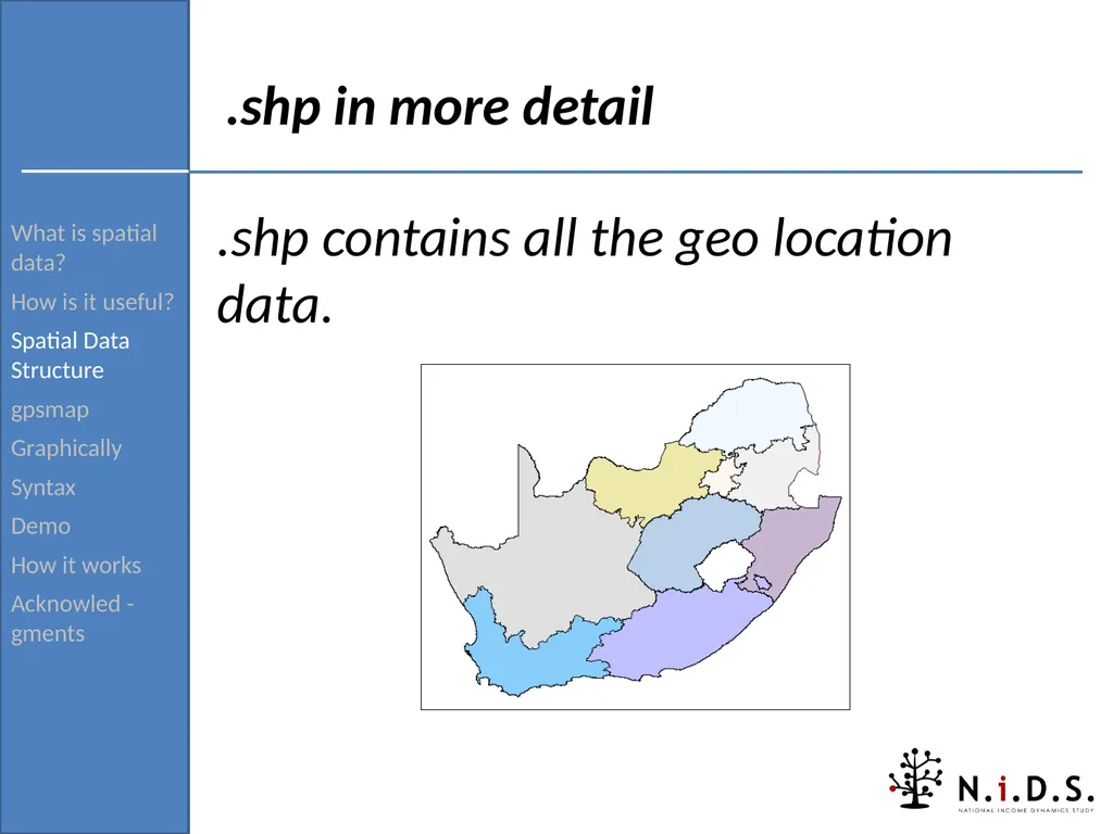
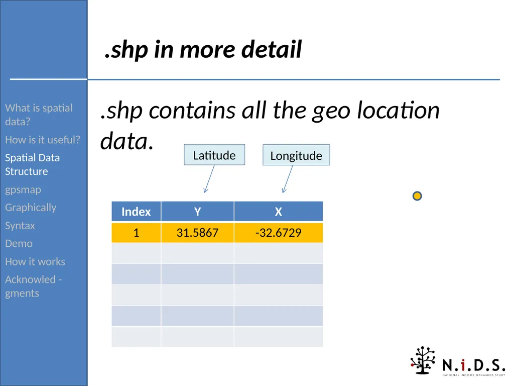
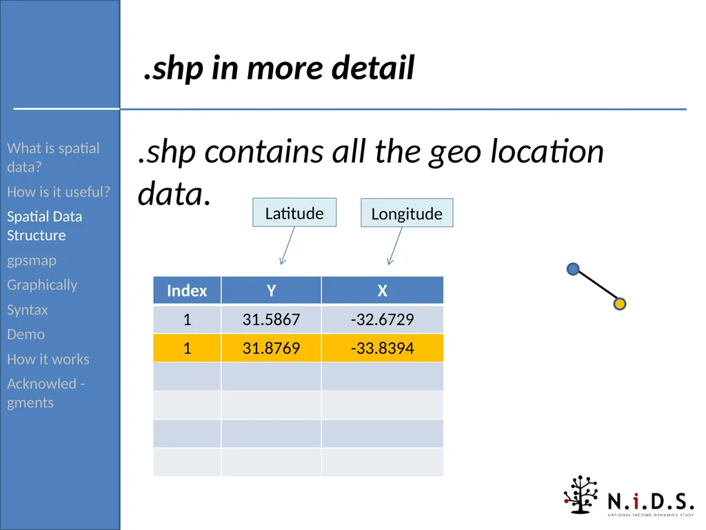
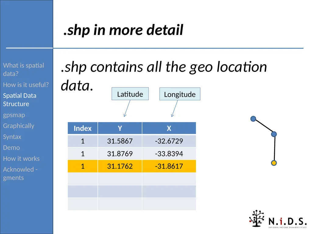
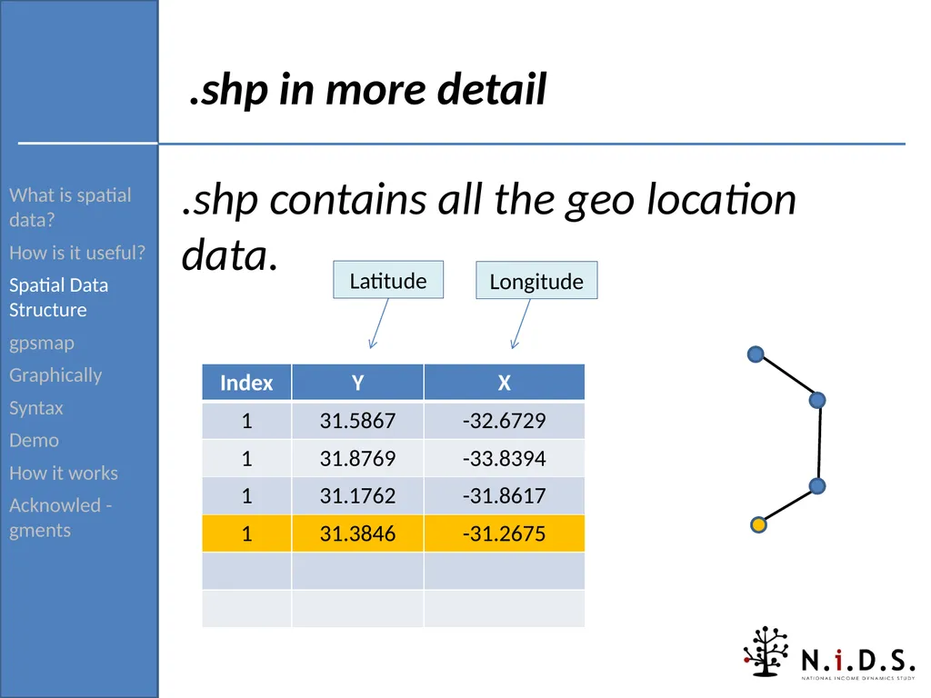
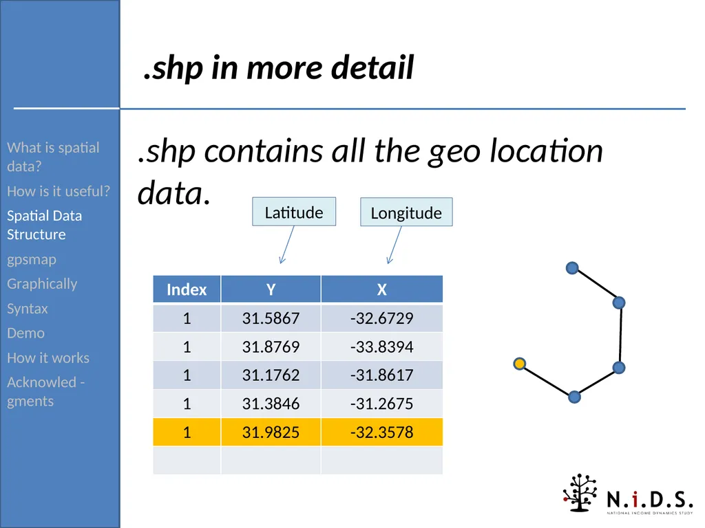
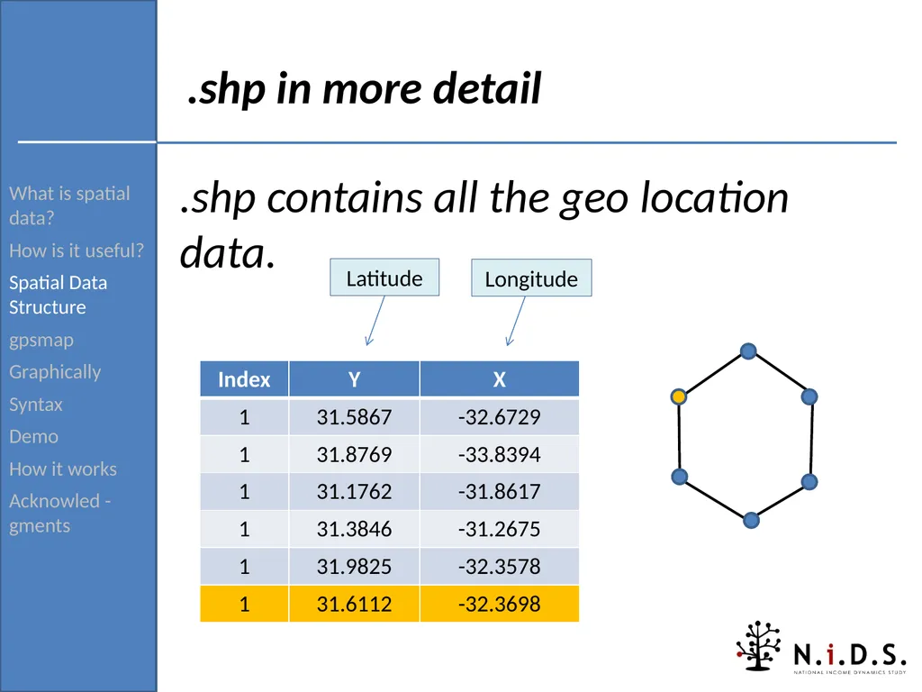
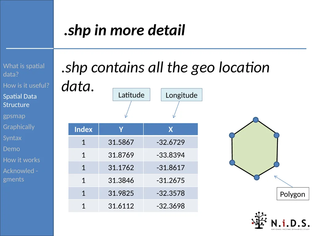
Acknowled -gments .shp in more detail .shp contains all the geo location data.<br>
How is it useful?
Spatial Data Structure
gpsmap
Graphically
Syntax
Demo
How it works
Acknowled -gments .shp in more detail .shp contains all the geo location data.<br>
08
What is spatial data?
How is it useful?
Spatial Data Structure
gpsmap
Graphically
Syntax
Demo
How it works
Acknowled -gments .shp in more detail .shp contains all the geo location data. Latitude Longitude<br>
How is it useful?
Spatial Data Structure
gpsmap
Graphically
Syntax
Demo
How it works
Acknowled -gments .shp in more detail .shp contains all the geo location data. Latitude Longitude<br>
09
What is spatial data?
How is it useful?
Spatial Data Structure
gpsmap
Graphically
Syntax
Demo
How it works
Acknowled -gments .shp in more detail .shp contains all the geo location data. Latitude Longitude<br>
How is it useful?
Spatial Data Structure
gpsmap
Graphically
Syntax
Demo
How it works
Acknowled -gments .shp in more detail .shp contains all the geo location data. Latitude Longitude<br>
10
What is spatial data?
How is it useful?
Spatial Data Structure
gpsmap
Graphically
Syntax
Demo
How it works
Acknowled -gments .shp in more detail .shp contains all the geo location data. Latitude Longitude<br>
How is it useful?
Spatial Data Structure
gpsmap
Graphically
Syntax
Demo
How it works
Acknowled -gments .shp in more detail .shp contains all the geo location data. Latitude Longitude<br>
11
What is spatial data?
How is it useful?
Spatial Data Structure
gpsmap
Graphically
Syntax
Demo
How it works
Acknowled -gments .shp in more detail .shp contains all the geo location data. Latitude Longitude<br>
How is it useful?
Spatial Data Structure
gpsmap
Graphically
Syntax
Demo
How it works
Acknowled -gments .shp in more detail .shp contains all the geo location data. Latitude Longitude<br>
12
What is spatial data?
How is it useful?
Spatial Data Structure
gpsmap
Graphically
Syntax
Demo
How it works
Acknowled -gments .shp in more detail .shp contains all the geo location data. Latitude Longitude<br>
How is it useful?
Spatial Data Structure
gpsmap
Graphically
Syntax
Demo
How it works
Acknowled -gments .shp in more detail .shp contains all the geo location data. Latitude Longitude<br>
13
What is spatial data?
How is it useful?
Spatial Data Structure
gpsmap
Graphically
Syntax
Demo
How it works
Acknowled -gments .shp in more detail .shp contains all the geo location data. Latitude Longitude<br>
How is it useful?
Spatial Data Structure
gpsmap
Graphically
Syntax
Demo
How it works
Acknowled -gments .shp in more detail .shp contains all the geo location data. Latitude Longitude<br>
14
What is spatial data?
How is it useful?
Spatial Data Structure
gpsmap
Graphically
Syntax
Demo
How it works
Acknowled -gments .shp in more detail .shp contains all the geo location data. Polygon Latitude Longitude<br>
How is it useful?
Spatial Data Structure
gpsmap
Graphically
Syntax
Demo
How it works
Acknowled -gments .shp in more detail .shp contains all the geo location data. Polygon Latitude Longitude<br>
15
What is spatial data?
How is it useful?
Spatial Data Structure
gpsmap
Graphically
Syntax
Demo
How it works
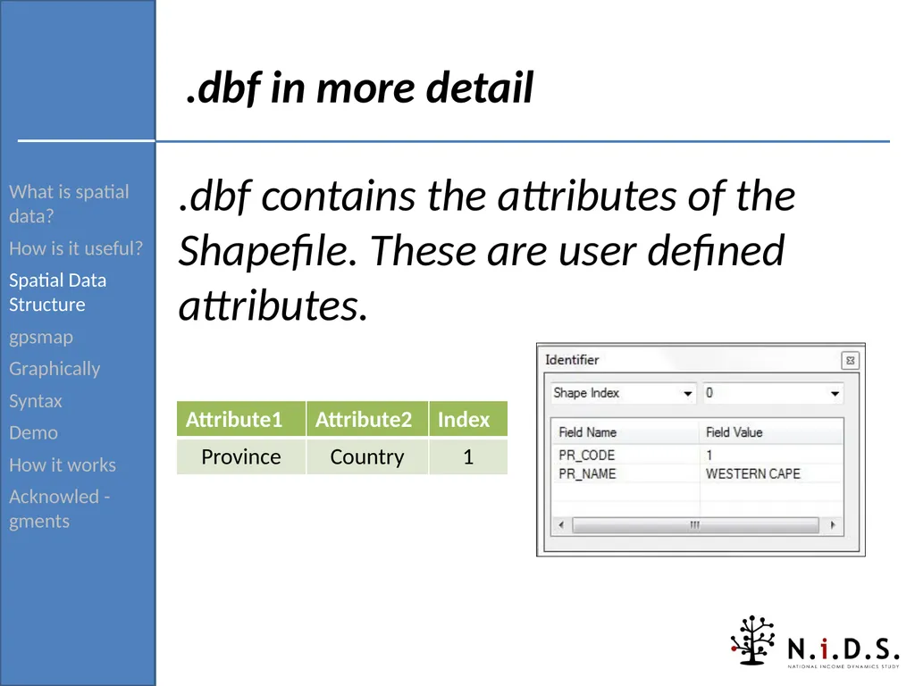
Acknowled -gments .dbf in more detail .dbf contains the attributes of the Shapefile. These are user defined attributes.<br>
How is it useful?
Spatial Data Structure
gpsmap
Graphically
Syntax
Demo
How it works
Acknowled -gments .dbf in more detail .dbf contains the attributes of the Shapefile. These are user defined attributes.<br>
16
What is spatial data?
How is it useful?
Spatial Data Structure
gpsmap
Graphically
Syntax
Demo
How it works
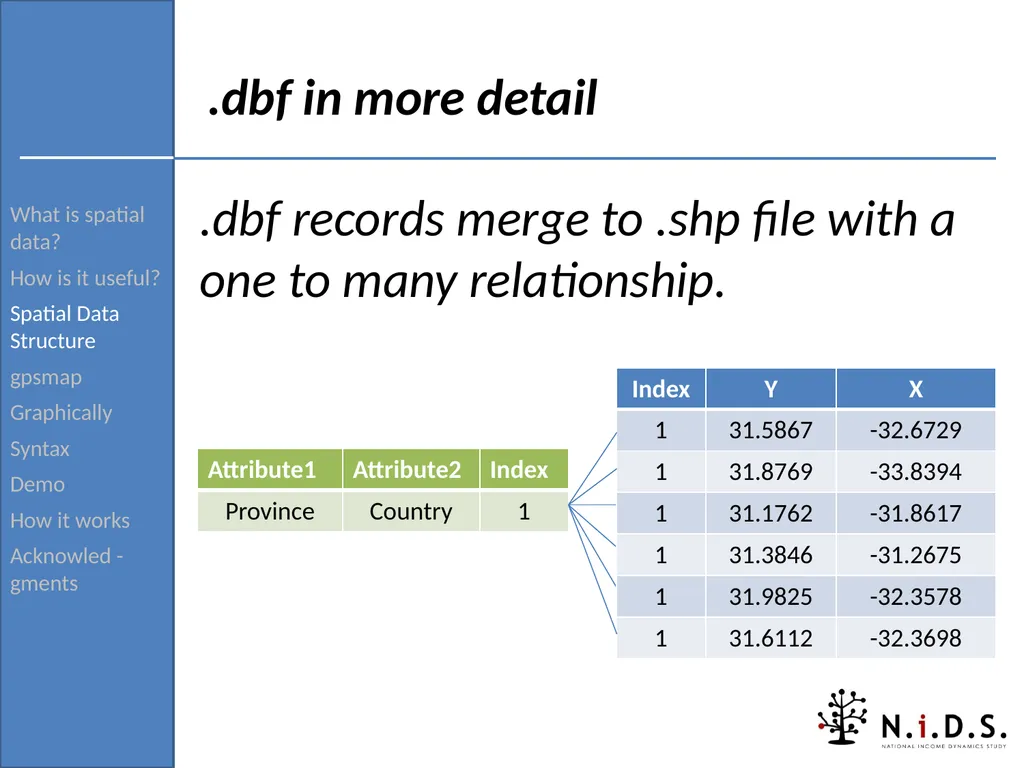
Acknowled -gments .dbf in more detail .dbf records merge to .shp file with a one to many relationship.<br>
How is it useful?
Spatial Data Structure
gpsmap
Graphically
Syntax
Demo
How it works
Acknowled -gments .dbf in more detail .dbf records merge to .shp file with a one to many relationship.<br>
17
What is spatial data?
How is it useful?
Spatial Data Structure
gpsmap
Graphically
Syntax
Demo
How it works
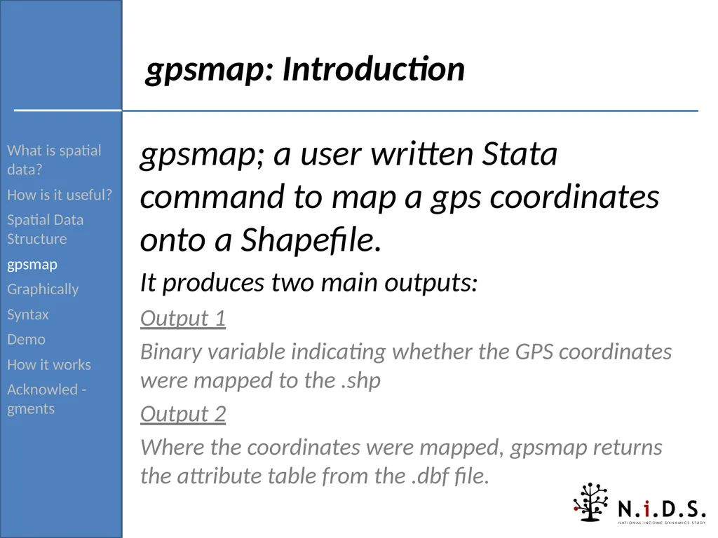
Acknowled -gments gpsmap: Introduction gpsmap; a user written Stata command to map a gps coordinates onto a Shapefile.
It produces two main outputs:
Output 1
Binary variable indicating whether the GPS coordinates were mapped to the .shp
Output 2
Where the coordinates were mapped, gpsmap returns the attribute table from the .dbf file.<br>
How is it useful?
Spatial Data Structure
gpsmap
Graphically
Syntax
Demo
How it works
Acknowled -gments gpsmap: Introduction gpsmap; a user written Stata command to map a gps coordinates onto a Shapefile.
It produces two main outputs:
Output 1
Binary variable indicating whether the GPS coordinates were mapped to the .shp
Output 2
Where the coordinates were mapped, gpsmap returns the attribute table from the .dbf file.<br>
18
What is spatial data?
How is it useful?
Spatial Data Structure
gpsmap
Graphically
Syntax
Demo
How it works
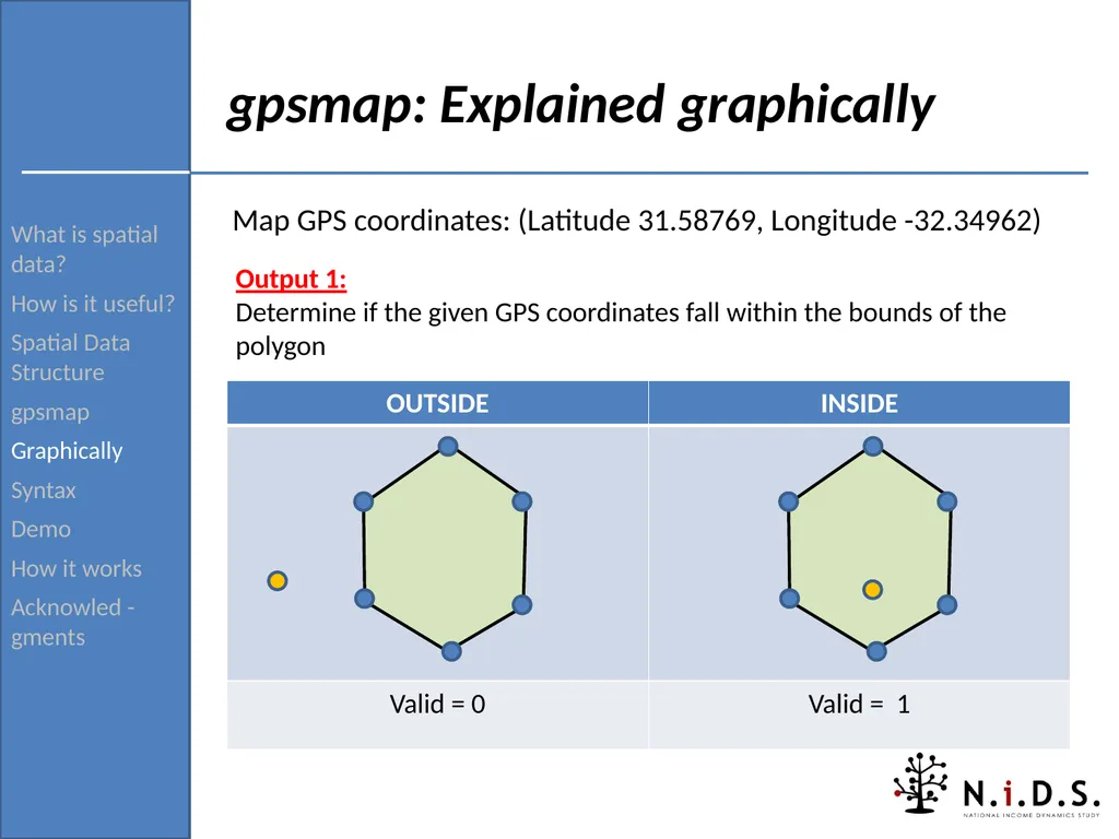
Acknowled -gments gpsmap: Explained graphically Map GPS coordinates: (Latitude 31.58769, Longitude -32.34962) Output 1:
Determine if the given GPS coordinates fall within the bounds of the polygon<br>
How is it useful?
Spatial Data Structure
gpsmap
Graphically
Syntax
Demo
How it works
Acknowled -gments gpsmap: Explained graphically Map GPS coordinates: (Latitude 31.58769, Longitude -32.34962) Output 1:
Determine if the given GPS coordinates fall within the bounds of the polygon<br>
19
What is spatial data?
How is it useful?
Spatial Data Structure
gpsmap
Graphically
Syntax
Demo
How it works
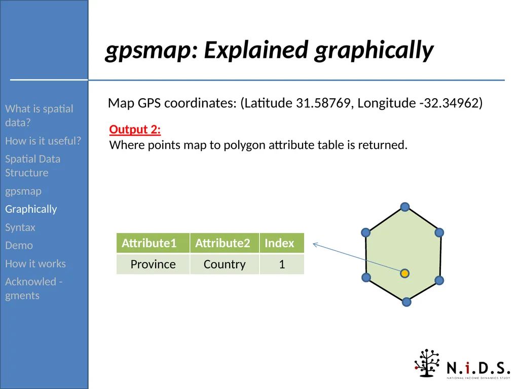
Acknowled -gments gpsmap: Explained graphically Map GPS coordinates: (Latitude 31.58769, Longitude -32.34962) Output 2:
Where points map to polygon attribute table is returned.<br>
How is it useful?
Spatial Data Structure
gpsmap
Graphically
Syntax
Demo
How it works
Acknowled -gments gpsmap: Explained graphically Map GPS coordinates: (Latitude 31.58769, Longitude -32.34962) Output 2:
Where points map to polygon attribute table is returned.<br>
20
What is spatial data?
How is it useful?
Spatial Data Structure
gpsmap
Graphically
Syntax
Demo
How it works
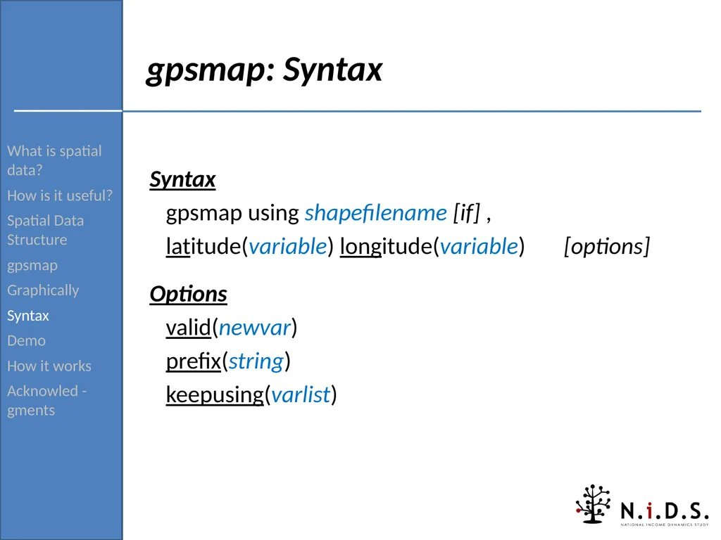
Acknowled -gments gpsmap: Syntax Syntax
gpsmap using shapefilename [if] ,
latitude(variable) longitude(variable) [options]
Options
valid(newvar)
prefix(string)
keepusing(varlist)<br>
How is it useful?
Spatial Data Structure
gpsmap
Graphically
Syntax
Demo
How it works
Acknowled -gments gpsmap: Syntax Syntax
gpsmap using shapefilename [if] ,
latitude(variable) longitude(variable) [options]
Options
valid(newvar)
prefix(string)
keepusing(varlist)<br>
21
What is spatial data?
How is it useful?
Spatial Data Structure
gpsmap
Graphically
Syntax
Demo
How it works
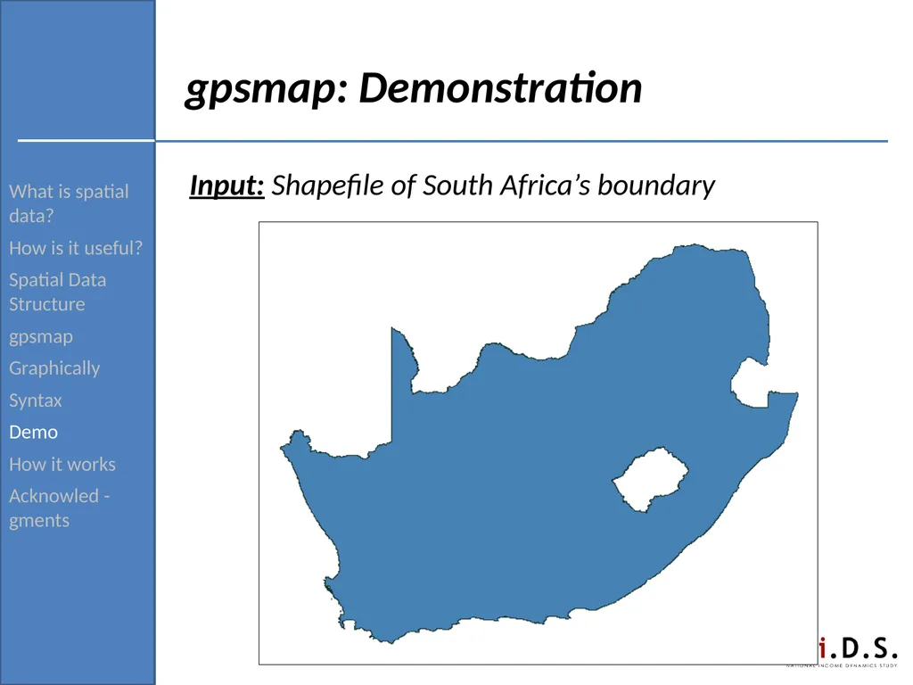
Acknowled -gments gpsmap: Demonstration Input: Shapefile of South Africa’s boundary<br>
How is it useful?
Spatial Data Structure
gpsmap
Graphically
Syntax
Demo
How it works
Acknowled -gments gpsmap: Demonstration Input: Shapefile of South Africa’s boundary<br>
22
What is spatial data?
How is it useful?
Spatial Data Structure
gpsmap
Graphically
Syntax
Demo
How it works
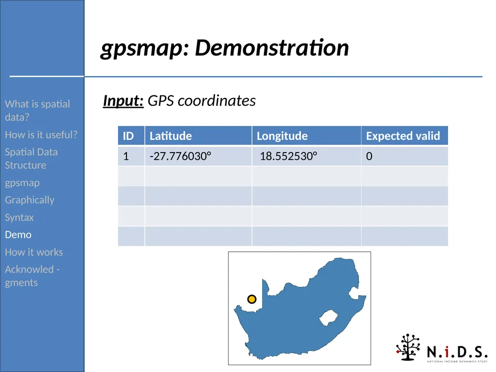
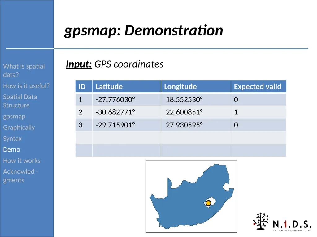
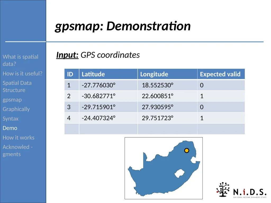
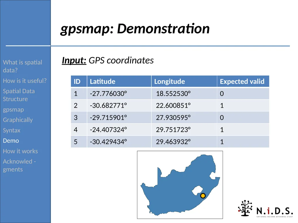
Acknowled -gments gpsmap: Demonstration Input: GPS coordinates<br>
How is it useful?
Spatial Data Structure
gpsmap
Graphically
Syntax
Demo
How it works
Acknowled -gments gpsmap: Demonstration Input: GPS coordinates<br>
23
What is spatial data?
How is it useful?
Spatial Data Structure
gpsmap
Graphically
Syntax
Demo
How it works
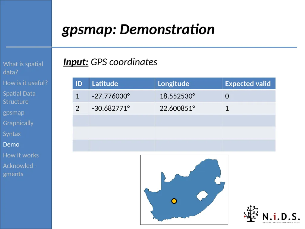
Acknowled -gments gpsmap: Demonstration Input: GPS coordinates<br>
How is it useful?
Spatial Data Structure
gpsmap
Graphically
Syntax
Demo
How it works
Acknowled -gments gpsmap: Demonstration Input: GPS coordinates<br>
24
What is spatial data?
How is it useful?
Spatial Data Structure
gpsmap
Graphically
Syntax
Demo
How it works
Acknowled -gments gpsmap: Demonstration Input: GPS coordinates<br>
How is it useful?
Spatial Data Structure
gpsmap
Graphically
Syntax
Demo
How it works
Acknowled -gments gpsmap: Demonstration Input: GPS coordinates<br>
25
What is spatial data?
How is it useful?
Spatial Data Structure
gpsmap
Graphically
Syntax
Demo
How it works
Acknowled -gments gpsmap: Demonstration Input: GPS coordinates<br>
How is it useful?
Spatial Data Structure
gpsmap
Graphically
Syntax
Demo
How it works
Acknowled -gments gpsmap: Demonstration Input: GPS coordinates<br>
26
What is spatial data?
How is it useful?
Spatial Data Structure
gpsmap
Graphically
Syntax
Demo
How it works
Acknowled -gments gpsmap: Demonstration Input: GPS coordinates<br>
How is it useful?
Spatial Data Structure
gpsmap
Graphically
Syntax
Demo
How it works
Acknowled -gments gpsmap: Demonstration Input: GPS coordinates<br>
27
What is spatial data?
How is it useful?
Spatial Data Structure
gpsmap
Graphically
Syntax
Demo
How it works
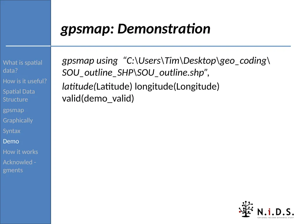
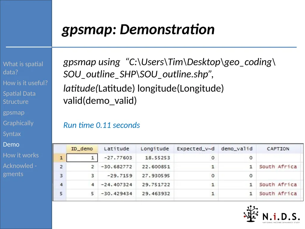
Acknowled -gments gpsmap: Demonstration gpsmap using “C:\Users\Tim\Desktop\geo_coding\SOU_outline_SHP\SOU_outline.shp”,
latitude(Latitude) longitude(Longitude) valid(demo_valid)<br>
How is it useful?
Spatial Data Structure
gpsmap
Graphically
Syntax
Demo
How it works
Acknowled -gments gpsmap: Demonstration gpsmap using “C:\Users\Tim\Desktop\geo_coding\SOU_outline_SHP\SOU_outline.shp”,
latitude(Latitude) longitude(Longitude) valid(demo_valid)<br>
28
What is spatial data?
How is it useful?
Spatial Data Structure
gpsmap
Graphically
Syntax
Demo
How it works
Acknowled -gments gpsmap: Demonstration gpsmap using “C:\Users\Tim\Desktop\geo_coding\SOU_outline_SHP\SOU_outline.shp”,
latitude(Latitude) longitude(Longitude) valid(demo_valid)
Run time 0.11 seconds<br>
How is it useful?
Spatial Data Structure
gpsmap
Graphically
Syntax
Demo
How it works
Acknowled -gments gpsmap: Demonstration gpsmap using “C:\Users\Tim\Desktop\geo_coding\SOU_outline_SHP\SOU_outline.shp”,
latitude(Latitude) longitude(Longitude) valid(demo_valid)
Run time 0.11 seconds<br>
29
What is spatial data?
How is it useful?
Spatial Data Structure
gpsmap
Graphically
Syntax
Demo
How it works
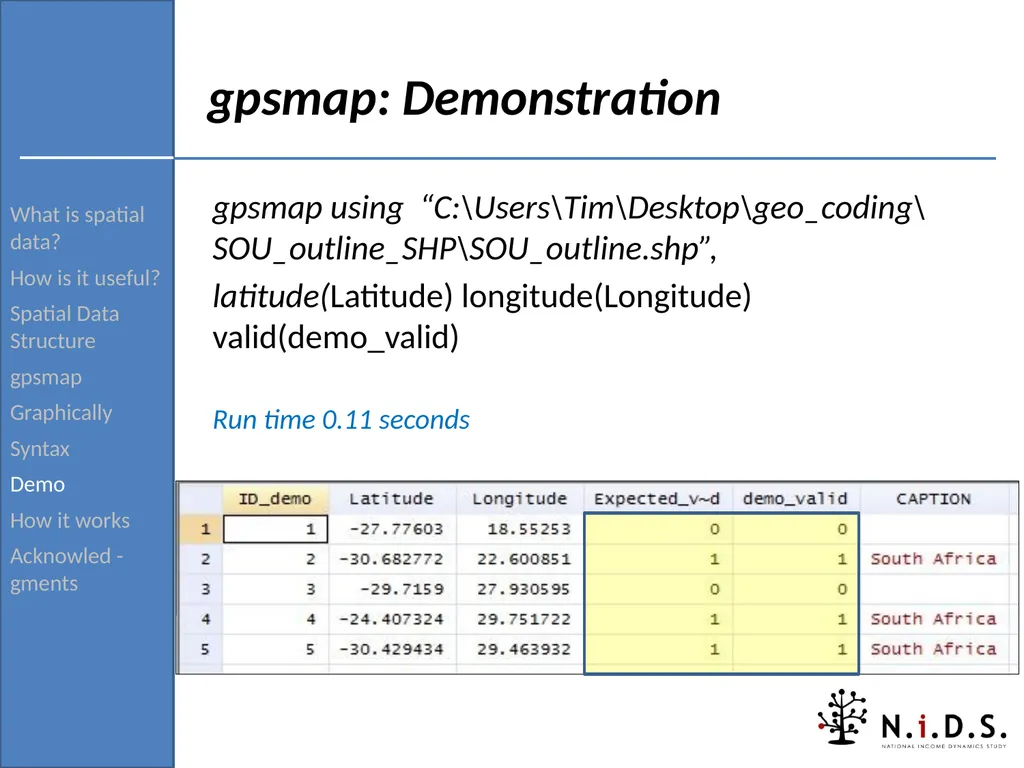
Acknowled -gments gpsmap: Demonstration gpsmap using “C:\Users\Tim\Desktop\geo_coding\SOU_outline_SHP\SOU_outline.shp”,
latitude(Latitude) longitude(Longitude) valid(demo_valid)
Run time 0.11 seconds<br>
How is it useful?
Spatial Data Structure
gpsmap
Graphically
Syntax
Demo
How it works
Acknowled -gments gpsmap: Demonstration gpsmap using “C:\Users\Tim\Desktop\geo_coding\SOU_outline_SHP\SOU_outline.shp”,
latitude(Latitude) longitude(Longitude) valid(demo_valid)
Run time 0.11 seconds<br>
30
What is spatial data?
How is it useful?
Spatial Data Structure
gpsmap
Graphically
Syntax
Demo
How it works
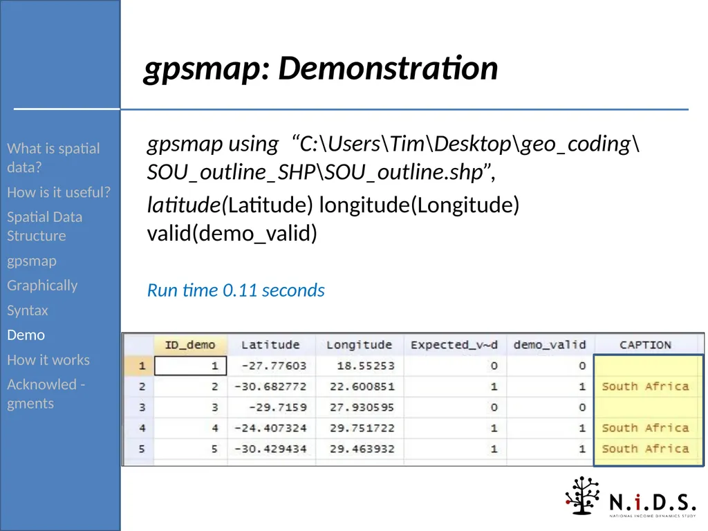
Acknowled -gments gpsmap: Demonstration gpsmap using “C:\Users\Tim\Desktop\geo_coding\SOU_outline_SHP\SOU_outline.shp”,
latitude(Latitude) longitude(Longitude) valid(demo_valid)
Run time 0.11 seconds<br>
How is it useful?
Spatial Data Structure
gpsmap
Graphically
Syntax
Demo
How it works
Acknowled -gments gpsmap: Demonstration gpsmap using “C:\Users\Tim\Desktop\geo_coding\SOU_outline_SHP\SOU_outline.shp”,
latitude(Latitude) longitude(Longitude) valid(demo_valid)
Run time 0.11 seconds<br>
31
What is spatial data?
How is it useful?
Spatial Data Structure
gpsmap
Graphically
Syntax
Demo
How it works
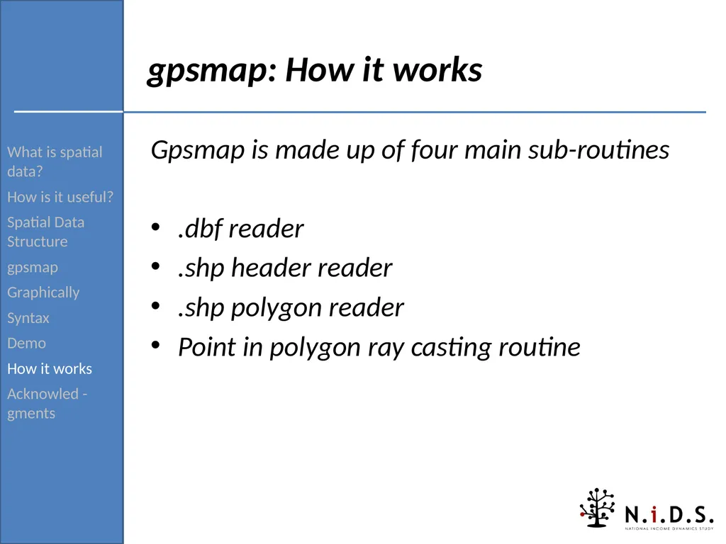
Acknowled -gments gpsmap: How it works Gpsmap is made up of four main sub-routines
.dbf reader
.shp header reader
.shp polygon reader
Point in polygon ray casting routine<br>
How is it useful?
Spatial Data Structure
gpsmap
Graphically
Syntax
Demo
How it works
Acknowled -gments gpsmap: How it works Gpsmap is made up of four main sub-routines
.dbf reader
.shp header reader
.shp polygon reader
Point in polygon ray casting routine<br>
32
What is spatial data?
How is it useful?
Spatial Data Structure
gpsmap
Graphically
Syntax
Demo
How it works
Acknowled -gments .dbf reader The .dbf reader reads the attribute table into Stata.
Controls for length of variable names 32 characters or less.
Imports all data as string format into Stata and then gets Stata to convert to numeric where applicable.
Due to this all variables are limited to 244 characters long.<br>
How is it useful?
Spatial Data Structure
gpsmap
Graphically
Syntax
Demo
How it works
Acknowled -gments .dbf reader The .dbf reader reads the attribute table into Stata.
Controls for length of variable names 32 characters or less.
Imports all data as string format into Stata and then gets Stata to convert to numeric where applicable.
Due to this all variables are limited to 244 characters long.<br>
33
What is spatial data?
How is it useful?
Spatial Data Structure
gpsmap
Graphically
Syntax
Demo
How it works
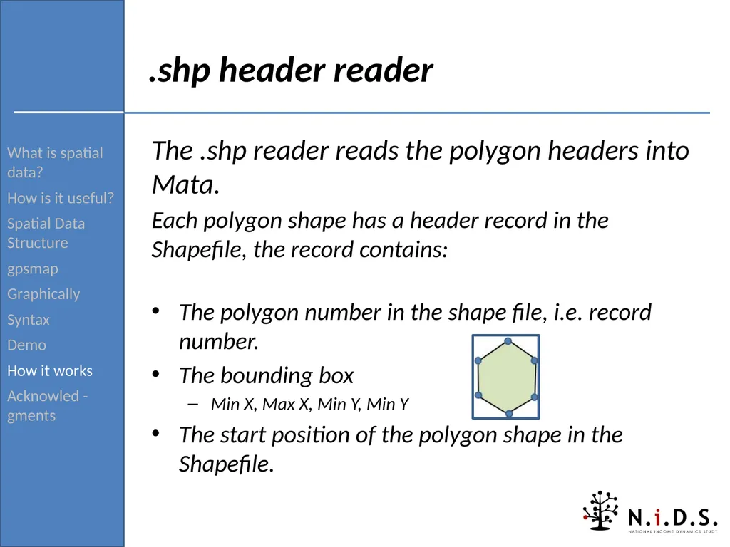
Acknowled -gments .shp header reader The .shp reader reads the polygon headers into Mata.
Each polygon shape has a header record in the Shapefile, the record contains:
The polygon number in the shape file, i.e. record number.
The bounding box
Min X, Max X, Min Y, Min Y
The start position of the polygon shape in the Shapefile.<br>
How is it useful?
Spatial Data Structure
gpsmap
Graphically
Syntax
Demo
How it works
Acknowled -gments .shp header reader The .shp reader reads the polygon headers into Mata.
Each polygon shape has a header record in the Shapefile, the record contains:
The polygon number in the shape file, i.e. record number.
The bounding box
Min X, Max X, Min Y, Min Y
The start position of the polygon shape in the Shapefile.<br>
34
What is spatial data?
How is it useful?
Spatial Data Structure
gpsmap
Graphically
Syntax
Demo
How it works
Acknowled -gments .shp polygon reader The .shp polygon reader reads a specific polygon from the Shapefile into Mata
Each GPS point from Stata is compared with the Max and Min values in the polygon header tables, selecting the most likely polygon that it will fall into.
Each selected polygon is then read in using the polygon reader.
Done for both performance and memory efficiency.<br>
How is it useful?
Spatial Data Structure
gpsmap
Graphically
Syntax
Demo
How it works
Acknowled -gments .shp polygon reader The .shp polygon reader reads a specific polygon from the Shapefile into Mata
Each GPS point from Stata is compared with the Max and Min values in the polygon header tables, selecting the most likely polygon that it will fall into.
Each selected polygon is then read in using the polygon reader.
Done for both performance and memory efficiency.<br>
35
What is spatial data?
How is it useful?
Spatial Data Structure
gpsmap
Graphically
Syntax
Demo
How it works
Acknowled -gments Point in polygon routine So far:
Polygon headers have been read in.
Most likely polygon have been identified and read in.
Now determine which polygon out of the likely polygon the GPS point falls into.<br>
How is it useful?
Spatial Data Structure
gpsmap
Graphically
Syntax
Demo
How it works
Acknowled -gments Point in polygon routine So far:
Polygon headers have been read in.
Most likely polygon have been identified and read in.
Now determine which polygon out of the likely polygon the GPS point falls into.<br>
36
What is spatial data?
How is it useful?
Spatial Data Structure
gpsmap
Graphically
Syntax
Demo
How it works
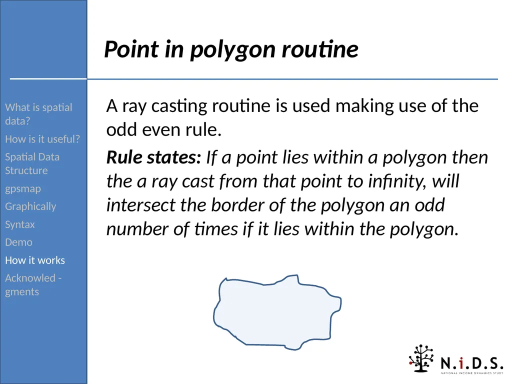
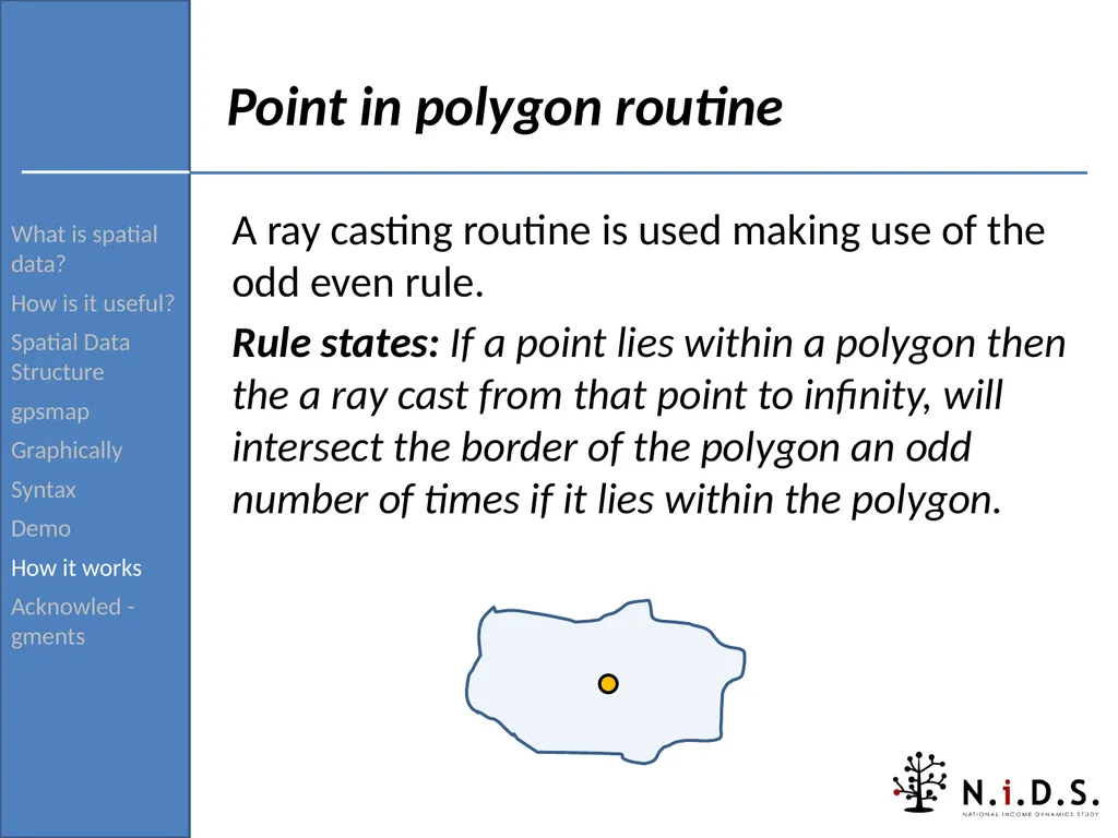
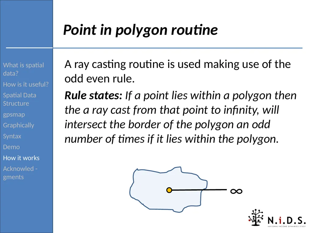
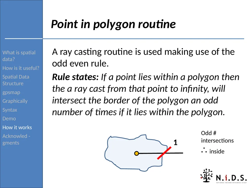
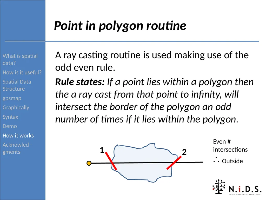
Acknowled -gments Point in polygon routine A ray casting routine is used making use of the odd even rule.
Rule states: If a point lies within a polygon then the a ray cast from that point to infinity, will intersect the border of the polygon an odd number of times if it lies within the polygon.<br>
How is it useful?
Spatial Data Structure
gpsmap
Graphically
Syntax
Demo
How it works
Acknowled -gments Point in polygon routine A ray casting routine is used making use of the odd even rule.
Rule states: If a point lies within a polygon then the a ray cast from that point to infinity, will intersect the border of the polygon an odd number of times if it lies within the polygon.<br>
37
What is spatial data?
How is it useful?
Spatial Data Structure
gpsmap
Graphically
Syntax
Demo
How it works
Acknowled -gments Point in polygon routine A ray casting routine is used making use of the odd even rule.
Rule states: If a point lies within a polygon then the a ray cast from that point to infinity, will intersect the border of the polygon an odd number of times if it lies within the polygon.<br>
How is it useful?
Spatial Data Structure
gpsmap
Graphically
Syntax
Demo
How it works
Acknowled -gments Point in polygon routine A ray casting routine is used making use of the odd even rule.
Rule states: If a point lies within a polygon then the a ray cast from that point to infinity, will intersect the border of the polygon an odd number of times if it lies within the polygon.<br>
38
What is spatial data?
How is it useful?
Spatial Data Structure
gpsmap
Graphically
Syntax
Demo
How it works
Acknowled -gments Point in polygon routine A ray casting routine is used making use of the odd even rule.
Rule states: If a point lies within a polygon then the a ray cast from that point to infinity, will intersect the border of the polygon an odd number of times if it lies within the polygon. ∞<br>
How is it useful?
Spatial Data Structure
gpsmap
Graphically
Syntax
Demo
How it works
Acknowled -gments Point in polygon routine A ray casting routine is used making use of the odd even rule.
Rule states: If a point lies within a polygon then the a ray cast from that point to infinity, will intersect the border of the polygon an odd number of times if it lies within the polygon. ∞<br>
39
What is spatial data?
How is it useful?
Spatial Data Structure
gpsmap
Graphically
Syntax
Demo
How it works
Acknowled -gments Point in polygon routine A ray casting routine is used making use of the odd even rule.
Rule states: If a point lies within a polygon then the a ray cast from that point to infinity, will intersect the border of the polygon an odd number of times if it lies within the polygon. 1 Odd # intersections ∴ inside<br>
How is it useful?
Spatial Data Structure
gpsmap
Graphically
Syntax
Demo
How it works
Acknowled -gments Point in polygon routine A ray casting routine is used making use of the odd even rule.
Rule states: If a point lies within a polygon then the a ray cast from that point to infinity, will intersect the border of the polygon an odd number of times if it lies within the polygon. 1 Odd # intersections ∴ inside<br>
40
What is spatial data?
How is it useful?
Spatial Data Structure
gpsmap
Graphically
Syntax
Demo
How it works
Acknowled -gments Point in polygon routine A ray casting routine is used making use of the odd even rule.
Rule states: If a point lies within a polygon then the a ray cast from that point to infinity, will intersect the border of the polygon an odd number of times if it lies within the polygon. 1 Even # intersections ∴ Outside 2<br>
How is it useful?
Spatial Data Structure
gpsmap
Graphically
Syntax
Demo
How it works
Acknowled -gments Point in polygon routine A ray casting routine is used making use of the odd even rule.
Rule states: If a point lies within a polygon then the a ray cast from that point to infinity, will intersect the border of the polygon an odd number of times if it lies within the polygon. 1 Even # intersections ∴ Outside 2<br>
41
What is spatial data?
How is it useful?
Spatial Data Structure
gpsmap
Graphically
Syntax
Demo
How it works
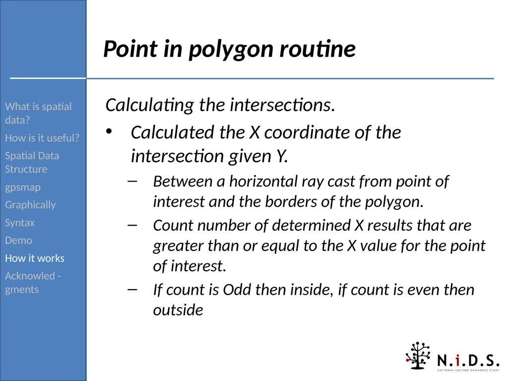
Acknowled -gments Point in polygon routine Calculating the intersections.
Calculated the X coordinate of the intersection given Y.
Between a horizontal ray cast from point of interest and the borders of the polygon.
Count number of determined X results that are greater than or equal to the X value for the point of interest.
If count is Odd then inside, if count is even then outside<br>
How is it useful?
Spatial Data Structure
gpsmap
Graphically
Syntax
Demo
How it works
Acknowled -gments Point in polygon routine Calculating the intersections.
Calculated the X coordinate of the intersection given Y.
Between a horizontal ray cast from point of interest and the borders of the polygon.
Count number of determined X results that are greater than or equal to the X value for the point of interest.
If count is Odd then inside, if count is even then outside<br>
42
What is spatial data?
How is it useful?
Spatial Data Structure
gpsmap
Graphically
Syntax
Demo
How it works
Acknowled -gments Acknowledgments and thanks Kevin Crow
shp2dta
Reza C. Daniels and Sibongile Musundwa
Co-authors and testing
Louise De Villiers, Michelle Chinhema and the rest of the NIDS team.
Support utilization and testing gpsmap.
Email: tslbrophy@gmail.com
Nids: http://www.nids.uct.ac.za<br>
How is it useful?
Spatial Data Structure
gpsmap
Graphically
Syntax
Demo
How it works
Acknowled -gments Acknowledgments and thanks Kevin Crow
shp2dta
Reza C. Daniels and Sibongile Musundwa
Co-authors and testing
Louise De Villiers, Michelle Chinhema and the rest of the NIDS team.
Support utilization and testing gpsmap.
Email: tslbrophy@gmail.com
Nids: http://www.nids.uct.ac.za<br>