Map work Skills Latitude, Longitude, Degrees and Minutes Social Sciences: Mapwork Skills What are we going to learn Use degrees and minutes Use an atlas index Calculate distances using scale Find out about places in the news New words
"Map work Skills Latitude, Longitude, Degrees and" is the property of its rightful owner. Permission is granted to
download and print the materials on this website for personal, non-commercial use only, and to display it
on your personal computer provided you do not modify the materials and that you retain all copyright
notices contained in the materials. By downloading content from our website, you accept the terms of this
agreement.
Presentation Transcript
01
Map work Skills
Latitude, Longitude, Degrees and Minutes Social Sciences: Mapwork Skills<br>
02
What are we going to learn Use degrees and minutes
Use an atlas index
Calculate distances using scale
Find out about places in the news<br>
03
New words Locate
to find the exact position of someone or something
Latitude
The lines that runs across the globe
Equator
The longest line of latitude
Parallel
Lines that are always the same distance from one another<br>
04
New words Co-ordinates
Sets of letters and numbers that you use to find the exact position of something (on a map)
Longitude
Lines across the globe joining the North and South Poles
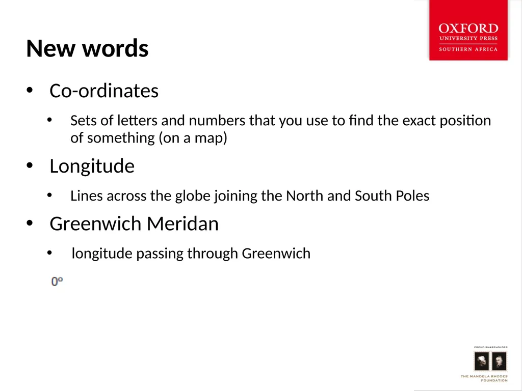
Greenwich Meridan
longitude passing through Greenwich<br>
05
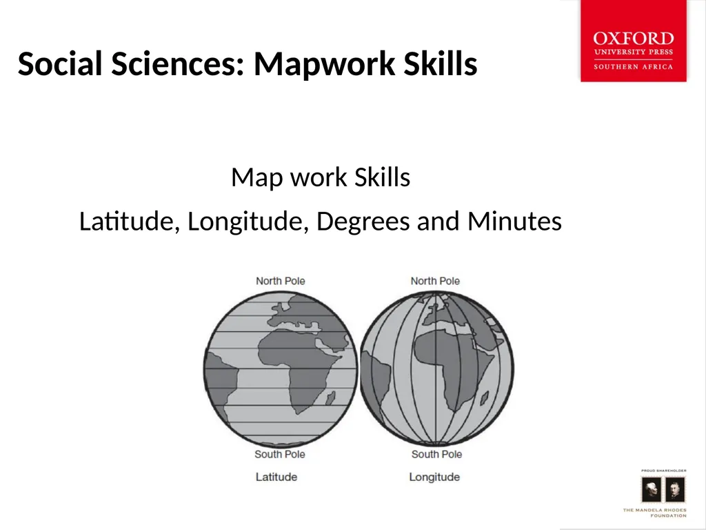
Latitude and longitude Lines of latitude are lines that run across a globe or map
The longest line of latitude is the equator
Other lines of latitude run parallel to the equator
Each line is numbered in degrees
From at the equator to north at the North Pole and south at the South Pole
We refer to the latitude of a place as a number of degrees north or south from the equator<br>
06
Latitude and longitude: degrees and minutes Lines of longitude are lines on a globe or map that join the North and South Poles
The line runs through a place called Greenwich, near London, England
So this line of longitude is called the Greenwich Meridan or the prime meridan
All the other lines of longitude are east of west of the Greenwich meridan
We refer to the longitude of a place as a number of degrees east or west of the Greenwich meridan.<br>
07
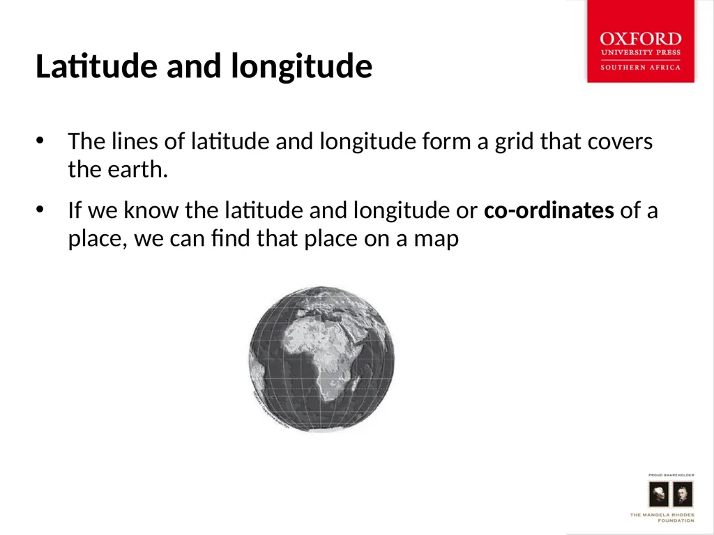
Latitude and longitude The lines of latitude and longitude form a grid that covers the earth.
If we know the latitude and longitude or co-ordinates of a place, we can find that place on a map<br>
08
Can you find the lines of latitude and longitude on the map below?
Find the Island of Tristan da Cunha on the map (Atlantic Ocean)<br>
09
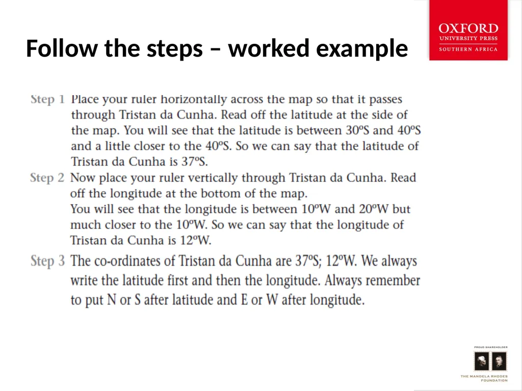
Follow the steps – worked example<br>
10
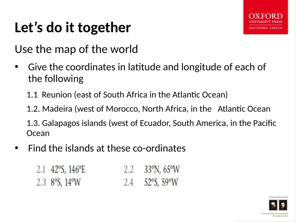
Let’s do it together Use the map of the world
Give the coordinates in latitude and longitude of each of the following
1.1 Reunion (east of South Africa in the Atlantic Ocean)
1.2. Madeira (west of Morocco, North Africa, in the Atlantic Ocean
1.3. Galapagos islands (west of Ecuador, South America, in the Pacific Ocean
Find the islands at these co-ordinates<br>
11
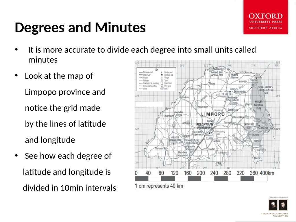
Degrees and Minutes It is more accurate to divide each degree into small units called minutes
Look at the map of
Limpopo province and
notice the grid made
by the lines of latitude
and longitude
See how each degree of
latitude and longitude is
divided in 10min intervals<br>
12
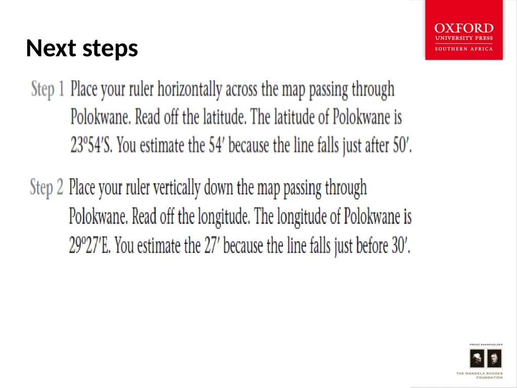
Next steps<br>
13
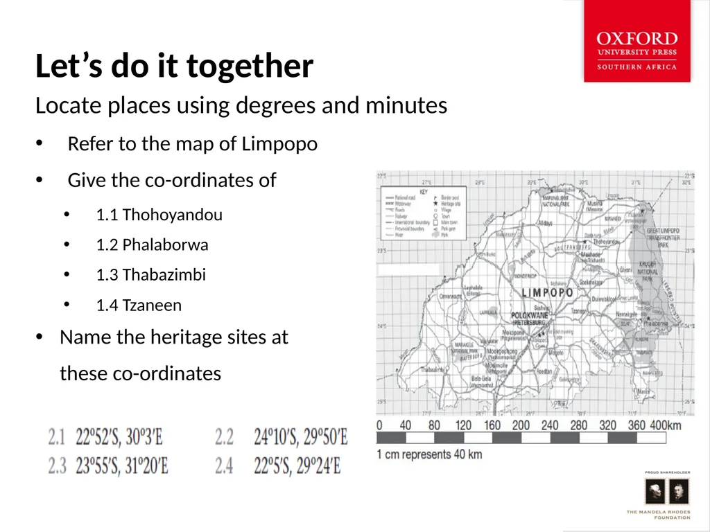
Let’s do it together Locate places using degrees and minutes
Refer to the map of Limpopo
Give the co-ordinates of
1.1 Thohoyandou
1.2 Phalaborwa
1.3 Thabazimbi
1.4 Tzaneen
Name the heritage sites at
these co-ordinates<br>