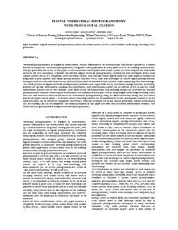
/
DIGITAL TERRESTRIAL PHOTOGRAMMETRY  WITH PHOTO TOTAL STATION   Zuxun Z DIGITAL TERRESTRIAL PHOTOGRAMMETRY  WITH PHOTO TOTAL STATION   Zuxun Z

DIGITAL TERRESTRIAL PHOTOGRAMMETRY WITH PHOTO TOTAL STATION Zuxun Z - PDF document

yoshiko-marsland
yoshiko-marsland . @yoshiko-marsland
Follow
429 views
Uploaded On 2015-11-13

DIGITAL TERRESTRIAL PHOTOGRAMMETRY WITH PHOTO TOTAL STATION Zuxun Z - PPT Presentation

1 INTRODUCTION Terrestrial photogrammetry is engaged in measurement contour delineation or 3D reconstruction with photos captured by a camera located on the ground During past few years with the r ID: 192496

INTRODUCTION Terrestrial photogrammetry

Share:

Link:

Embed:

Download Presentation from below link

Download Pdf The PPT/PDF document "DIGITAL TERRESTRIAL PHOTOGRAMMETRY WITH..." is the property of its rightful owner. Permission is granted to download and print the materials on this web site for personal, non-commercial use only, and to display it on your personal computer provided you do not modify the materials and that you retain all copyright notices contained in the materials. By downloading content from our website, you accept the terms of this agreement.


Presentation Transcript

DIGITAL TERRESTRIAL PHOTOGRAMMETRY WITH PHOTO TOTAL STATION Zuxun Zhanga, Shunyi Zhenga, Zongqian Zhana a School of Remote Sensing Information Engineering, Wuhan University, 129 Luoyu Road, Wuhan 430079, China zxzhang@supresoft.com.cn syzheng@263.net zzq09@263.net KEY WORDS: Digital terrestrial photogrammetry, Photo total station system (PTSS), Short baseline, Multi image matching, DTM generation ABSTRACT Terrestrial photogrammetry is engaged in measurement, contour delineation or 3D reconstruction with photos captured by a camera located on the ground. Terrestrial photogrammetry has gained wide applications in many fields such as 3D building reconstruction, heritage protection and so on. In this paper, a new instrument nam 1 INTRODUCTION Terrestrial photogrammetry is engaged in measurement, contour delineation or 3D reconstruction with photos captured by a camera located on the ground. During past few years, with the rapid development of digital photogrammetry techniques and the availability of ease-using, focusable and relatively cheap digital cameras, the method and device used in terrestrial photogrammetry also changed greatly. General speaking, digital techniques become mainstream and efficiency has been greatly improved. At same time, terrestrial photogrammetry has gained wide applications in many fields such as 3D building reconstruction, heritage protection and so on. Howe On the other hand, although widely accepted as an accurate surveying method, total station survey still suffers from a number of weaknesses: Firstly, total station does not mean total survey. It is impossible to record an absolute survey of all the features within a given area. It would be time-consuming and pointless to record every individual brick in a wall, for example. Sec popularity their bulk, cost and relative slowness compared to digital cameras saw their demise [K.B. Atkinson, 1996]. Nowadays, Total station has been widely used together with digital camera in applications such as accident, archaeological site survey, civil engineering survey as well as 3DGIS, building reconstruction. But in most cases they have been used separately, while total station is just used to achieve the 3D object coordinates of control points for the following photogrammetric process [Masataka Imura, etc., 2001; S. Ikeda etc., 2003]. Carl Gravel presented a CAP (computer assisted photogrammetry) system, which combines a total station with ordinary digital camera and also offers corresponding software for processing the data [Gravel C. etc., 1999]. Unlike his system, in PTSS camera is fixed with telescope of total station instead of total station so that camera can be rotate with the telescope. Field of vision has been extended by rotation photos so that high accuracy has been obtained. Generally speaking, the technique of integration of total station and digital camera is still under development. So when proposing several problems which should be resolved for further development of geoinformatics in one of his papers, Shunji Murai said “Integration of total station and digital camera for close range measurement: onsite processing for triangulation with ground based control survey has been developed. In future total station with digital camera should be developed.”[Shunji Murai, 2002] In this work our contribution aims at providing a further step towards fully development and wide application of this technique. In the following, section 2 presents the system hardware, photography method, Coordinates System, Collinear Equation, Orientation Offset definition in detail. Then measurement process and mode are introduced in section three. Experimental results as well as accuracy analysis and sample applications are shown in Section four and five respectively. 2 SYSTEM DESCRIPTION 2.1 Hardware The hardware of PTSS includes metric digital camera, total station and PDA (Personal Digital Assistant). As Fig.1 shows, metric digital camera is rigidly fixed on the telescope of total station with a mechanical adapter and PDA, which is not shown in the figure, is used to store measurement data and image index and also control whole survey process of total station. 2.2 Coordinates System In PTSS, three coordinate systems have been involved: ground coordinate system(G-XYZ), total station coordinate system (T-XYZ) and image space coordinate system (S-xyz) (see Fig. 2). Ground coordinate system is left-hand system. Total station coordinate system and image space coordinate system are right-hand system, but their orientation of coordinate axis is different. Before calculation, coordinates system should be transformed so that all calculation happens in same coordinate system. 2.3 Definition of OFFSET Image forming process of camera is a central projection defined in image space coordinate system. The location and orientation of central project in total station coordinate system can be uniquely determined in terms of coordinate 000SSSZYXof projection center S in total station coordinate system along with the angular orientation elements of its space axis system in the total station axis system (Fig. 3). The elements of angular orientation are commonly represented by three independent angles (000,,kwj), which, along with 000,,SSSZYX, is referred to as Orientation Offset between camera and total station. .4 Collinear Equation In traditional photogrammetry, collinear equation is used to describe the relationship between ground coordinate system and image space coordinate system. But in PTSS a new system, Fig. 1 Hardware of PTSS Metric digital camera Total station G ZG XG YG Ground coordinate system T ZT YT XT Total station coordinate system S y x z image space coordinate system Fig. 2 Coordinate systems x z Z X Y y XS0 YS0 ZS0 jjjjwwwwkkkk Fig. 3 Offset total station coordinate system is added. When an object point in total station coordinate system is projected into an image point (x, y, -f) in image space coordinate system and then transformed into total station coordinate system, we can get following equation:  \n\n\n -+ \n\n\n  \n\n\n - \n\n\n -= \n\n\n  \n\n\n - \n\n\n -= \n\n\n fyxRZYXZYXZYXSSSTTTTTT000000cossin0sincos0001cos0sin010sin0cos ©©©cossin0sincos0001cos0sin010sin0coskwjlbbbbaaaabbbbaaaa (1) where: XT, YT, ZT-----coordinates of a object point in total station coordinate system ,  ----- horizontal angle and vertical angle of total station 000000,,,,,kwjSSSZYXOffset between camera and total station Considering coordinates of object point in ground coordinate system can be represented by the following equation:  \n\n\n +++= \n\n\n GiTGiTGiTGGGZZYYXXZYX (2) where GiGiGiZYX,, are coordinates of total station in ground coordinate system, we can get:  \n\n\n - \n\n\n  \n\n\n + \n\n\n  \n\n\n = \n\n\n -+ \n\n\n  \n\n\n -= \n\n\n -+ \n\n\n  \n\n\n - \n\n\n -= \n\n\n ---fyxcccbbbaaaCCCBBBAAAZYXCCCBBBAAAfyxRZYXfyxRZYXZZYYXXSSSSSSSSSGiGGiGGiG321321321331321321331321321000000000000000 coscos sincos sinsin cos 0 cossin- sinsin- cos cossin0sincos0001cos0sin010sin0cosllbabaabbbabaalbbbbaaaakwjkwj (3) Simplifying the equations (3), on addition of interior orientation elements x0,y0 (the coordinates of the image principal point), we can get collinear equation in PTSS as following )]()[()]()[()]()[()]()[()]()[()]()[()()[()]()[()]()[()]()[()]()[()]()[(00000000000000000000000000000000000032133213321332123212321203213321332133211321132110SSSGiGSSSGiGSSSGiGSSSGiGSSSGiGSSSGiGSSSGiGSSSGiGSSSGiGSSSGiGSSSGiGSSSGiGZCYCXCZZnZBYBXBYYmZAYAXAXXlZCYCXCZZnZBYBXBYYmZAYAXAXXlfyyZCYCXCZZnZBYBXBYYmZAYAXAXXlZCYCXCZZnZBYBXBYYmZAYAXAXXlfxx++--+++--+++--++--+++--+++---=-++--+++--+++--++--+++--+++---=- (4) where: Ai , Bi , Ci , iiinml,, (i = 1, 2, 3) are coefficients; x0, y0----position of image principal point. 2.5 Orientation Offset Calibration As described above, because of the rigid connection between camera and total station, position and pose of camera (exterior orientation parameters) can be derived by the position and orientation of total station and the orientation offset between camera and total station. Position and orientation of total station can be easily calculated with observations of total station in traversing. So at this time, to get the position and pose of camera (exterior orientation parameters), the calibration of orientation offset between camera and total station become necessary, which is normally divided into three steps: (1) Control bar (board) has been putted not far from (less than 5 meters) traverse point and object space coordinates of control points on calibration bar (board) are measured by use of total station. (2) Photos are taken at each traversing point and image coordinates of control points are (semi-) automatically extracted. (3) Calibration is implemented by use of bundle adjustment. From description above, it can be easily seen that PTSS just uses some “near control” for “far measurement” to avoid locating sufficient control points around or on the surface of measured objects and in this case true non-contact measurement becomes possible. The accuracy of this kind of control method will be described in next section. When calibrating through bundle adjustment, it is necessary to linearize Equation (4) for practical operation. After linearization of Equation (4), we obtain general form of error equations as following: yiiiSSSyxiiiSSSxlZbYbXbaaaZaYaXavlZbYbXbaaaZaYaXav-D+D+D+D+D+D+D+D+D=-D+D+D+D+D+D+D+D+D=232221026025024023022021131211016015014013012011kwjkwj (5) where )6,...,2,1;2,1(==jiaij and )3,2,1;2,1(==jibij are coefficients derived from linearization and the derivation process is omitted here because of the limitation of space for this paper. Based on these error equations, normal equations can be formed through conventional methods. The solution of normal equations would give the elements of orientation offset between camera and total station. And subsequently exterior orientation parameters of each image can be determined. Once the offset (000000kwjSSSZYX) is calibrated, according to our test, it is normally unchanged during the whole measurement session. 3 MEASUREMENT PROCESS AND MODE The whole process of digital terrestrial photogrammetry includes two stages: field survey and indoor photogrammetric processing. Field survey mainly focuses on data acquisition. Firstly, traversing is complemented through total station and object coordinates of necessary control points are measured and photos are taken by metric digital camera. For specific measurement mission, three different measurement modes can be used depending upon the measurement condition and requirement: (1) Photos are captured completely by PTSS; (2) Photos are captured partly by handheld camera and partly by PTSS and in this case the photos captured by PTSS, named control photos, server as control in whole calculation process; (3) All photos are captured by handheld camera and total station is just used to obtain object coordinates of control or check points. Thus the measurement process can be very flexible. After field survey, all measurement data including images are processed by attached photogrammetry software. In this software, multi images based image matching (short base) is used instead of stereo based one in the conventional photogrammetry. Because geometry distortion in close-range photography is relatively large, traditional single-stereo matching which uses only two images is very difficult to meet the demand of matching in reliability and accuracy. Multi images based image matching use uses multi images and combines with short baseline and multi-photo perfectly solves the image matching and intersection accuracy problem at same time. This method has following characters: on one hand because the baseline between the neighbouring photos is relatively short, the geometry distortion of images is relatively little, thus help automatic matching; on the other hand, because baseline is short and multi photos are used, overlap between the neighbouring photos is normally very large, we can calculate 3D coordinate with multi image intersection to achieve high intersection accuracy. Another feature of our terrestrial photogrammetry method is that control bars (shown in Fig. 4) located near the camera are used, which are mainly used to calibrate the Offset and can replace regular control points around or on the object to be measured. Therefore, a real non-contact measuring method can be implemented so that control points around or on the measured object can be reduced or completely avoided. With this technique, DTM and contour generation, volume measurement and 3D modeling all can be completed. The measurement accuracy with control bar will be described in next section in detail. 4 ACCURACY TEST AND ANALYSIS In this section, several sets of data have been used to test the measurement accuracy of PTSS in different situations. 4.1 Measurement accuracy with OFFSET self-calibration This part aims at testing measurement accuracy when using OFFSET self-calibration. OFFSET self-calibration is completed during the process of measurement and two control bars with different size are used for calibration. As described in section 3.4, bundle adjustment has been used during the process of calibration. In this test, a hill was measured. Six traversing points is arranged and the interval between neighbor traversing points is about 8m. 13 check points is set on the hill. Two kinds of test condition are used as following: (1) All control points and check points spread around the object to be measured, which is a hill here. All their coordinates are measured with total station. During adjustment, the coordinates of check points are deemed unknown. In the end, adjustment results are compared with observation of total station to check the accuracy and results are shown in Table 1. (2) Compared with condition 1, the only difference is that control points is on control bar not far from traversing point instead of around the object to be measured. Test results are shown in Table 2. Two control bars with different size are putted in front of each traversing point. From the test results, conclusion can be drawn that although the accuracy when control bar is used is not as high as that when control point around the measured object is used, it is still up to 1/1500, high enough to meet ordinary measurement requirements. More important thing is that there is no need to put control points around of on the surface of the object to be measured and so photogrammetrists’ dream of “true non-contact measurement” becomes reality. Focus (mm) Planar relative accuracy Z coordinate relative accuracy Photo Number 10 1/1638 1/2093 24 30 1/2296 1/5419 105 10&30 1/2131 1/4647 129 In above test, two control bars with different size are used in front of each traversing point. When the number of control bars is reduced to one, the accuracy is shown in Table 3. focus Planar relative accuracy Z coordinate relative accuracy 10mm 1/1365 1/1331 30mm 1/1435 1/7876 At this time the accuracy falls down, but still higher than 1/1300. Reducing the number of control bar can greatly save labor force and work time, so it can be used when the accuracy requirement is not very high. 5 APPLICATION The usability of PTSS has been tested with two different cases. .1 Case 1 Focus (mm) Planar relative accuracy Z coordinate relative accuracy Photo Number 10 1/3413 1/7687 24 30 1/4406 1/14603 105 10&30 1/4515 1/18514 129 Table 1 Accuracy when control points around the object to be measured Table 3 Accuracy when number of control bars is reduce to one Table 2 Accuracy when control points on the control bar not far from traversing point Fig. 4 Control bar In first case, PTSS has been used to measure a stone pile in a concrete manufacturer where such measurement task is necessary and often used. The result is shown in Fig. 5. .2 Case 2 n this case, PTSS has been used to measure a building to create its 3D model. Because of the limitation of time, only part of this building is measured and reconstructed. The result is shown in Fig. 6. These results show that the 3D model reconstructed by PTSS can be very detailed. Such two application experiments described above show the usability and application potential of PTSS in terrestrial photogrammetry, cyber city modeling and so on. 6 CONCLUSION In this paper, we presented a completely novel surveying system, photo total station system (PTSS), which is an integration of mature digital photogrammetry technique and high accurate engineering surveying equipment (total station). Compared with traditional terrestrial photogrammetry, control points around or on the measured object are not needed in this system. Compared with traditional engineering survey, which mainly involves field survey, PTSS is much more laborsaving, efficient and automatic. To conduct experiments, metric digital camera D30 produced by Rollei company, Germany and total station SET 500 produce by Sokkia company, Japan are currently used in PTSS. Test results show that PTSS can implement true non-contact measurement and its measurement accuracy is high enough to meet the need of normal close-range measurement, it not only can complete ordinary engineering survey and large-scale topography survey, but also shows great potential in special survey, like the measurement of dams, coal mines, ore piles, Buddha, buildings and so on. Its accuracy, reliability and efficiency have been show in application examples. ACKNOWLEDGEMENTS The great support of Mr. Wu Baichuan, general manager of Lensoft company, is gratefully acknowledged. REFERENCE Feng Wenhao. 2001, Close-range Photogrammetry. Wuhan University Publishing House. 2001 S. Ikeda, T. Sato, N. Yokoya, 2003, A calibration method for an omnidirectional multi-camera system, IS&T/SPIE’s 15th Annual Symposium on Electronic Imaging, 20-24 January 2003, Santa Clara, California, USA Masataka Imura, etc., 2001, Digital Archiving of Kamegata-Ishi(Turtle Shape Stone) using Data Fusion of Heterogeneous Measurements, International Archives of Photogrammetry, Remote Sensing and Spatial Information Sciences, Vol. XXXIV, Part 5/W1 (Proceedings of International Workshop on Recreating the Past), pp.75-80, 2001/02/27(Ayutthaya, THAILAND) Shunji Murai, 2002, Yesterday, Today and Tomorrow of System for Spatial Data Processing, Analysis and Representation, ISPRS Commission II, Symposium 2002, (Proceedings of Integrated System for Spatial Data Production, Custodian and Decision Support), 20-23 August, 2002, Xi’an, China Zhizhuo, Wang, 1979, Principles of PhotogrammetryPublishing House of Surveying and Mapping, 575p Deren, Li and Zhaobao, Zheng, 1992Analytical PhotogrammetryPublishing House of Surveying and Mapping, 400p Gravel C.; C. Larouche; and P.A. Gagnon, 1999. Integration of total station and digital camera. Surveying with Images, Geomatics Info Magazine, 13(9): pp. 6-7. K.B. Atkinson. 1996, Close Range Photogrammetry and Machine Vision. Whittles Publishing, Caithness, Scotland. Fig. 5 PTSS has been used to measure stone pile. (a) Measurement scene (b) Contour Fig. 6 PTSS has been used to measure and reconstruct buildings. (a) (b)