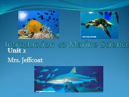
Unit 2 Mrs Jeffcoat scrippsnewsucsdedu 123rfcom marehawaiiedu Unit 2 Objectives Define Marine Science What are the four branches of oceanography What are careers in the field of oceanography ID: 353697
Download Presentation The PPT/PDF document "Introduction to Marine Science" is the property of its rightful owner. Permission is granted to download and print the materials on this web site for personal, non-commercial use only, and to display it on your personal computer provided you do not modify the materials and that you retain all copyright notices contained in the materials. By downloading content from our website, you accept the terms of this agreement.
Slide1
Introduction to Marine Science
Unit 2 Mrs. Jeffcoat
scrippsnews.ucsd.edu
123rf.com
mare.hawaii.eduSlide2
Unit 2 Objectives:
Define Marine ScienceWhat are the four branches of oceanography?What are careers in the field of oceanography?Explain the history of oceanography including contributions from various cultures and time periods
List, identify, and describe common tools used in oceanographySlide3
What is Marine Science
Marine: Related to the sea or oceanScience: Body of knowledge and an organized method used to gain knowledge about the observable universe
Marine Science: Process of discovering facts, processes and unifying principles that explains the nature of oceans and their associated life formOceanography = Marine Science
aaronetto.blogspot.comSlide4
4 Branches of Oceanography
Biological Oceanography: (AKA Marine Biology) Studies the diversity of life in the ocean and the ocean's role as their habitat
Chemical Oceanography: Studies the chemistry of seawater and the affect of chemical reactions on oceansGeological Oceanography: Examines the composition of marine sediments and rocks including undersea volcanoes, seabed movement, undersea earthquakes, etc.
Physical Oceanography: Studies water movement (waves, currents, tides, etc.)
Complete careers in oceanography poster project...Slide5
History of Oceanography
In class project... History of Seafaring People Keynote Options:PhoeniciansPolynesians
GreeksEgyptiansPortuguese and SpanishVikingsChinese Slide6
History of Oceanography
Rise of Seafaring: 5,000 BC to 800 AD5,000 BC Early civilizations interact with oceans to obtain food
early evidence from primitive fish hooks and spears4,000 BC Earliest reference to voyage on a ship is the story of Noah and the Ark...widely debated
rootsvt.comSlide7
History of Oceanography
EGYPTIANS-3,200 BC Egyptian Pharaoh Snefru brought 40 ships from Phoenicia to Egypt-2,750 BC First recorded sea voyage for explorations (recorded in Egyptian hieroglyphics)
-2,585-2,560 BC Egyptians built reed boat with oars and entombed the entire ship in the pyramid of Khufu
http://www.touregypt.net/featurestories/greatpyramid5.htmSlide8
History of Oceanography
POLYNESIANS
-2,000-500 BC Polynesians routinely crossed ocean over 1,000's of kilometers (1 mile=1609 m)in canoes made from tree trunks or planks that were sewn together with fiber rope and cracks sealed with tree sap
this is the earliest known regular long distance open ocean travel in over 1,000 years they settled Fiji, Tonga, Samoa, Hawaii
used the north star and constellations to navigatesouthpacifichotels.travelSlide9
History of Oceanography
Polynesians were able to use:wind and cloud formation Color and clearness of the seaUsed cold and warm currents
Cold currents are sources of food _green, red or brown colorWarm currents are clear and blue..Sediments from rivers turn water brown and change the odorSlide10
History of Oceanography
Polynesians discovered Hawaii 1400 years ago.http://app.discoveryeducation.com/search?Ntt=polynesian+
http://app.discoveryeducation.com/search?Ntt=polynesian
+Slide11
History of OceanographySlide12
History of Oceanography
GREEKSWere the first to use mathematics to make sophisticated maps for seafaring
Knew the earth was a sphere NOT flatPytheas (about 400 BC)- Determined the Atlantic tides are based on the phases of the moon and used degrees north and south of the north star to navigateEratosthenes (264- 194 BC)- Calculated the Earth's circumference and invented the 1st longitude/latitude system
Ptoleny (150 AD) - Mapped a portion of the Earth as a sphere on flat paper and continued to improve longitude and latitude grids into degrees, min, sec of the arc... we are still using this today!Slide13
http://
app.discoveryeducation.com/search?Ntt=chronometer
Slide14
Longitude and Latitude System
Imaginary grid lines used to identify specific locations on Earth
Both longitude and latitude lines are numbered in degrees and are further subdivided into minutes and secondsKnowing longitude and latitude can pinpoint a location on Earth
Latitude is written first and then followed by longitude
mrmeiners.wordpress.comSlide15
Latitude
Latitude lines run east-westThey never intersect and are called parallels0o
parallel is the equator (the equator runs around the Earth at its widest point)Parallels above the equator are called north latitudesParallels below the equator are called south latitudesSlide16
Longitude
Longitude lines run north-southBegin at one pole and end at the otherSometimes called meridiansThe 0o
or Prime meridian runs through Greenwich, England Slide17
http://
app.discoveryeducation.com/search?Ntt=latitude+and+longitude
Slide18
Practice Using Longitude and Latitude
Pretend that you want to find the wreck of the
Titanic...It's coordinates are 49
o 56' 49'' W, 41o 43' 57''
Those coordinates mean that 49 degrees, 56 minutes, and 49 seconds west longitude and 41 degrees, 43 minutes, and 57 seconds north latitude. Those coordinates will put you directly on the Titanic...
worldatlas.comSlide19
Complete Longitude and Latitude Activity....
Practice Using Longitude and Latitude Slide20
History of Oceanography
The Middle Ages (800 A.D. – 1400 A.D.)Europe is in the “Dark Ages”Fall of the Roman Empire
People thought the Earth was flatExcept for Vikings there is little ocean explorationVikings travelled the oceans from 790 A.D. to 1100 A.D. when global warming freed the North Atlantic of ice.
Explored, raided, and established trade routes to Southern Europe, North Africa, Central Asia, Iceland, Greenland, and the AmericasLeif Eriksson landed in Newfoundland, CanadaSlide21
http://
app.discoveryeducation.com/search?Ntt=age+of+discovery
Age of Discovery-United StreamingSlide22
History of OceanographyThe Middle Ages (800 A.D. – 1400 A.D.)
China1000 A.D. Invention of the magnetic compassShips with central rudders and watertight compartments
computersmiths.comSlide23Slide24
History of Oceanography
European Voyages of Discovery (1400 -1700)European Renaissance (rediscovery) sparks new interest in ocean exploration
1400’s Prince Henry of Portugal searched for a route to the East… didn’t make it but mapped out Western Africa in the process1487 Bartholomeu Dias completes first voyage around the Cape of Good Hope (tip of southern Africa)
1497 Vasco de Gama led the first voyage around the Cape of Good Hope to IndiaSlide25Slide26Slide27
History of Oceanography
European Voyages of Discovery (1400 -1700)1492 Portuguese explorer Christopher Columbus set out to find a route to Asia and accidentally discovers the Americas
1454-1512 Italian explorer Amerigo Vespucci voyaged to South America and is the first person to recognize the “New World” as a separate continent1500’s Vasco Nunez de Balboa crossed the Isthmus of the Panama and discovered the Pacific Ocean on the other side and was the first European to sail into the Pacific
1519 Ferdinand Magellan led exploration to sail around the world (he died but the 18 men from his crew that survived finished the voyage)Slide28Slide29Slide30
History of Oceanography
Birth of Marine Science (1700-1900)Captain James Cook (England) receives credit for first sea expedition devoted to scientific oceanography
1735 – Harrison Invented chronometerMade it possible to determine longitude in open sea (latitude was already calculated with star sightings)
Chronometer: Clock or watch that is not affected by the waves or motion of the sea
1oclockgun.com
bridgemanart.comSlide31Slide32Slide33
History of Oceanography
Birth of Marine Science (1700-1900)Wilkes Expedition (United States) is authorized by congress to explore the southern Atlantic and the Pacific Ocean
Travelled to Madeira, both coasts of South America, Tierra del Fuego, many South Pacific Islands, Australia, New Zealand, Hawaii, California, Oregon, the Philipines, Singapore, and St. HelenaVisited and proved the existence of
AntaraticaAt their conclusion they had 19 volumes of maps, texts, and illustrations documenting their discoveries as well as many specimens of flora and faunaSlide34
Route of Wilke’s Expedition
clade.ansp.orgSlide35
History of Oceanography
Birth of Marine Science (1700-1900)Father of Physical Oceanography- Mathew Maury
US Naval officer that discovered a world wide pattern of surface winds and currents1855 Published the first textbook on modern oceanography – The Physical Geography of the Sea
artworkoriginals.com
oceanmotion.orgSlide36
History of Oceanography
Birth of Marine Science (1700-1900)
1831 Charles Darwin’s voyage on the H.M.S. BeaglePublished two important scientific documents:Structure and Distribution of Coral Reefs
The Origin of a Species – Outlines his theory of natural selection and evolution
kobobooks.comSlide37
History of Oceanography
Birth of Marine Science (1700-1900)The Challenger Expedition 1872Devoted entirely to marine science exploration
Gathered physical, geological, chemical, and biological data as they documented temperature, currents, water chemistry, marine organisms, and bottom sedimentsSome of the many accomplishments of this mission include:First soundings deeper than 4,000 meters
Discovered marine organisms in the deepest part of the oceanIdentified 715 new genera and 4, 717 new species
*NASA named the second space shuttle in honor of this expeditionSlide38
Challenger Expedition
geology.uprm.eduSlide39
History of Oceanography
Tools of Oceanography—Woods Hole Interactive http://www.divediscover.whoi.edu/tools/atlantis.html
Slide40
History of Oceanography
Twentieth-Century Marine ScienceMany changes including the industrial revolution occurred during this time some of the major advancements include:
Steam engines and iron ships (allow sailors to travel without being at the mercy of the wind and currents)Submarines (made possible by the inventions of the diesel engine, electric motor, and lead batteries)Science and technology feed each other as funding from countries and private industry increases
Technology needs for wars also increase technology and scienceSlide41Slide42
History of Oceanography
Twentieth-Century Marine Science
Three “super” important expeditions:German Meteor -1925
Mapped the Atlantic sea floor using echo-sound technologyAtlantis – 1931 First ship specifically built and designed for ocean study
Confirmed existence of Mid-Atlantic RidgeChallenger II – 1951Found the deepest known part of the ocean located in the Marianas Trench (10,838 m or 35,558 ft)Slide43
As a result of advances in science and technology the 20th century brought about many important tools for studying oceanography (this list includes just a few):
-Submarines -Submersibles -Self-Contained Diving/Scuba - GPS -ROV’s -AUV’s -Satellites
History of Oceanography
Twentieth-Century Marine ScienceSlide44
History of Oceanography
Twentieth-Century Marine Science Tools
Until the 20th Century scientists studied the oceans from above until the invention of the submersibleThere are 3 Types of Submersibles:Bathysphere
BathyscapheDeep-diving submersibles
123rf.comSlide45
History of Oceanography
Twentieth-Century Marine Science Tools
Bathysphere: (1930’s) Steel Ball with a window connected to the boat by an umbilical that provided communications and power
Limited because only operated vertically and was lowered and raised by a cable on ship
en.wikipedia.orgSlide46
Bathyscaphe
: Sphere attached to a large float instead of a cable and ship with a small electric motor (operates like a blimp)The float contains fluid that’s buoyant in water and a heavy ballast – by releasing fluid or some of the ballast the sphere could rise or descend
Limitations – difficult to operate and horizontal motion is limited
History of Oceanography
Twentieth-Century Marine Science Tools
en.wikipedia.orgSlide47
Deep-diving Submersibles
: 2-3 person submersibles that that dive in moderate to deep depths with excellent horizontal maneuverabilityLess fragile that previous submersibles and easier to launch in rough seasLimitations – cannot travel as deep as bathyscapheSome are equipped with robotic arms to grasp samples or perform experiments outside of the sub
History of Oceanography
Twentieth-Century Marine Science ToolsSlide48Slide49
Self-Contained Diving:
First equipment had hard hat that was supplied air from the surface through a hose – this equipment was heavy and hard to maneuver Men of Honor ClipScuba: Lightweight self contained system for underwater exploration
1943 Jacques Cousteau developed scuba system that used compressed air and was relatively lightweight and simpleWithin 20 years, scuba was in use by the military, scientists, and for recreationHardsuits
: Wearable submersiblesProtect the diver from temperature and pressure and are far smaller and more mobile than conventional submersibles
History of Oceanography
Twentieth-Century Marine Science Tools
en.wikipedia.org
webspace.webring.comSlide50
Comparing the use of Scuba and Submersibles in Oceanography
Advantages
DisadvantagesSubmersibles
Greater Depth &Duration
High CostLarge SizeLogistical ComplexityScuba
SimplicityPortabilityLow Cost
Limited DepthShort Duration
*Today many scientists use both submersibles and scubaSlide51Slide52
Remotely Operated Vehicles (ROV):
Small unmanned submarines with propellers, a video camera, and an umbilical to the surfaceOperated by remote controlCan have claws, robotic arms, and other toolsUsed to explore the wreck of the Titanic
History of Oceanography
Twentieth-Century Marine Science Tools
sub-find.comSlide53
Autonomous Underwater Vehicle (AUV):
Untethered robotic devices that are controlled by onboard computers
History of Oceanography
Twentieth-Century Marine Science Tools
ysi.comSlide54
Electronic Navigation:1960’s
LORAN-C location system was based on transmitted radio signals and was accurate within a few meters Limits - would only work where LORAN transmitters were located and became less accurate farther away from transmittersGlobal Positioning System (GPS)
– Uses satellites to determine and display location within three – six meters of accuracySatellites
: Objects that orbit the Earth and provide continuous measurements of sea-surface height, temperature, color, pollutions, etc
History of Oceanography
Twentieth-Century Marine Science Tools
tf.nist.govSlide55
Mapping the Ocean Floor with Echo Sounding
To map the seafloor, scientists bounce a beam of sound waves off the ocean bottom. Research ships moving along the sea surface repeatedly “ping” the seafloor with sound to map a continuous line of seafloor elevations below. Multibeam
Bathymetry - The Successor to the Single-Beam Echo soundingBy sending out many beams of sound simultaneously, research vessels can collect data on a wide swath of the seafloor, rather than a single line. So they can map much larger areas during a single cruise
History of Oceanography
Twentieth-Century Marine Science Tools
http://www.divediscover.whoi.edu/tools/sonar-multibeam.htmlSlide56
Sea-Net: A new communications system developed in 1995 to extend the Internet to ships at sea
Much more affordable than using satellites to relay information
History of Oceanography
Twentieth-Century Marine Science Tools