Explore
Featured
Recent
Articles
Topics
Login
Upload
Featured
Recent
Articles
Topics
Login
Upload
Search Results for ''
published presentations and documents on DocSlides.
Coordinates and Projections
by olivia-moreira
Foundation of spatial analysis + mapping. Cartesi...
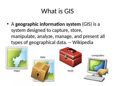
What is GIS A geographic information system
by hadley
(GIS) is a system designed to capture, store, mani...
Public GIS Viewer Mark Maddox
by pamella-moone
Phyllis Effah Addo-Boafo. August 2017. What is GI...
Collecting Geographic Coordinates
by karlyn-bohler
Using GPS Devices. <date of training> ....
BASIC MAP PREPARATION PRESENTED BY MAJOR SETH GOLDSTEIN
by undialto
WHO AM I?. WHY AM I HERE?. WHY ARE YOU HERE?. INTR...
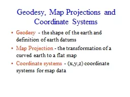
Geodesy, Map Projections and Coordinate Systems
by myesha-ticknor
Geodesy. - the shape of the earth and definition...
How to determine heavy atom coordinates from a difference Patterson map.
by obrien
An outline. Basic concepts. If we observe a differ...
CGDD 4113 Polygonal Texturing
by calandra-battersby
UV Coordinates. (AKA Texture coordinates). (0, 0)...
NAPP Photo Five Pockets near Dubois
by jane-oiler
Google Earth. Geometric Corrections. Rectificatio...
Interpreting difference Patterson Maps in Lab today!
by conchita-marotz
Calculate an . isomorphous. difference Patterson...
Lesson 8:
by liane-varnes
Image Techniques. Lesson 8 Objectives. Create cli...
LEARNING OBJECTIVES 3 Terminal Learning Objective:
by criticanime
Marine Option Naval ROTC students will identify te...
Spatial Referencing
by olivia-moreira
GIS for Environmental Engineering. Spatial Refere...
Beginners Guide: Embed GIS Maps Tutorial
by ellena-manuel
and Walkthrough w/Examples. How to Add GIS Maps t...
CS 4363/6353 Texture Mapping Part II
by briana-ranney
What we Know. We can open image files for reading...
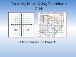
Creating Maps Using Coordinate Grids
by danika-pritchard
A Coordinate Grid . Project. Timeline. Day 1: . ...
2D transformations (a.k.a. warping)
by heartersh
. 16-385 Computer Vision. Spring 2019, . Lecture 7...
GEO 241: Geographic Information Systems I
by cheryl-pisano
GEO 241: Geographic Information Systems I Week 3 ...
GEO 241: Geographic Information Systems I
by danika-pritchard
Week 3. :. Cartographic Principles: Classificati...
Introduction to Geographic Information Systems
by tawny-fly
Spring 2013 . (INF 385T-28437). . Dr. David Ar...
Property Fitting Analysis
by sherrill-nordquist
PROperty FITting. PROFIT analysis evaluates the c...
Compass Reading
by calandra-battersby
for Cave Survey. The basics of understanding and ...
Load More...