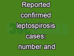
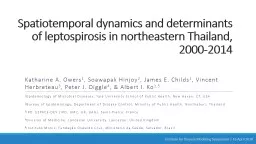
Katharine A Owers 1 Soawapak Hinjoy 2 James E Childs 1 Vincent Herbreteau 3 Peter J Diggle 4 amp Albert I Ko 15 1 Epidemiology of Microbial Diseases Yale University School of Public Health New Haven CT USA ID: 935193
Download Presentation The PPT/PDF document "Spatiotemporal dynamics and determinants..." is the property of its rightful owner. Permission is granted to download and print the materials on this web site for personal, non-commercial use only, and to display it on your personal computer provided you do not modify the materials and that you retain all copyright notices contained in the materials. By downloading content from our website, you accept the terms of this agreement.
Slide1
Spatiotemporal dynamics and determinants of leptospirosis in northeastern Thailand, 2000-2014
Katharine A. Owers1, Soawapak Hinjoy2, James E. Childs1, Vincent Herbreteau3, Peter J. Diggle4, & Albert I. Ko1,5 1Epidemiology of Microbial Diseases, Yale University School of Public Health, New Haven, CT, USA 2Bureau of Epidemiology, Department of Disease Control, Ministry of Public Health, Nonthaburi, Thailand 3IRD, ESPACE-DEV (IRD, UM2, UR, UAG), Saint-Pierre, France 4Division of Medicine, Lancaster University, Lancaster, United Kingdom 5Instituto Moniz, Fundação Oswaldo Cruz, Ministério da Saúde, Salvador, Brazil
Institute for Disease Modeling Symposium | 16 April 2018
Slide2Leptospirosis
10 species and >200 serovars of pathogenic Leptospira spirochetesEnvironmentally transmitted via contact of cut or abraded skin with urine-contaminated soil or waterWide range of mammalian hostsMost infections mild or asymptomatic, but severe manifestations have high fatality ratesHigh burden in rural farmers (particularly rice)
Slide3An explosive emergence of leptospirosis in Thailand
Before 1995, <300 cases per yearIn 2000, there were 14,285 casesEstablished endemic transmissionEmergence remains unexplainedNot a unique phenomenon—similar explosive emergence in Sri LankaTangkanakul, W., et al. (2005) Southeast Asian J Trop Med Public Health
Slide4Leptospirosis in northeastern Thailand
Site of >75% of cases during and since the emergenceMajor rice farming regionOther crops and livestock presentHeterogeneous leptospirosis distributionTransmission difficult to manage
Slide5Motivations, Objective, & Hypothesis
Motivating questionsWhat are the drivers of the spatiotemporally heterogeneous leptospirosis incidence?Is this a rice-driven system? Objective: Formally characterize leptospirosis transmission dynamics and determinants in northeastern Thailand to guide public health interventionsHypothesis: Agricultural and environmental features are important determinants of incidence
Slide6Surveillance Data
Leptospirosis is reportable in Thailand Thai Ministry of Public Health, form R50656,223 reported cases of leptospirosis in NE Thailand from 2000-2014Data before 2000 unavailable Data includes date of symptom onset & demographic features
Slide7Spatially heterogeneous incidence
Slide8Temporally heterogeneous incidence
Three PeriodsEmergence (2000)Transition (2001-2002)Endemic (2003-2014)Seasonal cases
Slide9Modeling Strategy
Spatiotemporally explicit quasipoisson generalized linear model for incidence in district d (n=320) in week w (n=717)Province: A province-level factor to account for variation above the district scaleDistrict-level covariatesRainfall & Temperature Seasonal sine-cosine waves: Capture seasonal fluctuations in incidence (6- & 12-month cycle lengths)
) +
Separate models by epidemiologic period
Emergence: Data from 2000Endemic: Data from 2003-2014
Slide11Covariates
Agriculture & Land Use Land Use (% district area): Rice paddy, urban, field crop, other agriculture, forest, water, marsh/swamp, otherAverage parcel sizeLivestock density: Buffalo, cattle, pigs, poultryIrrigationPhysical featuresElevationNDVINDWI (Gao)NDWI (McFeeters)Socioeconomic characteristicsPercent rural populationEducation* Income*Household size*Households with access to safe water*Public physicians per 100km2*
* Variable available at province-level (n=19) instead of district (n=320
)
Land Use
Irrigation
Slide12Spatiotemporally varying weather
Weekly data from 28 stationsTotal rain Mean temperatureGeostatistically modeled to generate a weekly predicted surface over the study area at a 5km resolutionCurrent and lagged weather
Slide13Effects of recent rainfall and temperature
RR (95% CI)
Variable
Emergence
(2000)
Endemic
(2003-2014)
Rainfall (cm)
Current week
0.985 (0.961 - 1.008)
0.979 (0.971 - 0.988)
1 Week Lag
0.983 (0.960 - 1.006)
0.995 (0.985 - 1.005)
2 Week Lag
1.012 (0.994 - 1.030)
1.012 (1.002 - 1.022)
3 Week Lag
0.992 (0.975 - 1.009)
1.018 (1.009 - 1.028)
4 Week Lag
0.974 (0.958 - 0.991)
1.001 (0.992 - 1.011)
5 Week Lag
0.977 (0.961 - 0.993)
0.997 (0.989 - 1.005)
Temperature (
°
Celsius)
Current Week
1.177 (1.043 - 1.330)
1.088 (1.039 - 1.140)
1 Week Lag
1.168 (1.012 - 1.349)
1.045 (0.982 - 1.112)
2 Week Lag
0.827 (0.736 - 0.929)
0.865 (0.826 - 0.905)
Emergence
Rain 4-5 weeks ago
Note: Similar but non-significant point estimates for 0-2 weeks of lag
Stronger relationship with temperature
Endemic
Recent rainfall (0, 2-3)
Note: Non-significant associations are in grey
Slide14Consistent landscape and agricultural associations
RR (95% CI)
Variable
Emergence
(2000)
Endemic
(2003-2014)
Rural population (%)
1.004 (1.001 - 1.008)
1.006 (1.004 - 1.008)
Land Use (% district area)
Urban
0.970 (0.959 - 0.981)
0.961 (0.955 - 0.968)
Marsh/Swamp
0.902 (0.872 - 0.931)
0.960 (0.949 - 0.972)
Average Patch Size (10,000 m
2
)
1.012 (1.009 - 1.016)
1.011 (1.009 - 1.013)
A rural disease
High rural population
Low % urban or marsh
Landscape fragmentation
Note: Non-significant associations are in grey
Slide15Certain landscape and agricultural determinants vary by period
RR (95% CI)
Variable
Emergence
(2000)
Endemic
(2003-2014)
Land Use (% district area)
Rice Paddy
1.011 (1.008 - 1.014)
0.995 (0.994 - 0.997)
Other Agriculture
0.995 (0.989 - 1.000)
1.005 (1.002 - 1.008)
Livestock Density/km
2
Poultry (per 100)
0.989 (0.978 - 0.999)
0.997 (0.989 - 1.005)
Pigs
1.001 (0.994 - 1.008)
0.993 (0.990 - 0.997)
Cattle
1.002 (0.994 - 1.009)
0.981 (0.977 - 0.985)
Irrigation (% area)
0.994 (0.987 - 1.001)
1.026 (1.022 - 1.030)
Emergence show the expected association with rice, but little else
Endemic leptospirosis
Rice paddy protective
Irrigation
risk heterogeneity
Unexpected other associations
Note: Non-significant associations are in grey
Slide16Significant inter-province variation
The province factor was highly significantPossible marker ofTrue risk heterogeneityReporting variationSocio-economic status or other factorsEmergenceEndemic
Slide17Limitations
Ecologic analysis of district-level dataPassive surveillance dataLimited data availability & resolutionExisting data at a policy-relevant scale
Slide18Public health recommendations Endemic leptospirosis in this setting is not a simple disease of rice farming
Important to think more broadly when planning public health interventionsIn the absence of the rice guiding principle, public health practitioners can use other information to allocate prevention resourcesPersistent spatial risk variation is associated with agricultural characteristics High: Irrigation, Other AgricultureLow: Pigs, CattleWeather can be used to determine temporally-varying risk
Slide19Acknowledgements
Peter DiggleVincent Herbreteau Soawapak HinjoyAlbert KoJames ChildsKanchana NakhapakornRicardo Soares MagalhãesThai Ministry of Public HealthThai Meteorological DepartmentThai Land Development Department
Financial support from the Yale Institute for
Biospheric
Studies and the National Institutes of Health
Slide20Questions?
Slide21Case timing varies by year and is not associated with major rice farming events
Rice data from Sawano et al., Paddy Water Environment (2008) 6:83-90
Slide22Geostatistically
modeling weatherGeostatistically modeled to generate a weekly predicted surface over the whole area at a 5km resolutionModel weekly station weather as a linear function of the station coordinates (X,Y) and elevationExtract residuals & plot as variogramChoose model family (exponential)Use visual best-fit line to initialize maximizationFit a geostatistical model with station latitude, longitude, and elevation as covariates and an exponential correlation structureSmooth weekly time series of model parametersUse smoothed parameters to generate weekly predicted values
We then constructed weather anomalies by modeling the predicted weather as a function of the region-wide seasonal sine and cosine waves with 6- and 12-month cycle lengths
Residual temporal correlation
The model’s temporal residuals capture notable data featuresCorrelated residuals during the endemic phase indicate additional time-varying factors play a roleEmergence PeakCase Definition Change
Endemic Transmission
Slide24Leptospiral determinants by period
Some variables have a consistent effect over timeRural population, Urban land, and MarshlandLandscape fragmentationOthers vary by epidemiologic periodEmergenceLess influenced by recent rainfallSignificant positive association with rice paddyFewer associations with agricultural variablesEndemic transmissionRice paddy is negatively associated with incidenceRecent rainfall & agricultural/landscape features are important
Expected association with rural population
Unexpected relationship
The expected association with rice, but few other variables
Importance of non-rice agricultural and weather-related determinants
Spatially-varying covariate details
VariableData Spatial Resolution How used in model
Source
Social Features
Percent rural population
District
District
value
National Statistical Office
of Thailand
Education
Province
Province value
National Statistical Office
of Thailand
Income
Province
Province value
National Statistical Office
of Thailand
Household Size
Province
Province value
National Statistical Office
of Thailand
Households with safe water access
Province
Province value
National Statistical Office
of Thailand
Public physicians per 100 km
2
Province
Province value
Ministry
of Public Health, Thailand
Physical Features
Elevation
90m
District
mean
STRM (Google Earth Engine)
NDVI
30m
District
mean
Landsat 7 (Google Earth Engine)
NDWI (Gao), Vegetation Water Content
30m
District
mean
Landsat 7 (Google Earth Engine)
NDWI
(
McFeeters
) Flooding Propensity500mDistrict mean USGS Forecast Mekong ProjectAgricultural Features & Land Use Irrigation5 arc-minutes (~ 8.3km)District meanFAO Livestock density: Buffalo, cattle, pigs, poultry (per square kilometer)3 arc-minutes (~ 5km)District meanFAO Land use: Rice Paddy, Field crop, Other agriculture, Forest, Built-up, Water, Swamp/Marsh, and Other
Continuous (polygons)Percent of district in each class
Land Development Department, Thailand
Average Patch Size
Continuous
(polygons)
District
mean
Land Development Department, Thailand
Slide26Spatial covariates
Agriculture & Land Use Land Use (% district area): Rice paddy, field crop, other agriculture, forest, built-up, water, marsh/swamp, otherAverage parcel sizeLivestock density: Buffalo, cattle, pigs, poultryIrrigationPhysical featuresElevationNDVINDWI (Gao)NDWI (McFeeters)Socioeconomic characteristicsPercent rural populationEducation* Income*Household size*Households with access to safe water*Public physicians per 100km2*
* Variable available at province-level (n=19) instead of district (n=320
)
Variable notes
Rice paddy, field crop, forest, and all the physical features (red circles) were highly correlated, so we excluded all variables in this group except Rice Paddy, since that was the variable we thought would be most interesting.
The province-level socioeconomic features (blue box) could not be included in the model at the same time as a province-level factor, so we tested both.
Cattle Density