/
Geo Engage: 11/30 Geo Engage: 11/30

Geo Engage: 11/30 - PowerPoint Presentation

aaron
aaron . @aaron
Follow
391 views
Uploaded On 2017-10-08

Geo Engage: 11/30 - PPT Presentation

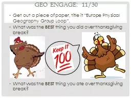
Get out a piece of paper title it Europe Physical Geography Group Loop What was the BEST thing you did over thanksgiving break What was the BEST thing you ate over thanksgiving break ID: 594155

amp europe islands peninsula europe amp peninsula islands river slide mediterranean alps major sea trees west black mountains eastern

Share:

Link:

Embed:

Download Presentation from below link

Download Presentation The PPT/PDF document "Geo Engage: 11/30" is the property of its rightful owner. Permission is granted to download and print the materials on this web site for personal, non-commercial use only, and to display it on your personal computer provided you do not modify the materials and that you retain all copyright notices contained in the materials. By downloading content from our website, you accept the terms of this agreement.


Presentation Transcript

Slide1

Geo Engage: 11/30

Get out a piece of paper, title it “Europe Physical Geography Group Loop”.What was the BEST thing you did over thanksgiving break? What was the BEST thing you ate over thanksgiving break?Slide2

Physical Geography Group Loop

Europe and Russia Slide3

Physical geo of europe

Majority of Europe lies within 300 miles of the coastSome portions of Europe lie below sea level (the Netherlands) so the Dutch built dikes: large banks of earth and stone to hold back water from the North SeaPolders - reclaimed lands which were once drained and kept dry by windmills (now kept dry by other power sources); land was used for farming and settlement Slide4

Slide 1: Coastal Europe

#1. Copy these notes: Majority of Europe lies within 300 miles of the coast#2. Define the following terms:DikesPolders#3. Why did the Dutch build dikes?#4. Where in Europe do people use polders?Slide5

Peninsulas of europe

Iberian peninsulaHome to Spain and Portugal Pyrenees Mountains – northern part of the peninsula cuts off Spain and Portugal from the rest of the continentThe Apennine PeninsulaHome to Italy Extends like a giant boot to the Mediterranean SeaVarying coastline from high, rocky cliffs, to long sandy beaches

Balkan Peninsula Southeastern Europe; bounded by the Adriatic and Ionian Seas on the west & the Aegean and Black seas on the eastSlide6

Slide 2: Peninsulas of Europe

#5. Make a quick sketch of the following peninsulas: a) Iberian Peninsula, b) Apennine Peninsula, and c) Balkan Peninsula.#6. Identify the countries that make up each peninsula & label the major bodies of water surrounding each.#7. How do think thisphysical featureimpacts the lives of Europeans living

on one?Slide7

Europe’s islands

Iceland – island located south of the Arctic Circle in the North Atlantic Ocean (capital – Reykjavik)The British Isles – lie northwest of the European mainland; consist of two large islands and thousands of smaller islandsIreland & Great Britain – two large islands Islands of the Mediterranean Sea Formed by rugged mountains – Sicily, Corsica, Crete, and CyprusSlide8

Slide 3:

Europe’s Islands#8. Describe the relative location of Iceland in 3 different ways.#9. What are the major islands that make up the British Isles? What nations make up the UK? What is the official name of the UK?#10. How were the islands of the Mediterranean formed? Identify the five largest islands in the Mediterranean in order from west to east. Slide9

The mountains of europe

The AlpsForms a crescent from Southern France to the Balkan PeninsulaMont Blanc – highest peak in the Alps; stands at 15,771 ft high on the boarder of France and ItalyOrigin spot of the Rhine and Po rivers The CarpathiansMountain chain that runs through Eastern Europe from Slovakia and RomaniaSlide10

Slide 4: Mountains of Europe

#11. What are the east and west borders of the Alps?#12. What is the highest peak in the Alps? What major rivers have their source at this peak?#13. What is the major mountain range that runs through eastern Europe? Identify the two countries in which this mountain range starts and stops.Slide11

The water

Thames River – (England) allows ocean going ships to reach the port of LondonThe Rhine River- most important river in western Europe; flows from Swiss Alps through France and Germany and into the Netherlands, connecting many industrial cities to the port of Rotterdam in the North SeaThe Danube – flows from Germany’s Black Forest to the Black Sea (major waterway of Eastern Europe)Slide12

Slide 5: The rivers

#14. What is the Thames located? What major port city benefits from this river allowing for ocean going ships to reach its harbor?#15. Which river do you think is the most important in Europe? Why did you choose this river?#16. Which river flows from the Black Forest of Germany to the Black Sea? Which region of Europe benefits most from this river?Slide13

Trees & highlands

Deciduous & Coniferous trees foundDeciduous trees found in Marine West Coast ClimatesConiferous trees found in Alps regionsTimberline – the elevation in which above trees cannot growFoehns – dry winds that blow down from mountains into plains and valleys which can cause avalanches – destructive masses of ice, snow, and rock that slide down a mountain sideSlide14

Slide 6: Climate & Vegetation

#17. Create a quick sketch of Europe. Shade in the following climates: Mediterranean, Humid Subtropical, Humid Continental, & Subarctic/Tundra#18. What is a timberline? What is a snowline?#19. What are Foehns?#20. What natural disaster is caused by Foehns? Draw this natural disaster.Slide15

Climate & Vegetation

Climate RegionsMarine West Coast – majority of western Europe – mild winders, cool summers, and abundant rainfallMediterranean – southern Europe (near Mediterranean Sea)Humid Subtropical – small portion above Italy & GreeceHumid Continental – Eastern EuropeSubarctic & Tundra – Northern Europe in the Arctic Circle