
PPT-Mapping tidal flat topography using ICESat-2 and
Document not showing?
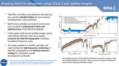
Mapping tidal flat topography using ICESat2 and satellite imagery a Detailed process of the tidal flat elevations extraction using a multilevel method based on ICESat2
Download Presentation
Download Note : "Mapping tidal flat topography using ICESat-2 and" is the property of its rightful owner. Permission is granted to download and print materials on this website for personal, non-commercial use only, provided you retain all copyright notices. By downloading content from our website, you accept the terms of this agreement.
Presentation Transcript
Transcript not available.