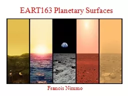
Francis Nimmo Course Overview How did the planetary surfaces we see form and evolve What processes arewere operating Techniques to answer these questions Images Modelling Quantitative analysis ID: 716809
Download Presentation The PPT/PDF document "EART163 Planetary Surfaces" is the property of its rightful owner. Permission is granted to download and print the materials on this web site for personal, non-commercial use only, and to display it on your personal computer provided you do not modify the materials and that you retain all copyright notices contained in the materials. By downloading content from our website, you accept the terms of this agreement.
Slide1
EART163 Planetary Surfaces
Francis NimmoSlide2
Course Overview
How did the planetary surfaces we see form and evolve? What processes are/were operating?Techniques to answer these questions:ImagesModelling/Quantitative analysis
Comparative analysis and analogues
Case
studies – examples from this Solar SystemSlide3
Course Outline
Week 1 – Introduction, planetary shapesWeek 2 – Strength and rheologyWeek 3 –
Tectonics
Week 4 –
Volcanism and cryovolcanism
Week 5 –
Midterm;
Impacts
Week 6 –
Impacts (cont’d)
Week 7
– Slopes and mass movement
Week 8 –
Wind
Week 9 –
Water & Ice
Week 10
– Ice cont’d; Recap;
FinalSlide4
Recent spacecraft missions (2018-19)
JAXA landed on an asteroid (
Ryugu
)
~2m
ESA landed on a comet (C-G)
NASA flew by a Kuiper Belt Object
(MU69)
CNSA landed on the lunar
farside
~10 kmSlide5
Logistics
Website: http://www.es.ucsc.edu/~fnimmo/eart163
Set text
–
Melosh,
Planetary Surface Processes
(
2011)
Prerequisites –
160; some
knowledge of calculusGrading – based on weekly homeworks (~30%), midterm (~20%), final (~50%). Homeworks due on
TuesdaysLocation/Timing – TuTh 1:30-3:05pm D258 E&MS
Office hours –MoTh 3:05-4:05pm (A219 E&MS) or by appointment (email: fnimmo@es.ucsc.edu)Questions/feedback? - Yes please!Slide6
Expectations
Homework typically consists of 3 questionsGrad students will have one extra question (harder)If it’s taking you more than 1 hour per question on average, you’ve got a problem – come and see me
Midterm/finals consist of short (compulsory) and long (pick from a list) questions
In both the midterm and the final you will receive a formula sheet
Showing up
and
asking questions
are usually routes to a good grade
Plagiarism – see website for policy
.
Disability issues – see website for policy.Slide7
This Week – Shapes, geoid
, topographyHow do we measure shape/topography?
What is topography referenced to?
The
geoid
(an
equipotential
)
What controls the global shape of a planet/satellite? What does that shape tell us?
Moment of inertia
– not covered in this class (see EART162)
What does shorter-wavelength topography tell us?Slide8
How high are you?
What is the elevation measured relative to?Mean Sea Level (Earth)Constant Radius Sphere (Mercury, Venus)
Geoid
at 6.1 mbar (Mars)
Center of Mass (Aste
roids)
Geoid
(see later)
Equipotential
Surface
Would be sea level if there was a seaSlide9
How is elevation measured?
GPSMeasure time of radio signals from multiple satellitesAltimetryTime-of-flight of LASER or RADAR pulses
Stereo
Pairs of slightly
mis
-aligned images
Photoclinometry
Simultaneous solution of slopes and albedos from brightness variations
Limb Profiles
Single image of the edge of a body (1D profile)
Shadow measurements
Uses known illumination conditionsSlide10
Altimetry
RADAR or LIDARFire a pulse at the ground from a spacecraft, time the returnPro:Extremely accurate (cm)Long distance (Mercury)
Con:
High power usage
Poor coverage
For which bodies do we have
altimetric
measurements?Slide11
Stereo
Pair of images of an area at slightly different angles.Infer topography from parallaxYour eyes use this methodPro:
Great coverage, high resolution (few pixels)
Con:
Stereo pairs require similar viewing geometries, illumination angles, resolutions
Al-
Adrisi
Montes, PlutoSlide12
LOLA 128
ppd versus
Kaguya
Terrain Camera Stereo Data (7 m/
px
)
Image courtesy Caleb
FassettSlide13
Shape from Shading
PhotoclinometryUse brightness variations in a single image to estimate the shape.Pro:
Only need one image
Con:
Can
’
t decouple color variation from shading
Errors accumulate (long-wavelengths unreliable –
why?
)
Jankowski &
Squyres
(1991)Slide14
Stereophotoclinometry
Brightness variations in many images used to determine topography and albedo.Pro:Great coverage
Resolution comparable to best images
Can use almost any images containing landmark
Con:
Computationally intensive
Operator inputSlide15
Dermott and Thomas 1988
~0.1 pixel
accuracy
Limb Profiles
Pappalardo
et al. 1997
“Poor man’s altimeter”
Works best on small bodies
Occultations
(point measurements) can also be useful
Prior to
New Horizons
,
occultations
were only way of measuring Pluto’s radiusSlide16
Shadow measurements
Illumination geometry used to derive relative heightsProOnly requires single image
Doesn
’
t require brightness assumptions
Con
Very limited information
Has generally been superseded
h
w
i
h = w
tan
iSlide17
Lighting Angles
The
phase angle
often determines the appearance of the subject
E.g. small particles are only visible at high phase (forward scattering) –
why?
The
incidence angle
controls how much topography affects the appearance
horizontalSlide18
Shadows
High incidence angleLonger shadowsEasier to see topography
Low incidence angle
Topo
washed out
See inherent brightness (
albedo
) variations
iSlide19
Geoid
The height of an equipotential surface above some reference shape (often an ellipsoid)
Mean sea level on Earth
In general, the surface a canal would follow
Pick an arbitrary
equipotential
on other planets
Measured in length unitsSlide20
Geoid of the EarthSlide21
Gravitational Potential V
Gravitational potential is the work done to bring a unit mass from infinity to the point in question:
For a spherically symmetric
body we have
which gives us
aSlide22
The Figure of the Earth
Spherically-symmetric, non-rotating EarthPotential outside Earth’s surface:Gravity at surface r=a:
Geoid is the outer surface
M
r=aSlide23
Spherically Symmetric, Rotating Earth
Centrifugal potentialTotal Potential
M
r=a
The
geoid
is an
equipotential
i.e. we have to find a surface for which
V
T
is independent of
q
aSlide24
What is the geoid
?Find a surface of constant V
T
:
r = a +
d
r
(
q
)
This is true for a
rigid
planet – for fluid planets it is only approximate
M
M
r=a
Line of constant potential (this is the level a canal would be at)
Potential more negative
g
T
smaller
at surface
Potential
less negative
g
T
larger
at surface
Centrifugal force offsets gravity at
equator
2
. Going
from pole to equator is walking “downhill”
aSlide25
An Application
Asteroid Ryugu, ~1km across
Rotation axis
“Downslope” motion
Many asteroids and small moons have equatorial ridges
The equator is a potential low
Material will tend to drift “downhill” towards the equatorSlide26
Equatorial Bulge & Flattening
Define the flattening f:From the previous page we have
What is the physical explanation for this expression?
For the Earth,
f
~1/300 i.e. small (~22 km)
What happens if
W
2
a/g
~1?
c
a
Remember these equations are approximate – assume a
rigid
body!Slide27
Fast-spinning asteroids
Pravec et al. 2001
Critical spin rate:
Min.
period ~2 hrs (
r
~3 g/cc)
Minimum spin period~2 hrs
What is this diagram telling us about the mechanical properties of asteroids?Slide28
Why do asteroids spin so fast?
Photons carry momentum!
Absorption and
reradiation
of photons can change the spins and orbits of small bodies
Depends on surface
area:volume
ratio and distance from SunSlide29
Satellite shapes
Deformed by tides and rotation
Triaxial ellipsoid (not oblate spheroid)
For
synchronous
satellites (i.e. most of them)
c
a
(tidal axis)
b
The
equipotential
surface shape is given by:
This is the shape a
fluid
satellite would adopt.
Any such satellite will have
(a-c)/(b-c)=
4 and
f=
5
W
2
a/g
Slide30
Table of Shapes
Body
W
2
a/g
a
(km)
b
(km)
c
(km)(a-c)/a(a-c)/(b-c)NotesEarth0.0034
637863786357
0.00331fluidJupiter0.08971492
71492668540.065
1fluid
Io0.00171830.0
1819.21815.60.0079
4.0fluid
Titan0.0000402575.152574.782574.470.000262.2
Not fluid
Mars
0.0046
3397
3397
3375
0.0065
1
Not fluid
Fluid planet predictions:
Fluid satellite predictions:
Remember these equations are approximate
A more rigorous expression is given in EART162Slide31
Hypsometry
Lorenz et al. 2011Slide32
Topographic Roughness
Local slopes at 0.6, 2.4 and 19.2 km baselines (Kreslavsky and Head 2000)
Global topographySlide33
Variance spectrum
Short
wavelength
Long
wavelength
Increasing
roughness
Nimmo
et al. 2011Slide34
Effect of elastic thickness?
Short-wavelength features are supported elasticallyLong-wavelength features are notCrossover wavelength depends on T
e
increasing
variance
decreasing wavelength
Low
T
e
High
T
eSlide35
Summary – Shapes, geoid
, topographyHow do we measure shape/topography?
GPS, altimetry, stereo,
photoclinometry
, limb profiles, shadows
What is topography referenced to?
Usually the
geoid
(an
equipotential
)
Sometimes a simple ellipsoid (Venus, Mercury)What controls the global shape of a planet/satellite? What does that shape tell us?Rotation rate, density, (rigidity)
Fluid planet f~W2a/2g Satellite
f~5W
2a/g
What does shorter-wavelength topography tell us?Hypsometry, roughness,
elastic thickness?Slide36
Earth
Referenced to ellipsoidBimodal distribution of topographyNo strong correlation with gravity at large scalesLong-wavelength gravity dominated by internal
density anomalies
Mantle convection!
All maps from
Wieczorek
, Treatise on Geophysics, 2
nd
ed
, 2015Slide37
Venus
Referenced to ellipsoidUnimodal hypsometryGeoid dominated by high topo, volcanic swellsSlide38
Mars
Referenced to ellipsoidBimodal hypsometry (hemispheric dichotomy)Huge gravity/geoid anomaly, dominated by T
harsis
High correlation between
topo
and
grav
.Slide39
Moon
Topo dominated by South Pole-AitkenNearside and
farside
very obviously different
High gravity anomalies in large craters
MASs
CONcentrations
What
’
s up with these?
Negative
correlationGRAIL has provided us
with truly amazing dataSlide40
Mercury
Gravity only well-determined in northern hemisphere (why?)Not much correlation between gravity and topography
Muted gravity suggests most topography is compensatedSlide41
End of lectureSlide42
200 km
2400 km
3 km/s
2000 km
q
DqSlide43
Height and geoid
heightSlide44
Pluto! (and Charon)