/
Using GIS and Open Source Information to Study Effects of China’s Reclamation Projects Using GIS and Open Source Information to Study Effects of China’s Reclamation Projects

Using GIS and Open Source Information to Study Effects of China’s Reclamation Projects - PowerPoint Presentation

alida-meadow
alida-meadow . @alida-meadow
Follow
349 views
Uploaded On 2018-11-05

Using GIS and Open Source Information to Study Effects of China’s Reclamation Projects - PPT Presentation

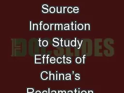
Strength in the South China Sea Robert Qi 5132015 Construction on Johnson South Reef Photograph Armed Forces Of The Philippines GEOG 596A Agenda Background Introduction Research Objectives ID: 714877

military research china source research military source china sea south island images china

Share:

Link:

Embed:

Download Presentation from below link

Download Presentation The PPT/PDF document "Using GIS and Open Source Information to..." is the property of its rightful owner. Permission is granted to download and print the materials on this web site for personal, non-commercial use only, and to display it on your personal computer provided you do not modify the materials and that you retain all copyright notices contained in the materials. By downloading content from our website, you accept the terms of this agreement.


Presentation Transcript

Slide1

Using GIS and Open Source Information to Study Effects of China’s Reclamation Projects on Change of Regional Military Strength in the South China Sea

Robert Qi5/13/2015

Construction on Johnson South Reef

Photograph: Armed Forces Of The Philippines

GEOG 596ASlide2

Agenda

Background IntroductionResearch Objectives Significances

Data Resources Research Methods

Image ProcessGIS Products DevelopmentPilot Research

Pre-research Preparation

Analysis Plan

Tools and SoftwareResearch Time LineAnticipated Results Slide3

Background Introduction

South China Sea3,500,000 square kilometersKey International sea transportation routeVast fishery and natural resources

Strategic significances Disrupted TerritoriesHistorical IssuesChina’s Nine-dashed Line

Disputed zoneCountries InvolvedChina’s Recent ActionsDiplomatic Approaches

Militarization

Increased Law

Enforcement ActivitiesReclamation Projects

Source of map: The devil and the deep South China Sea, http://chinhdangvu.blogspot.com/2014/03/the-devil-and-deep-south-china-sea.html

Disputed Islands and Boundary in the South China Sea Slide4

China’s Reclamation ProjectsThe reclamation projects started on seven

disputed Reefs in the Spratly Islands since 2013Mischief Reef

Fiery Cross ReefJohnson South ReefCuarteron Reef

Hughes ReefSubi Reef

Gaven

Reef

The Construction projects includeLand extensionLiving infrastructure constructions Military infrastructure constructions Anticipated effects of the ProjectsIncreased military and law enforcement capability

Strengthened control of

resource

exploitation and transportation routes

Enhanced political influence

Construction in Woody

Island in

Paracel

Islands Airstrip Extension project in 2014

Source of map: The Diplomat, April 25, 2015, http://thediplomat.com/2015/04/south-china-sea-chinas-unprecedented-spratlys-building-program/

Source of map: Peace and Freedom, https://johnib.wordpress.com/tag/island-building/

Change of Johnson South Reef from March 2012 to March 2015Slide5

Significance of the Research

Current problems Scant research combined spatial analysis, GIS, and open source information in open source domainStudies heavily rely on open source informationMost of the articles only focus on a specific island

This project studies an ongoing event in one of the most complex sea areas with important strategic meansDispute may be escalated to conflict in the near future. A sharp downturn in geostrategic circumstances will cause long-term and extensive global effectsThe reclamation project is a significant step for China’s transaction from a “land power” to “Sea power”, and “Blue Sea Navy Dream”

The research results can be used to forecast China’s further actionsFocus on the “big picture” and 1st order and 2

nd

order effects caused by the reclamation projects

A CGI plan of

Gaven

Reef shows a runway, hangars for fast jets, a port, wind turbines, and greenhouses. (China State Shipbuilding Corporation

)

Source: James Hardy, IHS Jane's, http://www.janes.com/article/39716/china-goes-all-out-with-major-island-building-project-in-spratlys

Source:

StratRisks


, http://stratrisks.com/geostrat/13282Slide6

Research Objectives Research Goal

The research focuses on the change of China’s military capability and operations in the South China Sea, completion of the reclamation projects in the future, as well as the subsequent effects caused by the change from various perspectives by using GIS overlay analysis.Research Objectives - Answer the following questions by means of a geospatial approach:

How the reclamation projects strengthen its regional military capability in all six military functions?What role will the strengthened military capability play in the scramble of energy and fishing resources? How the strengthened military capability impacts operations and existence of the US military in the region? How the change of military capability and subsequent results further affects international relationships and China’s strategies of the disrupted area?

Spratly Islands Occupation

Status

By JOE BURGESS

Sources: U.S. Department of State, Office of the Geographer; GEBCOSlide7

Project Time Line

CSIS ASIA MARITIME TRANSPARENCY INITIATIVE / DIGITALGLOBE / AFP-JIJI

Task

Date

Proposal Phase

February – May 2015

Develop a draft research proposal


Conduct a pilot research


Brief the research proposal


Receive comments and finalize the research proposal


Preparation Phase

June – December

2015

Contact data providers and obtain required imaging data


Monitor and collect related information from open source


Develop and test the database

set and scripting tools


Research Phase

January – March

2016

Process satellite images


Identify and create objects in the

database set


Create GIS overlays


Create the combined overlays for analysis


Conduct research analysis


Write

a draft

research paper


Revise the research report


Publish or brief the research result

 Slide8

Sources of High-resolution Images Commercial satellite image providers Google EarthPhilippine GovernmentImages obtained

Deadline - December 2015 Open Source InformationPSU LibraryInternetArmy Open Source Center( Unclassified)

Data Resources

CSIS ASIA MARITIME TRANSPARENCY INITIATIVE / DIGITALGLOBE / AFP-JIJI

Source: Philippines

Department of Foreign Affairs 

Left : Aerial images of

Mabini

Reef, taken by Philippines Department of Foreign Affairs; right: Satellite image of the Fiery Cross reef by CSIS/

DigitalGlobeSlide9

Image ProcessType of ImagesOblique Images- Aerial images from Philippine Government

and some images from Google EarthOrthophotos- Satellite Images and some images from Google Earth

Set up control points Points at well-defined positions and four corners Number of points varied for different types of image Geo-registration in

ArcGIS1st order transformation2nd order transformation

Horizontal

accuracy

assessment15-20 well-defined reference points on each image Meet standards of accuracyResearch Methods

CSIS ASIA MARITIME TRANSPARENCY INITIATIVE / DIGITALGLOBE / AFP-JIJI

Source: Philippines

Department of Foreign Affairs 

Woody Island, photo obtained from Google Earth, taken in August 2015. Slide10


Research Methods

CSIS ASIA MARITIME TRANSPARENCY INITIATIVE / DIGITALGLOBE / AFP-JIJI

Four Aircraft shelters on Woody Island with dimension of 35M X35M

toSlide11

Analysis PlanCSIS ASIA MARITIME TRANSPARENCY INITIATIVE / DIGITALGLOBE / AFP-JIJI

Analyze

and estimate PLA’s most likely and most dangerous

courses

of

action,

as well as

changes

of the regional military power

Investigate the consequent effects on the scramble of resources and impact on U.S. military

operations

in the region

Study geopolitical

changes

caused

by the

military extension Slide12

Research Methods CSIS ASIA MARITIME TRANSPARENCY INITIATIVE / DIGITALGLOBE / AFP-JIJI

Effects of the Woody Island Airstrip

Extension

project

on China’s military capability

Command

and

Control- capable for operation of Early-warning aircraft

Intelligence- Aerial SIGINT Platform

Fires- with increased range of H6K bombers, H6K bombers can directly fly from Woody Island to Guam without refueling

Movement and Maneuver- the extended airstrip is capable for refueling aircraft

Protection- Refueling aircraft extends range and duration time of fighters

Sustainment- Large cargo airplane can land and take off from the extended airstrip

Overlay in blue shows change of the H6 bomber ‘s operation range along with completion of the airstrip in Woody Island, China’s southeast airstrip. H6 bomber(operational range of 3500 KM) can directly fly to Guam from Woody Island without refueling Slide13

Tools and SoftwareCSIS ASIA MARITIME TRANSPARENCY INITIATIVE / DIGITALGLOBE / AFP-JIJI

ArcGIS-

Student

license provided by Pennsylvania State

University

Google

Earth

Pro-Free Software

PostgreSQL-Free

Software

Python-Free

SoftwareSlide14

Anticipated Result CSIS ASIA MARITIME TRANSPARENCY INITIATIVE / DIGITALGLOBE / AFP-JIJI

GIS Products

Processed high-resolution

aerial or satellite images of the targeted reefs

A GIS

database

set

Maps and combined overlays for

analysis of corresponding

objectives

Anticipated Analysis Result

China’s

military capability and

operations, and law enforcement activities at

the southern end of the South China Sea will be significantly

enhanced.

China will be benefited from the new forward operation bases in escorting trade fleets, surveying and exploiting natural resources.Strengthened military power will consolidate their claim on the dispute

area. New disputes and tensions between China and other countries may emerge. Slide15

Questions?