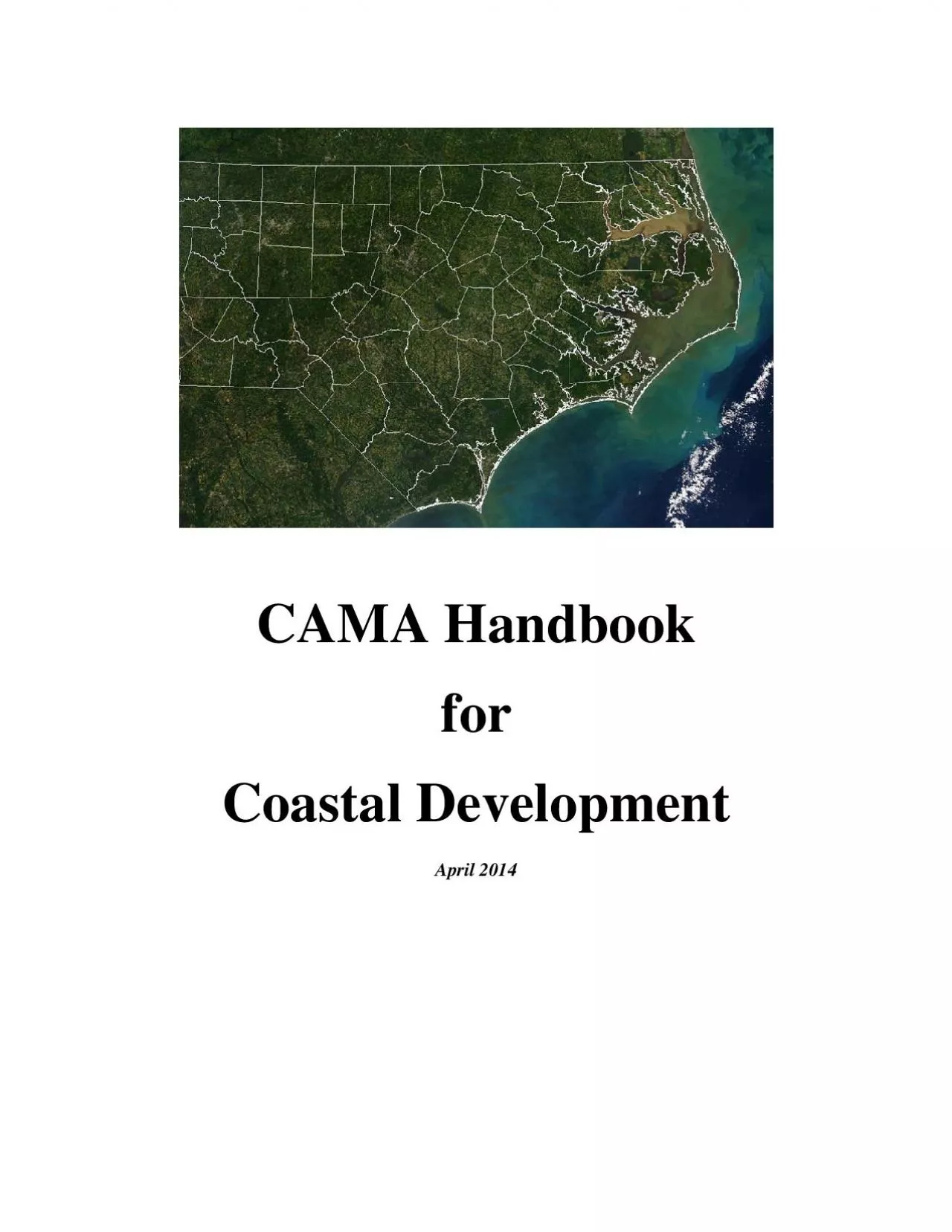
/
CAMA Handbook  for  Coastal Development April 2014 CAMA Handbook  for  Coastal Development April 2014

CAMA Handbook for Coastal Development April 2014 - PDF document

blanko
blanko . @blanko
Follow
342 views
Uploaded On 2021-06-14

CAMA Handbook for Coastal Development April 2014 - PPT Presentation

at types of projects require CAMA development permits the development regulations you will have to follow and how following those rules helps protect the natural resources that draw people to North ID: 842067

water permit project coastal permit water coastal project development feet areas public cama resources area management erosion general crc

Share:

Link:

Embed:

Download Presentation from below link

Download Pdf The PPT/PDF document "CAMA Handbook for Coastal Development ..." is the property of its rightful owner. Permission is granted to download and print the materials on this web site for personal, non-commercial use only, and to display it on your personal computer provided you do not modify the materials and that you retain all copyright notices contained in the materials. By downloading content from our website, you accept the terms of this agreement.


Presentation Transcript

1 CAMA Handbook for Coastal Development
CAMA Handbook for Coastal Development April 2014 at types of projects require CAMA development permits, the development regulations you will have to follow, and how following those rules helps protect the natural resources that draw people to North Carolina's coastal counties in the first place. an official statement ofdevelopment regulations and may not be relied on indevelopment. All coastal development projects subject to CAMA must be approved by the N.C. Division of Coastal Management. A list of Coastal Management offices is in Sectio development regulations may be found on the DCM website. You may obtain an official copy of the regulations from the Office of Administrative Hearings at 919-733-2691. Introduction The North Carolina coast may seem indestructible, but it's not. Left unmanaged, development around our state's sounds, rivers and beaches can destroy the very ecological, aesthetic and economic features In 1972, Congress passed the Coastal Zone Managementcoasts healthy by establishing programs to manage, protect and promote our country's fragile coastal resources. Two years later, the North Carolina General Assembly passed the landmark Coastal Area Management Act, known as CAMA. CAMA established the Coastal Resources Commission, required am for regulating development. The North Carolina Coastal ManagementAs a part of this program, the Coastal Resources Commission (CRC) Environmental Concern" within the 20 coastal counties and set rules for managing development within these areas. An Area of Environmental Concern, or AEC, is an area of natural importance: I

2 t may be easily destroyed by erosion or
t may be easily destroyed by erosion or flooding; or it may have environmental, socialvalues that make it valuable to our state. The CRC's rules are administered by the North Carolina Division of Coastal Management, a part of the state Department of Environment and Natural Resources. About This Guide This handbook is a guide to the permit program set up develop or build in the 20 coastal North Carolina counties. Because rules change, regulations are often more complicated than outlined here and every project is different, you should always contact the before you begin developmenthout destroying the natural systems around us or Management Act and the CRC, you can protect our coastal resources as well as your own development Section 1: Will Your Project Require a CAMA Permit? You must obtain a Coastal Area Management Act, or CAMA, permit for your project if it meets all of It is in one of the 20 counties covered by CAMA. It is considered "development" under CAMA. It is in, or it affects, an Area of Environmental Concern (AEC) established by the Coastal Resources Commission (CRC). It doesn't qualify for an exemption. The Coastal Resources Commission is a 15-memberestablish rules and policies for developmThe CRC receives guidance from a 45-member Coastamembers represent local governments, technical expertise. Members of the CRAC are responsible for keeping their aIf your project is in one of the following 20 counties and is located along the state's rivers, sounds or the Atlantic Ocean, you may need a permit: Bertie Camden Chowan Currituck New Hanover Pamlico Perquimans

3 The Coastal Area Management Act defines
The Coastal Area Management Act defines development as: "any activity in a environmental concern ... involving, onstruction or enlargement of a structure; excavation; dredging; filling; dumping; removal of clay, silt, sand, gravel or minerals; removal of sand dunes; alteration of the shore, bank river, creek, stream, lake or canal; or placement of a floating structure in an Area of Environmental Is my project in an Area of Environmental Concern? You're probably in an AEters within the 20 CAMA counties; on a marsh or wetland; within 75 feet of the normal high water line along an estuarine shoreline; near the ocean beach; near an inlet; within 30 feet of the normal high water level of areas designated asN.C. Marine Fisheries Commission and the N.C. Wildlife Resources Commission; within 575 feet of Outstanding Resource Waters defined by the Environmental Management Commission. Areas of Environmental Concern are detion of this manual. If you already e application information, turn to om the CAMA permit requirements? Section 113A-103(5)(b) of CAMA exempts the following activities from the definition of development: road maintenance within a public right-of-way; utility maintenance on projects that already have CAMA permits; energy facilities covered by other laws or N.C. Utilities Commission rules; that doesn't involve tlands (Note: these activities are not exempt from permitting requirements under the state's agricultural or forestry ditches less emergency maintenance and repairs whenthe construction of an accessory building usually found with an existing structure, i

4 f no filling of In addition, CAMA allows
f no filling of In addition, CAMA allows the CRC to exempt some types of minor maintenance and improvements. These types of projects, outlined in Section 6, are those with successful track records in protecting the resources around them. In all cases, you should check with the Division of Coastal Management you begin work to make sure that your project qualifies for an exemption. Section 2: Areas of Environmental Concern Areas of Environmental Concern Coastal Resources Commission's permitting program for coastal development. An AEC is an area of natural importance: it may be easily ooding; or it may have environmental, social, economic or aesthetic values that make it valuable to our state. The Coastal Resources Commission designates areas as AECs to protect them from uncontrolled development, which may cause irreversible damage to property, public health or the environment, thereby diminishing their value to the entire state. The CRC has set up four categories of AECs: The Estuarine and Ocean System The Ocean Hazard System Public Water Supplies Natural and Cultural Resource Areas AECs cover almost all coastal waters and about 3 following descriptions will help you determine if your project is in an AEC and will help you understand the importance of these natural systems. The estuarine and ocean system is the coast's broad network of brackish sounds, marshes and surrounding shores. Normally found where rivers and streams meet the ocean, an esimportant part of coastal life – a transitional area where fresh and salt water mix. From broad, shallow sounds like the Albem

5 arle and Pamlico, to narrow bodithe stat
arle and Pamlico, to narrow bodithe state's long string of barrier and creeks make up one of the largest estuarine systems in the United States. Permits may be required for development in four components of this system (see Figure are the coastal waters and submerged lands that every North Carolinian has the right to use for activities such as boating, swimming or fishing. These waters, but they also include many public trust areas: all waters of the Atlantic Ocean and the lands underneath, from the normal high water mark on shore to the state's official boundary three miles offshore; all navigable natural water bodies and the lands underneath, to the normal high water mark on include privately owned lakes where the public doesn't have access rights; accessible to the public from other waters; and prescription, custom, usage, dedication or any other means. are the state's oceans, sounds, tidal riverscoastal North Carolina and link to the other parts of the estuarine system: public trust areas, coastal wetlands and coastal shorelines. For regulatory purposes, the inland, or upstream, boundary of estuarine waters is the same line used to separate the jurisdictions of the Division of Marine Fisheries and the Wildlife Resources Commission. parts of their lives in estuaries move between the "official" estuarine and inland waters. include all lands within 75 feet of the normal high water level of estuarine waters. This definition also includes lands within 30 feet of the normal high water level fishing waters and inlaOutstanding Resource Waters, this 575 feet of the no

6 rmal high water level. 4. The Coastal R
rmal high water level. 4. The Coastal Resources Commission's rules define as any marsh in the 20 coastal counties that regularly or occasionally floods by lunar or wind tides, and that includes one or more of 10 plant species (see Figure 2.2) : Salt Marsh (Smooth) Cord Grass Juncus roemerianus: Black Needlerush : Glasswort Distichlis spicata: Salt (or Spike) Grass : Sea Lavender : Cattail : Salt Reed or Giant Cord Grass Freshwater swamps and inland, non-tidal wetlands are not in the CAMA permit jurisdiction, unless the CRC specifically designates them as AECs. However, these wetlands are protected by the federal Clean Water Act. An Army Corps of Engineers permit may bein these wetlands. Learn More: Why we should protect the estuarine and ocean systemThe lands and waters of the estuarine system are home to fish nursery areas, spawning areas, shellfish to North Carolina's commercial and More than 90 percent of North Carolina's commercial and recreational seafood species (such as shrimp, coastal wetlands and estuarine waters for much of their lives.The stems, roots and seeds of ma food and nesting materials for waterfowl and other wildlife. Marsh plants guard against erosion and flood damage: Their leaves and stems dissipate wave energy, and their root systems bind soil. The nutrients and decayed plant material the marsh plants produce also of the estuarine system. Estuarine plants trap debris and excess nutrients and help regulate the flow of fresh water into the estuary, maintaining the system's balance. Certain soil formations and plant communities along est

7 uarine shorelines also help slow erosion
uarine shorelines also help slow erosion. protect the water from excess sediment and pollutants, and they protect nearby developments from flooding and erosion. Estuarine waters and public trust areas are important for tourism, because they support commercial and recreational fishing, boating, swimming NC Division of Marine Fisheries, 1999 B. The Ocean Hazard System AECOne of the most notable aspects of North Carolina's together the state's eastern border. Many of these islands are home to thriving communities, such as the Outer Banks or the towns of WriMasonboro Island, remain largely untouched by development. hazards – such as storms, flooding and dune erosion – that can threaten buildings and other structures The Ocean Hazard System is made up of oceanfront lands and the inlets that connect the ocean to the sounds. The Coastal Resources Commission has designated three ocean hazard AECs (see Figure 2.3). The Ocean Erodible AEC covers North Carolina's beaches and any other oceanfront lands that are subject to long-term erosion and simean low water line. The landward limit of the AEC is measured landward from the first line of stable natural vegetation and is determined by adding: a distance equal to 60 times the long-term, avershoreline to ed during a major storm. The width of the AEC varies from about 145 feet to more than 700 feet. The CRC updates long-term erosion raexamine shoreline changes. General maps of erosee from the Division of Coastal Management; detailed erosion rate maps are available for inspection at all Coastal Management field and local permittin

8 g offices. The High Hazard Flood AEC c
g offices. The High Hazard Flood AEC covers lands water currents during a major storm. These are coastal flood with insurance rate maps prepared by the Federal Insurance Administration. "V zones" are determined by an engineering analysis of expected flood levels during a storm, expected topography of the land. The high hazard flood AEC often overlaps with the ocean erodible and inlet hazard AECs. The Inlet Hazard AEC let shorelines are especially vulnerablsuddenly and dramatically. For each inlet along the coast, the Division of Coastal Management prepares a hazard area map that is reviewed and approved by the Coastal Resources Commission. Each area is mapped based on a statistical analysis of inlet migration, previous inlet locations, narrow or low lands near the inlet, and the influence of man-made features, such as jetties and In each case, the distance the inlet hazard AEC extends inland is estimated to be large enough to encompass those lands where the inlet can be expected to migrate. At a minimum, this distance is the same distance inland as the ocean erodible AEC. Inlet hazard AECs range in width from about 250 feet for a fairly stable inlet to about 4,000 Learn More: Why we should protect ocean hazard areasAt the edge of the ocean, ocean hazard AECs get thWaves, wind and water can quickly change the shape of a shoreline, creating orbeaches and battering nearby structures. No oceanfront development can be absolutely safe from destructive natural forces, but development in ocean hazard areas can be carefully designed and located to minimize the risk to life and p

9 roperty, as well as to reduce the cost o
roperty, as well as to reduce the cost of relief aid. Oceanfront beaches and dunes help protect buildings and environments behind them by absorbing the uncontrolled, development can destroy these dunes and ththe risk of damage to structures from erosion, flooding and waves. We need fresh water for many aspects of life – driwaters is vital to our health and our economy. As rain runs off pavement and rooftops, it carries pollutants and sediments that can put our waters at risk. The CRC has designated two AECs that protect certain coastal public water supplies from the negative effects of development. protects coastal drainageC. Environmental Management Commission. This classification means that the best use of the water and this use must be een designated as AECs: the Fresh rder; and Toomer's Creek near Wilmington. are areas of rapidly draining sands extending from the earth's surface to a shallow groundwater table that supplies public drinking water. Currently, one wellfield is Learn More: Why we should protect public water supply AECsDevelopment is rarely proposed in these surface watersheds and wellfields, which are almost entirely in these water supplies could threaten public health or force local communities to spend a lot of money to develop alternative water sources. Uncontrolled development ment from construction sites and a variety of pollutants from buildings, parking lots and roads also can damage our waters. Natural and cultural resource AECs are specific sicontain environmental or cultural resources that are important to the entire state. They may be

10 important because of their role in maint
important because of their role in maintaining the coastal ecosystem, resources for scientific research and cultural resource AEC; the CRC makes are lands that support native plants and animal communities, ivity. These areas are key components of natural biological systems. They provide us t which to measure the change in coastal habitats; they are a valuable scenic or cuscientific and educational resource. You may be allowed to develop these areas if the development benefits the habitat or enhances the area's biological, scie Coastal areas that sustain remnant speciesant or animal species that the N.C. Wildlife Resources Commission or the federal government has determined to be rare, threatened or endangered. Such areas are necessary for the survival of these species within the coastal region and for maintaining the coast's natural diversity. These areas also provideformations or processes found in the coastal area. Such formations are important educatiand scenic resources. Jockey's Ridge in Dare County has been designated because of its unique geologic buildings or sites that: yield information important to the state's or the coastal region's history; are associated with events that have contare associated with the lives of historically important people; or embody the distinctive characte method of construction. These areas provide unmatched and irreplaceable scientific, educational and aesthetic resources that commemorate the coastal region's heritage. Permng archeological resources. Section 3: Rules Applying to Development in Areas of Environmental Concern The Coasta

11 l Resources Commission has approved deve
l Resources Commission has approved development rules for each type of Area of Environmental Concern (AEC). These rules are outlined in this section. Rules for specific types of development projects are in Section 4. Some projects may be exempted from CAMA permit requirements. These projects are covered in Section 6. 1. Estuarine and Ocean System AECs {15A NCAC 7H .0200}llowed in the Estuarine System? ine system. Such projects include bulkheads, boat ramps, groins, breakProjects such as restaurants, homesupland areas where they are less harmful to public resources. There are some exceptions, for development in a historically urbal Management office nearest you if The following requirements apply to all development in the Estuarine Wat must give highest priobiological, economic and social values of coason in public trust areas. to cause the least possible damage to the coastal wetlands; shellfish beds; submerged grass beds; important nesting and wintering areas for wildlife; and important natural barriers to erosion, such as marshes, cyprYour project must follow the air and water quae N.C. Environmental Management Commission. Generally, development will not be permitted if it lowers water as shellfishing, swimming or drinking). For more information, contact the N.C. Division of Air Quality or the Division of Water Quality. Telephone numbers are located inYour project must not significanon, which can smother important habitats, block sunlight from aquatic Your project must not create accumulate sediments and pollutants that threaten fish and shellfish habitats and publi

12 c health. You must time the constructio
c health. You must time the construction of your project to have the least impact on the life cycles and migration patterns of fish, shellfish, waterfowl and other wildlife. The life cycles of animals that depend on the estuarine system are especially sensitive during certain times of the year. For more information, contact the Coastal Management office nearest you. Your project must not cause major or irreversible damage to valuable archaeological or historic resources. Archaeological resources, such as the remains of Native and Early American settlements, shipwrecks and Civil or Revolutionary War artifacts, provide valuable information ople. Information on the loavailable from the N.C. Division of ArchivesYour project must not reduce or prevent the use of, and public access to, estuarine waters and Your project must comply with the local land an is a "blueprint" The following requirements apply to all develoong public trust waters, 75 feet ong estuarine waters. Along Outstanding Resource Waters, the rules apply within 575 feet of the normal high water line.Your project must not cause significant damage to any estuarine resources. Development for non-water-dependent uses shall be located a minimum of 30 feet landward of the normal high water line or normal water level, except along those coastal shorelines where the Environmental Management ComYour project must not interfere wNo project paid for (in any part) by public funds will be permitted if it is likely to require for maintenance and continued usof the project will outweigh the expense. Your project should preser

13 ve, and must not weakmarshland, resistan
ve, and must not weakmarshland, resistant clay shorelines and cypress-gum ng lots and roads, must cover no more than 30 Environmental Concern, unless you can show that the design of your project limits runoff equally limit hard surfaces to the smallest area necessary. Redevelopment of areas exceeding the 30 percent limit may be permitted if hard surface areas are not increased and the project meets the rule to the maximum extent feasible. ng Resource Water (ORW), you may cated within the AEC, and you may not use a stormwater collection system to gain buildable area. C, projects must comply with applicable rules of the N.C. Sedimentation Pollution Control Act of 1973 and the stormwater management rules of the Environmental Management Commission. Your project must not cause major or irreversible damage to valuable archaeological or historic resources, such as the remains of Native and Early American settlements, shipwrecks and Civil War artifacts. Information on the location of these sites is available fromon 9 for contact information.) Your project must comply w 2. Ocean Hazard AECs {15A NCAC 7H .0300} A primary dune is the first mound of sand (measured from the ocean) that is six feet taller than the mean flood level for the area. Frontal dunes are the first mounds of sand thand continuity to offer protection. The crest of the primary dune and the landward toe of the frontal dune are determined on a case-by-case basis by the Division of Coastal Management. The first line of stable natural vegetation is the first area on the oceanfront where natural dune-stabilizing

14 plants are present. Such plants include
plants are present. Such plants include sea oats and American beachgrass. The following requirements apply to all development in the Ocean Hazard AEC {15A NCAC 7H Your development must be lohuman lives and property from storms and erosion, to prevent permanent structures from encroaching on public beaches and disaster relief aid) that can result from poorly located development. Your development must incorporate all reasonable means and methods to avoid damage to the natural environment or public beach accessways. Reasonable means and methods include: limiting the scale of the project and the damage it causes; restoring a damaged site; or providing substitute resources to compensate for damage. Your project should be set as far back from the ocean as possible. At minimum, all buildings must be located behind the crest of the primary dune, the landward toe of the frontal dune or the erosion setback line - whichever is the farthest landward from the first line of stable natural Your project must not reor vegetation from primary or frontal dunes. These dunes help protect structures from erosion, flooding and storm waves, and they help maintain North Carolina's barrier islands and beaches. If you want to move a building that is in an you will need a CAMA permit. Buildings relocated entirely with private possible. Buildings relocamust meet all AEC standards, including the setback requirement. Your project must meet all local minimum lot-size and setback requirements. Counties and towns often require a setback from roads, property lines or dunes. For more information, contact

15 your local F igure 3.1 building inspec
your local F igure 3.1 building inspector. Your project must comply with the local CAcommunity's goals, management policies and a map classifying land according to the types of development allowed. You must not place a mobile home within the high hazard flood area unless it is in a mobile home park that existed before June 1, 1979. Not only are mobile homes likely to be damaged by coastal storms, they are also likely to damage other buildings during storms. You may not interfere with or block the public's ability to reach, use and belong to all the people of the state. These resources include the wet sand beaches and waters. No development is allowed seaward of the vegetation line, because the public has a right to use the sandy beach. Development also may not blYour project must not cause major or irreversible damage to valuable archaeological or historic resources. Information on the location of these sites is available from the N.C. Division of Archives and History in the Depa as sewers, water lines, roads, bridges and erosion control works, will be permitted only if they: , nation or state; don't promote additional development in ocean hazard AECs; won't damage natural buffers to erosion, wave wash and flooding; won't otherwise increase existing hazards. Setback Requirements for all development in the Ocean Hazard AEC The erosion setback line extends inland from the first line of stable natural vegetation.square feet, the line extends landward a distance of 30 times the average annual erosion rate at the site. In areas where erosion is less than 2 feet per year,

16 the setback is 60 feet. The setback fa
the setback is 60 feet. The setback factor for all structures between 5,000 and 10,000 square feet is 60 times the erosion rate. The setback factor increases incrementally with structure size, reaching a maximum setback of 90 times the erosion rate for stgreater. See the chart below to determine setbacks based on stru Coastal Management determines erosion rates for different segments of the state's ocean shoreline by analyzing a time-series of aerial photographs dating back to the 1930s. Erosion rates years and are adopted by the CRC. The following types of development may be permitted between the oceanfront setback line and the vegetation line if they don't remove or alter primary or frontal dunes or plants, if overwalks are used to protect dunes, and the projects meet all other AEC general rules: campgrounds with no substantial permanent structures; public fishing piers; parking areas made from clay, packed sand or gravel; beach access structures; unenclosed, uninhabitable gazebos with a footprint of 200 square feet or less; temporary amusement stands; sand fences. When the oceanfront setback requirement will not allow the development of permanent structures on lots that had been platted as of June 1, 1979, single-family homes may be permitted seaward of the setback line in ocean erodible areas if they meet the following conditions: the structure is set back as far as possible from the ocean with the least possible encroachment into the setback area; it is at least 60 feet landward of the vegetation line; it is entirely behind the landwall pilings used to sup

17 port the structure are driven at least f
port the structure are driven at least five feet below normal sea level (see Figure 3.3); covers no more than 1,000 squathe project meets all other state and local requirements. If the development is to be served by an onsite waste disposal system, a copy of a valid permit for this system from your county health department must be submitted with the CAMA permit application. to acknowledge that you are aware of the risks anThe AEC Hazard Notice also states that you are awerosion are building relocation or beach nourishment.removed by a date set in the permit.By granting permits for development, the Division of Coastal Management does not guarantee the safety of the development, and the Division and the Coastal Resources Commission do not assume liability for future damage.Inlet Hazard Areas ocean hazard AECs, all development in inlet hazard areas must meet All development must be set back from the first to the setback required in the adjacent ocean hazard area. You may receive a permit for only one permanent commercial or residential unit per 15,000 ter July 23, 1981. Mud flats, salt marshes and beach line are not included in computing a lot’s land area for the square feet of floor area are the t hazard area. Access roads to those areas and maintenance or replacement of bridges may be allowed. Development must not encroach on public accessways or restrict their use. Small-scale, non-essential development that does not induce further growth, such as single-family piers and bulkheads that do not interfere with natural inlet movement, may be permitted within designated

18 inlet hazard area shorelines that exhibi
inlet hazard area shorelines that exhibit features characshorelines. Features can include the presence erosion rates than in the adjoining ocean erodible area. Typically, these areas are on the back side of barrier islands and are not influenced by ocean waves. Small surface water supply watersheds protect coastal classified as WS I - WS V by the N.C. Environmental Management Commission. The Fresh Pond at the Nags Head and Kill Devil Hills border, and Toomer's Creek near Wilmington are classified as AECs. aining sands extending from the earth's surface to a Rules applying to small surface water supply watersheds: Septic tanks and drainfields must be located at least 100 feet from waters classified as WS IV by the Environmental Management Commission (see Figure 3.4). (Wastewater from the septic system can migrate through the soil and the a pond or stream.) must comply with the N.C. Sedimentation Pollution Control Act the soil near a public water supply can send sediment and other pollutants into the water during a rainstorm or high winds.) Pollutant Discharge Elimination System (NPDES) permit, you must obtain the NPDES permit before a CAMA permit may be granted. The Division of Water Quality in the Department of Environment and Natural Resources has more information on NPDES requirements. No sewers, septic tank fields or other sources of pollution may be built within 500 feet of the edge of the Fresh Pond in the Nags Head/Kill Devil Hills Fresh Pond watershed. Between 500 ems are limited to one system serving a single-family home with no more than four bedrooms (or an

19 equivalent volume of sewage) on a tract
equivalent volume of sewage) on a tract of land at least 40,000 square feet in size (see Figure 3.5). Rules applying to public water supply wellfields: Your project must not significantlter supply or reduce the amount of water available to recharge the wellfield. Your project must not use a septic tank system or other ground absorption system that is Your project must not inject pollutants below ground within the AEC boundaries. Your project must not discharge toxic and/or soluble materials that could contaminate the water supply. Your project must not let salt water leak into the public water supply. g ure 3. 4 The standards for development in areas designated as fit the management and resource protection needs Permuda Island and Jockey's Ridge, the only two natural and cultural AECs to date, are available from the Division of Coastal Management. Any person may nominate an area as a Natural & Cultural Resource AEC. The area must meet specific ces Commission. For nomination information, call the Division of Coastal Management. Section 4: Rules for Specific Types of Projects Beach Bulldozing(Also see Oceanfront Erosion Response) Beach bulldozing is a common method of oceanfront erosion management that moves beach sand from areas seaward of the first line of natural, stable vegetation to repair storm damage to an existing dune or to create a protective berm for an imminently threatened structure. Beach bulldozing can be authorized through several CAMA permit processes depending upon the circumstances and conditions on your Under a CAMA General Permit, sand movement

20 is limited to the beach area above the N
is limited to the beach area above the Normal High Water line. A CAMA Minor Permit for beach bulldozing allows work to the Normal High Water. or Minor Permit use standards or requires the movement of sand that is seaward of the Normal High Water Line, then a CAMA Major Permit and a State Dredge and Fill Permit will be required. You should contact your DCM District Office for assistance. Any work performed waterward of Normal High Water also requires a federal permit from the U.S. Army Corps of Engineers. CAMA Permit conditions will vary according to site conditions and type of permit, but in all cases the following permit conditiIn order to minimize adverse impacts to nesting sea turtles, no work shall occur within the Management, in coordination with the N.C. Wildlife Resources Commission, U.S. Fish and Wildlife Service and U.S. Army Corps of Engineers. The project should maintain a slope similar to normal conditions. The slope, or grade, of the project must not be so steep that it endangers the public or interferes with public use of the The beach profile may not be lowered more than one foot as measured from the existing surface elevation. Beach bulldozing must not extend past the lateral boundary of your property, unless you have permission from the neighboring landowner. Beach bulldozing must not significantly increase erosion on neighboring properties or adversely affect important natural or cultural resources. All of the above permits are issued to property owners to repair existing dunes and dune systems following an erosion event. The Coastal Area Managemen

21 t Act exempts beach bulldozing from the
t Act exempts beach bulldozing from the permit process when it is done to protect imminently threatened structures by sand dunes, A structure shall be considered imminently threatened if its foundation septic system, or right-of-way in the case of roads, is less than 20 feet away from the erosion scarp. Property owners who believe their structure is imminently threatened must contact a CAMA representative for consultation ect to the above listed conditions, and any work performed below the Normal High Water line still needs federal authorization from the U.S. Army Corps of Engineers. Beach Nourishment (Oceanfront) (Also see Oceanfront Erosion Response) Ocean beach nourishment must meet the general rules for development in the Ocean Hazard AEC as well as the following standards: Sand used for beach nourishment must be similar in quality and grain size to sand in the area 07H .0312 TECHNICAL STANDARDS FOR BEACH FILL PROJECTS, sediment samples must be taken from both the borrow site and recipient beach to determine if the sediment source is compatible.The cited rule provides an objective definition of sediment compatibility for beach fill projects, and outlines specific protocols for sampling the beach scheduled to receive nourishment and the proposed borrow site in order to correctly characterize the material found there. Sand may not be taken from sensitive natural areas or areas where it willcause more than a minimal environmental effect. In order to minimize adverse impacts to nesting sea turtles, no work shall occur within the period of May 1 through Nov. 15 withou

22 t prior approval from the Division of Co
t prior approval from the Division of Coastal Management, in coordination with the N.C. Wildlife Resources Commission, U.S. Fish and Wildlife Service and U.S. Army Corps of Engineers. The project should maintain a slope similar to normal conditions. The slope, or grade, of the project must not be so steep that it endangers the public or interferes with public use of the Beach Walkways(Also see Oceanfront Construction) Beach walkways make it easier to get to the beach without damaging dunes, which play a vital role in maintaining the structure and safety of North Carolina's barrier islands and beaches, and helping to protect property from flooding and erosion. A CAMA permit is required to construct a beach walkway. Beach walkways are not subject to CAMA oceanfront setback requirements. To ensure that the dune system is not damaged when a walkway is built, you must follow the following standards for the ocean hazard AEC {15A use only. Fi ure 4.2 Walkways wider than 6 feet or not for pedestrian use may be permitted if they meet a public need that cannot be met in other ways. maintaining the stability of the protective dune system. Walkways must be on posts or pilings embedded to a depth of 5 feet or less, so that when possible, only the posts – not the walkway itself – touch the frontal dune. Walkways may touch the dune only to the extent necessary. Walkways won't be allowed if they weaken the dune's protection agaiBoat ramps provide access to coasmay be constructed under a CAMA general permit if they meet the general rules for coastal shorelines, estuarine and public t

23 rust waters, and Boat ramps must not be
rust waters, and Boat ramps must not be wider than 15 feet and normal high water level contour in tidal areas or the normal water lee and below the normal high water level or normal water level will be limited to that absoluteand provide a ramp no greater in size than specified by the general permit. Placement of fill materials below the normal high water level, or normal water level contour, will be limited to the ramp structure itself. Boat ramps may be constructed of concrete, wood, steel, clean riprap, marl or any other acceptable materials approved by DCM personnel. Coastal wetland vegetation must not be excavated or filled at any time during construction and Construction of larger or commercial boat ramps require a major permit. Bulkheads and Estuarine Shoreline Stabilization Shoreline erosion is common along North Carolina's broad sounds and tidal rivers, and many waterfront property owners look for methods Estuarine Shoreline Stabilization section DCM’s website provides property owners with a simple interactive guide to help determine the best stabilization method for a particular shoreline. There are several approved methods estuarine shorelines. along the estuarine shoreline is the cheapest and most environmentally sound stabilization method. Plants slow wa also increase the marsh habitat ae and seaweeds, finfish and shellfish, mammals and Because of the variety of shoreline types and plant species in North Carolina estuaries, your project require preparation – i.e. grading – a permit is not required for Management, and check with the North Carolina Sea Grant

24 Program for information about plantings
Program for information about plantings. (See Section 9 for contact information.) Stone riprap also dissipate some wave action, the front and sides of the revetment. Because the stones or rocks of a revetment will settle and readjust with storms or waves, riprap material must be heavy enough or securely tied down to remain in place through storms and normal tidal and wave movement. Inspaces between the stone using Riprap material must be clean and free of pollutants.loss than permanent seawalls, riprap replaces soft bottom habitat with hard bottom habitat, and it changes plant and animal diversity and abundance. isting marsh to help reduce the erosion of the waterward edge (escarpment). If there is not marsh already on the property, a sill is placed just offshore of where marsh would or could grow and is planted. The sill helps to protect the marsh by dissipating enough wave energy so that the marsh can establish. Once established, the marsh grasses dissipate wave also increases the marsh habitat organisms such as algae and seaweeds, finfish and shellfish, mammals and shorebirds. tructed with stone (riprap) or as a side. Trapped sand becomes crificial buffer during storms. Groins(movement of sand along a shoreline) occurs and thus traps sand. Groins produce accretion of beach material along the updrift side from somewhere downdrift, which then in turn accelerates erosion downdriare not the most desirable metbecause they can encroach into estuarine waters or public trust areas and can prevent the natural landward migration of coastal wetlamay block normal sand migration

25 , increasing erosion ion of shallow-wate
, increasing erosion ion of shallow-water habitat. Bulkheads must follow the general CAMA rules for coastal wetlands, estuarine waters and public trust e shoreline. Sloping shoreline structures help ine, reducing the wave's ability to carry away ssipate wave energy as well; they can direct that energy to adjacent properties and to the base of the bulkhead, causing additional erosion and damage. ilization measures should landward of, the normal high water or normal water level (see Figure 4.4). The normal water site conditions, such as the presence and location of vegetation that is distline). Shoreline stabilization measures located waterward of this line encroach on the public's structures may be permitted below the normal water level if all of the conditions below are met: problem or has unusual features, such Coastal Management has documented the need for shoreline stabilization below the normal water line; The shoreline stabilization measure extends beyond the normal water line no more than necessary to: resolve the hardship resulting from unusual features; align with adjacent shoreline stabilization measures; or allow backfill of the area eroded in the year before the date of the permit application; The shoreline stabilization measure will not significantly impair public trust rights or damage adjacent waterfront properties; and The property is not on the oceanfront. oreline stabilization measure, you must build the structure landward of marsh areas (see Figure 4.5). In abilization measimmediately waterward of the marsh, it may be Marshes are vital to the healt

26 h and productivity of fish and shellfish
h and productivity of fish and shellfish, and they depend on regular may block this essential exchange and stimulate the gradual filling of the state's coastal wetlands. stabilization measure with backfill, the fill material must be from an approved upland source – not the state's wetlands, estuarine beaches, or sound and river bottoms. All backfill material must be confined behind the structure. g ure 4. 4 F i g ure 4. 5 Navigation channels, canals and boat basins are common along the coast's sounds, rivers and creeks. Navigation projects enhance our state's coastal waters But if they are poorly sturb shellfish beds and fish nursery areas, damage wetlands or accelerate shoreline erosion. You must meet the following specific development regulations fotuarine waters and public trust areas: Navigation channels, canals and boat basins must avoid primary nursery shellfish beds, beds of submerged aquatic vegetation and marshes. Navigation channels and canals can be allothey do not significantly damage fishery resources, water quality or adjacent wetlands and if no reasonable alternative exists. A canal or channel must be the smallest width possible to meet your needs and provide adequate water circulation. Canals, channels and basins must not cause water quality problems. This standard ensures that water can flow freely, and won't stagnate and concentrate pollutants. adjoining properties. Septic tanks are not allowed on the shores of canals serving more than one residence, unless they meet standards set by the Division of Water Quality and the Division of Environmental He

27 alth. Such septic systems may not have p
alth. Such septic systems may not have point-source discharges, and the development must have stormwater routing and retention systems, such as grassed swales and settling basins. This reduces the pollutants into canals, where water capacity to dissipate harmful materials. No canal or boat basin may be deeper than its connecting channels. Canals or boat basins deeper than adjoining channels can allow sediment and pollution to build up in the basin. Boat basins should be designed with the widest possible opening and the shortest possible entrance to prsin should decrease from the There are two common methods of excavating and maintaining navigabasins: mechanical dredging and hydraulic dredging. is used to construct and maintain naviboats to use coastal waters safely. But improperly placed dredged material (spoil) can smother coastal wetlands, shellfish beds and fish spawning and nursery areas, and can release pollutants into estuarine To qualify for a CAMA permit, your dredging project must meet the general CAMA regulations for coastal wetlands, estuarine waters and public trust areas. F i g ure 4. 6 All dredged material from the construction or maintenance of a canal, channel or basin must be confined inland of regularly or irregularly flooded coastal wetlands and must be stabilized to prevent sediment from entering adjacent marshes or waterways. Dredging in primary nursery areas and beds of submerged aquatic vegetation is prohibited, unless maintenance excavation is essential to maintain a traditional and established use in these areas. In order to conduct mainteYou

28 must meet certain criteria, and you must
must meet certain criteria, and you must present clear evidence that you can meet those criteria when you apply for a permit. You must prove that the project material will not harm coastal resources. Hydraulic Dredging Because hydraulic dredging increases the potential for environmental impacts, special rules apply {15A material (spoil) must be confined on high ocean beaches if the spoil is suitable. Dredged materials confined on high ground must be placed inland of any marshland and should be stabilized to keep sediments from entering adjacent waters or wetlands. far enough into the disposal area to keep the containment dike from eroding and far enough from the spillway to allow suspended sediments to settle evenly throughout the disposal area. (see Figure 4.7A). Effluent from a diked spoil disposal area must be carried by a pipe, trough or similar device to a point in the water past visible vegetation or below the normal low water line. When possible, you must return effluent to the area being dredged (see Figure 4.7B). A water control structure must be installed at the intake end of the effluent pipe to allow for the settling of suspended sediments, which restricts the flow of sediment into adjacent marshes and waterways (see Figure 4.8). areas holding spoil from closed shellfish waters must not be keeps the contaminants found in closed shellfish waters from reaching non-polluted shellfish beds, spawning and nursery areas, and submerged Piers and docking facilities serve important functions along the coast, allowing access to water for recreational and commercial b

29 oating, swimming, diving, fishing and tr
oating, swimming, diving, fishing and transportation. If poorly designed, estuary's natural systems. The type of permit you will need for a piers or docking facilities varies with the size of the structure. See the tables in Appendix A to help you determine the type of permit you may need. All piers and docking facilities must meet the general CAMA rules for coastal wetlands, estuarine waters and public trust areas ons {15A NCAC 7H .0208(b)(6)}: piers may be permitted only if the greater width is necessary for safe use, to improve public access, or to support otherwise occur. Piers in existence on or before July 1, 2001, may be braced with additional pilings and crossbeams to prevent or minimize storm damage, as long as the pilings do not extend more than 2 feet beyond either side of the pier. Piers and docking facilities extending more than 100 feet past the marsh vegetation or the shoreline must not extend beyond the length of existing piers used for similar purposes along the same shoreline. Piers and docking facilities must not extend into the channel portion of the water body. Piers and docking facilities must not extend morebody or man-made canal or basin (see Figure 4.9), except in cases where there is a federally the pier is located between longer piers within 200 feet of your e exceptions, your pier caadjacent piers and cannot in any case extend more than one-third the width of the water body. Pier and docking facility alignments along federally maintained channels must meet U.S. Army Corps of Engineers guidelines, available from the Corps' district office in

30 Wilmington. The total square footage o
Wilmington. The total square footage of shaded impact for shoreline with a maximum of 2,000 square feet. In calculating the shaded impact, uncovered open counted in the total. tables in Appendix A for more information.Piers and docking facilities must be elevated at least 3 feet over the coastal wetland substrate, as measured from the bottom of the decking. Boathouses may not be larger than 400 square feet, unless you can demonstrate a need for a larger boathouse. (A larger boathouse requires a major permit.) Boathouse walls may cover onlboathouse (from the roofline). The bottom half must remain open. Boathouses are not allowed on lots with less than The total area of a boat lift cannot be larger than 400 square feet, unless you can demonstrate a need for a larger boat lift. Piers and docking facilities must be single-story. They may have roofs, but must not be designed for second-story use. Piers and docking facilities must not interfere with access to any riparian property and shall have een any part of the pier and the adjacent property owners' areas shall be established by drawing a the properties, then drawto the line of the channel so that it intersects with the shore at the point the upland property line meets the water's edge (see Figure 4.10). The 15-foot setback requirement may be waived by a written agreement of the adjacent riparian propepermit together. In areas where the shoreline is irregular, such as the end of a canal, DCM field representatives are responsible for determining the projection of the riparian property lines into the water, and will as

31 sist property owners in determining pier
sist property owners in determining pier alignment. Piers and docking facilities must not significantly interfere with water flows, which could lead ngs allow water to circulate freely. Piers and docking facilities must not interfere with shellfish leases or franchises. You must provide notice of the permit application or exemption request for a pier or docking facility to the owner of any part of a shellfish franchise or lease that the proposed pier or docking facility s information on the location of these shellfish Dune Creation and Stabilization (Ocean Hazard Area only) forces of wind, water and waves. Sometimes it's or strengthen existing sand dunes or buildings and roads. Dune establishment and stabilization projects must becarried out to avoid damaging the beach and dune system. ects must meet the general rules for ocean hazard AECs as well as Man-made dunes must be aligned with existing adjacent dune ridges and be of similar shape (see Figure 4.11). Existing primary and frontal dunes may oceanward, except during beach nourishment projects or emergency situations authorized by the Division of Coastal Management. Dune building must not damage existing vegetation. You must immediately replant or otherwise stabilize the dunes if vegetation is harmed. Sand used to create dunes must be similar in quality and grain size to be compatible with the existing environment. Dunes may not be created in inlet hazard areas. Sand in any dune other than the frontal or primary dune may be redistributeis not placed farther oceanward than the crest of the primary dune or landward

32 of the toe of the frontal dune. ure b
of the toe of the frontal dune. ure built perpendicular to the shoreline. Often used on a small scale along the shores of North Carolina's om gradual erosion by slowing wave action and trapping sand. (Groins are not authorized along the oceanfront.) However, the effectiveness of limited. While they do trap sand under normal conditions, groins also may accelerate erosion of nearby shorelines. major storm. In addition, groins can impede navigation and threaten water quality unless located and maintained. To receive a CAMA permit for your wooden and riprap groin projects, you must meet the general CAMA rules for coastal wetlands, estuarine waters and public trust areas as well as the following specific regulations {15A NCAC 7H Groins must not impede boat traffic. Groins may not extend more than 25 feet waterward of the normal high water or normal water can be justified by site-speciples (see Figure 4.12A). Groins must be at least 15 feet from the adjoining property lines (see Fisetback requirement may be waived by a written agreement of the adjacent property owners or for a CAMA permit together. You may not construct more than two groins evidence that more structures are needed for shoreline stabilization (see Figure 4.12C). t apart a distance at least four times their length in order to interrupt water currents and trap sand. The height of a groin must not exceed one foot above the normal high water or normal water level (see Figure 4.13). The purpose of a groin is to trap sand, which happens at the water bottom — not the surface. In addition, if a groin is built too

33 high above the water level, storm waves
high above the water level, storm waves won't wash over it, and the groin could be damaged or could collapse. se they can impede navigation and accumulate pollutants and debris. Riprap material used to build a groin must be free from harmful quah to withstand waves or currents. ure 4.12 Marinas provide many boaters with a place for fuel, repairs, docking and storage. But the construction of a marina can involve significant alteration of shorUnder CRC rules, a marina is any pubuilt to accommodate more than 10 boats and providing permanent or temporary docking space, dry stack storage, haul-out faciliTo receive a CAMA permit, your marina must meet the general CAMA rules for coastal wetlands, estuarine waters and public trust areas as well as the specific rules below. [Boat ramps are exempt from access to the water (temporary docking deep waters that don't require dredging. They tland habitats, except foaccess to high-ground sites. Marinas should be designed to protect the environment as much as possible. The following are four alternatives for siting marinas, ranked Resources Commission preference: r estuarine habitats and has adequate water circulation to prevent the accumulation of sediment and pollutants in boat mage to fisheries or wetlands and requires dredging for access only; An open water site that doesn't require dreMarinas that require dredging may not be in primary nursery areas or in areas that require dredging a channel through nearby primary nursery areas to deeper waters. DCM will consider maintenance dredging in primary nursery areas for existing marinas

34 on a case-by-case basis. Marinas that
on a case-by-case basis. Marinas that require dredging must provide accepmaintenance dredging. Marinas may not be enclosed within breakwaters that hinder thmaintain water quality. Breakwaters that obstruct or alter the circulation of estuarine waters can accumulate sediment and pollutants and accelerate erosion on nearby shorelines. This could threaten marine life and public health, and it requires more frequent maintenance dredging. Marinas serving residential developments and bu must be limited to 27 square feet of public trust area for every one linlimit shall not apply to fairways between parallelaccess from land to the docking spaces. Marinas may not be located within areas where shellfish harvest for human consumption is a eas, if the proposed marina willareas. Construction or enlargement of a marinashellfishing area. Marinas should minimize interference with public waters by using a mixture of dry storage areas, public launching facilities and docking spaces. Marinas may not be built without written confirmation that the proposed location is not subject to a submerged lands lease or deed. (State law requires that marina owners receive an easement from the State Property Office.)Marina basins must be designed to promote flusincrease toward open water and must not be deeper than connecting waters. When possible, an -through circulation. Marinas must be designed to minimize adverse effects on boat traffic, federally maintained channels and public rights to use and enjoy state waters. Marinas must meet all applicable requirements for stormwater management. Boat

35 maintenance areas must be designed so t
maintenance areas must be designed so that all scraping, sandblasting and painting is over dry land and so that pollutants such as grease, oil, paint and sediments do not flush into estuarine waters. Grease and sediment traps can protect water quality at the marina and throughout the estuarine system. rge of waste from boat toilets and explaining ices. If dumped overboard, marine sewage can present a threat to marine life and public health. Marinas must comply with all other applicableMarina replacement may be allowed if all rules are met to the maximum extent practicable. Upland development associated with marinas must comply with coastal shoreline rules, which require that structures with non-water-dependent uses be located at least 30 feet from the water, unless the structures are located inA freestanding mooring is a stationary device used for attaching a boat, ship, floaticraft. Freestanding moorings include mooring buoys, buoyed anchors and pilings that To qualify for a mooring permit, you must either own the (general permit or major permit), or you must be planning to install the mooring buoy in a designated mooring area that meets the requirements of a local water use plan (requires major permit). If you plan to install a mooring, you must meet thMoorings must not interfere with navigaMoorings may be located up to a maximum of 400 feet from the normal high water line, or the normal water line, whichever is applicable. You may have up to four moorings, if you do notproperty. If you do have other docking space, the combined docking spaces and moorings must not t

36 otal more than four. Freestanding moori
otal more than four. Freestanding moorings along federally maintained channels must meet Corps of Engineers When you plan the location of your mooring, you must consider the boat as well. The space for a mooring must include a radius around the mooring by the boat at any time Moorings and associated boats must be located at least 15 feet from adjlines, as extended into the water – unless the adjoining property owner waives this setback. Moorings must not significantly interfere with shellfish franchises or leases. You must notify all ase over which your mooring would extend. Moorings must be marked in accordance with US Coast Guard and NC Wildlife Resources Commission requirements, and they must bear the owner's name, state vessel registration numbers and/or US Customs documentation numbers. Mooring buoys must be a minimum of 12 inches in diameter. If a mooring is not used for 12 months or more, it must be removed. ng moorings, the following standards apply to mooring All mooring fields must provide suitable access areas to moorings aMooring fields may not be located within areas wheradjacent to shellfish areas if the mooring field could lead to a shellfish closure. If the state has leased or deeded submerged lamust obtain the permission of the person/e submerged lands. thin breakwaters that prevent water from based operations must meet all applicable stormwater management requirements. Mooring fields must post a notice prohibiting from boat toilets and pumpouts and waste disposal. shipping, public service, or temporary evaluated on a case-by-case basis. Oceanfront

37 Building Construction Standards {15A NCA
Building Construction Standards {15A NCAC 7H.0308(d)}New construction or substantial improvements to existing structures must meet the following construction standards in addition to the general use standards for Ocean7H.0306. Substantial improvements occur when the cost to do the improvement exceeds 50 percent of the market value of the existing structure immediately prior to the time of damage or the time of In order to avoid danger to life and property, all development shall be designed and placed so as to minimize damage due to fluctution and wave action in a 100-year storm. Any building constructed within the ocean hazard area shall comply with relevant sections of the North Carolina Building Code including the Coastal and Flood Plain Construction Standards and the local flood damage prevention ordinance as required by the National Flood Insurance Program. If any provision of the building code or a flood damage prevention ordinance is inconsistent with any of the following AEC standards, the more restrictive provision shall control. Your local building inspector can explain the requirements of the State Building Code All structures must be on pilings at least 8 inches in diameter or, if All pilings shall have a tip penetration greater than eight feet below the lowest ground elevation under the structure. For those structures so located on or seaward of the primary dune, the pilings shall extend to five feet below mean sea level. (See Figure 4.15). Foundations must be adequately designed to be orm (see Figure 4.16). Cantilevered decks and walkways shall meet thi

38 s standard or be designed to break away
s standard or be designed to break away without structural damage to the main structure. Erosion is a fact of life in North Carolina's oceanfront communities: Nothing can prevent it. To protect your development from erosion, you should place your new buildings or developments as far back from the beach as possible. But new buildings aren't the only ones at risk. Many existing buildings may become threatened by the the Coastal Resources Commission allows two methodsmoving buildings out of the way, or replenishing the beach's supply of sand. The CRC does not generally allow permanent stabilizatsuch as bulkheads, seawalls, jettiemigration patterns and can increase C. General Assembly passeup to four terminal groins to be built in North Carolina inlets. Any oceanfront erosion protection measure must meet CAMA's general rules for development in ocean hazard AECs as well as the following specific standards {15A NCAC 7H Section .0308(a)}: Permanent erosion-control structures, such as Building relocation and beach nourishment are preferred responses to erosion. Comprehensive shoreline management is preferred over small-scale projects. Erosion management measures are more successful when Erosion-control measures that interfere with public beach access are prohibited. All erosion-response projects must demUnless appropriate mitigation is incorporated into your project plan, erosion-response projects will not be permitted in areas that provide substantial habitat for important wildlife. Your project must be timed to cause the least possible damage to biologictimes of year and da

39 y are important for breedoject must acco
y are important for breedoject must accommodate these cycles in order to protect North Carolina's wildlife. You must notify all adjacent property owners of your proposed project. No permit will be issued until the property owners have signed the notice form or until a reasonable effort has been made to contact them by certified mail. All exposed remnants and debris from failed erosion-control structures must be removed before Permanent erosion-control structures that normally are prohibited be permitted in certain cases for four terminal groin structures Sandbags are allowed (with the proper permit) to temporarily protect imminently threatened oceanfront structures. A structure is considered threatened when the erosion escarpment is less than 20 feet from a building's foundation (see Figure 4.17A). thorized with a general permit. Dune crossovers, pools, parking lots, decks, tennis courts and similar structures don't qualify as threatened structures. Roads are considered structures, and septic systems that currently are serving a building also qualify for sandbag protection. Sandbags are allowed only on a temporary basis. If left in place permanently, sandbags act as hard structures, and can cause the same types of damage to the beach as seawalls. To prevent that damage, the Coastal Resources Commission sets specific limits on sandbag use: Two years for buildings 5,000 square feet or smaller; Five years for buildings larger than 5,000 square feet. Five years for properties located in a community that is actively pursuing a beach nourishment project. Eight years for

40 properties located in an Inlet Hazard A
properties located in an Inlet Hazard Area adjacent to an inlet for which a inlet relocation project. Only one sandbag permit may be issued for the life of your property, even if the property changes ownership, unless the structure is located in an Inlet Hazard Area in a community that is actively pursuing an inlet relocation project. Existing sandbag structures located in Inlet Hazard Areas may be eligible for an additional eight-year permit extension provided the structure is still imminently threatened. Sandbags and other temporary oceanfront erosion controls must meet CAMA's general rules for the ocean hazard AEC, as well as the following standards {15A NCAC 7H Section .0308(a)}: Sandbags must be placed above the normal high water mark and parallel to the shore. Sandbag structures can't extend more than 20 feet past the Sandbag structures cannot be more than 6 feet tall, and their base width (measured from the oceanward side to the landward side) cannot be greater than 20 feet (see Figure 4.17B). The landward side of the sandbag structure must not be more than 20 feet seaward of the structure it protects. t temporary erosion-control structures must be tan. Each bag must be 3 to 5 feet wide and 7 to 15 feet long when measured flat. You may maintain your sandbag stpermit provided you don't make the structure any larger. If your sandbags are determined to be unnecessary because of the relocation or removal of the threatened structure, they must be removed within 30 days. If sandbags are buried and covered with vegetatinatural, the sandbags may remain in place.

41 Section 5: Applying for a CAMA Permit CA
Section 5: Applying for a CAMA Permit CAMA permits are designed to protect the resources of the coast and human lives and property. This section will explain: the types of permits the Division of Coastal Management issues; how to apply for permits; how to appeal a permit decision; how permits are enforced; the 20 CAMA coastal counties. The CAMA permit system is divided into major and minor permits, based impacts of your project. There are three types of CAMA permits: must review before a decision is made. General Permits, which are used for routine projects that no threat to the environment. le-family houses – that don't require major permits or general permits. They are reviewed, issued and administered to CRC standards by local governments under contract with the Division of Coastal Management. MAJOR PERMITS You will need a major development permit if your project involves development in an Area of Environmental Concern and any of the following: another state or federal permit, license or authorization, such as for dredging and filling, wetlands fill, stormwater management, sedimentatidischarge or mining; sources on land or under water; A major permit is usually required if there is any dredging or filling of water or marsh. How to Apply 1. Contact the DCM office in the distri2. A field representative will visit your project site, discuss the proposed project with you and give you a copy of the permit application. Befoe field representative to meet you meet the CRC's guidelines. You should l ordinances might af 3. The CAMA major permit application serves

42 as anpermits, to reduce confusion about
as anpermits, to reduce confusion about the application process and the time needed to review permit applications. These permits are: and Fill Act for any project involving excavation or filling in estuarine waters, tidelands, marshlands or state-owned lakes. Easement to Fill: Required by the N.C. Department of Administration for any filling project in navigable waters to raise lands normally submerged at high tide to above the mean high water mark or to place certain structures on state-owned bottoms. Division of Water Quality for any activity that may discharge fill into waters or wetlands and that requires a federal permit. rbors Act: Required by the U.S. Army Corps of Engineers for Section 404 of the Clean Water Act: Required by the U.S. Army Corps of Engineers for State of North Carolina for projects requiring a CAMA Major Development Permit and/or a state Dredge and Fill permit. Under this arrangement, the state receives comments on each project from CAMA permit and Corps approval letter before work may begin.sic information about the project athe applicant's name, address and telephone number; the type of equipment to be used; 5. A completed application and fee must be returnedsubmits a report on the application to the U.S. Army Corps of Engineers' Wilmington District Office. This ensures that state and federal reviews will begin at the same time. 6. A copy of the deed or other document showing title to the land must be attachDeeds can be obtained from the county Register of Deeds office. If you aren't the owner of the property, you must submit written permiss

43 ion from the pr7. The application packag
ion from the pr7. The application package must include a list of the names and addresses of the owners of adjacent You must notify the adjacent waterfront owners by sending them a copy of the completed application by certified mail, return receipt requested. The postal receipt must be ar. Coastal Resources Commission notification to make comments. Objections don't necessarily mean a permit will be denied, but 8. If your project is located in an ocean hazard Area of Environmental Concern (AEC), you must fill out and sign an AEC Hazard Notice. This notice states Commission (CRC) does not guaranteethat the CRC assumes no liability for future damage to the project. The notice also states thatmay be used to protect your building or other project, and that the development must be relocated if it becomes threatened by erosion and the shoreline doesn't receither naturally or through nourishment. 9. The permit application must be accompanied by a vicinity map and work plats (see Figure surveyor, engineer or architect, are part of the permit application and must be prepared as Use as few sheets as necessary to show A complete set of maps and plans must be attached to each application. Originals are preferred. india ink on clean, white, 8 ½" x 11" or 11" x 17" paper, with a margin of at least least a 2" margin along the other three sides. The drawings must be neat and clear blue-line copies are used, you must submit 26 sets of prints with your application. Each drawing must include a title block that identifies the project, the name of the applicant, the date the plat was prep

44 ared, who prepared the drAll maps and pl
ared, who prepared the drAll maps and plans must include a north arrow (see Figure 5.1). North should be at the top of the drawing. The vicinity map is a small-scale map showing the location of the work site. You may use a U.S. Geological Survey chart, a survey map or a county road map. An aerial photo is helpful but not required. The map should show the project's location (see Figure 5.1) and should identify the source and title of the map. The map must contain enough detail that someone unfamiliar with the area can find the project site.The work plat (top view), or project plan, must indicate the approximate mean low water line (MLW), the mean high water line (MHW) or the normal water line (NWL) and the extent of any marshland or other wetlands that are in or near the proposed work site. All coves, creeks and ed in the shoreline sketch. F i g ure 5.1 Arrows must indicate the the flow directions of streams (see Figure 5.1).The work plat must show property bnames of adjacent property owners. ed man-made structures, such as docks, a scale of 1" = 200' or less. The work plat must also clearly indicate and When fill is to be placed behind a bulkhead or dike, the plan must show that the structure will be adequate to confine the fill (see Figure 5.1). The depth of excavation below the mean low water mark or normal water level and the cubic yards of material to be removed also must be indicated. 10. A cross-section diagram is required for each proposed excavation, fill or structure, including oss-section diagram should level, the mean high water level and the mean low water

45 level (see Figure 5.1). The m11. Additio
level (see Figure 5.1). The m11. Additional forms may be required with the application for certain projects: excavation and fill (form DCM-MP-2); upland development (form DCM-MP-3); structures within public trust areas (form DCM-ts (form DCM-MP-5. All forms must be signed and dated. Note: if the N.C. Division of Water Quality determines that a stormwater plan is required under its rules, you must submit an addSee Section 9 for contact information. 12. You must pay an application fee ($250-$475; see Appendix B) when you submit your application. Contact your nearest DCM office for the amount. Payment should be in the form of a check made payable to the Department of Environment and Natural Resources or DENR. 13. Activities requiring a major development permit are often part of a larger development project that takes place outside of an Area of Environmental Concern. The Division of Coastal Management may require information on the entire project to determine the effect on coastal resources. If DCM needs more information about the project during its review of the application, you will be notified by mail. your application materials: make sure that the site maps and work plats onditions you may have to meet in order to comply with development standards. presentative will check to make sure that your proposed project complies with all AEC standardDuring the review, DCM will determine if your project complies with the local CAMA land use plan. Your project will be denied a CAMA permit if it is inconsistent with the policies and land categories or classificaYour project als

46 o may be reviewed for compliance with th
o may be reviewed for compliance with the local zoniordinance and other development regulations. The permit may be denied if the proposed project 15. After the field representative receives your application and determines that it is complete, DCM will newspaper to inform the communconsidered for a major development permit. The public may examine the application file for compliance with the CRC's development standardcal development ordinances. You will be notified when the application is deemed complete and will be given a projected time when the permit decision should be made. You also will be askea permit. anticipated effects on the environment. That report, along with a copy of your completed application, is sent to the permit staff at DCM'17. Because of the broad scope of the CAMA Major Development Permit, the complete application package is circulated to 10 state and four federal agencies. Both the DCM field report and agency comments are public documents and arState Review Agencies Department of AdministraDepartment of Cultural Resources, DiDepartment of Commerce, Division of Community Assistance Department of TransportaDepartment of Environment and Natural Resources Division of Marine Fisheries Division of Marine Fisheries Shellfish Sanitation and Recreational Water Quality Section Division of Water Resources Water Quality Program Wildlife Resources Commission Federal Review Agencies Army Corps of Engineers Environmental Protection Agency National Marine Fisheries Service Fish and Wildlife Service 18. The Coastal Area Management Act allows the Division of Co

47 astal Management 75 days from the date t
astal Management 75 days from the date the field representative accepts the application as complete to take action on a major development permit.DCM can place a project on hold if more information is needed to complete the application. When DCM receives that information, the review clock starts where it was stopped: For example, if DCM places a project on hold 15 days into the review, the clock will restart with 60 days remaining. A permit applicant Here's how DCM uses the revi After visiting the project site and examining the application file, the field representative submits a field report to state agencies, the Corps of Engineers and a permit coordinator at the DCM's agency comments, along with any comments from the public, to make a recommendation to DCM's direor deny the permit. DCM will issue a CAMA major permit if the project complies with the CRC's rules, the local land use ons. Most permits contain conditionsprotected. It is your responsibility to meet all conditions listed on the permit. If a permit is issued for your project, DCM will mail you an original permit, a copy and a postcard. Sign both the original permit and the copy immediately, provided. Before you begin work, complete the postcard area. DCM must deny a permit if the project violates the CRC's standards for development in an Area of Environmental Concern, the local CAMA land use plan or a local development regulation. If the application for a major development permit is also an application for a state Dredge and Fill permit, both permits can be denied or damage public use of waterways. The project

48 will diminish the value and enjoyment o
will diminish the value and enjoyment of adjacent property owners. The project will damage or threaten public health, safety and general welfare. The project will threaten the quality or quantity of public and private water supplies. The project will have a significant adverse impact on wildlife or fisheries. If your major development permit is denied, the Division of Coastal Management will send you a denial letter by certified or registered mail.appeal a permit denial orfrom the Coastal Resources Commission. GENERAL PERMITS A general permit is issued for certain types of projects with little or no impact on the environment. The following types of projects may qualify for a general permit if they meet certain criteria: e with bulkheads and riprap that don't extend more than five feet into the water; eline and public trust Areas of Environmental construction and maintenance of boat ramps along maintenance dredging of channels, canals, boat ba the maintenance doesn't remove more than 1,000 cubic yards of material; installation of aerial and subaqueous utility lines in the estuarine system Areas of Environmental emergency work requiring a CAMA and/or state Dredge and Fill permit, such as placing beach bulldozing landward of the mean high water line in the ocean hazard Area of Environmental Concern; construction of temporary structures in estuarine and ocean hazard AECs; modifications or repair of boat docks if there isn't a change in the facility's use or an increase in the number or size of slips in public trust waters; horeline protection and marsh enhancement i

49 n estuarine and public trust shorelines;
n estuarine and public trust shorelines; construction of freestanding moorings replacement of existing bridges and culverts in estuarine system AEC; emergency work for hurricane damage; placement of riprap sills for wetland protection in estuarine and public trust waters. How to Apply ce that serves your area. 2. You must document that the adjacent riparian property owners have agby certified mail with return receipt, and tunity to comment to DCM and not3. A field representative will visit the project site to determine if your permit. If it is, the representative will help you complete a permit form with your name and address, the e fee for most general permits is $200, but some have a fee of $400 (see Appendix B for listing). 4. Each general permit contains rules that must be me5. You must pay an application fee e application when you apply for a general permit. This should be paid with a check made out to the Department of Environment and Natural Resources or DENR. 6. Most general permits are issued on site. ligible for a general permit, the field for either a major or minor permit. MINOR PERMITS Your project may require a minor permit if it is a single-family home or otrequire a major permit. How to Apply 1. Contact the CAMA local permit officer for the community where your project is located. Local permit officers (LPOs) are local government employees – often building inspectors, zoning administrators or planners – who have been trained by the Division of Coastal Management to administer minor permits for their localities. If your local government does not have

50 a CAMA local permit officer, contact you
a CAMA local permit officer, contact your 2. The local permit officer or DCM an application. The LPO can help you fill out the application and suggest ways to better meet the CRC's guidelines. It's also a good idea to ask how the lalopment regulations might 3. You must pay a $100 application fee to cover the copaid with a check made out to the local government and must be paid when you submit your application to the local permit officer. 4. The minor development permit application asks for basic information about the project and the information includes: the names, addresses and telephone numbers ofthe location, scale and naa statement of property ownership, fowners and their addresses, availaa signed statement allowing the local permit officer to enter the property. 5. You must notify all adjacent riparianither in person or by mail, or as required by your local government. 6. If your project is located in an ocean hazard Area of Environmental Consign an AEC Hazard Notice, which states that you recognize the natural hazards of building on the site, assumes no liability for future damage to the project. and that you will relocate or dismantle your structure if it becomes threatened by erosion and the 7. Your permit application must be accompanied by characteristics of the property, plus the location ae permit application form lists specific information that must appear on the site drawing. The local permit officer can make where to obtain the necessary information. To make the application easy to understand and review, the site drawing should be clear and simple (see

51 Figure 5.2). It should be done on white
Figure 5.2). It should be done on white paper in black ink or dark pencil. The drawing does not need to be to scale, but significant dimensions must be indicated. It does not haor architect, but it must provide clear and complete information. Drawings also should comply with local requirements. materials: The local permit officer will visit the project site to make sure that the site drawing is accurate. He or she will look for conditions such as a marsh or an eroding shoreline – that could affect the construction or placement of your project. The permit officer may post a notice that an application has been filed for a minor development permit, or mail The LPO will check to make sure your proposed project complies with the CRC's standards for development. The they affect a particular project. The LPO will check to make sure that your project complies with the local land use plan before a CAMA permit can be issued. The local permit officer also will check to make sure your project complies with the local zoning ordinance. If it does not, the LPO will have to deny the permit. 9. Most minor permits can be reviewed in 25 days, the time allowed under the Coastal Area Management Act. If the local permit officer needs more information to review the application, you will be notified by certified or registered mail. If the review will take longer than 25 days, the LPO will send you a notice extending the review time for an additional 25 days. The 25-day period, which begins when the LPO deems the application complete, can be extended only once. 10. After receiving your complete

52 d application, the LPO will publish a le
d application, the LPO will publish a legal notice in the local newspaper. This notice lets other people in the comma minor development permit. Anyone may examine the application file to see if the project complies with the CRC's development standards, the local land use plan and local development ordinances. 11. Based on the review of the application, the LPO will either issue or deny the permit. Fi ure 5.2 A minor permit will be issued if the project complies with the CRC's development standards, the local land use plan and local development regulations. Your permit may include specific conditions to ensure that you comply with the CRC's reou are responsible for meeting all requirements or conditions of the permit. Minor Permit DenialThe permit will be denied if the proposed project violates the CRC's standards for development in areas plan or a local development regulation. After the LPO makes a decision, you will be sent an official CAMA permit decision. eal or to request a variance from the Coastal Resources Commission (see Section 8). Section 6: Permit Exemptions The Coastal Area Management Act (CAMA) excludes certain activities, such as highway maintenance, re from permit requirements {GS 113A-103 (5)(b)}. In addition, the Coastal Resources Commission has minor maintenance and improvement work that do not require a CAMA permit. However, you must receive an exemption certificate before you perform this work {15A NCAC 7K}. The following categories of work may qualify for an exemption: The CRC exempts simple additions or , boathouses and boat ramps that already

53 have permits. This exemption is intende
have permits. This exemption is intended to allow simple modifications for private use. However, the project must still meet specific rules to qualify for the exemption. Maintenance and Expansion – The Coastal Resources Commission exempts the maintenance and expansion of certain projects that have state easements and/or state Dredge-and-Fill permits. r the exemption if: the dimensions don't exceed 20 percent of the dimensions originally permitted; the project's purpose or primary use does not change; the maintenance or expansion will not damage the natural environment and/or adjacent property owners. Emergency Maintenance and Repairs – "Emergency maintenance any activity that is a response to a sudden, unexpected event (such as a hurricane or other major storm) that significantly threatens life or property. A structure in the ocean hazard area is considered imminently threatened when its foundation is less than 20 feet from the toe of the erosion scarp (see Figure 6.1). This exemption is limited to actions that will prevent further danger or restore the property to its condition prior to the emergency. It does not cover additions or expansions to the property. Check with the Division of Coastal Management to determine if your project qualifies for an exemption Single-Family Residences in the Estuarine Shoreline AEC – The CRC has exempted single-family residences built within the estuarine shoreline AEC, if the structure is built more than 40 feet landward of the normal water level. To qualify for this exemption, no land-disturbing activities may take place between your

54 house and the water. F i g ure 6.1 You
house and the water. F i g ure 6.1 You may build a walkway from the house to the feet. However, in eroding areas, this exempdetermines that the house has been placed as far landward as possible on the lot (it must be at least 40 feet from the shoreline). meet all other applicable CAMA permit standards and comply with all applicable local land uswork under this exemption, you must notify Coastal Management of the dimensions of ion and the landowner's name, address and telephone number. Single-Family Residences in the High Hazard Flood AEC – The CRC has exempted single-family houses and associated infrastructure in the High-Hazard Flood AEC from permit requirements as long as the development is consises also are exempt under the rule. s to meet certain requirements: It cannot also be located in the Ocean Erodible or Inlet Hazard AEC. It must be built on pilings and comply with the N.C. Building Code and local flood-damage prevention ordinance. Accessory Uses – The CRC also exempts accessory uses or structures related to the main use of the site, provided those structures do not exceed 200 square feet of floor area and don't require electricity, plumbing or other service connections. must not disturb more than 200 square feetpercent; must not remove, damage or destroy threatened or endangered plants or animals; must not alter surface drainage channels; must not alter the form or vegetation of a frontal dune; must have statements of "no objection" from adjacent riparian property owners; must not be within 30 feet of any permanent surface waters; and must comply

55 with all applicable CAMA standatime. C
with all applicable CAMA standatime. CAMA exempts the maintenance and repair (but not replacement) of any damaged structents of a water-dependentSand fences that are installed and maintained in accordance with the following criteria are exempt from CAMA permit requirements: The fencing must be no taller than 5 feet and built from evenly spaced thin wooden vertical slats connected with twisted wire. as possible to avoid interference with sea turtle nesting, public access and use of the beach. It must not be placed on the wet-sand beach. llel to the shoreline, it must crest of the frontal or primary dune. section of fence mustfeet, and sections must be spaced at least 7 feet apart. Fencing must not extend more than 10 feet beyond either the first line of stable natural vegetation, the toe of the frontal or primary dune, or the erosion escarpment of the dune, whichever is closest to the water. s may be as long as the access, and may l may extend up to 10 feet How to Apply for an Exemption To receive an exemption certificate, contact your Coastal Management district office. There currently is no fee for most exemptions. Section 7: Enforcement & Monitoring How are regulations enforced? CAMA permits are intended to protect the environment, public trust rights and the economy of the North Carolina coast. vision of Coastal Management employs a number of compliance and enforcement tools. Coastal Management staff and local permit officers monitor permitted projects on site to make certain they are being carried out correctly. DCM staff also make regular enforcement flights to l

56 ook for other CAMA violations. velopmen
ook for other CAMA violations. velopment in an Area of Environmental Concern without a valid CAMA permit, or if any of your CAMA-permitted work does not comply with the issued permit. When a violation occurs, Coastal Management staff or the local permit officerIn all violations, Coastal Management's and local government's first priority is toarily restore damage, Coastal Management may ask a judge to issue an injunction and may impose criminal penalties for willful permit violations. Under CRC rules, you may be fined up to $1,000 for minor development violations and up to $10,000 for major development violations. Such In addition, the Division may also assess up to one-ha$2,500 for major development violations or $1,000 for minor development violations, to recover the rcement involved with violations. Civil penalty amounts are based on a schedule set by the CRC, and the amount of the civil penalty can lty, a formal hearing will be held before an administrative law judge in the Office of Administ makes a recommendation session. The CRC then determines whetYou can avoid penalties by making sure your project complies with the CRC's development standards and all permit conditions. When you are issued a CAMA permit, you should consult with the Coastal Management field representative or local permit officer beginning work to make sure that your work will meet all requirements. A Coastal Management field representative or a local permit officer will periodically monitor work at your project site. Section 8: Variances & Appeals rmit is denied, or if you find the conditions on

57 a permit unacceptable, you may petition
a permit unacceptable, you may petition the Coastal Resources Commission for a variance, or you may appeal the permit rmit or its conditions objectionable, they may request from the CRC Chairman an opportunity to appeal the permit decision. Variances You may petition the CRC for a to undertake a project that CRC's development standards. Applying for a variance means that you recognize th valid, but request an exception to the restrictions because of hardships resulting from unusual conditions. You must have received a permit deci To apply for a variance, you must file a petition for a variance with the Division of Coastal Management Director and the State Attorney General's Office on a standard form, which must be accompanied by additional information on the natu petition must be received six weeks before the next be heard at that meeting. To be granted a variance, you must show that: Strict application of the CRC's development stanThese hardships result from conditions peculiar to the property, such as its location, size or The hardships did not result from irit, purpose and intent of the CRC's development standards; will secure public safety and welfare; and will preserve substantial justice. How variances are considered There are two procedures for If the facts are undisputed, an attorney from the Attorney General's Office will work with you in ulated facts and a recommendation developed by DCM and the Attorney General's Office stating the positions of each party and recommending grant or denial of the variance request are submitted directly to the CRC

58 for a decision. An attorney from the At
for a decision. An attorney from the Attorney General's Office repr Petitioners may represent themselves If the facts are disputed, the variance request goes to a contested case hearing before an administrative law judge in the Office of Administrative Hearings. The administrative law judge determines the facts in the case and transmits the official record to the CRC. This process normally takes approximately one year. The CRC then holds a variance hearing, during which it reviews the record transmitted from the Office of Administrative Hearings and considers arguments made by the parties. The CRC may deny a variance, grant the variance as requested, or grant the variance with a set of specific conditions. The decision will be set out in a formal order signed by the chairman, which will be sent to you following the hearing. If the CRC grants a variance, you may present the order to DCM or the local permit officer, who will issue a permit. You must receive that permit before you can begin work on your project. If the CRC denies the variance, you may appeal the decision to Superior of the CRC's Order. The Commission's rules regarding variance . and can be found on this web site by clicking "Current Rules." You are encouraged to review the rules for a complete description of the variance process. ces or other contested cases before it makes a decision. Do not attempt to contact CRC members to discuss your case. The Coastal Area Management Act and the N.C. Dredge and Fill Law grant an automatic right of appeal to the permit applicant and to the se

59 cretary of the Department of Environment
cretary of the Department of Environment and Natural Resources. You must file a petition for a contested case in the Office of Administ form within 20 days of the permit decision if you plan to appeal. No development is allowed while the permit in question is suspended until the matter is settled. Other directly affected people or groups may request a hearing on the permit decision. This petition for a third-party hearing must be receiv 20 days of the permit decision. Within 15 days of receiving the request, the chairman petitioner is entitled to a third-party hearing. To get a hearing, a petitioner must: Allege that the permit decision is contrary to a statute or rule. tly affected by the permit decision. Demonstrate that the ap If the CRC chairman grants a hearing, you may file a Petition for a Contested Case Hearing in the Office of Administrative Hearings. You must carefully follow detailed procedures and forms required by the state Administrative Procedure Act. Further informailable from the Office of Administrative Hearings or DCM. Parties to the hearing may be represented by attorneys, or may represent themselves. Aftecases that commence on or after Jan. 1, 2012 will no longer be returned to the CRC for a final agency decision. The Administrative Law Judge’s decision will be the final decision. You may appeal the Administrative La decision. Note: The CRC is not allowed to discuss specific appeals or other contested cases before it makes a CRC members to discuss your case. Section 9: Contact Information Morehead City Headquarters400 Commerce Ave.

60 Morehead City, NC 28557 Elizabeth City9
Morehead City, NC 28557 Elizabeth City943 Washington Square Mall WilmingtonWilmington, NC 28405-3845 N.C. Department of Environment and Natural Resources Division of Water Resources/Water Quality Program 1617 Mail Service Center Division of Land Resources 1601 Mail Service Center Division of Marine Fisheries Wilmington Office Wilmington, NC 28402 N.C. Department of Administration Administration Building 1321 Mail Service Center N.C. Department of Commerce unity Assistance 4313 Mail Service Center N.C. Department of Cultural Resources State Library Building 4610 Mail Service Center N.C. Department of Transportation Division of Highways 1536 Mail Service Center Morehead City, NC 28557-0769 Division of Water Resources 1611 Mail Service Center Wildlife Resources Commission Atlanta Federal Center 61 Forsyth Street, SW North Carolina State University Appendix A: Pier Requirements Building Piers Authorized by General PermitA general permit is an expedited form of major permit. General permits are issued for environmental damage. Coastal Management staff can issue general permits in the field, often on the same day as a site visit. The general permit fee for piers is $200. How do I qualify for a general permit? Pier cannot provide docking space for Want to dock more boats? Apply for a major permit. How long can my pier be? Up to 400 feet, provided pier meets length must give access to deeper Cannot extend more than 1/4 the width Are there exceptions? Could extend more than 1/4 width of your property are longer, but can't be and cannot extend more than

61 1/3 width Want a longer pier? Apply for
1/3 width Want a longer pier? Apply for a major permit. How wide can the pier be? Six feet maximum. heads, finger piers, platforms and decks? For shorter shorelines, combined total area cannot be more than 8 square feet and platforms? less than 75 linear fplatforms must be single-story. platforms, but no second-story use allowed. What about boat lifts? Areas enclosed by boat lifts cannot be bigger than 400 square feet. How close can I build to my neighbor's 15 feet from adjacent property owner's obtained from adjacent property Building Piers Authorized by Major Permit When do I have to apply for major permit? How long can my pier be? No set limit, but: additional length must give access to deeper water at a rate of at least one foot length on same shoreline; Cannot extend more than 1/4 width of the Are there exceptions? Could extend more than 1/4 width of your property are longer, but can't be cannot extend more than 1/3 width of 1/4 limit does not apply in areas where Army Corps of Engineers has established How wide can the pier be? Six feet. Sometimes can be wider, only if the greater width is necessary for safer use, improved public access, or to support a heads, finger piers, platforms and decks? Combined total area cannot be more than 8 square feet per linear foot of shoreline, with a maximum of 2,000 square feet. demonstrated need for a larger boathouse.Boathouses, decks and platforms must be Boathouses, decks and platforms may accommodate a demonstrated need for a larger boat lift How close can I build to my neighbor's 15 feet from adjacent adjacent

62 property owner's riparian corridor, unl
property owner's riparian corridor, unless written waiver obtained from adjacent property Appendix B: CAMA Permit Fees Permit Type Fee General Permit for certain post-storm redevelopment and recovery activities $0 General Permit for placement of riprap to protect wetlands in estuarine and public trust waters $200 General Permit for installation of sandbags $400 General Permit for placement of rip rap Normal High Water/Normal Water Line General Permit for placement of rip rap Normal High Water/Normal Water Line $400 General Permit for construction of a bulkhead. $400 General Permit for maintenance excavation within in estuarine or public trust waters, 101-1000 cubic yards General Permit for maintenance excavation within in estuarine or public trust waters, up to 100 cubic yards General Permit for beach bulldozing $400 General Permit for replacement of bridges and culverts $400 General Permit for Estuarine Enhancement Program mitigation $400 All other General Permits $200 Minor Permit $100 Major Permit for private, non-commercial development that does not involve the filling or excavation of wetlands or open-water areas Major Permit for public or commercial development, or projects that involve the filling or B) less than 150 linear feet of stream $400 Major Permit for development that involves the filling or excavation of more than one acre of linear feet or more of stream $475 Major development extension request $100 Minor modification to a Major Permit $100 Major modification to a Major Permit $250 Permit transfer $100 Appendix C: Permit