/
GOES-R Proving Ground NASA/SP GOES-R Proving Ground NASA/SP

GOES-R Proving Ground NASA/SP - PowerPoint Presentation

bobradio
bobradio . @bobradio
Follow
353 views
Uploaded On 2020-08-05

GOES-R Proving Ground NASA/SP - PPT Presentation

o RT Update 2009 Planning Meeting Boulder CO SPoRT Plan Outline 200910 Overview of planned contributions Transition and Evaluate GOESR ABI proxy dataproducts produced by other members of Proving Ground Team to SR WFOs ID: 799460

data lightning proxy products lightning data products proxy product weather wrf awips abi sport forecast forecasts severe glm channel

Share:

Link:

Embed:

Download Presentation from below link

Download The PPT/PDF document "GOES-R Proving Ground NASA/SP" is the property of its rightful owner. Permission is granted to download and print the materials on this web site for personal, non-commercial use only, and to display it on your personal computer provided you do not modify the materials and that you retain all copyright notices contained in the materials. By downloading content from our website, you accept the terms of this agreement.
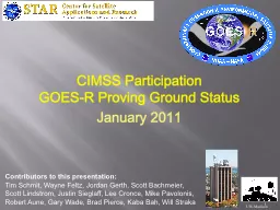

Presentation Transcript

Slide1

GOES-R Proving GroundNASA/SPoRT Update

2009 Planning Meeting, Boulder, CO

Slide2

SPoRT Plan Outline – 2009/10Overview of planned contributions

Transition and Evaluate GOES-R ABI proxy data/products produced by other members of Proving Ground Team to SR WFOs

Improve the display of LMA data in AWIPS

Risk Reduction via GLM proxy data

Development of multi-channel and composite products and displays to meet forecast needs

Apply lightning algorithm to WRF-ABI simulation

Assimilation of real and proxy data in modeling

Slide3

Transition EffortsMatch products to problemsMake PG products available to forecasters in their DSS

Developing and implementing product training

Conduct assessment on utility of product in operations

Document usefulness of product to address specific forecast need

This is the

SPoRT

paradigm.

Recent examples of transitioned products include MODIS SST and Fog products, GOES aviation products, and CIRA TPW.

Slide4

Forecast Problem

Proxy

Data / Source

Product(s)

Diagnosing changing weather

ABI / TBD

High resolution imagery and derived products

Diagnosing low clouds and fog ABI / SPoRTEnhanced channel difference imageryLocal temperature forecastsABI / SPoRTLand surface temperatureVisibility reductions due to smoke and fire weather supportABI / CIMSS-SPoRTColor composites, active fires and burn areasLead time for severe weatherGLM, WRF / AWGTotal lightning products, WRF lightning threatSea breeze impactABI / SPoRTLocal model forecasts initialized with surface parameters and SSTsDiagnosing severe weather and heavy precipitationABI / CIRA-SPoRTBlended total precipitable waterConvective weather forecastsABI / CIMSS-SPoRTLocal modeling initialized with vegetation parameters and SSTs, and assimilated cloud-tracked wind fieldsRegional precipitation forecasts and off shore weatherABI / CIMSS-SPoRTT(p), q(p), 3D fields of met. variables from model forecasts improved with radiances or profile information

SPoRT

South/Southeast Focus for GOES-R Products

Slide5

SPoRT South/Southeast Focus for GOES-R Products

Diagnosing changing weather

Diagnosing low clouds and fog

Local temperature forecasts

Visibility reductions from smoke and fire weather

Lead time for severe weather

Sea Breeze Impact

Diagnosing severe weather and heavy precipitationConvective weather forecastsRegional precipation forecasts and off shore weatherABI – high res. Imagery and derived productsABI – enhanced channel difference imageryABI – Land Surface TemperatureABI – Color Composites, active fires and burn areasGLM – Total lightning, and lightning threatABI – Local models initialized with sfc parameters and SSTABI – Blended TPWABI – Local modeling initialized with veg. parameters, and SSTs, and assimilated cloud track windsT(p), q(p), 3D fields of met. Variables from model forecasts improved with radiances or profile informationForecast IssuesRelevant GOES-R product/data

Slide6

Contributed Expertise

From proxy data sets by PG and AWG teams that mimic GOES-R instruments…….

Multi-channel

True Color, False Color, Fog

Composites

SST from simulated ABI – Impact difference from MODIS?

Lightning Threat

Facilitate GLM proxy data usage in severe weatherApply McCaul algorithm to ABI-WRF 2km domainAssimilation of Real and Proxy Data in ModelsABI simulated T and q profile assimilation (compare to AIRS/CrIS)ABI proxy data (MODIS LST, veg.) in coupled WRF-LISPartnershipsHUN, ESSC, GLM AWG membersNASA Goddard GMAO, JCSDA

Slide7

GLM Proxy Product from LMA data

Can applications from LMA still be used with reduced resolution of GLM?

Slide8

Updraft Intensifies

Vortex

Spin-up

Notice intra-cloud and CG trends before the tornado touchdown

Intra-cloud shows clear trend

Cloud-to-ground is steady

Correlates with:

Storm updraft strength Incipient severitySource density “jump” noted in advance of many severe weather occurrencesGLM?What is the Practical Benefit?

Slide9

WRF-based Forecasts of Lightning Threat

E

.

McCaul

, USRA, and S. Goodman, NOAA

GOALS

To apply the

McCaul et al lightning forecast algorithm to CAPS WRF ensembles to examine robustnessAPPROACH apply lightning algor. to some prototypical event modify calibrations using NALMA data, if needed examine scale sensitivity of the two threat fields examine statistical envelope of inferred lightning RECENT RESULTS- Completed first-pass analysis of CAPS WRF ensemble fields for 2 May 2008Threat1 (based on graupel flux) more scale sensitive than VII; LMA data uncertain (range)FUTURE WORK- Apply technique to additional dates to confirm preliminary findings for storms closer to LMA- Extend technique to analysis of CIMSS ABI WRF hemispheric simulation of 4 June 2005 event Sample 24 hr LTG forecast

Slide10

Evaluation of Products

Key to success

Sustained interaction between developers and end users facilitated by PG teams for the purpose of training, product assessment, and obtaining feedback

Type of methods to engage users

Site visits and presentations

(8 last year outside of HUN)

Distance-learning modules with GOES-R proxy product impacts to specific forecast problems

WES CasesRegular coord. telecons (Q&A and feedback opportunity)Online surveys (comparable, metric oriented)Blog posts (peer influence, visual, relevant)

Slide11

Data

in AWIPS II

Lightning Mapping Array Observations

18 February 2009 – 2306 UTC

AWIPS

AWIPS II

Displaying source densities

Using GRIB format Combined with radarHave physical side-by-side comparison of AWIPS versus AWIPS IILessons learned to be applied to other SPoRT products

Slide12

Magnitude Comparison

AWIPS

~86 sources

AWIPS II

~113 sources

Slide13

Benefits

to the Proving Ground

Radar

NALMA

SPoRT’s

efforts to ingest products into AWIPS II are preparing for the future of visualization by NWS

Lessons learned can be applied directly to GOES-R Lightning Mapper SPoRT is developing expertise with AWIPS II (future McIDAS plug-in)

Slide14

Updrafts

SPC Spring Program Activities with GOES-R PG

Training for source density product

SPoRT

and the Lightning Group are providing expertise in total lightning

Provide training to personnel

Visits by SPoRT staff to SPC and Experimental Warning Program

Real-time total lightning data from three networks will be providedNorth Alabama Lightning Mapping ArrayWashington DC Lightning Mapping ArrayKennedy Space Center Lightning Detection and Ranging II NetworkData Flow to SPC

Slide15

Summary

Transition and evaluation of proxy products from PG members to forecast issues of S/SE WFOs

Contribute expertise on total lightning in operations based on

partnerships with AWG and RR and past work over several years with WFOs within the NALMA

Use of proxy data for multi-channel or composite product development, as needed for S/SE

fcst

issues

Lightning threat forecast product from WRF-ABI runUse both real and proxy data to understand impacts of data assimilation / model initialization