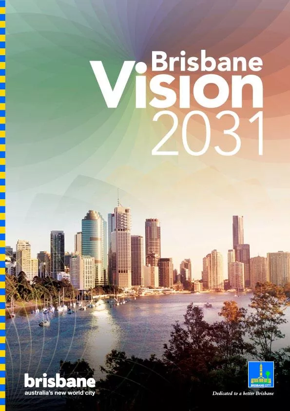
/
Brisbane City Plan 2000—Volume 1 Brisbane City Plan 2000—Volume 1

Brisbane City Plan 2000—Volume 1 - PDF document

briana-ranney
briana-ranney . @briana-ranney
Follow
383 views
Uploaded On 2017-11-22

Brisbane City Plan 2000—Volume 1 - PPT Presentation

Chapter 4 page 206aRacecourse Precinct Neighbourhood PlanRacecourse Precinct Neighbourhood Plan1 Local Plan under the City Plan It contains specific additional neighbourhood planning requirements ID: 607387

Chapter page 206aRacecourse Precinct

Share:

Link:

Embed:

Download Presentation from below link

Download Pdf The PPT/PDF document "Brisbane City Plan 2000—Volume 1" is the property of its rightful owner. Permission is granted to download and print the materials on this web site for personal, non-commercial use only, and to display it on your personal computer provided you do not modify the materials and that you retain all copyright notices contained in the materials. By downloading content from our website, you accept the terms of this agreement.


Presentation Transcript

Brisbane City Plan 2000—Volume 1 Chapter 4, page 206aRacecourse Precinct Neighbourhood PlanRacecourse Precinct Neighbourhood Plan1 Local Plan under the City Plan. It contains specific additional neighbourhood planning requirements. 2.1 remain as racecourses and racing facilities are upgraded to world class standards by incorporating a mix of residential and retail on select areas surplus 2.2 racing in South East Queensland and elements diminish as new stables are established within the balance the citywide strategic importance of Farm and Doomben Racecourses, where impacts can be best managed and access to public transport cafe/dining activities. The Racecourse Precinct area’s proximity to the Brisbane Airport also esidential streets present a strong traditional character by retaining pre–1946 houses. New houses, extensions to houses and multi-unit pre–1946 traditional building character where located within a Demolition Control Precinct. Pre–1946 commercial buildings are protected and Higher density residential development is located character and provides noise mitigation, including for aircraft, rail and road traffic noise. Buildings are climate and maximise energy efficiency, including 2.8 The efficiency and function of infrastructure measures and innovative, integrated water urban design, to protect downstream environments from stormwater quality and quantity impacts. Brisbane City Plan 2000—Volume 1 Chapter 4, page 206bRacecourse Precinct Neighbourhood Plan3 Precinct intentsRefer to Map A—Precincts and Table 4. 3.1 The Racecourse Road centre remains the focus of Precinct. Racecourse Road consolidates its role as the built form with active frontages, awnings and shade between the northern and southern gateways to the Centre activities are the preferred land use in the precinct. A mix of active uses at ground level such as shops, offices, cafes and services contribute to a scale commercial offices and multi–unit dwellings are of health care, child care, gyms and short term street. The adaptive reuse of these buildings as part of precinct to provide a human scale to the street while also density residential areas. The maximum building height contribute to the traditional building character of the precinct. Impacts on adjoining residential areas are development sites in the precinct that rationalise vehicle Pedestrian and cyclist movement along Racecourse Road is given priority. Driveway crossovers to Racecourse Road and Kingsford Smith Drive are limited to achieve a safe and continuous pedestrian spine. Additional access to Racecourse Road or Kingsford Smith Drive is not supported. Access for car parking and servicing is via side streets and shared where possible. Car Artwork and entrance features will reinforce the of racing and spectator facilities to international standards and development of new higher density mixed use development and community facilities. This term vision for the racecourses through a structure plan that shows: racing land uses and ancillary uses cycle access and connectivity, heritage and view The cultural heritage significance of Eagle Farm Racecourse is important for its contribution to the development of the racing industry in Queensland. gardens and significant trees, will continue to be protected and buildings will be encouraged to be parking areas, located infield of each track, will be developed to attract and accommodate event visitors and to minimise impacts on the surrounding neighbourhood. These facilities and amenities may be multi–purpose concerts and festivals, occurring on both courses outside It is envisaged that 19ha of land over Eagle Farm and Doomben Racecourses will be developed for a range of land uses. New development will embody precinct. Development density, height and land use will the current or future operations of Brisbane Airport. and passive recreation open spaces. The privately owned McGill Avenue, Lancaster and Kitchener Roads, is to Eagle Farm Racecourse site fronting Nudgee Road, will be obtained through development infrastructure contributions. Community facilities including the bowls club and scout hall are retained for community Brisbane City Plan 2000—Volume 1 use. Additional community recreation facilities are The intent of the precinct is captured in the following associated facilities of international standard as well as public parkland. Building heights will be a maximum of This sub–precinct caters for mixed use residential, retail, commercial uses and parkland although the predominant commercial uses and the weekly shopping needs of residents. Development of a supermarket is not required sub–precinct. The supermarket is to form part of a single building, preferably in a podium level, so that it the immediate residential population, including health connects to Nudgee Road with an upgraded intersection including the bowls club and SES facility are also retained and improved. Additional community recreation facilities are encouraged. The sub–precinct also provides for some residential development, including short term Direct vehicle access onto Nudgee Road from this Sub–precinct 2(d)—Doomben Racing and The sub–precinct retains a horse racing venue and ancillary racing facilities as well as providing community heights will be up to a maximum of 1 storey and 7.5m. This sub-precinct contains uses that minimise residential and complement the scale of surrounding residential The sub–precinct caters for low key activities that support the horse racing industry as well as stables for community based equestrian activities, subject to adequate landscape screening and setbacks to residential development. facilities, including racing day stalls and grandstand. inside of the 20 Australian Noise Exposure Forecast Street. Direct vehicular access to Nudgee Road is not supported. Development must ensure safe and convenient public access is provided to public recreation areas, including horse riding spaces, within the grounds Development in this sub–precinct, west of Brassey setback from Nudgee Road and Hampden Street. provides a transition between the high–rise development scale residential development north of Allen Street. The of Allen Street is managed with transitions in height and density development. Short term accommodation is desirable for travellers, given the location’s proximity to other destinations via the arterial road network. character by providing significant rear building setbacks and vegetated screening to lots fronting Allen Street and Brisbane City Plan 2000—Volume 1 In addition to residential developments (multi–unit dwellings and short term accommodation), offices are appropriate in sub–precinct 3(a) given the high Smith Drive. The location of retail activities in the roads and direct access is not supported. Alternative Development must not compromise future upgrades of Kingsford Smith Drive and Nudgee Road. Any buildings, structures, fixtures and landscaping associated with development must be located outside the area required for the upgrading of Nudgee Road and This sub–precinct supports the expansion of residential uses including short term accommodation. The sub–precinct may also support multi–unit dwellings. for new development where possible. Development site Streets is via a single crossover and is shared where A preliminary approval may change the level of The trigger for assessment in the level of assessment (associated with a use or structure specified in the level Precinct 2—The Racecourses [including all sub–precincts 2(a)–2(e)] Self AssessmentApplicable Codes1. Outdoor Lighting where complying with the Acceptable Solutions in the Light Nuisance Light Nuisance Code2. Park where complying with the Acceptable Solutions in the Park CodePark Code3. Outdoor Sport and Recreation Code (excluding a church)Community Facilities Code Demolition or removal in the Demolition Control PrecinctDemolition Code3. Operational work for Filling or ExcavationFilling and Excavation Code4. Building work (including demolition) on a Heritage Place or within a Heritage Precinct (1)Heritage Place Code5. Building work, operational work or or a Heritage Precinct (1)Heritage Place Code6. Outdoor Sport and RecreationOutdoor Sport and Recreation Code7. Satellite Dish (where not exempt development)Satellite Dish CodeEffective 10 May 2013 Brisbane City Plan 2000—Volume 1 Chapter 4, page 206eRacecourse Precinct Neighbourhood Plan Impact AssessmentRelevant CodesGenerally appropriate1. Centre Activities (except Display and Sale Activities, Garden Centre, Nightclub, Service Station) or Warehouse (where Racecourse Precinct Neighbourhood Plan Code, 2. Stable that is in accordance with a structure plan that has been adopted in accordance with Racecourse Precinct Neighbourhood Plan Code, 3. Reconfiguring a lot, including Volumetric Subdivision that is in accordance with Racecourse Precinct Neighbourhood Plan Code, 4. Building work, operational work or Heritage Place or within a Heritage Precinct (1) Racecourse Precinct Neighbourhood Plan Code and Generally inappropriate1. Demolition or removal of a Heritage Place or within a Heritage PrecinctHeritage Place Code2. Any other material change of use that is not in accordance with a structure plan that has been approved in accordance with the (1) If an application for development of a Heritage Place or within a Heritage Precinct, or of land adjoining a Heritage Place or of assessment trigger, and both sets of specified Codes 4.2 Kingsford Smith Drive Precinct (3) [sub–precinct (a)]—Kingsford Smith Drive West Self AssessmentApplicable Codes1. Racecourse Precinct Neighbourhood Plan Code and Brisbane City Plan 2000—Volume 1 Chapter 4, page 206fRacecourse Precinct Neighbourhood Plan Code AssessmentApplicable Codes1. Racecourse Precinct Neighbourhood Plan Code, Centre Amenity and Performance Code and Centre Centre Activities (except Medical Centre, Multi–unit Dwelling, Office or Short Term Accommodation) Racecourse Precinct Neighbourhood Plan Code, Centre Amenity and Performance Code and Centre 4.3 Kingsford Smith Drive Precinct (3) [sub–precinct (b)]—Kingsford Smith Drive East Code AssessmentApplicable Codes1. Racecourse Precinct Neighbourhood Plan Code and Short Term Accommodation where complying with the acceptable solutions Racecourse Precinct Neighbourhood Plan Code and Effective 10 May 2013 Brisbane City Plan 2000—Volume 1 Chapter 4, page 206gRacecourse Precinct Neighbourhood Plan5 his Code provides additional and/or alternative with a Code in Chapter 5, the Performance Criteria and Acceptable Solutions in this Neighbourhood Plan Code The purpose of this Code is to ensure development in the General Performance CriteriaAcceptable SolutionsMovement and connectivity P1 ‡FRQWULEXWHV domain by providing a streetscape and building interface with a strong pedestrian blend indoor and outdoor spaces identity of each precinct and sub–precinct domain through the selected palette of A1.1 ‡6XEWURSLFDO centre – 3.75m ‡/RFDOLW\ A1.2 Where the existing footpath width is less than that required in A1.1, a linear land A1.3 Development provides for awnings, street P2 Development provides for the widening of A2 Development dedicates land for new roads, Map G—Streetscape Hierarchy and Road Widening/ImprovementsDevelopment adjoining an operational rail corridor P3 Where located on land that is affected by environmental emissions generated by an Note: Sensitive development is defined as child care A3 No Acceptable Solution prescribedEffective 10 May 2013 Brisbane City Plan 2000—Volume 1 Chapter 4, page 206hRacecourse Precinct Neighbourhood Plan Protection of Operational Airspace P4 Aircraft safety in operational airspace is maintained Temporary or permanent physical obstructions A4.1 Buildings, structures and landscaping are Map E—Operational AirspaceA4.2 Uses involving temporary or permanent P5 Emissions do not adversely impact on air A5 None of the following is emitted from the 4.3m per second Note: Plume rise assessments are to be conducted in accordance with the Civil Aviation Safety P6 External lighting does not adversely impact on A6.1 Lighting does not distract or interfere with A6.2 Lighting does not imitate the format of Note: Compliance may be demonstrated with P7 Wildlife, particularly flying vertebrates such as A7 Potential food/waste sources are covered 5.2 Where involving new building work, other than industry Performance CriteriaAcceptable SolutionsBuilding design for aircraft noise attenuation P8 Buildings are designed and constructed to attenuate aircraft noise to protect the amenity, A8.1 Residential uses (including aged care A8.2 Other buildings located within the AS2021 Acoustics—Aircraft Intrusion—Building Siting Performance CriteriaAcceptable SolutionsEffective 10 May 2013 Brisbane City Plan 2000—Volume 1 Chapter 4, page 206iRacecourse Precinct Neighbourhood Plan5.3 Where in Precinct 1—Racecourse Road Performance CriteriaAcceptable SolutionsBuilding height P9 Building height is consistent with the height of adjoining development and preserves the A9 The maximum height of buildings and Map B—Racecourse Road PrecinctBuilding siting and design P10 Development is of a bulk and scale that: suburban centre in the citywide context terms of its height and setbacks A10 The maximum gross floor area complies with Table 1—Maximum Gross Floor AreaP11 Building siting and design in the precinct: setback) and character of existing buildings in Racecourse Road street design ‡SURYLGHV of the street to improve safety maximise pedestrian comfort and accessibility properties including by vegetated buffersA11.1 Buildings incorporate elements of A11.2 The ground floors of buildings are built to A11.3 Above ground, buildings are set back 3m A11.4 Buildings are set back a minimum of 6m A11.5 Above ground, buildings are set back a A11.6 Balconies and openings are provided A11.7 Awnings are provided to the Racecourse P12 A mix of active uses at ground level contributes A12.1 Active uses such as shops, offices and A12.2 Where a building contains residential uses, P13 Vehicle access, servicing and carparking building line site and streetscape A13.1 Vehicular access is not provided from Racecourse Road or Kingsford Smith Drive A13.2 There is no net increase in driveway Effective 10 May 2013 Brisbane City Plan 2000—Volume 1 Chapter 4, page 206jRacecourse Precinct Neighbourhood Plan Performance CriteriaAcceptable Solutions A13.3 Common access driveways, carparking and servicing areas are created where possible A13.4 Carparking and servicing areas are located at A13.5 Driveway crossovers maintain the integrity, 5.4 Where in Precinct 2—The Racecourses [including all sub–precincts 2(a)–2(e)] Performance CriteriaAcceptable SolutionsP14 All proposals in the Eagle Farm and Doomben A14.1 The application accords with an adopted ORA14.2 The application contains a Structure Plan P15 The Structure Plan establishes an integrated long remain the principal foci for metropolitan horse racing in South East Queensland class urban racing precinct that is sympathetic ‡0D[LPXP ‡'HYHORSPHQW gross floor area in Table 3—Precinct 2 (The Racecourses) and does not materially impact on A15 No Acceptable Solution prescribedEffective 10 May 2013 Brisbane City Plan 2000—Volume 1 Chapter 4, page 206kRacecourse Precinct Neighbourhood Plan ‡7KH racecourses area, buildings (including heritage grandstands, federation–style ticket office, constructed with transparent materials for the important views and vistas within and to/from ‡'HYHORSPHQW (including servicing and car parking), stormwater can be provided to meet the needs the Brisbane Airport is protectedWildlife Management in Open Space and Water Design P16 Landscaping, including water features, is designed to minimise wildlife hazards for aircraft Design and construction of water features Edges and substrates of water bodies inhibit Vegetation is planted throughout water bodiesA16 Landscaped open spaces and water features constructed to be free–draining bodies limits the surface area of open water bodies and does not involve the Performance CriteriaAcceptable SolutionsEffective 10 May 2013 Brisbane City Plan 2000—Volume 1 Chapter 4, page 206lRacecourse Precinct Neighbourhood Plan Performance CriteriaAcceptable Solutions ‡2SHQ with tall rushes (e.g. Schoenoplectus validis) to achieve an overall macrophyte constructed with steep sides of at least rocks adjacent to or within water bodies with dense low–growing vegetation that Stormwater Quality and Quantity Management P17 Downstream environments are protected from stormwater quality and quantity impactsA17.1 Stormwater management solutions are A17.2 Any constructed open water features 5.5 Where in Sub–precinct 3(a)—Kingsford Smith Drive West or Sub–precinct 3(b)—Kingsford Smith Drive East Performance CriteriaAcceptable SolutionsGross floor area P18 Development is of a bulk and scale that fits comfortably on the site and in the street in terms A18 The maximum gross floor area complies Table 1—Maximum Gross Floor AreaBuilding height P19 Building height is consistent with the height of adjoining development and preserves the A19 The maximum height of buildings and Table 2—Maximum Building HeightP20 Building setbacks protect the character, privacy residential areas by stepping down in height and scale at site boundaries does not create an overbearing appearance A20.1 For development with a side or rear A20.2 For development across a street from a residential area not within the sub–precinct, Effective 10 May 2013 Brisbane City Plan 2000—Volume 1 Chapter 4, page 206mRacecourse Precinct Neighbourhood Plan Access, parking and servicing P21 Vehicle access, servicing and car parking structures are designed and located: site and streetscape pedestrians and cyclists A21.1 There is no net increase in driveway crossovers on Kingsford Smith Drive A21.2 Common access driveways, carparking and A21.3 Car parking and servicing areas are located A21.4 Driveway crossovers maintain the integrity, P22 Vehicular access is not provided from arterial A22 Vehicular access is not provided from Building siting and design P23 Development design and layout must not compromise future road upgrades A23 Buildings, structures, fixtures and 5.6 Where in Sub–precinct 3(a)—Kingsford Smith Drive West Performance CriteriaAcceptable SolutionsBuilding siting and design P24 Building siting and design in the precinct: setback) and character of existing buildings ‡SURYLGHV of the street to improve safety maximise pedestrian comfort and accessibility and maintains the tree–lined streetscape properties including by vegetated buffersA24.1 The ground floor of buildings are built to A24.2 Above ground, buildings are set back 6m A24.3 Buildings are set back a minimum of 6m A24.4 Above ground, buildings are set back a A24.5 Balconies and openings are provided A24.6 Awnings are provided to the Kingsford A24.7 Buildings with a frontage to Allen Street are Performance CriteriaAcceptable SolutionsEffective 10 May 2013 Brisbane City Plan 2000—Volume 1 Table 1—Maximum Gross Floor Area (Precinct 1—Racecourse Road and Precinct 3—Kingsford Sub–precinct 3(a) Kingsford Smith Drive West1.25 times the site area for sites less than 1,200mSub–precinct 3(b) Kingsford Smith Drive East0.8 times the site area for sites less than 1,200m Sub–precinct 3(a) Kingsford Smith Drive West4 storeys and 14m, west of Seymour Road Sub–precinct 3(b) Kingsford Smith Drive East5 storeys and 15mTable 3—Precinct 2 (The Racecourses) Sub–precinctPrimary land usesOther potential ‡QR ‡QR ‡ development located more than 20m from ‘Building Transition Area’ (Map Effective 10 May 2013 Brisbane City Plan 2000—Volume 1 Chapter 4, page 206oRacecourse Precinct Neighbourhood Plan ‡ ‡ ‡ ‡ ‡ ‡ ‡ (1) Where a development is located on a street or road that is subject to a road widening requirement, the new property alignment, post widening, is regarded as the street front property boundary Sub–precinctPrimary land usesOther potential Brisbane City Plan 2000—Volume 1 Chapter 4, page 206pRacecourse Precinct Neighbourhood PlanTable 4—Racecourse Precinct Neighbourhood Plan Precincts Precinct numberPrecinct namePrecinct boundary descriptions Brisbane City Plan 2000—Volume 1 Chapter 4, page 206q 2 2 2 EN LANCASTER RD URE ST R GATEWAY MWY LA HAMPDEN ST RACEVIEW AVE S HANTS ST IE LONG ST IL NE ST ST S HILDA ST S OU SCHOOL ST EERD S SSE ST ONSL ST RM S MAGDALA ST S GATEWAY MWY O’SULLIVAN ST IN KINGSFORD SMITH DR NUDGEE RD 2 1 2 3 3 2 Map A: Precincts Neighbourhood Plan boundary Precinct boundary 2Railway Station cecoceco HendraStation AscotStation DoombenStation RACECOURS RACECOURS Racecourse Precinct Neighbourhood PlanEffective 10 May 2013 Brisbane City Plan 2000—Volume 1 Chapter 4, page 206r 4 4 4 4 4 3 4 4 4 4 4 3 3 3 3 3 5 LETENSCEWHENT Neighbourhood Plan boundary Precinct boundary mum Map Racecourse Precinct Neighbourhood PlanEffective 10 May 2013 Brisbane City Plan 2000—Volume 1 Chapter 4, page 206s LA RHEIL S SIL SLEIN SLO S T S S SOR SSTABE S SIN S R SD S 5*20* 17.5 1545 7 25 828 520 5 202(a)2(d)2(b)2(e)2(c)2(a) Map C: The Racecourses Precinct hbourhoodbounda ounda bounda ximum ildin gle ng andximum andsmaximum building heighand Racecourse Precinct Neighbourhood PlanEffective 10 May 2013 Brisbane City Plan 2000—Volume 1 Chapter 4, page 206t ALLEN ST KENT ST OXFORD ST BEATRICE TCE NUDGEE RD WINCHESTER ST WINDSOR ST BALOWRIE ST KINGSFORD SMITH DR COLLEGE ST SEYMOUR RD JACKSON ST 5 5 5 4 Neighbourhood Plan boundary Precinct boundary Sub-precinct Boundary³³çN( mum Map ord Brisbane River 3(a) 3(b) Racecourse Precinct Neighbourhood PlanEffective 10 May 2013