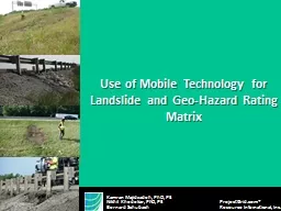
/
Use of Mobile Technology for Landslide and Geo-Hazard Ratin Use of Mobile Technology for Landslide and Geo-Hazard Ratin

Use of Mobile Technology for Landslide and Geo-Hazard Ratin - PowerPoint Presentation

calandra-battersby
calandra-battersby . @calandra-battersby
Follow
398 views
Uploaded On 2017-06-10

Use of Mobile Technology for Landslide and Geo-Hazard Ratin - PPT Presentation

Kamran Majidzadeh PhD PE Nikhil Khedekar PhD PE ProjectGridcom Bernard Schubach Resource International Inc Landslides cause public risk from 25 to 50 deaths ID: 558113

projectgrid hazard international rating hazard projectgrid rating international resource iicollector time com

Share:

Link:

Embed:

Download Presentation from below link

Download Presentation The PPT/PDF document "Use of Mobile Technology for Landslide a..." is the property of its rightful owner. Permission is granted to download and print the materials on this web site for personal, non-commercial use only, and to display it on your personal computer provided you do not modify the materials and that you retain all copyright notices contained in the materials. By downloading content from our website, you accept the terms of this agreement.


Presentation Transcript

Slide1

Use of Mobile Technology for Landslide and Geo-Hazard Rating Matrix

Kamran Majidzadeh, PhD, PE

Nikhil Khedekar, PhD,

PE ProjectGrid.com® Bernard Schubach Resource International, Inc. Slide2

Landslides cause public risk, from

25 to 50 deaths

annually

Impact on economy,

up to $2 billion in damages annuallyLimited fund in fixing highway slope failureDemand of an effective resource and asset management IntroductionSlide3

Study background

Rating/Management System

Year

ODOT Rockfall

Hazard Rating System (RHRS)1993ODOT Landslide Rating System2007WSDOT Unstable Slope Management System1991NYSDOT Rock Slope Rating System1988NYSDOT Rock Slope Rating System1992

UDOT Rockfall Hazard Inventory2002GIS Landslide Inventory Along Tennessee Highway2000INDOT Landslide Remediation Using Unconventional Methods1999Slide4

Ohio Hazard Rating

S

ystem

D

eveloped based on synthesis of ODOT in-house expertise and the existing systems of the other agenciesBased on an exponential scale system to heighten the severity of risk for each risk factor

Scores of 3, 9, 27, and 81 are assigned to four rating criteria for each risk factor Final hazard is a summation of the scores of six risk factors :  > 250    high hazard  150 <    < 250   moderate hazard  < 150   low hazardSlide5

Composite Numerical Hazard ScoreSlide6

Hazard Rating Matrix Category

Points 3

Points 9

Points 27

Points 81

Movement location/Impact

Impact on roadway

Low hazard on shoulder

Low hazard on roadway

Medium hazard on roadway

High hazard on roadway/structure

Impact on area beyond right of way

Low hazard on area beyond right of way

Moderate hazard on area beyond right of way

High hazard on area beyond right of way

High hazard on area beyond right of way/structure

Hazard to traveling public

Rate of displacement

< 1 in/year

1-3 in/year,

No single event > 1 in

3-6 in/year,

No single event > 3 in

6 in/year,

No single event > 3 in

Evidence of displacement

Visible crack or dip

<1 in of displacement

1-3 in of displacement

>3 in of displacement

Maintenance

Frequency

None to rare

Once a year

1-3 time/ year

> 3 time/ year

Response

No response

Periodic

maintenance

Routine

maintenance

Immediate maintenance

ADT

< 2000

2001 - 5000

5001 - 15000

> 15001

Decision sight distance (DSD)

>

90

89 < <

50

49 < <

35

< 34

Accident history

No accident

Vehicle or property damage

Injury

FatalitySlide7

Use of

iiCollector

TM

for

Landslide and Geo-Hazard Rating MatrixSlide8

ProjectGrid.com Web Based Solutions

An Award wining web-based solution for project and program management

Winner of Gold Software Enabler Award, Gold Technology Award &

IRF Global Road Achievement Award

ProjectGrid.com® iiCollectorTMCollaboration of Rii and Google Maps, API

iiCollector Mobile / Wearable Devices

Google Maps, API

Creates interactive maps and embodies the functionality of Google maps into ProjectGrid.com website and the mobile asset managerSlide9

Real Time Communication using Innovative Technology

iiCollector

Scheduled Inspections

Periodic Inspections

Owners

Document Control OperatorsComplianceGoogle Maps help to integrate field and office documentationSpecialty Inspections

Daily Safety Inspections

Continuous Surveillance

Corrective Action

Clients

Office Personnel

iiCollector

TM

Cloud

Project Grid

Field Operations

Reporting Deficiencies for Corrective Action

iiCollector

TM

Intelligent Integration of Office & Field

Office PersonnelSlide10

The

iiCollector

has Everything you Need for Data Collection

Intelligent integration of field and office documents

Real-time access to specifications and data as it is collected in the field

Interpretive software that analyzes and prioritizes dataAbility to integrate GIS data with other asset management systemsReal-time communication, sharing and data review among the project teamSlide11

iiCollector

TM

for TransportationAvailable Maintenance Categories

Pavements (Deterioration, Drop off and Obstruction)Guardrails, Impact Attenuator and End AssemblyDrainage (Ditches and Drainage Pipes)Planted SurfaceUnpaved ShoulderMedian

Pavement Surface CleanlinessVegetation ObstructionTraffic (Signs and Pavement Markings)Landslide (Geohazards)

Roadside Features Module 1

Structure (MSD walls, Noise walls, Barrier walls and Fences)*Rest Area (Plazas, Parking Lots)*Assets (Sidewalks, ADA Ramps, Curb and Gutters)Traffic (Overhead Signs and Traffic Control Device)

Light PolesCulvertsBridge Structures

Infrastructure Structural Assets, Module 2

* Available for single asset or multiple assets

** CustomizableSlide12

An Intelligent Integration of Office & Field

Asset inspection

Data condition collection

Data analysis and reports

Real-time access to relevant operational manuals, standards, specifications

Geo-hazard rating matrix, ASTM, DOTs, City, AASHTO, etc.Reports the status of maintenance and project managementAvailable for a single asset or multiple assetsCreates documents and reports Self audit, feedback and compliance reportsLandslides, Asset ID 1706452Slide13

Project Spotlight

Ohio Turnpike Landslide Assessment

ProjectGrid.com®

Resource International, Inc.

Rii performed a visual evaluation and rating of more than 40 embankment failure locations along the Ohio Turnpike using the

iiCollector.Project LinkSlide14

Project Demonstration

www.projectgrid.com

ProjectGrid.com®

A Resource International, Inc. CompanySlide15

iiCollector

TM for Wearable

Devices

ProjectGrid.com®

A Resource International, Inc. Company

Rii’s Information Technology Team is working to develop the iiCollectorTM on wearable devices to collect data more quickly and efficientlySlide16

What Others Are

Saying

“In

essence, the technology is playing a strong role in eliminating the lag time between when information is discovered and reported

.” – ConstrucTech Magazine July 2013“This technology promotes a paperless environment, significantly increases efficiency, and saves time and money with fewer communication bottlenecks, thus ensuring projects are completed on time and within budget.” – Construction Executive Tech Trends Magazine, April 2014

“This sounds like a great app, and something that [we] have looked favorably upon.” – Kathleen Bergeron, APRUSDOT, Federal Highway Administration

ProjectGrid.com®

Resource International, Inc.

iiCollector

VideoSlide17

Thank You

Mark Majidzadeh

Executive Vice President, CM

Resource International, Inc.

President, ProjectGrid.com®markm@resourceinternational.com www.ProjectGrid.comResource International, Inc.

Todd MajidzadehExecutive Vice President, TechnologyResource International, Inc.ProjectGrid.com® toddm@resourceinternational.com Bernard SchubachSr. Software EngineerResource International, Inc.ProjectGrid.com® bernards@resourceinternational.com Nikhil Khedekar, PhD, PEVice President, Engineering & PlanningResource International, Inc.nikhilk@resourceinternational.com