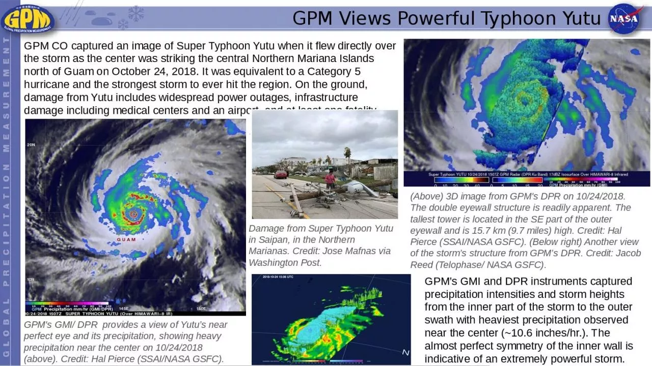
Yutu GPM CO captured an image of Super Typhoon Yutu when it flew directly over the storm as the center was striking the central Northern Mariana Islands north of Guam on October 24 2018 It was equivalent to ID: 1041995
Download Presentation The PPT/PDF document "GPM Views Powerful Typhoon" is the property of its rightful owner. Permission is granted to download and print the materials on this web site for personal, non-commercial use only, and to display it on your personal computer provided you do not modify the materials and that you retain all copyright notices contained in the materials. By downloading content from our website, you accept the terms of this agreement.
1. GPM Views Powerful Typhoon YutuGPM CO captured an image of Super Typhoon Yutu when it flew directly over the storm as the center was striking the central Northern Mariana Islands north of Guam on October 24, 2018. It was equivalent to a Category 5 hurricane and the strongest storm to ever hit the region. On the ground, damage from Yutu includes widespread power outages, infrastructure damage including medical centers and an airport, and at least one fatality.GPM’s GMI and DPR instruments captured precipitation intensities and storm heights from the inner part of the storm to the outer swath with heaviest precipitation observed near the center (~10.6 inches/hr.). The almost perfect symmetry of the inner wall is indicative of an extremely powerful storm. GPM's GMI/ DPR provides a view of Yutu’s near perfect eye and its precipitation, showing heavy precipitation near the center on 10/24/2018 (above). Credit: Hal Pierce (SSAI/NASA GSFC).(Above) 3D image from GPM's DPR on 10/24/2018. The double eyewall structure is readily apparent. The tallest tower is located in the SE part of the outer eyewall and is 15.7 km (9.7 miles) high. Credit: Hal Pierce (SSAI/NASA GSFC). (Below right) Another view of the storm’s structure from GPM’s DPR. Credit: Jacob Reed (Telophase/ NASA GSFC).Damage from Super Typhoon Yutu in Saipan, in the Northern Marianas. Credit: Jose Mafnas via Washington Post.