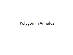
Chris Kimble NWS Gray ME Purpose Use GIS software to map a climatology of severe weather Where are the severe weather hot spots First in GYX Forecast Area Expanded to all of New England Problem ID: 440839
Download Presentation The PPT/PDF document "A Climatology of Polygon Warnings in New..." is the property of its rightful owner. Permission is granted to download and print the materials on this web site for personal, non-commercial use only, and to display it on your personal computer provided you do not modify the materials and that you retain all copyright notices contained in the materials. By downloading content from our website, you accept the terms of this agreement.
Slide1
A Climatology of Polygon Warnings in New England
Chris Kimble
NWS Gray, MESlide2
Purpose
Use GIS software to map a climatology of severe weather
Where are the severe weather hot spots?
First in GYX Forecast Area
Expanded to all of New EnglandSlide3
Problem
Reports of severe
weather do not fully
represent the spatial
extent of severe
weatherPopulation density a significant factorWarnings issued regardless of population
2014 Severe WX Reports
Wind Damage/Gust
HailSlide4
Methodology
Obtain polygon warnings from 2008-2014
http://
mesonet.agron.iastate.edu/lsr
Use GIS tool “fishnet” to create grid boxes
0.25 degree spacingCount number of warnings per boxMust repeat for each CWARepeat for SVR, TOR, FFW, SMWSlide5
Methodology
SVR Warnings
GYX - 2008Slide6
Methodology
GYX “Fishnet”
0.25 degreeSlide7
Methodology
SVR Warnings
GYX - 2008
Min – 0
Max – 18
1 18Slide8
Methodology
SVR Warnings
GYX – 2008 to 2014
Min < 3
Max – 64
Fewer at upstream CWA borders
1 64Slide9
Methodology
Are observed trends more a result of climatology or artifacts of CWA boundaries?
MUST EXPAND!
All of New England: 2008 to 2014
Repeat process for each CWA
Stitch it back together for regional perspectiveSlide10
Methodology
SVR Warnings
New England
2008 to 2014
Min < 5
Max > 95
3 100Slide11
Limitations
Polygon warnings only go back to 2008
Warnings are not entirely storm based, some political considerations are involved
County boundaries
Forecaster may consciously choose which to include
CWA bordersForecaster may NEVER issue warnings across CWA linesSignificant effect on frequency of warningsSlide12
Results: SVR Warnings
SVR Warnings
New England
2008 to 2014
More warnings in south and west
storm motion
surface wind
Fewer warnings in east and coast
3 100Slide13
Results: SVR Warnings
General reduction in frequency west to east
General increase in frequency north to south
Coastal influences cause local
minimums
Most frequent severe thunderstorm warnings:Western MassachusettsLeast frequent severe thunderstorm warnings:Cape Cod and islandsDowneast MaineSlide14
Results: FFW Warnings
FFW Warnings
New England
2008 to 2014
Max > 25
Min – 0
Max in hilly terrain
23
20
18
13
18
Max in inland urban areas
3 28Slide15
Results: FFW Warnings
New England
Topography
FFW Warnings
New England
2008 to 2014Slide16
Results: FFW Warnings
Northern and Western New England:
More FFW in mountainous areas
Southern and Eastern New England
More FFW in urban areas
Minimum in Cape Cod, islands, and MidcoastSome CWA disparityOKX and ALY issue more frequent FFWSlide17
Results: TOR Warnings
TOR Warnings
New England 2008 to 2014
Max – 8
1
8Slide18
Results: TOR Warnings
Rarity makes climatology difficult
Maximum in south central
MassachusettsSlide19
CWA Boundaries
Local minimum at upstream CWA border
Only upstream border suggests storm motion factor
Noticeable in all polygon warnings
Especially higher frequency warnings (SVR)
Typical warning process results in overwarningOverlapping polygonsPremature storm deathSlide20
Overlapping Polygons
CWA Border
Which area never has overlap?
Upstream CWA border!Slide21
Premature Storm Death
Overwarned
areaSlide22
Fortunate Storm Death
No warning issued
Upstream CWA
Downstream CWASlide23
CWA Boundaries
Upstream CWA border minimizes
overwarning
Areas downstream of a CWA border have fewer false alarms
At the possible expense of lead time
Within CWA overwarning occurs more oftenOverlapPremature storm deathSlide24
Solutions
Upstream CWA issues warning into downstream CWA
Minimizes the effect of CWA borders
Not realistic in current era
Minimize
overwarning within CWAAvoid large warnings in pulse environmentsMake use of county bordersDownstream County Removal (Kevin Laws – NWS BMX)
http://www.wdtb.noaa.gov/courses/SOTM/001-Nov14/player.htmlSlide25
Downstream County Removal
CWA Border
Overlap is minimized
Premature Storm Death minimizedSlide26
Downstream County Removal
Makes strategic use of county borders
Avoids overlap
Reduces premature storm death
Avoids alerting counties multiple times
EAS / NOAA Weather RadioNAWASReduces overall false alarm areaWarning duration should be long enough for storm to fully exit the countySlide27
Conclusions
Polygon warning frequency can provide insights into climatology
Reduces population bias
CWA boundaries cause artificial minimums
Result of natural
overwarning elsewhereCan be reduced by new warning techniquesSevere thunderstorms most common away from coastal influencesFlash floods most common in hills and citiesSlide28
Future Work
Expand to broader area
Do observed trends continue to appear?
Do new trends show up?
Maximum within ideal radar range?
Statistical adjustments to blend CWA bordersMore representative climatologyEffects of county boundariesEAS frequencySlide29
Acknowledgements/Questions?
Justin Arnott – SOO at GYX
Mike
Kistner
at GYX
Questions?