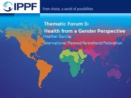
be monitored Africa regional workshop on the SEEA Jillian Campbell UN Environment Photo credit to be given as shown alongside in black or in white 2 Objectives NABUHolger Schulz ID: 724572
Download Presentation The PPT/PDF document "How will the 2030 Agenda" is the property of its rightful owner. Permission is granted to download and print the materials on this web site for personal, non-commercial use only, and to display it on your personal computer provided you do not modify the materials and that you retain all copyright notices contained in the materials. By downloading content from our website, you accept the terms of this agreement.
Slide1
How will the 2030 Agenda be monitored?
Africa regional workshop on the SEEA
Jillian
Campbell, UN EnvironmentSlide2
Photo credit to be given
as shown alongside
(in black or in white)
2
Objectives
©
NABU/Holger Schulz
Overview
Describe reporting
processes
Be
aware of the role of UN Environment in the
process
Provide an example of the link between land accounts, earth observation and ecosystem extentSlide3
The High-level Political Forum
The central platform for the follow up and review of the 2030 Agenda for Sustainable Development and the Sustainable Development Goals
Photo credit to be given
as shown alongside
(in black or in white)
3
SG's SDG Progress Report
UN Global Sustainable Development Goal database
The Secretary General’s Sustainable Development report
Analysis of global trends as provided by UN System
High Level Political Forum
National level statistics
National Sustainable Development Goal reporting
National level analysis
Economic and Social Council (ECOSOC)
Note: Regional reporting systems are still being developed.
Global reporting system
National reporting systemSlide4
Photo credit to be given
as shown alongside
(in black or in white)
4
GLOBAL Sustainable Development Goal Indicators:
81 Environment related SDGs
Plus:
Multilateral Environment Agreements and other initiatives (e.g. Biodiversity Indicators Partnership)
©
NABU/Holger Schulz
How will the 2030 Agenda be monitored?
REGIONAL Reporting:
A subset of the Globally Agreed Indicators along with Regionally Agreed Indicators
NATIONAL Sustainable Development Goal Reporting:
Based on Policy relevant national indicators with the aim to alignment with global and regional goalsSlide5
5
National data
A single SDG global database
How people may think SDG report
works
?
Indicator Reporting
I
nformation
S
ystemSlide6
6
The reality of SDG reporting:
SDG GLOBAL DATABASE (maintained by UNSD)
Harmonisation
and processing for international comparability
National
Data
The reality of SDG reporting:
UNODC
UNESCO
UNCTAD
…
World Bank
UN
Environment
SDG Custodian Agencies
ITU
ILO
FAO
WHO
OECD
UNISDR
U
N
SD
UNAIDS
UNICE
F
Indicator Reporting
I
nformation
S
ystemSlide7
Photo credit to be given
as shown alongside
(in black or in white)
7
©
NABU/Holger Schulz
National reporting
National monitoring should be based on national priorities and national contexts
The SEEA provides a framework for monitoring many of the environmental dimensions of development, including on the state of the environment, environmental trends, residuals and impacts.Slide8
Photo credit to be given
as shown alongside
(in black or in white)
8
©
NABU/Holger Schulz
The role of UN
Environment
UN
Environment is the custodian for 26
indicators.
Leading
methodological work and capacity building work on
these indicators. Ensuring full alignment with the SEEA.
Supporting across the SDG indicators to ensure coherence and to build capacity to monitor the environmental dimension of the SDGs. Slide9
8.4.1, 8.4.2,
12.1.1, 12.2.1, 12.2.2, 12.3.1, 12.4.1,12.4.2, 12.5.1, 12.6.1, 12.7.1, 12.a.1, 12.c.1
Sustainable consumption
and production, including
material flow accounts, chemicals and wastes, environmental policy, food waste and fossil fuel subsidies.
Water quality, water resource management, freshwater
ecosystems
Ocean related indicators on marine litter, acidification, marine management and coverage of protected areas
Protected areas, including mountains, and national targets for the Convention on Biological
Diversity
, and environmental protection expenditure
Environmentally sound technology and sustainable development policy
9
UN Environment Indicators
6.3.2, 6.5.1,
6.6.1
14.1.1, 14.2.1, 14.5.1
15.1.2, 15.4.1,
15.9.1
, 15.a.1 15.b.1
17.7.1, 17.14.1Slide10
M
aterial flow accounts, waste and food waste accounts
and fossil fuel
subsidies.
Water quality and freshwater ecosystem extent
Ocean related indicators on marine litter, acidification, marine management and coverage of protected areas
Protected areas, including mountains, and national targets for the Convention on Biological
Diversity
, and environmental protection expenditure
10
UN Environment
Indicators
– SEEA linkagesSlide11
Photo credit to be given
as shown alongside
(in black or in white)
11
©
NABU/Holger Schulz
Land
Accounting – Earth Observation –linkages with SDG 6.6.1 and other SDGsSlide12
Photo credit to be given
as shown alongside
(in black or in white)
12
©
NABU/Holger Schulz
Land accountingSlide13
Photo credit to be given
as shown alongside
(in black or in white)
13
©
NABU/Holger Schulz
Land cover
accounting example:
Example (6.6.1)
Note:
F
or illustrative purposes only.
2000
2015
A map is a collection of pixels (which can be counted
)Slide14
Photo credit to be given
as shown alongside
(in black or in white)
14
©
NABU/Holger Schulz
Turning a map into an accountSlide15
Photo credit to be given
as shown alongside
(in black or in white)
15
©
NABU/Holger Schulz
The data from the previous slide can be tabulated into statistics
Note:
F
or illustrative purposes only.
Tabluate
Area in
ArcMaps
(Spatial Analysis toolbox) was used to calculate the percentage for each type of land cover and then this was multiplied by the area of AfghanistanSlide16
Photo credit to be given
as shown alongside
(in black or in white)
16
©
NABU/Holger Schulz
Example continued
Note: for illustrative purposes only.
This is the result of the
ArcMaps
Tabulate Areas in percentage of area (with totals added)
How much land was water bodies in 2015 versus 2000 (in percent)?
Based on this table what land class did most water bodies become between 2000 and 2015
?
We can also bring protected areas into scope through this process.Slide17
Photo credit to be given
as shown alongside
(in black or in white)
17
©
NABU/Holger Schulz
Conclusions
High potential for using Earth Observation to produce an initial land cover map and land account.
There is still a need for ground
truthing
of information, particularly for the information to be useful for national policy making.
Greater resolution would be useful to catch smaller changes and to ensure that small water bodies and small ecosystems are captured. (A 30m CCI-LC should be public within the next year or so. Higher resolution data is available to purchase, but then there would be a need to convert images to land cover maps through direct analysis of satellite images.)Slide18
Thank you
Jillian Campbell
Statistician,
UN Environment
www.unep.org