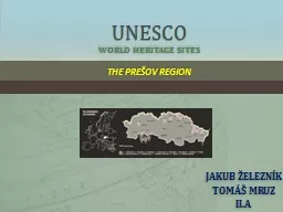
/
UNESCO WORLD HERITAGE UNESCO WORLD HERITAGE

UNESCO WORLD HERITAGE - PowerPoint Presentation

daniella
daniella . @daniella
Follow
343 views
Uploaded On 2021-01-28

UNESCO WORLD HERITAGE - PPT Presentation

Produced by Anna Abhazava Anna Medvedeva Natasha Demina Maria Abramova Alice Podchufarova Polina Volodina George Kolesnikov from Moscow Russia Secondary Comprehensive school 1497 grade 6 ID: 830518

delta sea world volga sea delta volga world level caspian water castle river heritage natural built unesco years pushcha

Share:

Link:

Embed:

Download Presentation from below link

Download The PPT/PDF document "UNESCO WORLD HERITAGE" is the property of its rightful owner. Permission is granted to download and print the materials on this web site for personal, non-commercial use only, and to display it on your personal computer provided you do not modify the materials and that you retain all copyright notices contained in the materials. By downloading content from our website, you accept the terms of this agreement.


Presentation Transcript

Slide1

UNESCO WORLD HERITAGE

Produced by Anna

Abhazava

, Anna

Medvedeva

, Natasha

Demina

, Maria

Abramova

, Alice

Podchufarova

,

Polina

Volodina

, George

Kolesnikov

from Moscow, Russia. Secondary Comprehensive school 1497, grade 6.

Slide2

Moscow

Russia

Slide3

St. Basil's Cathedral

The orthodox temple located in Red Square in Moscow. It was constructed in 1561 under Ivan the

Terrible's

decree in honor of a victory in war against the Kazan khanate. Now

Pokrovsky

Cathedral — State Historical Museum branch.

Slide4

St. Basil's Cathedral

Slide5

The Kremlin

The Kremlin is the most important sight of Moscow, the heart of the city. Moscow Kremlin was the first fortress constructed according to a new system of fortification. The towers were built in equal distance along the length of the wall. The Kremlin as a medieval castle was surrounded by water from all sides.

In its territory there are a lot of cathedrals and palaces. Nowadays, the Moscow Kremlin with all

t

he beauty of the palaces and cathedrals is a stunning sight. Today, all these cathedrals have been converted into museums.

Ivan the Great Bell Tower rises in the

centre

of the Kremlin. It unites all the Kremlin Cathedrals into a majestic ensemble.

Slide6

THE Kremlin

The Cathedral of

Assumption,

The Palace of Facets.

The Cathedral of Assumption was built by

Aristotile

Fioravante

, one the most skilful architects of his time specially invited from Italy.(1497) It served as the place of coronation of Russia’s czars. Another fine example of Russian architecture is the Palace of Facets. It was built in 1487-91. Russian czars received foreign ambassadors

t

here.

The cathedral of Annunciation is quite small, it was used as the private chapel of the royal family.

Slide7

The

Novodevichy

Convent

The

Novodevichy

Convent — an orthodox female monastery of the Russian Church in Moscow. The

Novodevichy

Convent was founded by the grand duke

Vasily

III in 1524 — in honor of the Smolensk icon of the Mother of God of "

Odigitriya

" — the main shrine of Smolensk, in gratitude for mastering Smolensk in 1514.

Slide8

The Novodevichy Convent

Slide9

Near Saratov. State, Province or RegionAstrakhkan

Region,

Kamyzyaksky

,

Ikryaninsky

and Volodarsky Districts. Name of Property

«The Volga Delta».

R

ussia

Slide10

Proposed Statement of Outstanding

Universal Value

The Volga Delta forms where the Volga – the great

Russian river – meets the Caspian Sea. The Caspian Sea is

the Earth’s largest landlocked water reservoir that has not

been connected to the sea in the modern geological

peri

-

od. The sea is characterized by rapid and significant water

level fluctuations accompanied by changes in the water

surface area and water volume. The average rate of the

most recent Caspian sea level rise was 100 times greater

than that of the

eustatic

global mean sea level rise; the

last Caspian sea-level cycle (1929-1995) has resulted in a 

3-meter water level drop.

The Volga Delta is the largest delta in Europe and oneof the world’s largest deltas. It is situated in the CaspianDepression, which is one of the lowest points on the Earth(27 meters below sea level). The Volga Delta bank andunderwater slope gradients are the lowest among large

river deltas throughout the world (less than 5 cm/km).

Slide11

Proposed Statement of Outstanding

Universal Value

The delta thereof has extremely complicated hydrographic

system and is characterized by an extensive

avandelta

(the subaqueous part of the delta) with depths of 1,5-2,5

meters that stretches 35-50 kilometer out into the sea.

River waters slowly flow down over a shallow

avandelta

off

to the sea and thus the zone of river and sea water mixing

is located several tens of kilometers away from the delta’s

marine edge. The total area of the Volga Delta (incl.

avan

-

delta) is over 20 000 square kilometers.

The Volga Delta has the most complicated hydro-

graphic network in the world. Approximately 900 water-ways reach the marine edge of the delta. That very tanglednetwork of channels and lakes in combination with richvegetation makes the landscape very peculiar. It also

makes the delta an oasis-looking area placed against a background of flat and monotonous, water- and vegeta-tion-lacking deserts and semideserts.

Slide12

Criteria under which inscription is proposed (and justification forinscription under these criteria)

The Volga Delta natural site is nominated for World Heritage status under the following criteria:

vii) Contains superlative natural phenomena or areas of exceptional natural beauty and

aes

-

thetic

importance.

Because of its mosaic structure where water landform elements (narrow and wide river channels, gulfs

and open water areas) are naturally combined with terrestrial landform elements (islands of different

size, shoals) and vegetation (gallery osier and reed beds, mace reed, wet meadows) the Volga Delta has an

low-key but very much aesthetically pleasant, pacifying landscape. However, during the blooming season

of the lotus (also called Caspian Rose) the delta has an eye-catching, magnificent look thanks to floating

carpets made of hundreds of splendid rose-colored flower buds.

viii) Outstanding examples representing major stages of earth’s history, including the record

of life, significant on-going geological processes in the development of landforms, or significant

geomorphic or physiographic features.

The Volga Delta is Europe’s largest river delta and one of the world’s biggest river delta systems. The

Volga River flows into the Caspian Sea, the Earth’s largest landlocked water body that is not connected tothe ocean in the present geological era.The history of the development of the Volga Delta is tightly connected with that of the Caspian Sea.

The Caspian Sea level fluctuations are much higher in frequency and amplitude than those of the globalsea level. The Caspian Sea level has reached its maximum highstand of +50 m AMSL in the Upper Pleisto-cene and was at its minimum lowstand of – 110 m AMSL in the Early Holocene. The average amplitude ofsea-level fluctuations was found to be about 25 meters in the late-Holocene sea level cycle (about 2 500years long) and about 3 meters in the instrumental observation period (i.e. during the last 150 years).

Over the course of its geologic history, the Volga Delta changed its location in connection with the

Caspian sea level changes, and the delta migrated hundreds of kilometers north and south.

Slide13

The Caspian sea

The causes of cyclic changes in the Caspian sea level

still stay unclear but most scientists believe that they

are caused mainly by climate change. The Volga provides

most of the Caspian fresh water inflow that increases with increasing precipitation in the Volga Basin.

In the recent decades, the Caspian Sea coast has been

drawing the attention of scientists in relation to global

environmental changes. Global warming has sped up

sealevel

rise that has resulted in coastal line changes. The

forecast of the impact on the coastal ecosystems is

dif

-

ficult

because of a slow rate of the sea level growth (by 13

centimeters in the 20-th century). The average rate of

themost

recent Caspian sea level rise was 100 times greater than that of the eustatic global mean sea level rise.In connection to this, the Caspian Sea is an importantnatural laboratory to study short-term sea level fluctua

-tions and their effects on a coastal zone (Kroonenberg etal., 2000). The Caspian Sea provides a unique chance tomonitor in natural conditions the mechanism of responseof the coastline to water level rise and to use the obtainedinformation further to build and test different forecastmodels.

Slide14

The Volga Delta

The modern Volga Delta bank and underwater slope

gradients are the lowest among large river deltas through-

out the world (less than 5 cm/km). As a result, the delta

has an extremely complicated hydrographic system that

includes large distributary channels, smaller waterways,

er

-

iks

(narrow channels less than 30 meters in width),

ilmens

(small lakes) and isolated bays (

kultuks

). The delta also

possesses an extensive

avandelta

(subaqueous part of the

delta) with depths of 1,5-2,5 meters that stretches 35-50kilometer out into the sea. River waters flow down slowlyover a shallow avandelta off to the sea and thus the zoneof river and sea water mixing is located several tens of ki-lometers away from the subaerial delta sea edge. The total

area of the Volga Delta (incl. the avandelta) is over 20 000square kilometers. The entire Volga River mouth area oc-cupies 120 000 square kilometers (Mikhailov, 1997).Therefore, the Volga Delta as a world scale uniquenatural property notably different from any of existingWorld Heritage river delta sites. The distinctive featuresof the Volga Delta are as follows: huge size, vast

subaque

-

ous

part of the delta (

avandelta

), the zone of river

andsea

water mixing that is moved tens kilometers off to

the sea, remarkably complicated hydrographic network, a 

very indented coastline, plenty of islands, high velocity

of natural processes influenced by rapid Caspian sea level

fluctuations.

Slide15

The Volga Delta

The Volga Delta forms where the Volga – the great

Russian river – meets the Caspian Sea. The Caspian Sea is

the Earth’s largest landlocked water reservoir that has not

been connected to the sea in the modern geological

peri

-

od. The sea is characterized by rapid and significant water

level fluctuations accompanied by changes in the water

surface area and water volume. The average rate of the

most recent Caspian sea level rise was 100 times greater

than that of the

eustatic

global mean sea level rise; the

last Caspian sea-level cycle (1929-1995) has resulted in a 

3-meter water level drop.

The Volga Delta is the largest delta in Europe and one

of the world’s largest deltas. It is situated in the CaspianDepression, which is one of the lowest points on the Earth(27 meters below sea level). The Volga Delta bank andunderwater slope gradients are the lowest among largeriver deltas throughout the world (less than 5 cm/km).The delta thereof has extremely complicated hydrographic

system and is characterized by an extensive avandelta(the subaqueous part of the delta) with depths of 1,5-2,5meters that stretches 35-50 kilometer out into the sea.River waters slowly flow down over a shallow avandelta offto the sea and thus the zone of river and sea water mixingis located several tens of kilometers away from the delta’smarine edge. The total area of the Volga Delta (incl. avan-delta) is over 20 000 square kilometers.

The Volga Delta is a unique natural property possessing

outstanding universal value and therefore is worthy of in-

scription

on to the World Heritage List. Despite of showing

resemblance in some characteristics to other large river

delta systems, the Volga Delta as a natural complex is no-

tably

different from any of existing World Heritage sites.

The distinguishing features of the Volga Delta are as

follows: huge size, extensive subaqueous part of the delta

(

avandelta

), the zone of river and sea water mixing that is

moved tens kilometers off to the sea, remarkably

compli

-

cated

hydrographic network, a very indented coastline, plenty of lakes, high dynamics of natural processes due torapid Caspian Sea level fluctuations. Expansive lotus fields

add a special charm and peculiarity to the Volga Delta

landscape. During the blooming period of the Caspian

Lotus (

Nelumbo

caspica

) the Delta becomes an area of

exceptional natural beauty and aesthetic importance.

Slide16

Germany

Slide17

The

Museumsinsel

The

Museumsinsel

(the isles of museums)

in Berlin is a big museum in the

capital city of Germany. Since 1999 it is a UNESCO World

Cultural Heritage. In the past it was a part of Berlin Castle.

70% of it was destroyed in the 2nd World War and as

it is in the east of Berlin it was in East Germany (GDR). In

1987 people talked about rebuilding this houses and everything

was planned but the work did not start because of

the high costs. When Germany was united again the

rebuilding work begun.

Slide18

The

Museumsinsel

In 1999 the ‘‘

Stiftung

Preußischer

Kulturbesitz

‘‘ wanted to make a

museum of these old houses. Today

there is not just one museum in it, no,

there are many museums in different

departments: The

Bodemuseum

,

Alte

Nationalgalerie

, Altes Museum (oldmuseum), Neues Museum (newmuseum), Pergamon Museum and the Kolonnadenhof(like a garden) in front of the new museum. In 2017 therewill be a James-Simon-Galerie.It’s beautiful there in the museums and also at the

Kolonnadenhof and of course you can go there and do allthe things what you can do in a museum.

Slide19

Sanssouci

The palace

Sanssouci

is in Potsdam and it is very beautiful.

Potsdam is close to Berlin.

It was built between 1745 and 1747.From 1747 on the Prussian king Friedrich

II. lived in it sometimes.

Since 1990 the palace is a world wide

Unesco

project.

Today it is a museum and you can visit it.

The palace has a very big park which is very pretty and

very, very big.

Slide20

Holstentor

»

Holstentor

« is the landmark of

Lübeck

, an important

harbour

town in the north of Germany.

It used to be a gate in the old town wall. The

Holstentor

divides the old town and the west of

Lübeck

where it is

the only preserved city gate (with the

Burgtor

).

Probably it was built in 1477 or 1478. The gate has

four floors.Since 1948 the »Holstentor« was depicted on stampsof the German Post Office.Between March 2005 and December 2006 the HolstenGate was restored from a value of approximately 1 millioneuros.Today in Holsten Gate there is a museum of the city’shistory.

Slide21

St. Michael’s Church

My topic is St. Michael’s Church in

Hildesheim.

This church is over 1,000 years old. It is

located in Hildesheim on a hill at the end of

Castle Road.

1945

everthing

looked very different. On the 22nd of

March, 1945, there was a bomb attack on Hildesheim and

St.

Michaelis

Church was largely destroyed. Later it was

rebuilt in the old state.

St.

Michaelis

Church shines today in her full beauty and provides harmony

and security. The church is named afterarchangel Michael. He should protect the church and allthe people who are in the churchagainst visible and invisible enemies. Since 1985 St. Michaelis Churchis registered as world culture heritageby UNESCO.

Slide22

Cathedral of Hildesheim

The first cathedral was built in 815.

The cathedral is older than 1,000 years.

As it is the seat of the Catholic bishop, it’s one of the most important

buildings of Hildesheim.

At the side of the cathedral there is the statue of one of the

most important bishops, bishop

Bernward

. About 1,000

years ago

Bernward

lived here. The statue does not show

the real Bernward

. Because the people who built it about

100 years ago did not know how he looked like. At the east side of the cathedral there is the rosebush

people believe to be about 1,000 years old. The rose as a

symbol of Hildesheim is quite famous.

In 1985 the cathedral was declared world heritage by UNESCO.

Slide23

China

Slide24

Ancient villages in southern Anhui-

xidi

and

Hongcun

The old buildings showed the cultures of China in the past. These buildings are good for sightseeing and there are streets to enjoy walking. You can see their classical forms.

Slide25

Classical gardens of Suzhou

Suzhou is an old capital of China. You can us. e a boat to move to other places. There are beautiful gardens. You will be amazed by the gardens that are from the 11th to the 19th century. You can feel the natural beauty

Slide26

West lake cultural landscape of Hangzhou

Many poets and artists came here to work. I think that was caused by the beautiful man-made lakes. You can take many nice photos from there. You can also see some gardens.

Slide27

Jordan has Four sites on the World Heritage List - Petra, Quseir Amra, Um

er-Rasas

(

Kastrom

Mefa'a) and Wadi Rum – and a further 16 sites on the Tentative List. UNESCO Amman works closely with the Department of Antiquities and several NGOs for the sustained protection and management of its World Heritage Sites, and also provides support for the preparation of nomination dossiers for sites on the Tentative List. In addition, UNESCO provides continuous support to the Department of Antiquities in the form of capacity building and training in site management and conservation.

Jordan

Slide28

Petra

Petra is Jordan’s ‘calling card’ and for this reason a great deal of UNESCO’s efforts in World Heritage are directed towards the preservation of this site, Petra is one of the world's most famous sites .currently a risk map of Petra - the basis improved site management -is being developed with the Department od Antiquities and the Petra

Archaeologicak

Park .

Slide29

Quseir

Amra

Quseir

Amra

is a well-preserved desert castle which acted as both a fortress with a garrison and a residence of the Umayyad caliphs, built in the early 8th century. The most outstanding features of this small pleasure palace are the reception hall and the

hammam

, both richly decorated with figurative murals that reflect the secular art of the time. UNESCO Amman is collaborating with the

inistitut

Francais

du

proche

Orient ( IFPO ) to revitalize the visitor

centre

and develop an interactive game to engage young visitors .

Slide30

Um er-Rasas

Um

er-Rasas

(

Kastrom

Mefa'a

) started as a Roman military camp and grew into a town in the Byzantine era and continues into the Early Islamic period. The site also has 16 churches, some with well-preserved mosaic floors. With the support from the UNESCO World Heritage Fund the

stylite

tower (a tower in which monks lived in isolation) was stabilized.

Slide31

Wadi Rum

Wadi

Rum is a varied desert landscape consisting of a range of narrow gorges, natural arches, towering cliffs, ramps, massive landslides and caverns. The site also has inscriptions and archaeological remains that testify to 12,000 years of human occupation and interaction with the natural environment, and for this reason was inscribed in the World Heritage List as a mixed natural and cultural property. The site illustrates the evolution of pastoral, agricultural and urban activity in the region.

Wadi

Rum is only one of two mixed sites listed in the Arab States Region.

Slide32

belarus

Slide33

There aren’t any UNESCO World Heritage sites in our town. Today only 4 Belarusian sites have already been included into the UNESCO World Heritage list.

Architectural

, Residential and Cultural Complex of the

Radziwill

Family at

Nesvizh

 (2005)

Mir Castle Complex (2000)

Struve Geodetic Arc (2005

)

Belovezhskaya

Pushcha

/

Białowieża

Forest

 (1979)

Slide34

The Architectural, Residential and Cultural Complex of the

Radziwill

Family is located at

Nesvizh

.

Nesvizh

is one of the oldest and the most enigmatic towns in Belarus. It’s situated in 112 km from Minsk. The first record of

Nesvizh

in chronicles dates back to 1223. But it achieved its prosperity only in the 16

th

century when

Nesvizh

became a residence of the

Radzvills

– one of the richest and most influential family in Europe of that times. The

Radziwill

dynasty, who built and kept the ensemble from the 16th century until 1939, gave birth to some of the most important personalities in European history and culture. Due to their efforts, the town of

Nesvizh

came to exercise great influence in the sciences, arts, crafts and architecture.

Slide35

In the 15-16

th

centuries the

Radzivills

started building a new castle at the place of the old wooden one. They invited a famous Italian architect Giovanni

Bernardoni

. He also built a

Radzivills

’ burial-vault –

Nesvizh

Farny

Roman-Catholic Church. The Christ Temple in Rome was taken as a model. The new residence with its beauty and luxury could leave behind many royal palaces. The castle was the center of cultural integrity and medieval art. It housed a rich library which contained 20000 volumes, a wide collection of weapons of European, Japanese, Arabic and Chinese artists, famous

Slutsk

belts, a collection of coins and medals. There was a picture gallery where one could see paintings by famous artists.

Slide36

Nesvizh

Palace is considered the most beautiful palace in Belarus and attracts thousands of tourists every year. It’s a particular attraction with ornamental lakes and beautifully landscaped gardens and parks. The complex consists of the residential castle and the mausoleum Church of Corpus Christi with their setting. The castle has ten interconnected buildings, which developed as an architectural ensemble around a six-sided courtyard. The palaces and church became important prototypes marking the development of architecture throughout Central Europe and Russia.

You can make a virtual tour around the castle:

http://niasvizh.by/en/mediatheque/virtual-tour/

Enjoy watching the video:

https://www.youtube.com/watch?v=viRIugvVPdU

back to the list

Slide37

The Mir Castle Complex is a central European castle typical for the region. The castle is located at Mir - a small town on the banks of the river

Mirunka

in the district of

Korelichy

within the county of Grodno. It was built in the Gothic style of architecture. Construction began in the 15th century and the castle was completed in the early part of the 16th century by Prince

Ilinich

.

Around 1568 Mir Castle became the property of Prince

Radziwill

, who finished off the construction of the castle in the Renaissance style. A three-storey palace was built along the eastern and northern walls of the castle. Plastered facades were decorated with limestone portals, cartouches, balconies and porches. The castle, which is now over 600 years old, has had its times of

splendour

and royal visits, but also suffered severe damage through wars and incursions. After being abandoned for nearly a century and suffering severe damage during the Napoleonic period, the castle was restored at the

end of the 19th century.

Slide38

Mir Castle is a real 16th-century castle with towers, spires, courtyard and everything. It’s a unique monument of the Belarusian national culture.

I

t's one of the few UNESCO sites in Belarus and a must-do day trip from Minsk. The castle has recently been through a total makeover, so it once again is complete. The interior has been cleverly rebuilt so the new modern exhibition rooms morph together with the original structure. Existing castle rooms are set up as dining room, meeting hall, etc. like in the old days, with antique furniture and paintings. Information is only in Belarusian, but you can make sense of most of the stuff without.

back to the list

Slide39

The Struve Arc is a chain of survey triangulations stretching from Hammerfest in Norway to the Black Sea, through 10 countries and over 2,820 km. These are points of a survey, carried out between 1816 and 1855 by the astronomer Friedrich Georg Wilhelm Struve, which represented the first accurate measuring of a long segment of a meridian. This helped to establish the exact size and shape of the planet and marked an important step in the development of earth sciences and topographic mapping. It is an extraordinary example of scientific collaboration among scientists from different countries, and of collaboration between monarchs for a scientific cause. The original arc consisted of 258 main triangles with 265 main station points. The listed site includes 34 of the original station points, with different markings, i.e. a drilled hole in rock, iron cross, cairns, or built obelisks.

back to the list

Slide40

A key tourist attraction of Belarus, Belovezhskaya

Pushcha

National Park is what’s left of the primeval forest which used to stretch from the Baltic Sea to the

Buh

River and from Odder to the Dnieper River.

The park is located 340km to the south-west of Minsk in the Brest region of Belarus  It is one of 4 National Parks in Belarus  and the largest forest in the lowlands of central Europe.

The first records of the

Belovezhskaya

Pushcha

National Park date back to the year 983. The name comes from a white tower in the vicinity (Belaya

Vezha

) erected 700 years ago, and the name

Pushcha

is mentioned in both Lithuanian and Polish historical documents dating back to the 15th century.

Belovezhskaya

Pushcha National Park has been a battleground throughout the ages. The Napoleonic War and world wars have all taken their toll on the forest. In 1939 the land was declared a state reserve and in 1944 part of the reserve was given to neighbouring Poland. Belovezhskaya

Pushcha

National Park was made a UNESCO World Heritage Site in 1992. In 1993 it was granted UNESCO Biosphere Reserve status.

You can travel around

Belovezhskaya

Pushcha

here: https://www.youtube.com/watch?v=JuUuSFvMmMU

Slide41

Today Belovezhskaya

Pushcha

National Park is one of the most famous places in Belarus and plays a very important role in the ecology of Belarus.

86% of the area of

Belovezhskaya

Pushcha

is covered by woods with coniferous forests prevailing (56%). The age of trees ranges up to 160-180 years while their heights amount up to 32-35 meters. Sometimes you can find true record breakers: 200 to 350 years old pine trees with trunk diameter of up to 150 cm (60 inches). 11.4% of the area is covered with fir-woods. By the way, it is a fir-tree that is the highest species of

Belavezhskaya

Pushcha

forests. Some of fir-trees reach 50 meters (165 feet) in height. Birch woods comprise 10.5% of the total area of the park while aspen trees are less common. Woods of oak-trees occupy 3.7% of the total forest area. Mostly oak trees are aged of 170 to 200 years however sometimes gigantic elders of 300 to 500 years old with trunks of two meters in diameter can be found. Banks of rivers and water-meadows are trimmed with hazel nut-trees, while heights are usually covered with maples and ash-trees as well as with undergrowth of hazel nut, buck-thorn, strawberry and black currant bushes.

Belovezhskaya

Pushcha

is extremely reach in herbaceous plants.

Belovezhskaya

Pushcha is the only forest tract in Europe remaining actually intact. Variety of flora and mild climate (average annual temperature is about +7.4°C) form favorable conditions for life of forest animals. Here live 55 species of mammals, more than 200 species of birds, 11 species of amphibia, 7 species of reptiles. However, the most remarkable wild animal of the park - and the biggest one in Europe - is European bison called "

zubr

" in Belorussian.

As well as the forest,

Belovezhskaya

Pushcha

National Park also boats a zoo, library and a museum, and supports wood processing, handicrafts and various local industries.  

Slide42

Situated on the watershed of the Baltic Sea and the Black Sea, this immense forest range, consisting of evergreens and broad-leaved trees, is home to some remarkable animal life, including rare mammals such as the wolf, the lynx and the otter, as well as some 300 European Bison, a species which has been reintroduced into the park.

Slide43

PAKISTAN

Slide44

The

Hawkes

bay Beach

Karachi is a beaching heaven. With its shiny sunny beaches, Karachi is one of the most popular beach cities in the world. The relatively mild climate and the sunny days makes the experience much more amazing.

Slide45

Quaid-e-

Azam’s

Mausoleum

One of the most important landmarks in the city of Karachi is the Mausoleum of the Quaid e Azam (the Great Leader) Muhammad Ali Jinnah. The city is also the birth place of the Nation's founder whose splendid white marbled mausoleum towers the skies of Karachi

Slide46

Paradise Point

The Paradise Point attracts visitors with its rock promontory and a natural rock arch. Discover underwater world with scuba diving. To boil it all up, you can't resist the charm of these beaches if you're a coastal vulture.

Slide47

Empress Market

The market traces its origins to the British Raj era, when it was first constructed. Today, it is amongst the most popular and busy places for shopping in Karachi and reflects as one of the few historical spots of the city. Commodities sold in the Empress Market range from condiments, fruit, vegetables and meat to stationary material, textiles and pet shops.

Slide48

Mohatta Palace

The architect of the palace was Agha Ahmed Hussain. However, Mohatta could enjoy this building for only about two decades before the independence, after which he left Karachi for India. He built the Palace in the tradition of stone palaces in Rajasthan, using pink Jodhpur

stone in combination with the local yellow stone from Gizri.

Slide49

Thank you!