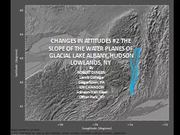
/
CHANGES IN ATTITUDES #2 The slope of the water planes of Glacial Lake Albany, Hudson Lowlands, CHANGES IN ATTITUDES #2 The slope of the water planes of Glacial Lake Albany, Hudson Lowlands,

CHANGES IN ATTITUDES #2 The slope of the water planes of Glacial Lake Albany, Hudson Lowlands, - PowerPoint Presentation

danika-pritchard
danika-pritchard . @danika-pritchard
Follow
351 views
Uploaded On 2018-10-25

CHANGES IN ATTITUDES #2 The slope of the water planes of Glacial Lake Albany, Hudson Lowlands, - PPT Presentation

By ROBERT DINEEN Lamb Cottage Geigertown PA ERIC HANSON HansonVan Vleet Clifton Park NY St Lawrence Lowlands Champlain Lowla nds Ontario Lowlands Erie Lowlands Allegheny Plateau ID: 696082

albany hudson lake ice hudson albany ice lake schenectady kingston ravena planar deltas newburgh poughkeepsie chart elfenbien mile lisa

Share:

Link:

Embed:

Download Presentation from below link

Download Presentation The PPT/PDF document "CHANGES IN ATTITUDES #2 The slope of the..." is the property of its rightful owner. Permission is granted to download and print the materials on this web site for personal, non-commercial use only, and to display it on your personal computer provided you do not modify the materials and that you retain all copyright notices contained in the materials. By downloading content from our website, you accept the terms of this agreement.


Presentation Transcript

Slide1

CHANGES IN ATTITUDES #2 The slope of the water planes of Glacial Lake Albany, Hudson Lowlands, NY

By

ROBERT

DINEEN

Lamb Cottage

Geigertown, PA

ERIC HANSON

Hanson-Van

Vleet

Clifton Park, NYSlide2

St. Lawrence

Lowlands

Champlain

Lowla

nds

Ontario Lowlands

Erie

Lowlands

Allegheny Plateau

Adirondack

Mountains

New

England

Uplands

Connecticut Lowlands

Mohawk

Lowlands

PHYSIOGRAPHIC PROVINCES

Hudson

Lowlands

RAVENA

KINGSTON

4.6 ft/mile

Lake Iroquois

Pair and others, 1988

4.7 ft/mile

Lake Hitchcock

Stone and others, 2005Slide3

LAKE ALBANY

GF

S

A

R

K

P

N

GF: Glens Falls

S: Schenectady

T: Troy

A: Albany

R: Ravena

KI: Kinderhook

H: Hudson

K: Kingston

P: Poughkeepsie

N: Newburgh

KI

T

HSlide4

DINEEN, DESIMONE, HANSON, 1988Slide5

WOODWORTH,

1905

2.2

Planar

FAIRCHILD,

1912, 1917, 1918

2.2 to 2.5Concave-up

Delayed until after Schenectady Delta

CHADWICK, 1928(northern Hudson)2.25 to 2.5

PlanarContemporaneous with ice removal

CHAPMAN, 1937, 1942 (Lake Vermont)

5Concave-up

Delayed until after Schuylerville deglaciated

CHADWICK, 19442.25

Contemporaneous

with ice removalLAFLEUR, 1965, 1979, 1983

(northern Hudson)2.5

Planar

Not caused by a wave of uplift

DINEEN, DESIMONE, HANSON, 1988

(southern Hudson)2.5

MixedContemporaneous with ice removal

REFERENCE

SLOPE (Ft/Mile)

SHAPE

TIMINGSlide6

CONNALLY and SIRKIN, 1986

(southern Hudson)

2.4

Planar

Rolling rebound

DINEEN

and others 1992

(southern Hudson)

2.65

Mixed

Contemporaneous

with ice removal

DeSimone and LaFleur, 1992

(northern Hudson)

2.7PlanarContemporaneous

with ice removal

CONNALLY and Cadwell, 2002(southern Hudson)

1.6Planar

Rolling rebound

STONE and others, 2005(Lake Hitchcock)4.7

Planar

Delayed 2000 years after Deglaciation of lower Connecticut Valley

DeSimone

and others

, 2008

(northern Hudson)

3.7

Planar

Contemporaneous

with ice removal

STANFORD,

2009, 2010

>4

Planar

Contemporaneous

with ice removal

REFERENCE

SLOPE (Ft/Mile)

SHAPE

TIMINGSlide7

STANFORD, 2009

GRADIENT of 4 ft/mile

PLANARSlide8

STANFORD, 2009

KAME DELTAS SUGGEST GRADIENT of 2 ft/mileSlide9

BEACH

DELTA

ESKER

DELTA

KAME

DELTA

OUTWASH

DELTA

ELEVATION in FEET

LATITUDE

ALBANY

RAVENA

KINGSTON

POUGHKEEPSIE

NEWBURGH

SCHENECTADY

Chart thanks to Lisa

Elfenbien

HUDSONSlide10

NEWBURGH

POUGHKEEPSIE

KINGSTON

RAVENA

ALBANY

SCHENECTADY

Deltas

Chart thanks to Lisa

Elfenbien

N= 58

HUDSONSlide11

NEWBURGH

POUGHKEEPSIE

KINGSTON

RAVENA

ALBANY

SCHENECTADY

Deltas

Schodack

Lake Albany I

Lake Albany II

Pleasant Valley

Chart thanks to Lisa

Elfenbien

Quaker Springs

& Coveville

HUDSONSlide12

NEWBURGH

POUGHKEEPSIE

KINGSTON

RAVENA

ALBANY

SCHENECTADY

Deltas

Schodack

Lake Albany I

Lake Albany II

Pleasant Valley

Chart thanks to Lisa

Elfenbien

Hudson Highlands

Catskill-Helderberg

Narrows

M-R Readvance

HUDSON

Quaker Springs

& CovevilleSlide13

NarrowsSlide14

NEWBURGH

POUGHKEEPSIE

KINGSTON

RAVENA

ALBANY

SCHENECTADY

Deltas

Schodack

Lake Albany I

Lake Albany II

3.0 ft/mi

4.3 ft/mi

3.0 ft/mi

3.8 ft/mi

1.5 ft/mi

Pleasant Valley

Chart thanks to Lisa

Elfenbien

HUDSON

Quaker Springs

& CovevilleSlide15

NEWBURGH

POUGHKEEPSIE

KINGSTON

RAVENA

ALBANY

SCHENECTADY

Catskill-Helderberg

Narrows

Hudson Highlands

Meadowdale

Schenectady-

Niskayuna

Schodack

Deltas

Pleasant Valley

Chart thanks to Lisa

Elfenbien

HUDSON

Quaker Springs

& CovevilleSlide16

NEWBURGH

POUGHKEEPSIE

KINGSTON

RAVENA

ALBANY

SCHENECTADY

Catskill-Helderberg

Narrows

Hudson Highlands

Meadowdale

Schenectady-

Niskayuna

Schodack

Deltas

4.4 ft/mi

2.1 ft/mi

3.3 ft/mi

2.5 ft/mi

3.6 ft/mi

2.5 ft/mi

5.1 ft/mi

Pleasant Valley

Chart thanks to Lisa

Elfenbien

HUDSONSlide17

NEWBURGH

POUGHKEEPSIE

KINGSTON

RAVENA

ALBANY

SCHENECTADY

Catskill-Helderberg

Narrows

Hudson Highlands

Meadowdale

Schenectady-

Niskayuna

Schodack

Deltas

4.4 ft/mi

2.1 ft/mi

3.3 ft/mi

2.5 ft/mi

3.6 ft/mi

2.5 ft/mi

5.1 ft/mi

Pleasant Valley

Chart thanks to Lisa

Elfenbien

HUDSONSlide18

NEWBURGH

POUGHKEEPSIE

KINGSTON

RAVENA

SCHENECTADY

ALBANY

Hudson Highlands

Catskill-Helderberg

Narrows

Chart thanks to Lisa

Elfenbien

N= 59

HUDSONSlide19

NEWBURGH

POUGHKEEPSIE

KINGSTON

RAVENA

SCHENECTADY

ALBANY

Hudson Highlands

Catskill-Helderberg

Narrows

Quaker Springs

Coveville

Albany II

Albany I

Chart thanks to Lisa

Elfenbien

HUDSONSlide20

NEWBURGH

POUGHKEEPSIE

KINGSTON

RAVENA

SCHENECTADY

ALBANY

Hudson Highlands

Catskill-Helderberg

Narrows

Quaker Springs

Coveville

Albany I

2.3 ft/mi

1.8 ft/mi

2.3 ft/mi

3.4 ft/mi

Chart thanks to Lisa

Elfenbien

HUDSONSlide21

NEWBURGH

POUGHKEEPSIE

KINGSTON

RAVENA

SCHENECTADY

ALBANY

Hudson Highlands

Catskill-Helderberg

Narrows

Albany I

Albany II

Quaker Springs

Chart thanks to Lisa

Elfenbien

HUDSONSlide22

NEWBURGH

POUGHKEEPSIE

KINGSTON

RAVENA

SCHENECTADY

ALBANY

Hudson Highlands

Catskill-Helderberg

Narrows

Albany I

Albany II

Quaker Springs

2.0 ft/mi

3.6 ft/mi

5.2 ft/mi

0.8 ft/mi

1.5 ft/mi

7.2 ft/mi

Chart thanks to Lisa

Elfenbien

HUDSONSlide23

NEWBURGH

POUGHKEEPSIE

KINGSTON

RAVENA

SCHENECTADY

ALBANY

Hudson Highlands

Catskill-Helderberg

Narrows

Albany I

Albany II

Quaker Springs

2.0 ft/mi

3.6 ft/mi

5.2 ft/mi

0.8 ft/mi

1.5 ft/mi

7.2 ft/mi

Chart thanks to Lisa

Elfenbien

HUDSONSlide24

LAFLEUR, 1965

Concave-up gradient

2.5

ft/mile

Hudson Lowlands

5.6

ft/mile Champlain Lowlands,from

Chapman, 1937, 1942 and Stewart, 1960

Schenectady

AlbanySlide25

WOODWORTH,

1905

2.2

Planar

FAIRCHILD,

1912, 1917, 1918

2.2 to 2.5

Concave-upDelayed until after Schenectady Delta

CHADWICK, 1928(northern Hudson)2.25 to 2.5

PlanarContemporaneous with ice removal

CHAPMAN, 1937, 1942 (Lake Vermont)

5Concave-upDelayed until after Schuylerville

deglaciatedCHADWICK, 1944

2.25

Contemporaneous with ice removal

LAFLEUR, 1965, 1979, 19832.5

PlanarNot caused by a wave of uplift

DINEEN, DESIMONE, HANSON, 1988

2.5Mixed

Contemporaneous with ice removal

REFERENCE

SLOPE (Ft/Mile)

SHAPE

TIMINGSlide26

CONNALLY and SIRKIN, 1986

2.4

Planar

Rolling rebound

DINEEN

and others 1992

2.65

Mixed

Contemporaneous

with ice removal

DeSimone and LaFleur, 1992

2.7Planar

Contemporaneous with ice removalCONNALLY and Cadwell, 2002

1.6?Planar

Rolling rebound

STONE and others, 2005(Lake Hitchcock)4.7

Planar

Delayed 2000 years after Deglaciation of lower Connecticut Valley

DeSimone and others

20083.7

Planar

Contemporaneous with ice removalSTANFORD, 2009, 2010

>4

Planar

Contemporaneous

with ice removal

REFERENCE

SLOPE (Ft/Mile)

SHAPE

TIMINGSlide27

Pleasant Valley

4.4

Planar

Delayed

Schodack (Wild & Crazy)

3.3

Concave-upDelayed

Albany I (Meadowdale)3.6

Concave-upContemporaneous with ice removal

Albany I(Schenectady)5.1

Concave-upContemporaneous with ice removal

Schodack(Traditional)3.4

Planar

Contemporaneous

with ice removalAlbany I

(Schenectady)2.3

Planar

Contemporaneous

with ice removalQuaker Springs

2.3

Planar

Ice in Champlain LowlandsCoveville

1.8

Planar

Ice in Champlain Lowlands

Albany Stage

SLOPE (Ft/Mile)

SHAPE

TIMINGSlide28

WHERE ARE WE?

Kame Deltas suggest a Rebounded Ice-Contact Lake Plane

of ~3.3 to 5.1 ft/mile

Lake Planes Steepen North OF ALBANY

Both Planar and Concave-Upwards curves fit the Data

in the mid-Hudson LowlandsThe concave-up curves suggests an isostatic “hinge line”

Followed the retreating ice frontThe lake outlet was within the Hudson’s bedrock gorgeSouth of Kingston

The outlet migrated from:newburgh

(albany I) to kingston

(albany ii) to

hudson (quaker springs)Slide29

GENERAL PROBLEMS WITH LAKE ALBANY DELTAS

We’ve historically connected the ice-contact or kame deltas

There is a great deal of scatter in the elevations of ice-contact or kame deltas

Especially in the NarrowsThe large number of deltas make correlation difficult.

Exposures of the topset-foreset contact are rare and exposures are short-livedMany LA deltas have very thin topsets (Thanks Carl!)The literature contains few actual descriptions of the LA topset-foreset contact

Most delta identifications and elevations are based on surface landforms. The area between the Hudson Highlands and Poughkeepsie is heavily developed

Making exposures rare and modifiying the landforms

POSSIBLE SOLUTIONS

Make more observations in deltas south of KinderhookUse Ground-Penetrating Radar profiles of

deltaforms to ID the topset/Foreset interfaceUse LIDAR to “trace the bathtub rings” between deltas

This is a good project for a team of geophysicists, glacial geomorphologists, statisticians, and stratigraphersSlide30
Slide31

Geography

Uplands vs. LowlandsPhysiographic ImageUplands pinch Hudson Lowlands between Ravena & KingstonWallkill Lowlands open to the southwest

Hudson Lowlands held Glacial Lake Albany Lake Albany extended from Newburgh to Glens Falls

The water plane of the lake has been measured by various workersUntil the 1990s, the consensus slope was approximately 2.5 ft/mile AMQUA & FOP chart

Lake Albany was contemporaneous with Lake Hitchcock in the Connecticut LowlandsNew England Mafia measured an isostatic tilt of 4+ ft/mile during 80s and 90sGlacial MovementFocused into narrows

Spread into Wallkill LowlandsMiddleburgh-Rosendale Readvance reached just south of KingstonWhere Wallkill sublobe pulled flow away from Hudson LLIce Movement map

M-R Readvance stagnated in the Ravena-Kingston neckAs indicated by numerous low-elevation KDs in neck, as noted by Cook & Chadwick.Slide32

Check Antev’s

correlation betwixt Hudson & Connecticut lowlands retreats. Ice front was further south in HLL, because of M-R Readvance.Thus isostatic contours were bent south in HLL.

This slowed rebound in the HLL, so the immediate rebound from the retreat through the Hudson Highlands had passed north.

In addition, the M-R readvance would have reversed rebound because of the rapid addition of ice.A probable factor in the difference between rebound rates in the southern HLL was differences in the physical characteristics (elasticity, brittleness) between a subduction

zone (HLL: west) and a failed rift (CLL: east).The compressed rocks in the HLL would differ from the pulled-apart rocks under the CLL.Slide33

LONGITUDINAL PROFILESBased on exposures north of Kingston on the west side of the HR

Based on LaFleur (1965) north of Kinderhook.Based on airphotos

, topographic map analysis, and soils maps south of Kinderhook (or Kingston) plus work by ConnallyK+O+E+D+B Scatter Plot

You could plot any gradient that you wantK+O+E Scatter Plot K+O+E plot focuses on the upper-most kame deltas that were the traditional Plot Note cluster of low-elevation KDs in the Ravena-Kingston neck. Slide34

B Scatter Plot shows beaches.

Much less scatter than deltasTwo concave-up lines are defined by the beaches.Upper line curves up from 250 ft @ 42.55

O to 330 ft @ 42.65O

(80 ft in0.1 degree of latitude)Upper line ends with large scatter.Upper line is Defreetsville-Voorheesville, Meadowdale moraine line

Lower line curves up from 175 ft @42.55O to 200 ft @ 42.60O to 355 ft @

42. 75O (25 ft in 0.05 degree of latitude to 155 ft in 0.15 degree of latitude).Lower line is Schenectady Delta line.Difference between the two line is ~75 ft.

Suggests a fall in lake level from Albany Ia to Lake Albany Ib

(both ice contact) of 75 ft when ice retreated ( to Niskayuna margin?) and unblocked the MohawkLowlands. Lake Amsterdam flooded into the HLL