/
May 2011May 2011Dispossession and Exploitation May 2011May 2011Dispossession and Exploitation

May 2011May 2011Dispossession and Exploitation - PDF document

danika-pritchard
danika-pritchard . @danika-pritchard
Follow
380 views
Uploaded On 2016-03-15

May 2011May 2011Dispossession and Exploitation - PPT Presentation

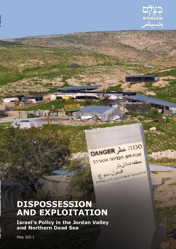
Dispossession and Exploitation Israel146s Policy in the Jordan Valley and Northern Dead SeaMay 2011 Researched and written by Eyal HareuveniEdited by Yael SteinTranslated by Zvi ShulmanEnglish edi ID: 257273

Dispossession and Exploitation Israel’s Policy

Share:

Link:

Embed:

Download Presentation from below link

Download Pdf The PPT/PDF document "May 2011May 2011Dispossession and Exploi..." is the property of its rightful owner. Permission is granted to download and print the materials on this web site for personal, non-commercial use only, and to display it on your personal computer provided you do not modify the materials and that you retain all copyright notices contained in the materials. By downloading content from our website, you accept the terms of this agreement.


Presentation Transcript

May 2011May 2011Dispossession and Exploitation Dispossession and Exploitation Israel’s Policy in the Jordan Valley and Northern Dead SeaMay 2011 Researched and written by Eyal HareuveniEdited by Yael SteinTranslated by Zvi ShulmanEnglish editing Shaul VardiData coordination by Atef Abu a-Rub, Wassim Ghantous, Tamar Gonen, Iyad Hadad, Kareem Jubran, Noam RazGeographic data processing by Shai EfratiCover photo: Bedouin community inside �ring area, next to Route 678 (Allon Road) (Keren Manor/activestills.org)ISSN 0793-520XB’Tselem thanks Salwa Alinat, Kav LaOved’s former coordinator of Palestinian �eldworkers in the settlements; Daphna Banai, of Machsom Watch; Hagit Ofran, Peace Now’s Settlements Watch coordinator; Dror Etkes; and Alon Cohen-Lifshitz and Nir Shalev, of Bimkom. Chapter TwoTaking control Taking control of water sources Chapter Four Restrictions on movement Chapter Five Restrictions on building and development Chapter Seven Prohibitions in international law on exploiting resources Appendix Two Data on the settlements in the Jordan Valley and 5 5 Toward the end of 2010, residents of settlements in the Jordan Valley and northern Dead Sea area demonstrated against rightwing activists who entered the city of Jericho without army approval in an attempt to settle there. The settlers, like many Israelis, do not consider the Jordan Valley and the northern Dead Sea occupied territory, but part of the sovereign State of Israel. Placards carried during the demonstration, stating “This is not Judea and Samaria,” con�rmed this belief.Similarly, successive Israeli governments have viewed the Jordan Valley and the northern Dead Sea as areas over which Israeli control must be maintained. This view is based on the plan of Yigal Allon, a leading force in the Labor Party and minister of labor at the time, which was submitted to the government in July 1967, shortly after Israel occupied the West Bank.Under the plan, which was never of�cially adopted by any government, the Jordan River marks the strategic border of the State of Israel and serves as a buffer zone between Israel and the “Eastern Front,” as a potential Iraqi-Jordanian-Syrian military coalition was referred to. The plan also called for Israel to annex a strip up to 15 kilometers wide along the Jordan Valley and Judean Desert, in which a relatively small number of Palestinians lived after 1967, and to leave a land corridor in the Jericho area that would link Jordan and Palestinian population centers in the West Bank. The settlements in the area were to be “permanent advance-position lookouts that would avoid having to call up military forces and could not only alert the military to a sudden attack by the enemy, but also attempt to halt, or at least delay, the enemy’s advance until military forces could control the situation.”From 1967, when the Allon Plan was presented to the government, to 1977, the government initiated the establishment of 19 settlements in the Jordan Valley and northern Dead Sea area. The prime minister, Yitzhak Rabin, wrote that these settlements would re�ect the “political and security conception with respect to the peace borders in the Mideast.” In September 1977, following the rise of the Likud to power, Ariel Sharon, who was minister of agriculture and head of the Ministerial Committee for Settlement, presented a plan that referred to the Jordan Valley as “the eastern security zone” and proposed expanding the chain of settlements in the area. From 1978-1992, under Likud-dominated governments, 11 more settlements were built.Following the beginning of the Oslo Process in 1993, Israel’s government, headed by the Labor Party, undertook not to establish new settlements and not to expand existing settlements. However, it did not consider the undertaking to apply to the Jordan Valley. In his speech to the Knesset on approval of the Israeli-Palestinian Interim Agreement (Oslo II), Prime Minister Rabin explained clearly that “the security border to protect the State of Israel will be set in the Jordan Valley, in the broadest meaning of this term.” . See Lee Cahaner, Arnon Sofer and Yuval Kna’an, (Reuven Chaikin Chair in Geostrategy, University of Haifa, February 2006), 25-26 [Hebrew]; Anita Shapira, (Sifriyah Hadasha, Hakibbutz Hameuchad/Siman Kriya, 2004), 486, 488-491 [Hebrew]; Yerucham Cohen, (Hakibbutz Hameuchad, 1972), 171-180 [Hebrew]; B'Tselem, (May 12-13; Edith Zertal and Akiva Eldar, . Yitzhak Rabin, [Army Service Book]. Government Decision 145, 11 November 1977, announcing the expansion of the settlements in the “Judea, Samaria, Jordan Valley, Gaza Strip, and Golan Heights, by increasing the population of the existing communities and by establishing additional communities on state-owned land”; Shaul Arieli, “Settling in Judea and Samaria – The Strategy: Gathering Together with Minimal Exchange of Territory,” paper given at a conference on shaping the spatial environment in Israel: 1948-2008, held at the Hebrew University, Jerusalem, on 13 April 2008, 5-7 [Hebrew]; Zertal and Eldar, Lords of the Land, 285.. Announcement made by Prime Minister and Minister of Defense Yitzhak Rabin to the Knesset plenum on approving the Palestinian-Israeli Agreement on the West Bank and the Gaza Strip, 5 October 1995, available on the Knesset’s website, www.knesset.gov.il/rabin/heb/Rab_RabinSpeech6.htpremier, Shimon Peres, indicating the intention to annex the Jordan Valley settlements to the State of Israel, in Zertal and Eldar, - Israel’s Policy in the Jordan Valley and Northern Dead Sea 7 The present government, headed by Binyamin Netanyahu, continues this policy, opposing any withdrawal from the Jordan Valley. In a speech to the Knesset, Netanyahu quoted Rabin, saying that Israel’s security border will be set in the Jordan Valley, and during a visit in the Jordan Valley he declared that the army “must remain along the Jordan River in any future agreement.”This report studies the various means Israel uses to ensure its control of the Jordan Valley and the northern Dead Sea area: the land, the water sources, the tourist sites, and the natural resources. Chapter One provides statistics on the area and its residents. Chapters Two and Three analyze the mechanisms Israel created to control large swaths of land and the water sources. Chapters Four and Five deal with the restrictions Israel imposes on Palestinian movement in the area and on building and development of Palestinian communities. Chapter Six discusses other aspects of economic exploitation – agricultural development, exploitation of Palestinian labor, control of tourist sites and natural resources, and placement of Israeli environmental-nuisance disposal facilities in the area. The last chapter of the report describes the prohibitions established in international humanitarian law on exploitation of the resources of occupied territory. of Yitzhak Rabin, 20 October 2010, available on the website of the Prime Minister's Of�ce, http://www.pmo.gov.il/PMO//speechrabinkneset201010.ht (visited on 6 March 2011) [Hebrew]. See also Barak Ravid, “Prime Minister Binyamin Netanyahu: IDF Must Remain along the Jordan in any Future Agreement,” 6 7 The Jordan Valley and northern Dead Sea area covers 1,611,723 dunams, constituting 28.8 percent of the total area of the West Bank.This region, most of which is under Israeli control, includes the area of the Jordan Valley and Mizpe Yeriho regional councils, part of the area of the Mate Binyamin Regional Council, on which the settlements Mizpe Yeriho, Rimmonim, and Kochav Hashahar were built, and the part of the municipal area of the city Ma’ale Adumim that lies between the Jordan Valley and Megillot regional councils. Of this area, 87.5 percent is situated in Area C, over which Israel has complete control. The remainder includes enclaves of land in Area A, which is under the complete control of the Palestinian Authority, Jericho among them, and in Area B, where the PA controls civil affairs and Israel controls security matters.The eastern borders of the area are the Jordan River and the western shore of the Dead Sea. In the north, the borders are the Green Line, near the route of Bazak Stream. In the west, the border runs along the eastern slope of the Mountain Ridge and the eastern route of the Separation Barrier in the The Jordan Valley and northern Dead Sea area is among the most thinly populated sub-districts in the West Bank. According to �gures of the Palestinian Ministry of Agriculture and the Palestinian Water Authority, 64,451 Palestinians lived in the Jordan Valley in 2009, which represents 2.6 percent of the Palestinian population of the West Bank.The Jordan Valley has 29 Palestinian communities, which are concentrated in three areas: Jericho, which has a population of 51,217 (80 percent of the Palestinians living in the Jordan Valley), with 24,013 residing in the city and the others in 12 nearby communities; Wadi al-Far’a, in the central Jordan Valley, where 8,452 Palestinians live in six communities; and the northern Jordan Valley, which is home to 4,782 Palestinians living in ten communities. The Jordan Valley also has dozens . The West Bank’s land area is 5,602,951 dunams [4 dunams 0.89 acres; 10 dunams 1 hectare; 1,000 dunams one square kilometer]. See B'Tselem, Regarding Administration of Regional Councils (Amendment No. 2) of Judea and Samaria (No. 806), 5740 – 1979, map of the Jordan Valley Regional Council and the map of the Megillot Regional Council as demarcated by the Commander of Judea and Samaria, Brig. Gen. Binyamin Ben-Eliezer, on 30 September 1979 and 15 June 1981. Palestinian Authority land in the Jordan Valley includes the Jericho and Tubas governorates, a total of 1,638,000 dunams, comprising 29 percent of the West Bank, not including the northern area of the Dead Sea. See Palestinian Authority Ministry of Agriculture and Palestinian Water Authority,(May 2010), 5 [original in Arabic]. . Area C covers 1,378,911 dunams. In the agreements signed between Israel and the PLO, the West Bank is divided into Areas A, B, and C. Area A was transferred to the complete control – security and civil – of the Palestinian Authority; Area B is under Israeli control in security matters and Palestinian control in civilian matters; and Area C, which comprises 60 percent of the land area of the West Bank, remains under complete Israeli control in all matters – land registration, planning and building, designating land use, and so forth. See Israeli-Palestinian Interim Agreement on the West Bank and Gaza Strip, Annex I: Protocol Concerning Redeployment and Security Arrangements, 28 September 1995, http://www.mfa.gov.il/MFA/Peace+Process/Guide+to+the+Peace+Process/THE+ISRAELI-PALESTINIAN+INTERIM+AGREEMENT+-+Annex+I.ht. The �gures on the number of Palestinians living in the Jordan Valley are taken from 14-15. In 2009, there were 2,448,433 Palestinians living in the West Bank. See Palestinian Central Bureau of Statistics, (May 2010), 11. - Israel’s Policy in the Jordan Valley and Northern Dead Sea 9 of small Bedouin communities, most of them without infrastructure and permanent structures, in which an additional 15,000 persons live.Prior to Israel’s occupation, the area was also home to Palestinian refugees of 1948. In 1967, most of them moved to Jordan. The number of these refugees has been estimated at between 50,000 and At the end of 2009, the number of settlers in the Jordan Valley and northern Dead Sea area was 9,354, representing 3.1 percent of the total settler population in the West Bank (excluding East Jerusalem). Settlers comprise 10.5 percent of the area’s population. The settlements in this area were among the �rst built by Israel in the territories it occupied in June 1967. By early 1968, the �rst two settlements were established in the area: Mehola, built south of the Palestinian village Bardala, in the northern Jordan Valley, and Qalya, in the northern Dead Sea area, where a Jewish community had existed prior to 1948. These two settlements were established following a government decision Since then, Israel has built settlements along the two main traf�c arteries in the area – Route 458 (Allon Road) and Route 90 (Gandhi Road), part of which runs through the Jordan Valley and northern Dead Sea area. In early 2011, there were 37 settlements in the area, including seven unauthorized The two largest outposts are Mevo’ot Yeriho, which lies east of Jericho, and Giv’at Sal’it, which is situated in the northern Jordan Valley.Four of the settlements are Nahal encampments that were turned, without government decision, into civilian communities in recent years. The most recent one – Maskiyot – became civilian in 2008. It is now populated by Israelis who were removed from the Shirat Hayam settlement in the Gaza Strip. The change to civilian status was carried out in the past decade, during which Israel undertook not to establish new settlements. According to Spiegel’s database, these settlements were built without . Ma’an Development Center,. The United Nations Relief and Works Agency notes that “many” residents of the refugee camp, the largest refugee camp in the West Bank, in which 30,000 refugees lived prior to 1967, and “most” of the residents of refugee camp, which was home to 20,000 refugees prior to 1967, �ed to Jordan during the 1967 war. UNRWA does not note whether the residents of the Far’a refugee camp, which was smaller than the other two, �ed to Jordan in 1967. See www.unrwa.org/htemplate.php?id 10http://www.unrwa.org/htemplate.php?id 11. Palestinian attorney and writer Raja Shehadeh estimates that some 100,000 Palestinian refugees left the Jordan Valley in 1967. See Raja Shehadeh, (Pro�le Books, 2010), 60. An Israeli source puts the �gure at 200,000 refugees. See . Qalya was established in 1929. It had a phosphate plant, a worker’s housing complex, and hotel. The Beit Haarava settlement, was also established on land of Kibbutz Beit Haarava, which was established in 1939. These communities were alley,”in S. Shmueli, D. Grossman, and R. Zeevi, vol. 2 (Tel Aviv and Bar-Ilan Universities, Canaan Publications, 1977), . Government Decision No. 217, of 28 January 1968.. For additional particulars on the establishment of settlements in this area, see (Nature Reserves Authority and the Jordan Valley Regional Council, . See the tables in Appendix Two. These tables contain information on the year the settlements were established, the kind of community, and population.. For Israel’s commitments, see community in Judea and Samaria,” in Talia Sasson, http://www.pmo.gov.il/NR/rdonlyres/0A0FBE3C-C741-46A6-8CB5-Brig. Gen. (res.) Baruch Spiegel. See Uri Blau, “Secret Israeli Database Reveals Full Extent of Illegal Settlement,” http://www.vfp143.org/lit/Gaza/Secret_Israeli_database_reveals_full_extent_of_illegalon 30 March 2011); “Ministry of Defense Approves Building Compromise in Maskiyot,” 8 9 In addition, the Jordan Valley Regional Council and the coordinator of the Tasks Department in the Kibbutz Movement, Yoel Marshak, are working to establish a new settlement next to the Yitav settlement north of Jericho, on land of an evacuated military base, and to establish a few settlements in the area. Former members of the army’s Haruv Company, which was active in the area following its occupation, also want to build a settlement in the area. The government has not approved these initiatives.Based on the non-implemented approved building plans, building potential in the Jordan Valley and northern Dead Sea area is high, enabling the construction of an additional 3,054 housing Since the average-sized family in settlements is 4.5 persons, if the full building potential is realized, the population in the area will increase by 250 percent. By the end of 2010, the government had approved funding for the construction of 36 new housing units in Shademot Mehola and dozens of units had been built in Maskiyot. Both of these settlements are in the northern Jordan Valley.The growth rate of the settler population in this area is modest compared with elsewhere in the West Bank. From the end of 2000 to the end of 2009, the settler population in the Jordan Valley and northern Dead Sea area grew by 15 percent, compared with a growth rate of 56 percent in the entire West Bank (not including East Jerusalem). The population of Ma’ale Efraim dropped by 14 percent despite the exceptional incentives that the government provided in 2003 and 2005 to encourage Israelis to move to the area.As of May 2009, the built-up area of the settlements in the Jordan Valley and northern Dead Sea area totaled 6,661 dunams, less than half a percent (0.0041 percent) of the total area. Their municipal area, including the broad swaths of land allocated for farming and future development, is 28 times greater than the built-up area and covers 191,143 dunams (11.8 percent of the total area). The municipal area of the settlements in the West Bank is 9.4 times as large as the built-up area of the settlements. The municipal area of all the settlements in the West Bank is classi�ed a closed military area, to which Palestinians without permits are prohibited entry. . Minutes of the plenary meeting of the Jordan Valley Regional Council held on 6 May 2010; letter of 22 April 2010 from Yoel Marshak to labor of�cials of the Tasks Department; Akiva Eldar, “Kibbutz Movement Working to Strengthen Settlement in the Occupied Territories,” 5 May 2010.ve a alley a potential for 2,097 apartments. According to Bimkom, building plans for settlements in the area that have not been implemented, some of them still in the planning and approval dunams in Maskiyot This information was provided in an email correspondence of 15 March 2011 from Alon Cohen-Lipschitz, of Bimkom.Schedule 5.9: Families by Family Type, Family Size, District, and Population Group, 2009, available athttp://www.cbs.gov.il/shnaton61/st05_09.pd. Minutes of the plenary meeting of the Jordan Valley Regional Council held on 22 November 2010.al Bureau of Statistics, are available on B'Tselem’s website at http://www.btselem.org/English/Settlements/Statistics.asJordan Valley and the northern Dead Sea area was 8,159 in 2000. For further discussion on the incentives, see . The calculation of the settlements’ land area – the built-up area and the municipal areas – is based on of�cial maps of the State of Israel that were produced by the Civil Administration, on which aerial photos of the settlements and outposts were superimposed by Peace Now in 2009. The boundaries of the built-up area were based on the developed area in each of the settlements, and include land on which there has been development of any kind, except for the open areas. See By Hook and by - Israel’s Policy in the Jordan Valley and Northern Dead Sea 11 The total land area of the Megillot, Jordan Valley, and Mate Binyamin regional councils, plus the municipal land area of the Ma’ale Adumim Municipality and of the Ma’ale Efraim Local Council is 1,4654,730 dunams, which account for 90.1 percent of the Jordan Valley and northern Dead Sea Built-up area of settlements in the Jordan Valley and the northern Dead Municipal area of settlements in the Jordan Valley and northern Dead SeaArea of the Jordan Valley, Megillot, and Mate Binyamin regional councils, plus the municipal areas of Ma’ale Adumim and of the Ma’ale Efraim Local Council 10 11 Chapter TwoOver the years, Israel took control of large swaths of land in the Jordan Valley and northern Dead Sea and tried to prevent Palestinian use of more than three-quarters of the area. Israel seized private Palestinian land and declared large sections of land closed military areas, nature reserves, and state land. The vast majority of these lands are included in the jurisdiction of the regional councils that amalgamate settlements in the area. In the past two years, Israel has taken stronger measures, removing a few small Bedouin communities from the area.Some of the means used by Israel to take control of the land are unique to this area. The reason is that the �rst settlements there were established at the end of the 1960s, before Israel institutionalized the seizing of control of land to establish dozens of settlements throughout the West Bank. The most important mechanism for this purpose was declaration of extensive areas as “state land,” a practice The State Comptroller found that Israel stole thousands of dunams of privately-owned Palestinian land in the Jordan Valley, in breach of the provisions of the military order of July 1967, which arranged Most of the stolen land belonged to absentee Palestinians, the majority of whom were refugees who �ed from the West Bank in 1967. The land was seized in the late 1960s and in the 1970s, “by exchange of land, in which the Palestinians were given substitute land that had belonged to absentees, and by direct allocation of the land of absentees, amounting to thousands of dunams.”The State Comptroller did not mention how the land was seized, did not state the precise magnitude of the land that was stolen to build the settlements, and did not specify which settlements were built on the seized land. However, during the period covered by the State Comptroller’s report, Israel established 16 settlements and six army bases in the area. Brig. Gen. Spiegel’s database mentions seven settlements where an exchange of land of absentee owners was made, and two settlements The land-exchange procedure involved Palestinians from the area. Nasser Suliman Fuqha, who lives in Bardala, provided B'Tselem with copies of land-exchange contracts his father made with the custodian of abandoned and government property. According to Fuqha’s testimony and the contracts, his father exchanged his 46 dunams of land east of the Mehola settlement, which the settlement subsequently used to grow crops, for 34 dunams of absentee-owned land west of Bardala, in the northern Jordan Valley. The contracts state that Suliman's land was leased to the custodian for consideration, and, “to facilitate the accounting” between the sides, the custodian leased substitute land to Suliman. . For more on “state land,” see , 24-28; B'Tselem, (in preparation). . Order Regarding Abandoned Assets (Private Property) (Judea and Samaria) (No. 58), 5727 – 1967, signed by Maj. Gen. Uzi Narkis, commander of military forces in the West Bank, on 23 July 1967; State Comptroller, . State Comptroller, . The settlements established in the Jordan Valley in the years 1968-1979 are Argaman, Beka’ot, Gittit, Gilgal, Hemdat, Hamra, Mehola, Mekhora, Mizpe Yeriho, Massu’a, Niran, Netiv Hagedud, Peza’el, Ro’i, Shademot Mehola, and Tomer. Regarding the number of army bases, see Akiva Eldar, “The Jordan Valley Blacklist,” . According to the database, exchange of absentee property was carried out with respect to lands of the settlements Argaman, Beka’ot, Mehola, Niran, Netiv Hagedud, Peza’el, and Tomer. Absentee property was allocated to the settlements Mekhora and Niran. - Israel’s Policy in the Jordan Valley and Northern Dead Sea 13 The contracts were for three and a half years, from September 1969 to April 1973. Fuqha claims that his father did not sign any contract extension. The contracts do not state that Suliman's land was for the Mehola settlement or that the land leased to him was property belonging to absentees. Fuqha added that, in 1994, the Abu Hifaa family, whose land had been leased to his father, returned to the West Bank. The family leased the land to Suliman for several years, but then refused to extend the lease. Fuqha was left without any land on which to raise his crops.The State Comptroller adopted the opinion of the legal advisor of the Civil Administration and held that allocation of land of absentee Palestinians to the settlements was “prima facie unlawful.” The State Comptroller contended that the powers of the custodian of abandoned private property, who is responsible for the assets of absentee Palestinians, require that he safeguard the assets in a way that enables their return to the owner. Therefore, “the custodian may not make any transaction regarding the asset that con�icts with the obligation to safeguard the asset as stated, especially his obligation to return the asset to the owner upon his return to the region.”The military order regarding abandoned assets enables absentee owners who return to the West Bank to regain their assets if they succeed in proving their ownership. According to the former head of the Civil Administration, Brig. Gen. (res.) Ilan Paz, the of�ce of the Civil Administration’s custodian of abandoned property had a secret list of the absentee owners of land. The list was referred to as the “List of One Hundred,” but over the years, it came to include more than two thousand names of absentee owners. The list was used to deny their entry to the West Bank, including for purposes of family uni�cation, to prevent Israel from being compelled to return the land to them, on which the settlements had been built. Paz said that he ordered the list to be cancelled. B'Tselem does not know if this has been done.After the second intifada began, Israel froze family uni�cation and summer visits of Palestinians in the West Bank, so there has not been a need for the list since then.The theft of private land belonging to absentee Palestinians contradicts the explanation later given by Israeli of�cials for freezing the procedure for registering land in the West Bank in 1968.The procedure, �rst applied by Mandate authorities and by the Jordanian government, led to the registration in the land registry of most of the land in the Jordan Valley and large segments of the northern West Bank. Israel said the suspension of the procedure resulted from its desire to prevent harm to the property rights of absentee owners, since implementation of the procedure was liable to result in denial of the property rights of the many absentee owners who were unable to appear before the registration committees to claim ownership.B'Tselem’s requests under the Freedom of Information Law to the Civil Administration’s public-requests of�cer on the subject of the theft of private land of absentee Palestinians were not granted, . The testimony was given to Atef Abu a-Rub on 29 September 2010. Copies of the contracts are attached to the testimony.Comptroller, . Order Regarding Abandoned Assets (Private Property) (Judea and Samaria) (No. 58), 5727 – 1967, and Order Regarding Abandoned Assets (Private Property) (Additional Provisions) (No. 1) (Judea and Samaria) (No. 150), 5727 – 1967. . The conversation was held on 4 January 2011. Paz headed the Civil Administration in 2002-2005. See also Akiva Eldar, “The Jordan Valley Blacklist.”. Order Regarding Land and Water Arrangement (Judea and Samaria) (No. 291), 5729 – 1968, of 19 December 1968. Section 3 states that, “The validity of every arrangement order and every procedure carried out by order is suspended.”. Eyal Zamir, (Jerusalem Institute for Israel Studies, 1985), 27 . Requests for information under the Freedom of Information Law – Land under Palestinian Ownership and State Land in the Jordan Valley, directed to the public-requests of�cer in the Civil Administration, Second Lieut. Amos Wagner, made on 14 September and 2 December 2010. On 16 February 2011, Second Lieut. Wagner informed B'Tselem that its request “had been forwarded to the relevant of�cials in the Civil Administration for handling.” 12 13 In the �rst decade of the settlement enterprise, Israel seized land for the settlements also by military orders, contending that the settlements have a security-military function. Of�cial Israeli sources provide partial �gures on the scope of the land that was seized by military orders. The Spiegel database states that military orders were used to seize land for eight settlements in the Jordan Valley. The database provides no information on two of them, and the amount of land seized is not According to a map of the Civil Administration updated to 2007, 11,778 dunams of land were seized pursuant to military orders for nine settlements in the Jordan Valley.In 1979, the Supreme Court held, in the Elon Moreh case, that the seizure of land by military order for the purpose of establishing the Elon Moreh settlement violated international law, since it was not intended for military purposes and was not intended to be temporary. However, the justices did not prohibit, in principle, the seizure of land for the establishment of settlements, so long as it was done for security considerations. Following the judgment, Israel ceased using military orders to seize land for the purpose of establishing settlements.The Jordan Valley and the northern Dead Sea region is one of the few areas in the West Bank which were registered by the Jordanian authorities as government property – state land – at the time the occupation began. Some of the land was privately acquired by the Turkish sultan ‘Abd al-Hamid; and after the Young Turks Revolution of 1908, this land was nationalized. The amount of the sultan’s land that was nationalized was estimated at more than 220,000 dunams: 144,000 in the northern Dead Sea area, 77,000 in the area of Wadi al-Far’a, in the central Jordan Valley, and the rest in other sections of the Jordan Valley.There is now four times as much state land in the Jordan Valley and northern Dead Sea area– 861,000 dunams, constituting 53.4 percent of the area. Of the 861,000 dunams, 472,000 are “arranged state land,” which includes the nationalized land from the Ottoman period. The remainder – 386,000 dunams – is land that Israel declared state land, primarily from 1980 to 1992, by relying on a tendentious interpretation of sections of the Ottoman Land Law of 1868.In recent years, there have been several declarations of state land in the Jordan Valley and northern Dead Sea. The Civil Administration informed B'Tselem that in 2008 and 2009, there were two such declarations, one in the settlement Avenat, in the northern Dead Sea, and the other to expand the Israeli Og Reservoir wastewater treatment plant, next to the Bet Haarava junction and south of Jericho. The Civil Administration did not indicate the amount of land that was taken. In 2009, the custodian of abandoned and government property in Judea and Samaria registered as state land some 138,600 dunams along the Dead Sea, most of which was land that had once been under water as part of the Dead Sea. had been issued), Gittit, Yitav, Kochav Hashahar, Mekhora, Ma’ale Efraim, and Ro’i.. The settlements mentioned on the Civil Administration map are Almog, Beka’ot, Gittit, Yitav, Kochav Hashahar, Mekhora, Ma’ale Efraim, Ro’i, and Rimmonim. The map was provided to the former coordinator of Yesh Din’s lands project, Dror Etkes.. For further discussion, see . For further discussion on the policy of declaration of state land, see . “Despite the Declarations, Israel expropriates 2 percent of the West Bank,” Peace Now Settlement Watch (July 2009). The custodian of government property announced, in the newspaper state land. See the letter of 26 January 2011 to B'Tselem from the public-requests of�cer in the Civil Administration, Second Lieut. Amos Wagner. - Israel’s Policy in the Jordan Valley and Northern Dead Sea 15 In July 2010, the custodian announced the taking of 627 dunams east of the Almog settlement and their declaration as “government property.” These actions were taken despite Israel’s international commitments to freeze construction in settlements, in the framework of the Road Map, and the speech of Prime Minister Binyamin Netanyahu in June 2009, in which he stated that Israel had no intention “to expropriate land to expand existing communities.” Israel also declared state land natural grazing land in the area, which shepherds from throughout the West Bank used, primarily in wintertime. Under the legislation that existed in the West Bank prior to Israel’s occupation, and according to Supreme Court case law on lands of this kind inside Israel, the land is ostensibly public land that the state is prohibited from seizing or from claiming ownership.The land controlled by the 30 settlements and outposts in the Jordan Valley and the northern Dead Sea includes land Israel has declared state land. According to Spiegel’s database, as far back as 1978, before the Israeli government decided that settlements would be built only “on state-owned land,” four settlements in the Jordan Valley were allotted 20,860 dunams of state land for construction and farming purposes, in addition to the land that was allotted to them at the time they were established. The allocation of the land was made before the Military Appeals Committee began to function. The Committee was supposed to enable Palestinians in the West Bank to object to the declaration of state land in the West Bank. In addition, Israel has expropriated state land in the Jordan Valley and included this in the municipal area of the Ma’ale Adumim settlement, even though it is far-removed from the settlement’s built-up area.B'Tselem knows of two cases, from 2003, in which the Civil Administration ordered two Bedouin families to vacate, within 45 days, state land north of Jericho. The orders were based on a military order dating from 1967, which allowed the military commander to “use all necessary means” to remove any person who is on land deemed “government property.” B'Tselem is not aware of other attempts to remove Palestinians from state land in this area.Israel declared 11 large swaths of land in the Jordan Valley and northern Dead Sea area as closed military areas, totaling 736,000 dunams, or 45.7 percent of the area. The closing was carried out pursuant to military orders prohibiting persons from entering and remaining on the land, including for grazing purposes, except for persons who were on the land before it was closed. The military commander has the authority to arrest persons who enter the land, and to con�scate their livestock. vernment property in Judea and Samaria, Yossi Segel, on the Order Regarding Government Property (Judea and Samaria) (No. 59), 5727 – 1967. . See the undertakings of Israel in the framework of the Road Map and the understandings with the US Administration, in 15-17; speech of Prime Minister Binyamin Netanyahu at the Begin-Sadat Center, Bar-Ilan University, 14 lands. For further discussion on this issue, see and 91 of the Ottoman Land Law of 1868; Civ. App. 4/50, . The settlements are Almog, Argaman, Gittit, Beit Haarava, Gilgal, Vered Yeriho, Hemdat, Hamra, Ya�t, Kochav Hashahar, Mehola, Ma’ale Efraim, Mizpe Yeriho, Mizpe Shalem, Massu’a, Maskiyot, Naama, Netiv Hagedud, Peza’el, Qalya, Ro’i, Rotem, Rimmonim, Shademot Mehola, and Tomer and the built-up area in the outposts Ma’ale Hagit, Omer Farm, Mevo’ot Yeriho, the Orna tent encampment, and Neve Erez.. The government decision on building settlements on state land is No. 145, of 11 November 1979. See also Sasson, The four settlements Argaman, Gilgal, Hamra, and Tomer were allotted the additional 20,860 dunams by the World Zionist Organization. . For further discussion on the Appeals Committee, see . Order Regarding Government Property (Judea and Samaria) (No. 59), 5727 – 1967.. The declarations were made pursuant to the Order Regarding Security Provisions (Closing of Training Areas) (No. 377), 5730 – 1970, and section 90 of the Order Regarding Security Provisions (Judea and Samaria) (No. 378), 5730 – 1970, which was amended numerous times. 14 15 Furthermore, Israel built the Separation Barrier in the northern Jordan Valley on West Bank land south of the Green Line. As a result, 2,500 dunams of land belonging to Bardala and Ein al-Beida’ remain on the northern side of the Separation Barrier, to which the villagers do not have access.Israel declared the closed military area in the late 1960s and early 1970s, around the time that members of Palestinian armed groups tried to enter the West Bank via the Jordan Valley. Israel did not reduce the closed military areas after the number of attempts dropped following King Hussein's repression of the uprising of the Palestinian organizations in September 1970. Nor were the closed areas reduced after the Israeli-Jordanian peace agreement was signed and many military bases in the area were evacuated.Some of the closed military areas were used, and continue to be used, for military training. Some sections of the closed areas are used by settlements to grow crops. On some of the land, Bedouin were living when the land was closed. The military training in the area, which included the �ring of live ammunition and the leaving of unexploded ammunition on the ground, led to the deaths of at least six residents of ‘al-Aqabah and injury to dozens of persons.Immediately after Israel occupied the West Bank, it began to close areas and declare them nature reserves and national parks. In the Jordan Valley and northern Dead Sea, Israel declared 26 sections of land nature reserves, a total of 318,000 dunams, which constitute 20 percent of the area. Fifteen nature reserves, amounting to 200,000 dunams (63 percent of the land allotted to nature reserves) were land that has been declared closed military areas. This fact shows that Israel did not show great concern for the environment of the area, or, alternatively, did not intend to use the closed areas for Israel developed only two of the nature reserves to accommodate visitors – Wadi Qelt (Ein Prat), which is located east of Jericho, and Ein Fashkha (Einot Tzukim), in the northern Dead Sea area. Two nature reserves have been classi�ed national parks – Qumran, in the northern Dead Sea, which, like the previously mentioned two reserves, has been developed to accommodate visitors, and the Hashmonaim palaces, east of Jericho. Elsewhere, the lands seized as nature reserves were not developed for visitors, and had no fencing or marking of land indicating an intention to protect nature in the area. The only marking distinguishing between the reserves and the adjacent land is a sign of the Israel Nature and Parks Authority. On these lands, too, Israel forbids Palestinians to enter or remain there, whether to live or to graze their �ocks. In the past two years, Israel has increased enforcement of the prohibition on Palestinians . Calculation of the land taken for the Separation Barrier was made by B'Tselem. See also Integrated Report for the Palestinian Agro-Production and Marketing System (Case Study of the Northeast Jordan Valley Area) (Applied Research Institute – Jerusalem in collaboration with Action Against Hunger, 2010), 14.which involved a petition �led by the Association for Civil Rights on behalf of residents of al-Aqabah; B'Tselem, . The land was seized in accordance with two military orders: Order Regarding Nature Protection (Judea and Samaria) (No. 363), 5730 – 1969, and the Order Regarding Parks (Judea and Samaria) (No. 373), 5730 – 1970. The nature reserves are Rotem and Maskiyot, Agamit, Umm Zuqa, Haruva, Sartaba, Gesher Adam, Tirza Stream (two reserves), Waid Malha Pond (two reserves), Wadi Malha, Matzok Haetakim, Qumran National Park, Einot Tzukim, Qana and Samar, Maoch Stream, Hahasmonaim Palaces National Park, Nahal Prat, Daraja Eli Stream, Yitav Stream, and Kochav Hashahar (two reserves), Peza’el, Har Tamun, Har Gadir, and Bezek Eli Stream.. For further discussion on this subject, see Chapter Six of the report, on additional aspects of economic exploitation. See also the Nature Reserves and National Parks Unit on the website of the Coordinator of Government Activities in the Territories, tp://www.cogat.idf.il/CivilAdministration/govermment/Pages/parks2.asp. Order Regarding Security Provisions (Judea and Samaria) (No. 378), 5730 – 1970, and the Order Regarding Nature Protection (Judea and Samaria) (No. 363), 5730 – 1969, which has been amended numerous times. Inspectors from the Israel Nature and Parks Authority also impose �nes pursuant to the Rules of Behavior in Nature Reserves (Judea and Samaria), 5733 – 1972, and the Rules of Behavior in Parks (Judea and Samaria), 5734 – 1974. - Israel’s Policy in the Jordan Valley and Northern Dead Sea 17 grazing their �ocks on these lands, and has informed the Palestinian District Coordination and Liaison Of�ce in Jericho that the shepherds would be �ned. The amount of the �ne is arbitrary, ranging from 730 to 1,700 shekels. In one case, which occurred in March 2011, three Palestinians were detained for a few hours for picking a protected plant - Gundelia tournefortii (a spiny, thistle-like plant) - in one of the nature reserves.East of Route 90, along the Jordan River, are 64 sections of land – 16,973 dunams, constituting 1.1 percent of the Jordan Valley and northern Dead Sea – in which Israel buried hundreds of thousands of mines, most of them anti-personnel. Even following the Israeli-Jordanian Peace Treaty, in 1994, Israel did not remove the mine�elds. On the East Bank, the Jordanians cleared some 100,000 mines, The State Comptroller stated, in his annual report for 1999, that the defense establishment does not have a policy to take action to remove landmines that are no longer necessary for state security, such as those in the Jordan Valley. In explaining its policy, the army stated that, “the reason for leaving the mine�elds along the border with Jordan is not based on security, but on safety, given the great danger in removing the mines.” Following publication of the report, the government decided, in February 2000, to establish procedures for removal of mine�elds, but the decision did not clarify the policy on removal of non-vital mine�elds. It was not until March 2011, following injury to a child in a mine�eld in the Golan Heights, that the Knesset enacted a statute establishing a national authority for the removal of non-vital mine�elds and allocated an annual budget of 27 million shekels for the removal of the mine�elds. On its own initiative, the army began to clear 28 mine�elds from In 1995, Israel signed the Convention on Prohibitions or Restrictions on Certain Conventional Weapons, and in 2000, joined Protocol II of the Convention, which restricts the use of mines that are liable to be excessively injurious. In November 2006, Israel reported to the Convention's committee that the army had removed 40 mine�elds against tanks in the northern Jordan Valley, at a cost of �ve million shekels. Israel has not signed the Mine Ban Treaty, which took effect in 1999. The treaty completely bans the use of mines and requires their removal. . See Machsom Watch, “Hostile Terrorist Activity in Jordan Valley – Picking of Wild Plant,” 3 March 2011, http://www.machsomwatch.org/reports/checkpoints/03/03/2011/afternoon; Yehoshua Bryner, “Palestinians Delayed for Five Hours for Picking Protected Plant,” . For an estimate of the number of mines, see Anshel Pfeffer, “‘Military Archeologists’ Remove Landmines,” March 2011; Survivors Corps, “What’s Our Story with Landmines? Facts on the Problem of Landmines and the Way to Solve It” . State Comptroller, . Government Decision No. 1160, 17 February 2000.. Proposed National Authority for Removing Landmines Law, 5770 – 2010. On adoption of the bill, see Jonathan Lis, “Bill to Remove Landmine Fields in Israel Clears Final Knesset Hurdle,” , 14 March 2011; Anshel Pfeffer, “‘Military Archeologists’ Remove Mine�elds.”. Flora Koch Davidovich, “Landmine Fields in Israel – Status Report,” submitted to the Foreign Affairs and Defense Committee of the Knesset; Knesset Research and Information Center, 15 March 2010. Prior to the removal of these landmine �elds, the army compensated residents in the Beit She’an Valley for closing the farmland on which landmines were found. See State Comptroller, . “What’s Our Story with Landmines?” 16 17 Size of area in the Jordan Valley and northern Dead Sea that Palestinians are forbidden to use Percentage of Jordan Valley and northern Percentage of West Closed for army training and �ring exercises 19 19 The Jordan Valley area is considered one of the richest natural water sources in the West Bank. It contains aboveground water from the Jordan River Basin, �oodwaters, and waters �owing into the Jordan River from West Bank streams and underground water from the eastern section of the Mountain Aquifer, the most important and highest quality water reservoir of Israel and the Palestinians.Under international law, some of these water sources are shared by the Israelis and the Palestinians, and some belong solely to residents of the Palestinian areas. Despite this prohibition, Israel has taken control of most of the water sources in the area and has earmarked the use of most of the resources exclusively for the settlers in the area, while ignoring Palestinian communities and the chronic water shortage in the rest of the West Bank.This policy began in 1967. One of the �rst military orders issued by the commander of the region prohibited Palestinians from using the water sources without permission. In 1995, these restrictions were incorporated in the Interim Agreement, which prohibited Palestinians from increasing the quantity of water they pumped in the Jordan Valley or the number of wells they used. This was contrary to the way Israel allowed Palestinians to act elsewhere in the West Bank. Due to the policy, the Palestinian water economy in the area – unlike that of Israel – is vulnerable, and is dependent on annual precipitation. Under international law, the Jordan River Basin waters are shared by Israel, Syria, Jordan, and the Palestinians. The Basin contains several sources. Its northern section – the Upper Jordan River – includes the running streams of the Sea of Galilee, whose headwaters are Dan, Banyas, and Hatzbani; in its central section lies the Sea of Galilee; and in its lower section is Yarmouk Stream, which �ows from Syria to the Israeli-Syrian-Jordanian tri-border area, south of the Sea of Galilee and north of the West Bank. The Jordan River, which is considered part of the Basin, marks the eastern border of the West Bank, from where it meets Bazak Stream in the north, to the Dead Sea in the south. The Basin feeds the Jordan River from hydrological �ow in the northern and eastern parts of the Mountain Aquifer. The northern section of the Mountain Aquifer lies within the West Bank and in the Gilboa region, inside Israel, but almost the entire eastern part of the aquifer lies in the West Bank.Even before it occupied the West Bank, Israel exploited the Basin’s water, �rst when it built Degania Dam, at the southern part of the Sea of Galilee, in 1932, and to a greater extent when it instituted the National Water Carrier, the largest water enterprise in Israel, in 1964. Today, Israel prevents Palestinians any access to the Basin's waters (as do Jordan and Syria, to a lesser degree). In the political negotiations between Israel and the Palestinian Authority, the latter demanded about 200 million cubic meters of water a year from the Basin. The discussion on the demand was postponed . For further discussion on international law’s prohibition on exploiting the natural resources of occupied territory, see Chapter Seven. . Order Regarding Powers Involving Water Laws (No. 92), 5727 – 1967, issued on 15 August 1967. . See the Palestinian responsibility, speci�ed in article 40(7)(b) of Annex III of the Israeli-Palestinian Interim Agreement on the West Bank and the Gaza Strip, www.mfa.gov.il/MFA/Peace+Process/Guide+to+the+Peace+Process/THE+ISRAELIPAL. For further discussion on the Eastern Aquifer (part of the Mountain Aquifer) and on the Jordan River Basin, see B'Tselem, Thirsty for a Solution: The Water Shortage in the Occupied Territories and its Solution in the Final Status Agreement (June 2000), 22-24. . Prof. Haim Gvirtzman, “The Israel-Palestinian Water Question – The Israeli Position,” Ecology and Environment, May 2010) - Israel’s Policy in the Jordan Valley and Northern Dead Sea 21 Israel pumps, on average, 420 million cubic meters of water a year from the Sea of Galilee: 55 m are supplied to Jordan in accordance with the peace agreement between the countries, 45 million m are earmarked for local use in communities around the Sea of Galilee, and the rest is moved by the National Water Carrier to central and southern Israel for drinking water and agricultural use. Overpumping of the Sea of Galilee in the past 20 years has droped its water level almost to the “bottom red line,” under which pumping is supposed to cease. Also, the settlements in the Jordan Valley pump a small amount of water from the �ood plain of the Jordan River, Gaon Hayarden.In the Israeli-Jordanian peace treaty, the two states also agreed upon division of the water that will be pumped from the Jordan River and Yarmouk River and collected in lakes from high tides of the river, depending on the season. Under the treaty, Israel will pump 33 million m in the winter and supply to Jordan 20 million m from the Jordan River, from the area next to Degania Dam. Jordan is allowed to collect 20 million m of high-tide waters at the juncture of the Jordan and Yarmouk rivers.From 1966-1987, Jordan operated the King Abdullah Canal on the east bank of the Jordan River. The canal pumps water for agriculture from the Yarmouk River and from its springs. In 2007, Jordan and Syria inaugurated the “Unity Dam” on the Yarmouk River, which absorbs most of the river’s natural �ow, which had been the second largest tributary of the river and the primary water sources of the lower Jordan River. The Unity Dam is capable of collecting up to 110 million m of water for drinking and agricultural purposes.The Friends of the Earth Middle East estimates that the water enterprises of Israel, Syria, and Jordan have diverted more than 98 percent of the historical �ow of the Jordan River that crossed the southern part of the Jordan River Basin. The river’s annual �ow dropped to 20-30 million a year, compared to �ow that reached 1.3 billion m in the 1940s. The river lost more than one-half its biological diversity due to loss of habitats and polluting waste that �owed into the river from towns and villages and from �sh ponds inside Israel. Large sections of the river are now in danger of drying up. Reduction in the river’s �ow also led to a dramatic drop of one meter a year in the Dead Sea’s water level, and hastened the formation of sinkholes next to the Dead . In the peak year, 2004, a larger quantity of water, 550 million m, was pumped from the Sea of Galilee. See “Sea of Galilee Basin” on the website of the Government Water and Sewage Authority and on the website of Mekorot – The National Water Company: http://www.water.gov.il/Hebrew/WaterResources/Kinneret-Basin/Pages/default.asphttp://www.mekorot.co.il//WaterResourcesManagement/waterresource/Pages/Kinneret.asp (visited on 2 March 2011) [Hebrew]. For details on the quantities of water supplied to Jordan, see Shalom Drori, “Basic Statistics on the Water Economy in Israel,” prepared at the ater Economy in Israel, (Lotem Economic and Business . The “Bottom Red Line” was set in 2001 at -215 meters. Previously, it was -213 meters. The Water Authority stated that, on 2 March 2011, the water level stood at -213.3 meters. See “Level of the Sea of Galilee” on the website of the Sea of Galilee Administration, http://www.kineret.org.il/mi�asim2.ht (visited on 2 March 2011) [Hebrew]. For �gures on the water level, see http://www.water.gov.il/water/console/kinnert_history.asp. Israel-Jordan Peace Treaty, Annex II: Water and Related Matters, which took force on 10 November 1994. Annex II and the other treaty documents are available at http://www.mfa.gov.il/MFA/Peace%20Process/Guide%20to%20the%20Peace%20Process/Israel-Jordan%20Peace%20Treaty%20Annex%20I. Dr. Sarig Gafny, Dr. Samer Talozy, Banan Al Sheikh, Elizabeth Yaari, (Friends of the Earth Middle East, May 2010 ), 15.. Ibid., 13, 16.. Nurit Kliot, “Trans-Border Environmental Pollution and Trans-Border Cooperation on Environmental Issues: Israel, Arab Countries, and the Palestinian Authority,” amended version of report submitted to the Regional Council for Environmental Protection and the Committee for Regional Cooperation (Geography Department, Haifa University, January 2003), 21-30 [Hebrew]. For details on pollution indicators and effects, see , 37-49. See also Eliezer Schwartz, Yehuda Tamar, Omer Schwartz, and Ami Tzadik, “Drop in Level of Dead Sea – Description, Analysis of Implications, and Solutions” (Knesset Research and Information Center, 17 November 2008) [Hebrew]; Tzafrir Rinat, “Level of Dead Sea Drops, Hundreds of Sinkholes Threaten Coast,” 20 21 Between 1997 and 2003, Israel built Tirza Reservoir next to the flood plain of the Jordan River, Gaon Hayarden, and the Yafit settlement, in the central Jordan Valley. The reservoir is an artificial lake that collects, by means of three terraced dams, the flood waters of Wadi al-Far’a (Tirza Stream), the largest stream in the West Bank, before they reach the Jordan River. Tirza Reservoir collects from five to nine million m of water annually, depending on the rainfall. The water from the reservoir is used by settlements in the area for irrigation of crops and for raising According to �gures of Mekorot, Israel’s national water company, most of Israel’s drillings for water in the West Bank are located in the Jordan Valley, in the eastern, rich section of the Mountain Aquifer. In 2008, Mekorot made 42 water drillings, pumping 46.5 million m from them. Twenty-eight of the drillings were in the Jordan Valley, from which Mekorot pumped 32 million m, which were 69 percent of the water the company pumped in the West Bank.Mekorot acts independently in the Jordan Valley, detached from the national system in which it supplies water to communities in Israel and to other settlements in the West Bank. Its pumping stations, including those on or near land of Palestinian communities, are closed and fenced.There is an exception: six million m of water are supplied annually from Mekorot drillings in the Jordan Valley for the Palestinian villages Bardala, Cardala, and Ein al-Beida’, in the northern Jordan Valley, and to several villages in the central part of the valley. This water is supplied in the framework of Israel’s obligations from the 1970s, as compensation for the Palestinian wells that dried up as a result of Mekorot drillings in the area (Bardala 1 and 2).In 2008, the Palestinians produced in the Jordan Valley 30.7 million mof water, which was 44 percent less than they produced in the area prior to the signing of the Interim Agreement, in 1995. When the agreement was signed, the Palestinians reported the production of 54 million mof water in the Jordan Valley: 24 millionfrom wells and 30 million from springs. The World Bank found that the amount of water available to residents of the West Bank droppedduring this period in comparison Currently, there are 89 active Palestinian wells in the Jordan Valley; prior to 1967, there were 209. Most of the wells in operation are for agricultural use, and few are intended for household purposes. . See “Tirza Reservoir” on the Jordan Valley Regional Council’s website on Tourism in the Jordan Valley, http://www.bikathayarden.co.il/default.asp?PageID 183&itemID 10. Letter of 15 November 2009 from the director of Mekorot’s central district, Danny Soffer, to Attorney Nasrat Daqwar, of the active drillings. See “Jordan Valley Water Supply Plant” on Mekorot’s website, http://www.mekorot.co.il/Heb/WaterResourcesManagement/mapeplants/central/Pages/JordanVally.asp. On the supply of water in the Jordan Valley, see the previous note. . The total water supply to Bardala and Cardala in 2008 was 4.7 million m, while Israel pumped 8.3 million mMekorot drillings next to Bardala. For details on the harm to Palestinian drillings in Bardala, see Gvirtzman, “The Israel-Palestinian Water Question,” 53.. Israeli-Palestinian Interim Agreement, Annex III: Protocol Concerning Civil Affairs, Schedule 10. See also Palestinian Hydrology Group, (Water and Sanitation, Hygiene (WaSH) Monitoring Program 2007/2008), 34.. World Bank, worldbank.org/INTWESTBANKGAZA/Resources/WaterRestrictionsReport18Apr2009.pd (visited on 2 March 2011); Amnesty http://www.amnestylibrary/asset/MDE15/027/2009/en/e9892ce4-7fba-469b-96b9-c1e1084c620c - Israel’s Policy in the Jordan Valley and Northern Dead Sea 23 The wells are not deep, ranging from dozens of meters to 200 meters, compared to Israeli wells, which go down hundreds of meters. In 2008, 10.37 mof water were drawn from Palestinian wells. According to the Palestinian Water Authority, over the past decade, these wells produced an average a year.Some wells are no longer operating due to obsolete pumping equipment. Pumping from other wells, such as the wells in Wadi al-Far’a, in the central Jordan Valley, and al-A’uja, a village north of Jericho, decreased and then ceased due to Israeli drillings nearby, which directly affected the amount of water the Palestinians could pump, as well as the water quality.For example, Israel drilled three deep wells west of al-A’uja, next to the Yitav settlement (Naran 2, 3, and 4). The drillings, like those next to Bardala and Ein al-Beida’, are located on the hydrologic channel of the Mountain Aquifer, between the recharge area of the aquifer in the central West Bank mountain strip and the aquifer’s eastern outlet in the Jordan Valley. As a result, the quantity of water produced from the seven active wells in the area of al-A’uja dropped by 38 percent from 2000 to 2008: in 2000, the Palestinians pumped 700,000 mand in 2008, 433,000 m, which were intended for the village’s 4,717 residents. The quantity of water pumped in 2008 was only 21 percent of the quantity that Israel pumped in the nearby drillings for the Yitav settlement that year, 2.06 million m. Of the water pumped, 1.2 million m were allocated to Yitav, in which 227 settlers live, and the remainder for nearby settlements. Representatives of al-A’uja Local Council told B'Tselem that, as a result of the Israeli pumping, the quantity of water that al-A’uja’s wells can pump in December and January drops and the village’s principal spring is dry eight months of the year.Only recently has the Israeli-Palestinian Joint Water Committee, which has the authority to approve water projects in the West Bank, approved in principle the restoration of some 50 Palestinian wells that had been active before 1967. The approval applies to wells less than 150 meters deep and calls for Israeli supervision of the quantity of water pumped. The Palestinian Water Authority still has to present a detailed rehabilitation plan for each well, including the installation of electronic meters, before the Committee will give its �nal approval.In addition to the wells, the Jordan Valley contains 22 springs whose water �ow depends on the amount of rainfall. The quantity of water in the springs has fallen in recent years due to the little precipitation and the pumping by Mekorot. In 2008, the Palestinians drew only 20.3 million m of water, half of which came from springs in the Jericho area. According to �gures of the Palestinian Water Authority, the multi-year average of water drawn from these springs is 44 million m. At the time the Interim Agreement was signed, the Palestinians reported a multi-year average of about 30 million m No Palestinian of�cial was able to explain the gap in the �gures, but it was . Ibid., 6.. Palestinian Water Authority, “Table: Aghwar Wells 2000-2008”; . Letter from Danny Soffer, director of Mekorot’s central district. The population �gures on Yitav are taken from �gures of the Central Bureau of Statistics appearing on B'Tselem’s website.. Palestinian Water Authority, “Table of Springs in the Valley Region.” Only in 2004 did the water supplied by the springs, , exceed the multi-year average. The testimonies of Suliman Romanin, head of al-A’uja Local Council, of Council members Salah ‘Abd a-Rahman Frihat, Hussein S’aida, and Hussein ‘Atiat, and of Iyad S’aida, head of the Council’s agricultural division, were given to Iyad Haddad, of B'Tselem, on 19 and 21 September 2010. See also A. Interview on 13 December 2010 with Idal Yassin, director of the Information Department in the Palestinian Water Authority. See also minutes of the plenary meeting of the Jordan Valley Regional Council held on 21 November 2010, stating that the Civil Administration requested approval for 52 drillings for water for Palestinians; Human Rights Watch, www.hrw.org/sites/default/�les/reports/iopt1210webwcover_0.pd. Israeli-Palestinian Interim Agreement, Annex III: Protocol Concerning Civil Affairs, Schedule 10; 22 23 clear that the quantity of water the Palestinians currently produce from the springs is appreciably less than the springs produced in the past. Israel prevents Palestinians living in the Jordan Valley from gaining access to springs that lie outside the limited land area of the Palestinian communities. In some cases, Civil Administration inspectors have issued �nes and con�scated agricultural equipment of Palestinians who drew water from the springs. B'Tselem knows of nine cases in 2010 in which the inspectors con�scated equipment for this reason. The equipment included water pumps, water containers, and tractors. In one case, the reason given for the con�scation of pumps was “theft of water from the stream.”Faik Subih, a resident of Tayasir, who works land in Khirbet Samra, east of the village al-Aqabah, told B'Tselem that the Civil Administration inspector’s explanation he received when his farm equipment was con�scated was that his pumping the water “affected the water level of the Sea of Galilee.”Palestinians do not have access to the springs of Ein Fashkha, in the northern Dead Sea area, from which it is possible, according to the Palestinian Water Authority, to produce up to 100 million m a year. The head of the Palestinian Water Authority, Dr. Shadad al-‘Attili, told B'Tselem that the Palestinian Water Authority formulated a plan, at the cost of 400 million dollars, for a pumping and desalinization project of Ein Fashkha Spring for the residents of the Bethlehem and Hebron governorates. According to al-‘Attili, the Israeli members of the Joint Water Committee vetoed the project, saying the decision would be made during negotiations on the �nal-status Israel uses treated wastewater for irrigation in settlements in the Jordan Valley and northern Dead Sea area. The treated wastewater is produced from wastewater that is �owed from Jerusalem: from neighborhoods in West Jerusalem, from Israeli neighborhoods built on land in the West Bank that it annexed to Jerusalem, from Palestinian neighborhoods, from the settlements Ma’ale Adumim, Geva Binyamin (Adam), Anatot, and Mizpe Yeriho, and from the Palestinian communities of Bethlehem, Beit Sahur, Abu Dis, and al-‘Eizariya. The water is collected in two facilities. A diversion facility, which operates without of�cial approval, built in Horqaniya Valley, south of Nabi Musa, is run by the Jordan Valley Water Association. The second facility is Og Reservoir, south of the Bet Haarava intersection, which is run by a subsidiary of the Jerusalem Municipality water corporation (Hagihon) and the Jerusalem Development Authority.In both facilities, the wastewater undergoes initial, partial treatment. In 2009, the Ministry of Health issued irrigation permits to settlements in the Jordan Valley for 9.37 million m of treated wastewater, which came from the Horqaniya Valley facility. More than three million of wastewater from Og Reservoir is supplied for irrigation of date trees in settlements in the northern Dead Sea and in the Naama settlement. The Jordan Valley Water Association plans to transport additional quantities of wastewater northwards to the bloc of settlements next to . Orders issued by the Central Supervision Unit in the Civil Administration under section 80 of the Order Regarding Security Provisions, 5730 – 1970.. Testimony of Faik Subih, given to Atef Abu al-Rub on 22 April 2010.. Interview with Dr. Shadad al-‘Attili, head of the Palestinian Water Authority, 20 December 2010.. The facility was built without a plan for landscape restoration. See the letter of 12 August 2007 from Attorney Hagit Hellmer, of the Society for the Protection of Nature, to Architect Daniel Halimi, chair of the subcommittee for Environmental ation; B'Tselem, (June 2009), 13-14; Tzafrir Rinat, “Civil Administration Approves Movement of Wastewater from Jerusalem for Irrigation in Settlements,” . Ariel Cohen, Dina Fiman, Avi Tzipori, Yuval Sever, Findings in 2008-2009 (Environmental Unit, Nature and Parks Authority, 2010), 41, http://www.sviva.gov.il/Environment/Static/ - Israel’s Policy in the Jordan Valley and Northern Dead Sea 25 Peza’el once the not yet begun expansion work on Og Reservoir is completed. The Ministry of National Infrastructures plans to direct 12 million m of wastewater from the two facilities for irrigation use in settlements in the area.In 2008, the settlements in the Jordan Valley and northern Dead Sea area were allocated 44.8 million of water, 97.5 percent of which (43.7 million m) were for agricultural use. Seventy percent of the water allocated to settlements in the area came from Mekorot drillings, the rest from aboveground water sources – Tirza Reservoir, the Jordan River, and treated wastewater. According to the Water Authority, 487 liters a day of water per capita were allocated that year to settlements in the Jordan Valley for household use; in the northern Dead Sea area, the �gure was 727 liters. The Water Authority informed B'Tselem that there had not been any “signi�cant changes” in the allocation to these settlements compared with previous years. These water allocations are three and four times higher than the average per capita water consumption for household use in communities inside Israel, which is 165 liters.Water consumption for household use in Palestinian communities in the Jordan Valley differs depending on the area. The reason for the differences is the break in contiguity between the communities resulting from Israel’s seizure of large swaths of land that Palestinians are not allowed to enter. Therefore, water cannot be moved from water-rich areas to Palestinian communities located far from them, or to Palestinian communities outside the area. In the Jericho district, the area of the West Bank richest in water, per capita daily consumption was 161 liters in 2009. In Jericho city itself, consumption was even higher – 225 liters. In the nearby refugee camps – Ein a-Sultan and ‘Aqbat Jaber – the �gure was 208 and 158 liters. In two villages in the northern Jordan Valley – Bardala and Cardala – per capita daily consumption was 209 liters and in Ein al-Beida, 117 liters. In other areas in the Jordan Valley, the per capita daily �gure was less than 100 liters, the minimal water-consumption recommended by the World Health Organization. In the central Jordan Valley, in the area of Wadi al-Far’a, and in the northern Jordan Valley, per capita water consumption was 61 and 61.8 liters. These �gures are almost 40 percent lower than the WHO recommendation. Cutting off contiguity between Palestinian communities prevents Palestinian communities around Jericho, except the village Fasil, to bene�t from the local water resources. Per capita . For further discussion, see 13-18; Ministry of National Infrastructures, (Water Commission Planning Department, 12 July 2005); 13-14. For �gures on the quantity of treated wastewater produced from Og Reservoir, see “Stream Improvement Plants” on Mekorot’s http://www.mekorot.co.il/Heb/WaterResourcesManagement/israelWaterSystem/Pages/streamImprovmentPlants.asp. Email of 10 July 2008 to B'Tselem from Edna Harari-Avraham, the person in charge of public requests and special tasks in the Government Water and Sewage Authority. The correspondence includes the water allocations for 2009 to administrative by the main water consumers in settlements, and by regional councils.agricultural settlements in the Jordan Valley did not take into account the settlements of Mate Binyamin Regional Council (Mizpe Yeriho, Kochav Hashahar, and Rimmonim, where the per capita daily household allocation was 320 liters), or the Ma’ale Efraim . Figures on water consumption, indicating per capita consumption of 165 liters, appear on the website of the Government Water and Sewage Authority, http://www.water.gov.il/Hebrew/Water-saving/Pages/Household.aspclinics, and the like, which is more common and refers to per capita daily water consumption in the community. On per capita daily consumption in the community, see, for example, Central Bureau of Statistics, “Local Authorities in Israel-2008,” press 24 25 water consumption in these communities is appreciably less than the recommended minimal consumption. In a-Nu’ima, which lies east of Jericho, per capita daily water consumption is only 24 liters. In the Bedouin villages al-Hadidya, al-Farsiya, and Ras al-Akhmar, in the northern Jordan Valley, which are cut off from water supply and residents have to buy water from water-tanker operators, the per capita daily water consumption is 20 liters. The WHO has determined that 20 liters is the amount necessary for “short-term survival” in humanitarian disasters, such as refugee camps in Darfur, Congo, or in Haiti following the earthquake there.Discrimination in water quantities and expenditures for water consumptionIn 2008, only 144.4 million m were accessible to the 2.44 million Palestinians living in the West Bank. That same year, less than 10,000 settlers in the Jordan Valley and northern Dead Sea area had access to almost one-third that amount – 44.8 million m The average quantity of water that Israel pumps from drillings in the Jordan Valley, 31 million m, was three times greater than the quantity (10-12 million m) that Palestinians pumped from wells in the area. Per capita, settlers in the Jordan Valley and northern Dead Sea were allocated 1,312 liters of water, most for agricultural use, a �gure almost 18 times greater than the per capita quantity accessible to Palestinians in the West Bank.The huge disparity between the quantity of water allocated to settlements in the area and water consumption in nearby Palestinian communities is even clearer when we compare the situation The per capita allocation, for household use only, in the Ro’i settlement, in the northern Jordan Valley, was 431 liters, and in the nearby Beka’ot settlement, 406 liters. These settlements were established next to the Bedouin community al-Hadidya. In the Bedouin community, which is not connected to regular water supply, despite its proximity to a major pumping facility of Mekorot (Beka’ot 2), per capita water consumption was less than 5 percent of this �gure, only 20 liters.The per capita water allocation in the Niran settlement, located north of Jericho, was 433 liters, while in the nearby Palestinian village al-A’uja it was less than one-�fth that amount, 82 liters. The per capita water allocation in the Argaman settlement, in the central Jordan Valley, was 411 liters, while in the adjacent Palestinian village a-Zubeidat it was less than one-�fth that amount, The monthly outlay for water by a Palestinian family is three times higher than for a family in the settlements. According to the World Bank’s �gures, the average monthly expenditure for water by a Palestinian family is 283 shekels, which represent 8 percent of the family’s monthly expenditures, a percentage more than twice as high as the average �gure worldwide. In communities not connected to a running-water system, the outlay for water amounts to half the family’s monthly expenditures – 1,744 shekels. In the Jordan Valley, there are dozens of small . All the �gures on water consumption in Palestinian communities are from , 17; World Health Organization, “Minimum water quantity needed for domestic use in emergencies,” in (January 2005). For disaster areas in which the WHO is involved, see http://www.who.int/features/emergencies/en/index.htm (visited on 2 March 2011). For the WHO’s recommendation regarding minimal per capita water consumption, see Guy Howard & Jamie Bartram, “Domestic Water Quantity, Service Level and Health – Executive Summary” (World Health Organization, 2003), http://www.who.int/water_. Palestinian Central Bureau of Statistics, “Annual Available Water Quantity by Region and Source, 2008,” in (2009), 516 (original in Arabic).. For details on average water consumption in the West Bank, see B'Tselem, “24 March 2010: International Water Day: Chronic water shortage in the West Bank due to discriminatory division of shared resources,” ://www.btselem.org/english/water/20100324_International_water_day.as. The comparison was made based on the data in 14-15; statistics of the Water Authority on allocation of water for 2008 for administrative areas. The �gures represent household use in the settlements and do not include allocations for agricultural or industrial use. - Israel’s Policy in the Jordan Valley and Northern Dead Sea 27 Bedouin communities that are not connected to a running-water system and residents have to buy water from water-tankers operators. In comparison, the average monthly outlay for water consumption for a family in the settlements is 105 shekels, which represents 0.9 percent of the family’s monthly expenditures.Despite the huge disparity, the head of the Jordan Valley Regional Council, David Elhayani, said at a council meeting that the council would oppose the Civil Administration’s intention to approve restoration of 52 wells by the Palestinians. At another meeting, Elhayani said that he intended to oppose the claim that it was “legitimate to supply water to Palestinians.” . According to the World Bank, water consumption accounts for 3.5 percent of family monthly expenditures worldwide. See , 21-22. The average total expenditures for a family in the West Bank is 708 Jordanian dinars (NIS 3,548 at the current exchange rate). See Palestinian Central Bureau of Statistics, “On the Occasion of World Population Day, 11 July, PCBS Issues a Statistical Overview on Palestinian Population,” 11 July 2008. For Sub-district, for 2006,” in Prof. Dan Suan and Dr. Vered Neeman-Haviv (eds.), (Ariel University Center of Samaria and Jordan Valley Research and Development Center, 2008), 125 [Hebrew]. Average total Valley Regional Council held on 22 November 2010. 26 27 Chapter FourBy the late 1990s, Israel had already placed checkpoints in the Jordan Valley and northern Dead Sea, restricting Palestinian movement in the area. In May 2005, however, toward the end of the second intifada, Israel imposed harsher restrictions and began to implement a policy to separate the area from the rest of the West Bank and restrict the Palestinian presence there. The policy was adopted despite the calm security situation in the area, compared with the rest of the West Bank, so the policy is hard to justify on security grounds, the claim raised by the army regarding the rest of the West Bank.101Israel’s extensive removal of checkpoints and roadblocks in the West Bank in 2009 did not reach the Jordan Valley. Under the new policy, only 56,000 Palestinians – those whose address in their identity cards indicates they live in the area and a small number of Palestinians whom Israel recognizes as owning land there – were allowed to remain in the area. In addition, Israel permitted the entry of thousands of Palestinian laborers in settlements, but they must, as in other settlements in the West Bank, obtain temporary permits from the Coordination and Liaison Of�ces of the Civil Administration alley.These restrictions seriously harmed the local residents. First, they harmed Palestinians who had lived for many years in the Jordan Valley even though their ID card had a different address. Persons in this category included members of Bedouin communities, whose registered address was that of their mother community – Tammun, Tubas, Ramallah, and Hebron, which are not in the Jordan Valley. In addition, Israel controls the Palestinian population registry, and since 2000, in breach of agreements between the sides, it has refused to update and recognize the changes in the registry made by the Palestinian Authority. As a result, persons who moved during the past decade were not recorded accordingly in the Israeli data. These persons included women who married Jordan Valley residents. The restrictions prevent, for example, members of the Ka’abneh Bedouin community, located next to the village al-A’uja, who are registered as residents of Hebron and Ramallah, from leaving the area out of fear they will not be permitted to return to their community. Second, Palestinians who own land in the Jordan Valley but do not live there, must obtain permits to work their land. The permits allow them to remain there only during the day. Also, the permits do not enable them to bring in laborers or farm equipment from outside the area. In April 2007, the Ministry of Defense announced that it had decided, “following reexamination,” to cancel the sweeping prohibition on Palestinian entry into the Jordan Valley, subject to a security check. In making the change, the ministry did not offer any justi�cation for the prohibition in the �rst place.104However, B'Tselem found that the restrictions had only been partially removed. Palestinians are allowed to enter from elsewhere in the West Bank by foot or by motor vehicle owned by a resident of the Jordan Valley, but not in their own vehicle, unless they have a special permit, and provided that the permit was given for the vehicle registered in the name of the person requesting the permit. Restrictions on landowners in the area have remained as they were. . To illustrate, from the beginning of the second intifada, on 29 September 2010, to the end of 2010, six Israeli civilians and seven security forces were killed in the Jordan Valley. They were among the 351 Israelis who were killed in the West Bank during that period. During the same period, 25 Palestinians were killed in the Jordan Valley (of a total of 1,867 Palestinians who were killed throughout the West Bank).. Under the Israeli-PLO Interim Agreement, the authority for handling the population registry was transferred to the Palestinian Authority, with the PA being only required to inform Israel of changes made in the registry, including a change in residence. Israel was granted certain veto powers. See the Israeli-PLO Interim Agreement, Annex III: Protocol Concerning Civil . OCHA, “Special Focus: Jordan Valley, Humanitarian Update” (October 2005).. Letter of 10 April 2007 from Ruth Bar, assistant to the minister of defense, to the Association for Civil Rights. See also B'Tselem, (August 2007), 35-36. - Israel’s Policy in the Jordan Valley and Northern Dead Sea 29 Israel maintains four checkpoints in the Jordan Valley. They primarily control Palestinian movement from the few communities in the central and northern Jordan Valley to elsewhere in the West Bank, and also the movement of thousands of Palestinian laborers coming from the rest of the West Bank to work in settlements in the area. The movement of Palestinians to the Jericho enclave is possible from the northern and central sections of the West Bank without having to cross any checkpoint, but the way is longer than by travelling the main traf�c arteries in the Jordan Valley.The two major checkpoints Israel uses to channel Palestinian movement, primarily that of laborers, are Tayasir, east of the village al-Aqabah, and Hamra (Beka’ot), east of the Hamra settlement. Since June 2009, the two checkpoints have been open around the clock, but are active mainly early in the morning and in the evening, when Palestinian laborers come to work and return home. All passengers, but not the drivers, are required to get out of the vehicle dozens of meters before the checkpoint. The men have to remove their belts and approach in a line. When they reach the checkpoint, they are inspected in an isolated area by a metal detector. They are then allowed to return to the vehicle, which is checked separately.Ma’ale Efraim Checkpoint, at the Gittit junction, west of the Ma’ale Efraim and Gittit settlements. The checkpoint leads to the center of the Jordan Valley and is currently partially staffed. In the past, Palestinians were not allowed to cross. The only persons allowed to cross were Israelis and foreign residents. The prohibition on Palestinians crossing is not enforced at the present time.Yitav Checkpoint, west of al-A’uja, is the southernmost checkpoint in the Jordan Valley. It controls Palestinian movement toward the central and northern sections of the Jordan Valley. Movement A checkpoint, intended to prevent entry into Israel, in the northern Jordan Valley, north of the At the end of 2004, the army placed a checkpoint at the Beit Haarava junction. The checkpoint prevented, primarily on weekends, Palestinians from entering the Dead Sea area. In June 2008, the Association for Civil Rights petitioned the High Court of Justice to remove the checkpoint, arguing that the commander of the Jordan Valley Brigade, Col. Yigal Slovik, said at a brie�ng of of�cers in the brigade that the checkpoint was intended to prevent Palestinians to go to the shore at the Dead Sea, which, he believed, might cause a drop in revenues of Israeli businesses there. The High Court held that the brigade commander’s comments “were inaccurate and improper.” In August, two months after the petition was �led, the army removed the checkpoint.Machsom Watch’s reports indicate that light and swift inspections are occasionally made at the checkpoints, and that, on occasion, soldiers carry out lengthy inspections of pedestrians and vehicles. In some instances, the soldiers stop and delay Palestinian movement for a prolonged period of time, also on hot summer and cold winter days. Sometimes, the delay continues until a number of other vehicles arrive at the checkpoint.At the beginning of the second intifada, Israel also prohibited Palestinians whose address on their ID cards was not in the Jordan Valley to travel on Route 90. This roadway is one of the two main thoroughfares in the area; it links the northern West Bank with Allenby Bridge, the sole land crossing petition was �led on 10 June 2008 and the decision of the court was given on 10 December 2009.. See, for example, the Machsom Watch report of a visit at Hamra (Beka’ot), Ma’ale Efraim, Tayasir, on the afternoon of 23 http://www.machsomwatch.org/reports. For other Machsom Watch http://www.machsomwatch.org/taxonomy/term/58 28 29 between the West Bank and Jordan, and from there to the rest of the world. Route 90 was formerly, until Highway 6 (the Trans-Israel Highway) was opened, the main thoroughfare between the Jerusalem region and northern Israel.Presently, Israel allows Palestinian residents of the West Bank who are not registered as residents of the Jordan Valley to travel the roadway in their private vehicles, without having to pass any checkpoints, but only if they come from the southerly direction, at the section beginning south of Jericho. Removing this restriction is irrelevant for Palestinians who do not live in the Jordan Valley, since they do not have access from the road to Allenby Bridge, which continues to be channeled via Jericho and is permitted only by bus. Furthermore, there are few Palestinian communities along the route, and the roadway does not help Palestinians wanting to go from population centers in the northern or southern sections of the West Bank to Palestinian towns and villages in the Jordan Valley. For example, the distance from Tubas to the village Bardala, in the northern Jordan Valley, via Tayasir Checkpoint is 24 kilometers. Palestinians wanting to make the trip via Route 90 have to ride a distance more than seven times longer – 178 kilometers.Israel also limits movement to the city of Jericho, blocking entry to the northeast section of the city from the direction of Route 90, next to the Na’ama settlement. At the eastern exit from the city, Israel allows only buses to travel in the direction of Allenby Bridge. Tourists are allowed to enter the city only from the southern entrance, even if they arrive from the north.In addition, according to OCHA’s �gures, Israel set up in the area 18 other movement obstructions – six trenches covering a distance of 24.8 kilometers, eight dirt mounds, and four agricultural gates.108Machsom Watch checked the handling of the gate leading from south of the Ro’i settlement to the town of Tubas, which shortens the travel of residents of Tubas who work in the Jordan Valley, and generally cross the Hamra checkpoint. The gate is supposed to be opened twice a day, three times a week, but the Machsom Watch check indicated that the army ignores the of�cial opening times, forcing the laborers to wait a long time before they can cross.109Restrictions on movement severely harm Palestinians living in the area, who are completely dependent on services available outside the Jordan Valley. Hospitals and most educational institutions are located outside the area, and anyone wanting to reach them must pass inspection at a checkpoint. The restrictions on movement also apply to ambulances, which are not permitted to enter the Jordan Valley. Sick and injured persons have to go to the checkpoint on their own, or with the aid of an Israeli rescue vehicle, where they are transferred to a Palestinian ambulance. Due to the restrictions, residents also have dif�culty working their land and marketing their produce in other parts of the West Bank.110The International Covenant on Civil and Political Rights allows states to restrict the freedom of movement of persons under their jurisdiction, but only for purposes of protecting state security, public order, or public health. In addition, the High Court of Justice has ruled that impeding freedom of movement is lawful only if there is a rational connection between the harm to the freedom of movement and the security objective for which the harm is imposed, and if there is no alternative means to achieve that objective. The restrictions imposed by Israel in the Jordan Valley and . Palestinian Central Bureau of Statistics, “PCBS issues a press release on the occasion of World Tourism Day,” 27 September 2010; interview on 11 January 2011 with Iyad Hamdan, head of the Tourism and Archeology Department, Jericho Municipality.. See Machsom Watch reports on visits to checkpoints in the Jordan Valley (note 106).. Palestinian Trade Center,. For further discussion, see B'Tselem, See also article 12(c) of the Covenant on Civil and Political http://www2.ohchr.org/english/law/ccpr.ht. Regarding High Court of Justice case law on the issue, see HCJ 2056/04, 31 31 Chapter FiveIsrael prohibits Palestinians from using over three-quarters of the Jordan Valley and northern Dead Sea area. Some of this territory has been allocated to settlements and regional councils, and other parts have been classi�ed closed military areas or nature reserves. These actions have resulted in Palestinian land space being cut up and divided into separate sections, with a weak connection between them. In these separate sections of land as well, Israel limits Palestinian building and prevents any possibility of sustainable development of Palestinian communities.Seventy-seven percent of the Jordan Valley and northern Dead Sea area have been declared closed military areas, nature reserves, and state land. Israel prohibits Palestinians from staying in these areas, even if they once lived there or even continue to live there. Over the years, there have been periodic attempts to enforce the military orders, primarily by repeated demolition of the small Bedouin communities in these areas. In the past two years, the army seems to have increased its efforts to expel these communities, especially from closed military areas, which constitute some 45 percent of the Jordan Valley and northern Dead Sea area.In May 2009, the army began placing dozens of concrete panels, on which “�ring area” was written, next to all Bedouin communities in the Jordan Valley. The panels were also positioned next to main traf�c arteries, near the long-standing Bedouin communities of al-Farsiya and Khirbet Tana, and also adjacent to Bedouin communities located only dozens of meters from where settlements such as al-Hadidya were established. The IDF Spokesperson’s of�ce refused to explain the placement of the panels, saying only that they were placed where “IDF training and ongoing activity were being conducted.”According to B'Tselem’s �gures, from 2004 to the end of March 2010, the Civil Administration demolished at least 163 residential dwellings in Palestinian communities in the Jordan Valley, as well as an unknown number of agricultural structures, most of them on grounds that they were built in closed areas. The demolished dwellings were home to 1,060 Palestinians, among them 340 minors. So far, the Civil Administration’s efforts have been directed at three villages: Khirbet Tana, al-Aqabah, and al-Farsiya.The village Khirbet Tana lies east of Beit Furik, on land that has been declared a closed military area. The village has about 600 residents. The residents petitioned the High Court of Justice, demanding that the Civil Administration prepare an outline plan for the village and reduce the size of the closed area in which they live. The court denied the petition, holding that it relied on the decision of the Civil Administration’s planning authorities which, “for substantive reasons based on environmental needs,” have not prepared a plan for the village. The court also censured the residents for not taking the initiative to prepare a building plan for their community. Since the residents �led their �rst petition, in 2005, the Civil Administration has demolished the structures in the village six times, four of them in 2011; in the last demolition operation, the . For further discussion, see Bimkom, http://eng.bimkom.org/_Uploads/23ProhibitedZone.pdesperson’s Of�ce, to Noam Raz, of B'Tselem. petition was �led by the Association for Civil Rights. See also HCJ 9646/10, - Israel’s Policy in the Jordan Valley and Northern Dead Sea 33 Civil Administration sealed ancient caves that residents used as dwellings and for sheltering their Despite the repeated demolitions, the residents continue to live in the village.In 2008, the Civil Administration tried to demolish 35 of the 48 structures in the village al-‘Aqabah, which is situated east of Tayasir Checkpoint. Among the structures designated for demolition were a mosque, a kindergarten, and a medical clinic. The plan was frozen when village leaders petitioned the High Court of Justice to order the Civil Administration to prepare an outline plan for the village and began a public campaign together with international organizations. In response to the petition, the Civil Administration proposed demarcating the land on which construction was permitted, with most of the existing structures being located within the demarcated area. The Civil Administration did not propose a solution for the other structures, and did not allocate land for future development In the summer of 2010, the Civil Administration demolished, in two waves, all of the 80 temporary structures in the Bedouin village al-Farsiya, to the east of which the Shademot Mehola settlement was built. Among the structures demolished was a packing house that had been built some 30 years ago in cooperation with the Israeli agricultural export company Agresco. The Civil Administration also con�scated water pumps and much farm equipment belonging to the residents. The village has International humanitarian law prohibits damage to property of the population under occupation. Article 46 of the Hague regulations states that private property must be respected and may not be con�scated. Article 53 of the Fourth Geneva Convention states that destruction of real or personal property is prohibited “except where such destruction is rendered absolutely necessary by military operations.”118Over the years, Israel has prepared few building plans in areas in which Palestinians were allowed to live, and prevents the future development of most Palestinian communities in the area.Israel justi�es its policy on the grounds that it does not want “extreme changes in the work patterns that had developed” under Jordanian rule, and in reliance on British Mandate outline plans that were prepared for the area in the 1940s. According to these plans, the Jordan Valley, except for the city of Jericho and a small number of Palestinian villages in the northern Jordan Valley, was classi�ed as agricultural land, on which the possibility of building was limited. Although the Mandatory plans enable the establishment of residential neighborhoods even on land for agricultural use, subject to stringent conditions, Israel prohibits all Palestinian construction in these areas. The Mandatory plans did not prevent the Israeli planning system from approving extensive building and development plans, covering tens of thousands of dunams, for the settlements in the Jordan Valley and northern . OCHA, “Khirbet Tana: Extensive Demolitions, the Third Time in Slightly More than a Year” (February 2011); OCHA, “Weekly Report on Protection of Civilians, 16- 22 February 2011”statement of 21 February 2011 by the UN humanitarian coordinator for the Palestinian Occupied Territory, Maxwell Gaylard, on additional demolitions in Khirbet Tana.. B'Tselem, “8 August 2008: Civil Administration threatens to demolish most of al-‘Aqabah village,” http://www.btselem.. On the struggle for the village, see Rebuilding http://rebuildingalliance.org/archives/67, and the Save Aqaba website, http://www.saveaqaba.or. B'Tselem, “12 August 2010: Civil Administration demolishes Bedouin village of al-Farsiya, in the Jordan Valley,” www.btselem.org/English/Planning_and_Building/20100812_Whole_village_demolished_in_Jordan_Valley.as. The Hague Convention of 1907 and its attached regulations are available at http://avalon.law.yale.edu/20th_century/. The Fourth Geneva Convention is available at avalon.law.yale.edu/20th_century/geneva07.as. For further discussion, see the af�davit response of 18 April 1980 made by the director of the Planning Of�ce, in HCJ Al-Ta’uniyyah Jam’iyyat Iskan al-Mu’aliman et al. v. Minister of Defense et al. For a discussion on the Mandatory plan’s building provisions, see The Prohibited Zone, 48-53, 73. Email correspondence of 15 March 2011 from Alon Cohen-Lifshitz, of Bimkom. 32 33 Dead Sea area. In some cases, the approvals for building in settlements was given retroactively or pursuant to military orders, even though land on which building was forbidden was involved, such as an airport, on which the Rotem settlement was established. In other settlements, the construction was carried out in the absence of approved plans.The plans that Israel prepared for Palestinian communities was much more limited than the plans for settlements in the area. For example, the plan for al-Jiftlik, a village in which 5,176 Palestinians lived in 2009, contains only 590 dunams. In comparison, the plan approved in 2008 for the Maskiyot settlement, in which an estimated 200 settlers lived, covered 690 dunams.Only one proper plan, dating from the late 1980s, has been prepared for Palestinian communities in the area. A detailed outline plan for the village Fasil, in the central Jordan Valley, classi�ed the lands on which construction was allowed and increased the permitted building density in the village. The In the early 1990s, seven additional plans – for the villages Bardala, Ein al-Beida’, Marj Na’ja, a-Zubeidat, al-A’uja, al-Nu’ima, and Ein a-Duyuk – were prepared, but they restricted construction to small areas. According to Bimkom, the restrictions made building almost impossible. The Civil Administration issued only eight permits for structures in Bardala. The Interim Agreement, of 1995, transferred responsibility for planning sections of these villages, those classi�ed as Area B, to the Palestinian Authority.In 2005, Israel approved an additional plan for al-Jiftlik, the most populous Palestinian community in Area C. The village is surrounded by settlements: Argaman to the east, Massu’a to the south, and Hamra, to the northwest, which were allocated extensive lands for agricultural purposes. The plan, which relates to three sections in the village and was prepared without the involvement of the residents, does not enable building and development. Rather, it permits building only on 590 dunams. Route 57 demarcates the village’s land from the north in the easterly direction and links the Hamra intersection on Route 578 (Allon Road) with the Adam intersection, on Route 90. The plan related to this road as the boundary for construction in the village and expanded the roadway from 15 meters to 40 meters. The plan also prohibited construction on a 240-meter strip of land extending from the road, on which many of the village’s houses stood. In addition, the plan covered only 60 percent of the built-up area of the village, leaving 40 percent of the structures in the village subject to demolition. The planners also ignored the need to arrange family ownership of the land in the village in a way that would enable each family equal rights to build and would allocate other areas for future development or for roadways. According to information provided by residents to Bimkom, in 2006-2008, following approval of the plan, the Civil Administration issued 100 demolition orders for structures in the village that had been built outside the borders of the plan, and demolished thirty of them. a, Ro’i, and Rimmonim, in which building was approved under military orders. According to the database, the settlements Avenat, Rotem (which was ot, the construction was carried out without approved plans.. Email and conversation with Alon Cohen-Lifschitz, 15 and 16 March 2011.. For further discussion, see 144. Email and conversation with Alon Cohen-Lifschitz, 15 and 16 March . The al-Jiftlik plan refers to the Civil Administration’s regional road plan, National Outline Plan 50, which was approved prior to approval of the village plan, and already determined the width of Route 57 and the building restrictions alongside the road. According to NOP 50, Route 57 was to be 100 meters wide, like Highway 6 (the Trans-Israel Highway), even though traf�c volume was much less than on Highway 6. See 35 35 Since the beginning of the occupation, Israel has utilized the resources of the Jordan Valley and northern Dead Sea it took control of – the fertile land, the water sources, mineral resources, tourist sites, as well as the cheap labor of the local population. It has done this despite its declaration, which conforms with the interpretation given in 1983 by the High Court of Justice to the laws of occupation, Israel prevents Palestinians from utilizing the area’s resources for Palestinian economic development. The Palestinian Authority considers the area a key commercial and transportation center with Mideast countries, “the breadbasket” of the future Palestinian state and the center for agricultural exports. It is in this area that, by extracting its minerals, the Palestinian economy is 125The area is a focal point of tourism, containing some of the symbols most closely identi�ed with the “Holy Land” – the city of Jericho, the oldest city and the city with the lowest altitude in the world; the Jordan River, one of the world’s most famous rivers in human history and culture; the Dead Sea, the unique body of water whose shore is the lowest place on earth and whose waters have therapeutic qualities; and Qumran, where the Dead Sea Scrolls were discovered.The Jordan Valley and northern Dead Sea area is suitable for cultivation thanks to its fertile land, which can be intensively worked throughout the year, and its unusual geo-climatic conditions, including diverse water sources, high temperatures that enable early harvests of winter and summer crops, high-sun rays that accelerate growth, and less exposure to disease.The settlements in the area relied on the special geo-climatic conditions to develop a successful agricultural economy. Farming in the settlements is intensive, year round, computerized, utilizes agro-technological innovations, and switches crops depending on demand in Israel and abroad. The agricultural produce of settlements in the Jordan Valley and northern Dead Sea amounts to about 500 million shekels a year, most of which is for export, mostly by the Agresco company and under the “Carmel” brand name. Thirty percent of families of the area engage in agriculture, and a comparable number of families provide auxiliary services for agriculture.The total cultivated land of settlements in the Jordan Valley, based on the Jordan Valley Regional Council’s calculations, is about 32,000 dunams, half of which is used for hundreds of thousands of date trees of various kinds. Another thousand dunams of date trees are planted every year. In addition, adjacent to the settlements in the northern Jordan Valley – Bet Haarava, Vered Yeriho, Avenat, and Mizpe Shalem – there are a several thousand more dunams of date groves. This is the largest area on which dates are grown in the West Bank and Israel. 37(4) 785 (section 13 of the judgment, given on 28 December 1983, written by Justice Aharon Barak). The alestinian movement on Route 443, HCJ 2150/07, ., judgment given on 29 December 2009. The State Attorney's Of�ce adopted this position. See section 60 of its preliminary response, of 22 February . PLO Negotiations Affairs Department, “Village on the Way: Al-Aqabah and Theft of the Jordan Valley” (June 2006).. See “Farming in the Jordan Valley” on the Tourism in the Jordan Valley website, http://www.bikathayarden.co.il/default.asp?PageID 13 - Israel’s Policy in the Jordan Valley and Northern Dead Sea 37 Four thousand dunams in the Jordan Valley are vineyards for growing grapes for eating, 2,400 dunams for peppers, and 3,000 dunams for spices. The rest of the land is used for growing citrus fruits, olives, �owers, cherry tomatoes, eggplant, and animal feed. Eighteen dunams are used for ponds for raising �sh for consumption. The settlements in the Jordan Valley also raise for consumption 350 head of sheep and goats, and chickens and turkeys, producing 6,350 tons of meat a year. Also, the National Infrastructures Ministry plans to transfer 2,400 dunams of land from abandoned army The settlements in the Jordan Valley and northern Dead Sea are assisted by the agricultural experiment stations of the Ministry of Agriculture, Jordan Valley Research and Development, which introduce new technologies to Israeli farmers, advise them on how to cope with the salinity of land, and provide data on the evaporation of water in the course of irrigation.Agricultural activity in Palestinian communities in the Jordan Valley and northern Dead Unlike the success of agriculture in the settlements, the variety of crops, and �exibility of the farmers in conforming their activity to market demand, Palestinians have dif�culty developing their agricultural sector in the area. The dif�culty arises from the many restrictions Israel imposes on access to farmland, the limited water sources available to them, and restrictions on movement, including movement of goods and workers.Although the Palestinian Authority designates the Jordan Valley for massive agricultural development, due to the Israeli restrictions, only 50,000 dunams of Palestinian land – one-eighth of the land area under Palestinian control suitable for farming – are now under cultivation. Thirty-two thousand workers are engaged in the Palestinian agricultural sector in the area. In comparison, on the Jordanian part of the Jordan Valley, 200,000 dunams are under cultivation, on which 150,000 persons work, and where farmers reap the bene�t of up to 250 million m of water annually.130Jericho Governorate, which covers 10 percent of the land area of the West Bank, has the lowest degree of utilization of farmland among all the governorates in the West Bank, despite its bountiful water sources and fertile land. Whereas the average utilization of farmland in the rest of the West Bank is 25 percent, the �gure is only 4.7 percent in Jericho Governorate.The decrease in water sources available to Palestinians has raised farmers’ costs, has caused changes and reduction in the variety of crops, and has decreased the attractiveness of these crops in Palestinian markets and in comparison with the crops grown by the settlements in the area. The head of Cardala’s village council, Ghassan Fuqha, told B'Tselem that, in the past, before Israel began pumping water from drillings near villages in the northern Jordan Valley, Palestinians there were primarily growing citrus fruits and pears. Now, the most common crops are vegetables – cucumbers and squash – which cannot compete with the vegetables grown by Palestinian farmers elsewhere in the West Bank. Bassem Sawafteh, a resident of Tubas whose family owns 1,300 dunams of land in . See “Farming in the Jordan Valley” on the Jordan Valley Experiments Station website,http://www.mop-bikathe Jordan Valley – Current Settlement in the Jordan Valley, Achievements, Dif�culties, and Challenges” [Hebrew]; Ministry of National Infrastructures, . The experiment station was established by the Jordan Valley Regional Council and the Megillot Regional Council, with the assistance of the Ministry of Agriculture, the Settlement Division in the World Zionist Organization, and the Jewish . The area of the Jericho governorate, as de�ned by Palestinian administrative of�cials, is larger than the Jericho enclave, which is composed of land in Area A (under complete Palestinian control) and land in Area B (under Palestinian control in civil matters and Israeli control in security matters). See AIX Group, . Interview with Ghasan Fuqha on 17 August 2010. See also 36 37 Bardala, related to B'Tselem that the drop in the quantity of available water led him and his family to decrease the amount of land under cultivation to 800 dunams and to employ fewer workers.The village al-A’uja was once known as the “green fuel” due to its bountiful yield. A member of the village council, Salah ‘Abd a-Rahman Frihat, told B'Tselem that, prior to 1967, the villagers worked 5,000 dunams of bananas and 6,000 dunams of other crops, such as eggplant, squash, corn, tomatoes, and melons. The land under cultivation has decreased since then by 90 percent. Now, there are 200 dunams on which bananas and citrus fruits are grown, and 1,000 dunams on which villagers grow vegetables and melons.The World Bank estimated that, if Israel were to permit Palestinians access to 50,000 more dunams of land in the Jordan Valley and to its water sources, they would be able to develop a modern agricultural industry, including food-manufacturing plants, that would generate about a billion dollars a year. This calculation is based on the added value of crops grown in this area, which is four to ten times higher than in the rest of the West Bank. If Palestinians were allowed to work an additional 100,000 dunams of land, even using relatively simple cultivating methods, an additional 150,000-200,000 persons would be employed in the agricultural sector.Israel’s policy in the Jordan Valley, which is based on seizure of lands and closing them to Palestinians, restricting Palestinian access to the area’s water sources, restrictions on movement, and the distance from the central areas of employment in the West Bank, decreased employment opportunities of Palestinians living in the area. The settlements in the area, whose economy is based on intensive farming with a large workforce, have �lled this vacuum. The Jordan Valley Regional Council estimates that some 5,000 Palestinians work on the agricultural settlements in the Jordan Valley. According to the Ministry of Industry, Trade and Labor, settlements in the Jordan Valley and northern Dead Sea area also employ 750 migrant workers. However, according to estimates of the labor and employment staff of�cer in the Civil Administration, of Kav LaOved, and of the Jericho Workers Association, the number of Palestinians working in settlements is higher, and during the date pruning and harvest periods and the grape harvest, in May to August, the number can reach 20,000, including workers coming from the Jenin and Tubas governorates.137A military order issued in 1981 and a High Court of Justice judgment given in 2007 state that Israeli labor laws apply in settlements (“Israeli enclaves,” in the wording of the High Court). However, the Ministry of Industry, Trade and Labor and the employment staff of�cer in the Civil Administration . Testimony of Bassem Sawafteh, given to Atef Abu al-Rub on 23 November 2010.. Testimony of Salah ‘Abd a-Rahman Frihat was given to Iyad Haddad on 19 and 21 September 2010. . World Bank, Report to the Ad Hoc Liaison Committee (21 September 2010), 15.. The �gure relating to the number of Palestinian workers in the settlements appears in the minutes of the plenary meeting of the Jordan Valley Regional Council that was held on 22 June 2010; Eckstein Report, “Schedule on Allocation of Foreign Workers in Agriculture and Employment of Uneducated Israeli Workers, by Geographic Area, End of 2006.”. Gittit Ginat, “Up a High Tree,” 27 September 2006; “Bitter Dates,” a �lm produced by Kav LaOved, http://www.youtube.com/watch?v cwTZ2xeSAk. Order Regarding Administration of Regional Councils (Judea and Samaria) (No. 783), 5739 – 1979, and in the addendum to Order Regarding Administration of Regional Councils (Judea and Samaria) (No. 892), 5741 – 1981; HCJ 1234/10, unanimous judgment of expanded High Court panel, given on 10 October 2007; Yuval Yoaz, “HCJ: Labor Laws Apply to Palestinians in the Occupied Territories,” 10 October 2007; B'Tselem, - Israel’s Policy in the Jordan Valley and Northern Dead Sea 39 have not enforced the labor laws in the area’s settlements, and ignore complaints of violation of the labor laws submitted to them by Kav LaOved.According to testimonies given to Kav LaOved and B'Tselem, as well as documentation of the governmental committee that examined the employment of migrant workers, Palestinian workers in the agricultural settlements in the area are paid as little as one-third the minimum wage they are entitled to receive, which is currently NIS 178 a day. The governmental committee for shaping policy on non-Israeli workers found that the hourly rate and cost of employment of a Palestinian living in the Occupied Territories employed in agriculture was less than one-third of the rate and cost of an Israeli worker.Documentation of Kav LaOved and press reports indicate that workers engaged in pruning and harvesting the hundreds of thousands of date trees in the settlements are especially exploited, with the employers violating safety regulations on working at height, which apply also to the date harvest. Some of these workers were not provided personal protective equipment against pesticides, some were compelled to climb to the tops of short date trees, a height of 5-6 meters, without the aid of a crane. Some laborers who were raised to the tops of the high trees, to a height of ten meters and more, were compelled to remain there most of the day, without any safety device, such as a lifting platform, safety harnesses, or apparatus to stop a fall. “I have to work and I’ll continue to work,” Walid Abu Shahit told B'Tselem, a resident of al-Jiftlik. “I have no choice. After all, it’s better to receive 60 shekels than nothing.”144In August 1967, shortly after its occupation of the West Bank, Israel began to generate income from the nature, tourist, and vacation sites in the northern Dead Sea area, and around Jericho and the Dead Sea shores. Israel does not presently deny Palestinians access to these sites, but few Palestinians visit them. There are four main archeological-tourist sites that generate revenues for Israel.Qumran Caves – park lies south of the Qalya settlement and west of Route 90. The Dead Sea Scrolls, now on display at the Israel Museum, were discovered at the site. In the second century CE, a Jewish ascetic sect with practices similar to the Essenes lived there, until the major revolt against the Romans. Since August 1967, the site has been run by the Nature and Parks . See, for example, the letter of 8 March 2009 from Hana Zohar, executive director of Kav LaOved, to the head of the Foreign Workers Authorization Unit, in the Industry and Trade Ministry, to the ministry’s legal advisor, and to Zvi Avner, chairperson of the Jordan Valley Agricultural Committee, regarding the violation of the rights of workers in the settlements Tomer, Peza’el, Massu’a, and Netiv Hagedud; Amira Hass, “Industry and Trade Ministry will Enforce Minimum Wage for Palestinians in Settlements,” . The minimum wage is NIS 20.92 per hour, from NIS 154-179.50 a day, depending on the number of work days, and NIS age on the Ministry of Industry and Trade website, http://www.tamas.gov.il/NR/exeres/01E4A3A1-5BCE-4B2A-A843-40385C3392CE.ht. The gross hourly wage for a Palestinian worker in agriculture is NIS 8 compared with NIS 18.10 for a foreign worker and NIS 26.80 for an Israeli worker. The cost of employing a Palestinian worker in agriculture is NIS 10 an hour, compared to NIS 24.30 for a foreign worker and NIS 34.20 for an Israeli worker. See Eckstein Report, “Table of Labor Cost for Uneducated Israelis and of Non-Israelis in Agriculture, Construction, and Nursing, for 2005,” 36.. Labor Safety Regulations (Working at Height), 5767 – 2007, Ministry of Industry, Trade, and Labor, http://www.tamas.gov.il/NR/exeres/A8107512-6A12-4DAC-989D-AA234A4667A6.ht (visited on 3 March 2011) [Hebrew]. See also the comments of Attorney Hani Ben-Yisrael, of Kav LaOved, in the movie “Bitter Dates.”. The method of employment in which Palestinian workers are left on the tops of date trees throughout the workday is called “taxi drivers.” See Gittit Ginat, “Climbing a High Tree,” “Forbidden Work Method,” and “Who Bene�ts from the Jordanian Law,” http://www.haaretz.co.il/hasite/pages/ShArtPE.jhtml?itemNo 762282&contrassID 2&subContrassID 13&sbSubContrassID (visited on 3 March 2011); “Bitter Dates.” . Testimony of Walid Abu-Shahin, given to Atef Abu al-Rub on 7 November 2010. 38 39 Authority, which collects an entry fee (NIS 20 for an adult), under army supervision. In 2009, Ein Fashkha (Einot Tzukim Reserve) – The nature reserve is located south of the Qalya settlement, east of Route 90, between Haetakim Cliff and the Dead Sea. It is the lowest nature reserve in the world and has springs at changing temperatures. The site also contains archeological remnants of the Essenes and from the time of Herod. In November 1967, Israel declared the area a nature reserve. Since then, the Nature and Parks Authority has managed the site, collecting an entry fee of NIS 27 for adults. In 2009, 80,660 visitors came to the nature reserve.Wadi Qelt (Ein Prat Nature Reserve) – The reserve is located north of the Adumim bloc and the Almon and Allon settlements. The reserve has springs, a stream, and Greek Orthodox monastery from the fourth century, the Hariton Monastery. Since the 1970s, the reserve has been managed by the Nature and Parks Authority, which collects an entry fee of NIS 20 for an adult. In 2009, it had 73,340 visitors. The Authority plans to collect an additional fee for access to one of the reserve’s main springs, Ein Fuar (Ein Mabu’a), adjacent to the Allon settlement. The Separation Barrier is planned to be built inside the reserve, on the southern bank of the Fara (Prat) Stream. The plan is now frozen. If implemented, it would irrevocably damage the site’s landscape and ecology.148Qasr Alyahud (The Baptismal Site) – The site lies east of Jericho. In Jewish tradition, it was here that the Children of Israel crossed the Jordan when they entered the Land of Israel. According to Christian tradition, it was here that John the Baptist baptized Jesus and where he experienced a spiritual awakening. The site is considered the third holiest site in Christendom, after the Church of the Nativity, in Bethlehem, and the Church of the Holy Sepulcher, in Jerusalem.Until 1967, Jordan operated a tourist site there. Israel closed it in 1968 since it was located in a closed military area. Since the 1980s, Israel has allowed the entry, upon prior coordination, of organized pilgrim groups wanting to conduct baptisms there. According to press reports, Israel intends to open the site for visitors in 2011, without requiring prior coordination. The site is operated by the Nature and Parks Authority, in cooperation with the Jordan Valley Regional Council. No entrance fee The area has other historical sites, which are not developed. All of them are in Area C, which is under complete Israeli control. Among them are Sartaba, southwest of the Massu’a settlement and west of Route 90. At the site are remnants of a fortress built by Alexander Yanai, in the Second Temple period, and the ridge that served as the second station for lighting the torches to announce the arrival of the new month. The Jordan Valley Regional Council contends that Abraham passed by the site on his way to the Promised Land and where Jacob fought the angel, but there is no . The entry fees are set in the Order Regarding Parks (Order No. 89), issued on 16 August 1967 by OC Central Command Uzi Narkis, which has been amended many times. See also Order Regarding Nature Protection (Amendment No. 22) (Judea and Samaria) (No. 363), 5730 – 1970. See the website of the Nature and Parks Authority, http://parks.org.il/sigalit/DAFDAFOT/kumeran.pd. Society for the Protection of Nature,http://www.teva.org.il/_Uploads/dbsAttachedFiles/ThreatBook_Distribution.pd. Society for the Protection of Nature,http://www.teva.org.il/_Uploads/dbsAttachedFiles/ThreatBook_Distribution.pd. Matthew 3:13-15, Mark 1:9-11, Luke 3:21-22.. Ronen Madzini, “Pilgrims’ Ceremony in Jordan River will Harm Israel,” 12 January 2011; Ya’ir Altman, “More than 10,000 Pilgrims Visited Jesus’ Baptism Site,” . For information on the site, see the Nature and Parks Authority website, http://www.parks.org.il/BuildaGate5//general2/ 101; plenary meeting of the Jordan Valley Regional Council held - Israel’s Policy in the Jordan Valley and Northern Dead Sea 41 support for these claims. The site also contains Hashmonaim palaces (Tel Abu-al-‘Aliq), located west of the Aqbat Jaber refugee camp, which contains remnants of three of Herod’s palaces. In the Israeli-Palestinian Interim Agreement, Israel included this site among the archeological sites 153Another site is the Greek-Orthodox monastery Dir Hajla, located east of the Bet Haarava settlement and Route 90. According to Christian tradition, Miriam, Joseph, and Jesus stopped there on their way to Egypt, in �ight from King Herod. Israel allows Israeli groups to enter the ancient Jericho synagogue “Peace unto Israel,” which was recognized in the Interim Agreement as an archeological site important to the Israeli side. The site is supervised by the Palestinian Ministry of Tourism and Antiquities, which renovated the site and its mosaic �oor. Israeli groups entering the site are escorted by the army, without coordination with the Palestinian ministry, and do not pay the NIS 10 entry In addition to the above sites, the northern Dead Sea area has four designated bathing beaches with lifeguards services– Qalya, Biankini, Neve Midbar, and Mineral, which charge an entry fee ranging from 30-55 shekels. The beaches lie in the municipal area of settlements. Visitors can rub the high-mineral-content mud on their bodies, and some have natural sulphur springs. The area also has some 200 guest rooms in the Almog and Qalya settlements.Israel impedes the development of the tourism sector by the Palestinian Authority in the limited areas under its control in the Jordan Valley. Jericho, which this year commemorated its 10,000 anniversary, is the third most important site for the Palestinian tourism sector in the West Bank, for both local and foreign tourism, following the Church of the Nativity in Bethlehem and the Church of the Holy Sepulcher in Jerusalem. The number of tourist sites in the city is much smaller than that in areas under Israeli control in the Jordan Valley. The sites include the Tel a-Sultan archeological site, which contains remnants of ancient Jericho, and Khirbet al-Mafjar, north of Jericho, which has structures of the royal family from the Umayyad period. The Nabi Musa site, situated southwest of the city, is where, according to Muslim tradition, the Prophet Moses is buried. The site lies in Area C, under Israeli control, but Israel allows the Palestinian Authority to organize there every Spring pilgrimages of Muslims from the area and elsewhere in the West Bank. With the outbreak of the �rst intifada, Israel prohibited the pilgrimages, but permitted them again following the establishment of the Palestinian Authority.159According to �gures of the Palestinian Ministry of Tourism and Antiquities, in 2010, 773,381 tourists visited Jericho, an increase of 59 percent over the previous year, and of 41 percent compared with 2008. However, due to the small number of tourist and vacation sites available to tourists, Israel’s restrictions on movement to and from the city, and the dif�culty in going from the city to other tourist sites in the area that are under Israeli control, most tourists spend little time in the city. Overnight stays in Jericho in 2010 were substantially fewer than the number of visitors to the city: 75,054 . See the Tourism in the Jordan Valley website, http://www.bikathayarden.co.il/default.asp?PageID 166&itemID 92&title . Israeli-Palestinian Interim Agreement, Annex III: Protocol Concerning Civil Affairs, “Table 1: Important Archeological Sites for the Israeli Side.”. Interview on 11 January 2011 with Iyad Hamdan, director of the Tourism and Archeology Division, Jericho Municipality. . See the Megillot Regional Council website, http://www.dead-sea.org.il/?CategoryID 169. See “Jericho City 10,000,” http://www.jericho10000.ps/details.php?id fzemhda7yevdbp4um. Palestinian Central Bureau of Statistics press release, “On Tourism Activity in the Palestinian Authority on the Occasion of Palestinian and Arab Tourism Day, 15 November 2009.”. See further information on the Jericho City’s website, http://www.jericho-city 40 41 overnights compared with 773,381 visitors, an average of less than one overnight stay for every ten visitors to the city. By comparison, in 2010, 1,092,570 tourists visited Bethlehem, the most popular tourist site in the Palestinian-controlled areas in the West Bank, accounting for 547,502 overnight stays in hotels in the city, a 50 percent average.Despite international law’s prohibition on exploiting the natural resources of occupied territory, for decades Israel has allowed Israeli private entrepreneurs to pro�t from the resources at two main The Dead Sea Cosmetics concern, better know by its brand name “Ahava,” is located within the Mizpe Shalem settlement. The business is the best known Israeli enterprise that uses the plentiful black mud on the shores of the Dead Sea to manufacture a variety of products. The mud has a rare high concentration of minerals – magnesium, calcium, sodium, and potash, which soak up water and maintain a liquid state, becoming a natural moisturizer. Throughout history, this natural mud has been thought to contain almost mystic therapeutic qualities, especially for persons with skin and joint ailments. The enterprise praises itself, on its website, as “the only cosmetics �rm in its natural environment,” and, therefore, it protects the environment, “only taking what it requires, and enabling Nature to effortlessly replenish itself.”The company was founded in 1988. It is owned by the Mizpe Shalem and Qalya settlements and by Israeli �rms controlled by Gaon Holdings. The company does not provide �gures on its sales turnover, the number of employees, or exports, but a press report valued the company in 2008 at $72 million. The report stated the company had 200 employees and operated a chain of shops marketing the Ahava brand in 29 countries. Tourists on their way to tourist sites in the area stop by to visit the company’s visitors center. East of the Kochav Hashahar settlement, on land of the Jordan Valley Regional Council, lies a large Israeli quarry for the mining of building materials. The quarry is operated by a private company, Kochav Hashahar (Operations), whose registered address is within the Green Line. The quarry was founded by a Civil Administration employee who was in charge of enforcement of the building laws, including with respect to quarrying, and was �red because of his con�ict of interest.As early as 1970, Israel permitted Israeli corporations to mine building materials in the West Bank.Since then, Israel has not regulated the quarries in matters of environmental protection, and has not prepared a plan or allocated resources for restoring the landscape after the mining is completed. In addition, none of the quarries’ revenue is used to bene�t Palestinians living in the West Bank. An examination made by the State Comptroller indicates that the quarries were supposed to transfer part of their revenues to the Civil Administration, which was to use the money for the Palestinian population, but the monies were transferred to the state treasury. . Ministry of Tourism and Antiquates Planning Unit, “Distribution of Number of Inbound Visitors during 2008-2009-2010 by Region” and “Distribution of Number of Inbound Overnights during 2008-2009-2010 by Region” (6 January 2011).. See the company’s website, http://www.ahava.co.il/?CategoryID 18. Orna Yefet, “Gaon Holdings Purchases Ein Gedi Shares in Ahava,” . Order Regarding Utilization of Natural Treasures (Order No. 389), 5730 – 1970, issued on 5 June 1970, which directly . State Comptroller, - Israel’s Policy in the Jordan Valley and Northern Dead Sea 43 Following a petition to the High Court of Justice �led by Yesh Din, the state announced it would not expand the area of the ten quarries Israeli companies operate in the West Bank. In response to the petition, of�cials of the Kochav Hashahar quarry stated that 90 percent of the material mined in the quarry was used for building in settlements, was sold to Palestinian companies, or was used for security purposes, without detailing the amount of quarried material.The environmental-nuisance disposal sites Israel built in the Jordan Valley and northern Dead Sea area are primarily intended to serve Israeli governmental authorities – the city of Jerusalem, the settlements in the Jordan Valley and northern Dead Sea, and settlements elsewhere in the West Bank. Establishing the sites in the Jordan Valley enables the disposal to take place far from the territory of the Israeli authorities, saves valuable space for the Israeli governmental authorities, and reduces costs for transporting and handling the material at the disposal sites inside Israel. For many years, Israel has not invested meaningful sums in the sites in the Jordan Valley and northern Dead Sea area. Had it done so, they would be operating in accordance with the relevant regulations and standards applying inside Israel, thus preventing environmental pollution.Israel has claimed that the sites in the West Bank are also intended to serve the local Palestinians. This was the justi�cation the state gave for continuing to operate the waste-disposal site in Abu Dis, east of Jerusalem, when it said that, “It is illogical to build and operate a waste-disposal site in the heart of a particular population group, when it does not bene�t from the site but bears the environmental cost.”In practice, Palestinian authorities make only marginal use of the Abu-Dis site, and the same is true of the disposal sites in the Jordan Valley and northern Dead Sea. Management of the sites in the Jordan Valley and northern Dead Sea area was handed over to private companies and the Jordan Valley Water Association, which pro�t �nancially from the sites. Some of this pro�t goes to the Israeli North of the Ya�t settlement, next to Tirza Reservoir, the Samaria Towns Environmental Association operates the Tovlan waste-disposal site. Alongside it is a fertilizer-manufacturing operation that uses the waste from the Tovlan site. The Tovlan site has been operated since the 1990s as a private business, without a plan approved by the regional council, and without infrastructure to prevent ground pollution and emission of greenhouse gases, or a plan to rehabilitate it. In 2004, the Towns Association upgraded and enlarged the facility to give it a “national dimension,” with a capacity of a thousand tons of refuse a day. From the 1990s to 2007, when a Palestinian waste-disposal site was inaugurated next to Jenin, the Nablus Municipality buried its waste in the Tovlan site. According to municipal of�cials and Friends of the Earth – Middle East, the municipality used the site despite the relatively high expenses involved, a 33-shekel fee for each ton of refuse and an additional 30 shekels for transporting each ton of refuse. . See B'Tselem’s website, “22 September 2010: Following court petition, Israel will reduce prohibited mining in the West Bank,” www.btselem.org/English/Settlements/20100922_Israeli_quarries_in_the_West_Bank.asThe petition describes the Israeli quarries in the West Bank, along with projections of supply of mined materials for the next 30 years, based on the national mining and quarrying outline plan. Response of the state, 22 February 2009. For further discussion, see B'Tselem and Bimkom, 42 43 According to the head of the Health Department in the Nablus Municipality, Dr. ‘Azzam Halawa, the municipality dumped 200 tons of waste a month at the Tovlan land�ll.Currently, the site is used only by Israeli settlements. In addition to settlements in the Jordan Valley and northern Dead Sea area, large settlements such as Ari’el and the Barkan industrial area also use The site is operated by a subsidiary of a French corporation Veolia, T.M.M. Integrated Recycling Industries, that pays royalties to the Jordan Valley Regional Council. Og Reservoir, situated south of the Beit Haarava intersection, is a wastewater-treatment facility for Israeli and Palestinian neighborhoods on Jerusalem’s northeastern slope, for the settlements Ma’ale Adumim, Adam, Anatot, and Mizpe Yeriho, and the Mishor Adumim industrial area. The reservoir is operated by Hagihon (the Jerusalem Municipality water corporation) and the Jerusalem Development Authority.The facility, which was to be a temporary facility, was intended to treat about one-third of the amount of waste it currently receives, so it can treat only some of the waste that arrives at the facility. About 80 percent of the treated wastewater produced by the facility is used for irrigating date trees in settlements in the Jordan Valley and northern Dead Sea area. Hagihon intends to expand the facility and the quality of the wastewater treatment to a level that enables irrigation of ground crops. The planned expansion is to be carried out by the Minrav Company and other entrepreneurs that will operate it and pay royalties to Hagihon. The expansion work has not yet begun.In addition, a diversion facility located south of the Nabi Musa site, in Horqaniya Valley, was built by the Jordan Valley Water Association. It diverts Jerusalem’s raw waste that is directed into Kidron Stream. The facility dams the untreated wastewater and moves it by conduits for irrigation of date trees in Jordan Valley settlements. The facility was built despite the objection of the professional staff of the Israeli Ministry of the Environment, and without a plan to rehabilitate the landscape where the facility is located. Frequent breaks in the conduit moving the wastewater from the facility to the settlements pollute the area with raw wastewater and stench. . Zecharya Tagar and Violet Qumeish, “A Seeping Time Bomb – Pollution of the Mountain Aquifer by Solid Waste” (Friends of the Earth Middle East, January 2006), 19. Conversation on 24 January 2011 with Dr. Azzam Halawa, director of the Nablus Municipality’s Health Department. See also Tzafrir Rinat, “Palestinians Have Dif�culty Paying Burial Levies for Israeli Waste,” 17 August 2007.’s Interior and Environmental Protection Committee on the matter of refuse dumps. See “Tovlan Waste Land�ll Site,” on the website of the Municipal Environmental Associations of Samaria, http://www.enviosh.org.il/shomron.php?id. For further discussion, see . Ariel Cohen et al., 41; letter of 12 August 2007 from Attorney Hagit Hellmer. 45 45 Chapter SevenProhibitions in international law on exploiting resources of occupied territory Israel’s exploitation of the natural resources of the Jordan Valley breaches fundamental provisions of international humanitarian law. Primarily, it breaches the Hague Convention on the Law and Customs of War on Land, of 1907, and its accompanying regulations (hereafter: the Hague Regulations).A fundamental principle of international humanitarian law is that occupation is temporary. The laws of occupation grant the occupying country temporary authority to administer the territory and its assets, but the laws do not make the occupying country the sovereign in the territory, and it serves only as a “trustee” acting on behalf of the lawful sovereign. As such, it may take into account only two considerations in exercising its authority: the welfare of the local population and its own legitimate security interests.Article 43 of the Hague Regulations states:The authority of the legitimate power having in fact passed into the hands of the occupant, the latter shall take all the measures in his power to restore, and ensure, as far as possible, public order and safety, while respecting, unless absolutely prevented, the laws in force in the country.The occupying State shall be regarded only as administrator and usufructuary of public buildings, real estate, forests, and agricultural estates belonging to the hostile State, and situated in the occupied country. It must safeguard the capital of these properties, and administer them in accordance with the rules of usufruct.In 1983, the High Court of Justice ruled that the Hague Regulations prohibit the exploitation of resources of occupied territory for the economic needs of the occupying country:The military commander may not weigh national, economic, or social interests of his country insofar as they have no rami�cations on his security interest in the area, or on the interest of the local population. Even military needs are his [i.e., the military commander's] needs and not national security needs in their broad sense. Territory held in belligerent occupation is not an open �eld for economic or other kind of exploitation. 173The State Attorney's Of�ce relied on this principle in its response to the petition the Ma’ale Adumim Municipality �led to exempt it from paying for burying Palestinian waste in the Abu Dis waste-disposal site: It is absolutely clear that the powers speci�ed in article 55 too are subject to the fundamental principle involving the powers of the military commander in territory that is subject to belligerent occupation, as appears from article 43, whereby the area is not an open �eld for economic exploitation. Therefore, the entire authority of the military commander in the region is exercised for security interests or for civilian needs of the population living in the territory, and this includes also the authority under article 55. The issue of exploitation of natural resources of occupied territory has arisen elsewhere as well. For example, following the occupation of Iraq by military forces of the United States and Britain, in 2003, the two countries made a commitment to the Security Council that all the receipts from the Iraqi oil sector would be used for the Iraqi people and would be kept in a fund from which only a recognized representative of the Iraqi people could draw. . The text of the Hague Regulations is available at http://avalon.law.yale.edu/20th_century/hague04.. HCJ 393/82, Jam'iyyat Iskan al-Mu'alamoun al-Mahddudat al-Mas’uliyyah, supra, 793. state’s response, 22 February 2009.. Eyal Benvenisti, “Agora (Continued): Future Implication of the Iraq Con�ict: Water Con�icts During the Occupation of Iraq,” - Israel’s Policy in the Jordan Valley and Northern Dead Sea 47 Another case involves the occupation of the Ituri district, in the western section of the Democratic Republic of Congo, by Uganda’s army in 1998-2002. Forces loyal to Uganda mined gold in the occupied territory, and Uganda removed the gold as if it had been mined on Ugandan soil. The International Court of Justice, in The Hague, ruled that it was absolutely forbidden to utilize the natural resources of the occupied territory for the needs of the occupying country, and that doing so breaches article 43. The court described the actions of Ugandan soldiers in the Ituri district as “looting, plundering and exploitation in the occupied territory.”176The temporary nature of occupation restricts the ability of the occupying country to create facts in the territory, such as establishing settlements. In addition, article 46 of the Hague Regulations prohibits the con�scation of private property, article 47 forbids pillage, and article 52 prohibits requisitions in kind except for military needs. Establishment of the settlements are prohibited, also, under article 49 of the Fourth Geneva Convention of 1949, which is intended, in part, to preserve the demographic status quo in occupied territory. The article expressly states that, “The Occupying Power shall not deport or transfer parts of its own civilian population into the territory it occupies.” In the advisory opinion of the International Court of Justice relating to the legality of the Separation Barrier, the court holds that the Israeli settlements are illegal under the Geneva Convention. Under the Rome Statute, of 1998, which established the International Criminal Court, the transfer of a population to occupied territory, directly or indirectly, is a war crime.The �rst article common to the Covenant on Civil and Political Rights and the Covenant on Economic, Social and Cultural Rights enshrines the right of a people of self-determination. The article states, inter alia, that, “All peoples may, for their own ends, freely dispose of their natural wealth and resources. . . In no case may a people be deprived of its own means of subsistence.”The covenants date from 1966 and Israel rati�ed them in 1991. Israel has consistently claimed that the covenants do not apply to its activity in the Occupied Territories, since they are not part of its sovereign territory and jurisdiction. However, this claim has been rejected time and again by jurists and by the committees responsible for implementation of the covenants, which have held that the covenants apply in every area under the state’s control, regardless of who holds sovereignty in the Israel’s claim was also rejected by the International Court of Justice in its opinion on the Separation Barrier, where the court held that the covenants apply also to the Occupied Territories. . For an extensive discussion on this issue, see , 37-41. The Fourth Geneva Convention is available at http://avalon.law.yale.edu/20th_century/geneva07.as; article 8(b)(2) of the Rome Statute (Israel atify it, so it does not apply to Israel). See also with http://www.btselem.org/English/Separation_Barrier/International_, Advisory Opinion of 9 July 2004, I.C.J. Reports 2004, is available at http://www.icj-cij.org/docket/�les/131/1671.pdf?PHPSESSID. The Covenant on Civil and Political Rights is available at .ohchr.org/english/law/ccpr.ht. The Covenant on Economic, Social and Cultural Rights is available at .org/english/law/cescr.ht. Concluding Observations of the Committee on Economic, Social and Cultural Rights: Israel, 23 May 2003, E/C.12/1/Add.90 (Concluding Observations/Comments), available at http://www.unhchr.ch/tbs/doc.nsf/(Symbol)/ (visited on 6 March 2011); Consideration of reports submitted by State Parties under article 40 of the International Covenant on Civil and Political Rights, CCPR/C/ISR/CO/3, 3 September 2010, available at UNISPAL.NSF/0/51410EBD25FCE78F85257770007194A 46 47 In its 44 years of occupation, Israel has created a regime in the Jordan Valley and northern Dead Sea area that denies Palestinians their rights. Israel has closed more than three-quarters of the land area to Palestinians and has prohibited them from working the area’s fertile land. Israel has restricted Palestinian access to water sources such that, in some Palestinian villages, water consumption is minimal and comparable to that of disaster areas. Israel also restricts Palestinian movement and prevents Palestinians from building and developing their communities. It has also taken control of the tourist sites and enables private enterprises to exploit and pro�t from the minerals in the area.This regime, which exploits the area’s resources to a greater extent than in other sections of the West Bank indicates Israel’s intention: de facto annexation of the area.The settlers in the Jordan Valley and northern Dead Sea area bene�t from extensive bene�ts, even compared with settlers living elsewhere in the West Bank. The Jordan Valley is the only area in which settlers are given generous allocations of water, appreciably larger than the average consumption of Israel’s families, both in Israel and in the other settlements. The settlements in the area have been allocated large swaths of land; their municipal area is 28 times as large as the built-up area. These bene�ts have enabled the settlers to develop modern, intensive agriculture, based in part on cheap The Jordan Valley contains the largest land reserves available to the Palestinian Authority in the West Bank with which the Palestinians can develop a modern agricultural sector, tourism, industry, and logistic elements such as airports and roadways. However, Israel restricts the Palestinians’ ability to realize any of this potential.Israel’s policy in the Jordan Valley and northern Dead Sea area re�ects, more clearly than anywhere else in the West Bank, its instrumental use of international law, local law, and Israeli law to meet its objectives. Israel justi�es its acts by relying on provisions of law, but breaches those provisions when it serves its purposes. For example, Israel stopped registration of land in the West Bank on grounds that it wanted to protect the property rights of Palestinian refugees, but established settlements in the Jordan Valley on thousands of dunams of land that it stole from them. Israel contends it is committed to international law, and declares that it will not allow the occupation to become “an open �eld for economic exploitation,” while it simultaneously takes control of natural resources of the Jordan Valley and northern Dead Sea, the most important being the water resources, and designates them for the sole use of the settlers. Also, Israel has refrained from preparing building and development plans for the Palestinian communities, claiming “substantive environmental reasons” and relying on antiquated outline plans, but enables the establishment of settlements on the same territory.Given the illegality of the settlements, and the cumulative and continuing human rights violations they cause to the Palestinians living there, B'Tselem urges Israel to evacuate the settlements in the Jordan Valley and northern Dead Sea area in an orderly manner and in coordination with the Palestinian Authority. In so doing, the settlers’ rights must be protected, including payment of compensation. In addition, in accordance with international law prohibitions on exploitation of the natural resources of occupied territory, Israel must allow Palestinians access to all the areas that have been closed to them, and to allow them use of the water sources. Israel must also cancel the restrictions on movement and enable building and development in the Palestinian communities. Lastly, Israel must close the enterprises that pro�t from the area’s minerals and other natural resources, as well as the Israeli waste-disposal sites. 49 49 One Maps and photosSettlements in the Jordan Valley and northern Dead Sea The built-up areas of the photos of Peace Now. of the Civil Administration. - Israel’s Policy in the Jordan Valley and Northern Dead Sea 51 Israeli water drillings in the Jordan Valley the Israeli water information provided by Mekorot - Israel’s National Water Company. 50 51 Firing areas and nature reserves in the Jordan Valley and northern Dead Sea The �ring areas and nature reserves by the Society for the Protection of Nature in Israel and the Israel National Agency for Geodesy, Cadastre, Mapping and Geographic Information, edited by Uri Dvir:Map 5-6 Jordan Valley and East - Israel’s Policy in the Jordan Valley and Northern Dead Sea 53 Areas closed to Palestinians in the Jordan Valley and northern Dead Sea of the Civil Administration prepared by the Society Nature in Israel and the Israel National Agency for Geodesy, Cadastre, Mapping and Geographic Information, edited by Uri Dvir:Map 5-6 Jordan Valley and 52 53 Agricultural land of settlements in northern Dead Sea area, inside military zone.(Keren Manor / activestills.org, 13 March 2011)Mekorot water drilling station “Beka’ot 2,” next to the Beka’ot settlement, Jordan Valley.(Eyal Hareuveni / B’Tselem, 3 January 2011) - Israel’s Policy in the Jordan Valley and Northern Dead Sea 55 Aquarium �sh ponds in the Ro’i settlement, northern Jordan Valley.(Eyal Hareuveni / B’Tselem, 13 April 2011)The dry spring of al-’Ujah at the end of winter, Jordan Valley.(Eyal Hareuveni / B’Tselem, 23 March 2011) 54 55 Northern shores of the Dead Sea, operated by settlements.(Keren Manor / activestills.org, 13 March 2011)Israeli-run Kochav Hashahar quarry, east of the Kochav Hashahar settlement.(Keren Manor / activestills.org, 8 February 2011) - Israel’s Policy in the Jordan Valley and Northern Dead Sea 57 Og wastewater treatment facility, run by Israel, northern Dead Sea area.(Keren Manor / activestills.org, 13 March 2011)Hamra (Beka’ot) checkpoint, Jordan Valley.(Keren Manor / activestills.org, 8 February. 2011) 56 57 Appendix Two MoshavMoshavMoshavCooperative YitavMoshavPeza’elMoshavHamraMoshavMoshavMekhoraMoshavNiranKochav Hashahar*Torah communityMoshavRo’iMoshavTomer MoshavSmall community Mizpe Yeriho*Torah communityMa’ale EfraimMoshavYa�tMoshavMoshav - Israel’s Policy in the Jordan Valley and Northern Dead Sea 59 RotemMaskiyot Former residents of the Shirat Hayam settlement in the Gaza StripYeriho*Ma’ale Efraim Academy30 students and facultyKeramim (Kochav Ahavat Hayyim (Kochav High-school yeshiva, dozens of students and facultyMevo’ot YerihoFarm * Part of theMate Binyamin Regional Council.** Nahal encampments that became civilian without a formal government decision sanctioning the change. The year in parentheses is the year the Nahal encampment became a civilian community. Hemdat became a civilian entity in 1991, but reverted to a Nahal encampment in 1993.Sources: Central Bureau of Statistics, “Communities and Their Populations 2009, Sites of the Jordan Valley and Mate Binyamin Regional Council”; Peace Now, “Settlements in Focus – The Eastern Strip of the West Bank” (September 2004); Attorney Talia Sasson, of Defense by the staff of Brig. Gen. (res.) Baruch Spiegel. 58 59 Northern Dead Sea settlements Number of settlers in 2009 QalyaHaaravaVered YerihoAvenatReligious communityNeviya * A Nahal encampment that became civilian without a formal government decision sanctioning the change. The year in parentheses is the year it became a civilian entity.Sources: Central Bureau of Statistics, “Communities and Their Populations 2009”; the data bank on settlements prepared for the Ministry of Defense by the staff of Brig. Gen. (res.) Baruch Spiegel; Peace Now’s list of outposts. In addition to our hundreds of individual donors in Israel and abroad, B'Tselem thanks the following donors for their generous support: B’TSELEM - The Israeli Information Center for Human Rights in the Occupied Territories8 Hata’asiya St., Talpiot P.O. Box 53132 Jerusalem 91531 May 2011Dispossession and Exploitation May 2011 B’TSELEM May 2011Dispossession and Exploitation Dispossession and Exploitation Israel’s Policy in the Jordan Valley and Northern Dead SeaMay 2011 5 5 Introduction Toward the end of 2010, residents of settlements in the Jordan Valley and northern Dead Sea area demonstrated against rightwing activists who entered the city of Jericho without army approval in an attempt to settle there. The settlers, like many Israelis, do not consider the Jordan Valley and the northern Dead Sea occupied territory, but part of the sovereign State of Israel. Placards carried during the demonstration, stating “This is not Judea and Samaria,” con�rmed this belief.Similarly, successive Israeli governments have viewed the Jordan Valley and the northern Dead Sea as areas over which Israeli control must be maintained. This view is based on the plan of Yigal Allon, a leading force in the Labor Party and minister of labor at the time, which was submitted to the government in July 1967, shortly after Israel occupied the West Bank.Under the plan, which was never of�cially adopted by any government, the Jordan River marks the strategic border of the State of Israel and serves as a buffer zone between Israel and the “Eastern Front,” as a potential Iraqi-Jordanian-Syrian military coalition was referred to. The plan also called for Israel to annex a strip up to 15 kilometers wide along the Jordan Valley and Judean Desert, in which a relatively small number of Palestinians lived after 1967, and to leave a land corridor in the Jericho area that would link Jordan and Palestinian population centers in the West Bank. The settlements in the area were to be “permanent advance-position lookouts that would avoid having to call up military forces and could not only alert the military to a sudden attack by the enemy, but also attempt to halt, or at least delay, the enemy’s advance until military forces could control the situation.”From 1967, when the Allon Plan was presented to the government, to 1977, the government initiated the establishment of 19 settlements in the Jordan Valley and northern Dead Sea area. The prime minister, Yitzhak Rabin, wrote that these settlements would re�ect the “political and security conception with respect to the peace borders in the Mideast.” In September 1977, following the rise of the Likud to power, Ariel Sharon, who was minister of agriculture and head of the Ministerial Committee for Settlement, presented a plan that referred to the Jordan Valley as “the eastern security zone” and proposed expanding the chain of settlements in the area. From 1978-1992, under Likud-dominated governments, 11 more settlements were built.Following the beginning of the Oslo Process in 1993, Israel’s government, headed by the Labor Party, undertook not to establish new settlements and not to expand existing settlements. However, it did not consider the undertaking to apply to the Jordan Valley. In his speech to the Knesset on approval of the Israeli-Palestinian Interim Agreement (Oslo II), Prime Minister Rabin explained clearly that “the security border to protect the State of Israel will be set in the Jordan Valley, in the broadest meaning of this term.” . See Lee Cahaner, Arnon Sofer and Yuval Kna’an, (Reuven Chaikin Chair in Geostrategy, University of Haifa, February 2006), 25-26 [Hebrew]; Anita Shapira, (Sifriyah Hadasha, Hakibbutz Hameuchad/Siman Kriya, 2004), 486, 488-491 [Hebrew]; Yerucham Cohen, (Hakibbutz Hameuchad, 1972), 171-180 [Hebrew]; B'Tselem, (May 12-13; Edith Zertal and Akiva Eldar, 2. Yitzhak Rabin, [Army Service Book]. Government Decision 145, 11 November 1977, announcing the expansion of the settlements in the “Judea, Samaria, Jordan Valley, Gaza Strip, and Golan Heights, by increasing the population of the existing communities and by establishing additional communities on state-owned land”; Shaul Arieli, “Settling in Judea and Samaria – The Strategy: Gathering Together with Minimal Exchange of Territory,” paper given at a conference on shaping the spatial environment in Israel: 1948-2008, held at the Hebrew University, Jerusalem, on 13 April 2008, 5-7 [Hebrew]; Zertal and Eldar, Lords of the Land, 285.. Announcement made by Prime Minister and Minister of Defense Yitzhak Rabin to the Knesset plenum on approving the Palestinian-Israeli Agreement on the West Bank and the Gaza Strip, 5 October 1995, available on the Knesset’s website, www.knesset.gov.il/rabin/heb/Rab_RabinSpeech6.htpremier, Shimon Peres, indicating the intention to annex the Jordan Valley settlements to the State of Israel, in Zertal and Eldar, 6 - Israel’s Policy in the Jordan Valley and Northern Dead Sea 7 The present government, headed by Binyamin Netanyahu, continues this policy, opposing any withdrawal from the Jordan Valley. In a speech to the Knesset, Netanyahu quoted Rabin, saying that Israel’s security border will be set in the Jordan Valley, and during a visit in the Jordan Valley he declared that the army “must remain along the Jordan River in any future agreement.”This report studies the various means Israel uses to ensure its control of the Jordan Valley and the northern Dead Sea area: the land, the water sources, the tourist sites, and the natural resources. Chapter One provides statistics on the area and its residents. Chapters Two and Three analyze the mechanisms Israel created to control large swaths of land and the water sources. Chapters Four and Five deal with the restrictions Israel imposes on Palestinian movement in the area and on building and development of Palestinian communities. Chapter Six discusses other aspects of economic exploitation – agricultural development, exploitation of Palestinian labor, control of tourist sites and natural resources, and placement of Israeli environmental-nuisance disposal facilities in the area. The last chapter of the report describes the prohibitions established in international humanitarian law on exploitation of the resources of occupied territory. of Yitzhak Rabin, 20 October 2010, available on the website of the Prime Minister's Of�ce, http://www.pmo.gov.il/PMO//speechrabinkneset201010.ht (visited on 6 March 2011) [Hebrew]. See also Barak Ravid, “Prime Minister Binyamin Netanyahu: IDF Must Remain along the Jordan in any Future Agreement,” 6 7 Chapter One Statistics The Jordan Valley and northern Dead Sea area covers 1,611,723 dunams, constituting 28.8 percent of the total area of the West Bank.This region, most of which is under Israeli control, includes the area of the Jordan Valley and Mizpe Yeriho regional councils, part of the area of the Mate Binyamin Regional Council, on which the settlements Mizpe Yeriho, Rimmonim, and Kochav Hashahar were built, and the part of the municipal area of the city Ma’ale Adumim that lies between the Jordan Valley and Megillot regional councils. Of this area, 87.5 percent is situated in Area C, over which Israel has complete control. The remainder includes enclaves of land in Area A, which is under the complete control of the Palestinian Authority, Jericho among them, and in Area B, where the PA controls civil affairs and Israel controls security matters.The eastern borders of the area are the Jordan River and the western shore of the Dead Sea. In the north, the borders are the Green Line, near the route of Bazak Stream. In the west, the border runs along the eastern slope of the Mountain Ridge and the eastern route of the Separation Barrier in the The Jordan Valley and northern Dead Sea area is among the most thinly populated sub-districts in the West Bank. According to �gures of the Palestinian Ministry of Agriculture and the Palestinian Water Authority, 64,451 Palestinians lived in the Jordan Valley in 2009, which represents 2.6 percent of the Palestinian population of the West Bank.The Jordan Valley has 29 Palestinian communities, which are concentrated in three areas: Jericho, which has a population of 51,217 (80 percent of the Palestinians living in the Jordan Valley), with 24,013 residing in the city and the others in 12 nearby communities; Wadi al-Far’a, in the central Jordan Valley, where 8,452 Palestinians live in six communities; and the northern Jordan Valley, which is home to 4,782 Palestinians living in ten communities. The Jordan Valley also has dozens 6. The West Bank’s land area is 5,602,951 dunams [4 dunams 0.89 acres; 10 dunams 1 hectare; 1,000 dunams one square kilometer]. See B'Tselem, Regarding Administration of Regional Councils (Amendment No. 2) of Judea and Samaria (No. 806), 5740 – 1979, map of the Jordan Valley Regional Council and the map of the Megillot Regional Council as demarcated by the Commander of Judea and Samaria, Brig. Gen. Binyamin Ben-Eliezer, on 30 September 1979 and 15 June 1981. Palestinian Authority land in the Jordan Valley includes the Jericho and Tubas governorates, a total of 1,638,000 dunams, comprising 29 percent of the West Bank, not including the northern area of the Dead Sea. See Palestinian Authority Ministry of Agriculture and Palestinian Water Authority,(May 2010), 5 [original in Arabic]. 7. Area C covers 1,378,911 dunams. In the agreements signed between Israel and the PLO, the West Bank is divided into Areas A, B, and C. Area A was transferred to the complete control – security and civil – of the Palestinian Authority; Area B is under Israeli control in security matters and Palestinian control in civilian matters; and Area C, which comprises 60 percent of the land area of the West Bank, remains under complete Israeli control in all matters – land registration, planning and building, designating land use, and so forth. See Israeli-Palestinian Interim Agreement on the West Bank and Gaza Strip, Annex I: Protocol Concerning Redeployment and Security Arrangements, 28 September 1995, http://www.mfa.gov.il/MFA/Peace+Process/Guide+to+the+Peace+Process/THE+ISRAELI-PALESTINIAN+INTERIM+AGREEMENT+-+Annex+I.ht8. The �gures on the number of Palestinians living in the Jordan Valley are taken from 14-15. In 2009, there were 2,448,433 Palestinians living in the West Bank. See Palestinian Central Bureau of Statistics, (May 2010), 11. 8 - Israel’s Policy in the Jordan Valley and Northern Dead Sea 9 of small Bedouin communities, most of them without infrastructure and permanent structures, in which an additional 15,000 persons live.Prior to Israel’s occupation, the area was also home to Palestinian refugees of 1948. In 1967, most of them moved to Jordan. The number of these refugees has been estimated at between 50,000 and At the end of 2009, the number of settlers in the Jordan Valley and northern Dead Sea area was 9,354, representing 3.1 percent of the total settler population in the West Bank (excluding East Jerusalem). Settlers comprise 10.5 percent of the area’s population. The settlements in this area were among the �rst built by Israel in the territories it occupied in June 1967. By early 1968, the �rst two settlements were established in the area: Mehola, built south of the Palestinian village Bardala, in the northern Jordan Valley, and Qalya, in the northern Dead Sea area, where a Jewish community had existed prior to 1948. These two settlements were established following a government decision Since then, Israel has built settlements along the two main traf�c arteries in the area – Route 458 (Allon Road) and Route 90 (Gandhi Road), part of which runs through the Jordan Valley and northern Dead Sea area. In early 2011, there were 37 settlements in the area, including seven unauthorized The two largest outposts are Mevo’ot Yeriho, which lies east of Jericho, and Giv’at Sal’it, which is situated in the northern Jordan Valley.Four of the settlements are Nahal encampments that were turned, without government decision, into civilian communities in recent years. The most recent one – Maskiyot – became civilian in 2008. It is now populated by Israelis who were removed from the Shirat Hayam settlement in the Gaza Strip. The change to civilian status was carried out in the past decade, during which Israel undertook not to establish new settlements. According to Spiegel’s database, these settlements were built without . Ma’an Development Center,. The United Nations Relief and Works Agency notes that “many” residents of the refugee camp, the largest refugee camp in the West Bank, in which 30,000 refugees lived prior to 1967, and “most” of the residents of refugee camp, which was home to 20,000 refugees prior to 1967, �ed to Jordan during the 1967 war. UNRWA does not note whether the residents of the Far’a refugee camp, which was smaller than the other two, �ed to Jordan in 1967. See www.unrwa.org/htemplate.php?id 10http://www.unrwa.org/htemplate.php?id 11. Palestinian attorney and writer Raja Shehadeh estimates that some 100,000 Palestinian refugees left the Jordan Valley in 1967. See Raja Shehadeh, (Pro�le Books, 2010), 60. An Israeli source puts the �gure at 200,000 refugees. See . Qalya was established in 1929. It had a phosphate plant, a worker’s housing complex, and hotel. The Beit Haarava settlement, was also established on land of Kibbutz Beit Haarava, which was established in 1939. These communities were alley,”in S. Shmueli, D. Grossman, and R. Zeevi, vol. 2 (Tel Aviv and Bar-Ilan Universities, Canaan Publications, 1977), . Government Decision No. 217, of 28 January 1968.. For additional particulars on the establishment of settlements in this area, see (Nature Reserves Authority and the Jordan Valley Regional Council, . See the tables in Appendix Two. These tables contain information on the year the settlements were established, the kind of community, and population.. For Israel’s commitments, see community in Judea and Samaria,” in Talia Sasson, http://www.pmo.gov.il/NR/rdonlyres/0A0FBE3C-C741-46A6-8CB5-Brig. Gen. (res.) Baruch Spiegel. See Uri Blau, “Secret Israeli Database Reveals Full Extent of Illegal Settlement,” http://www.vfp143.org/lit/Gaza/Secret_Israeli_database_reveals_full_extent_of_illegalon 30 March 2011); “Ministry of Defense Approves Building Compromise in Maskiyot,” 10 - Israel’s Policy in the Jordan Valley and Northern Dead Sea 11 The total land area of the Megillot, Jordan Valley, and Mate Binyamin regional councils, plus the municipal land area of the Ma’ale Adumim Municipality and of the Ma’ale Efraim Local Council is 1,4654,730 dunams, which account for 90.1 percent of the Jordan Valley and northern Dead Sea Built-up area of settlements in the Jordan Valley and the northern Dead Municipal area of settlements in the Jordan Valley and northern Dead SeaArea of the Jordan Valley, Megillot, and Mate Binyamin regional councils, plus the municipal areas of Ma’ale Adumim and of the Ma’ale Efraim Local Council 10 11 Chapter Two Over the years, Israel took control of large swaths of land in the Jordan Valley and northern Dead Sea and tried to prevent Palestinian use of more than three-quarters of the area. Israel seized private Palestinian land and declared large sections of land closed military areas, nature reserves, and state land. The vast majority of these lands are included in the jurisdiction of the regional councils that amalgamate settlements in the area. In the past two years, Israel has taken stronger measures, removing a few small Bedouin communities from the area.Some of the means used by Israel to take control of the land are unique to this area. The reason is that the �rst settlements there were established at the end of the 1960s, before Israel institutionalized the seizing of control of land to establish dozens of settlements throughout the West Bank. The most important mechanism for this purpose was declaration of extensive areas as “state land,” a practice The State Comptroller found that Israel stole thousands of dunams of privately-owned Palestinian land in the Jordan Valley, in breach of the provisions of the military order of July 1967, which arranged Most of the stolen land belonged to absentee Palestinians, the majority of whom were refugees who �ed from the West Bank in 1967. The land was seized in the late 1960s and in the 1970s, “by exchange of land, in which the Palestinians were given substitute land that had belonged to absentees, and by direct allocation of the land of absentees, amounting to thousands of dunams.”The State Comptroller did not mention how the land was seized, did not state the precise magnitude of the land that was stolen to build the settlements, and did not specify which settlements were built on the seized land. However, during the period covered by the State Comptroller’s report, Israel established 16 settlements and six army bases in the area. Brig. Gen. Spiegel’s database mentions seven settlements where an exchange of land of absentee owners was made, and two settlements The land-exchange procedure involved Palestinians from the area. Nasser Suliman Fuqha, who lives in Bardala, provided B'Tselem with copies of land-exchange contracts his father made with the custodian of abandoned and government property. According to Fuqha’s testimony and the contracts, his father exchanged his 46 dunams of land east of the Mehola settlement, which the settlement subsequently used to grow crops, for 34 dunams of absentee-owned land west of Bardala, in the northern Jordan Valley. The contracts state that Suliman's land was leased to the custodian for consideration, and, “to facilitate the accounting” between the sides, the custodian leased substitute land to Suliman. . For more on “state land,” see , 24-28; B'Tselem, (in preparation). . Order Regarding Abandoned Assets (Private Property) (Judea and Samaria) (No. 58), 5727 – 1967, signed by Maj. Gen. Uzi Narkis, commander of military forces in the West Bank, on 23 July 1967; State Comptroller, . State Comptroller, . The settlements established in the Jordan Valley in the years 1968-1979 are Argaman, Beka’ot, Gittit, Gilgal, Hemdat, Hamra, Mehola, Mekhora, Mizpe Yeriho, Massu’a, Niran, Netiv Hagedud, Peza’el, Ro’i, Shademot Mehola, and Tomer. Regarding the number of army bases, see Akiva Eldar, “The Jordan Valley Blacklist,” . According to the database, exchange of absentee property was carried out with respect to lands of the settlements Argaman, Beka’ot, Mehola, Niran, Netiv Hagedud, Peza’el, and Tomer. Absentee property was allocated to the settlements Mekhora and Niran. 12 - Israel’s Policy in the Jordan Valley and Northern Dead Sea 13 The contracts were for three and a half years, from September 1969 to April 1973. Fuqha claims that his father did not sign any contract extension. The contracts do not state that Suliman's land was for the Mehola settlement or that the land leased to him was property belonging to absentees. Fuqha added that, in 1994, the Abu Hifaa family, whose land had been leased to his father, returned to the West Bank. The family leased the land to Suliman for several years, but then refused to extend the lease. Fuqha was left without any land on which to raise his crops.The State Comptroller adopted the opinion of the legal advisor of the Civil Administration and held that allocation of land of absentee Palestinians to the settlements was “prima facie unlawful.” The State Comptroller contended that the powers of the custodian of abandoned private property, who is responsible for the assets of absentee Palestinians, require that he safeguard the assets in a way that enables their return to the owner. Therefore, “the custodian may not make any transaction regarding the asset that con�icts with the obligation to safeguard the asset as stated, especially his obligation to return the asset to the owner upon his return to the region.”The military order regarding abandoned assets enables absentee owners who return to the West Bank to regain their assets if they succeed in proving their ownership. According to the former head of the Civil Administration, Brig. Gen. (res.) Ilan Paz, the of�ce of the Civil Administration’s custodian of abandoned property had a secret list of the absentee owners of land. The list was referred to as the “List of One Hundred,” but over the years, it came to include more than two thousand names of absentee owners. The list was used to deny their entry to the West Bank, including for purposes of family uni�cation, to prevent Israel from being compelled to return the land to them, on which the settlements had been built. Paz said that he ordered the list to be cancelled. B'Tselem does not know if this has been done.After the second intifada began, Israel froze family uni�cation and summer visits of Palestinians in the West Bank, so there has not been a need for the list since then.The theft of private land belonging to absentee Palestinians contradicts the explanation later given by Israeli of�cials for freezing the procedure for registering land in the West Bank in 1968.The procedure, �rst applied by Mandate authorities and by the Jordanian government, led to the registration in the land registry of most of the land in the Jordan Valley and large segments of the northern West Bank. Israel said the suspension of the procedure resulted from its desire to prevent harm to the property rights of absentee owners, since implementation of the procedure was liable to result in denial of the property rights of the many absentee owners who were unable to appear before the registration committees to claim ownership.B'Tselem’s requests under the Freedom of Information Law to the Civil Administration’s public-requests of�cer on the subject of the theft of private land of absentee Palestinians were not granted, . The testimony was given to Atef Abu a-Rub on 29 September 2010. Copies of the contracts are attached to the testimony.Comptroller, . Order Regarding Abandoned Assets (Private Property) (Judea and Samaria) (No. 58), 5727 – 1967, and Order Regarding Abandoned Assets (Private Property) (Additional Provisions) (No. 1) (Judea and Samaria) (No. 150), 5727 – 1967. . The conversation was held on 4 January 2011. Paz headed the Civil Administration in 2002-2005. See also Akiva Eldar, “The Jordan Valley Blacklist.”. Order Regarding Land and Water Arrangement (Judea and Samaria) (No. 291), 5729 – 1968, of 19 December 1968. Section 3 states that, “The validity of every arrangement order and every procedure carried out by order is suspended.”. Eyal Zamir, (Jerusalem Institute for Israel Studies, 1985), 27 . Requests for information under the Freedom of Information Law – Land under Palestinian Ownership and State Land in the Jordan Valley, directed to the public-requests of�cer in the Civil Administration, Second Lieut. Amos Wagner, made on 14 September and 2 December 2010. On 16 February 2011, Second Lieut. Wagner informed B'Tselem that its request “had been forwarded to the relevant of�cials in the Civil Administration for handling.” 14 15 Furthermore, Israel built the Separation Barrier in the northern Jordan Valley on West Bank land south of the Green Line. As a result, 2,500 dunams of land belonging to Bardala and Ein al-Beida’ remain on the northern side of the Separation Barrier, to which the villagers do not have access.Israel declared the closed military area in the late 1960s and early 1970s, around the time that members of Palestinian armed groups tried to enter the West Bank via the Jordan Valley. Israel did not reduce the closed military areas after the number of attempts dropped following King Hussein's repression of the uprising of the Palestinian organizations in September 1970. Nor were the closed areas reduced after the Israeli-Jordanian peace agreement was signed and many military bases in the area were evacuated.Some of the closed military areas were used, and continue to be used, for military training. Some sections of the closed areas are used by settlements to grow crops. On some of the land, Bedouin were living when the land was closed. The military training in the area, which included the �ring of live ammunition and the leaving of unexploded ammunition on the ground, led to the deaths of at least six residents of ‘al-Aqabah and injury to dozens of persons.Immediately after Israel occupied the West Bank, it began to close areas and declare them nature reserves and national parks. In the Jordan Valley and northern Dead Sea, Israel declared 26 sections of land nature reserves, a total of 318,000 dunams, which constitute 20 percent of the area. Fifteen nature reserves, amounting to 200,000 dunams (63 percent of the land allotted to nature reserves) were land that has been declared closed military areas. This fact shows that Israel did not show great concern for the environment of the area, or, alternatively, did not intend to use the closed areas for Israel developed only two of the nature reserves to accommodate visitors – Wadi Qelt (Ein Prat), which is located east of Jericho, and Ein Fashkha (Einot Tzukim), in the northern Dead Sea area. Two nature reserves have been classi�ed national parks – Qumran, in the northern Dead Sea, which, like the previously mentioned two reserves, has been developed to accommodate visitors, and the Hashmonaim palaces, east of Jericho. Elsewhere, the lands seized as nature reserves were not developed for visitors, and had no fencing or marking of land indicating an intention to protect nature in the area. The only marking distinguishing between the reserves and the adjacent land is a sign of the Israel Nature and Parks Authority. On these lands, too, Israel forbids Palestinians to enter or remain there, whether to live or to graze their �ocks. In the past two years, Israel has increased enforcement of the prohibition on Palestinians 50. Calculation of the land taken for the Separation Barrier was made by B'Tselem. See also Integrated Report for the Palestinian Agro-Production and Marketing System (Case Study of the Northeast Jordan Valley Area) (Applied Research Institute – Jerusalem in collaboration with Action Against Hunger, 2010), 14.which involved a petition �led by the Association for Civil Rights on behalf of residents of al-Aqabah; B'Tselem, . The land was seized in accordance with two military orders: Order Regarding Nature Protection (Judea and Samaria) (No. 363), 5730 – 1969, and the Order Regarding Parks (Judea and Samaria) (No. 373), 5730 – 1970. The nature reserves are Rotem and Maskiyot, Agamit, Umm Zuqa, Haruva, Sartaba, Gesher Adam, Tirza Stream (two reserves), Waid Malha Pond (two reserves), Wadi Malha, Matzok Haetakim, Qumran National Park, Einot Tzukim, Qana and Samar, Maoch Stream, Hahasmonaim Palaces National Park, Nahal Prat, Daraja Eli Stream, Yitav Stream, and Kochav Hashahar (two reserves), Peza’el, Har Tamun, Har Gadir, and Bezek Eli Stream.. For further discussion on this subject, see Chapter Six of the report, on additional aspects of economic exploitation. See also the Nature Reserves and National Parks Unit on the website of the Coordinator of Government Activities in the Territories, tp://www.cogat.idf.il/CivilAdministration/govermment/Pages/parks2.asp. Order Regarding Security Provisions (Judea and Samaria) (No. 378), 5730 – 1970, and the Order Regarding Nature Protection (Judea and Samaria) (No. 363), 5730 – 1969, which has been amended numerous times. Inspectors from the Israel Nature and Parks Authority also impose �nes pursuant to the Rules of Behavior in Nature Reserves (Judea and Samaria), 5733 – 1972, and the Rules of Behavior in Parks (Judea and Samaria), 5734 – 1974. 16 - Israel’s Policy in the Jordan Valley and Northern Dead Sea 17 grazing their �ocks on these lands, and has informed the Palestinian District Coordination and Liaison Of�ce in Jericho that the shepherds would be �ned. The amount of the �ne is arbitrary, ranging from 730 to 1,700 shekels. In one case, which occurred in March 2011, three Palestinians were detained for a few hours for picking a protected plant - Gundelia tournefortii (a spiny, thistle-like plant) - in one of the nature reserves.East of Route 90, along the Jordan River, are 64 sections of land – 16,973 dunams, constituting 1.1 percent of the Jordan Valley and northern Dead Sea – in which Israel buried hundreds of thousands of mines, most of them anti-personnel. Even following the Israeli-Jordanian Peace Treaty, in 1994, Israel did not remove the mine�elds. On the East Bank, the Jordanians cleared some 100,000 mines, The State Comptroller stated, in his annual report for 1999, that the defense establishment does not have a policy to take action to remove landmines that are no longer necessary for state security, such as those in the Jordan Valley. In explaining its policy, the army stated that, “the reason for leaving the mine�elds along the border with Jordan is not based on security, but on safety, given the great danger in removing the mines.” Following publication of the report, the government decided, in February 2000, to establish procedures for removal of mine�elds, but the decision did not clarify the policy on removal of non-vital mine�elds. It was not until March 2011, following injury to a child in a mine�eld in the Golan Heights, that the Knesset enacted a statute establishing a national authority for the removal of non-vital mine�elds and allocated an annual budget of 27 million shekels for the removal of the mine�elds. On its own initiative, the army began to clear 28 mine�elds from In 1995, Israel signed the Convention on Prohibitions or Restrictions on Certain Conventional Weapons, and in 2000, joined Protocol II of the Convention, which restricts the use of mines that are liable to be excessively injurious. In November 2006, Israel reported to the Convention's committee that the army had removed 40 mine�elds against tanks in the northern Jordan Valley, at a cost of �ve million shekels. Israel has not signed the Mine Ban Treaty, which took effect in 1999. The treaty completely bans the use of mines and requires their removal. . See Machsom Watch, “Hostile Terrorist Activity in Jordan Valley – Picking of Wild Plant,” 3 March 2011, http://www.machsomwatch.org/reports/checkpoints/03/03/2011/afternoon7; Yehoshua Bryner, “Palestinians Delayed for Five Hours for Picking Protected Plant,” . For an estimate of the number of mines, see Anshel Pfeffer, “‘Military Archeologists’ Remove Landmines,” March 2011; Survivors Corps, “What’s Our Story with Landmines? Facts on the Problem of Landmines and the Way to Solve It” . State Comptroller, . Government Decision No. 1160, 17 February 2000.. Proposed National Authority for Removing Landmines Law, 5770 – 2010. On adoption of the bill, see Jonathan Lis, “Bill to Remove Landmine Fields in Israel Clears Final Knesset Hurdle,” , 14 March 2011; Anshel Pfeffer, “‘Military Archeologists’ Remove Mine�elds.”. Flora Koch Davidovich, “Landmine Fields in Israel – Status Report,” submitted to the Foreign Affairs and Defense Committee of the Knesset; Knesset Research and Information Center, 15 March 2010. Prior to the removal of these landmine �elds, the army compensated residents in the Beit She’an Valley for closing the farmland on which landmines were found. See State Comptroller, . “What’s Our Story with Landmines?” 16 17 Size of area in the Jordan Valley and northern Dead Sea that Palestinians are forbidden to use Percentage of Jordan Valley and northern Percentage of West Closed for army training and �ring exercises 20 21 Between 1997 and 2003, Israel built Tirza Reservoir next to the flood plain of the Jordan River, Gaon Hayarden, and the Yafit settlement, in the central Jordan Valley. The reservoir is an artificial lake that collects, by means of three terraced dams, the flood waters of Wadi al-Far’a (Tirza Stream), the largest stream in the West Bank, before they reach the Jordan River. Tirza Reservoir collects from five to nine million m of water annually, depending on the rainfall. The water from the reservoir is used by settlements in the area for irrigation of crops and for raising According to �gures of Mekorot, Israel’s national water company, most of Israel’s drillings for water in the West Bank are located in the Jordan Valley, in the eastern, rich section of the Mountain Aquifer. In 2008, Mekorot made 42 water drillings, pumping 46.5 million m from them. Twenty-eight of the drillings were in the Jordan Valley, from which Mekorot pumped 32 million m, which were 69 percent of the water the company pumped in the West Bank.Mekorot acts independently in the Jordan Valley, detached from the national system in which it supplies water to communities in Israel and to other settlements in the West Bank. Its pumping stations, including those on or near land of Palestinian communities, are closed and fenced.There is an exception: six million m of water are supplied annually from Mekorot drillings in the Jordan Valley for the Palestinian villages Bardala, Cardala, and Ein al-Beida’, in the northern Jordan Valley, and to several villages in the central part of the valley. This water is supplied in the framework of Israel’s obligations from the 1970s, as compensation for the Palestinian wells that dried up as a result of Mekorot drillings in the area (Bardala 1 and 2).In 2008, the Palestinians produced in the Jordan Valley 30.7 million mof water, which was 44 percent less than they produced in the area prior to the signing of the Interim Agreement, in 1995. When the agreement was signed, the Palestinians reported the production of 54 million mof water in the Jordan Valley: 24 millionfrom wells and 30 million from springs. The World Bank found that the amount of water available to residents of the West Bank droppedduring this period in comparison Currently, there are 89 active Palestinian wells in the Jordan Valley; prior to 1967, there were 209. Most of the wells in operation are for agricultural use, and few are intended for household purposes. . See “Tirza Reservoir” on the Jordan Valley Regional Council’s website on Tourism in the Jordan Valley, http://www.bikathayarden.co.il/default.asp?PageID 183&itemID 10. Letter of 15 November 2009 from the director of Mekorot’s central district, Danny Soffer, to Attorney Nasrat Daqwar, of the active drillings. See “Jordan Valley Water Supply Plant” on Mekorot’s website, http://www.mekorot.co.il/Heb/WaterResourcesManagement/mapeplants/central/Pages/JordanVally.asp. On the supply of water in the Jordan Valley, see the previous note. . The total water supply to Bardala and Cardala in 2008 was 4.7 million m, while Israel pumped 8.3 million mMekorot drillings next to Bardala. For details on the harm to Palestinian drillings in Bardala, see Gvirtzman, “The Israel-Palestinian Water Question,” 53.. Israeli-Palestinian Interim Agreement, Annex III: Protocol Concerning Civil Affairs, Schedule 10. See also Palestinian Hydrology Group, (Water and Sanitation, Hygiene (WaSH) Monitoring Program 2007/2008), 34.. World Bank, worldbank.org/INTWESTBANKGAZA/Resources/WaterRestrictionsReport18Apr2009.pd (visited on 2 March 2011); Amnesty http://www.amnestylibrary/asset/MDE15/027/2009/en/e9892ce4-7fba-469b-96b9-c1e1084c620c 22 - Israel’s Policy in the Jordan Valley and Northern Dead Sea 23 The wells are not deep, ranging from dozens of meters to 200 meters, compared to Israeli wells, which go down hundreds of meters. In 2008, 10.37 mof water were drawn from Palestinian wells. According to the Palestinian Water Authority, over the past decade, these wells produced an average a year.Some wells are no longer operating due to obsolete pumping equipment. Pumping from other wells, such as the wells in Wadi al-Far’a, in the central Jordan Valley, and al-A’uja, a village north of Jericho, decreased and then ceased due to Israeli drillings nearby, which directly affected the amount of water the Palestinians could pump, as well as the water quality.For example, Israel drilled three deep wells west of al-A’uja, next to the Yitav settlement (Naran 2, 3, and 4). The drillings, like those next to Bardala and Ein al-Beida’, are located on the hydrologic channel of the Mountain Aquifer, between the recharge area of the aquifer in the central West Bank mountain strip and the aquifer’s eastern outlet in the Jordan Valley. As a result, the quantity of water produced from the seven active wells in the area of al-A’uja dropped by 38 percent from 2000 to 2008: in 2000, the Palestinians pumped 700,000 mand in 2008, 433,000 m, which were intended for the village’s 4,717 residents. The quantity of water pumped in 2008 was only 21 percent of the quantity that Israel pumped in the nearby drillings for the Yitav settlement that year, 2.06 million m. Of the water pumped, 1.2 million m were allocated to Yitav, in which 227 settlers live, and the remainder for nearby settlements. Representatives of al-A’uja Local Council told B'Tselem that, as a result of the Israeli pumping, the quantity of water that al-A’uja’s wells can pump in December and January drops and the village’s principal spring is dry eight months of the year.Only recently has the Israeli-Palestinian Joint Water Committee, which has the authority to approve water projects in the West Bank, approved in principle the restoration of some 50 Palestinian wells that had been active before 1967. The approval applies to wells less than 150 meters deep and calls for Israeli supervision of the quantity of water pumped. The Palestinian Water Authority still has to present a detailed rehabilitation plan for each well, including the installation of electronic meters, before the Committee will give its �nal approval.In addition to the wells, the Jordan Valley contains 22 springs whose water �ow depends on the amount of rainfall. The quantity of water in the springs has fallen in recent years due to the little precipitation and the pumping by Mekorot. In 2008, the Palestinians drew only 20.3 million m of water, half of which came from springs in the Jericho area. According to �gures of the Palestinian Water Authority, the multi-year average of water drawn from these springs is 44 million m. At the time the Interim Agreement was signed, the Palestinians reported a multi-year average of about 30 million m No Palestinian of�cial was able to explain the gap in the �gures, but it was . Ibid., 6.. Palestinian Water Authority, “Table: Aghwar Wells 2000-2008”; . Letter from Danny Soffer, director of Mekorot’s central district. The population �gures on Yitav are taken from �gures of the Central Bureau of Statistics appearing on B'Tselem’s website.. Palestinian Water Authority, “Table of Springs in the Valley Region.” Only in 2004 did the water supplied by the springs, , exceed the multi-year average. The testimonies of Suliman Romanin, head of al-A’uja Local Council, of Council members Salah ‘Abd a-Rahman Frihat, Hussein S’aida, and Hussein ‘Atiat, and of Iyad S’aida, head of the Council’s agricultural division, were given to Iyad Haddad, of B'Tselem, on 19 and 21 September 2010. See also A. Interview on 13 December 2010 with Idal Yassin, director of the Information Department in the Palestinian Water Authority. See also minutes of the plenary meeting of the Jordan Valley Regional Council held on 21 November 2010, stating that the Civil Administration requested approval for 52 drillings for water for Palestinians; Human Rights Watch, www.hrw.org/sites/default/�les/reports/iopt1210webwcover_0.pd. Israeli-Palestinian Interim Agreement, Annex III: Protocol Concerning Civil Affairs, Schedule 10; 28 29 between the West Bank and Jordan, and from there to the rest of the world. Route 90 was formerly, until Highway 6 (the Trans-Israel Highway) was opened, the main thoroughfare between the Jerusalem region and northern Israel.Presently, Israel allows Palestinian residents of the West Bank who are not registered as residents of the Jordan Valley to travel the roadway in their private vehicles, without having to pass any checkpoints, but only if they come from the southerly direction, at the section beginning south of Jericho. Removing this restriction is irrelevant for Palestinians who do not live in the Jordan Valley, since they do not have access from the road to Allenby Bridge, which continues to be channeled via Jericho and is permitted only by bus. Furthermore, there are few Palestinian communities along the route, and the roadway does not help Palestinians wanting to go from population centers in the northern or southern sections of the West Bank to Palestinian towns and villages in the Jordan Valley. For example, the distance from Tubas to the village Bardala, in the northern Jordan Valley, via Tayasir Checkpoint is 24 kilometers. Palestinians wanting to make the trip via Route 90 have to ride a distance more than seven times longer – 178 kilometers.Israel also limits movement to the city of Jericho, blocking entry to the northeast section of the city from the direction of Route 90, next to the Na’ama settlement. At the eastern exit from the city, Israel allows only buses to travel in the direction of Allenby Bridge. Tourists are allowed to enter the city only from the southern entrance, even if they arrive from the north.In addition, according to OCHA’s �gures, Israel set up in the area 18 other movement obstructions – six trenches covering a distance of 24.8 kilometers, eight dirt mounds, and four agricultural gates.108Machsom Watch checked the handling of the gate leading from south of the Ro’i settlement to the town of Tubas, which shortens the travel of residents of Tubas who work in the Jordan Valley, and generally cross the Hamra checkpoint. The gate is supposed to be opened twice a day, three times a week, but the Machsom Watch check indicated that the army ignores the of�cial opening times, forcing the laborers to wait a long time before they can cross.109Restrictions on movement severely harm Palestinians living in the area, who are completely dependent on services available outside the Jordan Valley. Hospitals and most educational institutions are located outside the area, and anyone wanting to reach them must pass inspection at a checkpoint. The restrictions on movement also apply to ambulances, which are not permitted to enter the Jordan Valley. Sick and injured persons have to go to the checkpoint on their own, or with the aid of an Israeli rescue vehicle, where they are transferred to a Palestinian ambulance. Due to the restrictions, residents also have dif�culty working their land and marketing their produce in other parts of the West Bank.110The International Covenant on Civil and Political Rights allows states to restrict the freedom of movement of persons under their jurisdiction, but only for purposes of protecting state security, public order, or public health. In addition, the High Court of Justice has ruled that impeding freedom of movement is lawful only if there is a rational connection between the harm to the freedom of movement and the security objective for which the harm is imposed, and if there is no alternative means to achieve that objective. The restrictions imposed by Israel in the Jordan Valley and . Palestinian Central Bureau of Statistics, “PCBS issues a press release on the occasion of World Tourism Day,” 27 September 2010; interview on 11 January 2011 with Iyad Hamdan, head of the Tourism and Archeology Department, Jericho Municipality.. See Machsom Watch reports on visits to checkpoints in the Jordan Valley (note 106).. Palestinian Trade Center,. For further discussion, see B'Tselem, See also article 12(c) of the Covenant on Civil and Political http://www2.ohchr.org/english/law/ccpr.ht. Regarding High Court of Justice case law on the issue, see HCJ 2056/04, 32 33 Dead Sea area. In some cases, the approvals for building in settlements was given retroactively or pursuant to military orders, even though land on which building was forbidden was involved, such as an airport, on which the Rotem settlement was established. In other settlements, the construction was carried out in the absence of approved plans.The plans that Israel prepared for Palestinian communities was much more limited than the plans for settlements in the area. For example, the plan for al-Jiftlik, a village in which 5,176 Palestinians lived in 2009, contains only 590 dunams. In comparison, the plan approved in 2008 for the Maskiyot settlement, in which an estimated 200 settlers lived, covered 690 dunams.Only one proper plan, dating from the late 1980s, has been prepared for Palestinian communities in the area. A detailed outline plan for the village Fasil, in the central Jordan Valley, classi�ed the lands on which construction was allowed and increased the permitted building density in the village. The In the early 1990s, seven additional plans – for the villages Bardala, Ein al-Beida’, Marj Na’ja, a-Zubeidat, al-A’uja, al-Nu’ima, and Ein a-Duyuk – were prepared, but they restricted construction to small areas. According to Bimkom, the restrictions made building almost impossible. The Civil Administration issued only eight permits for structures in Bardala. The Interim Agreement, of 1995, transferred responsibility for planning sections of these villages, those classi�ed as Area B, to the Palestinian Authority.In 2005, Israel approved an additional plan for al-Jiftlik, the most populous Palestinian community in Area C. The village is surrounded by settlements: Argaman to the east, Massu’a to the south, and Hamra, to the northwest, which were allocated extensive lands for agricultural purposes. The plan, which relates to three sections in the village and was prepared without the involvement of the residents, does not enable building and development. Rather, it permits building only on 590 dunams. Route 57 demarcates the village’s land from the north in the easterly direction and links the Hamra intersection on Route 578 (Allon Road) with the Adam intersection, on Route 90. The plan related to this road as the boundary for construction in the village and expanded the roadway from 15 meters to 40 meters. The plan also prohibited construction on a 240-meter strip of land extending from the road, on which many of the village’s houses stood. In addition, the plan covered only 60 percent of the built-up area of the village, leaving 40 percent of the structures in the village subject to demolition. The planners also ignored the need to arrange family ownership of the land in the village in a way that would enable each family equal rights to build and would allocate other areas for future development or for roadways. According to information provided by residents to Bimkom, in 2006-2008, following approval of the plan, the Civil Administration issued 100 demolition orders for structures in the village that had been built outside the borders of the plan, and demolished thirty of them. a, Ro’i, and Rimmonim, in which building was approved under military orders. According to the database, the settlements Avenat, Rotem (which was ot, the construction was carried out without approved plans.. Email and conversation with Alon Cohen-Lifschitz, 15 and 16 March 2011.. For further discussion, see 144. Email and conversation with Alon Cohen-Lifschitz, 15 and 16 March . The al-Jiftlik plan refers to the Civil Administration’s regional road plan, National Outline Plan 50, which was approved prior to approval of the village plan, and already determined the width of Route 57 and the building restrictions alongside the road. According to NOP 50, Route 57 was to be 100 meters wide, like Highway 6 (the Trans-Israel Highway), even though traf�c volume was much less than on Highway 6. See 36 37 Bardala, related to B'Tselem that the drop in the quantity of available water led him and his family to decrease the amount of land under cultivation to 800 dunams and to employ fewer workers.The village al-A’uja was once known as the “green fuel” due to its bountiful yield. A member of the village council, Salah ‘Abd a-Rahman Frihat, told B'Tselem that, prior to 1967, the villagers worked 5,000 dunams of bananas and 6,000 dunams of other crops, such as eggplant, squash, corn, tomatoes, and melons. The land under cultivation has decreased since then by 90 percent. Now, there are 200 dunams on which bananas and citrus fruits are grown, and 1,000 dunams on which villagers grow vegetables and melons.The World Bank estimated that, if Israel were to permit Palestinians access to 50,000 more dunams of land in the Jordan Valley and to its water sources, they would be able to develop a modern agricultural industry, including food-manufacturing plants, that would generate about a billion dollars a year. This calculation is based on the added value of crops grown in this area, which is four to ten times higher than in the rest of the West Bank. If Palestinians were allowed to work an additional 100,000 dunams of land, even using relatively simple cultivating methods, an additional 150,000-200,000 persons would be employed in the agricultural sector.Israel’s policy in the Jordan Valley, which is based on seizure of lands and closing them to Palestinians, restricting Palestinian access to the area’s water sources, restrictions on movement, and the distance from the central areas of employment in the West Bank, decreased employment opportunities of Palestinians living in the area. The settlements in the area, whose economy is based on intensive farming with a large workforce, have �lled this vacuum. The Jordan Valley Regional Council estimates that some 5,000 Palestinians work on the agricultural settlements in the Jordan Valley. According to the Ministry of Industry, Trade and Labor, settlements in the Jordan Valley and northern Dead Sea area also employ 750 migrant workers. However, according to estimates of the labor and employment staff of�cer in the Civil Administration, of Kav LaOved, and of the Jericho Workers Association, the number of Palestinians working in settlements is higher, and during the date pruning and harvest periods and the grape harvest, in May to August, the number can reach 20,000, including workers coming from the Jenin and Tubas governorates.137A military order issued in 1981 and a High Court of Justice judgment given in 2007 state that Israeli labor laws apply in settlements (“Israeli enclaves,” in the wording of the High Court). However, the Ministry of Industry, Trade and Labor and the employment staff of�cer in the Civil Administration . Testimony of Bassem Sawafteh, given to Atef Abu al-Rub on 23 November 2010.. Testimony of Salah ‘Abd a-Rahman Frihat was given to Iyad Haddad on 19 and 21 September 2010. . World Bank, Report to the Ad Hoc Liaison Committee (21 September 2010), 15.. The �gure relating to the number of Palestinian workers in the settlements appears in the minutes of the plenary meeting of the Jordan Valley Regional Council that was held on 22 June 2010; Eckstein Report, “Schedule on Allocation of Foreign Workers in Agriculture and Employment of Uneducated Israeli Workers, by Geographic Area, End of 2006.”. Gittit Ginat, “Up a High Tree,” 27 September 2006; “Bitter Dates,” a �lm produced by Kav LaOved, http://www.youtube.com/watch?v cwTZ2xeSAk. Order Regarding Administration of Regional Councils (Judea and Samaria) (No. 783), 5739 – 1979, and in the addendum to Order Regarding Administration of Regional Councils (Judea and Samaria) (No. 892), 5741 – 1981; HCJ 1234/10, unanimous judgment of expanded High Court panel, given on 10 October 2007; Yuval Yoaz, “HCJ: Labor Laws Apply to Palestinians in the Occupied Territories,” 10 October 2007; B'Tselem, Human Rights Violations of Palestinians from the Occupied Territories Working in Israel and the Settlements 38 - Israel’s Policy in the Jordan Valley and Northern Dead Sea 39 have not enforced the labor laws in the area’s settlements, and ignore complaints of violation of the labor laws submitted to them by Kav LaOved.According to testimonies given to Kav LaOved and B'Tselem, as well as documentation of the governmental committee that examined the employment of migrant workers, Palestinian workers in the agricultural settlements in the area are paid as little as one-third the minimum wage they are entitled to receive, which is currently NIS 178 a day. The governmental committee for shaping policy on non-Israeli workers found that the hourly rate and cost of employment of a Palestinian living in the Occupied Territories employed in agriculture was less than one-third of the rate and cost of an Israeli worker.Documentation of Kav LaOved and press reports indicate that workers engaged in pruning and harvesting the hundreds of thousands of date trees in the settlements are especially exploited, with the employers violating safety regulations on working at height, which apply also to the date harvest. Some of these workers were not provided personal protective equipment against pesticides, some were compelled to climb to the tops of short date trees, a height of 5-6 meters, without the aid of a crane. Some laborers who were raised to the tops of the high trees, to a height of ten meters and more, were compelled to remain there most of the day, without any safety device, such as a lifting platform, safety harnesses, or apparatus to stop a fall. “I have to work and I’ll continue to work,” Walid Abu Shahit told B'Tselem, a resident of al-Jiftlik. “I have no choice. After all, it’s better to receive 60 shekels than nothing.”144In August 1967, shortly after its occupation of the West Bank, Israel began to generate income from the nature, tourist, and vacation sites in the northern Dead Sea area, and around Jericho and the Dead Sea shores. Israel does not presently deny Palestinians access to these sites, but few Palestinians visit them. There are four main archeological-tourist sites that generate revenues for Israel.Qumran Caves – park lies south of the Qalya settlement and west of Route 90. The Dead Sea Scrolls, now on display at the Israel Museum, were discovered at the site. In the second century CE, a Jewish ascetic sect with practices similar to the Essenes lived there, until the major revolt against the Romans. Since August 1967, the site has been run by the Nature and Parks . See, for example, the letter of 8 March 2009 from Hana Zohar, executive director of Kav LaOved, to the head of the Foreign Workers Authorization Unit, in the Industry and Trade Ministry, to the ministry’s legal advisor, and to Zvi Avner, chairperson of the Jordan Valley Agricultural Committee, regarding the violation of the rights of workers in the settlements Tomer, Peza’el, Massu’a, and Netiv Hagedud; Amira Hass, “Industry and Trade Ministry will Enforce Minimum Wage for Palestinians in Settlements,” . The minimum wage is NIS 20.92 per hour, from NIS 154-179.50 a day, depending on the number of work days, and NIS age on the Ministry of Industry and Trade website, http://www.tamas.gov.il/NR/exeres/01E4A3A1-5BCE-4B2A-A843-40385C3392CE.ht. The gross hourly wage for a Palestinian worker in agriculture is NIS 8 compared with NIS 18.10 for a foreign worker and NIS 26.80 for an Israeli worker. The cost of employing a Palestinian worker in agriculture is NIS 10 an hour, compared to NIS 24.30 for a foreign worker and NIS 34.20 for an Israeli worker. See Eckstein Report, “Table of Labor Cost for Uneducated Israelis and of Non-Israelis in Agriculture, Construction, and Nursing, for 2005,” 36.. Labor Safety Regulations (Working at Height), 5767 – 2007, Ministry of Industry, Trade, and Labor, http://www.tamas.gov.il/NR/exeres/A8107512-6A12-4DAC-989D-AA234A4667A6.ht (visited on 3 March 2011) [Hebrew]. See also the comments of Attorney Hani Ben-Yisrael, of Kav LaOved, in the movie “Bitter Dates.”. The method of employment in which Palestinian workers are left on the tops of date trees throughout the workday is called “taxi drivers.” See Gittit Ginat, “Climbing a High Tree,” “Forbidden Work Method,” and “Who Bene�ts from the Jordanian Law,” http://www.haaretz.co.il/hasite/pages/ShArtPE.jhtml?itemNo 762282&contrassID 2&subContrassID 13&sbSubContrassID (visited on 3 March 2011); “Bitter Dates.” . Testimony of Walid Abu-Shahin, given to Atef Abu al-Rub on 7 November 2010. 40 41 overnights compared with 773,381 visitors, an average of less than one overnight stay for every ten visitors to the city. By comparison, in 2010, 1,092,570 tourists visited Bethlehem, the most popular tourist site in the Palestinian-controlled areas in the West Bank, accounting for 547,502 overnight stays in hotels in the city, a 50 percent average.Despite international law’s prohibition on exploiting the natural resources of occupied territory, for decades Israel has allowed Israeli private entrepreneurs to pro�t from the resources at two main The Dead Sea Cosmetics concern, better know by its brand name “Ahava,” is located within the Mizpe Shalem settlement. The business is the best known Israeli enterprise that uses the plentiful black mud on the shores of the Dead Sea to manufacture a variety of products. The mud has a rare high concentration of minerals – magnesium, calcium, sodium, and potash, which soak up water and maintain a liquid state, becoming a natural moisturizer. Throughout history, this natural mud has been thought to contain almost mystic therapeutic qualities, especially for persons with skin and joint ailments. The enterprise praises itself, on its website, as “the only cosmetics �rm in its natural environment,” and, therefore, it protects the environment, “only taking what it requires, and enabling Nature to effortlessly replenish itself.”The company was founded in 1988. It is owned by the Mizpe Shalem and Qalya settlements and by Israeli �rms controlled by Gaon Holdings. The company does not provide �gures on its sales turnover, the number of employees, or exports, but a press report valued the company in 2008 at $72 million. The report stated the company had 200 employees and operated a chain of shops marketing the Ahava brand in 29 countries. Tourists on their way to tourist sites in the area stop by to visit the company’s visitors center. East of the Kochav Hashahar settlement, on land of the Jordan Valley Regional Council, lies a large Israeli quarry for the mining of building materials. The quarry is operated by a private company, Kochav Hashahar (Operations), whose registered address is within the Green Line. The quarry was founded by a Civil Administration employee who was in charge of enforcement of the building laws, including with respect to quarrying, and was �red because of his con�ict of interest.As early as 1970, Israel permitted Israeli corporations to mine building materials in the West Bank.Since then, Israel has not regulated the quarries in matters of environmental protection, and has not prepared a plan or allocated resources for restoring the landscape after the mining is completed. In addition, none of the quarries’ revenue is used to bene�t Palestinians living in the West Bank. An examination made by the State Comptroller indicates that the quarries were supposed to transfer part of their revenues to the Civil Administration, which was to use the money for the Palestinian population, but the monies were transferred to the state treasury. . Ministry of Tourism and Antiquates Planning Unit, “Distribution of Number of Inbound Visitors during 2008-2009-2010 by Region” and “Distribution of Number of Inbound Overnights during 2008-2009-2010 by Region” (6 January 2011).. See the company’s website, http://www.ahava.co.il/?CategoryID 18. Orna Yefet, “Gaon Holdings Purchases Ein Gedi Shares in Ahava,” . Order Regarding Utilization of Natural Treasures (Order No. 389), 5730 – 1970, issued on 5 June 1970, which directly . State Comptroller, 42 - Israel’s Policy in the Jordan Valley and Northern Dead Sea 43 Following a petition to the High Court of Justice �led by Yesh Din, the state announced it would not expand the area of the ten quarries Israeli companies operate in the West Bank. In response to the petition, of�cials of the Kochav Hashahar quarry stated that 90 percent of the material mined in the quarry was used for building in settlements, was sold to Palestinian companies, or was used for security purposes, without detailing the amount of quarried material.The environmental-nuisance disposal sites Israel built in the Jordan Valley and northern Dead Sea area are primarily intended to serve Israeli governmental authorities – the city of Jerusalem, the settlements in the Jordan Valley and northern Dead Sea, and settlements elsewhere in the West Bank. Establishing the sites in the Jordan Valley enables the disposal to take place far from the territory of the Israeli authorities, saves valuable space for the Israeli governmental authorities, and reduces costs for transporting and handling the material at the disposal sites inside Israel. For many years, Israel has not invested meaningful sums in the sites in the Jordan Valley and northern Dead Sea area. Had it done so, they would be operating in accordance with the relevant regulations and standards applying inside Israel, thus preventing environmental pollution.Israel has claimed that the sites in the West Bank are also intended to serve the local Palestinians. This was the justi�cation the state gave for continuing to operate the waste-disposal site in Abu Dis, east of Jerusalem, when it said that, “It is illogical to build and operate a waste-disposal site in the heart of a particular population group, when it does not bene�t from the site but bears the environmental cost.”In practice, Palestinian authorities make only marginal use of the Abu-Dis site, and the same is true of the disposal sites in the Jordan Valley and northern Dead Sea. Management of the sites in the Jordan Valley and northern Dead Sea area was handed over to private companies and the Jordan Valley Water Association, which pro�t �nancially from the sites. Some of this pro�t goes to the Israeli North of the Ya�t settlement, next to Tirza Reservoir, the Samaria Towns Environmental Association operates the Tovlan waste-disposal site. Alongside it is a fertilizer-manufacturing operation that uses the waste from the Tovlan site. The Tovlan site has been operated since the 1990s as a private business, without a plan approved by the regional council, and without infrastructure to prevent ground pollution and emission of greenhouse gases, or a plan to rehabilitate it. In 2004, the Towns Association upgraded and enlarged the facility to give it a “national dimension,” with a capacity of a thousand tons of refuse a day. From the 1990s to 2007, when a Palestinian waste-disposal site was inaugurated next to Jenin, the Nablus Municipality buried its waste in the Tovlan site. According to municipal of�cials and Friends of the Earth – Middle East, the municipality used the site despite the relatively high expenses involved, a 33-shekel fee for each ton of refuse and an additional 30 shekels for transporting each ton of refuse. . See B'Tselem’s website, “22 September 2010: Following court petition, Israel will reduce prohibited mining in the West Bank,” http://www.btselem.org/English/Settlements/20100922_Israeli_quarries_in_the_West_Bank.asThe petition describes the Israeli quarries in the West Bank, along with projections of supply of mined materials for the next 30 years, based on the national mining and quarrying outline plan. Response of the state, 22 February 2009. For further discussion, see B'Tselem and Bimkom, The Establishment and 45 45 Chapter SevenProhibitions in international law on exploiting resources of occupied territory Israel’s exploitation of the natural resources of the Jordan Valley breaches fundamental provisions of international humanitarian law. Primarily, it breaches the Hague Convention on the Law and Customs of War on Land, of 1907, and its accompanying regulations (hereafter: the Hague Regulations).A fundamental principle of international humanitarian law is that occupation is temporary. The laws of occupation grant the occupying country temporary authority to administer the territory and its assets, but the laws do not make the occupying country the sovereign in the territory, and it serves only as a “trustee” acting on behalf of the lawful sovereign. As such, it may take into account only two considerations in exercising its authority: the welfare of the local population and its own legitimate security interests.Article 43 of the Hague Regulations states:The authority of the legitimate power having in fact passed into the hands of the occupant, the latter shall take all the measures in his power to restore, and ensure, as far as possible, public order and safety, while respecting, unless absolutely prevented, the laws in force in the country.The occupying State shall be regarded only as administrator and usufructuary of public buildings, real estate, forests, and agricultural estates belonging to the hostile State, and situated in the occupied country. It must safeguard the capital of these properties, and administer them in accordance with the rules of usufruct.In 1983, the High Court of Justice ruled that the Hague Regulations prohibit the exploitation of resources of occupied territory for the economic needs of the occupying country:The military commander may not weigh national, economic, or social interests of his country insofar as they have no rami�cations on his security interest in the area, or on the interest of the local population. Even military needs are his [i.e., the military commander's] needs and not national security needs in their broad sense. Territory held in belligerent occupation is not an open �eld for economic or other kind of exploitation. 173The State Attorney's Of�ce relied on this principle in its response to the petition the Ma’ale Adumim Municipality �led to exempt it from paying for burying Palestinian waste in the Abu Dis waste-disposal site: It is absolutely clear that the powers speci�ed in article 55 too are subject to the fundamental principle involving the powers of the military commander in territory that is subject to belligerent occupation, as appears from article 43, whereby the area is not an open �eld for economic exploitation. Therefore, the entire authority of the military commander in the region is exercised for security interests or for civilian needs of the population living in the territory, and this includes also the authority under article 55. The issue of exploitation of natural resources of occupied territory has arisen elsewhere as well. For example, following the occupation of Iraq by military forces of the United States and Britain, in 2003, the two countries made a commitment to the Security Council that all the receipts from the Iraqi oil sector would be used for the Iraqi people and would be kept in a fund from which only a recognized representative of the Iraqi people could draw. . The text of the Hague Regulations is available at http://avalon.law.yale.edu/20th_century/hague04.173. HCJ 393/82, Jam'iyyat Iskan al-Mu'alamoun al-Mahddudat al-Mas’uliyyah, supra, 793. state’s response, 22 February 2009.. Eyal Benvenisti, “Agora (Continued): Future Implication of the Iraq Con�ict: Water Con�icts During the Occupation of Iraq,” 46 - Israel’s Policy in the Jordan Valley and Northern Dead Sea 47 Another case involves the occupation of the Ituri district, in the western section of the Democratic Republic of Congo, by Uganda’s army in 1998-2002. Forces loyal to Uganda mined gold in the occupied territory, and Uganda removed the gold as if it had been mined on Ugandan soil. The International Court of Justice, in The Hague, ruled that it was absolutely forbidden to utilize the natural resources of the occupied territory for the needs of the occupying country, and that doing so breaches article 43. The court described the actions of Ugandan soldiers in the Ituri district as “looting, plundering and exploitation in the occupied territory.”176The temporary nature of occupation restricts the ability of the occupying country to create facts in the territory, such as establishing settlements. In addition, article 46 of the Hague Regulations prohibits the con�scation of private property, article 47 forbids pillage, and article 52 prohibits requisitions in kind except for military needs. Establishment of the settlements are prohibited, also, under article 49 of the Fourth Geneva Convention of 1949, which is intended, in part, to preserve the demographic status quo in occupied territory. The article expressly states that, “The Occupying Power shall not deport or transfer parts of its own civilian population into the territory it occupies.” In the advisory opinion of the International Court of Justice relating to the legality of the Separation Barrier, the court holds that the Israeli settlements are illegal under the Geneva Convention. Under the Rome Statute, of 1998, which established the International Criminal Court, the transfer of a population to occupied territory, directly or indirectly, is a war crime.The �rst article common to the Covenant on Civil and Political Rights and the Covenant on Economic, Social and Cultural Rights enshrines the right of a people of self-determination. The article states, inter alia, that, “All peoples may, for their own ends, freely dispose of their natural wealth and resources. . . In no case may a people be deprived of its own means of subsistence.”The covenants date from 1966 and Israel rati�ed them in 1991. Israel has consistently claimed that the covenants do not apply to its activity in the Occupied Territories, since they are not part of its sovereign territory and jurisdiction. However, this claim has been rejected time and again by jurists and by the committees responsible for implementation of the covenants, which have held that the covenants apply in every area under the state’s control, regardless of who holds sovereignty in the Israel’s claim was also rejected by the International Court of Justice in its opinion on the Separation Barrier, where the court held that the covenants apply also to the Occupied Territories. . For an extensive discussion on this issue, see , 37-41. The Fourth Geneva Convention is available at http://avalon.law.yale.edu/20th_century/geneva07.as; article 8(b)(2) of the Rome Statute (Israel atify it, so it does not apply to Israel). See also with http://www.btselem.org/English/Separation_Barrier/International_, Advisory Opinion of 9 July 2004, I.C.J. Reports 2004, is available at http://www.icj-cij.org/docket/�les/131/1671.pdf?PHPSESSID. The Covenant on Civil and Political Rights is available at .ohchr.org/english/law/ccpr.ht. The Covenant on Economic, Social and Cultural Rights is available at .org/english/law/cescr.ht. Concluding Observations of the Committee on Economic, Social and Cultural Rights: Israel, 23 May 2003, E/C.12/1/Add.90 (Concluding Observations/Comments), available at http://www.unhchr.ch/tbs/doc.nsf/(Symbol)/E.C.12.1.Add.90. (visited on 6 March 2011); Consideration of reports submitted by State Parties under article 40 of the International Covenant on Civil and Political Rights, CCPR/C/ISR/CO/3, 3 September 2010, available at UNISPAL.NSF/0/51410EBD25FCE78F85257770007194A 46 47 Conclusions In its 44 years of occupation, Israel has created a regime in the Jordan Valley and northern Dead Sea area that denies Palestinians their rights. Israel has closed more than three-quarters of the land area to Palestinians and has prohibited them from working the area’s fertile land. Israel has restricted Palestinian access to water sources such that, in some Palestinian villages, water consumption is minimal and comparable to that of disaster areas. Israel also restricts Palestinian movement and prevents Palestinians from building and developing their communities. It has also taken control of the tourist sites and enables private enterprises to exploit and pro�t from the minerals in the area.This regime, which exploits the area’s resources to a greater extent than in other sections of the West Bank indicates Israel’s intention: de facto annexation of the area.The settlers in the Jordan Valley and northern Dead Sea area bene�t from extensive bene�ts, even compared with settlers living elsewhere in the West Bank. The Jordan Valley is the only area in which settlers are given generous allocations of water, appreciably larger than the average consumption of Israel’s families, both in Israel and in the other settlements. The settlements in the area have been allocated large swaths of land; their municipal area is 28 times as large as the built-up area. These bene�ts have enabled the settlers to develop modern, intensive agriculture, based in part on cheap The Jordan Valley contains the largest land reserves available to the Palestinian Authority in the West Bank with which the Palestinians can develop a modern agricultural sector, tourism, industry, and logistic elements such as airports and roadways. However, Israel restricts the Palestinians’ ability to realize any of this potential.Israel’s policy in the Jordan Valley and northern Dead Sea area re�ects, more clearly than anywhere else in the West Bank, its instrumental use of international law, local law, and Israeli law to meet its objectives. Israel justi�es its acts by relying on provisions of law, but breaches those provisions when it serves its purposes. For example, Israel stopped registration of land in the West Bank on grounds that it wanted to protect the property rights of Palestinian refugees, but established settlements in the Jordan Valley on thousands of dunams of land that it stole from them. Israel contends it is committed to international law, and declares that it will not allow the occupation to become “an open �eld for economic exploitation,” while it simultaneously takes control of natural resources of the Jordan Valley and northern Dead Sea, the most important being the water resources, and designates them for the sole use of the settlers. Also, Israel has refrained from preparing building and development plans for the Palestinian communities, claiming “substantive environmental reasons” and relying on antiquated outline plans, but enables the establishment of settlements on the same territory.Given the illegality of the settlements, and the cumulative and continuing human rights violations they cause to the Palestinians living there, B'Tselem urges Israel to evacuate the settlements in the Jordan Valley and northern Dead Sea area in an orderly manner and in coordination with the Palestinian Authority. In so doing, the settlers’ rights must be protected, including payment of compensation. In addition, in accordance with international law prohibitions on exploitation of the natural resources of occupied territory, Israel must allow Palestinians access to all the areas that have been closed to them, and to allow them use of the water sources. Israel must also cancel the restrictions on movement and enable building and development in the Palestinian communities. Lastly, Israel must close the enterprises that pro�t from the area’s minerals and other natural resources, as well as the Israeli waste-disposal sites. 49 One Maps and photos Settlements in the Jordan Valley Dead Sea The built-up areas of the photos of Peace Now. of the Civil Administration. 52 53 Agricultural land of settlements in northern Dead Sea area, inside military zone.(Keren Manor / activestills.org, 13 March 2011)Mekorot water drilling station “Beka’ot 2,” next to the Beka’ot settlement, Jordan Valley.(Eyal Hareuveni / B’Tselem, 3 January 2011) 54 - Israel’s Policy in the Jordan Valley and Northern Dead Sea 55 Aquarium �sh ponds in the Ro’i settlement, northern Jordan Valley.(Eyal Hareuveni / B’Tselem, 13 April 2011)The dry spring of al-’Ujah at the end of winter, Jordan Valley.(Eyal Hareuveni / B’Tselem, 23 March 2011) 58 - Israel’s Policy in the Jordan Valley and Northern Dead Sea 59 RotemMaskiyot Former residents of the Shirat Hayam settlement in the Gaza StripYeriho*Ma’ale Efraim Academy30 students and facultyKeramim (Kochav Ahavat Hayyim (Kochav High-school yeshiva, dozens of students and facultyMevo’ot YerihoFarm * Part of theMate Binyamin Regional Council.** Nahal encampments that became civilian without a formal government decision sanctioning the change. The year in parentheses is the year the Nahal encampment became a civilian community. Hemdat became a civilian entity in 1991, but reverted to a Nahal encampment in 1993.Sources: Central Bureau of Statistics, “Communities and Their Populations 2009, Sites of the Jordan Valley and Mate Binyamin Regional Council”; Peace Now, “Settlements in Focus – The Eastern Strip of the West Bank” (September 2004); Attorney Talia Sasson, of Defense by the staff of Brig. Gen. (res.) Baruch Spiegel.