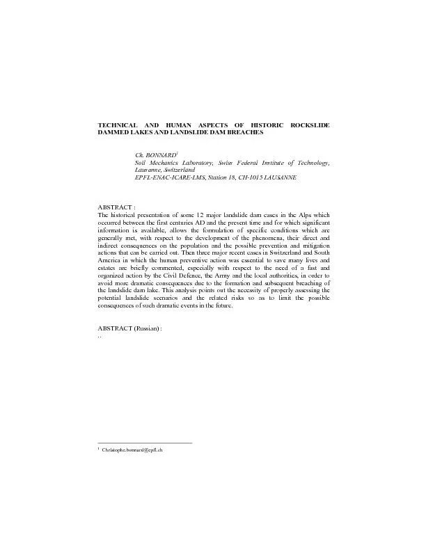
/
TECHNICAL AND HUMAN ASPECTS OF HISTORIC ROCKSLIDE DAMMED LAKES AND LAN TECHNICAL AND HUMAN ASPECTS OF HISTORIC ROCKSLIDE DAMMED LAKES AND LAN

TECHNICAL AND HUMAN ASPECTS OF HISTORIC ROCKSLIDE DAMMED LAKES AND LAN - PDF document

danika-pritchard
danika-pritchard . @danika-pritchard
Follow
395 views
Uploaded On 2016-03-10

TECHNICAL AND HUMAN ASPECTS OF HISTORIC ROCKSLIDE DAMMED LAKES AND LAN - PPT Presentation

Christophebonnardepflch 1 Introduction Landslide dam lakes are fairly frequent phenomena in mountainous regions but are often unknown or not recorded because of their frequently temporary char ID: 250721

Christophe.bonnard@epfl.ch Introduction

Share:

Link:

Embed:

Download Presentation from below link

Download Pdf The PPT/PDF document "TECHNICAL AND HUMAN ASPECTS OF HISTORIC ..." is the property of its rightful owner. Permission is granted to download and print the materials on this web site for personal, non-commercial use only, and to display it on your personal computer provided you do not modify the materials and that you retain all copyright notices contained in the materials. By downloading content from our website, you accept the terms of this agreement.


Presentation Transcript

TECHNICAL AND HUMAN ASPECTS OF HISTORIC ROCKSLIDE DAMMED LAKES AND LANDSLIDE DAM BREACHES Ch. BONNARD Soil Mechanics Laboratory, Swiss Federal Institute of Technology, Lausanne, Switzerland EPFL-ENAC-ICARE-LMS, Station 18, CH-1015 LAUSANNE The historical presentation of some 12 major landslide dam cases in the Alps which occurred between the first centuries AD and the present time and for which significant information is available, allows the formulation of specific conditions which are generally met, with respect to the development of the phenomena, their direct and indirect consequences on the population and the possible prevention and mitigation actions that can be carried out. Then three major recent cases in Switzerland and South America in which the human preventive action was essential to save many lives and estates are briefly commented, especially with respect to the need of a fast and organized action by the Civil Defence, the Army and the local authorities, in order to avoid more dramatic consequences due to the formation and subsequent breaching of the landslide dam lake. This analysis points out the necessity of properly assessing the potential landslide scenarios and the related risks so as to limit the possible consequences of such dramatic events in the future. ABSTRACT (Russian) : .. Christophe.bonnard@epfl.ch 1. Introduction Landslide dam lakes are fairly frequent phenomena in mountainous regions, but are often unknown or not recorded because of their frequently temporary character, following their rapid destruction or filling with sediments, especially if the reservoir displays a limited volume. Indeed detailed data on the landslides are quite scarce in the case of rapid dam breaches. However the major phenomena have left significant traces in history following the destructive consequences induced by the dams breaches that are liable to transform a local initial event into a regional disaster, if not international, as it could happen with the largest landslide dam in the world, lake Sarez in Tadjikistan [11, 15]. Indeed, in most of the cases for which information is available, the landslide itself has caused only minor damage to man and goods, but the formation of the lake upstream and the flooding downstream following the dam breaches have provoked momentaneous or permanent destructions that are reported in several archive documents or in historic books relating past disasters [1, 8, 13,18], or are known through expert reports. A general description of landslide dams processes and characteristics is given in (Schuster (ed.), [24]), but most of the cases presented in this book refer to America and Asia, so that it was felt as an interesting contribution to present a dozen of major historical European cases during the last 2000 years. The paper will then give more detailed data on three remarkable fairly recent landslide dams, in Switzerland (Randa, 1991), Peru (Mayunmarca, 1974 – thanks to a personal contribution of Prof. Hutchinson [14]) and Ecuador (La Josefina, 1995). In these cases the preventive human action was essential to mitigate the consequences of the potential or effective dam breaches. This paper will conclude on some perspectives related with the management of potential landslide dams, illustrated by a significant case in France (Séchilienne). Landslide dams are quite ancient phenomena and their existence since glacial periods is still proved by several natural lakes of large size in Switzerland (Sils lake, Silvaplana lake, Poschiavo lake, Schwarzsee lake, Klöntal lake, Davos lake, Arnon lake for instance; for the three last ones, the reservoir has even been increased for hydro-electric purposes by the construction of a dam on the landslide mass itself) (Figure 1). The most ancient reported events date from the beginning of the Christian era (the Turedunum landslide, in the Rhone valley, reported by the Bishop Marius of Lausanne in the Vth century [23]; the Platé Massif landslide, in the Arve valley, as commented by Mougin [19] – see below). Some of these ancient events are even better recorded as they occurred several times at the same site, either if they were caused by repetitive massive debris flows or if the first main scarp induced regressive failures and consecutive rockfalls. Many reported cases put forward several typical characteristics, either with respect to their mechanism or with respect to the reaction of the affected population or authorities and the technical actions undertaken in order to reduce the harmful consequences of these sudden dramatic phenomena. Existing prehistoric landslide dam (confirmed) and lake Existing prehistoric landslide dam (supposed) and lake Existing prehistoric landslide dam with lake, enlarged by an artificial dam or control structure Prehistoric rockslide or debris slide breached dam (confirmed) Prehistoric rockslide or debris slide breached dam (supposed) Historic breached landslide dam (Buzza di Biasca) Historic landslide dam with existing natural lake Historic landslide dam with filled reservoir Historic ice or snow dam which was formed and breached several times Figure 1. Map of landslide dams in Switzerland (the cases presented in the following text are marked by letters A-E; see the names of numbered cases in Table 1).2. Historical presentation of major landslide dams in the Alps This presentation, which does not aim at being exhaustive, will be done in a chronological perspective (always considering the earliest event reported at a specific site), without consideration of the respective countries (which have anyway changed in the Alpine region during the latest 2000 years), so as to describe the evolution of the respective impacts and of the human reactions. For each of the three periods considered in the following paragraphs, four cases will be presented and illustrated. 23456 781321 24AB D EC TABLE 1. List of major confirmed or supposed landslide dam lakes in Switzerland, still existing. No Name Canton Area Max. El. (m a.s.l) Max. depth (m) Volume of lake or reservoir (10Type Observations Confirmed existing prehistoric landslide dam and lake 1 Sils lake Graubünden 4.11 1797 71 137 A Max. level regulated Silvaplana lake Graubünden 3.16 1791 77 132 A Max. level regulated Oeschinen lake Bern 1.15 1578 56 B 4 Dauben lake Wallis 0.69 2205 A No overflow is observed 5 Türler lake Zürich 0.49 643 22 A Schwarzsee lake Freiburg 0.47 1046 10 A1 7 Obersee Glarus 0.24 989 10 A 8 Voralp lake St. Gallen 0.15 1123 Supposed existing prehistoric landslide dam and lake 11 Sarnen lake Obwald 7.38 469 52 244 A According to A. Heim 12 Lauerz lake Schwyz 2.99 447 14 A Lungern lake Obwald 2.01 689 68 65 A (landslide origin supposed) Existing prehistoric landslide dam with lake enlarged by an artificial dam or control structure 21 Klöntal lake Glarus 3.29 (832) 47 56 A Dam built in Poschiavo lake Graubünden 1.98 962 84 111 A Control structure built in 1908 23 Davos lake Graubünden 0.59 1559 51 15 A Dam built in 19.. 24 Arnen lake Bern 0.45 1543 50 12 A1 Dam built in 25 Heidsee Graubünden 1.0 1484 5 0.5 A Lake on the landslide mass Notes : Among the 35 natural lakes in Switzerland (including those enlarged by dams) which cover (or covered) an area above approx. 0.5 km, 12 can reliably be considered as landslide dam lakes. Explanation of types according to Heim [13] (modified) : A A main valley is dammed by a landslide originating in an adjacent slope or a lateral valley A1 A-type landslide dam formed by two opposed landslides B A lateral valley is dammed by a landslide extending in the main valley 2.1. I-XVTH CENTURIES (ROMAN ERA AND MIDDLE AGES) One of the most ancient reported cases originates below the limestone Massif of Platénear the Mont-Blanc, some 1500 m above the Arve river (Figure 2). During the early Christian era a large slide mass blocked the gorge of the Arve, an affluent of the Rhone river, impounding a lake which overflowed, not into the original gorge, but into a parallel gorge of Le Châtelard, some 500 m to the south. The lake seems to have persisted until the XIIIth century, that is more or less 1’000 years, which can be justified Figure 2. Perspective view on the slides affecting the slopes of the Massif of Platé. The village of Servoz is shown by a star. by the fact that the initial overflow did not occur on the slide mass itself. The failure of the landslide dam finally reestablished the old course of the river. In February 1471 a part of the slope failed again, raising the water level some 150 m higher than the river bed, due to the narrowness of the gorge. Before the nearby village of Servoz was affected, its inhabitants excavated a ditch on the slide mass, thus draining the lake without further damage. This last action proves that the best engineering technique to control landslide dams was already practiced more than 500 years ago. In August 1191, some 150 km to the south of the first mentioned site, a large rock avalanche and debris flow elevated a narrow part of the Romanche valley that meets the Isère river near Grenoble, and rose the level of the already existing shallow lake near the town of Bourg d’Oisans by 10 to 15 m, appearently without causing victims (Figure 3). 28 years later, that is on September 24, 1219, the downstream face of the debris dam was eroded leading to a collapse. The wave of water and debris destroyed the settlements all along the Romanche valley down to the city of Grenoble, located 30 km downstream, which was partially flooded, as it was built in a flat plain. The channels of the Romanche and Isère rivers were displaced and the flood was perceived down to the Mediterranean sea. Thousands of casualties were reported. The debris flow dam phenomenon repeated itself in 1449 (a new lake appeared), 1465, 1617 and 1666, but without downward flood, as a channel was quickly excavated after the two last episodes, limiting the flooding upstream and the surge downstream. In the last three centuries, the lake bed was progressively filled with sediments and became a swampy area along a channalized river course. In the XIXth century drainage ditches allowed the plain to become a fertile agricultural land and later the town to extend (Figure 3). * Figure 3. View of Bourg d’Osians in Romanche valleyThis case is useful to remember because, some 10 km downstream, the Séchilienne landslide presently threatens the Romanche valley (see § 4). On January 25, 1348 a significant earthquake shook the Dobratsch massif (El. 2’000 m) and caused large rockslides, one of which, approx. 30 in volume, along a fault surface dipping 45° to the south, blocked the 2.5 km wide Gail valley (El. 500 m) (Figure 4). This valley, which corresponds to a major Alpine fault (Periadriatic Lineament) had already been affected by several rockfalls at the end of the last glaciation following the erosion of the toe of the north side of the valley. Several settlements were buried by the rockfall and flooded upstream, and a short time later the dammed lake burst across the dam and devastated the valley below. Presently the hydraulic head created by the remaining debris lobe is used in a hydroelectric scheme and villages are developing in the valley despite of risks related to the presence of large sinkholes and fissures behind the highest Dobratsch cliff face. Figure 4. View of the top scarp of Dobratsch rockslide. Large fissures can be seen in the forest on the top. Finally, some 250 km to the west of Dobratsch massif, in the Passer narrow valley upstream of the town of Merano, the large Ganderberg rockslide blocked the valley in 1404 and created a lake 50 m deep and 1 km long, called Wildsee (or Wild lake) (Figure 5). This lake lasted for almost 400 years, despite of several serious overflow episodes : in September 1419 a section of the debris dam failed and the consecutive flood killed 400 people, down to the town of Merano, 25 km south of the lake; in September 1503, the walls of the town of Merano were completely demolished; in September 1512, the city tower of Merano collapsed and in May 1572, the reconstructed walls were breached again. This series of events is probably due to the constant sagging movement affecting the Ganderberg slope. After a quiet period of nearly 150 years, a section of the dam failed again in June 1721 and a flood dashed downstream; at that time plans were prepared to design a protection structure, but the works were not carried out. In September 1772 after a severe regional rainstorm which brought many logs to the lake, the outlet was plugged and the level of the lake rose, until 3 million m3 of water and debris swept down the valley. The following year a drainage channel equipped with gates was built to control the runoff, but in October 1774, the gates were opened too far, so that the flood flows undercut the embankments which collapsed and provoked a drainage of the lake in 12 hours. Several buildings in Merano were demolished. The lake did not reappear but over the last century, several dykes, check dams and linings have been carried out and require permanent maintenance. Figure 5. Sketch of Ganderberg rockslide [8]. These first four ancient cases, whose details have been obtained from Eisbacher and Clague [8], demonstrate that the problems set by landslide dammed lakes are always the same, whatever their age can be : - dams may last very little or very long, so that the threat usually does not decrease with time; - they cause dramatic consequences upon failure at a large distance downstream; - possibilities of limiting the damage do exist provided that well and quickly built structures are carried out. 2.2. XVITH TO XVIIITH CENTURIES On September 30, 1513 a large rockslide 10 to 20 collapsed from the north-western steep slope of Pizzo Magno (El. 2’329 m) (Figure 6 and case A in Figure 1) and blocked the Blenio Valley at El. 400 m, just upstream of the town of Biasca where the Ticino River and Brenno river (flowing in Val Blenio) merge. This landslide dam called Buzza di Biasca (Bonnard, 2004) first destroyed several buildings down to the outskirts of Biasca, then created a lake extending 5 km upstream, which reached a volume of 100 and drowned the communities of Malvaglia and Semione. During nearly 20 months, this lake, first well observed, seemed to have become a permanent feature of Figure 6. Viewof Pizzo Magno from which the rockslide started.the valley. But on May 20, 1515, a few months before the battle of Marignan, the spring time overflow eroded the dam, causing its collapse. The city of Biasca was swept away as well as the valley of The Ticino down to Bellinzona (a main fortified town) and then to Lago Maggiore, so that 600 persons died. This dramatic event had two main human consequences : first, the bridge connecting Bellinzona to Locarno was destroyed and could not be rebuilt for more than a century, causing major economic difficulties in the local trade. Then the population of the Ticino Valley assigned the inhabitants of Biasca in justice, accusing them of witchcraft. It took several years until the court decided that they had no direct responsibility in the disaster. To the south-east of the mountain ridge of Les Diablerets (El. 3’209 m) which is one of the highest peaks in the western Swiss Alps, several million m detached in June 1714 from the slope, after that repeated small rockfalls were observed, and overwhelmed the pasture lands of Derborence, killing 15 persons (Figure 7 and case B in Figure 1); one of the men trapped in his chalet where he was making cheese survived and after excavating in the slide mass for three months, he emerged, but was not recognized by his neighbours, as told in a novel by the Swiss writer C.F. Ramuz. In the same area, a renewed larger failure of some 30 occurred on July 23, 1749 and moved over a total distance of 5 km, creating the lake of Derborence at the outlet of a nearby creek called the Derbonne, the lake of Godey in another creek, which has been raised by a dam built just on the side of the landslide mass, as well as three small lakes just on the side of the landslide mass itself which still exist [10]. The total landslide mass has been assessed by Heim [13] at 50. Smaller rockfall events still occurred later but without major impact. The main natural lake, still existing today, is now nearly filled with sediments and its depth does not exceed 3 m so that it does not represent a threat anymore (Figure 7). Figure 7. Lower part of Derborence rockslide as seen for Les Diablerets mountain. The major lake is visible on the right side of the photo. Some years later, in 1771, not very far from the recent Vaiont disaster, at the limit of the Southern Alps, a dip slope rockslide of some 20 blocked the Cordèvole valley, climbing more than 50 m up the opposite slope, destroying three hamlets and killing its 49 inhabitants. With the formation of the lake of Alleghe, 5 hamlets were drowned upstream, as the lake extended over some 4 km. On May 1, 1771, a part of the main scarp cliff fell and plunged into the lake from a height of 1’000 m causing a wave that surged over the opposite slope and up a lateral valley formed by the Zunaina Torrent. In the nearby village of Alleghe, it damaged the church and killed three people. Happily the rockslide dam was not affected by the wave; it was reinforced later to provide a stone masonry and concrete lining. As in the precedent case, the sediments of Cordèvole Torrent are progressively filling the lake, the depth of which has decreased from 50 m to 15 m. Despite of residual risks of rockfall, the area of the dam has been developed as a vacation resort (Figure 8). Figure 8. Lake of Alleghe with developing vacation resort on the landslide dam. Some 40 km south of the Dobratsch rockslide, at the toe of the southern Alps, near the town of Udine, a large dipslope rockslide of some 30 fell from the slope of Monte Auda, at an elevation of 1’500 m, down to the Tagliamento valley at an elevation of 500 m, and climbed 100 m up the opposite side of the valley. This rockslide which destroyed the village of Borta and killed 53 inhabitants in August 1692, is represented on one of the most ancient sketches of landslide disasters, produced by Pascolo Pascoli one month after the event [13], quoting [5] (Figure 9). It created a lake almost 7 km long which reached a maximum depth of 80 m in two months; then it experienced two overflows on 4 and 20 October 1692 which lowered the lake level. The lake persisted for some times then filled with sediments over a depth of 30 m which were eroded to form a deep channel across the river deposits and rockslide mass. Other events affected the Tagliamento valley in the last two centuries, mainly due to seismic activity, but they did not modify the stability conditions of the slope that had destroyed the village of Borta. Figure 9. Sketch of Tagliamento valley rockslide produced by Pascolo Pascoli one month after the event, i.e. in 1692 [8]. These four last cases whose details were mainly obtained from Eisbacher and Clague [8] and Heim [13] confirm some known major ever-lasting characteristics of landslide dam lakes : - When the drainage area of the dammed valley is large like in the case of Biasca and Tagliamento valleys, the reservoir usually does not last very long. - The presence of lakes in tourism areas constitutes an attraction whereas residual risk related to the event which formed the lake often still exists. - In three out of the presented cases, warning signs of an anormal activity of the slope had been perceived before the disaster, but the potential impact of the main landslide had been completely understated; the falling mass can thus extend high up on the slope facing the landslide. 2.3. XXTH CENTURY CASES It is remarkable that nearly no major landslide dams are reported in the last century in the Alpine range. Therefore, only four particular cases bringing a new perspective on some problems related to landslide dams will be briefly mentioned. The first one refers to Motto d’Arbino rockfall, located some 20 km South of the Buzza di Biasca (see above), which occurred in October 1928, when 30 to 40 of rock blocked the valley of Arbedo causing a small lake 1.5 km long (Figure 10 and case C in Figure 1). Despite of several debris flows which reached the village of Arbedo downstream, the gorge formed by the Traversagna torrent was not eroded. Between 1930 and 1950 a 30 m high debris retention dam was built so that the lake is now totally filled with sediments and the former debris course has been occupied by residential buildings. The most interesting aspect of this case is that, since 1925, a routine triangulation survey on Motto d’Arbino monument at the top of the mountain showed a clear preparatory movement, which was monitored in detail in 1927 and 1928, Figure 10. View of Motto d’Arbino rockfall dam in Arbedo valley, taken just after the event, in 1928. supplying the first scientific and duly measured evidence of the acceleration phase before the rockfall [9], allowing the evacuation of the 16 houses that were demolished by the rockfall. For the second case, La Clapière rockslide in the South of the French Alps, near the Italian border, the slope movement caused by a large toppling mechanism was first reported in 1976, but despite of several critical periods of acceleration, in particular in 1987 and 2001 [6, 21], the landslide mass displaced the river bed of the Tinée river towards the west, but never dammed it effectively (Figure 11). However, due to the high risks involved for the village of St. Etienne de Tinée immediately upstream and for the very developed valley downstream, reaching the Mediterranean Sea in the outskirts of Nice, a diversion gallery was built. The design and engineering aspects of this work deserve some comments, as well as the human aspects the importance of which justified many preventive actions (sophisticated monitoring system, significant modification of the access road, construction of a long diversion gallery). Figure 11. Recent photo of La Clapière rockslide which permanently threatens the Tinée valley, north of Nice. The third case, in Valtellina valley in the North of Italy, deserves mentioning for two reasons. First it is a dramatic example of a two-phase landslide : a first debris flow originating in the adjacent Val Pola, following the extraordinary rainfall of July 18 and 19, 1987, dammed the Adda valley and increased the height of an existing small lake. A week later, as a long crack appeared in the slope of Monte Zandila and frequent rock blocks fell below this crack, four villages upstream were evacuated. But on July 28, at 7.23 in the morning, a huge rockslide (approx. 40) occurred, fell in the valley mainly downstream of the lake the level of which had increased and went up the opposite slope some 300 m above the valley floor; the upstream part of the mass fell directly in the lake, causing a 95 m high wave of water and debris which moved more than 2 km upstream, provoking the destruction of two villages which had not been evacuated initially and therefore the death of 27 persons ([12] and chapter X in this book) (Figure 12). Then it deserves mentioning it here because a series of technical measures were taken to control the risks downstream, induced by the 90 m high natural dam. A first channel was excavated in the landslide mass to control the overflow. Pumping stations were installed to reduce the lake water level. Two 3 km long diversion tunnels were built within less than a year and a large spillway was built on the mass to allow the floods to pass without destroying the dam. Figure 12. Air view of Monte Zandila rockslide mass in the Valtellina valley. The formed lake is visible on the right. The last recent case worthwhile reporting occurred in August 1994, due to Chlöwena landslide [25] which dammed the Höllbach Torrent, not far from the City of Freiburg, after a progressive acceleration phase which lasted at least four months (Figure 13 and case D in Figure 1). Even though the lake was of very limited volume, the risk was high as the dam height nearly reached 40 m, as the torrent was known to experience violent floods (hence his name : Höllbach, i.e. Hell Torrent) and as there were several industrial plants along the river downstream in the town of Marly. Due to the progressive movement of the slide (a maximum displacement 250 m was recorded) and creation of the dam, time was allowed for the computation of the formation of the dam with a viscous mechanical model and for the execution of hydraulic model tests to check the overflow conditions. Finally the flow found its way along the edge of the landslide mass without causing any damage up to now. Figure 13. Lower part of Chlöwena landslide and destroyed Falli Hölli village. The lower part of the slide evolved in a mudslide to form a dam in the nearby river.. The four last cases allow the formulation of the following conclusions : - The modern survey and modelling techniques enable the engineers to develop fairly reliable predictions related to the formation and behaviour of landslide dams, if time is available. - Several engineering works can be designed and carried out to limit the consequences of landslide dams, but they require a sophisticated design and appropriate building technologies. - A fast preventive action is required as soon as the risks are assessed, because the value of the exposed objects, in particular downstream, tends to increase exponentially with time. 3. Resent cases in which the human preventive action was essential to save lives and goods Three cases, namely one in Switzerland and two in South America, are selected for presentation as their management was significant to prove that efficient measures may be taken, even in difficult situations, to decrease the risks induced by landslide dams, and to illustrate such measures. 3.1. RANDA ROCKFALL, SWITZERLAND (1991) This large rockfall (approx. 30 in two main stages) which occurred on April 18 and May 9, 1991, formed a large dam in the Vispa Valley, some 10 km downstream of the famous tourist resort of Zermatt, interrupting the railway and road accesses [20, 22]. The dam had a minimum height of 100 m above the river bed in the central part of the rockfall mass, whereas the lowest point of the “crest” of the dam, at El. 1’421 m, on the opposite slope formed by the alluvial fan of the Dorfbach Torrent, was 44 m higher than the upstream toe of the dam (see Figure 14 and case E in Figure 1). Despite of the very coarse material observed at the surface, the first excavations for the construction of a spillway channel showed a compact material, which was confirmed later by the high natural compaction of the mass (swell factor of 13 %), so that the seepage through the huge fallen mass was negligible. Fortunately three factors contributed to significantly limit the rising of the lake : - The weather was fairly cold and not very wet during the spring of 1991 so that the snowmelt did not represent a major contribution to the flow of the Vispa river. - A large part of the drainage area of this river is included in the general catchment area of the Grande Dixence hydroelectric scheme, so that it was possible to divert a large part of its flow out of the Vispa river, thanks to the continuous operation of the Z’mutt pumping station. - The Swiss army as well as several contractors quickly intervened on the site, once a provisional road was reestablished, to install up to 36 pumps in the lake which was beginning to rise and evacuate the pumped waters downstream of the rockfall mass. Figure 14. General view of Randa rockfall causing the damming of the Vispa river. The mitigation warks are already carried out. These comprehensive mitigation actions, combined with the construction of a provisional channel, limited the flooding of the lower part of Randa Village : only at two occasions, after intense storms, the village was partially under water; in particular, on the second occasion, the main cause was the plugging of the diversion channel by a debris flow coming from the Dorfbach, facing Randa rockfall (Figure 15). Figure 15. Due to a debris flow which blocked the provisional excavation channel, the plain below Randa village was flooded for a short while. The road could be maintained thanks to a floating bridge set up by the Swiss army. Later on, a 3 km long diversion tunnel was built in the left bank to avoid flooding, so that no catastrophic dam breach occurred. But the sewage plant used for Randa and the upstream villages, located along the river, was completely flooded during the year 1991, which caused additional environmental impacts (see lower part of Figure 15). 3.2. MAYUNMARCA ROCKSLIDE, PERU (1974) In April 1974 a gigantic and fast rockslide with a volume estimated at 1 to 1.3dammed the Mantaro river in the Peruvian Andes, causing more than 450 casualties and forming a 130 m to 150 m high dam [16, 17]. The lake was rapidly filled to El. 2’625 m reaching a volume of 670 and extending about 30 km upstream from the natural dam. 44 days after the rockslide, on June 8, 1974, it breached (Figure 16); the flow passed first, during the previous day, through a shallow channel up to 3 m deep, which had been excavated by bulldozer over a length of 250 m. The maximum discharge can be assessed between 7’000 and 15’000 /s, which eroded a deep gorge whose longitudinal profile had an inclination of not more then 1.5° (Figure 17). Figure 16. Aerial view of Mayunmarca landslide dam (from Servicio Aerofotográfico Nacional del Perú).. Thanks to a well organized action of the Civil Defence, all the potentially exposed persons downstream, as well as along the lake shores where slides could occur (on a zone 3 km wide), were evacuated, so that no lives were lost during the dam breach, despite of the very high wave, which still reached 20 m at an approximate distance of 100 km downstream of the slide dam, at the site of the Mantaro Power Station (the corresponding Tablachaca dam was only 1 to 2 km upstream of the farthest point impounded by the landslide lake). Figure 17. Erosion gorge in Mayunmarca landslide dam after the outflow, more than 100 m deep. This example corresponding to one of the largest landslide dams shows again the brittleness of landslide dams, especially as its zone of origin was already affected by deep rotational slides which decreased the shear strength of these materials. This leads to a short duration lake which is quickly emptied as soon as overtopping begins. But a good management of the situation downstream nevertheless allows the protection of all the population threatened by the dam breach. In this case however the scarce occupation of the affected zone reduced the effective damage. 3.3. LA JOSEFINA LANDSLIDE, ECUADOR (1993) After a long period of intense rain, a large rockslide with a volume of 20 to 30 10occurred during the night of March 29, 1993 at La Josefina, downstream of the city of Cuenca, Ecuador, damming the river Paute as well as a small affluent called river Jadán, and causing 80 deaths [2]. It can be proved that it was a slide because, in a house located at the top of the landslide mass, a baby was forgotten when his parents fled, but was found safe some 300 m lower, in the next morning. Despite of a very fast action of the army which could excavate a 18 m deep channel implying a volume of 150’000 m in two weeks, the lake reached a volume of 185 in one month, flooding important infrastructures including the access road to the lower Amazonian valleys, the Panamerican highway and a power plant upstream. On May 1, 1993 the flow in the channel rapidly increased the erosion so that nearly 90 % of the reservoir was emptied in 10 hours with a maximum discharge of 8’000-10’000 m/s, causing major damage to the communities of Gualaceo and Paute downstream, but no victim (Figure 18). The most important hydro-electric plant of Figure 18. View of La Josefina landslide dam, some monthes after breaching. A deeper artificial channel is excavated to decrease the level of the residual lake. Ecuador located downstream, which had been partially emptied during the month of April by its bottom outlets, was rapidly filled with water and sediments (equivalent to one year of normal siltation) and the spillway could safely evacuate some 4’500 m/s at the maximum, saving the dam. The only major damage was the destruction of the platform in front of the entrance to the underground power plant, so that it was inaccessible by vehicles. This example once more proves the efficiency of the fast construction of a channel on the slide mass to reduce the damage downstream and the possibility to save all lives even over a large area if the action of the Civil Defence is well organized, but provided that the overflow occurs a few weeks after the slide. If the dam fails after a much larger period, it is more difficult to keep the whole threatened population away from the endangered zone. The second lesson from this case is that a good coordination between all the public administrations involved may reduce the damage and help solving many problems created by the landslide lake. However the action of these administrations is much more difficult after the disaster, to manage the reconstruction and provide all the affected persons with a partial help depending on the resources gathered through the national and international assistance. One of the mitigation actions includes the excavation of a new channel in order to decrease the level of the upstream residual lake and the stabilization of the river bed downstream to limit the river erosion (Figure 19). It is only after these preventive measures that the road in the valley can be rebuilt. Figure 19. Excavation of a new channel in the landslide mass after the May 1, 1993 overflow. The unstable left slope that needed a stabilizing scheme can be observed. 4. Conclusions and perspectives The consideration of historic landslide dam events and of the process through which they occurred leads to the conclusion that an active intervention is in most of the cases impossible to stop the landslide. After it has occurred, a passive acceptance of the situation is unacceptable when the potential dam breach represents a high risk for the population and properties downstream. It is thus essential to take immediate and even preventive measures when it is possible, to protect the exposed populations and infrastructures. A good example of these preventive actions is given by Séchilienne landslide in the valley of the Romanche river already mentioned above in § 2.1 (Figure 20). The evidence of increasing movements in the slope since 1985 perceived by the fall of individual blocks and the evolution of the morphology has led the authorities to develop extensive monitoring, to change the layout of the exposed national road leading to important tourist resorts and to create a new river bed protected by a dam, which might retain a limited volume of rockfall material [7]. As the monitoring results after some years induced to think that the potential rockfall volume could be larger than expected, a gallery was built so as to allow a partial diversion of the river flow in case of the formation of a landslide dam. Finally a detailed modelling of the formation of the dam, studied by two different dynamic approaches has allowed the determination of the dam height in several scenarios and thus the analysis of the flow conditions downstream. Figure 20. Zone of impact of Séchilienne rockfall. Other preventive measures are still studied in order to limit to a minimum the impact of the eventual flood wave on the city of Grenoble and its surroundings, where important industrial plants induce very high indirect risks. It is clear that for potential large landslide dams, the early identification of eventual scenarios based on a complete analysis of their triggering and run-out conditions is essential to organize appropriate preventive actions in due time [4]. But a detailed knowledge of past events like those mentioned above will always be useful to help determining their probability of occurrence, considering that significant bases in this field are lacking. It is therefore interesting to continue analyzing the major landslide dams which occurred in the past. 5. Acknowledgements Sincere thanks are expressed to my collegues Jordi Moreno who contributed to the preparation of the figures and to Karine Barone who mastered the typing and editing tasks of this paper. 6. References 1. Abele, G. (1974) Bergstürze in den Alpen. Wissenschaftliche Alpenvereinshefte, München. H. 25, 230 S. 2. Basabe, P. et al. (1996) Prevención de desastres naturales en la cuenca del río Paute. Libro “Sin plazo para la esperanza”. Escuela politécnica nacional, Quito-Ecuador, 271-287. 3. Bonnard, Ch. (2004) La Buzza di Biasca. Contribution au Dict. Historique de la Suisse. 4. Bonnard, Ch., Forlati, F. & Scavia, C. (eds) (2004) Identification and Mitigation of Large Landslide Risks in Europe. Advances in Risk Assessment. 317 p., Balkema. 5. Cavallin, A. & Martinis, B. (1974) Studio geologico della grande frana di Borta (Ampezzo). Cronaca del Soc. Alp. FriulianaV. 58, 297-319. 6. Durville, J.-L. (2002) Pers. Comm. 7. Durville, J.-L., Effendiantz, L., Pothérat, P., MarchesiniP. (2004) The Séchilienne Landslide. In Identification and Mitigation of Large Landslide Risks in Europe. Advances in Risk Assessment, Balkema 8. Eisbacher, G.H. & Clague, J.J. (1984) Destructive mass movements in High mountains : Hazard and management. Geol. Survey of Canada, 230 p. 9. Engel, Th. (1986) Nouvelles méthodes de mesure et d’analyse pour l’étude des mouvements du sol en terrains instables. Thèse n°601, Ecole Polythechnique Fédérale de Lausanne. 10. Gabus, J.H. (1990) Atlas géologique de la Suisse, feuille No 1285, Les Diablerets, Office fédéral des eaux et de la géologie, Bienne. 11. Gaziev, E. (1984) Study of the Usoi Landslide in Pamir. Proc. 4 Int. Symp. on Landslides, Toronto, Vol. , 511-514. 12. Govi, M. (1990) Mouvements de masse récents et anciens dans les Alpes italiennes. Proc. 5th Int. Symp. on Landslides, Lausanne, Vol. , 1509-1514. 13. Heim, A. (1932) Bergsturz und Menschenleben. Fretz & Wasmuth Verlag, Zürich, 227p. 14. Hutchinson, J.N. (2004) Pers. Comm. 15. ISDR (2000) Usoi Landslide Dam and Lake Sarez. UN-ISDR Prevention Series N° , 115p. 16. Kojean, E. & Hutchinson, J.N. (1978) Mayunmarca rockslide and debris flow, Peru. In : Rockslides and Avalanches, B. Voight (ed.), Vol. , 315-361. 17. Lee, K.L. & Duncan, J.M. (1975) Landslide of April 25, 1974 on the Mantaro River, Peru. Committee on Natural Disasters, National Research Council. 72 p. Washington : National Academy of Sciences. 18. Montandon, F. (1933) Chronologie des grands éboulements alpins, du début de l’ère chrétienne à nos jours. Soc. de Géographie, Genève, Matériaux pour l’Etude des Calamités, N° , 271-340. 19. Mougin, P. (1914) Les Torrents de la Savoie. Grenoble, 1250 p. 20. Noverraz, F. & Bonnard, Ch. (1992) L’écroulement rocheux de Randa, près de Zermatt. Proc. 6th Int. Symp. on Landslides, Christchurch, Vol. , 167-170. 21. Pilot, G. & Durville, J.-L. (1990) Les mouvements de terrain dans les Alpes françaises. Proc. 5th Int. Symp. on Landslides, Lausanne, Vol. , 1515-1537. 22. Schindler, C. & Eisenlohr, T. (1992) Bergsturz Grossgufer bei Randa. Geologisch-geotechnische Expertise. ETH-Zürich, 83 p. + Annexes. 23. Schöneich, Ph. (2000) Impact of Rockfalls on Soft Water Saturated Floodplain Sediments. Three Examples from the Swiss Rhone Valley. Proc. VIIIth Int. Symp. on Landslides, Cardiff, Vol. , 1327-1332. London : Thomas Telford. 24. Schuster, R.L. (ed) (1986) Landslide Dams : Processes, Risk and Mitigation. Geot. Spec. Publ. No . Am. Soc. Civ. Eng., New York, 164 p. 25. Vulliet, L. & Bonnard Ch. (1996) The Chlöwena landslide : Prediction with a viscous model. Proc. 7th Int. Symp. on Landslides, Trondheim, Vol. , 1525-1530.