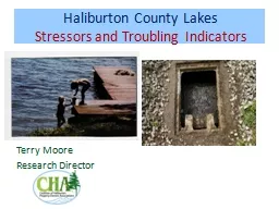
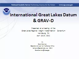
/
International Great Lakes Datum International Great Lakes Datum

International Great Lakes Datum - PowerPoint Presentation

luanne-stotts
luanne-stotts . @luanne-stotts
Follow
349 views
Uploaded On 2018-11-05

International Great Lakes Datum - PPT Presentation

amp GRAVD Presented at a meeting of the Great Lakes Regional Height Modernization Consortium Harrisburg PA April 1314 2011 by David Conner Geodetic Advisor to the State of Ohio National Geodetic Survey NOAA ID: 716416

great igld heights lakes igld great lakes heights datum water ngs grav noaa vertical data level 2010 updated geoid system october international

Share:

Link:

Embed:

Download Presentation from below link

Download Presentation The PPT/PDF document "International Great Lakes Datum" is the property of its rightful owner. Permission is granted to download and print the materials on this web site for personal, non-commercial use only, and to display it on your personal computer provided you do not modify the materials and that you retain all copyright notices contained in the materials. By downloading content from our website, you accept the terms of this agreement.


Presentation Transcript

Slide1

International Great Lakes Datum

& GRAV-DPresented at a meeting of the Great Lakes Regional Height Modernization ConsortiumHarrisburg, PAApril 13-14, 2011

by

David Conner

Geodetic Advisor to the State of Ohio

National Geodetic Survey, NOAA

Dave.Conner@noaa.govSlide2

NGS and the NSRSWho are those guys and what is CO-OPS?

NOAA's National Geodetic Survey (NGS) defines and manages a National coordinate system. This network, the National Spatial Reference System (NSRS), provides the foundation for transportation and communication; mapping and charting; and a multitude of scientific and engineering applications. NGS was known as the US Coast and Geodetic Survey (USC&GS) until 1970 when it was renamed to become part of the newly formed National Oceanic and Atmospheric Administration (NOAA). NOAA is within the US Dept of Commerce. NGS is within NOAA’s National Ocean Service (NOS). The Center for Operational Oceanographic Products and Services (CO-OPS) is another element of NOS. They are responsible for monitoring tides/water levels and currents, and maintain a network of some 54 water level gauges throughout the Great Lakes and their connecting channels. They are responsible for determining heights associated with the International Great Lakes Datum (IGLD), in cooperation with NGS and our International partners in Canada.Slide3

Gravity for the

Redefinition of the American* Vertical DatumAn NGS project whose target is to redefine the official civilian vertical datum as the geoid, realized through the use of GNSS technology and a gravimetric geoid model over at least the United States and its territories Last Updated 12 October 2010 (DAS)3

What is GRAV-D? (

1)Slide4

Official NGS policy as of Nov 14, 2007

Airborne Gravity SnapshotAbsolute Gravity TrackingRe-define the Vertical Datum of the USA by 2022 (at current funding levels)Part of the NGS 10 year plan (2008-2018)Target:

2 cm accuracy

orthometric heights from GNSS and a geoid model

Last Updated 12 October 2010 (DAS)

4

What is GRAV-D? (

2)Slide5

GRAV-D means fast, accurate, consistent orthometric heights

everywhere in the USAGPS already gives fast accurate ellipsoid heightsIf the geoid were modeled (and monitored) to highest accuracy…fast, accurate orthometric heights, anywhere, anytimeNo need to use leveling to “bring in the datum” Last Updated 12 October 2010 (DAS)

5

What is GRAV-D? (

3)Slide6

GRAV-D will mean:Primary access to the vertical datum will be through a GNSS receiver and a gravimetric geoid model

One consistent vertical datum for all of North AmericaCONUS, Alaska, Hawaii, PR, VIAvailable for adoption byCanada, Mexico, Caribbean, Central America Last Updated 12 October 2010 (DAS)6

What is GRAV-D?

(

4

)Slide7

GRAV-D will mean:As the H=0 surface, the geoid will be tracked over time to keep the datum up to date

The reliance on bench marks will dwindle to:Secondary access to the datumMinimal NGS involvementMaintenance/checking in the hands of usersUse at your own riskLast Updated 12 October 2010 (DAS)7

What is GRAV-D?

(

5

)Slide8

A relatively small workforce can update the geoid as compared to the large workforce needed to re-level bench marks

A 2 cm target accuracy anywhere that GNSS receivers can be used, kept up to date through monitoring CORS and the geoid, is better than the accuracy and accessibility of NAVD 88 todayIt is cheaper than levelingThe geoid can’t be bulldozed out of usefulnessThe effect of subsidence upon the realization will be known (and accounted for) by monitoring CORS and monitoring the geoid

Last Updated 12 October 2010 (DAS)

8

Why GRAV-D? (

1)Slide9

Geoid accuracy depends on quality of data and quality of theory

Theory being revised by Y. Wang (IAG study group)Data being updated using airborne techniquesAirborne gravimetry is the best technique to:Cover the country quickly and consistentlyConnect terrestrial to near-shore oceanic dataFill in the gap between point-by-point terrestrial measurements and 200 x 200 km footprint satellite (GRACE) measurements

Last Updated 12 October 2010 (DAS)

9

Why GRAV-D? (

2)Slide10

Last Updated 12 October 2010 (DAS)

10Ship gravityTerrestrial gravity

New Orleans

20-100 km gravity gaps along coast

Airborne gravity is the only technique that can adequately connect existing terrestrial data to existing ship and altimetry data in the oceans and fill coverage gaps.

Airborne data will not replace existing data, but will be used as a baseline for correcting that data to be consistent across the

country.

Why GRAV-D? (

3)Slide11

Decades of disparate gravity surveys are inconsistent with one another

Airborne gravity will provide a baseline for removing these inconsistencies Last Updated 12 October 2010 (DAS)11

Why GRAV-D? (

4)

%Slide12

FY12 Plan for CONUS

FY11 = Alaska and CaliforniaSlide13

FY12-13 Great Lakes Plan

FY12 = White, FY13 = OrangeSlide14

IGLD … what is it?

The IGLD is a dynamic height system. Dynamic heights, by definition, define a water level surface. Their use is not limited to the Great Lakes but they are the base height system used for IGLD 85 in the Great Lakes. Dynamic heights are the reference of choice for all large hydraulic systems everywhere.NAVD 88 heights are orthometric heights. Orthometric heights do not define a water level surface.IGLD heights are corrected dynamic heights.

Hydraulic correctors

(HC) are applied to dynamic heights to remove various observational and other inconsistencies in the NSRS. HC’s are the difference in the mean water level for the reference period 1982 -88 (7 year) between a subordinate gauge and the primary gauge on a lake.Slide15

IGLD … “I” is for International!

Management of these waters is governed by International Treaty administered by the International Joint Commission with representatives from the US and Canada.US scientific agencies have Canadian counterparts.Published Great Lakes water level data are coordinated by government agencies in both countries to ensure there is agreement.Coordinated basic hydraulic and hydrologic data are required to solve numerous international problems related to joint use of Great Lakes watersSlide16

IGLD … Why is it important?

The Great Lakes are a vast hydraulic system with water levels and flows influenced by engineered channels and control structures. The entire region is tilting due to post-glacial rebound (aka glacial isostatic adjustment … GIA)The absolute rate of change at a given location must be considered along with the relative rate of change across the region. The overall Great Lakes basin is tilting at a rate of about 60 cm (two) feet per century.Slide17
Slide18

National Spatial Reference System (NSRS)

NOS has two fundamental backbone systems …- GPS CORS (3-D) by NGS- Tide and Water Level Gauges (height) by CO-OPS

Cleveland Water Level Gauge and GPS CORSSlide19

Vertical rate of change due to Post-Glacial Rebound

International Great Lakes Datum of 1985 (IGLD 85), IGLD 2015 is comingSlide20
Slide21
Slide22

Seasonal fluctuation ~ +/- 1 ft, Long term fluctuation ~ +/- 6 ft

Storm events can cause short term fluctuations of up to ~ 8 ft at BuffaloSlide23

IGLD … Why is it useful?

Because it is a dynamic height system and can be used to relate various data to a common water level surface It provides a mechanism for the US and Canada to reference heights to a common datum throughout the Great Lakes regionEach country has adopted other vertical datums for general use. The Canadian vertical datum is CGVD 28. The US vertical datum is NAVD 88. Slide24

IGLD …

When/where is it used?It is used for basic hydraulic and hydrologic data related to engineering and scientific works on or near Great Lakes waters in both the US and CanadaThese works include things related to navigation and management of water … navigation charts, dredging, marine boundary determination, bridges, locks, dams, sewage and drainages systems, and much more.Slide25

IGLD … Why is there more than one?

The IGLD is revised about every 30 years to remove the effect of GIA from published heights.IGLD 85 is the current datum. It was preceded by IGLD 55, USLS 35, and various outer datums. Efforts are underway now to compute IGLD 2015Slide26

IGLD …

How are IGLD heights made available?Dynamic heights are published by NGS on all bench mark datasheetsIGLD 85 heights are not displayed on NGS’ datasheetsHydraulic correctors are determined by CO-OPSNOS provided software can be used to convert NAVD88 heights to IGLD 85 heights. This software applies a hydraulic corrector when appropriate.http://www.ngs.noaa.gov/TOOLS/IGLD85/igld85.shtmlIGLD water levels are found on the CO-OPS water level web page at

http://www.tidesandcurrents.noaa.gov/

Slide27
Slide28

www.ngs.noaa.govSlide29
Slide30
Slide31
Slide32

IGLD 85 heights…

some important detailsHydraulic correctors are applied to dynamic heights at locations on or very near the lake surface, which is assumed to be flat.Hydraulic correctors are not applied on rivers and connecting channels, which are sloping water surfaces. On sloping water surfaces the IGLD 85 height and NAVD 88 dynamic height are one and the sameSlide33

Hydraulic Correctors - DIY

Maps of each lake show the hydraulic corrector at each water level gauge. Correctors are interpolated between each gauge based on location of interestAccuracy of an interpolated HC is one or two cm as stated in the IGLD 85 toolkit HC are applied only on the lake, not on sloping surfaces of rivers or connecting channelsSlide34
Slide35
Slide36
Slide37
Slide38
Slide39

IGLD 2015 … how and when?

Preliminary data collection work is ongoing in the US and Canada Schedule of the main effort is uncertain and contingent upon funding. Cost of the US effort is estimated at approx $15 M over 5 years (~ $3M per year), including the cost of GRAV-D in the regionSlide40

IGLD 2015 Update

A funding request for 2012 was deniedAnother attempt is in the 2013 budget requestCanada has similar budget uncertaintiesNo funding identified for FY 10, 11, or 12

Great Lakes Commission Resolution

http://www.glc.org/about/resolutions/10/pdf/Final_IGLD_Resolution_20100223.pdfSlide41

From the Great Lakes Commission

http://www.glc.org/Resolution: Maintaining Accuracy of the International Great Lakes Datum (IGLD) Adopted on February 23, 2010 Whereas, movement of the earth’s crust across the Great Lakes - St. Lawrence River system occurs on a very gradual, continuous and non-uniform basis (in some areas in the magnitude of centimeters per decade), referred to as “glacial isostatic adjustment” or rebounding of the land surface from the weight of glaciers that retreated over 10,000 years ago; and Whereas, water levels in the Great Lakes - St. Lawrence system fluctuate on a short-term, seasonal, and long-term basis, requiring careful and accurate measurements within an accurately established vertical datum; and

Whereas,

the safety and economic viability of the Great Lakes commercial navigation industry, the extensive recreational boating community and ports/harbors across the region all rely heavily on accurate water level forecasts and maintenance of congressionally authorized dredging programs to provide depths in the navigation channels including waterways connecting the Great Lakes; and

Slide42

page 2 of 3

Whereas, all coastal zone management, including erosion prediction, flood prediction and response, and coastal structure design, construction and maintenance, rely upon an accurate vertical elevation datum; and Whereas, all coastal habitat restoration, rehabilitation, creation, enhancement, improvement and protection activities currently underway and expected to be implemented under the Great Lakes Restoration Initiative require an accurate vertical datum; and Whereas, prediction of the magnitude, timing and duration of climate variability and global climate change as it affects the Great Lakes – St. Lawrence River system, and the development of adaptive management approaches thereto, require accurate water level measurements and forecasts; and

Whereas,

the vertical elevation datum for the Great Lakes, known as the International Great Lakes Datum (IGLD), first established in 1955 and last updated in 1985, needs to be updated every 25 to 35 years to reflect continuous and differential changes in land surface elevations across the region.Slide43

page 3 of 3

Therefore, Be It Resolved, that the Great Lakes Commission urges the National Oceanic and Atmospheric Administration (NOAA) to prioritize the IGLD update to complete this work by 2015, and to coordinate their activities with Canadian federal and provincial partners, to ensure that this foundational vertical datum is maintained to the highest accuracy possible using the best available technologies; and Be It Finally Resolved, that the Great Lakes Commission urges the U.S. Congress to provide necessary financial resources to complete the IGLD by 2015, and further requests that the Canadian federal government provide a commensurate share to ensure timely completion of this important endeavor. Adopted at the 2010 Seminnual Meeting of the Great Lakes Commission, Washington, D.C., Feb. 22-23, 2010.Slide44

Last Updated 12 October 2010 (DAS)

44

The NGS 10 year plan (2008-2018)

http://www.ngs.noaa.gov/INFO/NGS10yearplan.pdf

The GRAV-D Project

http://www.ngs.noaa.gov/GRAV-D

Socio-Economic Benefits of CORS and GRAV-D

http://www.ngs.noaa.gov/PUBS_LIB/Socio-EconomicBenefitsofCORSandGRAV-D.pdf

Additional InformationSlide45

Further Information

NOAA, NOS, National Geodetic Survey www.ngs.noaa.govNOAA, NOS, Center for Operational Oceanographic Products and Services http://www.co-ops.nos.noaa.gov/ For data request information incl IGLD55 and USLS35: User Services: (301) 713-2815