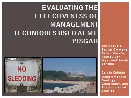
Harefa Ashley Van Wyk and Jacob Zondag Calvin College Department of Geology Geography and Environmental Studies Evaluating the Effectiveness of Management Techniques Used at Mt Pisgah ID: 700307
Download Presentation The PPT/PDF document "Joe Arevalo, Taylor Emmons, Sarah" is the property of its rightful owner. Permission is granted to download and print the materials on this web site for personal, non-commercial use only, and to display it on your personal computer provided you do not modify the materials and that you retain all copyright notices contained in the materials. By downloading content from our website, you accept the terms of this agreement.
Slide1
Joe Arevalo, Taylor Emmons, Sarah Harefa, Ashley Van Wyk, and Jacob ZondagCalvin CollegeDepartment of Geology, Geography, and Environmental Studies
Evaluating the Effectiveness of Management Techniques Used at Mt. PisgahSlide2
Holland, Michigan – Mt. Pisgah circled in redStudy AreaSlide3
Trampling impact (Andersen 1995)van Dijk and Vink (2005) study resultsUnnaturally angled ramp down bare sand slipfaceNotch in crest 5 meters lower than surrounding crest
Most visitors not local and do not believe the dune has problemsManagement techniques completed in 2009
BackgroundSlide4
Have management techniques at Mt. Pisgah been effective?Research QuestionSlide5
To
measure activity on the dune.To compare extent of activity measured to results of van Dijk and
Vink (2005) study.To map and assess the presence and quality of dune management techniques implemented.To understand visitors perception of dune management at Mt. Pisgah.
Study
objectivesSlide6
Measured sediment activity with erosion pins Compared extent of activity by replicating pictures taken in 2005Mapped management techniques and human impactsGauged visitor perceptions by distributing questionnaire
MethodsSlide7
Measuring Sediment ActivitySlide8
Comparing Activity Levels
2005 2012
View along southern arm looking westSlide9
Comparing Activity Levels
2005 2012
View from blowout looking toward the crestSlide10
Comparing Activity Levels
View across middle of the blowout looking north
2005 2012Slide11
Comparing Activity Levels
View from base of leeward slope looking west – unnaturally angled slope
2005 2012Slide12
Comparing Activity Levels
View from crest towards Lake
Macatawa
2005 2012Slide13
Map of Management TechniquesSlide14
Map of Human Impacts:
Unmanaged TrailsSlide15
Map of Human Impacts:Litter and damaged fencesSlide16
Visitor PerceptionsSlide17
Visitor PerceptionsSlide18
Visitor PerceptionsSlide19
Visitor PerceptionsSlide20
Visitor PerceptionsSlide21
Visitor PerceptionsSlide22
Visitor PerceptionsSlide23
Management techniques have been effective at limiting and mitigating human impact.In general, there is public acceptance and cooperation with management techniques.However, unmanaged trails, litter, and damaged fences indicate an uncooperative segment of visitors.ConclusionsSlide24
WORKS CITEDAndersen, U.V. 1995. “Resistance of Danish coastal vegetation types to human trampling.” Biological Conservation 71:223–230.Michigan Department of Natural Resources. “Holland State Park.” Slideshow. <http://www.michigan.gov/documents/dnr/Holland_SP_Slideshow_334712_7.pdf>.
van Dijk, Deanna and D. Robert Vink 2005. “Visiting A Great Lakes Sand Dune: The Example of Mt. Pisgah in Holland, Michigan.”
The Great Lakes Geographer 12(2): 45-63.ACKNOWLEDGEMENTSOttawa County Parks and Recreation Commission who provided our research site and Calvin College for providing facilities and equipment.
This research was supported by the National Science Foundation Grant 0942344, Melanie
Manion
and
Deanna
van
Dijk
.