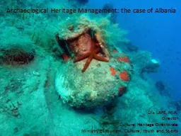
By Paul Roddy Pennsylvania State University GEOG 596 A Spring 2016 Dr Alexander Klippel Advisor Westcott and Brandon declared that GIS as a research tool may have as profound of an effect on archaeological field work as the introduction of carbon dating did in the 1950s Westcott and B ID: 677574
Download Presentation The PPT/PDF document "3D Archaeological Survey Modeling as a C..." is the property of its rightful owner. Permission is granted to download and print the materials on this web site for personal, non-commercial use only, and to display it on your personal computer provided you do not modify the materials and that you retain all copyright notices contained in the materials. By downloading content from our website, you accept the terms of this agreement.
Slide1
3D Archaeological Survey Modeling as a Compliment to Traditional Excavation Methods for Enhanced Visualization, Comprehension, and Documentation
ByPaul Roddy
Pennsylvania State University
GEOG 596 A, Spring 2016
Dr. Alexander
Klippel
AdvisorSlide2
Westcott and Brandon
declared that GIS as a research tool may have as profound of an effect on archaeological field work as the introduction of carbon dating did in the 1950s (Westcott and Brandon, 2000).Slide3
Introduction
Goals and Objectives
Methodology
Light Detection and Ranging (LiDAR) GIS Software Platforms
Anticipated ResultsSlide4
Introduction
Apply 3D GIS model as a compliment to 2D methods
Virtual preservation
Public access via web based platforms
Educational opportunities and public awareness
Slide5
Goals & Objectives
Create a virtual model of an archeological site
Cahal Pech
Develop workflow that can be easily replicated
Create an accompanying web site
Slide6
Cahal Pech
Mayan early pre-classic (1200-900 BC) continually occupied until 800 AD
Situated on an acropolis on the southern edge of the city of San Ignacio
Considered a medium size Mayan occupation
Site core contains 34 structures
Dozens of occupations on the outskirts
Image: (Archaeological
Institute of America
, April
2016
).Slide7
San Ignacio and Site Core Temple
Image: Google Earth Pro, May 2016
.
Image: http
://www.belizeadventure.ca/an-afternoon-at-cahal-pech-ruins
/Slide8
Cahal Pech Southern ViewSlide9
Methodology
LiDAR data collected via aircraftESRI ArcGIS 10.3.2
ArcScene extension
ESRI
CityEngine
Procedural Rule
Unity Game Engine (down the road)Slide10
Standard Archaeological Methods
Seek human activity relative both horizontally or “where” the activity took place, and vertically or “when” the activity took place.
Destructive by nature
Gridded layout
3D by nature having X, Y, and Z factors
Painstaking procedure with every excavation unit removed typically via trowel at 10cm increments
Provenience of artifacts are recorded X, Y, and Z
Excavated meter pits
Bulk earth
Image: https
://en.wikipedia.org/w/index.php?title=Archaeology&oldid=715698599
Slide11
Standard Documentation Methods
Photograph recording of feature
Sketch of same feature
Images: The
Belize Valley Archaeological Reconnaissance
Project 2014.Slide12
Past 3D Models
3D models for reconstruction date back to the 18th century
Cork, wood, or plaster were used to make detailed reconstructions
State
model of Pompeii at the 1:100 scale created by Giuseppe
Fiorelli
. State models represent the “state” of the item as it was at the time of reproduction
.
National Archaeological Museum,
Naples.
Image:
National Archaeological Museum, Naples (
Frischer
, 2005).Slide13
LiDAR
Aircraft equipped with instruments which include: laser scanner, GPS, and Inertia Measurement Unit
400,000 pulse/second in the near infrared spectrum
Time for each return in relation to the A/C determines surface
Buildings/vegetation
Point cloud data in ASCII format
Digital Surface Model (DSM) with vegetation and Digital Terrain Model (DTM) (sometimes called DEM) bare earth with vegetation removed
Image: https://www.metabunk.org/n22387-zig-zig-flight-path-near-sacramento-lidar-data-collection.t4307/Slide14
LiDAR Images
Point Cloud Images of Main Campus
Images: Alex
Klippel
PSU Dept. of Geography Slide15
Hillshade Images
Images and Shapefile in collaboration with Claire Ebert PSU Dept. of AnthropologySlide16
City Engine
Stand alone software
Uses Computer Generated Architecture or CGA rule files
Procedural Modeling is a process of creating 3D models through the use of specific rules and algorithms
Creates detailed 3D architecture out of simple shape grammar
Geometric production is iterative
Shape
Block model
Facades
Roof
Façade is textured for realism
Image: Christiane
Radies
, 2013.Slide17
Procedural Model
Images in collaboration with
Mahda
Bagher
PSU Dept. of GeographySlide18
Anticipated Results
3D virtual reality modelHistorical model
Current model
Enhance scientific research
Perception for decision
making
Diachronic evolution of a site can be
observed
Preservation of Cahal Pech
Education and research opportunities
Posterity
Image: http://
www.cahalpech.com/blog/exploring-cahal-pech-in-san-ignacio-belizeSlide19
Timeline
May 2016
Integrate peer review suggestions and finalize to some extent my “living” document
June – October 2016
Process data and develop VR
Data has been acquired through collaboration with Claire Ebert
Work around anticipated computing setbacks
Need for extreme computing power
One option may be to develop a virtual machine through the VR lab at PSU
Possible need for photogrammetry
For realistic texture photography is necessary
Digital SLR and overcast are optimum but must be deployed
October 2016
Find a journal for publication Slide20
References
3D Archaeology. (2014). Journal of Eastern Mediterranean Archaeology & Heritage Studies, 2(1), 1-29.About Cahal
Pech
- Archaeological Institute of America. (
n.d.
). Retrieved April 22, 2016, from
https://www.archaeological.org/interactivedigs/cahalpechbelize/about
Archaeology. (2016, April 17). In Wikipedia, The Free Encyclopedia. Retrieved 12:46, April 19, 2016, from
https://en.wikipedia.org/w/index.php?title=Archaeology&oldid=715698599
ARCGIS VIDEOS. (March, 2013). Retrieved May 03, 2016, from
http://video.arcgis.com/watch/2207/building-smart-cities-with-esri-cityengine ArcMap. (n.d.
). Retrieved April 22, 2016, from
http://desktop.arcgis.com/en/arcmap/latest/tools/conversion-toolbox/ascii-to-raster.htm
Auer, M.,
Agugiaro
, G.,
Billen
, N., Loos, L., &
Zipf
, A. (2014). Web-based Visualization and Query of semantically segmented
multiresolution
3D Models in the Field of Cultural Heritage. ISPRS Ann.
Photogramm
. Remote Sens. Spatial Inf. Sci. ISPRS Annals of Photogrammetry, Remote Sensing and Spatial Information Sciences, II-5, 33-39
.Billen,N., Loos, L., Auer, M., Zipf, A., Richards-Rissetto, H., Reindel, M. & von Schwerin, J.:
Development of a 4D-webgis for archaeological research, Workshop on integrating 4D, GIS and cultural heritage, 16th AGILE 2013, Leuven.Bill Whittaker at English Wikipedia, CC BY-SA 3.0, Retrieved May 3, 2016, from https://commons.wikimedia.org/w/index.php?curid=6795426
CyArk
, 2011.
Archaeological Areas of Pompeii
. (
n.d.
). Retrieved April 22, 2016, from
http://www.panoramio.com/photo/58703055
Uploaded on September 9,
2011.
D., &
Dell'Unto
, N. (2015, March/April). The Use of 3D Models for Intra-Site Investigation in Archaeology. Retrieved April 13, 2016, from
https://www.youtube.com/watch?v=O0Ea9IY58DM
Universita
Di Siena, Creative Commons Attribution license (reuse allowed
).
Davis, Oliver
2012.
Processing and working with LiDAR data in ArcGIS: a practical guide for archaeologists.
[Technical Report]. Cardiff: Royal Commission of the Ancient and Historical Monuments of Wales.
3D Cities. (
n.d.
). Retrieved May 03, 2016, from
http://desktop.arcgis.com/en/3d/3d-cities/3d-city-base-layers/add-elevation-data.htm
Esri
CityEngine. (
n.d.
). Retrieved April 22, 2016, from
http://www.esri.com/software/cityengine
.Slide21
References Cont.
Frischer, B., 2005. "The Digital Roman Forum Project: Remediating the Traditions of Roman Topography," in Acts of the 2nd Italy-United States Workshop, Rome, Italy, November 3-5, 2003, Berkeley, USA, May, 2005 edited by M. Forte, BAR International Series 1379 (Oxford 2005) 9-21
.
Hitchborne
, D. Image Copyright. This work is licensed under the Creative Commons Attribution-Share Alike 2.0 Generic
Licence
.
http://creativecommons.org/licenses/by-sa/2.0/
Kimball, J. L., (2016). 3D Delineation: A modernization of drawing methodology for field archaeology.
Archaeopress
and JJL Kimball. ISBN 978 1 78491 305 2.
May, N. and Beardall, A. (2014). Excavations of Structures B1 and B7 at Baking Pot, Belize. The Belize Valley Archaeological Reconnaissance Project, 13, 109-143.
National Oceanic and Atmospheric Administration (NOAA) Coastal Services Center. 2012. “
Lidar
101: An Introduction to
Lidar
Technology, Data, and Applications.” Revised. Charleston, SC: NOAA Coastal Services Center
.
Peer
reviewed proceedings of Digital Landscape Architecture 2013 at
Anhalt
University of Applied Sciences (pp. 175-184). (2013). Berlin: Wichmann.
Remondino
, F.,
Campana
, S., &
Dell'Unto, N. (2014). 3D recording and modelling in archaeology and cultural heritage: Theory and best practices. Oxford, England: Archaeopress. Renfrew, C., &
Bahn, P. G. (1991). Archaeology: Theories, methods, and practice. New York, NY: Thames and Hudson. Tsipidis, S., Koussoulakou, A.,
Kotsakis
, K., (2008). 3D Visualization of Archaeological Excavation Data. Journal of Archaeological Science, 35 (3), 655-667
.
United States Geologic Survey (USGS) Light Detection and Ranging (LIDAR). (
n.d.
). Retrieved April 22, 2016, from
https://
lta.cr.usgs.gov/lidar_digitalelevation
Wescott
, K., & Brandon, R. J. (2000). Practical applications of GIS for archaeologists: A predictive modeling toolkit. London: Taylor and Francis.Slide22
Thank You
Alex
Klippel
Claire Ebert
Mahda
BagherSlide23
Questions?