/
ACE  Objectives and Targets for OLYMPEX/ ACE  Objectives and Targets for OLYMPEX/

ACE Objectives and Targets for OLYMPEX/ - PowerPoint Presentation

ellena-manuel
ellena-manuel . @ellena-manuel
Follow
378 views
Uploaded On 2017-05-23

ACE Objectives and Targets for OLYMPEX/ - PPT Presentation

RADEX Jay Mace Roj Marchand Tristan LEcuyer Objectives Collect datasets suitable for retrieval case studies M ultiinstrument synergy Cloud vertical motion with cloud and precipitation ID: 551140

citation utc flight frontal utc citation frontal flight cloud precipitation convection flew front coordinated shallow conducted racetrack olympex offshore race radar post

Share:

Link:

Embed:

Download Presentation from below link

Download Presentation The PPT/PDF document "ACE Objectives and Targets for OLYMPEX/" is the property of its rightful owner. Permission is granted to download and print the materials on this web site for personal, non-commercial use only, and to display it on your personal computer provided you do not modify the materials and that you retain all copyright notices contained in the materials. By downloading content from our website, you accept the terms of this agreement.


Presentation Transcript

Slide1

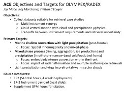
ACE

Objectives and Targets for OLYMPEX/

RADEX

Jay Mace,

Roj

Marchand,

Tristan

L'Ecuyer

Objectives:

Collect datasets suitable for retrieval case studies

M

ulti-instrument

synergy

Cloud vertical motion with

cloud and precipitation

μphysics

Tradeoffs between Instrument requirements

and

retrieval uncertainty

Primary Targets:

Marine shallow convection with light precipitation

(post-frontal)

Focus: Spatial inhomogeneity and mixed-phase

Mixed phase process

(riming, aggregation,

ice

production) and

precipitation

(in off-shore narrow-band cold/occluded fronts)

Focus: embedded

/intense convection within the front

Focus: impact

of radar attenuation and multiple scattering on

retrievals

Light

precipitation and

virga

in prefrontal/warm sector clouds

RADEX Resources

:

ER2 (54 total hours, 4 week deployment).

ER-2 Instrument payload (next slide).

S

upplement GPM hours for citation.Slide2

eMAS

VIS-IR imager

(not

hyperspectral

)

EXRAD

(X-band radar)AirMSPI (VIS-SWIR multiangle imaginging polarimeter)

nose

superpod

Q-

bay

superpod, (unpressurized aft)

CPL

Lidar Backscatter

GMI

CRS

W-band radar

HIWRAP

Ka

/Ku-

band radar

AMPRPassive Microwave~ 10-85 GHz

ER-2 Payload for RADEX - OLYMPEXSlide3

Flight

Target

/ HighlightInstruments / Other Notes

11/18A cirrus shield from an advancing warm frontal overrunning systems was approaching from the Southwest while post frontal shallow showers continued in the cold air behind the previous frontal system. DC8 and ER2 conducted multiple long coordinated race tracks that had their eastern ends near the NPOL radar site. The first race track was oriented east-west and a second race track was set up more southwest-northeast.

The Citation conducted stepped sampling in the advancing ice cloud.Due to disk switch issue, lost about 1 hour of data from hiwrap and CRS. Other Instruments nominal.

Noted +30db from showers under high overcast on NPOL. Stratiform rain at far end of racetrack by end of flight.11/23

ER2 and DC8 conducted a coordinated flight in an advancing frontal band offshore of the Olympic Peninsula. SW-NE oriented race tracks that were entirely offshore were conducted initially followed by a NW-SE oriented racetrack that had NPOL on SE end. Citation conducted two flights. Early flight was conducted under the NE end of the early race tracks. Second flight was near the SE end of the later racetrack. Frontal Rainbands advanced and clouds thickened during the flight. The early racetracks were oriented along the flow while the later race track was oriented perpendicular to the flow. All instruments nominal except some data loss by Hiwrap and CRS near the end and during a brief period when during the flight. 2nd Citation flight took place after the DC8 and ER2 departed to RTB. Table of ER-2 flights during RADEX/OLYMPEX Slide4

Flight

Target

/ HighlightInstruments / Other Notes

11/24An Inland cold front with strong northerly

post frontal flow over the

Olympex region.

All three aircraft targeted orographically enhanced snow along the northern slopes of the Olympics form ~15 to 17 UTC.Coordinated ER2 and citation sampling of off-shore transition from cloud free to extensive stratocumulus cloud cover from ~ 19:30 to 22 UTC. GMAO model runs indicated a continental aerosol plume being advected offshore,

consistent with CPL backscatter and Citation observations of high cloud droplet number concentrations.ER-2: flew near principal plane during off shore legs,AirMSPI was in the nose. Some loss (20-30 minutes) Hiwrap (Ku and Ka) early in the flight. 12/1 An occluded front with stratiform precipitation, and significant orographic enhancement. ER-2 and DC-8 flew coordinated racetracks over Quinault valley (radar sites) 22 to 24 UTC with coincident citation profiles.

Strong rain shadow to the NE of the Olympics. Variety of ice crystal habits (irregulars, plates, plate aggregates needles), melting layer near 7 kft (was sloping).EXRAD in nose but went/stayed after 23:30 UTC.

HIWRAP up after 22:06 UTC. Table of ER-2 flights during RADEX/OLYMPEX Slide5

Flight

Target

/ HighlightInstruments / Other Notes

12/3 Strong Frontal/Pre-Frontal Precipitation over the Olympex

.Coordinated data from all three aircraft with a GPM overpass of the high Olympics at 15:22 UTC.

The GPM under-flight was followed by sampling along the Quinault Valley using a racetrack similar to that used during the Dec. 1 flight

until ~ 16:45 UTC.Citation observed a variety of (large aggregates, needles, slide plates on aggregates, capped columns, stellar plates and signficant quantites of supercooled liquid near the time over the GPM overpass. EXRAD in nose. AMPR 19 GHz channel failed (others OK).

12/4Post-frontal conditions with shallow convection along the coast after about 10 UTC. All three aircraft sampled a shallow precipitating convective line that was propagating eastward at 13 UTC just off the coast near the NPOL radar site.A small, developing low-level offshore cumulus was observed by ER-2 and UND Citation between 17:45 and 19:10 UTC. Near 13 UTC: Citation observed large amounts of cloud liquid water (at -2 C) and irregular aggregates at colder temperature through the convective line.

~ 17:30 to 19:30 UTC: The ER-2 flew a variety of legs in the solar principal plane. Polarimetric (AirMSPI) data appear to be of very good quality for retrievals.

Table of ER-2 flights during RADEX/OLYMPEX Slide6

Flight

Target

/ HighlightInstruments / Other Notes

12/5Warm sector precipitation with orographic enhancement near coast and heavy snow over the Olympic mountains All three aircraft sampled heavy snow along the Quinault Valley west of the mountains crossing into the rain shadow to the east. Coordination with Citation in situ was good along the valley. The elongated southwest to northeast racetracks of the ER-2 include ~30 nm of sampling light rain over the ocean.

The ER-2 flew two long/level N-S loops in decaying light rain behind the front all the way north to Vancouver Island that may provide a good target for sensitivity testing.

1450 UTC: Citation sampled cloud along valley at multiple altitudes reporting large aggregates at (-8 C) but no super-cooled LWC; capped columns at -20 C; and small ice crystals extending up to 30

kft1525 UTC: ER-2 crossed bands of embedded convection offshore12/8Offshore precipitation associated with ‘atmospheric river’ event

ER-2 flew independent flight consisting of three 200 nm racetracks offshore including a Suomi NPP underflight (though west of the nadir ground track). EXRAD, HIWRAP, and CRS operated in test mode during the first racetrack but collected science data in light to moderate liquid precipitation along the other two.Flight hours were split between RADEX and Gerry Heymsfield’s radar test flight.The North-South racetrack from 21-22 UTC provides an interesting transect across the northern half of the moisture plume. AMPR characterized the transition from moderate stratiform precipitation with embedded convection to non-precipitating liquid clouds.More than 6” of rain reported at OLYMPEX ground sites over this 24 hour periodTable of ER-2 flights during RADEX/OLYMPEX Slide7

Flight

Target

/ HighlightInstruments / Other Notes

12/10Tail-end of occluded front followed by post-frontal shallow convection.

ER-2 and DC-8 flew beautifully coordinated racetracks, along Quinault

continuing well offshore between 17 and 19 UTC..

After 19 UTC, the ER-2 began a sequence of off shore legs in the solar principal plane to sample classic post-frontal shallow convection. Some cirrus was present but also some cirrus free cloud suitable for polarimetric “rainbow” retrievals is also visible.No ER-2 + Citation: Citation and DC-8 were on station earlier than ER-2. Citation left at 16:40 UTC, with the intent of refueling and returning, but encountered a maintenance issue and was unable to return. AirMSPI

in nose. Worked well. CPL backscatter images suggest noteworthy levels of boundary layer aerosols, perhaps due to very high surface winds.12/12Occluding warm front and trailing showers.The DC-8 dropped 8 dropsondes along a racetrack across front prior to ER-2 takeoff. Citation collected microphysics at 2, 5, 8, 11, 14, 17, and 20 kft along one leg of this track.ER-2 flew independent NNE-SSW racetracks near the shore aligned with the coast (due to ER-2 delayed takeoff). ER-2 observed overrunning precipitation while northbound and trailing isolated warm showers on the southbound leg.Citation observed significant supercooled liquid up to -15 C and a wide variety of crystals from large aggregates to columns.CRS data collection failed (other frequencies operated nominally). eMAS

IR channels were also suboptimal.Table of ER-2 flights during RADEX/OLYMPEX Slide8

Flight

Target

/ HighlightInstruments / Other Notes

12/13A surface low centered over/near Vancouver Island brought cold, moist NW flow and significant post-frontal precipitation to the Washington coast.

17 to 19 UTC: All three aircraft sampled shallow convection with ample upper level ice cloud on/near the coast.

19:31 UTC: Terra underflight

by ER-2.20 to 20:30 UTC: ER2 and Citation sampled low-level clouds and shallow convection off shore. Some lingering cirrus complicates analysis. ER-2: CRS failed near start of flight, and despite several tries could not be operated. HIWRAP was operated without CRS after ~17 UTC.

AirMPSI in the nose, flew in principal plane after 20 UTC.2DC went out during on the part of mission for about 20 minutes, but otherwise was fine.Table of ER-2 flights during RADEX/OLYMPEX Slide9

Summary of ER-2 flights :

10 ER-2 Flights

Most Coordinated with DC-8 (additional Microwave and Scanning Radar) and/or Citation (in situ cloud microphysics). DC8 coordination when attempted was often very tight with nearly continuous simultaneous samplingWorking

with the GPM GV team/UW team was a very positive experience.Target AssessmentOverall very positive on the breadth of the sampling heavy sampling of warm conveyor belt (ice phase processes)Limited prefrontal conditions were sampled.Only a few examples of embedded frontal convectionPost frontal convection was sampled well on 4 flights but particularly well on two flights.

… next few slides highlight a few cases/datasetsSlide10

Highlights: 11/23 Advancing Frontal Rain bands

Advancing Frontal

Rainbands

Citation Spiral

DC8 and ER2 Racetracks

11/23

ER2 and DC8 conducted a coordinated flight in an advancing frontal band offshore of the Olympic Peninsula. SW-NE oriented race tracks that were entirely offshore were conducted initially followed by a NW-SE oriented racetrack that had NPOL on SE end. Citation conducted two flights. Early flight was conducted under the NE end of the early race tracks. Second flight was near the SE end of the later racetrack. Slide11

Flight

Target

/ HighlightInstruments / Other Notes

…11/24An Inland cold front

with strong northerly post frontal

flow over the Olympex

region. All three aircraft targeted orographically enhanced snow along the northern slopes of the Olympics form ~15 to 17 UTC.Coordinated ER2 and citation sampling of off-shore transition from cloud free to extensive stratocumulus cloud cover from ~ 19:30 to 22 UTC. GMAO model runs indicated a continental aerosol plume being

advected offshore, consistent with CPL backscatter and Citation observations of high cloud droplet number concentrations.ER-2: flew near principal plane during off shore legs,AirMSPI was in the nose. Some loss (20-30 minutes) Hiwrap (Ku and Ka) early in the flight. …Highlights: 11/24 Stratocumulus

eMAS Vis/IRIn situ microphysics from UND CitationAirMPSI Imaging Polarimeter

Citation Track 4 legs/altitudesSlide12

Highlights: 12/1 Front

12/1

An occluded front with

stratiform

precipitation,

and significant orographic enhancement.

ER-2 and DC-8 flew coordinated racetracks over Quinault valley (radar sites) 22 to 24 UTC with coincident citation profiles.Strong rain shadow to the NE of the Olympics. Slide13

Highlights: 12/13 Cold Air Convection

12/13

A surface low centered over/near Vancouver Island brought cold, moist NW flow and significant post-frontal precipitation to the Washington coast.

17 to 19 UTC: All three aircraft

sampled s

hallow convection with ample upper level ice cloud on/near the coast.

19:31 UTC: Terra underflight by ER-2.20 to 20:30 UTC: ER2 and Citation sampled low-level clouds and shallow convection off shore. Some lingering cirrus complicates analysis. Slide14

Extra Slides Slide15

Flight

Target

/ HighlightInstruments / Other Notes11/18

A cirrus shield from an advancing warm frontal overrunning systems was approaching from the Southwest while post frontal shallow showers continued in the cold air behind the previous frontal system. DC8 and ER2 conducted multiple long coordinated race tracks that had their eastern ends near the NPOL radar site. The first race track was oriented east-west and a second race track was set up more southwest-northeast.

The Citation conducted stepped sampling in the advancing ice cloud.Due to disk switch issue, lost about 1 hour of data from hiwrap and CRS. Other Instruments nominal.

Noted +30db from showers under high overcast on NPOL. Stratiform rain at far end of racetrack by end of flight.11/23ER2 and DC8 conducted a coordinated flight in an advancing frontal band offshore

of the Olympic Peninsula. SW-NE oriented race tracks that were entirely offshore were conducted initially followed by a NW-SE oriented racetrack that had NPOL on SE end. Citation conducted two flights. Early flight was conducted under the NE end of the early race tracks. Second flight was near the SE end of the later racetrack. Frontal Rainbands advanced and clouds thickened during the flight. The early racetracks were oriented along the flow while the later race track was oriented perpendicular to the flow. All instruments nominal except some data loss by Hiwrap and CRS near the end and during a brief period when during the flight. 2nd Citation flight took place after the DC8 and ER2 departed to RTB. 11/24An Inland cold front with strong northerly post frontal

flow over the Olympex region. All three aircraft targeted orographically enhanced snow along the northern slopes of the Olympics form ~15 to 17 UTC.Coordinated ER2 and citation sampling of off-shore transition from cloud free to extensive stratocumulus cloud cover from ~ 19:30 to 22 UTC. GMAO model runs indicated a continental aerosol plume being advected offshore, consistent with CPL backscatter and Citation observations of high cloud droplet number concentrations.

ER-2: flew near principal plane during off shore legs,AirMSPI was in the nose. Some loss (20-30 minutes) Hiwrap (Ku and Ka) early in the flight. 12/1 An occluded front with stratiform precipitation,

and significant orographic enhancement. ER-2 and DC-8 flew coordinated racetracks over Quinault valley (radar sites) 22 to 24 UTC with coincident citation profiles.Strong rain shadow to the NE of the Olympics. Variety of ice crystal habits (irregulars, plates, plate aggregates

needles), melting layer near 7 kft

(was sloping).EXRAD in nose but went/stayed after 23:30 UTC.

HIWRAP up after 22:06 UTC. 12/3 Strong Frontal/Pre-Frontal Precipitation over the Olympex.Coordinated data from all three aircraft with a GPM overpass of the high Olympics at 15:22 UTC. The GPM under-flight was followed by sampling along the Quinault Valley using a racetrack similar to that used during the Dec. 1 flight until ~ 16:45 UTC.

Citation observed a variety of (large aggregates, needles, slide plates on aggregates, capped columns, stellar plates and signficant quantites of supercooled liquid near the time over the GPM overpass. EXRAD in nose.

AMPR 19 GHz channel failed (others OK).12/4Post-frontal conditions with shallow convection along the coast after about 10 UTC. All three aircraft sampled a shallow precipitating convective line that was propagating eastward at 13 UTC just off the coast near the NPOL radar site.A small, developing low-level offshore cumulus was observed

by ER-2 and UND Citation between 17:45 and 19:10 UTC. Near 13 UTC: Citation observed large amounts of cloud liquid water (at -2 C)

and irregular aggregates at colder temperature through the convective line.

~

17:30 to 19:30 UTC: The ER-2 flew a variety of legs in the solar principal plane. Polarimetric (AirMSPI) data appear to be of very good quality for retrievals. 12/5Warm sector precipitation with orographic enhancement near coast and heavy snow over the Olympic mountains

All three aircraft sampled heavy snow along the Quinault Valley west of the mountains crossing into the rain shadow to the east. Coordination with Citation in situ was good along the valley. The elongated southwest to northeast racetracks of the ER-2 include ~30 nm of sampling light rain over the ocean.The ER-2 flew two long/level N-S loops in decaying light rain behind the front all the way north to Vancouver Island that may provide a good target for sensitivity testing.1450 UTC: Citation sampled cloud along valley at multiple altitudes reporting large aggregates at (-8 C) but no super-cooled LWC; capped columns at -20 C; and small ice crystals extending up to 30 kft

1525 UTC: ER-2 crossed bands of embedded convection offshore12/8Offshore precipitation associated with ‘atmospheric river’ eventER-2 flew independent flight consisting of three 200 nm racetracks offshore including a Suomi NPP underflight (though west of the nadir ground track). EXRAD, HIWRAP, and CRS operated in test mode during the first racetrack but collected science data in light to moderate liquid precipitation along the other two.

Flight hours were split between RADEX and Gerry Heymsfield’s radar test flight.The North-South racetrack from 21-22 UTC provides an interesting transect across the northern half of the moisture plume. AMPR characterized the transition from moderate stratiform precipitation with embedded convection to non-precipitating liquid clouds.

More

than 6” of rain reported at OLYMPEX ground sites over this 24 hour period

12/10

Tail-end

of

occluded front followed by post-frontal shallow convection.

ER-2 and DC-8 flew beautifully coordinated racetracks, along

Quinault

continuing well offshore between 17 and 19 UTC..

After 19 UTC, the ER-2 began a sequence of off shore legs in

the

solar principal plane

to sample classic

post-frontal shallow convection. Some cirrus was present but also some cirrus free cloud suitable for

polarimetric

“rainbow” retrievals is also visible.

No ER-2 + Citation

:

Citation

and DC-8 were on station earlier than ER-2.

Citation left at 16:40 UTC, with the intent of refueling and returning, but encountered a maintenance issue and was unable to return.

AirMSPI

in nose. Worked well.

CPL backscatter images suggest noteworthy levels of boundary layer aerosols,

perhaps

due to very high surface winds.

12/12

Occluding

warm front and trailing showers.

The DC-8 dropped

8

dropsondes

along a racetrack across front

prior to ER-2 takeoff. Citation collected microphysics at 2, 5, 8, 11, 14, 17, and 20

kft

along one leg of this track.

ER-2 flew independent NNE-SSW racetracks near the shore aligned with the coast (due to ER-2 delayed takeoff). ER-2 observed overrunning precipitation while northbound and trailing isolated warm showers on the southbound leg.

Citation observed significant

supercooled

liquid up to -15 C and a wide variety of crystals from large aggregates to columns.

CRS data collection failed (other frequencies operated nominally).

eMAS

IR channels were also suboptimal.

12/13A surface low centered over/near Vancouver Island brought cold, moist NW flow and significant post-frontal precipitation to the Washington coast.17 to 19 UTC: All three aircraft sampled shallow convection with ample upper level ice cloud on/near the coast.19:31 UTC: Terra underflight by ER-2.20 to 20:30 UTC: ER2 and Citation sampled low-level clouds and shallow convection off shore. Some lingering cirrus complicates analysis. ER-2: CRS failed near start of flight, and despite several tries could not be operated. HIWRAP was operated without CRS after ~17 UTC. AirMPSI in the nose, flew in principal plane after 20 UTC.2DC went out during on the part of mission for about 20 minutes, but otherwise was fine.

Table of ER-2 flights

(full table in

powerpoint

)