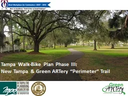
21 st Century Competitiveness David Dysard Bike Plan Presentation December 2015 Slide 1 Bike Trails are an Amenity to Attract TalentTourism to our Area Natural and man made amenities are very high on the list of items that attract the best and brightest minds of the new generation of ID: 693018
Download Presentation The PPT/PDF document "City of Toledo Bike Plan – A Tool for" is the property of its rightful owner. Permission is granted to download and print the materials on this web site for personal, non-commercial use only, and to display it on your personal computer provided you do not modify the materials and that you retain all copyright notices contained in the materials. By downloading content from our website, you accept the terms of this agreement.
Slide1
City of Toledo Bike Plan – A Tool for21st Century Competitiveness
David DysardBike Plan Presentation December 2015
Slide 1Slide2
Bike Trails are an Amenity to Attract Talent/Tourism to our Area Natural and man made amenities are very high on the list of items that attract the best and brightest minds of the new generation of Millenials
to a region. Slide 2Slide3
Bike Trails and Bike Planning are part of local and regional efforts Regional Bike Plan and Regional Policies to preserve linear rights of way and encourage complete streets are part of this effort.Many jurisdictions have or are working on bike plans and implementing projects.
Several joint projects with multiple jurisdictions partnering on major facilities for the region are in process or have been completed.Slide 3Slide4
Bike Planning is part of the City of Toledo Complete Streets PolicySupport and direction from City Council has been established as a basis for change.Established complete streets policy with Ord. 656-10 in December 2010Policy is in Toledo Municipal Code, Chapter 901
Provided definition and elements to considerProvided impetus to drive new ways of looking at bicycle use and public rights of way in ToledoSlide 4Slide5
Complete Streets Implementation:Examples –Bike lanes/new sidewalkWestwood near the University of ToledoBike lanes
-------------------------------
“UT”
cross
walks
-----------------------
Slide 5Slide6
Complete Streets Implementation:Examples –Paths within right of waySummit Street near VGCS and Craig Street Bridge
Slide 6Slide7
Complete Streets Implementation:Examples –Paths within right of waySummit Street near Craig Street BridgePath fromCraig Bridge
Towards Downtown- Bottleneck
-------------------------------
Slide 7Slide8
Complete Streets Implementation:Examples –Paths within right of waySummit Street near Craig Street BridgePath beingInstalled
– roadway shifted
Slide 8Slide9
Complete Streets Implementation:Examples –Paths within right of waySummit Street near Craig Street BridgePath being
Installed – roadway narrowed / shifted
Slide 9Slide10
Bike Plan Development – Effective implementation in tandem with projects (“opportunistic synergy”) requires a clear and specific overall plan – drove development of planBegan by developing bike demand locationsmajor attractions (downtown, zoo, TMA) major parks, existing rec trails, major employers, neighborhood cores, etc.Slide 10Slide11
Toledo Hospital
Ottawa Park
UT
Art Museum
St. Vincent’s
Joe E. Brown Park
Downtown
International Park
Maritime Museum
Middlegrounds
Metropark
Hollywood Casino
Cullen Park
Jeep Plant
GM
Powertrain
Toledo Zoo
Schneider Park
UTMC
Swan Creek
Metropark
Keil
Farms
Metropark
Toledo Botanical Gardens
Wildwood
Metropark
Westfield Mall
Bowman Park
Highland Park
Maumee Bay State Park
Lucas County
Rec
Center
Slide 11Slide12
Bike Plan – Primary Network Routes Plan lists Primary Network - the “Top Level” RoutesConnectivityHighest demandFocus of efforts and fundingMade up of 13 interconnected “trails”Slide 12Slide13
`
University Parks Trail
Chessie
Circle Trail
Overland Trail
Riverside Trail
Riverside East Trail
Cherry-University Trail
Swan Creek Trail
Greenhouse Trail
Trilby-Washington Trail
Buckeye Basin Trail
Oregon Trail
Angola-Scott Park Trail
Bancroft-Promenade Trail
Slide 13a – 13mSlide14
Bike Facility Types –Cycle Track on StreetSlide 14Slide15
Bike Facility Types –Bike Lanes on StreetSlide 15Slide16
Bike Facility Types –Sharrows on StreetSlide 16Slide17
Bike Plan – Type of FacilitiesPATHS (SEPARATED)SIDE PATHSBIKE LANESSHARROW LANES
SHARE THE ROAD TOTAL108,605214,955
137,040
35,135
38,995
534,730
Linear Feet
Miles
PATHS
(SEPARATED)
SIDE PATHS
BIKE LANES
SHARROW LANES
SHARE THE ROAD
TOTAL
20.57
40.71
25.95
6.65
7.39
101.27
Slide 17Slide18
Slide 18Slide19
Bike Plan – Cost Estimates TRAIL LENGTH (LF)
TRAIL LENGTH (MILES)STAND ALONE COST ESTIMATE
LENGTH (LF)
Path, Side
path
Bike Lane,
Sharrow
Lane, Share the Road
534,730
101.3
$32,322,000
323,560
211,170
Miles
61.28
39.99
Slide 19Slide20
Bike Plan ImplementationIn tandem with road projects (“opportunistic synergy”) as very few grants and limited capital funds for stand alone bike projectsPartnerships to preserve linear corridors and create important major trails such as:University – Parks TrailWabash Cannonball Trail Chessie Circle Trail Slide 20Slide21
Major Trail Partnerships in our Region –off street dedicated pathsThere have been several partnerships to preserve linear corridors and create important major trails:University – Parks TrailWabash Cannonball Trail Chessie Circle Trail Slide 21Slide22
Critical connection between major north/ south and east/west trails in core of our region
Connects major assets: Ottawa Park, UT, Maumee River, WW Knight Preserve
Chessie
CircleTrail
Overview
Slide 22Slide23
Chessie Circle Trail – Partnership in Action
Partners on
Chessie
Circle:
Slide 23Slide24
Bike Plan – vision of major routes to take advantage of future opportunitiesSlide 24