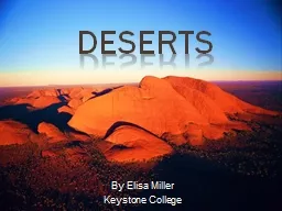
/
Deserts Adiabatic Warming and Cooling Deserts Adiabatic Warming and Cooling

Deserts Adiabatic Warming and Cooling - PowerPoint Presentation

giovanna-bartolotta
giovanna-bartolotta . @giovanna-bartolotta
Follow
343 views
Uploaded On 2020-01-14

Deserts Adiabatic Warming and Cooling - PPT Presentation

Deserts Adiabatic Warming and Cooling Warm moist air masses forced up and over mountains experience decreasing atmospheric pressure and as a result expand This process causes the expanding air mass to release a portion of its latent heat resulting in a decrease in air temperature This is ID: 772746

desert air deserts mass air desert mass deserts form water rock highlands streams dry rocks resistant weathering valley basin

Share:

Link:

Embed:

Download Presentation from below link

Download Presentation The PPT/PDF document "Deserts Adiabatic Warming and Cooling" is the property of its rightful owner. Permission is granted to download and print the materials on this web site for personal, non-commercial use only, and to display it on your personal computer provided you do not modify the materials and that you retain all copyright notices contained in the materials. By downloading content from our website, you accept the terms of this agreement.


Presentation Transcript

Deserts

Adiabatic Warming and Cooling Warm, moist air masses forced up and over mountains experience decreasing atmospheric pressure and, as a result, expand. This process causes the expanding air mass to release a portion of its latent heat, resulting in a decrease in air temperature. This is called adiabatic cooling. Depending on the height to which the air is forced the air mass temperature may drop below the dew point, resulting in the formation of water droplets and precipitation in the form of rain or snow. As a result, when the air mass reaches the summit, it is cold and dry. Crossing the summit, the air mass descends and compresses. This produces a corresponding increase in atmospheric pressure and, as descent continues, the compressing air mass begin to warm. This is a called adiabatic warming. However, because the moisture was released during the cooling stage, the descending air mass is warm and dry. If sufficient moisture is removed the descending air mass could be dry enough to create a rain shadow effect where precipitation is much lower than surrounding areas. In some cases a rain shadow desert can form.

Humbolt and Benquela Currents While most oceanic surface currents are warmer than the surrounding ocean water, the Humbolt Current and the Benguela Current are cold water currents. Their 3OC deep ocean waters are drawn to the surface by strong western winds blowing off the continents to the east. As warm moist air from the southern oceans pass over the Humbolt and Benquela Currents the air is chilled far below the dew point, removing much of the moisture in the form of torrential rains and thick fog. Once across the two currents, the extremely dry air floods up onto the western margin of the continents creating fog deserts that extend along the western coastlines of both continents. The driest desert in the world is the Atacama Desert of northern Chile on the eastern side of the Andes Mountains The last recorded rain event in the Atacama Desert was 50 years ago. Nearly no rainfall has been recorded for the period from 1570 to 1970. The extreme aridity of the Atacama desert is due to the combined effects of the Humbolt fog scenario and the adiabatic rain shadow effect caused by the Andes Mountains.

Click On Illustration For More… Weathering Because of the scarcity of water in deserts, physical weathering is far more important than chemical weathering. Thus, mass wasting processes are normally limited to rock falls and debris and rock slides. What stream erosion that does exist carves slot canyons in the resistant rocks creating valley walls that rise vertically from the stream margins. Upon penetrating the resistant cap rock, streams begin to erode any underlying softer rocks. Because of their lower resistance to erosion, these rocks are removed, under cutting and removing the support for the overlying resistant rock layers. With the loss of support, the resistant rocks shear off by rock falls and rock and debris slides resulting in the cliff faces moving away from each other while still maintaining their vertical orientation. As the stream continues to downcut through the resistant rocks and undercut the softer rocks, this sequence of events is repeated. The actual stream valley attains an overall V-shape while the resistant cliffs remain vertical.

Weathering and Stream Carving Another desert scenario involves streams carving down through a sequence of resistant rocks. The top drawing illustrates the youthful stage of the process when streams have carved slot canyons. Between the top and middle drawing the region has entered the stage of maturity in which the streams begin to meander. As the streams meander they undercut the resistant, vertical walls of the canyons. Catastrophic short term mass wasting events continuously shear unsupported rock from canyon walls which remain vertical even as the valleys widen. What had been a plateau consisting of layers of resistant cap rock has been carved into blocks of various sizes. The larger blocks are called mesas. As the rocks of the valley walls continue to be undercut mesas are reduced to buttes. By the time the region attains old age, as indicated in lower drawing, many of the buttes have been reduced to picturesque needle rocks. These will eventually topple to the valley floor. Ultimately no remnant of the rocks that made up the original plateau would remain.

Deposition by Interior Drainage The evolution of the landscape involving the interior drainage systems that characterize desert regions differs from that of humid regions. Debris stripped from the highlands by weathering, mass wasting, and erosion collects in adjacent valleys or basins rather than being carried to the ocean. During uplift of the mountainous areas (top drawing) streams flow onto the adjoining basin floor where they deposit their sediment loads in the form of alluvial fans. Over time, as the highlands continue to be worn away, the region enters a more mature stage of landscape evolution where individual alluvial fans overlap to form a bajada . Given more time, bajadas building from opposite sides of the basin meet and begin to fill the basin with sediment (middle drawing). As the region enters old age, the bajadas from opposite sides of the basin meet and completely fill the basin. What had been grand mountain ranges are literally buried in their own weathering and eroded debris (bottom drawing).

Alluvial Fans, Bajadas, and Bolsons As newly-formed desert highlands begin to be attacked by the combined efforts of weathering, mass wasting and erosion, the interior type stream characteristic of deserts begin to reduce the rock mass of the highlands and transport the sediments to the valley floor. As the stream reach the valley floor, the water usually disappears by sinking underground to the watertable. With no water to continue the transport, the sediments are deposited at the mouth of the streams in the form of fan-shaped alluvial fans. Over time, as the highlands continue to be reduced, the alluvial fans begin to overlap, creating a deposit along the base of the mountain called a bajada. Eventually, the bajadas from opposite sides of the desert basin build toward the center of the basin where they meet to completely fill the valley. The sediment-filled basin is then referred to as a bolson.

Interior Streams Interior streams headwater in highlands and end in an adjoining desert basin. There are three ways interior streams come to an end. In one case, they flow into a lake that persists throughout the year, such as Great Salt Lake in Utah. These kinds of lakes are very saline due to salts derived by the chemical weathering in the highlands are concentrated because there is no outlet to dilute the salt build up. Commonly, salt lakes will expand in area during the wet season and shrink during the dry season. Another characteristic of salt lakes is their variety of color caused by changes in the types of algae that can live in the water depending on its salinity. Playa lakes fill with water during the wet season but disappear during the dry season. While some of the water is lost due to evaporation as the stream enters the valley most is lost by sinking down into the groundwater table. As the water disappears, the solid load is deposited in the form of an alluvial fan.

Desert Highlands Desert highlands can be formed in many way. These drawings show a highland formed by normal faulting. The displacement of the fault may create a highland that rises more than 10,000 feet above the valley floor. Regardless of how the highlands are created, they are all undergo the weathering, mass wasting and erosion that creates alluvial fans and, bajadas and bolsons. The end result is the same; what was once a grand range of mountains may be reduced to a string of rock mounds.

Kinds of Deserts Rainshadow deserts form on the leeward side of mountain ranges. Moisture in the winds approaching from the windward side experience adiabatic cooling, initiating precipitation on the windward side. As the cool, dry air masses cross the summit and begin to descend they undergo adiabatic warming, producing a warm and dry air masses. The deserts of the southwest United States are excellent examples of landscapes and environments produced by these processes. Fog deserts form as warm moist air evaporates from the ocean surface and is then blown landward across cold surface currents. As it cools, the air mass gives up its water in the form of rain and fog. The cool, dry air mass then floods up onto the coastline to form a desert. Representatives of fog deserts are the Chilean Deserts of South America and the Namib Desert of Africa. The largest deserts on Earth are subtropical deserts that exist between the Tropics of Cancer and Capricorn. Warm moist air from both the northern and southern hemispheres rise over the equator to elevations as high as 40,000 feet. Most of their original moisture content is lost due to adiabatic cooling. Thus, the descending air is very warm and dry. The Sahara Desert and central Australia are the examples of deserts formed by the influence of the air masses descending along the two tropics. Although they are not shown in the drawings, the Gobi Desert and Antarctica, which is technically a desert, exist because they are essentially isolated from all sources of ocean waters. The Mongolian Gobi Desert is far from the Atlantic, isolated from the Indian Ocean by the rain shadow effect of the Himalayan Mountains, and receives little moisture from the Arctic Ocean. In Antarctica the air is just to cold to hold much moisture.