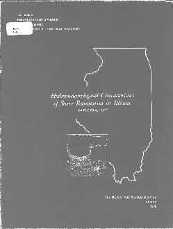
/
Hydrometeorological Characteristics of Severe Rainstorms in Illinois Hydrometeorological Characteristics of Severe Rainstorms in Illinois

Hydrometeorological Characteristics of Severe Rainstorms in Illinois - PDF document

giovanna-bartolotta
giovanna-bartolotta . @giovanna-bartolotta
Follow
375 views
Uploaded On 2015-10-03

Hydrometeorological Characteristics of Severe Rainstorms in Illinois - PPT Presentation

a 6 1 1 1 2 2 4 5 6 6 Tabl 2 100Yea Rainstor Estimate Storm duration Depth inches for given area mi 1 hours 10 25 50 100 200 500 Northwest Section 6 5 5 5 5 5 4 1 6 ID: 147983

Share:

Link:

Embed:

Download Presentation from below link

Download Pdf The PPT/PDF document "Hydrometeorological Characteristics of S..." is the property of its rightful owner. Permission is granted to download and print the materials on this web site for personal, non-commercial use only, and to display it on your personal computer provided you do not modify the materials and that you retain all copyright notices contained in the materials. By downloading content from our website, you accept the terms of this agreement.


Presentation Transcript

Hydrometeorological Characteristics of Severe Rainstorms in Illinois a 6 . . . 1 1 1 2 2 4 5 6 6 Tabl 2 100-Yea Rainstor Estimate Storm duration Depth (inches) for given area (mi 1 ) (hours) 10 25 50 100 200 500 Northwest Section 6 5. 5. 5. 5. 5. 4. 1 6. 6. 6. 6. 6. 5. 2 8. 8. 8. 7. 7. 7. 4 9. 9. 8. 8. 8. 8. North Central Section 6 5. 4. 4. 4. 4. 4. 1 5. 5. 5. 5. 5. 5. 2 7. 7. 6. 6. 6. 6. 4 7. 7. 7. 7. 7. 7. South Central Section 6 5. 5. 5. 5. 5. 4. 1 6. 6. 6. 6. 6. 6. 2 8. 8. 8. 7. 7. 7. 4 9. 8. 8. 8. 8. 8. Southeast Section 6 6. 5. 5. 5. 5. 5. 1 7. 7. 6. 6. 6. 6. 2 8. 8. 8. 8. 8. 7. 4 9. 9. 9. 8. 8. 8. Tabl 3 Rati o 100-Yea Rainstort Probabl Maximu Stor i Illinoi Storm Average ratio for given duration (hours) area (mi 2 ) 6 12 24 48 Relatio betwee Maximu Observe an Probabl Maximu Storm A par o it researc program th Atmospheri Science Sectio o th Wate Survemad a comprehensiv stud o al heav rainstorm recorde i Illinoi durin th 75-yea period1887-1961 Befor 1887 record ar to spars t carr ou suc stor studies Beginnin i1948 extensiv fiel survey o sever rainstorm i Illinoi wer initiate b th Wate Surveyan thes hav provide muc informatio o th spatial temporal an synopti weathe characteristic o suc storms Fo storm prio t 1948 analysi wa base primaril o dat recordeb th climatologica networ o th Weathe Bureau Area-dept relation wer compute foeac storm Thes wer the adjuste fo gag densit difference (variation i samplin densityb us o empirica transformatio factor develope fro th field-surveye storm (Huf anSemonin 1960) Tabl 4 show th area-dept envelop value (mea rainfal maxima observe i Illinoistorm fo stor period o 6 t 4 hour an area o 1 t 100 squar miles base upo storstudie b th Wate Surve an Corp o Engineer (U S Army 1945) Compariso o table 4 a 6 ‘ true a 6 The values in table 6 represent envelope values for the state, not a specific location within the state. a a a a a a a 6 a 7 6 a 6 Thes studie hav yielde muc knowledg concernin th characteristic o sever rainstorm iIllinois A par o thi research depth-duration-are relation wer determine i thes stormsTh previou section hav deal wit generalize relationships However i sometime desirablfo th desig hydrologis t hav informatio relatin t specifi storm producin exceptionallheav rainfal amount ove area (basins o variou sizes Therefore tabl 8 wa compile t provid suc informatio o a grou o outstandinstorm occurrin betwee 194 an 1978 Tabl 8 show area-dept relation fo extremelheav storm whic encompasse area o 500 squar mile o more Dat hav bee presentefo stor period o 3 t 2 hours Th fewe numbe i th 3-hou categor wa dictate b ouinabilit t subdivid th storm int 3-hou increment i th majorit o th field-surveye stormsMos o th dat i tabl 8 ar fro fiel surveys sinc the ar relativel larg storm no containewithi an raingag network Th las colum i tabl 8 show th sectio (figur 1 i whic thstor wa centered Tabl 8 Depth-Duration-Are Relation i Selecte Storm Depth (inches) for given area (mi 2 ) and duration (hours) Date 25 50 100 200 500 WOO 2000 5000 10,000 Section 24 Hours 8/16-17/59 10. 10. 9. 9. 8. 8. 7. 5. 4. S 6/14-15/57 16. 16. 15. 14. 12. 11. 9. 6. 5. S 6/27-28/57 12. 12. 11. 11. 10. 9. 8. 7. 6. S 7/12-13/57 11. 11. 10. 10. 9. 8. 7. 5. 4. N 5/21-22/57* 7. 7. 7. 7. 6. 6. 5. 4. 3. S 10/9-10/54 11. 11. 11. 10. 10. 9. 8. 7. 5. N 12 Hours 7/2/62 5. 4. 4. 4. 3. 2. 2. 1. N 7/28-29/61 10. 9. 9. 8. 7. 6. 5. 4. 3. S 5/20/59 6. 6. 5. 5. 4. 3. 2. 1. N 8/16-17/59 9. 9. 8. 8. 7. 7. 6. 4. 3. S 7/14/58 8. 8. 8. 7. 7. 6. 5. 3. N 6/14-15/57 16. 15. 14. 13. 12. 10. 8. 6. 4. S 6/27-28/57 12. 11. 10. 10. 9. 8. 7. 5. 4. S 7/12-13/57 9. 9. 9. 8. 8. 7. 6. 4. N 5/21-22/57* 7. 7. 6. 6. 5. 5. 4. 3. S 10/9-10/54 7. 7. 7. 6. 6. 5. 5. 4. 3. N 7/8-9/51 12. 11. 10. 9. 8. 7. 6. 5. 4. N 6 Hours 8/16-17/59 5. 5. 4. 4. 4. 4. 3. 2. 2. S 6/14-15/57 12. 11. 10. 9. 8. 6. 5. 3. S 6/27-28/57 8. 8. 8. 7. 6. 6. 5. 4. 3. S 7/12-13/57 6. 6. 6. 6. 5. 5. 4. 3. N 5/21-22/57* 7. 6. 6. 6. 5. 4. 4. 3. S 10/9-10/54 5. 5. 5. 4. 4. 4. 3. 2. 2. N 7/8-9/5 + 11. 10. 10. 9. 8. 7. 6. 5. 4. N 3 Hours 8/16-17/59 4. 3. 3. 3. 3. 2. 2. 1. 1. S 6/14-15/57 8. 8. 7. 6. 5. 4. 3. 2. S 6/27-28/57 4. 4. 4. 4. 3. 3. 3. 2. 2. S 7/12-13/57 5. 5. 4. 4. 4. 3. 3. 2. N 7/8-9/51 7. 7. 6. 6. 5. 4. 3. 2. N *Fiel survey was primary data source **Network supplied most of isobyetal information tBoth field surveys and SWS networks provided key information 9 33 4 a a a A a 5 Tabl 13 Probabilit Distribution o Anteceden Rainfal fo 1 t 1 Day o Selecte Areai Storm Producin Rainfal o 1 Inc o Mor Average rainfall (inches) exceeded for given antecedent period and area (mi 2 ) Probability 1 Day 2 Days 3 Days 5 Days 10 Days (percent) 10 100 400 10 100 400 10 100 400 10 100 400 10 100 400 5 1.0 1.4 1.8 1.5 1.7 2.0 1.6 1.9 2.1 2.0 2.3 2.5 3.1 3.4 3.5 1 0.6 0.8 1.1 0.9 1.2 1.4 1.1 1.3 1.6 1.4 1.7 2.0 2.4 2.6 2.8 2 0.2 0.3 0.5 0.4 0.6 0.8 0.5 0.8 0.9 0.9 1.1 1.4 1.7 1.9 2.2 3 0.0 0.1 0.2 0.1 0.3 0.5 0.2 0.4 0.6 0.6 0.8 1.0 1.3 1.4 1.7 4 0.1 0.1 0.3 0.1 0.2 0.3 0.4 0.5 0.7 1.0 1.0 1.3 5 0.1 0.1 0.2 0.2 0.3 0.4 0.7 0.8 1.1 Result ar show i tabl 1 whic present probabilitie fo selecte area o 10 100an 40 squar mile durin anteceden period o 1 t 1 days Amount i th tabl wer abstracte fro probabilit curve derive fo eac specifie situation Tabl 1 show tha th anteceden rainfal tend t b greate a th samplin are increasesThi i relate t a stron tren fo heav convectiv storm o th large area t b associate witorganize convectiv activit o a macroscal natur an t occu durin period o relativel heavrainfal i th genera region Wherea a singl ai mas showe o stron intensit coul produca 1-inc mea o 1 squar miles i woul requir a stor syste o considerabl area exten tproduc a mea o thi magnitud ove 40 squar miles Intense isolate ai mas shower frequentl develo i summe durin period whe rainfal i no widespread SHAPE ORIENTATION AN MOVEMEN O HEAV RAINSTORM Basi runof characteristic i heav storm ar influence b th shape orientation anmovemen o th storms Severa Wate Surve studie utilizin networ an historica stor dathav yielde considerabl informatio o thi subject Finding ar summarize briefl i thfollowin paragraphs Stor Shap Tw studie hav bee mad t determin th shap characteristic o heav rainstormi Illinois I on study dat fro 26 storm o a dens raingag networ i eas centra Illinoiwer use t investigat shape o area o 5 40 squar mile (Huff 1967) Storm weruse i whic area mea rainfal exceede 0.5 inch I th othe study historica dat fo 35heav storm havin duration u t 7 hour wer use i a shap stud o large-scale flood-producin rai events Thes wer Illinoi storm i whic maximu 1-da amount exceede 4 inche o i whic 2-da an 3-da amount exceede 5 inche (Stou an Huff 1962) Stormencompasse area rangin fro a fe hundre mile t 10,00 squar miles Th stud o historica storm indicate tha th rai intensit center mos frequentlha a elliptica shape Th rati o majo t mino axi tende t increas wit increasin areenclose withi a give isohyet tha is th ellips become mor elongated Withi limit employei th study n significan differenc i th shap facto occurre wit increasin stor magnitudo wit duration rangin fro a fe hour t 7 hours 1 I th networ study elliptica pattern wer foun als t b th mos prevalen typebu th heavies storm tende t mad u o a serie o rainfal bands However intensitcenter withi thes band wer mos frequentl elliptical Fro thes tw studies a mea shapfacto ha bee determine tha ca b use a guidanc i hydrologi problem i whic storshap i a significan desig factor Th shap relatio i show i figur 6 fo stor area o 10 t 10,00 squar miles Thisohyeta shap facto ha bee expresse a a functio o th are enclose b th isohyet Thordinat represent th media rati o majo t mino axi o th elliptica isohye enclosin thare give o th abscissa Figur 6 i applicabl fo al Illinoi storm wit duration u 7hours an shoul b usefu wher i pertinen t incorporat a stor shap facto int hydrologimodels Stor Orientatio A importan consideratio i an regio i th orientatio o th majo axi o heavrainstorms Fo example i th axe o heav rainstorm ten t b paralle t a rive basi oothe are o concern the th tota runof i thi regio wil b greater o th average tha ia regio perpendicula t mos stor axes Th orientatio o th stor axi als provide aindicatio o th movemen o th majo precipitation-producin entitie embedde i an largescal weathe system Sinc mos individua stor element hav a componen o motio froth west a azimut angl rangin fro 18 t 360 wa ascribe t eac storm Thus i a storha a orientatio o 230° th orientatio wa alon a lin fro 23 t 050 (SW-NE) Networstudie sho i i the ver likel tha th majo rain-producin cell withi a stor wit thiorientatio move fro th southwes t th northeast N significan differenc wa foun betwee th orientatio o storm whe the werstratifie accordin t mea rainfal an area extent Tabl 1 show th distributio i 26heav storm havin mea rainfal exceedin 1 inc ove a contiguou are o 10,00 squar mile 1 ARE O ELLIPTICA STORM mi 2 Figur 6 Shap facto fo heav rainstorm Azimuth Percent Azimuth Percent (degrees) of storms (degrees) of storms 4 6 6 1 8 9 3 a a a a a W a Azimuth Percent Azimuth Percent (degrees) of storms (degrees) of storms 6 4 2 2 2 2 7 4 REFERENCE Ackermann W C 1970 Rainfall frequencies. Illinoi Stat Wate Surve Technica Lette 13 6 p Hershfield Davi M 1961 Rainfall frequency atlas o the United States. U S Departmen o CommerceWeathe Bureau Washington DC Technica Pape 40 11 p Huff F A 1967 Time distribution o rainfall i heavy storms. Wate Resource Research v 3:1007-1019 Huff F A 1975 Urban effects o the distribution o heavy convective rainfall. Wate Resource Researchv 11:889-896 Huff F A. an S Changnon Jr 1965 Development and utilization o Illinois precipitation networks. Internationa Associatio o Scientifi Hydrolog Publicatio No 67 pp 97-125 Huff F A. an J C Neill 1959 Frequency relations for storm rainfall i Illinois. Illinoi Stat Wate SurveBulleti 46 6 p Huff F A. an R Semonin 1960 A investigation o flood-producing storms i Illinois. America Meteorologica Societ Meteorologica Monographs v 4(22):50-55 Huff F A. an J L Vogel 1976 Hydrometeorology o heavy rainstorms i Chicago and northeastern Illinois. Illinoi Stat Wate Surve o Investigation.82 6 p Huff F A. R G Semonin S A Changnon Jr. an D M A Jones 1958 Hydrometeorological analysis osevere rainstorms i Illinois, 1956-1957. Illinoi Stat Wate Survey Repor o Investigatio 35 7 Riedel J T. J F Appleby an R W Schloemer 1956 Variation o the probable maximum precipitation east of the 105th meridian for areas from 10 to 1000 square miles and durations of 6, 12, 24, and 48 hours. U S Departmen o Commerce Weathe Bureau Washington DC Hydrometeorolog Repor 33 Stout G E. an F Huff 1962 Studies o severe rainstorms i Illinois. ASC Journa o Hydraulic Divisionv 88(HY4):129-146 U S Army 1945 Storm rainfall i the United States, depth-area-duration data. (Plu supplementar dat sinc1945) Corp o Engineers Washington DC Vogel J L. an F A Huff 1977 Relation between surface winds, storm movement, and rainfall. I Summaro METROMEX Volum 1 Weathe Anomalie an Impacts Illinoi Stat Wate Surve Bulleti 62pp 61-66 1