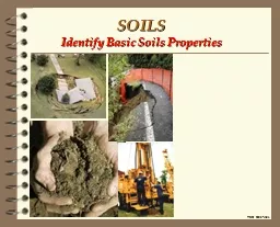
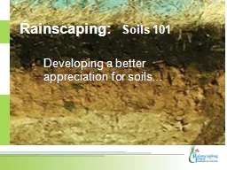
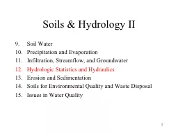
Soil Water Precipitation and Evaporation Infiltration Streamflow and Groundwater Hydrologic Statistics and Hydraulics Erosion and Sedimentation Soils for Environmental Quality and Waste Disposal ID: 580966
Download Presentation The PPT/PDF document "1 Soils & Hydrology II" is the property of its rightful owner. Permission is granted to download and print the materials on this web site for personal, non-commercial use only, and to display it on your personal computer provided you do not modify the materials and that you retain all copyright notices contained in the materials. By downloading content from our website, you accept the terms of this agreement.
Slide1
1
Soils & Hydrology II
Soil Water
Precipitation and Evaporation
Infiltration, Streamflow, and Groundwater
Hydrologic Statistics and Hydraulics
Erosion and Sedimentation
Soils for Environmental Quality and Waste Disposal
Issues in Water QualitySlide2
2
What is the significance of understanding streamflow?
Why are we concerned with how it relates to Landscapes?
Streamflow is important because it is related to:
Construction
of houses, bridges, spillways, and culverts
Surface Runoff
over landscapes, including flooding
The associated processes of
Erosion, Transport
, and
Deposition
.
Drinking
and
Irrigation
water supplies, especially during droughts
Recreational
activities, such as boating and fishing
Navigation
of commercial shipping and transportSlide3
3
Hydrograph:
Plots precipitation and runoff over time.
Runoff can be discharge, flow, or stageSlide4
4
Storm HydrographSlide5
5
Storm HydrographSlide6
6
Storm HydrographSlide7
7
Storm HydrographSlide8
8
Storm HydrographSlide9
9
Lag
TimeSlide10
10
Flow behavior for different streamsSlide11
11
Hydrograph BehaviorSlide12
12
Hydrograph Behavior:
Related to channel sizeSlide13
13
Hydrograph
for 1997 Homecoming Weekend
StormSlide14
14Slide15
15Slide16
16
Hydrograph Behavior:
Also related to channel patternsSlide17
17
Measurement Units
cfs: cubic feet per second
gpm: gallons per minute
mgd: million gallons per day
AF/day: Acre-Feet per day
cumec: cubic meters per second
Lps: liters per second
Lpm: liters per minute
1 cfs
2 AF/day
450 gpm
28.3 Lps
1 m
3
/s = 35.28 cfs
1 mgd
1.5 cfs
1 gpm = 3.785 LpmSlide18
18
WEIR: Used to provide accurate flow measurementsSlide19
19Slide20
20
Weir Types
Circular opening:
Q = c
r
2
h
1/2
Rectangular:
Q = c W h
3/2
Triangular:
Q = c h
5/2
where
Q is flow, cfs
c are weir coefficients
h is stage, ft
r is the pipe diameter, ft
W is the weir width, ftSlide21
21
Rectangular Weir
V-Notch (Triangular) Weir
Coweeta Hydrologic StationSlide22
22
Field Velocity Measurements
Flow Equation:
Q = v A
where
Q is the discharge, cfs
v is the water velocity, ft/s
A is the flow cross-sectional area, ft
2Slide23
23Slide24
24
Discharge MeasurementsSlide25
25
Manning's Equation
When flow velocity measurements are not available
v = (1.49/n) R
2/3
S
1/2
where
v is the water velocity, ft/s
n is the Manning's hydraulic roughness factor
R = A / P is the hydraulic radius, ft
A is the channel cross-sectional area, ft
2
P is the channel wetted perimeter, ft
S is the water energy slope, ft/ftSlide26
26
Hydrologic Statistics:
Trying to understand and predict streamflow
Peak Streamflow Prediction:
Our effort to predict catastrophic floods
Recurrence Intervals:
Used to assign probability to floods
100-yr flood:
A flood with a 1 chance in 100 years, or a flood with a probability of 1% in a year.Slide27
27
Return Period
T
r
= 1 / P
T
r
is the average recurrence interval, years
P is exceedence probability, 1/years
Recurrence Interval Formulas:
T
r
= (N+1) / m
Gringarten Formula: T
r
= (N+1-2a) / (m-a)
where
N is number of years of record,
a = 0.44 is a statistical coefficient
m is rank of flow (m=1 is biggest)Slide28
28
River Stage:
The elevation of the water surface
Flood Stage
The elevation when the river overtops the natural channel banks.Slide29
29
Bankfull Discharge
Q
bkf
= 150 A
0.63Slide30
30Slide31
31
Rating Curve
The relationship between river stage and dischargeSlide32
32Slide33
33Slide34
34
Peak Flows in Ungaged Streams
Q
n
= a A
x
P
n
where
A is the drainage area, and
P
n
is the n-year precipitation depth
Q
n
is the n-year flood flow
Q
2
= 182 A
0.622
Q
10
= 411 A
0.613
Q
25
= 552 A
0.610
Q
100
= 794 A
0.605Slide35
35
Channel flooding vs upland floodingSlide36
36
Curve Number Method
Most common method used in the U.S. for predicting stormflow peaks, volumes, and hydrographs.
Useful for designing ditches, culverts, detention ponds, and water quality treatment facilities. Slide37
37
P = Precipitation, usually rainfall
Heavy precipitation causes more runoff than light precipitation
S = Storage Capacity
Soils with high storage produce less runoff than soils with little storage.
F = Current Storage
Dry soils produce less runoff than wet soilsSlide38
38
r = Runoff Ratio => how much of the rain runs off?
r = Q / P
r = 0 means that little runs off
r = 1 means that everything runs off
r = Q / P = F / S
r = 0 means that the bucket is empty
r = 1 means that the bucket is full
F = P - Q or r = Q / P = (P - Q) / S
the soil fills up as it rains
Solving for Q yields:
Q = P
2
/ (P + S)Slide39
39
S is maximum available soil moisture
S = (1000 / CN) - 10
CN = 100 means S = 0 inches
CN = 50 means S = 10 inches
F is actual soil moisture content
F / S = 1 means that F = S, the soil is full
F / S = 0 means that F = 0, the soil is empty
Land Use CN S, inches
Wooded areas 25 - 83 2 - 30
Cropland 62 - 71 4 - 14
Landscaped areas 72 - 92 0.8 - 4
Roads 92 - 98 0.2 - 0.8Slide40
40
Curve Number Procedure
First we subtract the initial abstraction, I
a
, from the observed precipitation, P
Adjusted Rainfall: P
a
= P - I
a
No runoff is produced until rainfall exceeds the initial abstraction.
I
a
accounts for interception and the water needed to wet the organic layer and the soil surface.
The initial abstraction is usually taken to be equal to 20% of the maximum soil moisture storage, S, => I
a
= S / 5
The runoff depth, Q, is calculated from the adjusted rainfall, P
a
, and the maximum soil moisture storage, S, using:
Q = P
a
2
/ (P
a
+ S)
or use the graph and the curve number
We get the maximum soil moisture storage, S, from the Curve Number, CN:
S = 1000 / CN - 10
CN = 1000 / (S + 10)
We get the Curve Number from a Table. Slide41
41
Example
A typical curve number for forest lands is CN = 70, so the maximum soil storage is: S = 1000 / 70 - 10 = 4.29"
A typical curve number for a landscaped lawn is 86, and so
S = 1000 / 86 - 10 = 1.63”
A curve number for a paved road is 98, so S = 0.20”
Why isn’t the storage equal to zero for a paved surface?
The roughness, cracks, and puddles on a paved surface allow for a small amount of storage.
The Curve Number method predicts that I
a
= S / 5 = 0.04 inches of rain must fall before a paved surface produces runoff.
For a CN = 66, how much rain must fall before any runoff occurs?
Determine the maximum potential storage, S = 1000 / 66 - 10 = 5.15"
Determine the initial abstraction, I
a
= S
/ 5
= 5.15” / 5 = 1.03"
It must rain 1.03 inches before runoff begins.
If it rains 3 inches, what is the total runoff volume?
Determine the effective rainfall, P
a
= P - I
a
= 3" - 1.03" = 1.97"
Determine the total runoff volume, Q = 1.97
2
/ (1.97 + 5.15) = 0.545"Slide42
42
Unit HydrographsSlide43
43
Unit HydrographSlide44
44
Unit Area HydrographsSlide45
45
Unit Hydrograph Example
A unit hydrograph has been developed for a watershed
The peak flow rate is 67 L/s for 1 mm of runoff and an area of 100 ha
What is the peak flow rate for this same watershed if a storm produces 3 mm of runoff?
The unit hydrograph method assumes that the hydrograph can be scaled linearly by the amount of runoff and by the basin area.
In this case, the watershed area does not change, but the amount of runoff is three times greater than the unit runoff.
Therefore, the peak flow rate for this storm is three times greater than it is for the unit runoff hydrograph, or 3 x 67 L/s = 201 L/s.
What would be the peak flow rate for a nearby 50-ha watershed for a 5-mm storm?
Peak Flow: Q
p
= Q
o
(A / A
o
) (R / R
o
)
where
Q
p
is the peak flow rate and Q
o
is for a reference watershed,
A is the area of watershed and A
p
is the area of reference watershed.
Q = (67 L/s) (50 ha / 100 ha) (5 mm / 1 mm) = 168 L/s
In this case, the peak runoff rate was scaled by both the watershed area and the runoff amount. Slide46
46
Flood RoutingSlide47
47
Streamflow and Land Management
BMPs improve soil and water quality
Most of our attention is placed on preventing pollution, decreasing stormwater, and improving low flows.
Forestry
Forest streams have less stormflow and total flow, but more baseflow
Forest litter (O-Horizon) increases infiltration
Forest canopies intercept more precipitation (higher Leaf-Area Indices, LAI)
Forest have higher evapotranspiration rates
Forest soils dry faster, have higher total storageSlide48
48
Forest Management
Harvesting
High-lead yarding on steep slopes reduces soil compaction
Soft tires reduces soil compaction
Water is filtered using vegetated stream buffers (SMZs)
Water temperatures also affected by buffers
Roads
Road runoff can be dispersed onto planar and convex slopes
Broad-based dips can prevent road erosion
Site Preparation
Burning a site increases soil erosion and reduces infiltration
Leaving mulch on soils increases infiltration
Piling mulch concentrates nutrients into local "hot spots"
Distributing mulch returns nutrients to soils
Some herbicides cause nitrate increase in streamsSlide49
49
Forestry Compliance in Georgia with Water Quality Protection Standards (1991-2004)Slide50
50
Agricultural Land Management
Overland flow is a main concern in agriculture
increases soil erosion, nutrients, and fecal coliform
increases herbicides, pesticides, rodenticides, fungicides
Plowing
exposes the soil surface to rainfall (and wind) forces
mulching + no-till reduces runoff and increases infiltration
terracing and contour plowing also helps
Pastures (livestock grazing)
increases soil compaction
reduces vegetative plant cover
increases bank erosion
rotate cattle between pastures and fence streams
Urban Land Management
Urban lands have more impervious surfaces
More runoff, less infiltration, recharge, and baseflow
Very high peak discharges, pollutant loads
Less soil storage, channels are straightened and piped, no floodplains
Baseflows are generally lower, except for irrigation water (lawns & septic)Slide51
51
Benefits of Riparian Buffers
Bank Stability:
The roots of streambank trees help hold the banks together.
When streambank trees are removed, streambanks often collapse, initiating a cycle of sedimentation and erosion in the channel.
A buffer needs to be at least 15 feet wide to maintain bank stability.
Pollutant Filtration:
As dispersed overland sheet flow enters a forested streamside buffer, it encounters organic matter and hydraulic roughness created by the leaf litter, twigs, sticks, and plant roots.
The organic matter adsorbs some chemicals, and the hydraulic roughness slows down the flow.
The drop in flow velocity allows clay and silt particles to settle out, along with other chemicals adsorbed to the particles.
Depending on the gradient and length of adjacent slopes, a buffer needs to be 30-60 feet wide to provide adequate filtration. Slide52
52
Denitrification:
Shallow groundwater moving through the root zones of floodplains is subject to significant denitrificiation.
Removal of floodplain vegetation reduces floodplain denitrification
Shade:
Along small and mid-size streams, riparian trees provide significant shade over the channel, thus reducing the amount of solar radiation reaching the channel so summer stream temperatures are lower and potential dissolved oxygen levels are higher.
Buffers need to be at least 30 feet wide to provide good shade and microclimate control, but benefits increase up to 100 feet.
Organic Debris Recruitment:
River ecosystems are founded upon the leaves, conifer needles, and twigs that fall into the channel.
An important function of riparian trees is providing coarse organic matter to the stream system.
Buffers only need to encompass half the crown diameter of full-grown trees to provide this function. Slide53
53
Large Woody Debris Recruitment:
Large woody debris plays many important ecological functions in stream channels.
It helps scour pools, a favored habitat for many fish.
It creates substrate for macroinvertebrate and algae growth, and it forms cover for fish.
It also traps and sorts sediment, creating more habitat complexity.
Woody debris comes from broken limbs and fallen trees.
The width of a riparian buffer should be equal to half a mature tree height to provide good woody debris recruitment.
Wildlife Habitat:
Many organisms, most prominently certain species of amphibians and birds use both aquatic and terrestrial habitat in close proximity.
Maintaining a healthy forested riparian corridor creates important wildlife habitat.
The habitat benefits of riparian buffers increase out to 300 feet.