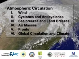
Circulation Wind Cyclones and Anticyclones Sea breezes and Land Breezes Air Masses Fronts Global Circulation and Climate California Science Project I Winds There are several factors that affect the motion of air at the Earths surface including ID: 626193
Download Presentation The PPT/PDF document "Atmospheric" is the property of its rightful owner. Permission is granted to download and print the materials on this web site for personal, non-commercial use only, and to display it on your personal computer provided you do not modify the materials and that you retain all copyright notices contained in the materials. By downloading content from our website, you accept the terms of this agreement.
Slide1
Atmospheric
Circulation
Wind
Cyclones and AnticyclonesSea breezes and Land BreezesAir MassesFrontsGlobal Circulation and Climate
California Science ProjectSlide2
I
. Winds
There are several factors that affect the motion of air at the Earth’s surface, including:Pressure gradient forceCoriolis effectFriction
Air moves in response to horizontal differences in pressure — wind blows in an attempt to equalize imbalances in air pressure. NASASlide3
Factors that affect winds – pressure gradient force
Barometric pressure is generally shown on weather maps as
isobars that are lines that connect places of equal pressure. The pressure gradient force
is the force directed from higher to lower pressure at right angles to the isobars. WW2010 Univ. of ILSlide4
Factors Affecting Wind — Pressure Gradient Force
The
weather map shows barometric pressure plotted as isobars.
If the isobars were closer together, we would have a steep (or strong) pressure gradient and stronger winds. If the isobars were further apart, we would have a gentle (or weak) pressure gradient and weak winds. Slide5
Factors Affecting Wind— Coriolis
Effect
Coriolis describes an apparent force that is due to the rotation of the Earth. All free moving objects (winds, currents, rockets, etc.) are
deflected to the right of their path in the northern hemisphere and to the left in the southern hemisphere. Imagine a rocket shot from the north pole to the equator. While it is in flight, the Earth has rotated beneath it. From the perspective of the Earth’s surface, it appears that the path of the rocket has curved.From space, it would appear that the rocket took a straight path.
National Snow and Ice Data CenterSlide6
The velocity is greater at pt. A due to the rotation of the Earth around its axis than at pt. B.
A
B
Consider this example where the Earth is rotating to the right.
We are ignoring the axial tilt of the Earth as a simplification.
Imagine that we launch an object toward the north pole
.
It has “inherited”
a
large component of movement to the right
(momentum) as
it
flies to the north.
Thus, the apparent path of the launched object deflects to the
right.
NOVA: The Coriolis EffectSlide7
Factors Affecting Wind—
Coriolis Force
The Coriolis “force” is an apparent force — it is not really a physical force and is more accurately called the Coriolis effect.
The Coriolis effect is greatest at high latitudes (poles) and is zero on the equator. The Coriolis effect only affects wind direction and does not affect wind speed.
National Snow and Ice Data CenterSlide8
Below an altitude of 600 m, friction
with the Earth’s surface is an important factor in wind. Friction lowers the wind speed and reduces the
Coriolis effect. The figure shows that the vectors indicate that the wind at the surface blows across isobars at an angle from an area of high pressure to an area of low pressure.
Factors Affecting Wind— FrictionSlide9
Geostrophic Winds
Wind at elevations above 600 m are above the friction caused by the surface of the Earth.
Wind direction is a compromise between the PGF (across isobars) and the Coriolis force (deflection to the right) and winds flow parallel to isobars. Geostrophic wind is wind at high altitude (above the friction of the Earth’s surface) that flows in a path parallel to
isobars.Slide10
Cyclones
are low pressure systems - winds blow inward and counterclockwise around a low in the N. hemisphere. Anticyclones are high pressure systems - winds blow outward and clockwise out of the high in the N. hemisphere.
II. Cyclonic and Anticyclonic WindsSlide11
Satellite photo of a cyclone (low pressure system) in the northern hemisphere with counterclockwise circulation.
Satellite photo of a cyclone (low pressure system) in the southern hemisphere with clockwise circulation. Slide12
Cyclones and Anticyclones
At the surface as winds blow inward toward the center of a low,
the air must go somewhere. The converging air at the surface slowly rises. Aloft, the upflow will diverge (spread apart) to compensate for the converging surface air.
Surface pressure will change if the upper-level outflow and the surface inflow are not balanced. National Snow and Ice Data CenterSlide13
National Snow and Ice Data Center
Likewise, for a high pressure system to be maintained at the Earth’s surface, it must be coupled with convergence aloft (in the upper atmosphere) to continue to “fill” the high pressure system.
Cyclones and Anticyclones
Low and high pressure systems at the Earth’s surface must be coupled divergence or convergence aloft (respectively) to be maintained. If not, the system will dissipate. Slide14
NOAA
Cyclones and Anticyclones
Descending air associated with a high pressure system is associated with atmospheric stability and clear conditions.
Ascending air associated with a low pressure system is associated with atmospheric instability, cloud development and precipitation. Slide15
If the molecules in air have higher
kinetic energy at higher temperature, what happens when they collide?
Which box of air has the lower density?
As the temperature of a gas or liquid increases, the average kinetic energy increases. Thus, the energy of the collisions increases causing the distance between the molecules/atoms to increase that result in an expansion of the gas or liquid. BoldMethod
Wikipedia: User:Greg LSlide16
Buoyancy
is the ability or tendency for an object with a lower density to float or rise within a fluid (liquid or gas) of greater density. Solid ice has a lower density than liquid water and therefore floats in a glass of water.
Photo courtesy photos-public-domain.com
The hot air inside the balloon is less dense and buoyantly rises through the colder air outside the balloon. Wikimedia User: TakeAwaySlide17
III. Sea breezes and Land Breezes
The image shows the surface temperature for land and ocean surfaces during January.
What differences are there between ocean and land surfaces in the northern and southern hemisphere?Slide18
Land and water surfaces heat up and cool off at different rates even if they are receiving the same amount of solar radiation.
In general, land surfaces heat and cool more quickly than water.
Sea and land breezes that occur in coastal regions are
due to the differential heating and cooling of land and water.Slide19
During
the day, the land surface heats the lower atmosphere and the air begins to rise (updraft). Cooler sea air moves inland to replace the upward moving air.
A
sea breeze
is a type of
thermal circulation
. It is the differential heating rates of land and water that causes these local winds. The
sea breeze blows from the sea toward the land. The strongest winds occur at the beach.
Since the strongest thermal gradient occurs late in the afternoon, the
sea breeze
is strongest then.
The ascending air may result in cloud formation and thunderstorms.
physicalgeography.net
Michael
Pidwirny
& Scott Jones
Sea BreezesSlide20
This Space Shuttle image shows the development of clouds over the land surface of Florida caused by
sea breeze
circulation cells.
Florida is subject to a lot of thunderstorms during the afternoon because the sea breezes from the Gulf and Atlantic can converge over the peninsula leading to atmospheric instability.
NASASlide21
Land Breezes
At night, the land cools more quickly than the water.
The warmest air at the surface of the Earth is over the water and it will begin to rise buoyantly
The sea breeze reverses itself and becomes a
land breeze
— flow from the land to the water.
In the region of ascending air, cloud formation is common.
On the east coast, it is common to have clouds over the land during the day and over the ocean at night.
physicalgeography.net
Michael
Pidwirny
& Scott JonesSlide22
The image on the right shows the development of clouds over Lake Huron as the result of a
land breeze
.
The clouds develop in the region of ascending air associated with the
land breeze
circulation cell. Slide23
IV. Air
Masses
An
air mass is an extremely large body of air whose properties of temperature and moisture are fairly similar in any horizontal direction at a given altitude — may cover thousands of square kilometers. Air masses originate in known source areas.The source area
is usually generally flat (little topographic relief) with a uniform surface (land, ocean, etc.). It is the movement of air masses that is responsible for changes in local weather.
NOAASlide24
Classification of Air Masses
Air masses are grouped into 4 general categories depending on their source region.
Air masses originating in polar latitudes are given the designation 'P.” Polar air masses are designated ”A.”Air masses originating in tropical latitudes are given the designation "T."
If the source region is land, the air mass will be dry and the lowercase letter c precedes P or T. If the air mass originates over water, the air mass will be moist and the lower case letter m precedes P or T. NOAASlide25
V. Fronts
The real weather action occurs not within air masses but along their margins where air masses of different characteristics meet — weather
fronts
. A front is a transition zone between two air masses of different densities — density differences are due to differences in temperature or moisture content.
The figure shows a simplified weather map with four different fronts illustrated.
APTISlide26
A
cold front
is the leading edge of a cold air mass replacing warmer air as it moves forward. Cold air is generally more dense than warm air. As the cold front advances, it pushes the warm air that it is replacing at the surface aloft.
The ascending air is associated with atmospheric instability and precipitation. APTI
APTISlide27
A
warm front
is the leading edge of a warm
air mass replacing the retreating cold air.The warm air is less sense and is forced aloft as the warm front advances. Note that cold and warm fronts commonly organize around a low pressure system (L) and form a mid-latitude cyclone. APTIAPTISlide28
As cold and warm fronts rotate around the low pressure center in a mid-latitude cyclone, the cold front catches up with the warm front and forces the warm air aloft.
This process is called
occlusion
and forms an occluded front. Stationary fronts are where there is no movement between two air masses. APTIAPTISlide29
VI. Global Atmospheric Circulation and Climate
In order to develop a model for global circulation, we must consider a simple model first.
The figure shows the theoretical circulation of the Earth if it were not rotating (no Coriolis) and had a uniform surface.
Each hemisphere contains a circulation cell where heated equatorial air rises and would deflect poleward where it would cool sink and flow to lower latitude. In this simple model, global circulation is driven by density differences due to temperature. NOAASlide30
The
Coriolis
effect (due to the rotation of the Earth) breaks the simple convection cells that we just considered into a series of smaller cells to redistribute the heat of the planet. This very simple model of global circulation is very good at describing many of the broad details of global climate and circulation.
NOAASlide31
NOAA
Rising air at the equator is associated with abundant precipitation and is known as the
equatorial low. The ascending air cools (adiabatic) resulting in cloud formation and precipitation.
Subsidence of air at ~30° latitude results in adiabatic heating of the air and produces hot, arid conditions in a region known as the subtropical high. Slide32
NOAA
The
polar front is a stormy belt that occurs in a region with ascending air known as the
subpolar low. This region is the source for many many of the mid-latitude storms (severe thunderstorms) that affect the mid-continent of North America. At each pole, cold polar air subsides and is known as the polar high - the air from the polar high spreads toward equator. Slide33
NOAA
The
westerlies flow out from the subtropical high and flow dominantly from the west to the east.
Between the equatorial low and the subtropical high, the Coriolis effect causes deflection so that winds dominantly blow from the east to the west and are known as the trade winds. Slide34
NASA
Wikimedia User:Vzb83
NOAA
Intertropical Convergence Zone
The equatorial low near the Earth’s equator results in a band of persistent precipitation known as the Intertropical Convergence Zone (ITCZ).
The map shows that the ITCZ is the responsible for the distribution of the world’s major rain forestsSlide35
augmentedworld.co.il
via www.continentsandoceans.com/
NOAASubtropical HighThe subtropical high that occurs ~30° N and S of the equator is a zone of warm dry conditions.
The map shows that the distribution of the world’s great deserts are associated with the subtropical high. ITCZ
Subtropical HighSubtropical High