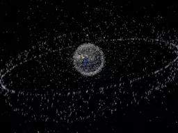
review of research Shamil Maksyutov Tsuneo Matsunaga National Institute for Environmental Studies Tsukuba Japan CEOS meeting Frascati Sep 12 2017 Guidebook plan Ministry of Environment Japan and National Institute for Environmental Studies support preparation of a Guidebook on use ID: 662923
Download Presentation The PPT/PDF document "Guidebook on use of GHG observations by ..." is the property of its rightful owner. Permission is granted to download and print the materials on this web site for personal, non-commercial use only, and to display it on your personal computer provided you do not modify the materials and that you retain all copyright notices contained in the materials. By downloading content from our website, you accept the terms of this agreement.
Slide1
Guidebook on use of GHG observations by satellites for estimating surface emissions:review of research
Shamil Maksyutov, Tsuneo Matsunaga
National Institute for Environmental Studies, Tsukuba, Japan
CEOS meeting,
Frascati
, Sep 12, 2017 Slide2
Guidebook plan
Ministry of Environment, Japan and National Institute for Environmental Studies support preparation of a Guidebook on use of greenhouse gas (GHG) observations by satellites for estimating surface emissions (title is tentative)
The purpose of the Guidebook is to facilitate use of satellite GHG concentration observations for estimating the emissions, at a city to national scale, for applications such as national emission inventory improvement and verification in support of implementation of the Paris agreement on the gradual reductions of the GHG emissions
The timing and schedule of the Guidebook preparation is set to provide a contribution to materials available for use in 2019 Refinements to 2006 IPCC Guidelines on Emission Inventories.
Guidebook will include overview, introduction to satellite GHG data analysis methodology and a number of case studies, based on published research papers. Slide3
Guidebook table of contents and schedule
1. Overview
2. Fundamentals, Part 1
Satellite measurements of GHG concentration, retrievals, validation,
atmospheric transport models, emission sources, etc.
3. Fundamentals, Part 2
How to compare satellite GHG measurements and emission inventories
3.1 Concentration-based methods
3.2 Flux estimates by inverse modeling
4. Case Studies of using satellite observation data for emission estimates
4.1 ...
Appendix
1. List of available satellites and products
2. List of related peer-reviewed papers
Schedule and plan
- Language: English (The final edition will be translated into other languages later.)
- Number of pages: 4 - 8 printed pages (including figures and tables)
- Contents: Explaining methods for comparing flux estimation using the satellite GHG measurements with GHG emission inventories, and showing practical examples.
Submission deadline for case studies and chapters/sections: Friday, September 1, 2017
Draft edition of the guidebook to be completed and released on a website at the end of September,
First edition will be published at the end of March, 2018.
- Notes: Main methods on this manuscript must be published in peer-reviewed papers by the time of guidebook publication. Case studies using actual satellite GHG data are preferable.Slide4
Emission estimation methods
Observing local concentration enhancements
Anthropogenic emissions of CO
2
, CH
4
, (and NO
x, CO, …) lead to buildup of the concentration above the emission area and transport of a high concentration plume by wind downstream the emission source (city, powerplant, etc.). Satellites observe increased column GHG concentration when the plume is in the observation footprint. The plumes are identified either by using transport model, or by another pollution tracer observation (eg NO2 by OMI), or by long term averaging (see SCIAMACHY papers)Processed mean enhancements are related to fluxes using either simple wind-speed dependent model, or high resolution transport model.Inverse modelingInverse modeling optimize fluxes by providing flux corrections that reduce misfit/difference between observations and transport model simulations. The inverse model provides fluxes at grid-point resolution, that can be used to estimate regional flux by summing over selected (country) area. The emission enhancement processing is not done usually, as transport model makes prediction of both background and emission influenced concentration.
observations
forward inversion
model vs observations, CH4, COI station (Japan)
OCO-2 observation over US,
Nassar
et al 2017Slide5
Studies featured in the guidebook: CO2
Schneising
et al ACP 2008, ACP 2013 used 3 years of SCIAMACHY CO
2
observations to show anthropogenic CO
2
enhancements over W. Europe and their correlation with EDGAR emissions
Kort et al GRL 2012 Used GOSAT observations to quantify anthropogenic CO2 enhancements over megacities Los-Angeles and MumbaiReuter et al Nat. Geosci. 2014 looked at the ratio of NOx to CO2 enhancements and found decreasing emissions of NOx relative to CO2 in East AsiaJanardanan et al GRL 2016 used GOSAT observations and transport model to quantify anthropogenic CO2 enhancements around the globe and found good correlation between observations and model, allowing to infer regional emission biases in inventory
Hakkarainen et al GRL 2017 used XCO2 observations by OCO-2 and NO
2 from OMI to map anthropogenic CO2 enhancements globally
Nassar et al 2017 (in review) used observations by OCO-2 to estimate CO2 emissions by several power plants in US using simple Gaussian plume model to simulate CO2 enhancementsSlide6
Studies featured in the guidebook: methane
Schneising
et al Earth's Future 2014, found increase of SCIAMACHY-observed CH
4
enhancements over US gas and oil fields over time and used the data to estimate increase of fugitive methane emissions.
Kort
et al GRL 2014 observed SCIAMACHY XCH4 anomaly over Four Corners region from 2003 to 2009, corresponding to large emissions from coal and gas basin
Buchwitz et al ACP 2017 estimated annual methane emissions from SCIAMACHY and GOSAT observations for the three regions: Four Corners, Central Valley, in USA, and Turkmenistan Turner et al ACP 2015 used GOSAT XCH4 observations and inverse model to estimate methane emissions over the globe and North AmericaJanardanan et al RS 2017 (in print) used GOSAT XCH4 observations and transport model to quantify anthropogenic CH4 enhancements around the globe and estimated regional emission corrections for North America and East AsiaSlide7
Detecting anthropogenic CO2 concentration enhancements using
SCIAMACHY
observations
Schneising
, O., et al: Three years of greenhouse gas column-averaged dry air mole fractions retrieved from satellite – Part 1: Carbon dioxide, Atmos. Chem. Phys., 8, 3827-3853, 2008.
“When averaging the SCIAMACHY X
CO2
over all three years we find elevated CO2 over the highly populated region of western central Germany and parts of the Netherlands (“Rhine-Main area”) reasonably well correlated with EDGAR anthropogenic CO2 emissions. On average the regional enhancement is 2.7 ppm including an estimated contribution of 1–1.5 ppm due to aerosol related errors and sampling” (Schneising et al, 2008)
Schneising
et al Anthropogenic carbon dioxide source areas observed from space: assessment of regional enhancements and trends, Atmos. Chem. Phys., 13, 2445-2454, 2013.Slide8
Decreasing emissions of NO
x
relative to CO
2
in East Asia inferred from satellite observations
(SCHIAMACHY)
Reuter, M., M.
Buchwitz, A. Hilboll
, A. Richter, O. Schneising, M. Hilker
, J. Heymann, H. Bovensmann and J. P. Burrows (2014), Nature Geoscience, doi:10.1038/ngeo2257
Analyzed simultaneous and co-located satellite retrievals from SCIAMACHY of the column-average dry-air mole fraction of CO2 and NO2 for the years 2003–2011 to provide a top-down estimate of trends in emissions and in the ratio between CO2 and NOx emissions. Findings suggest that the recently installed and renewed technology in East Asia, such as power plants, transportation and so on, is cleaner in terms of NOx emissions than the old infrastructure, and roughly matches relative emission levels in North America and Europe.Slide9
Space-based observations of megacity carbon dioxide
(
with
GOSAT)
Observed XCO2 urban dome of Los Angeles from June 2009 to August 2010. (a) Nightlights map of the Los Angeles megacity and surroundings. Selected GOSAT observations within the basin (pink circles near 34ºN, 118ºW) and in the desert (red triangles near 35ºN, 117–118ºW). (b) Time-series for basin and desert observations averaged in 10-day bins. (c) The difference between 10-day block averages of basin and desert observations. The dashed black line shows the average difference (3.2 ±1.5 ppm)
Kort
, E. A., C. Frankenberg, C. E. Miller, and T. Oda (2012),
Geophys
. Res. Lett., 39, L17806
Enhancements, ppmSlide10
Comparing
GOSAT
observations of localized CO
2
enhancements by large emitters with inventory-based estimates
Janardanan
, R.; Maksyutov, S.; Oda, T.; Saito, M.; Kaiser, J. W.;
Ganshin, A.; Stohl, A.; Matsunaga, T.; Yoshida, Y.; Yokota, T.. Geophysical Research Letters (2016), 43, 3486–3493
model+inventory
GOSAT observed CO
2 enhancementsSimulated XCO2 enhancements agree with the observed over several continental regions across the globe, including North America with a regression slope of 1.05±0.21, but with a larger slope over East Asia (1.22±0.32). Slide11
Direct space-based observations of anthropogenic CO
2
emission areas from
OCO-2
Hakkarainen
, J., I.
Ialongo
, and J. Tamminen (2016), Geophys. Res. Lett., 43, 11,400–11,406.
Identification of anthropogenic CO2
signatures from space is challenging because of the strong effect of natural variability and transport. For OCO-2, additional challenge is large amount of high spatial resolution data, - difficult to make global transport modeling
Authors developed a novel methodology to derive CO2 anomaly maps, solely based on collocated satellite-based OCO-2 CO2 and OMI NO2 measurements with high spatial coverage and detail. Were able to identify the major anthropogenic CO2 emission regions, such as Europe, USA and China. In addition, several smaller isolated emitting areas, like individual cities, were detected.Slide12
“Close Flyby” of Ghent Generating Station
ECMWF -121.9
°
, 0.50 m/s
MERRA -138.4
°
, 1.41 m/s
~8 km to swath
Kentucky
Aug 2015
MtCO
11.02/yr
Enhancement is large due
to low wind speed (~ 1 m/s)
EPA Reported Emissions: 29.2
ktCO
2
/day
Estimated Emissions: 27.6
±
ktCO
13.7
2
/day
Error budget:
wind speed:
±
13.2
kt
/day
background ensemble:
±
0.5
kt/day
enhancement ensemble:
±
2.8
kt/day
km
2.5
buffer zone
Wind direction adjusted by +22.2
°
from mea
n
XCO
2
Relative to Background Average
Quantifying CO
2
emissions from individual coal power plants using
OCO-2
observations
R.
Nassar
, T. G. Hill, D. Wunch, D. Jones and T. Oda, IWGGMS, 2017
(do not cite: paper in review)Slide13
Estimated methane emissions are shown for the targeted regions Bakken in light brown, and Eagle Ford in dark brown. Shown are absolute emission increase (2009–2011 relative to 2006–2008) in the left panel, and the leakage rate relative to production in the right panel, in each case together with the 1𝜎-uncertainty ranges.
For comparison, leakage estimates from previous studies in Marcellus, Uintah and Denver-Julesburg (yellow, blue, and magenta) are shown together with the EPA bottom-up inventory estimates
Schneising
, O., et al, Earth's Future, 2014.
Remote sensing of fugitive methane emissions from oil and gas production in North American tight geologic formations
The difference between the SCHIAMACHY mole fraction anomalies of methane, for the period 2009–2011 relative to the period 2006–2008. The locations of the oil and gas wells are shown in pink. Well positions are taken from the Fracking Chemical Database [
SkyTruth
, 2013] Slide14
Four corners: The largest US methane anomaly viewed from space
Column methane anomalies and emissions over the U.S. (a) Average SCIAMACHY anomaly from 2003 to 2009. (b) Average anomaly over just the Four Corners region 2003 to 2009. (c) EDGAR v4.2 gridded methane emissions (smoothed). (d) WRF-
Chem
simulated methane anomaly using 3.5 times EDGAR v4.2 emissions for the Four Corners region.
Kort
, E. A., C. Frankenberg, K. R.
Costigan
, R. Lindenmaier, M. K. Dubey, and D. Wunch (2014), Geophys. Res. Lett., 41, 6898-6903, doi:10.1002/ 2014GL061503
Kort et al. (2014) found the Four Corners to be the largest single methane source in the continental US (0.59
Tg a−1) on the basis of SCIAMACHY and TCCON observations, with a magnitude 3.5 times larger than EDGARv4.2 and 1.8 times larger than reported by the US EPA Greenhouse Gas Reporting Program (EPA, 2014).Slide15
Satellite-derived methane hotspot emission estimates using a fast data-driven method
Annual methane emissions as obtained from SCIAMACHY and GOSAT for the three regions: (a) Four Corners in the USA, (b) Central Valley, California, USA, and (c) Turkmenistan compared with EDGAR and literature values.
Buchwitz
, M.,
Schneising
, O., Reuter, M.,
Heymann
, J., et al, Atmos. Chem. Phys., 17, 5751-5774, https://doi.org/10.5194/acp-17-5751-2017, 2017.Slide16
Estimating global and North American methane emissions with high spatial resolution using
GOSAT
satellite data
Methane emissions in North America in 2009–2011 estimated with inverse model, using global GEOS-
Chem
transport model with 0.5
deg
resolution zoom over N. America. The left panel show posterior (optimized=best fit) emissions and the right panel shows the scaling factors, ratio of posterior(optimized)/priorTurner, A. J., Jacob, D. J., Wecht, K. J., et al. (2015). Atmospheric Chemistry & Physics, 15, 7049.Slide17
Summary
Guidebook on use of GHG observations by satellites for estimating surface emissions is now in preparation by MOE, NIES and expert scientists from around the world
The Guidebook introduce methods developed for estimating GHG emissions using satellite observations: observation of concentration enhancements around strong emitting sources and inverse modeling
Case studies based on more than 12 published research papers are presented to demonstrate application of the data analysis methods for regional to country level emission estimates based on satellite observations by SCIAMACHY, GOSAT and OCO-2
Guidebook publication is scheduled for March 2018, to make it available for use in 2019 Refinements to 2006 IPCC Guidelines on Emission Inventories